Google Maps Route
Google Maps Route
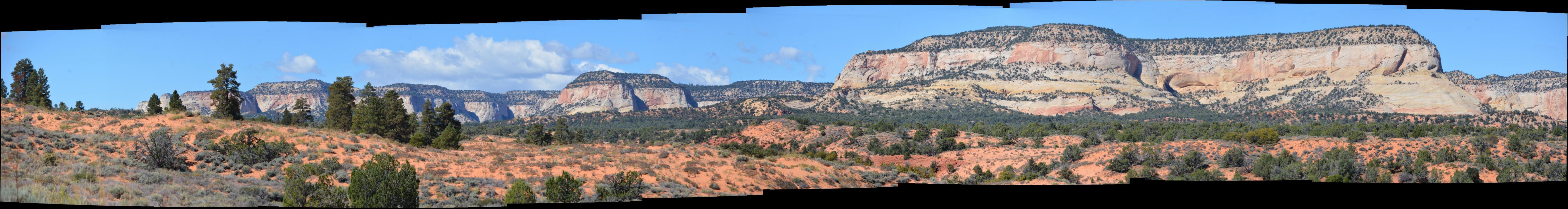
Utah Colorado Wyoming, October 2015
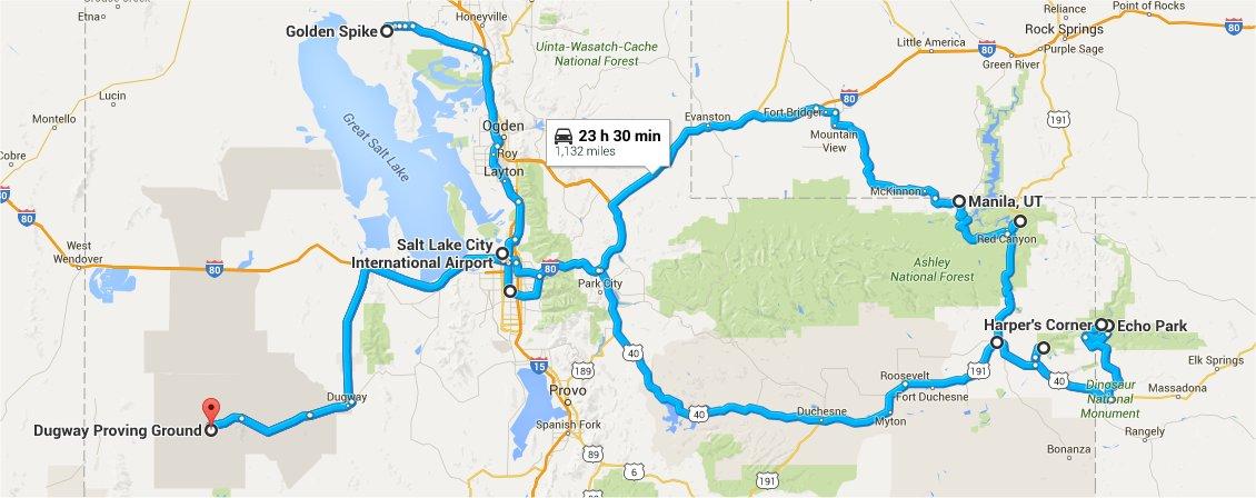
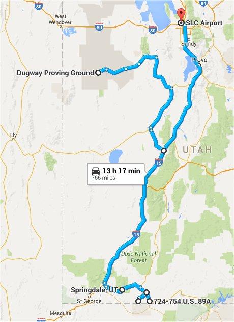
| I had a business trip to Dugway Proving Grounds, Utah for two weeks of flight testing in October 2015, and visited several places in the state on my days off. I also made it a little bit into Colorado and Wyoming when I visited Dinosaur National Monument and Flaming Gorge National Recreation Area. |
Google Maps Route |
Google Maps Route |
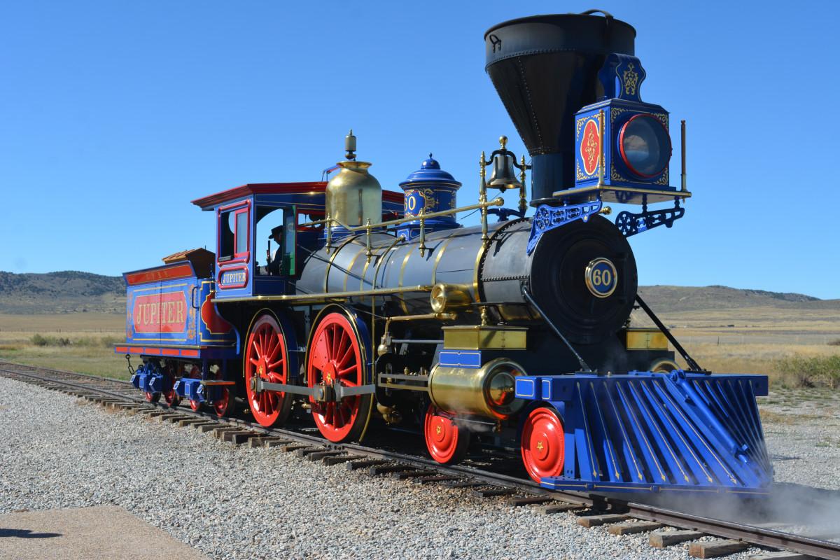
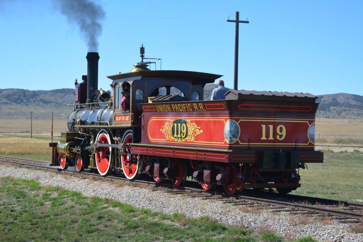
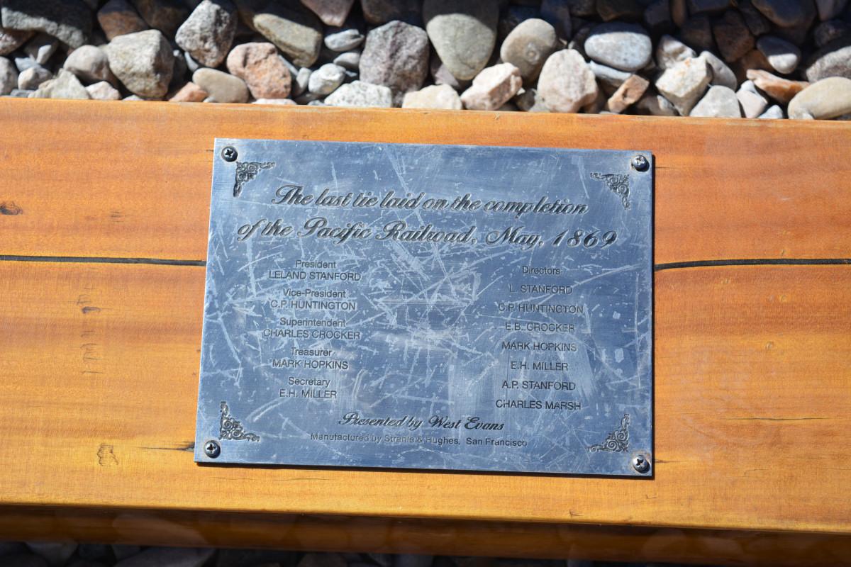
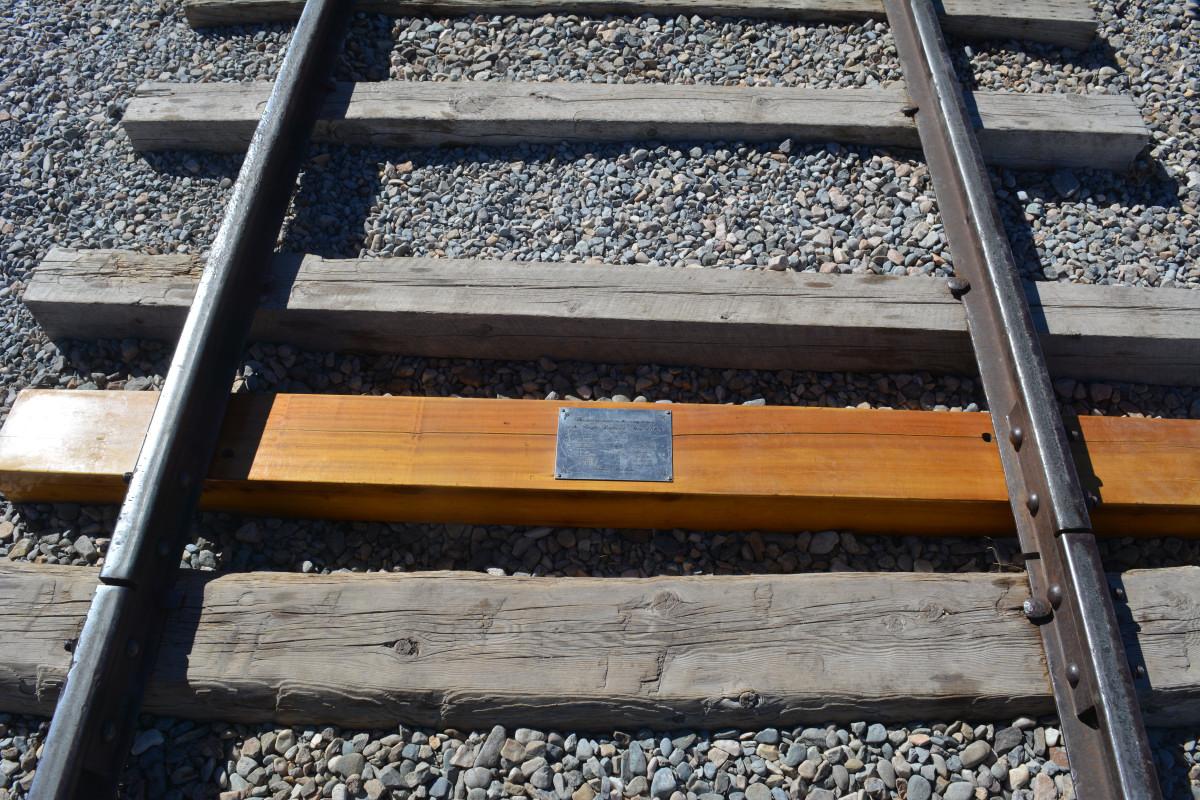
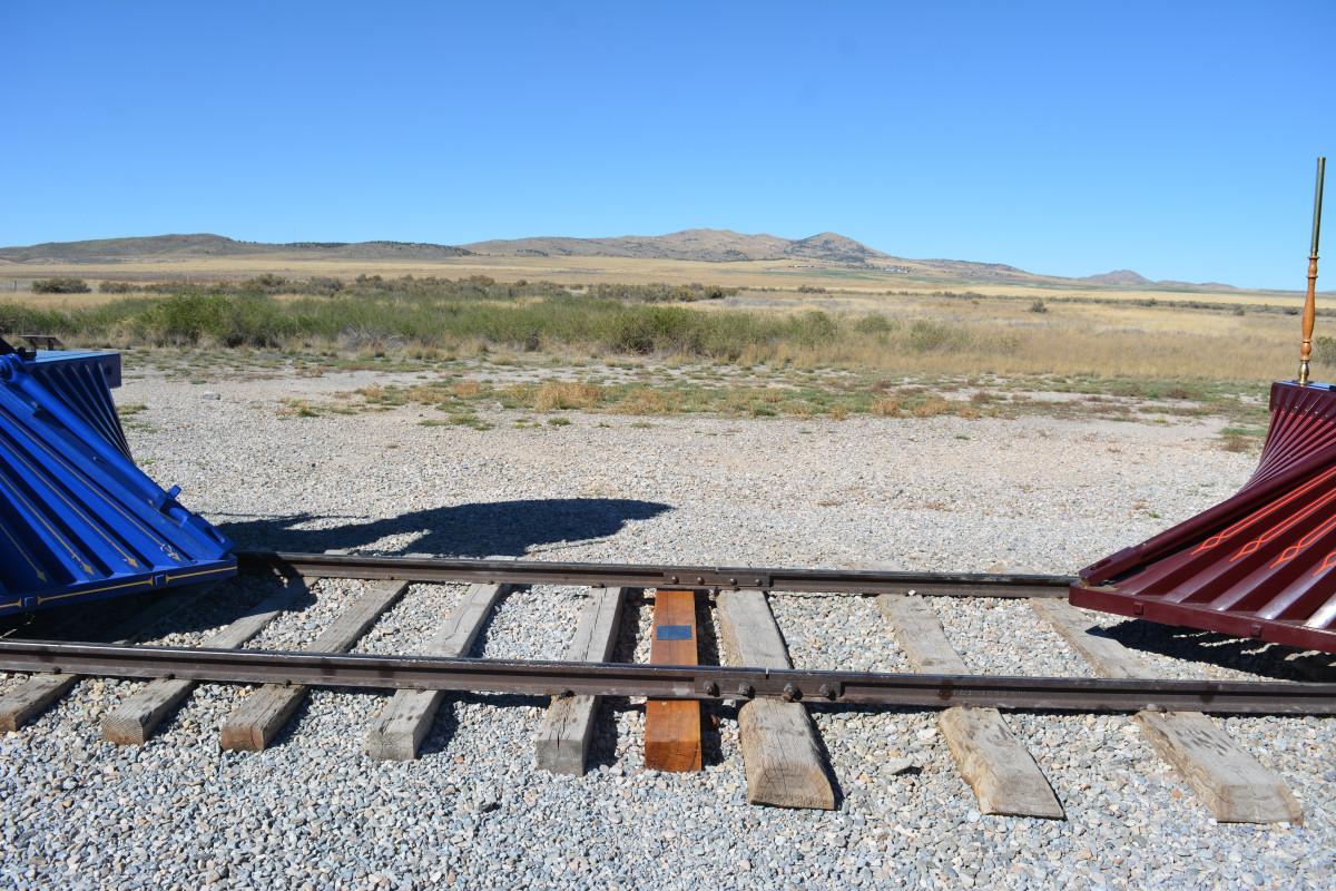
Golden Spike National Historic Site, Utah, 12 October 2015
I drove to Golden Spike National Historic Site at Promontory on Columbus Day, Monday, 12 October. This was where the first transcontinental railway was completed, on 10 May 1869. The Union Pacific and Central Pacific Railroads met at Promontory on that date when the Golden Spike was driven into the last tie to join the rails from east and west. I am not a big railroad buff, but the TV show Hell On Wheels got me interested enough to want to visit. As one ranger said, they are a bit off the beaten path, but it was all worth it. As it turned out, I picked the perfect day to visit, as it was the last day of the year when the trains were running for the mid-day demonstration before they were put away for the winter. They also usually don't run both engines on the same day, but as it was the last demo of the year, both trains were run up and down the tracks.
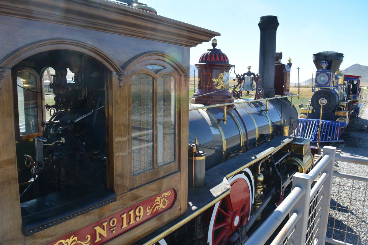
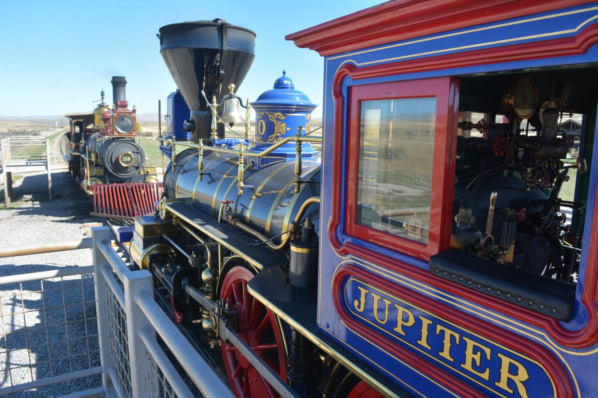
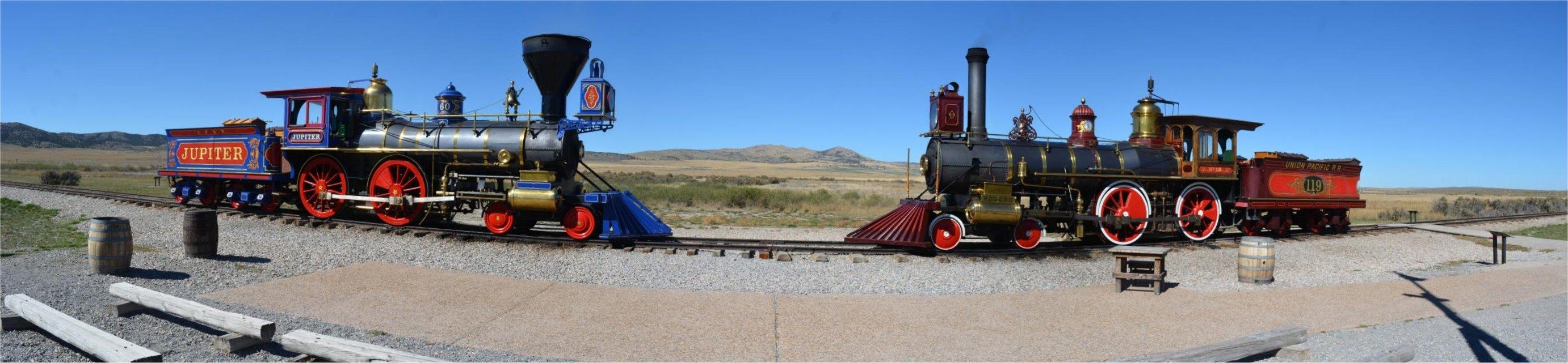
This video shows both trains as they were run.
The rangers were very knowledgeable and gave a good presentation. The history of the how each railroad company worked to get as much money and land from the federal government as possible is interesting, and shows how much that money drove that effort to make the 'road'. Because the government had not told the two companies where to meet, each railroad had actually been building their own right-of-way foundation for their rails in parallel to each other for 250 miles, and were paid handsomely for it. When Congress found out what was happening, they immediately put a stop to it and forced the companies to come to joint decision on where the rails would actually meet. The 'Big Fill' hike at the National Historic Site shows a good example of where the two companies built these foundations in parallel, and how they solved problems a little differently. The Central Pacific was building the northern track base at this point, and used earthen fill to bridge a canyon. The Union Pacific was short on time, and because of the landscape, they built a bridge across the same canyon. That bridge ended up being used for less than 6 months before the earthen fill path became the used railroad line.
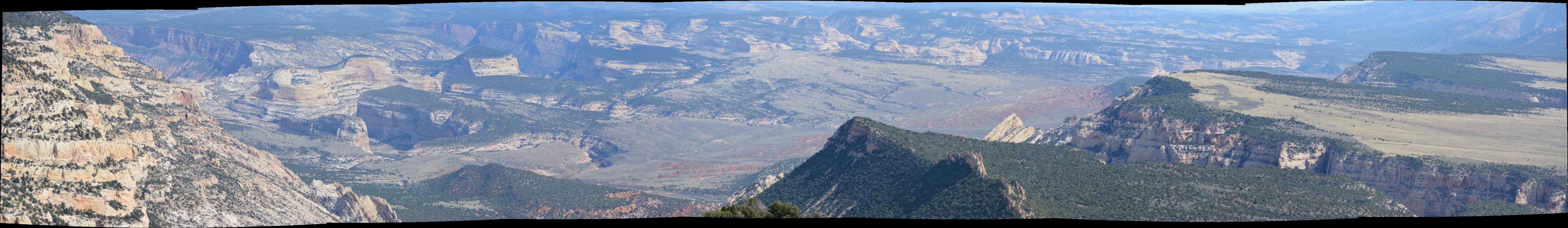
Dinosaur National Monument, Utah & Colorado, Flaming Gorge National Recreation Area, Utah & Wyoming, 17 - 18 October 2015
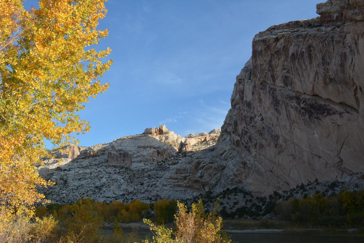
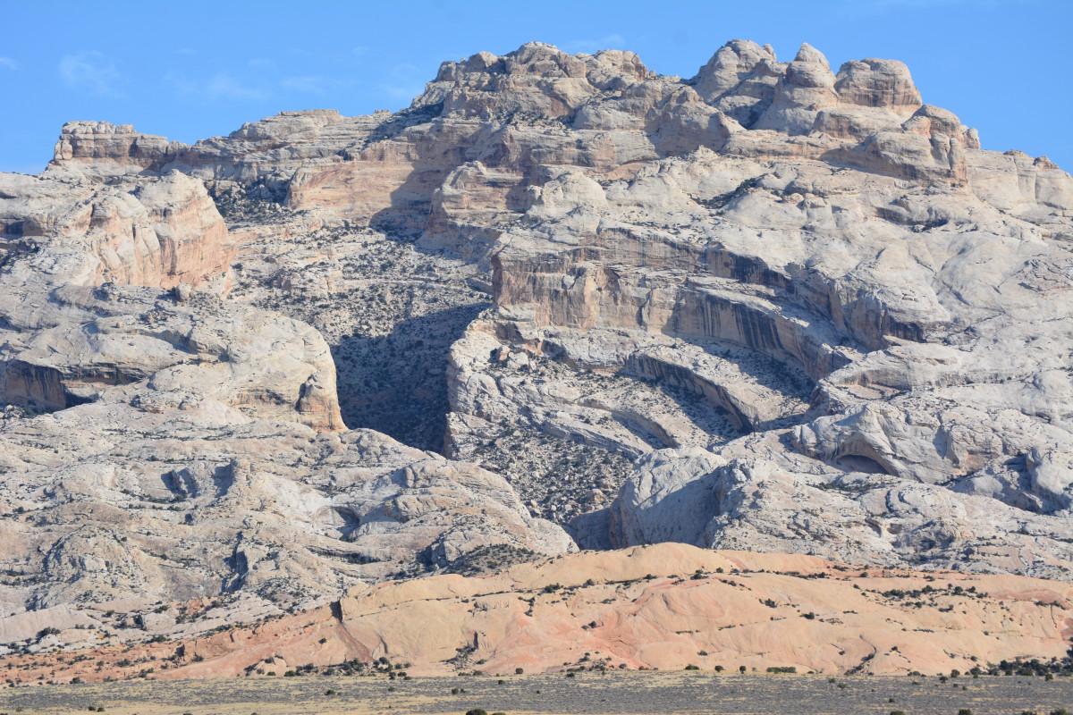
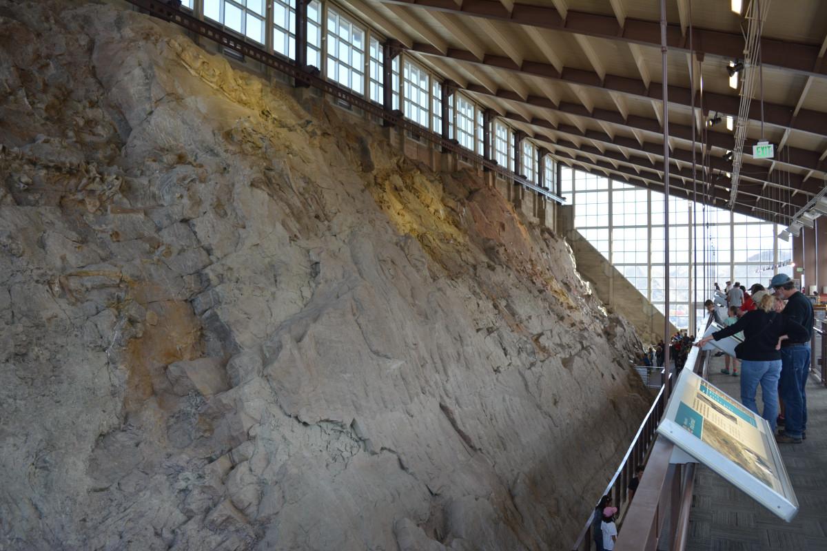
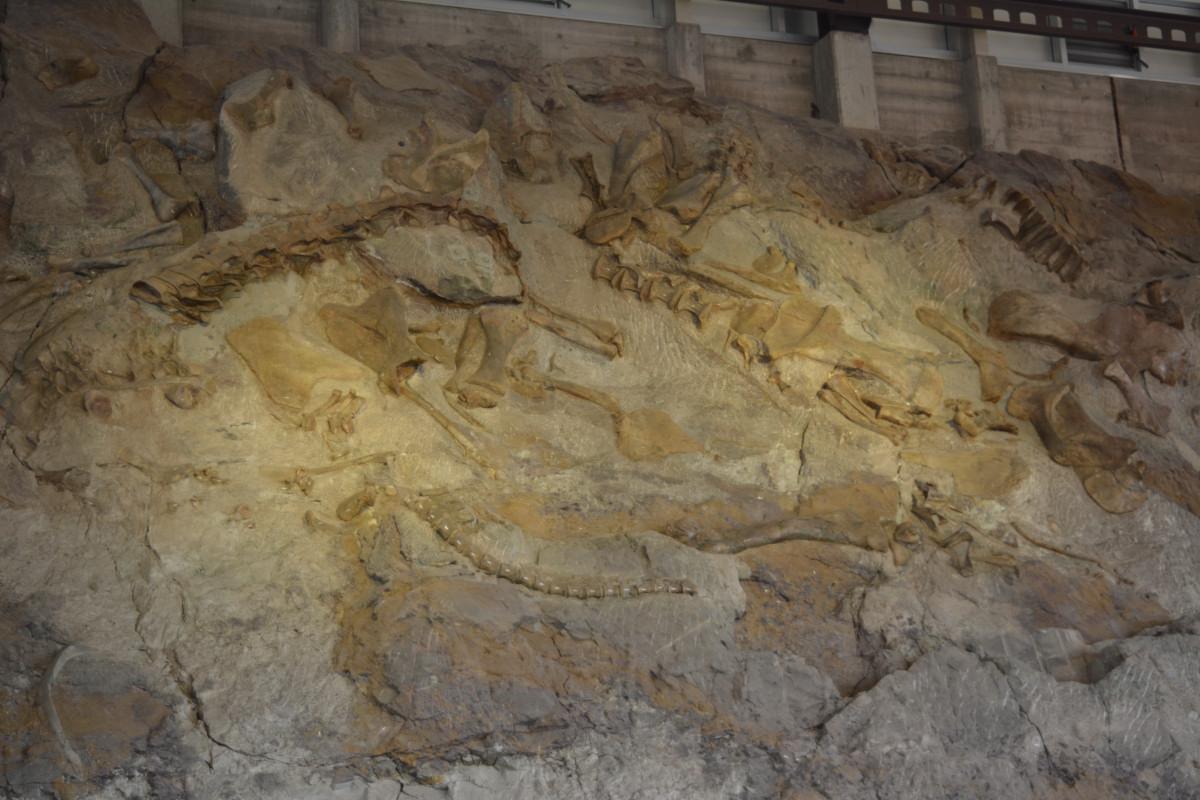
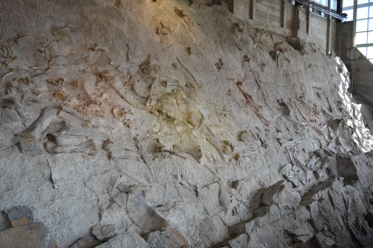
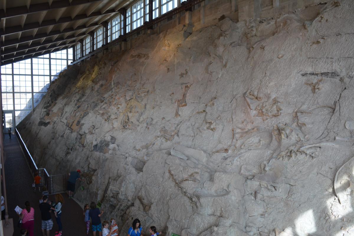
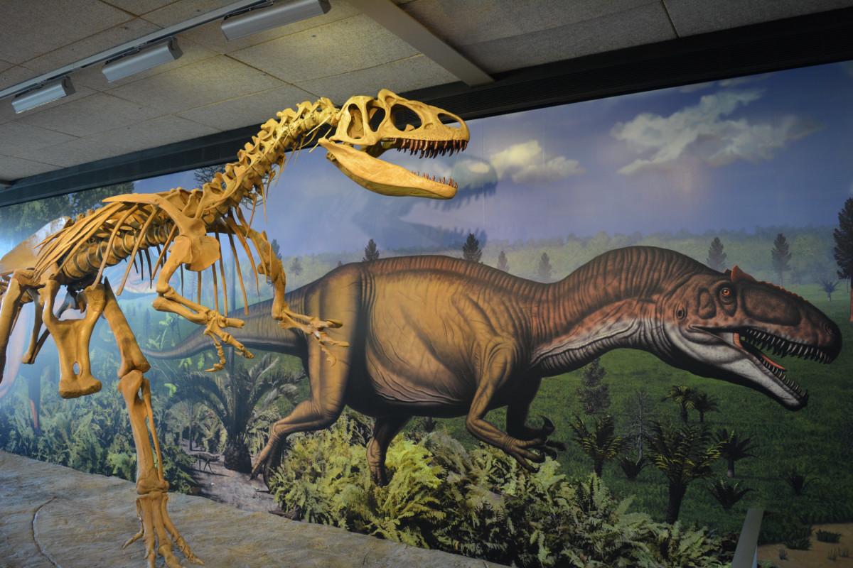
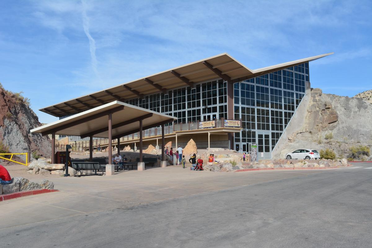
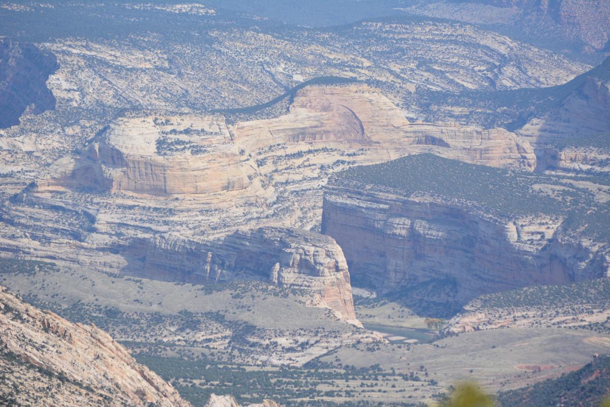
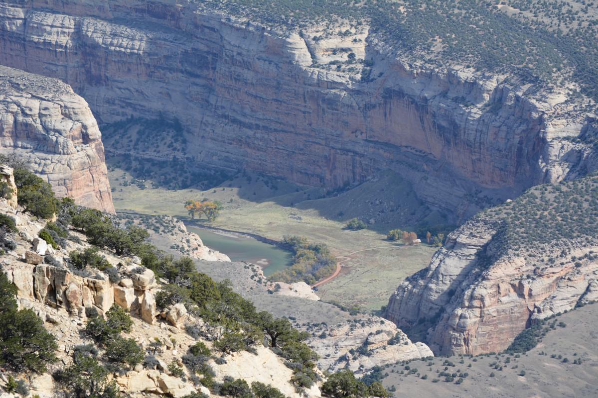
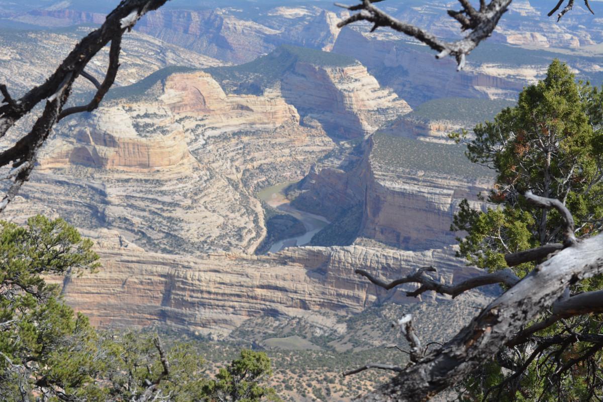
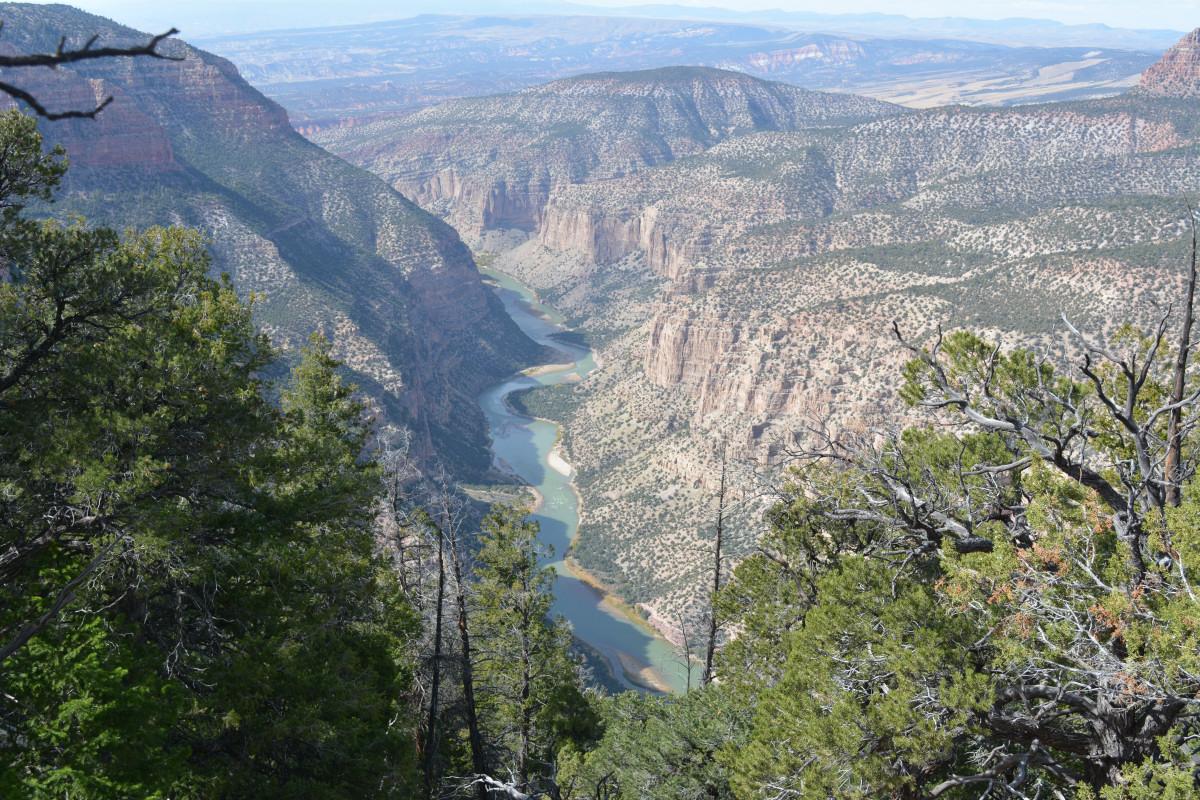
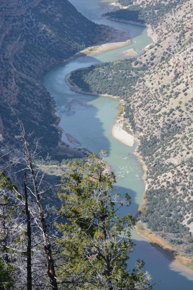
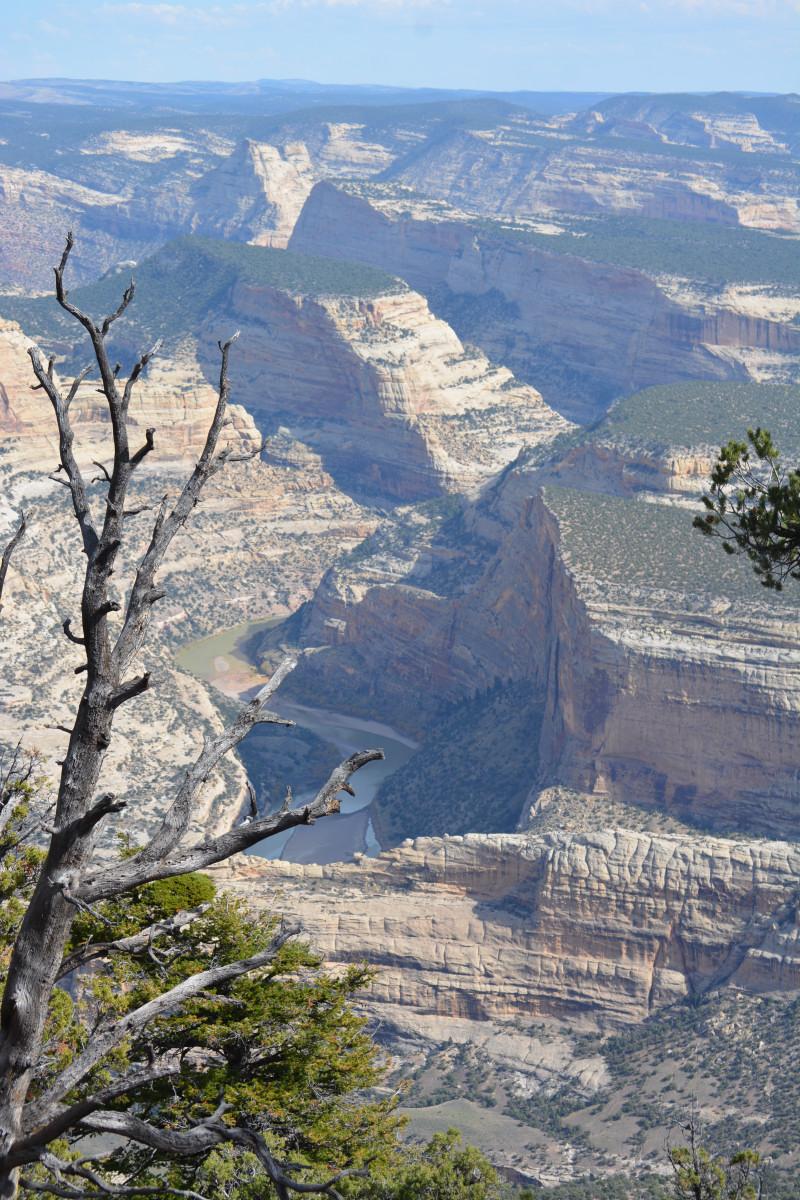
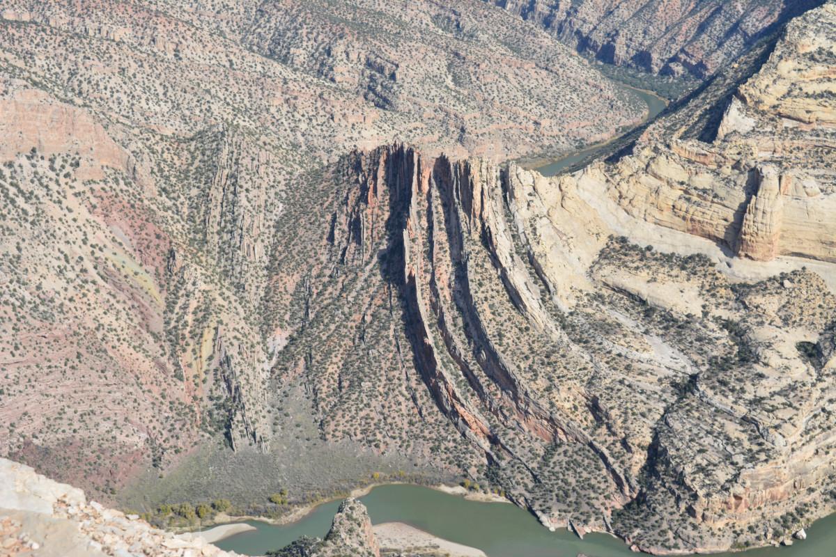
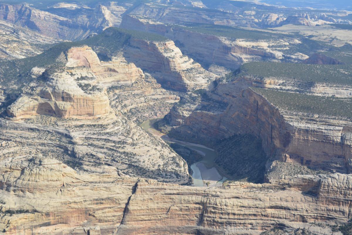
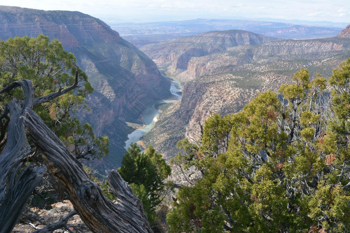
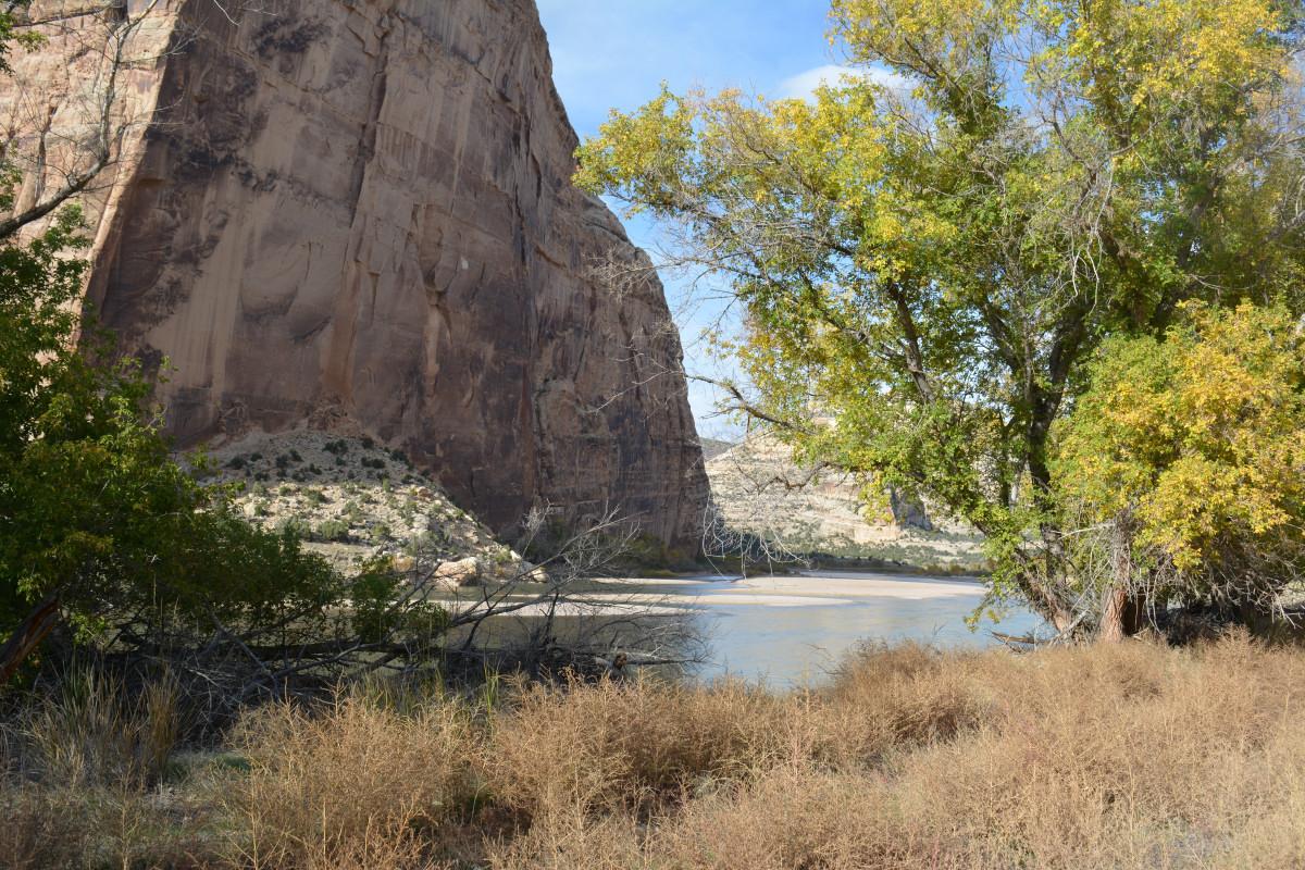
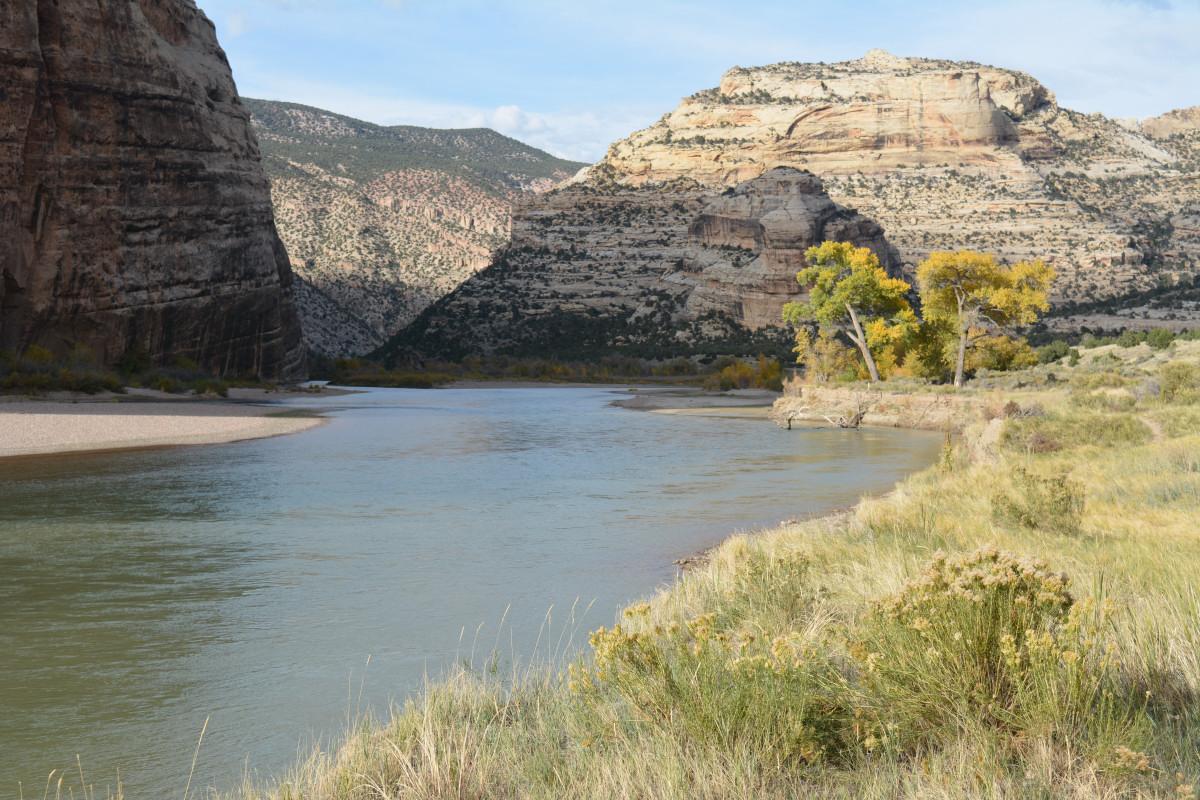
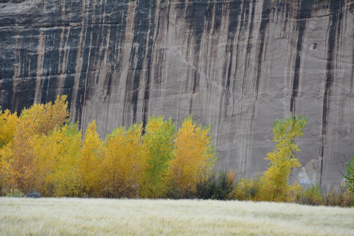
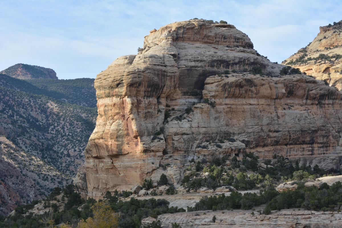
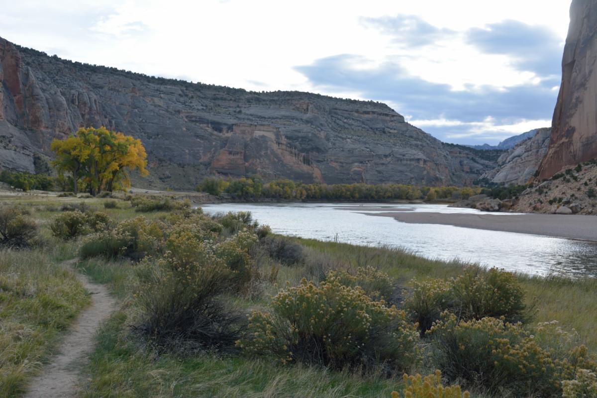
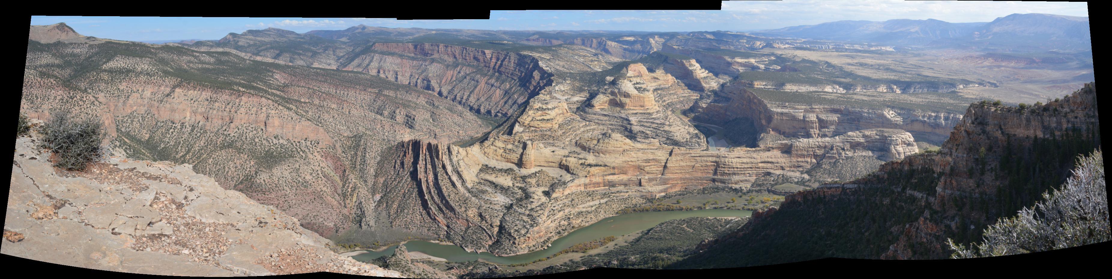
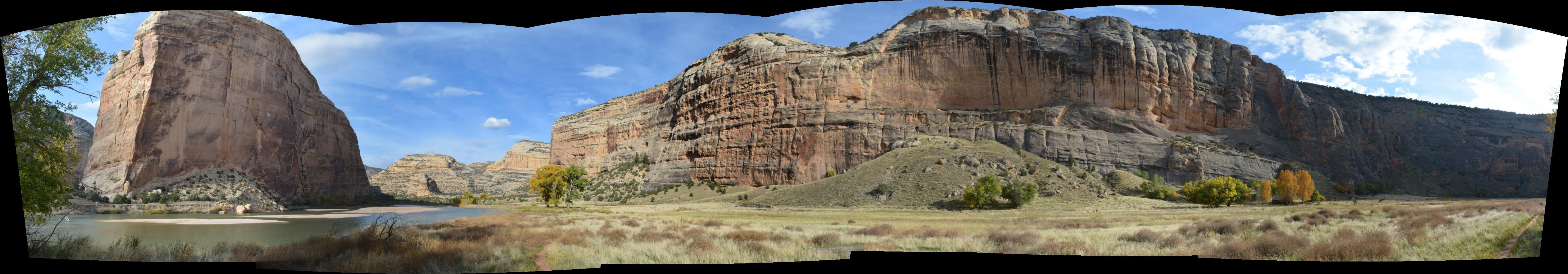
After the first week of flight testing, I drove to Dinosaur National Monument in northeast Utah for the weekend. I spent Saturday morning at the Dinosaur Quarry area in Utah. Before I left the Utah section of the park, I drove just outside the park boundary into BLM land and flew my RC plane, from which I got aerial video of the Split Mountain area. I then went to the canyons section in Colorado where I spent the rest of the day. I drove down the Echo Park Road at the end of the day, and camped at the Echo Park campground for Saturday night. I hiked a few trails, including Harpers Corner and through Echo Park out to the confluence of the Green and Yampa Rivers. This whole area had been threatened by a dam in the 1950's and would have been under several hundred feet of water, but the dam was defeated by the Sierra Club and other environmental groups. The Yampa is the last major undammed river in the Colorado River basin. It is all very pretty, remote, and quiet. This video shows the drive down the Echo Park Road, and the massive rock walls surrounding the confluence of the Green and Yampa Rivers.
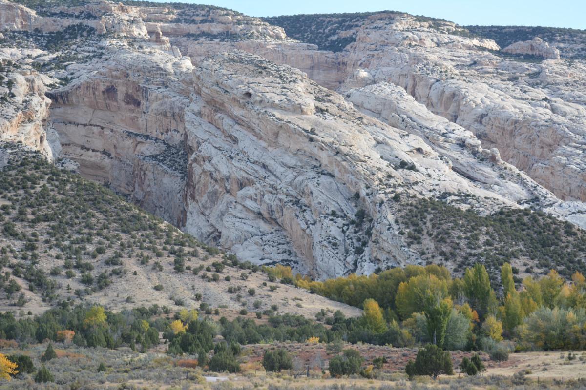
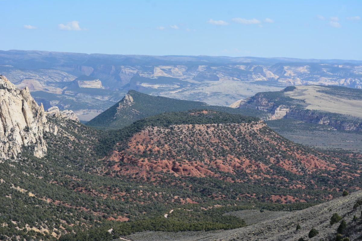
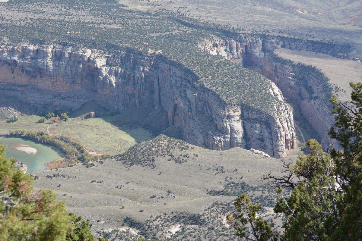

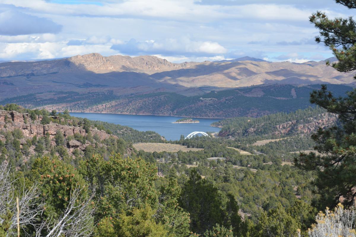
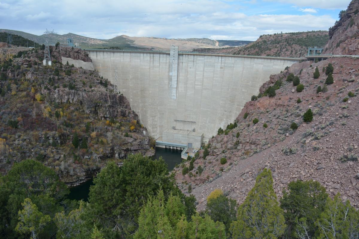
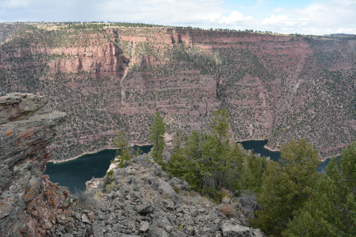
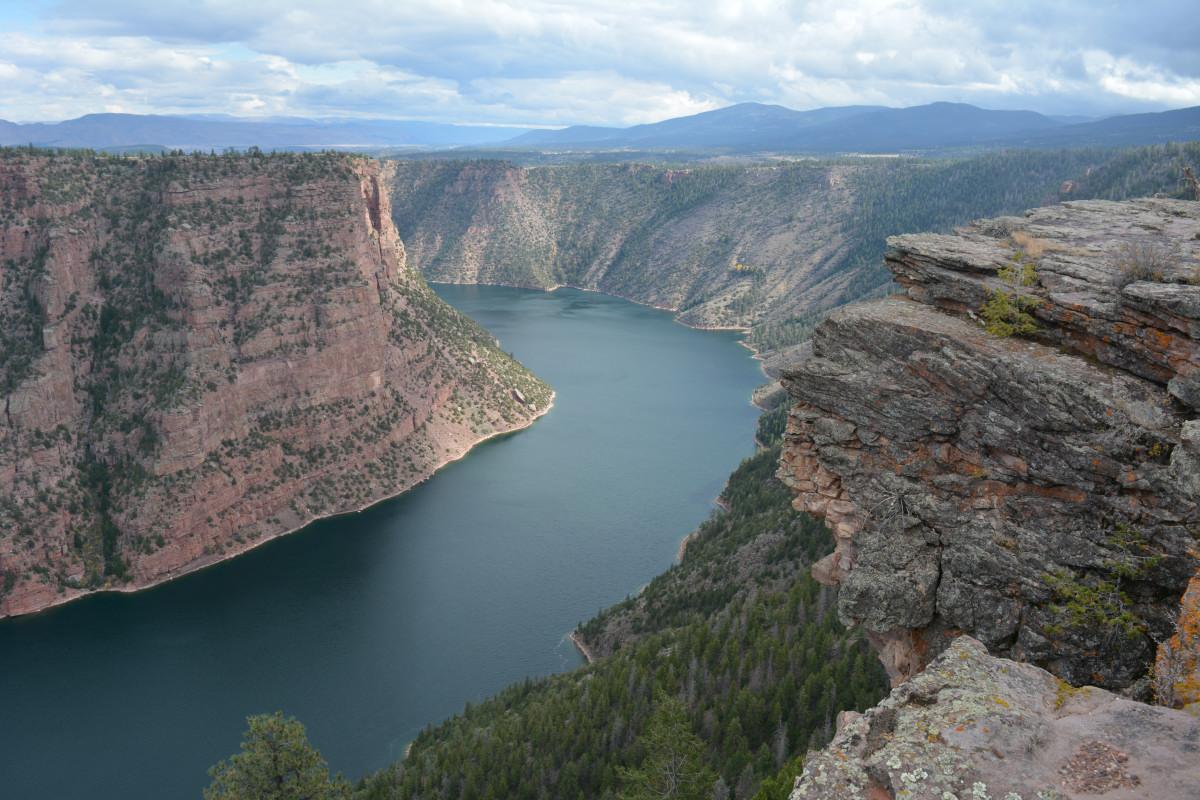
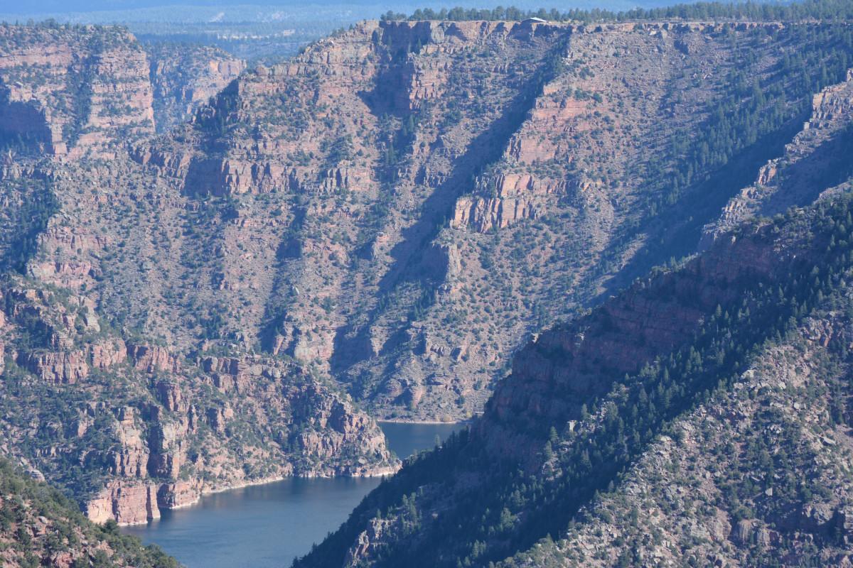
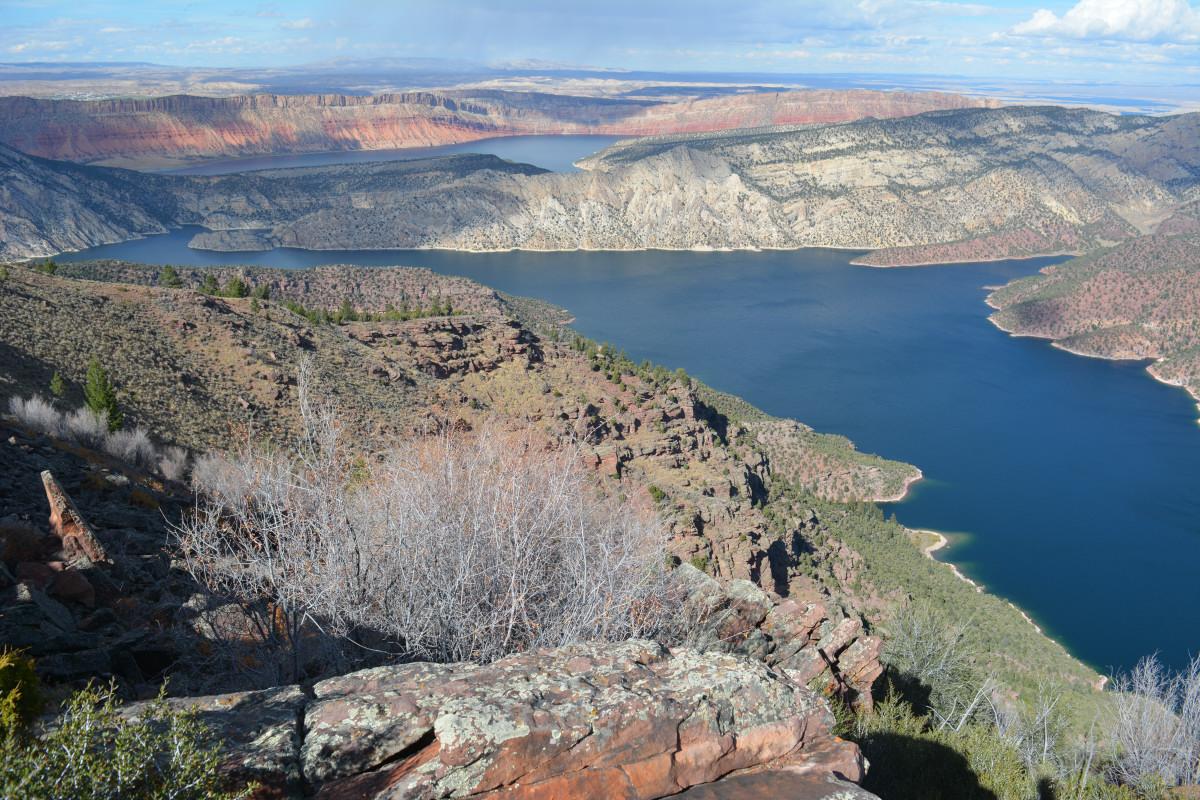
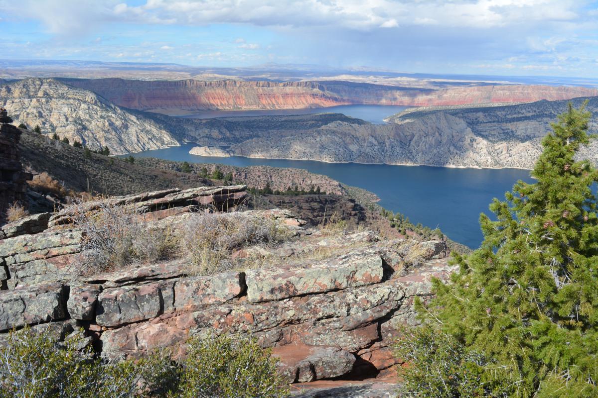
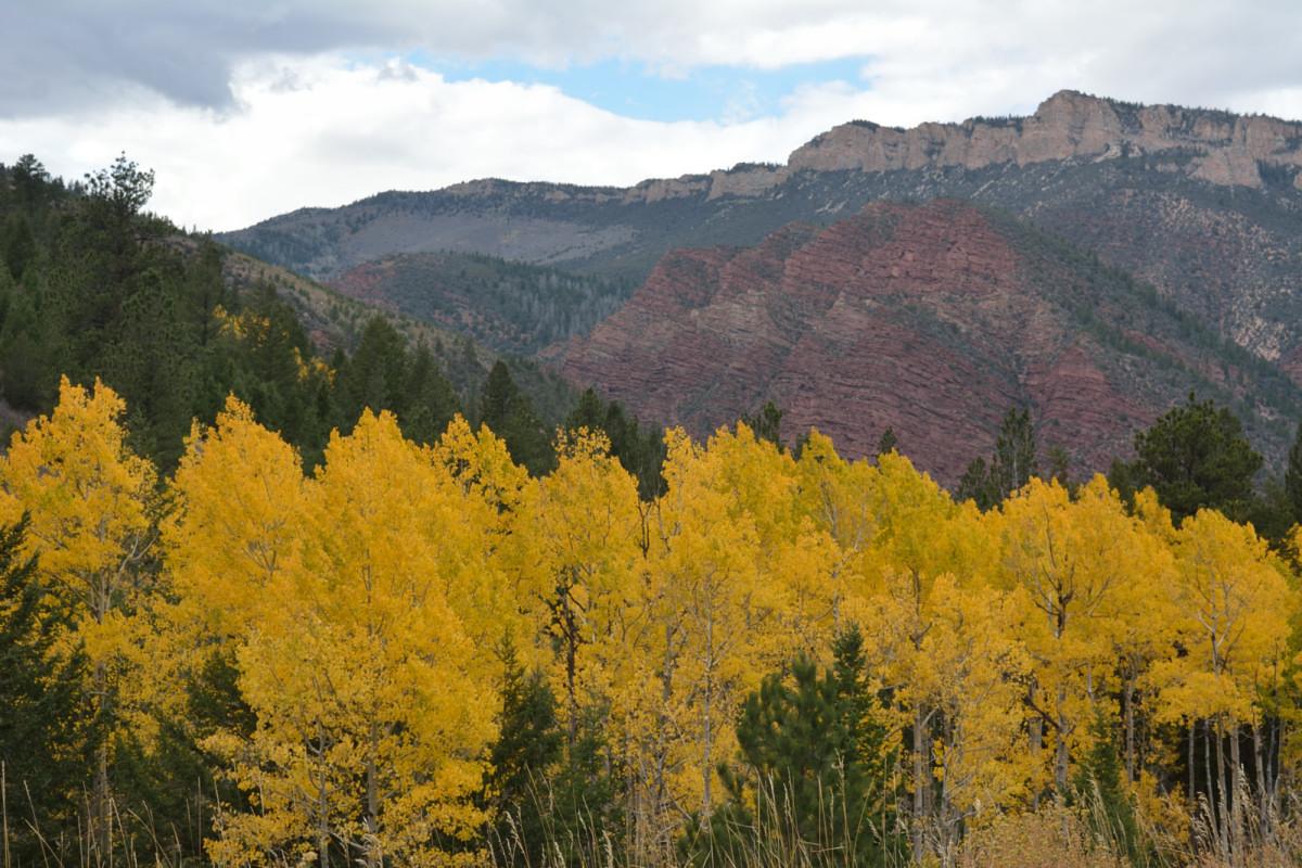
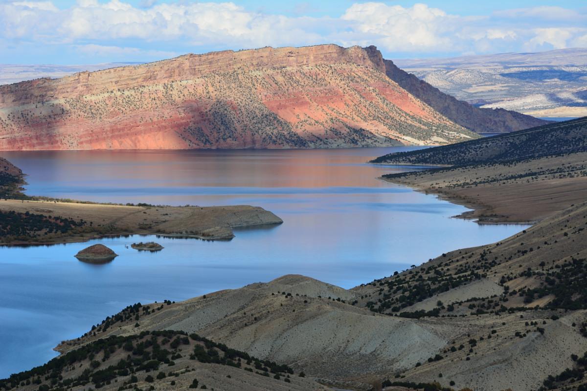
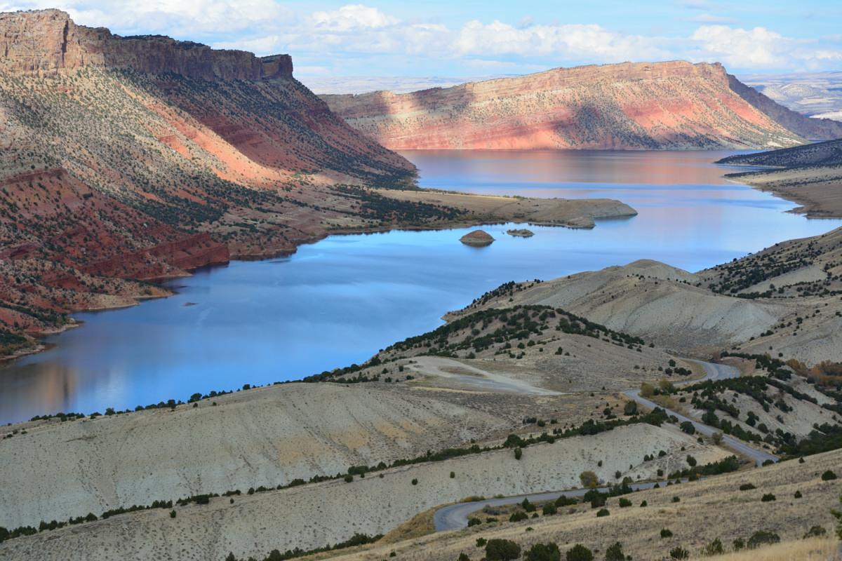
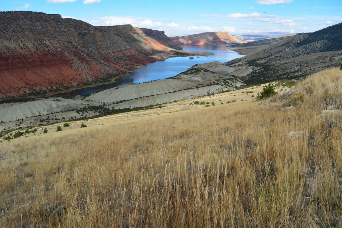
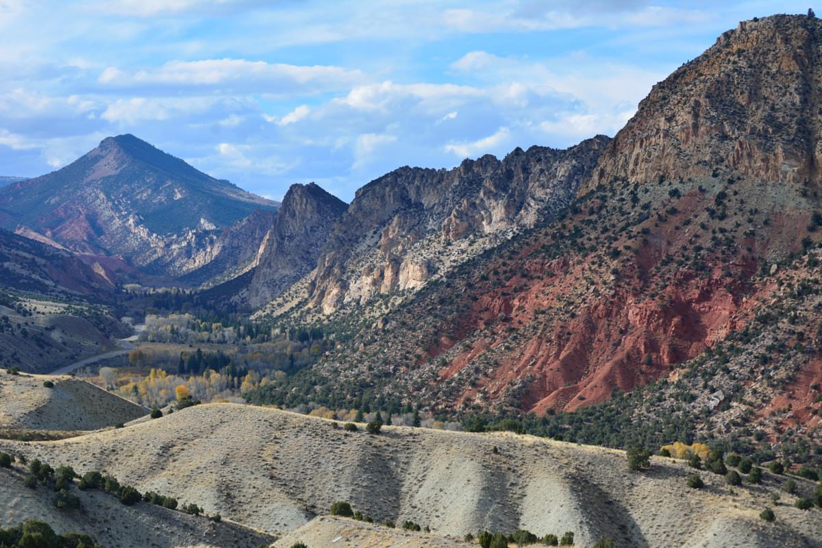
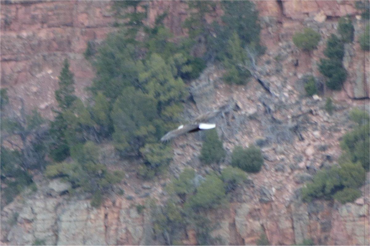
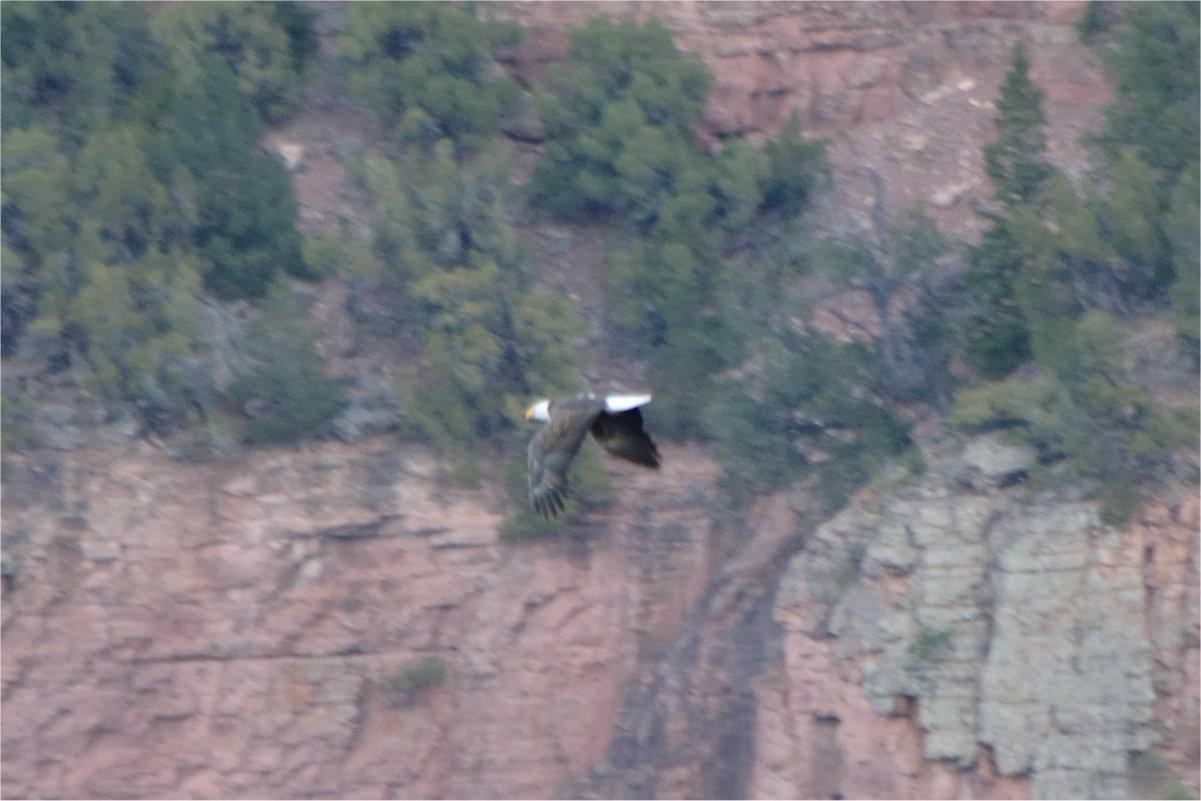
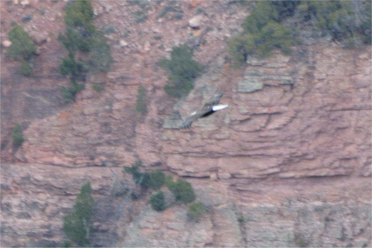
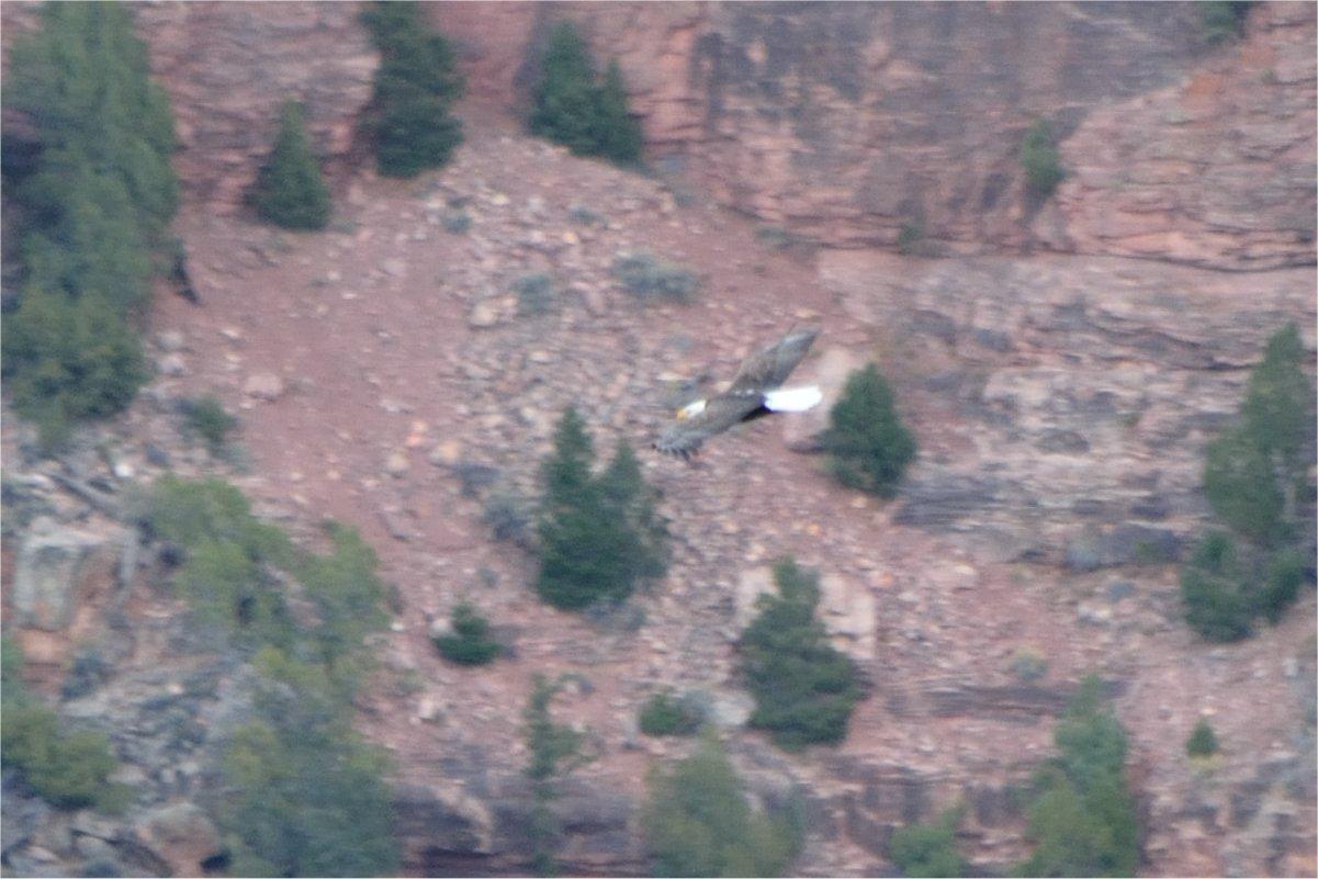
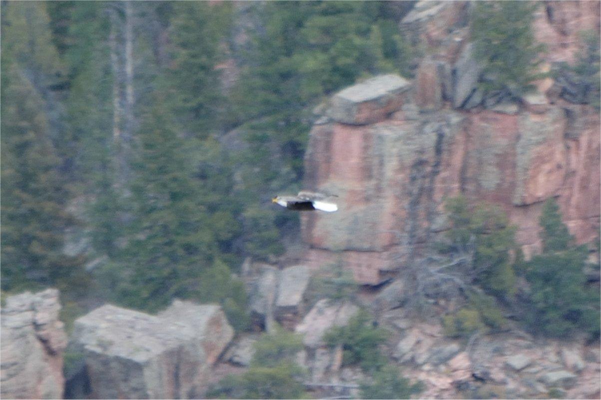
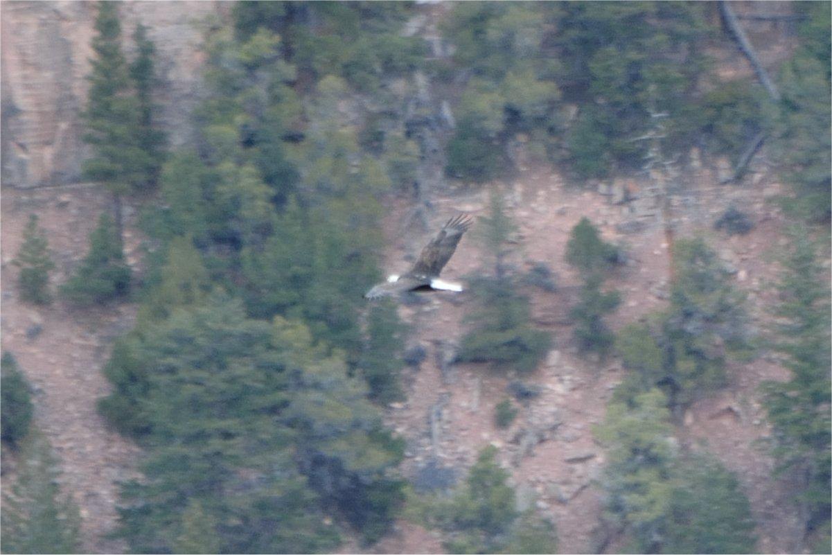
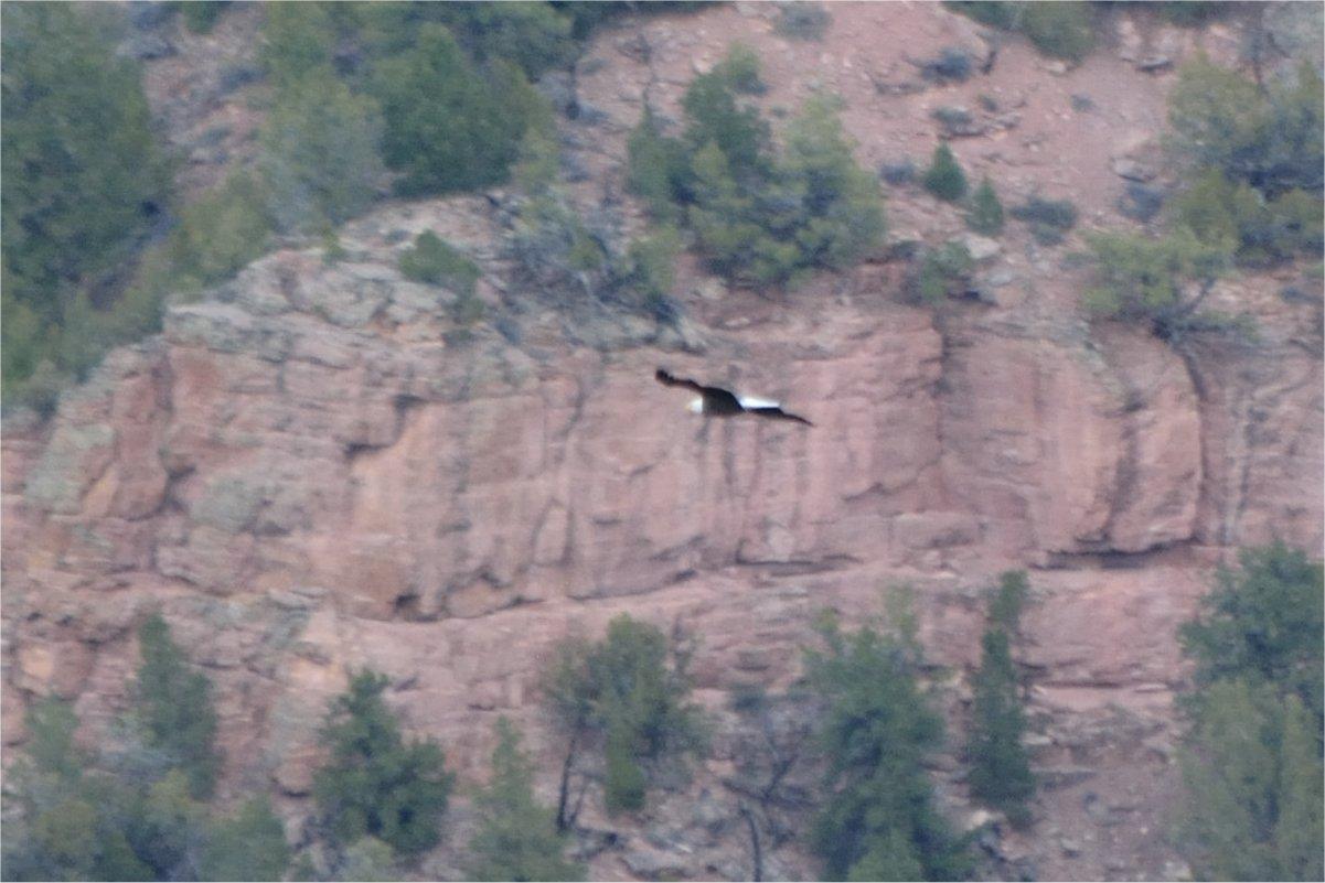
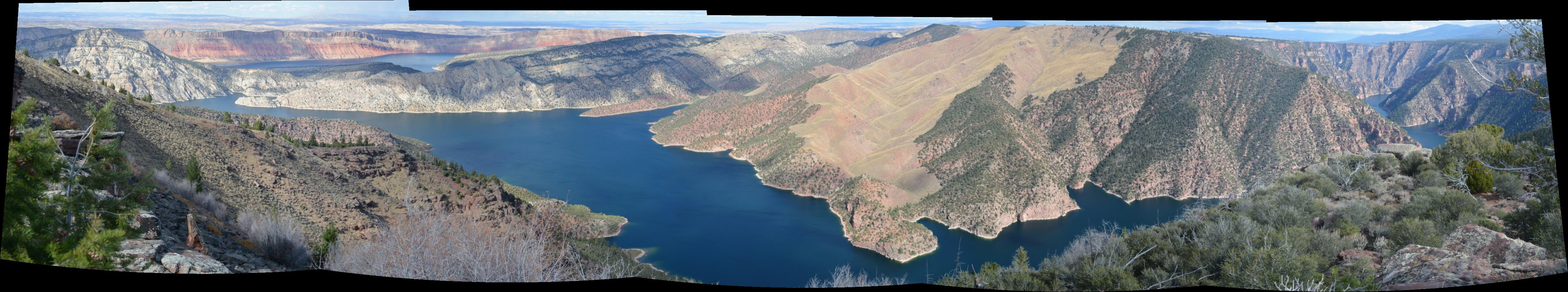
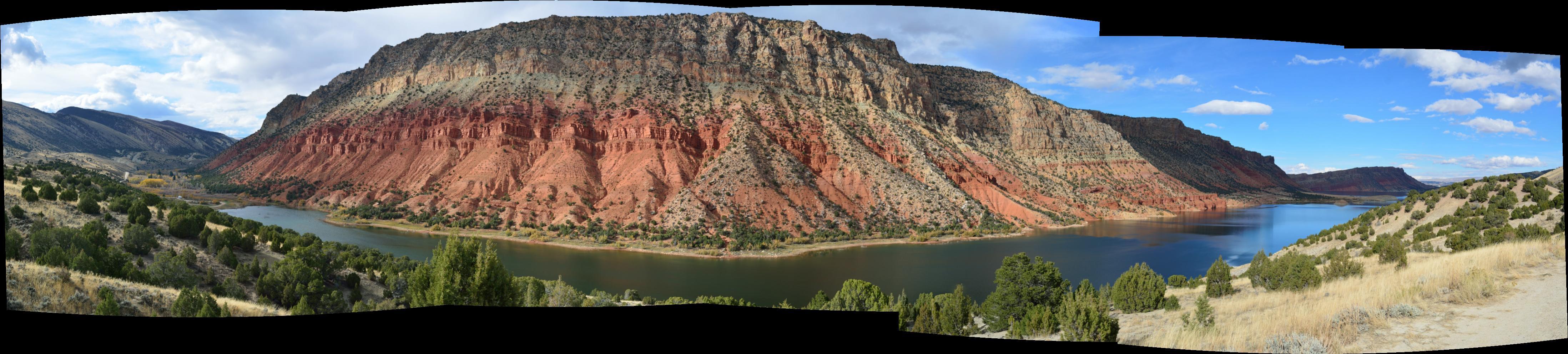
After spending Saturday night at the bottom of the canyon, I traveled to Flaming Gorge National Recreation Area, about 2 hours away. I spent the afternoon there, driving along the south and west sides of the gorge, going to lots of viewpoints. The reservoir in this canyon of the Green River was formed by the Flaming Gorge Dam, which backs up the Green River for over 100 miles, all the way into Wyoming. John Wesley Powell visited this area twice during his expeditions in 1869 and 1871-1872. He named Flaming Gorge and Red Canyon as he traveled along the Green River. I even spotted a Bald Eagle soaring through Red Canyon as I was taking photos near the visitor's center. On the way back north and west through Wyoming, I flew my RC plane just south of Mountain View, Wyoming and captured some aerial video of the badlands there.

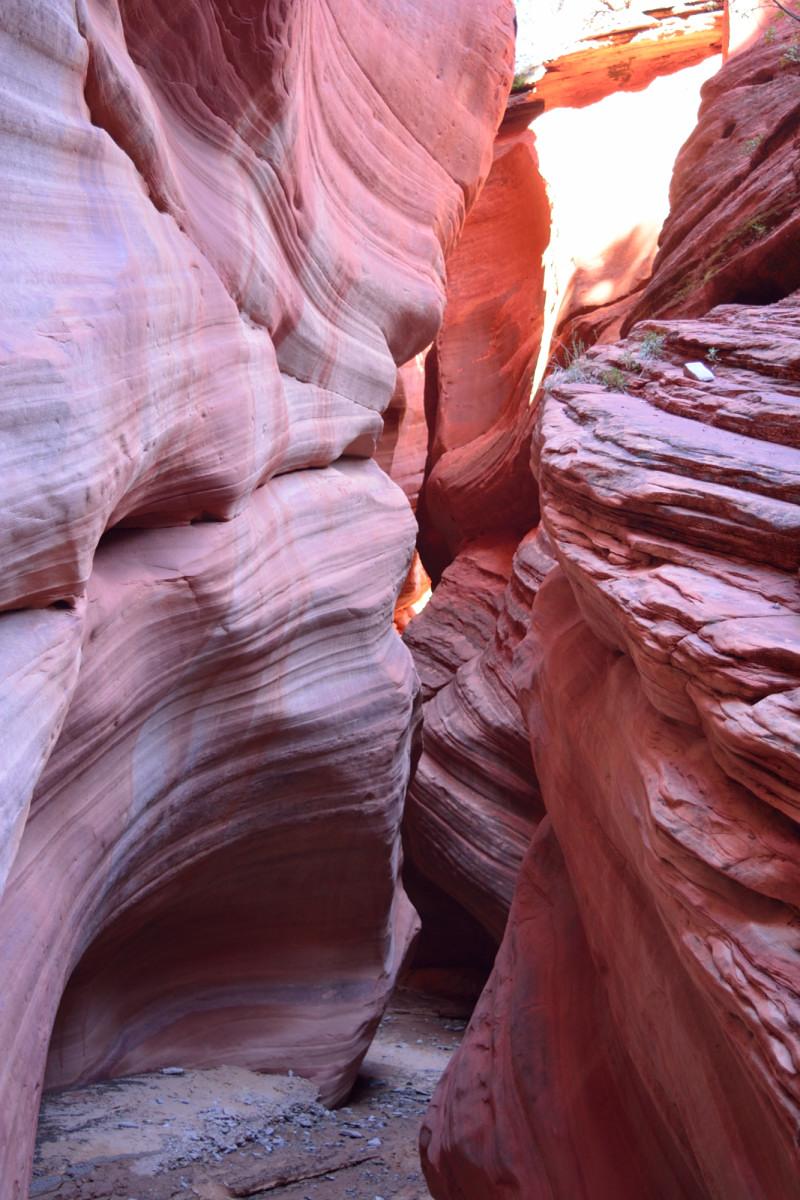
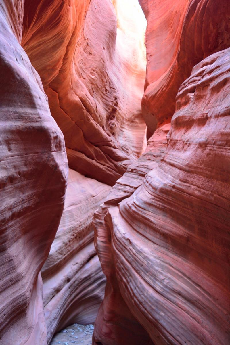
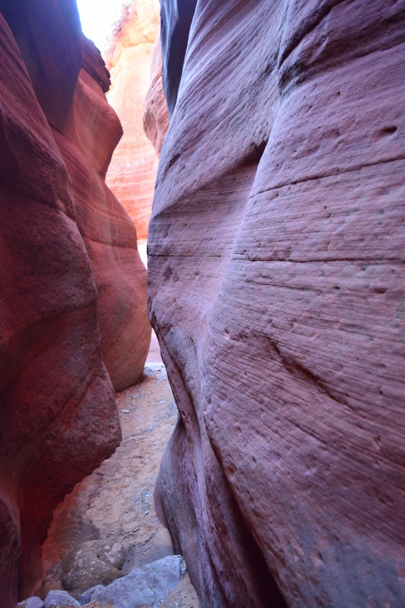
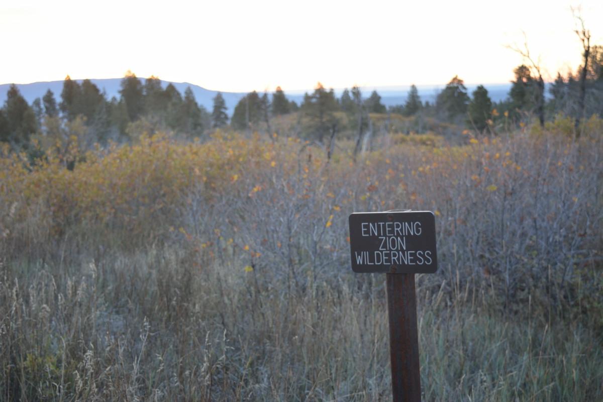
Zion National Park, Coral Pink Sand Dunes State Park, Peek-A-Boo Slot Canyon, Utah, 22 - 24 October 2015
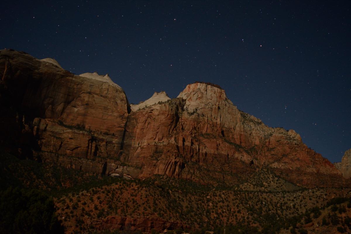
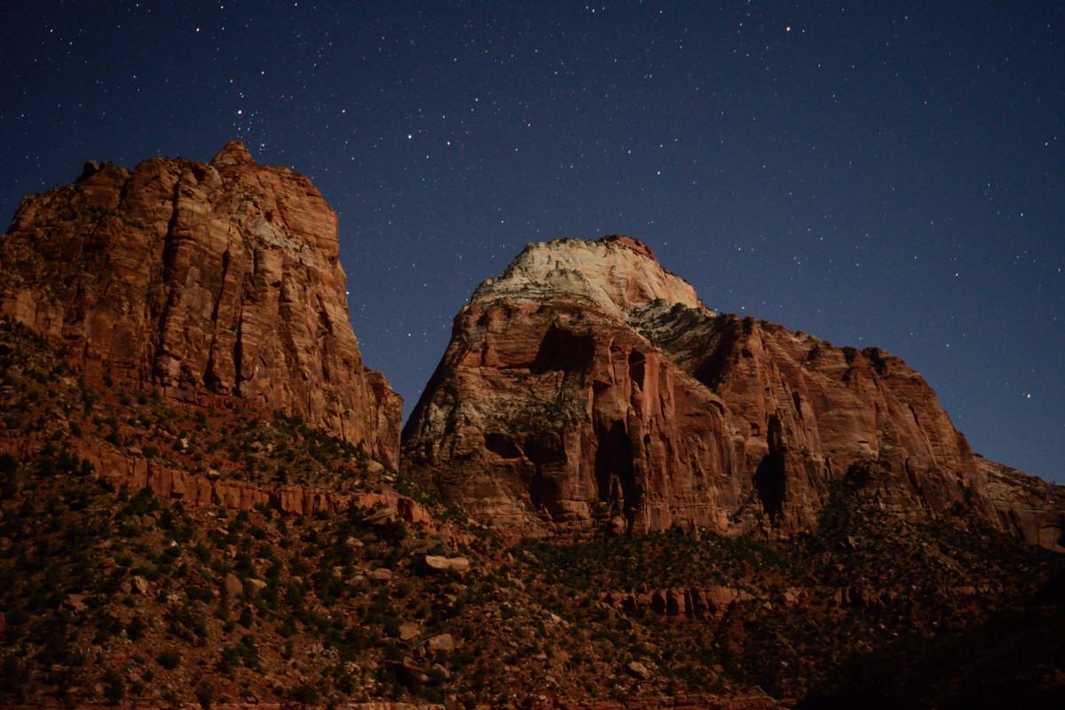
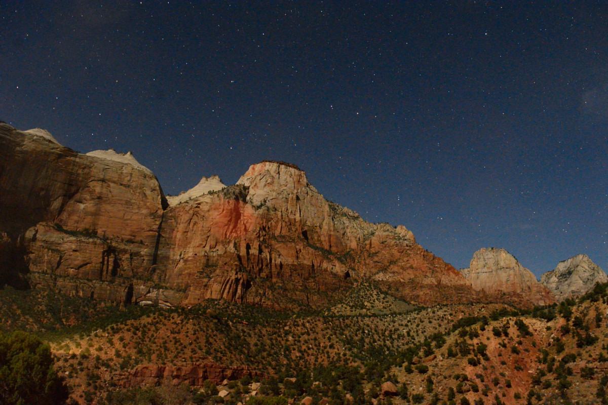
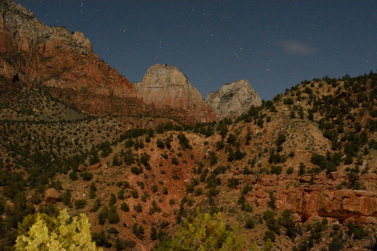
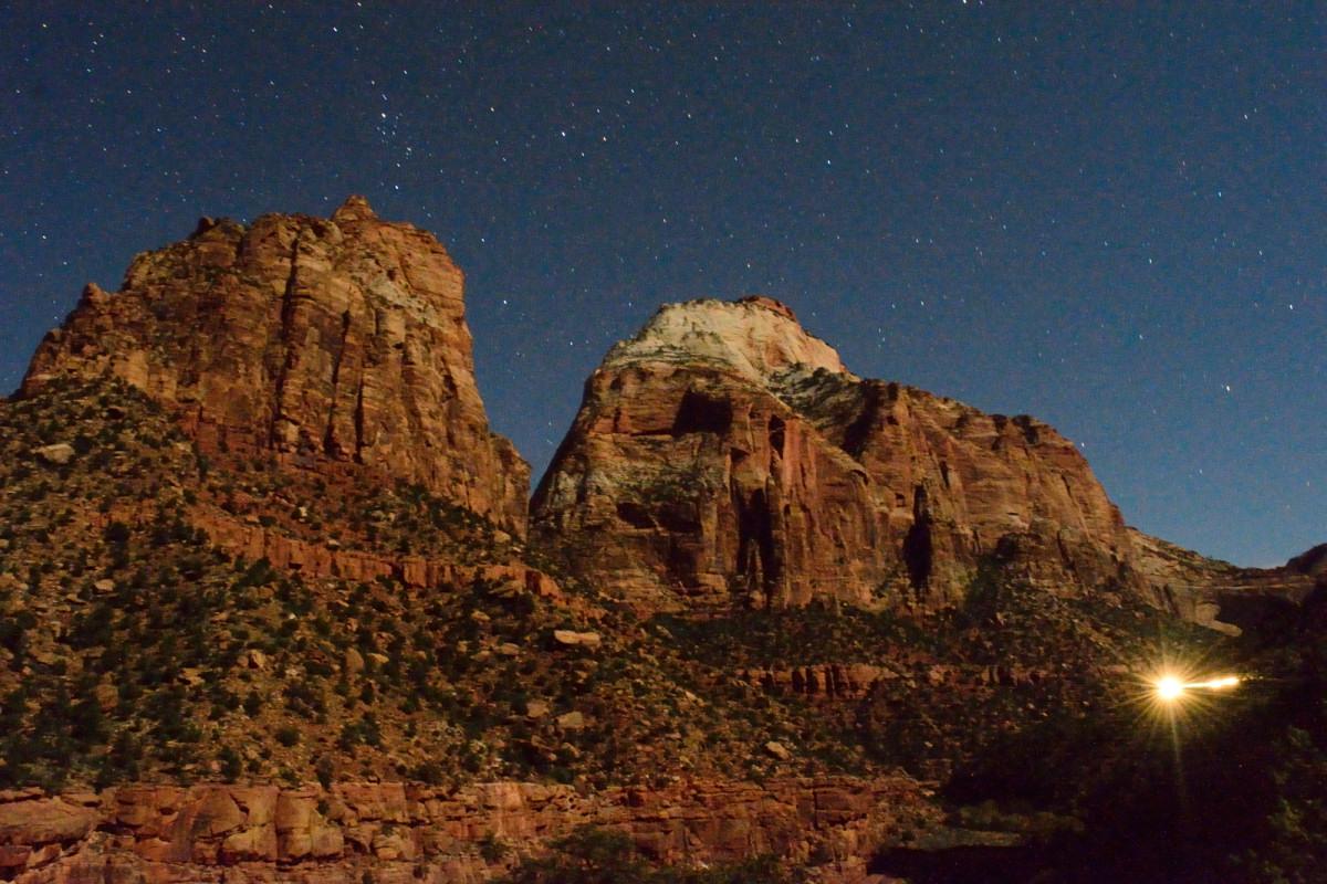
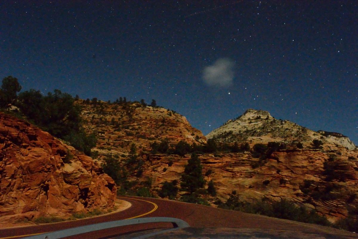
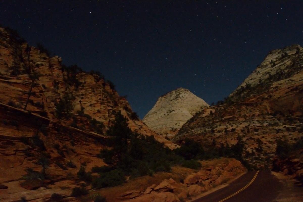
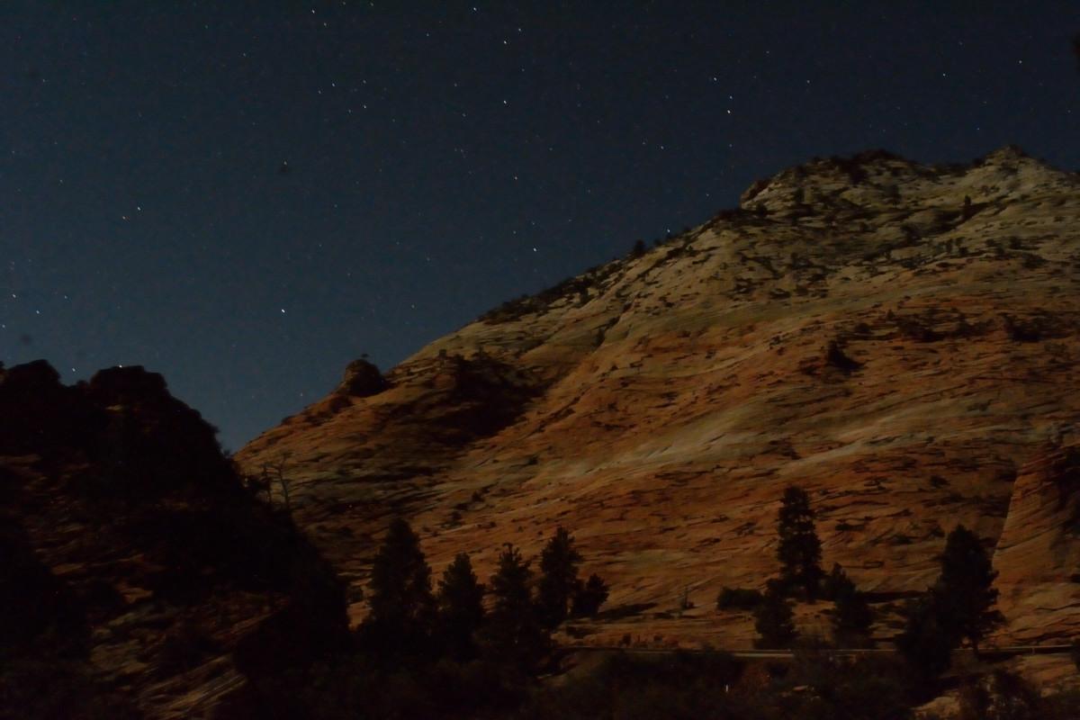
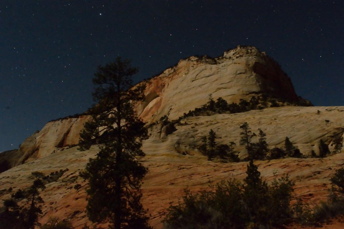
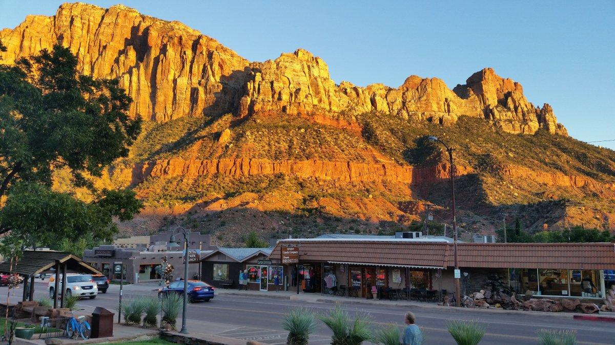
When flight testing was completed the second week, I drove to Zion National Park on Thursday evening. I had dinner at Pizza & Noodles in Springdale. As I have written in other posts about Zion, I always end up eating there in Springdale. I spent Thursday evening taking night shots of Zion Canyon and along Mt Carmel Road, before camping in the park that night.
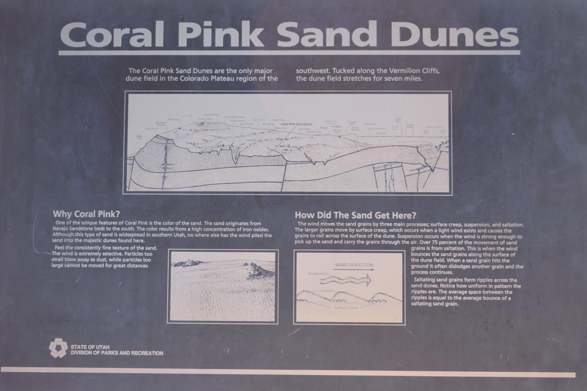
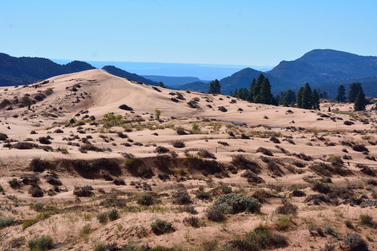
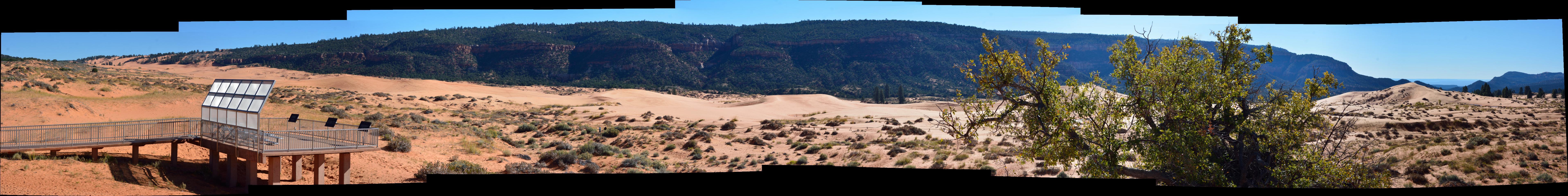
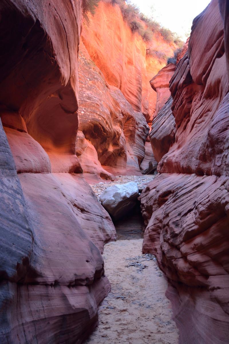
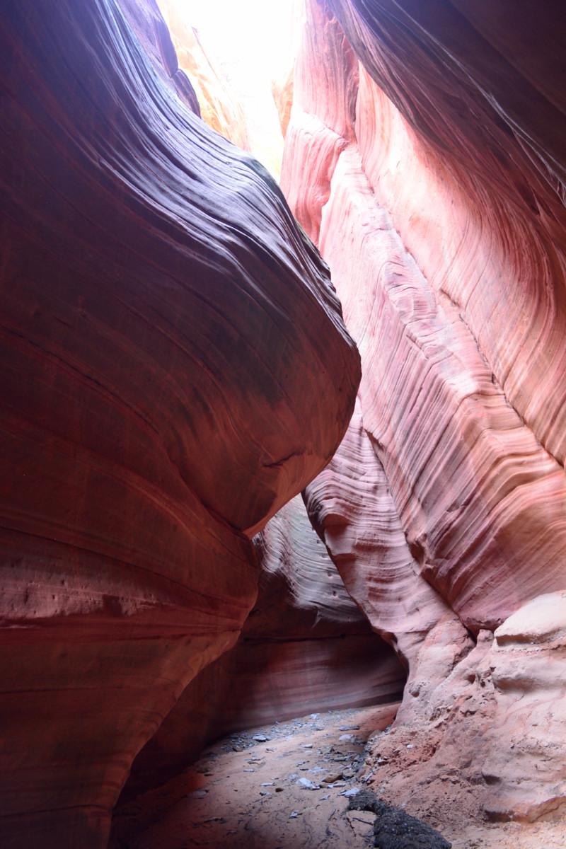
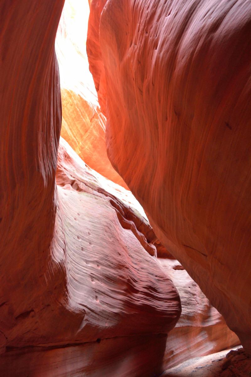
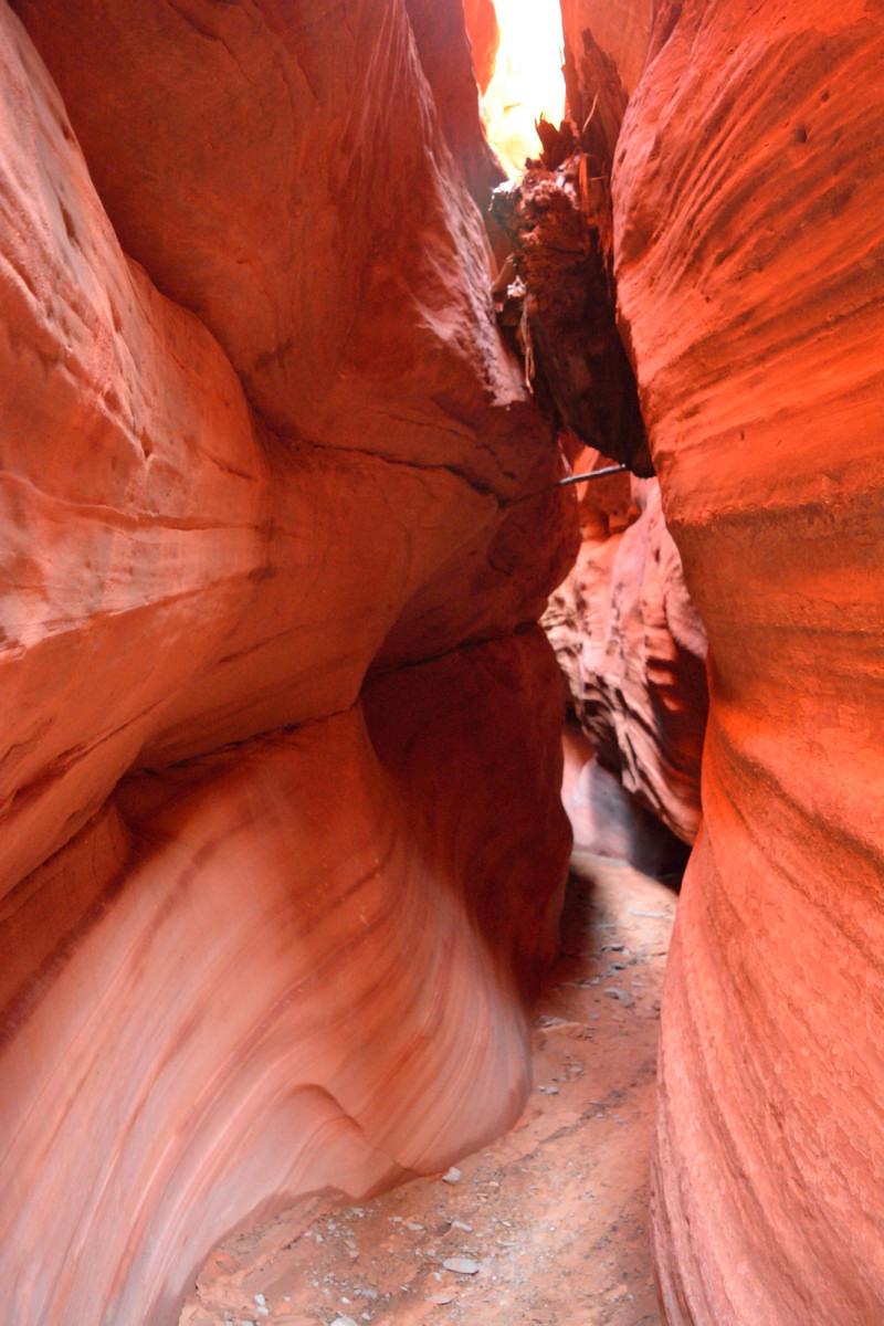
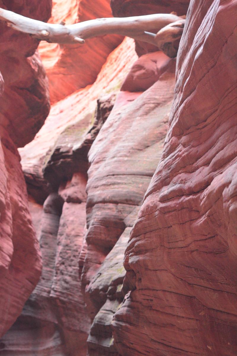
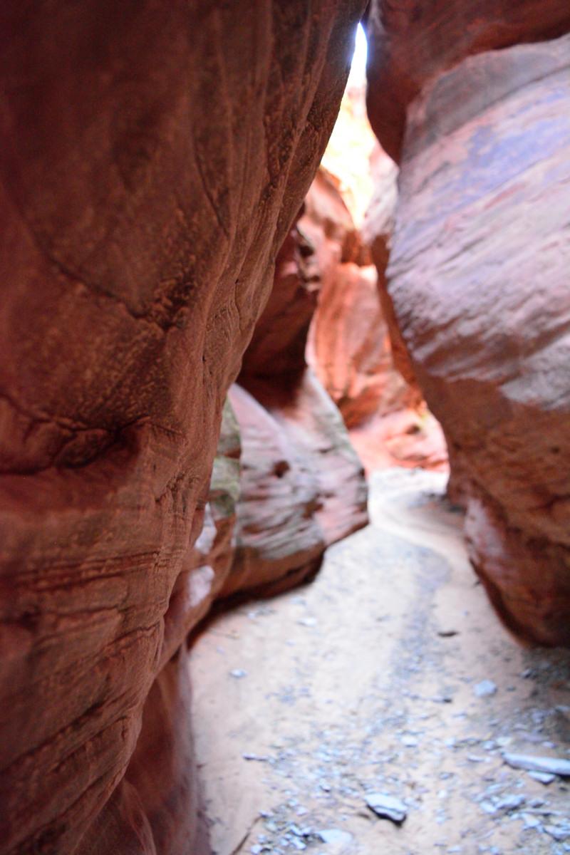
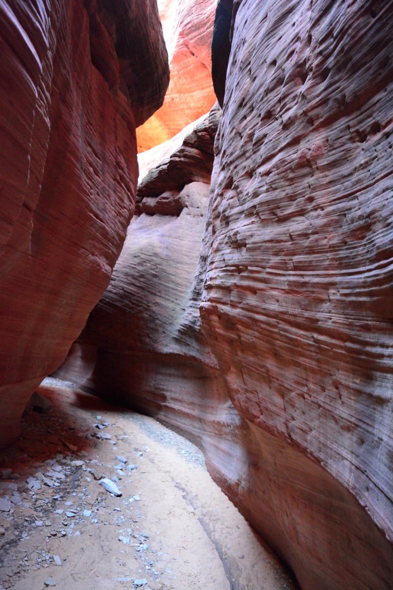
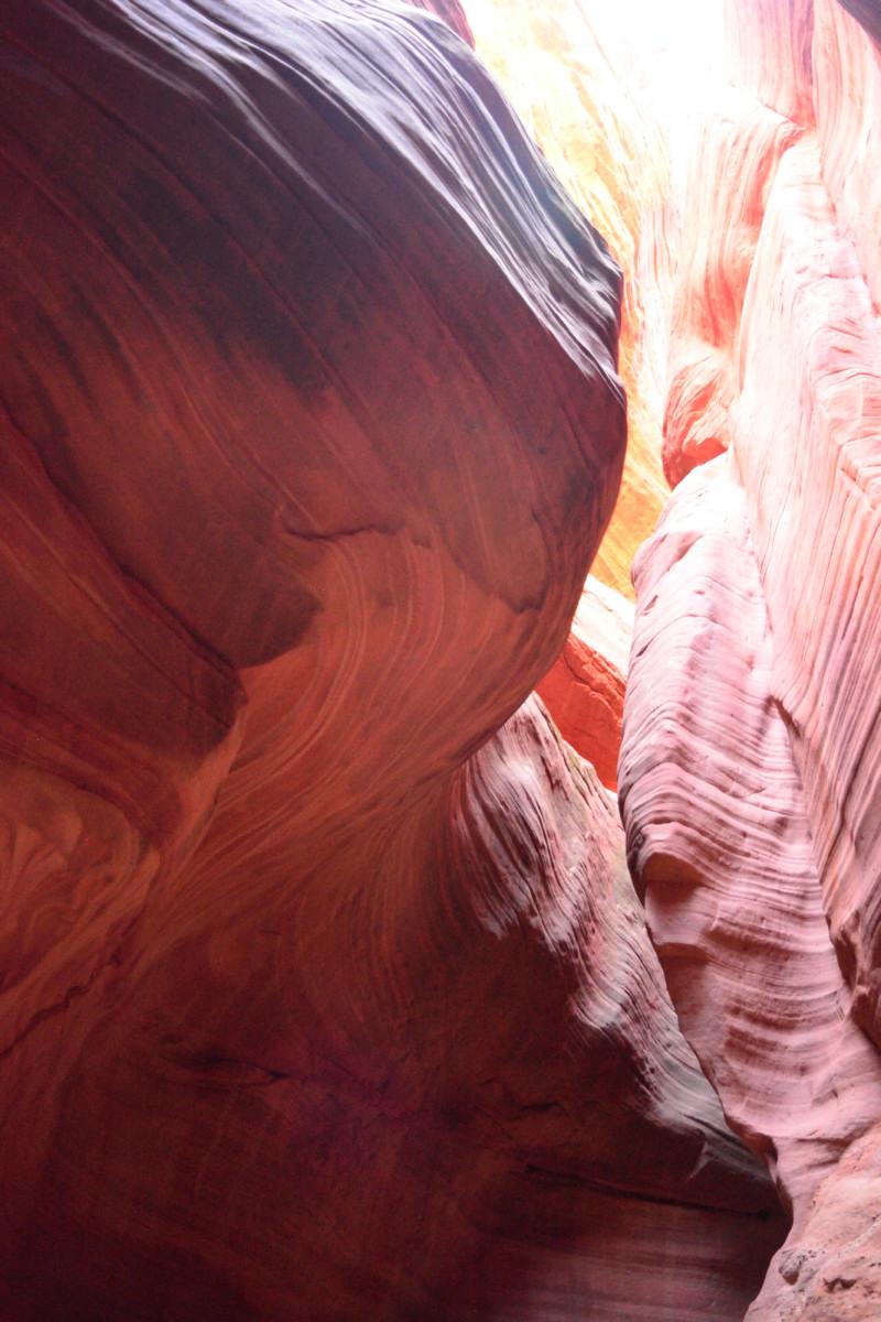
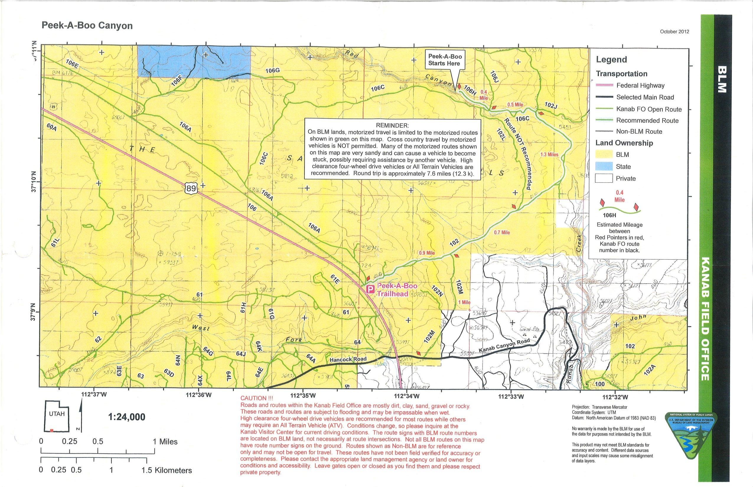
On Friday, I went to Kanab to explore. I went to the BLM Office in Kanab to ask their help in finding a slot canyon nearby that I had read about. Peek-A-Boo slot canyon is just north of Kanab, and can be reached by a high clearance 4-wheel drive or by hiking. This is not the more famous Peek-A-Boo slot canyon that is on the Hole-In-The-Rock Road in southeast of Escalante. The people at the BLM Office were very nice and gave me a map and directions that took me right to the slot canyon. The entrance to this Peek-A-Boo slot canyon is here. However, before I hiked Peek-A-Boo, I drove to Coral Pink Sand Dunes State Park, which is about 12 miles west of Kanab. On the way out to the park, I flew my RC plane and took aerial video of the open spaces and White Cliffs of the Grand Staircase. Coral Pink Sand Dunes State Park stretches for 10 miles along a mountain where the winds have pushed the fine sand up into dunes. If you have an off-road vehicle, it looks like a great place to visit and have a lot of fun. If you are just visiting to see the sand dunes, you will probably spend a less time at the park. I was not there for long, but I did fly my RC plane again, and took aerial video of the dunes in the north section of the park.
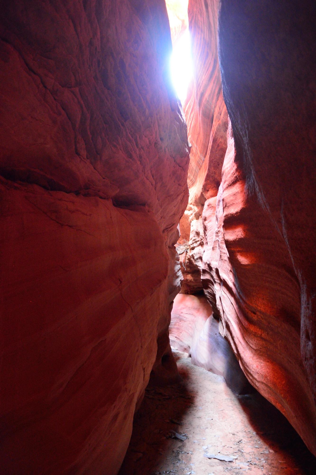
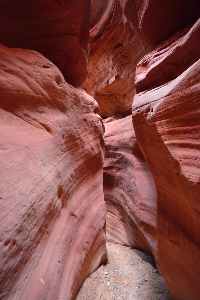
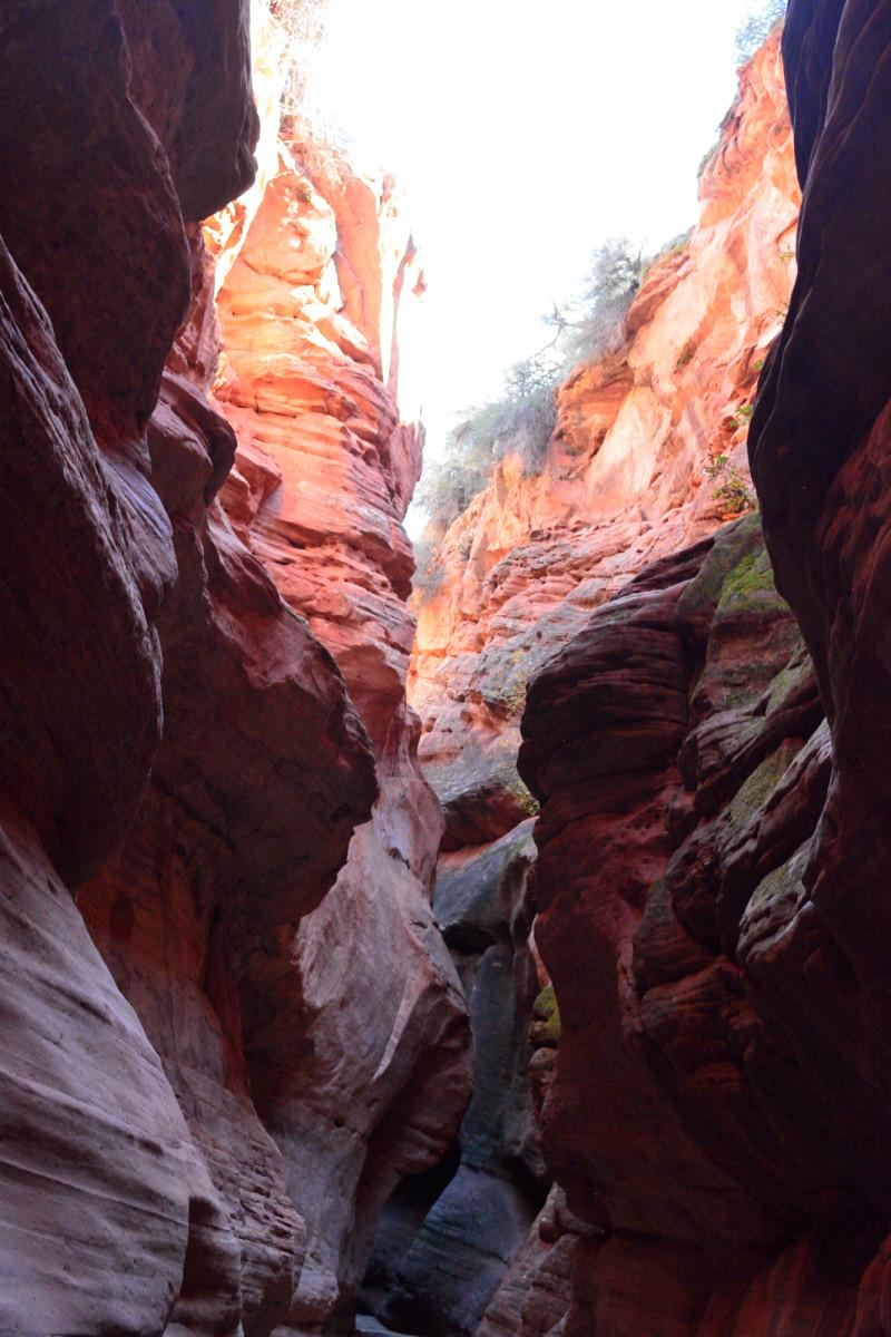
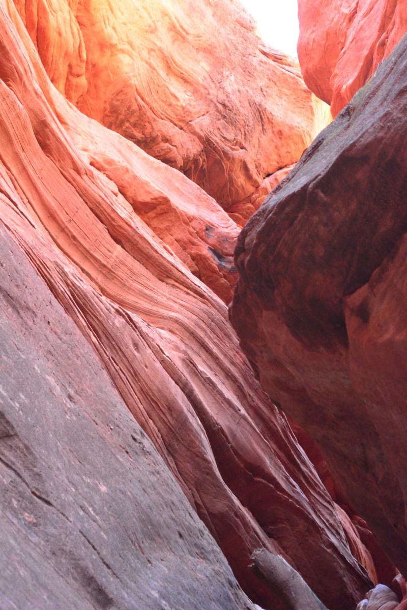
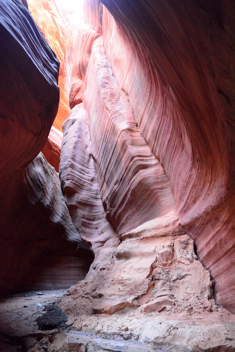
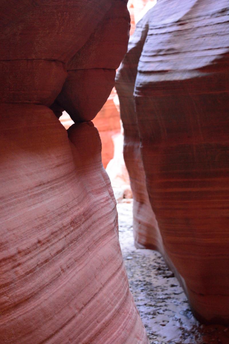
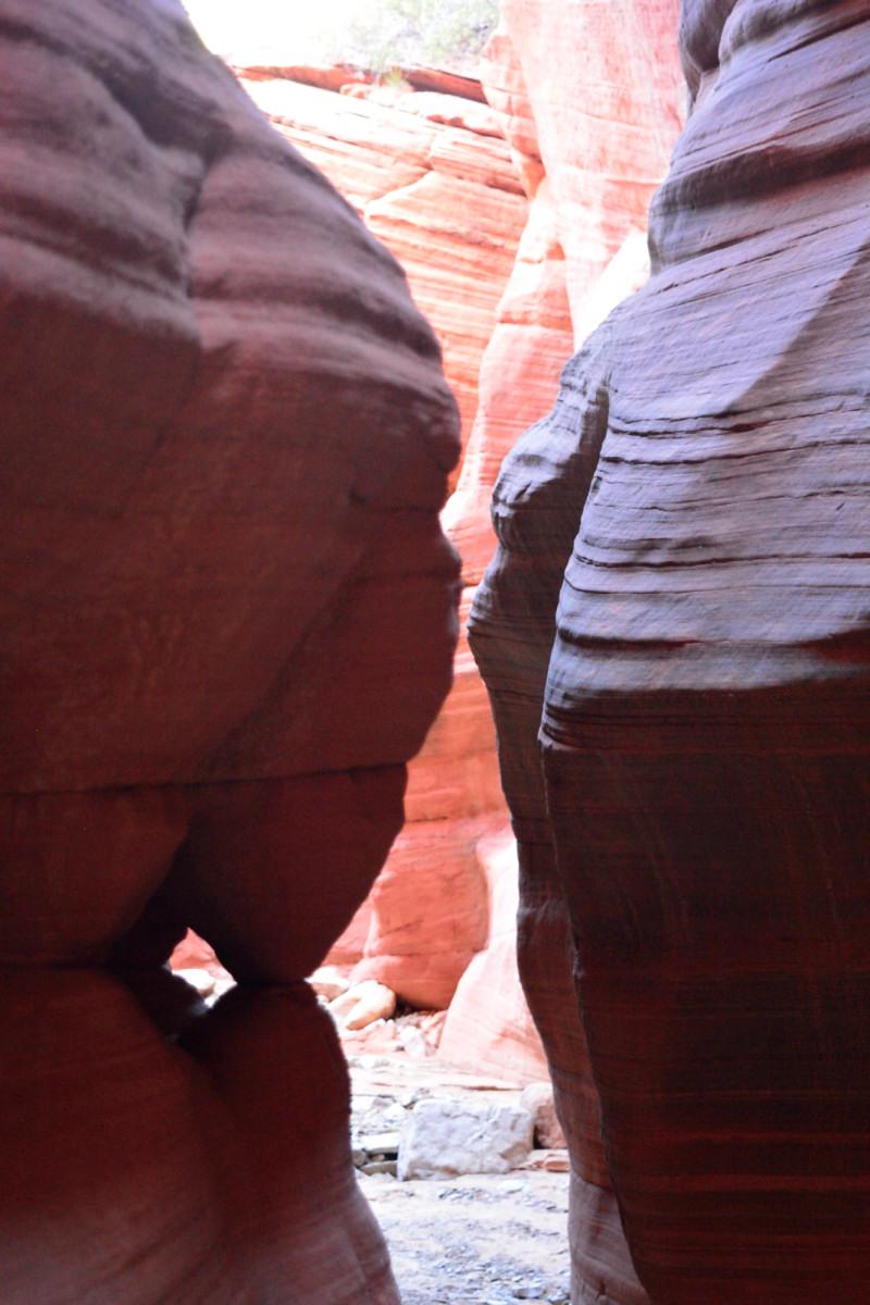
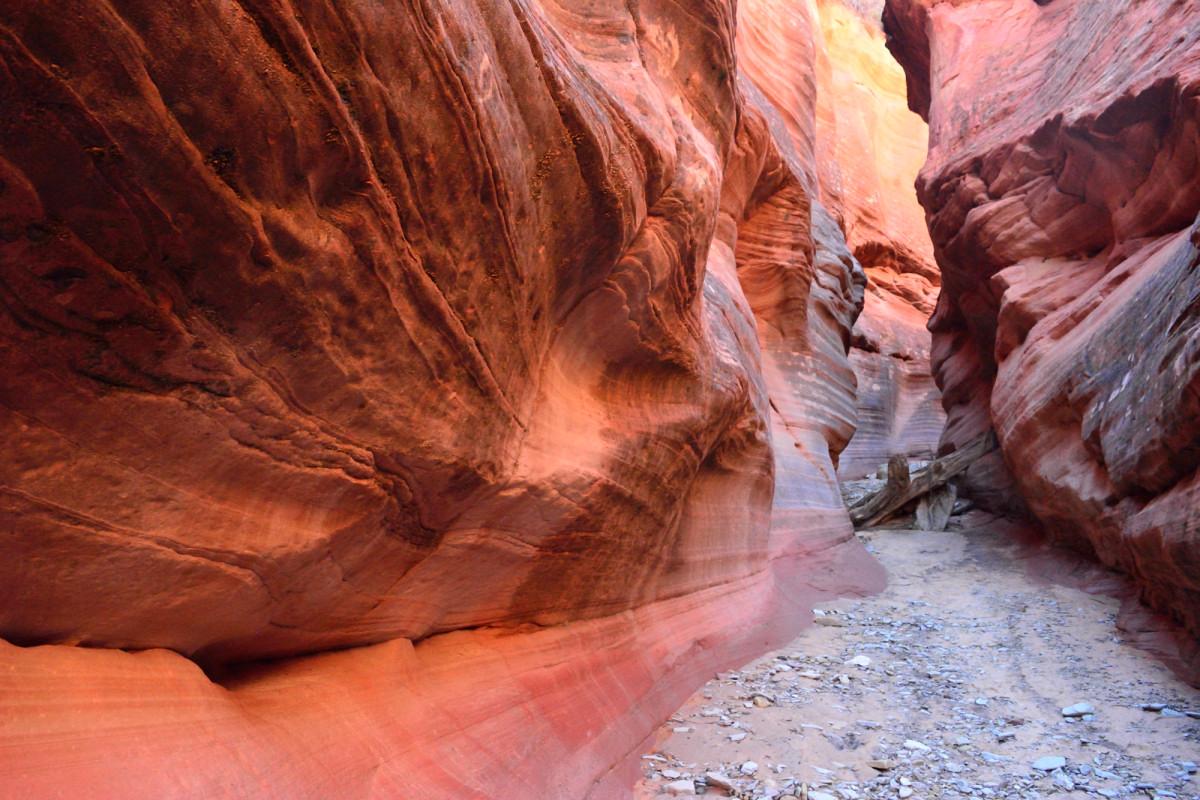
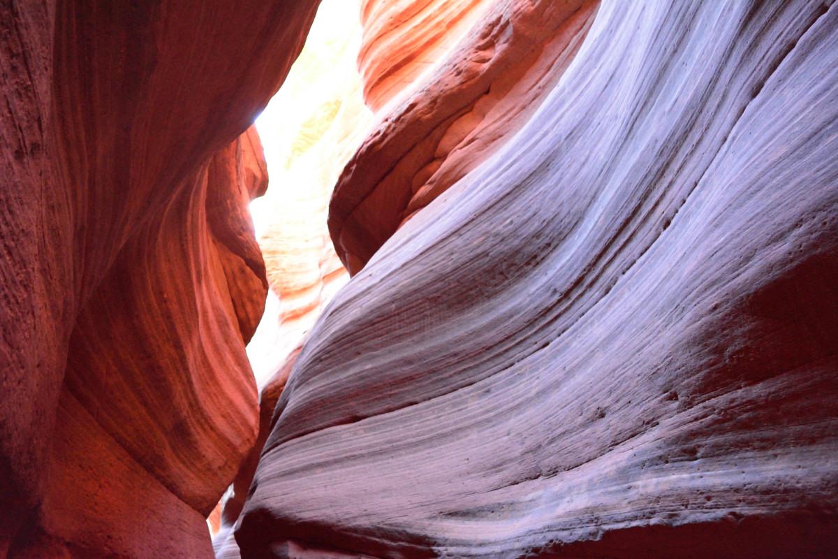
I drove back to the trailhead for Peek-A-Boo slot canyon and hiked, as my rental car was not up to the task of making it on the road out to the slot canyon. I hiked about 3.8 miles out, walked up and down the slot section for about a mile while recording with my GoPro on my headmount, then walked back 3.8 miles. Because most of the trip out and back is through soft sand, it felt like a lot more than 8.5 miles. It was worth it, as the slot was very neat with some good colors.
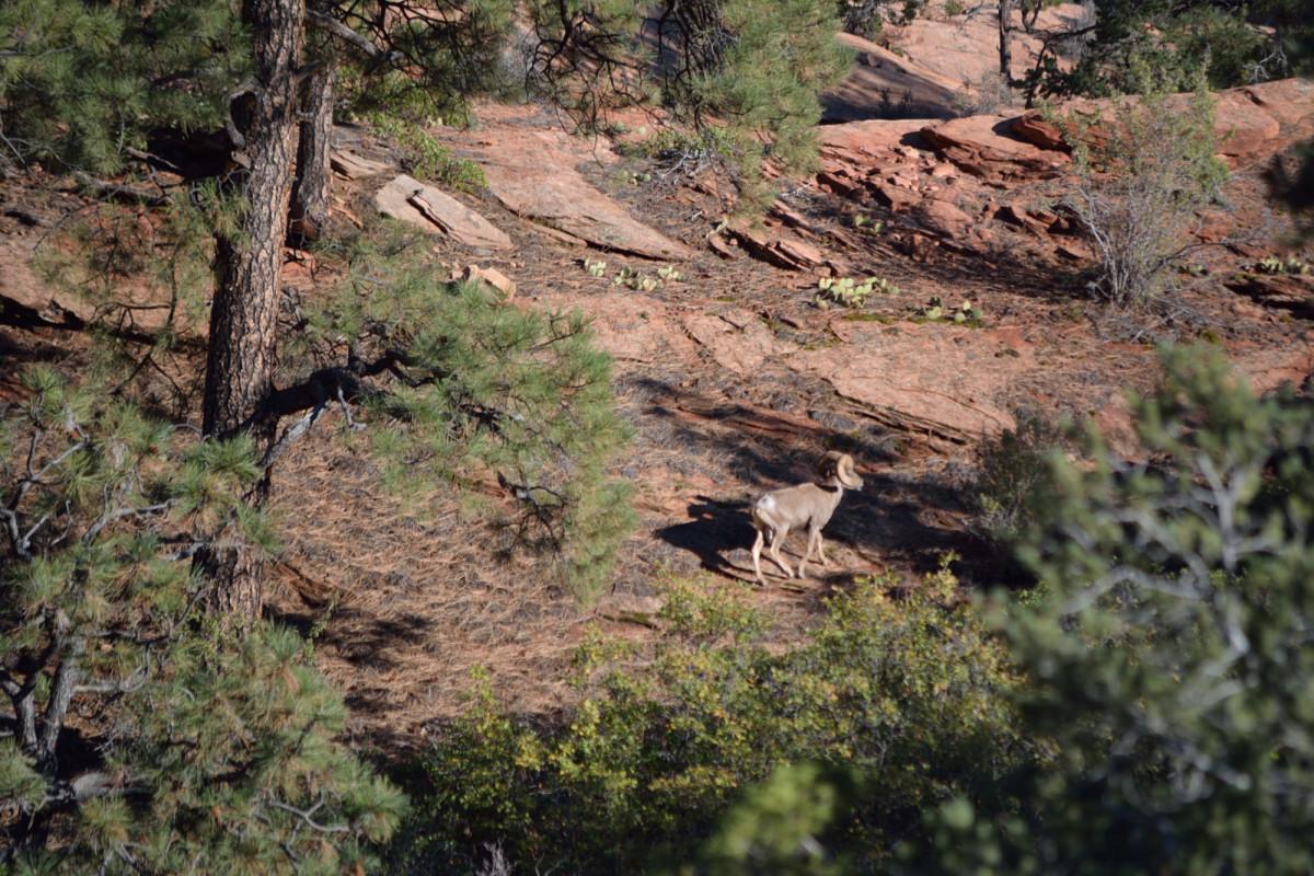
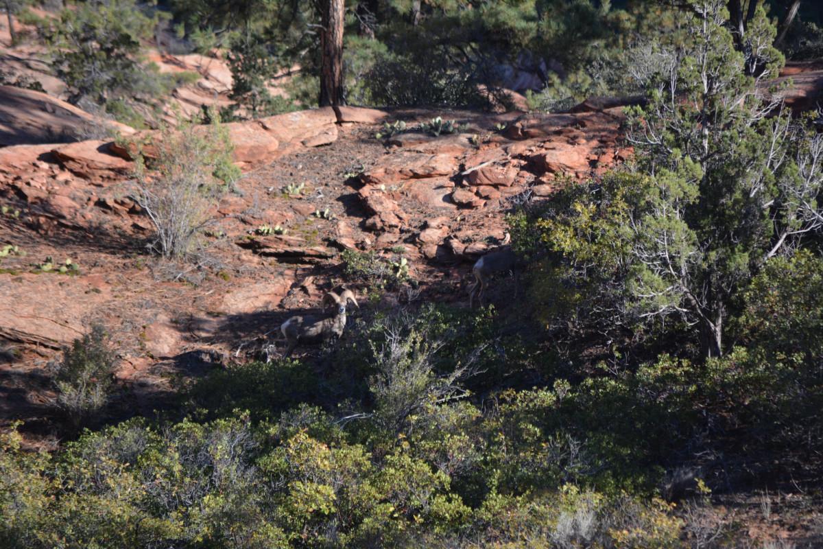
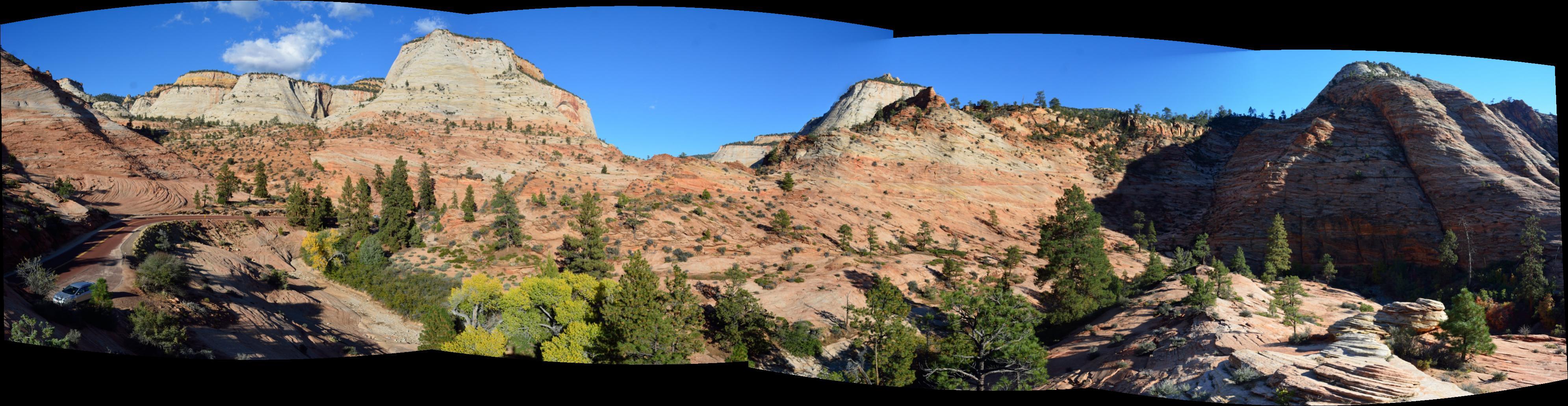
I then drove back to Zion, had dinner, and rested for Friday night in a hotel in Springdale, getting ready for my long hike on Saturday. I had reservations for a shuttle to Lava Point early on Saturday morning, where I would hike the West Rim Trail down to the Grotto. On the way back from Kanab, I drove the Mt Carmel highway through the east section of the park in late afternoon. If you only shoot photos to the east, this is a good time to drive that road for photography. I got lucky also; there were mountain sheep along the road in one section.
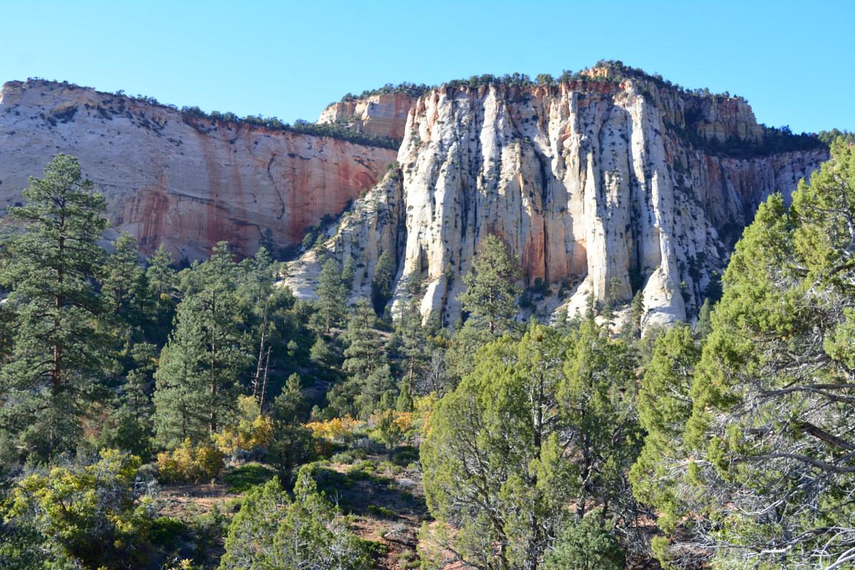
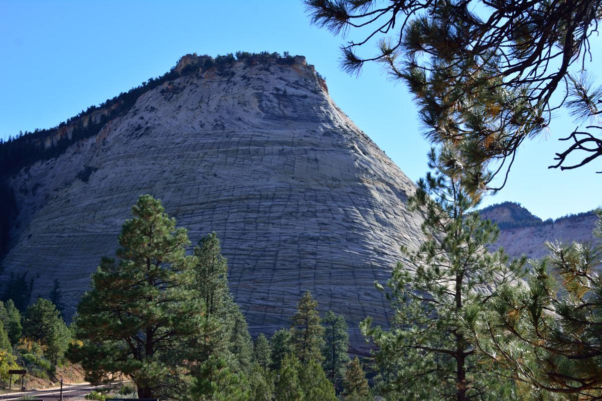
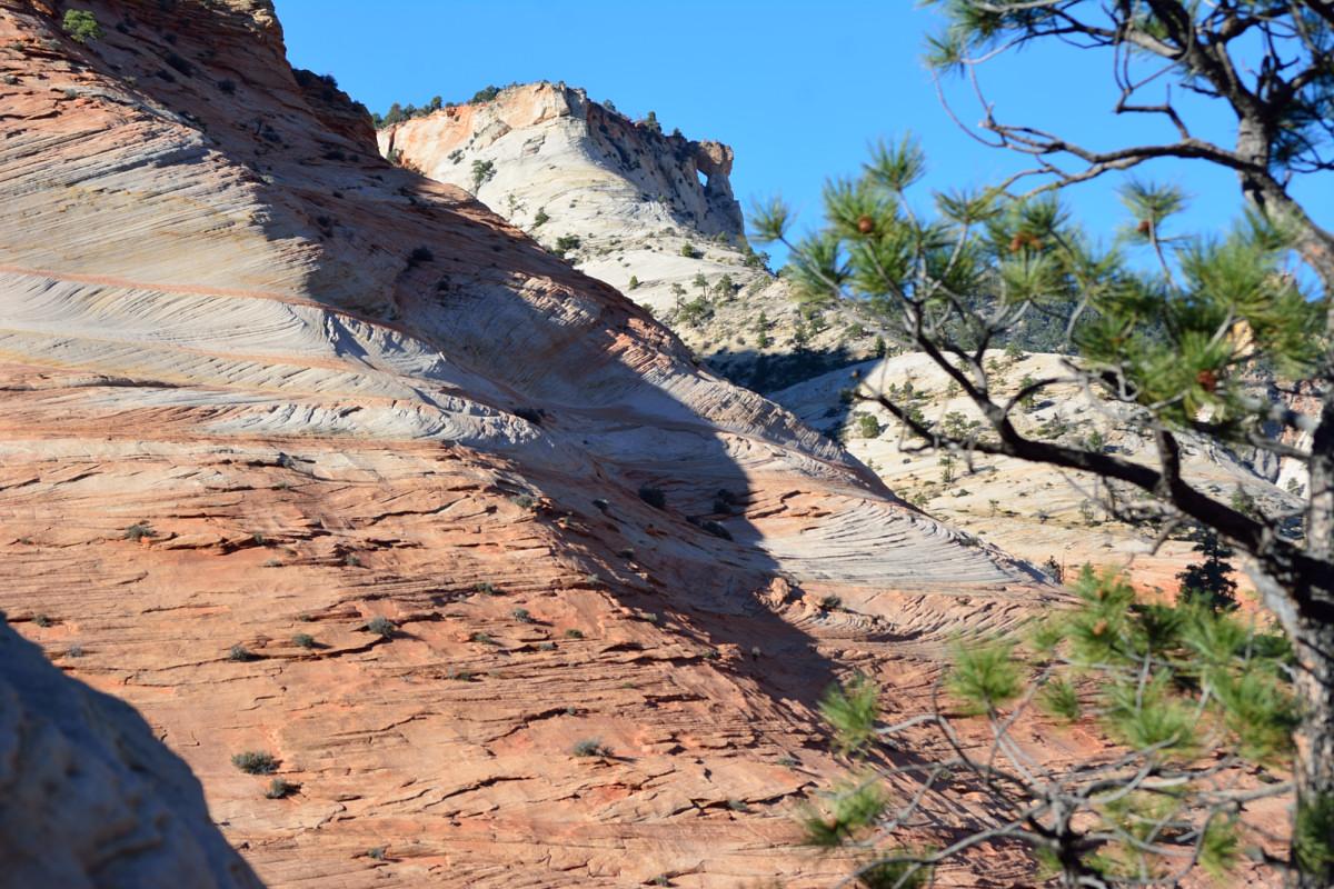
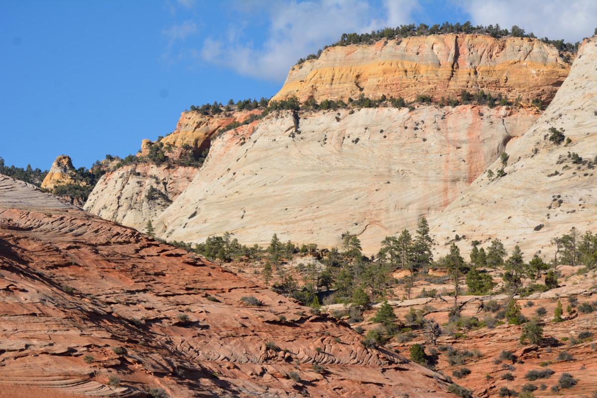
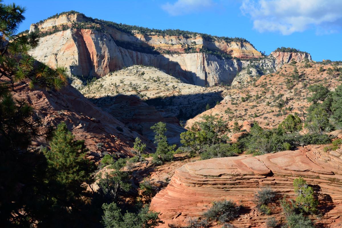
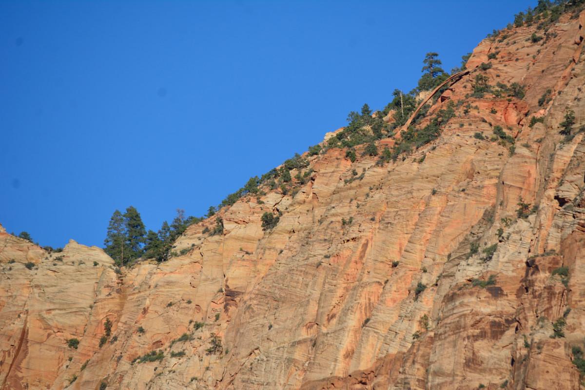
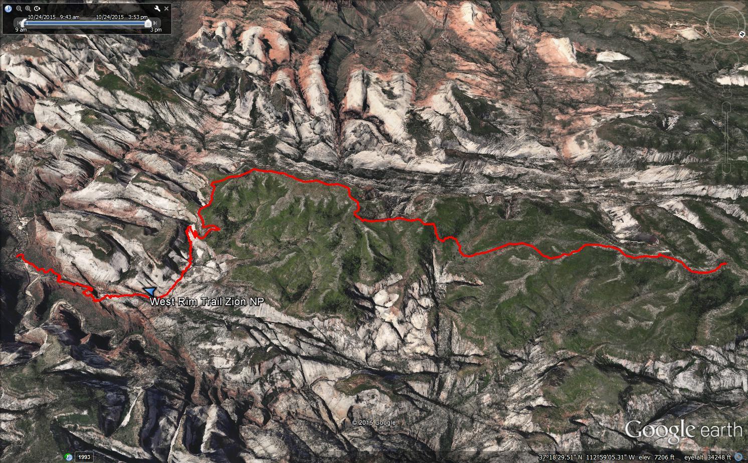
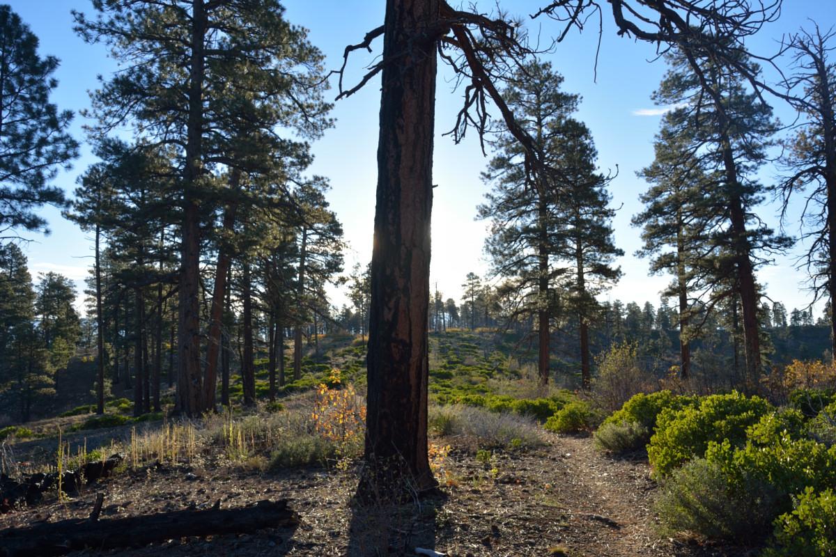
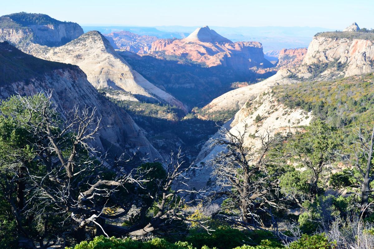
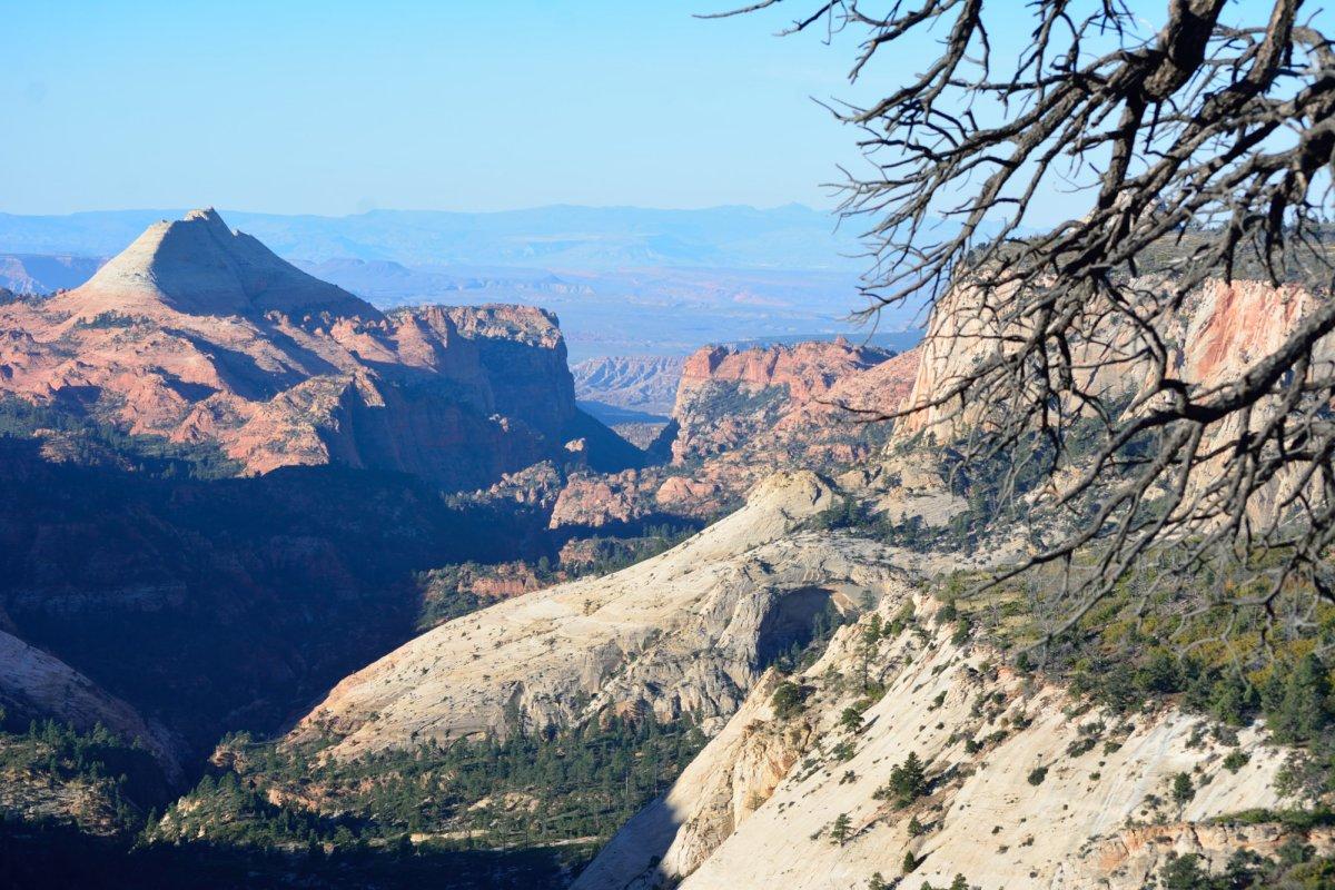
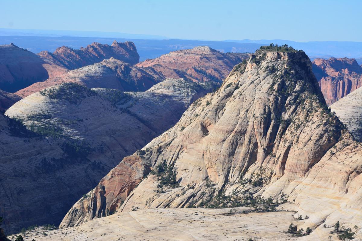
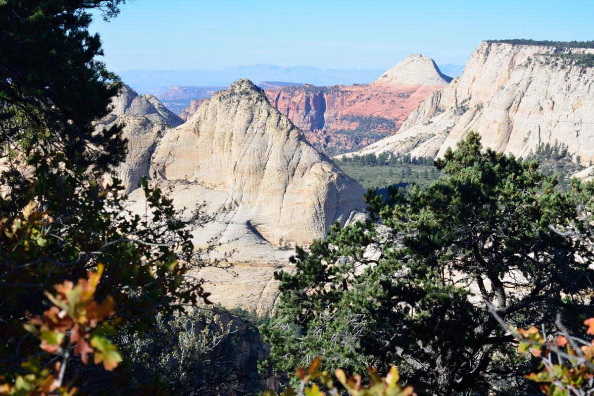
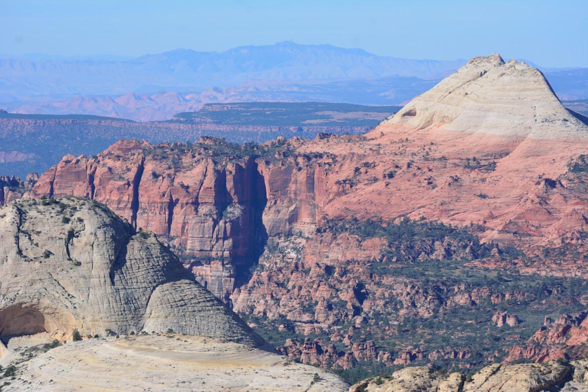
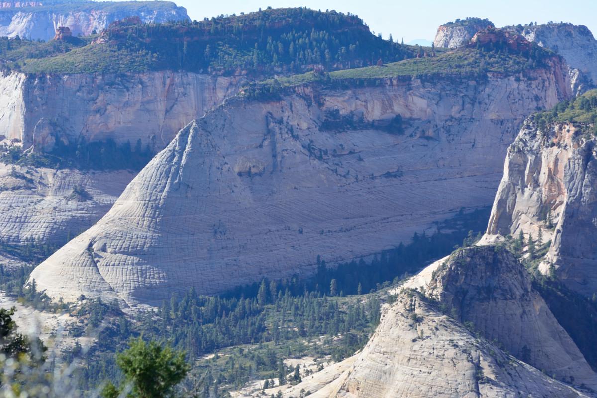
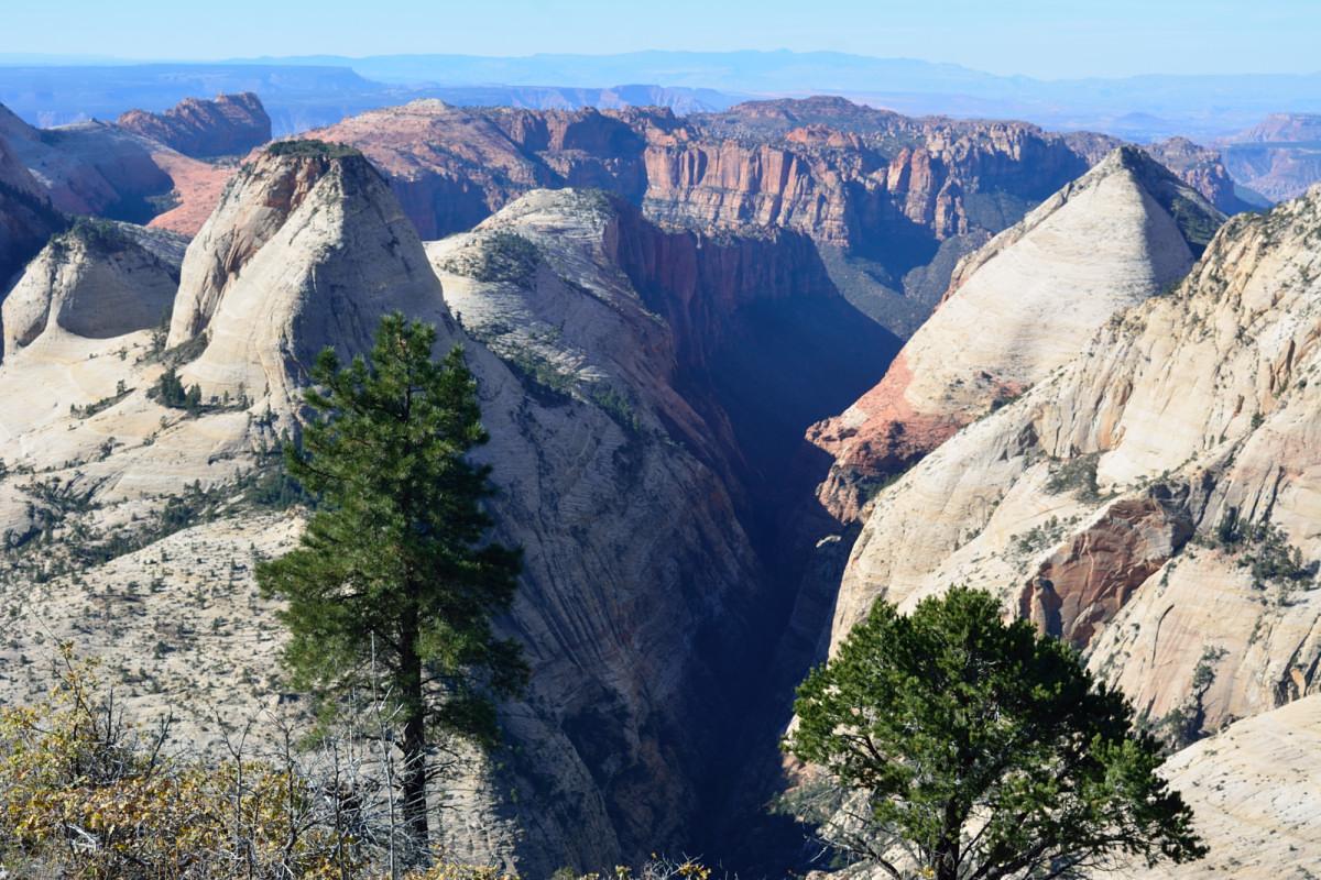
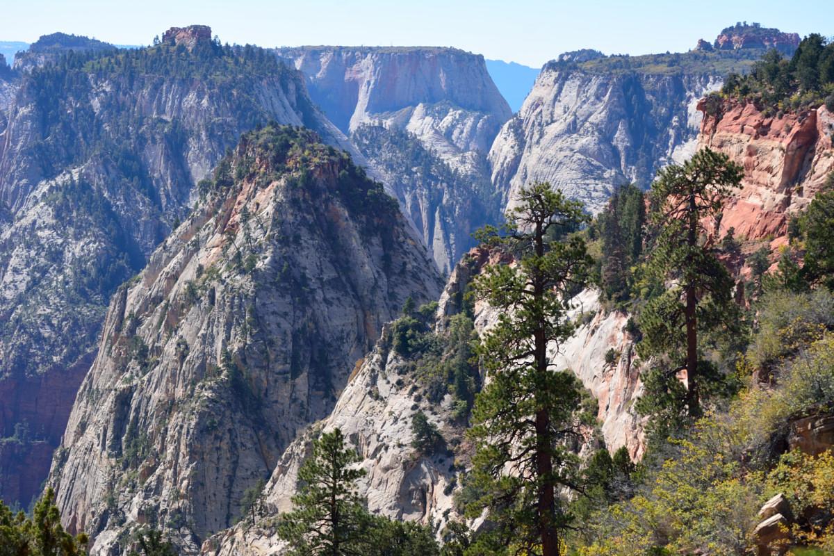
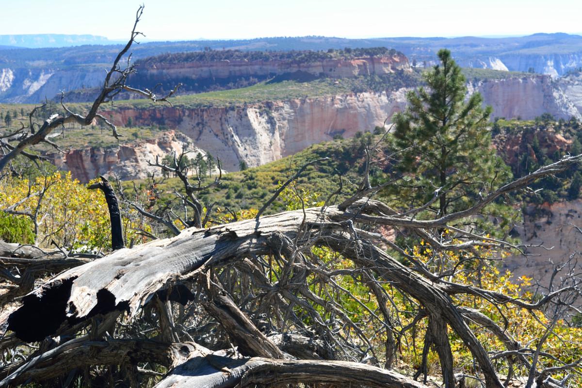
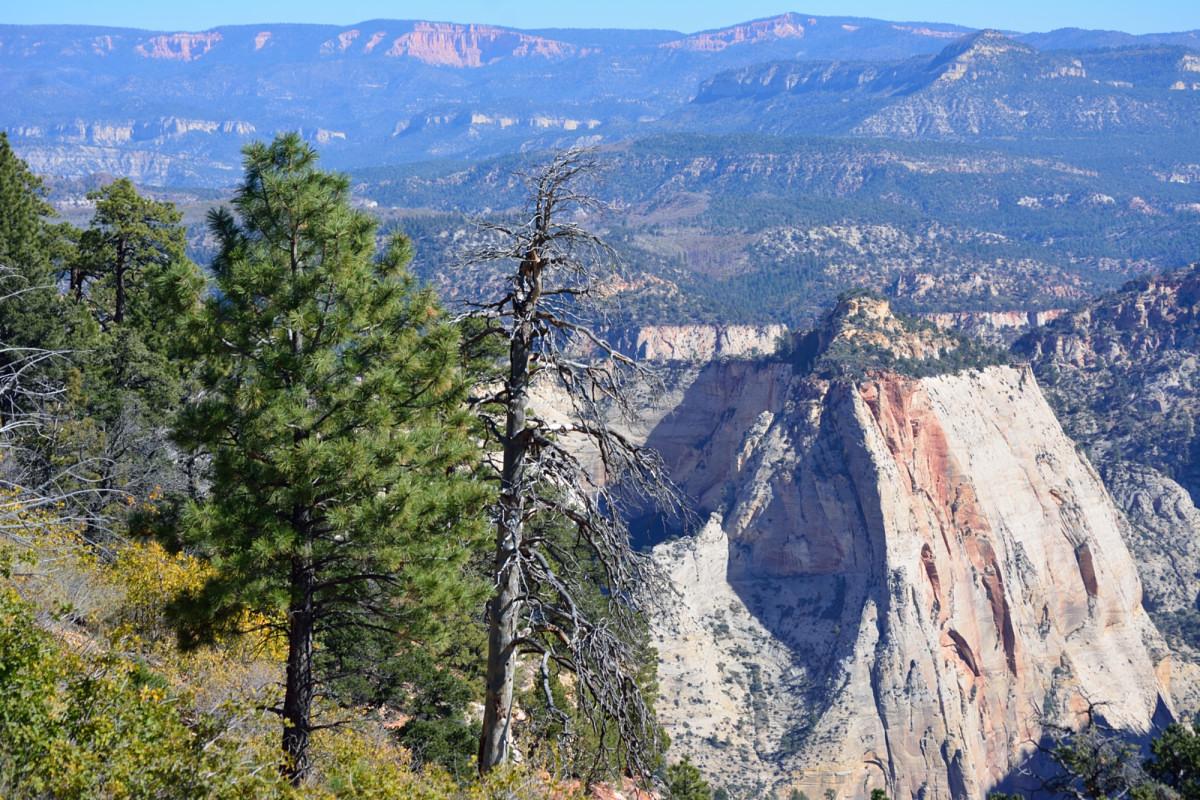
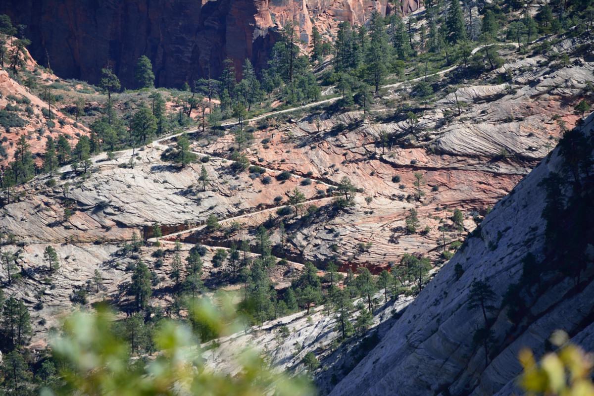
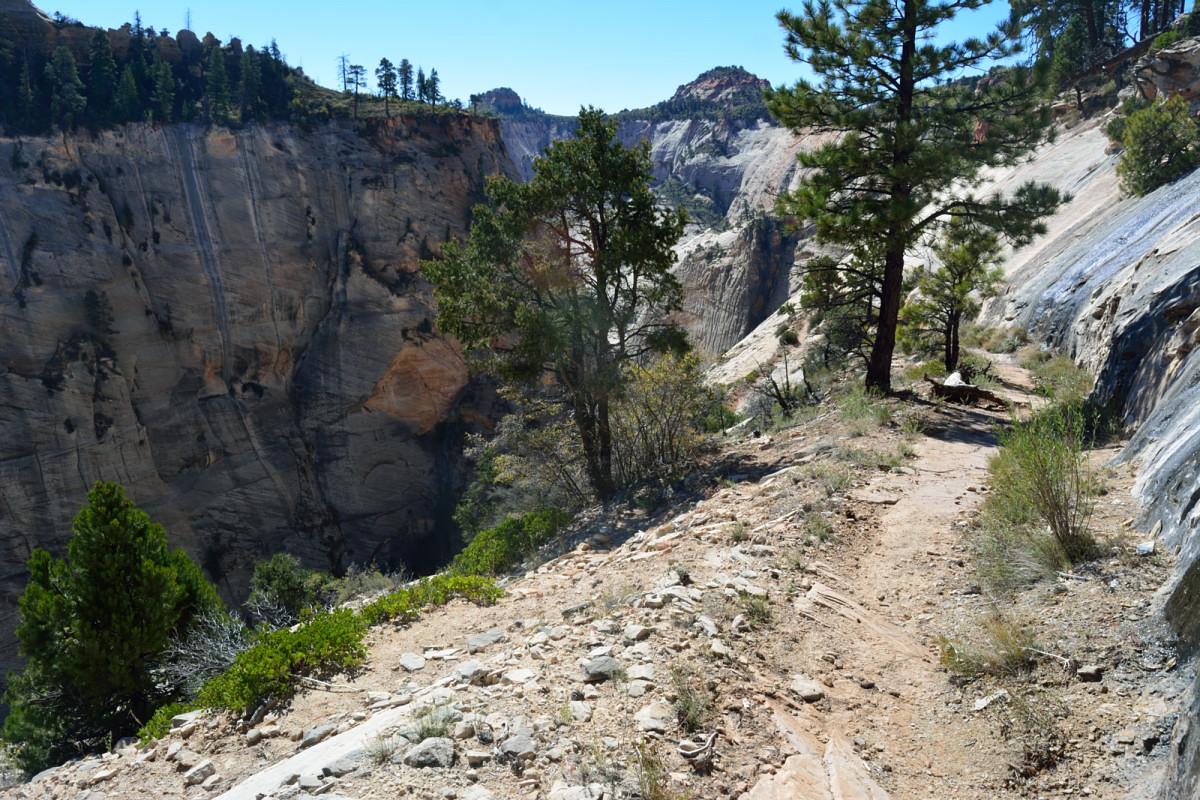
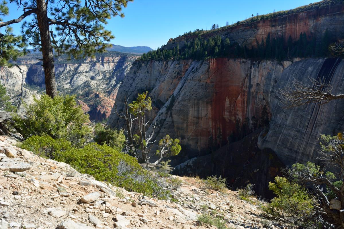
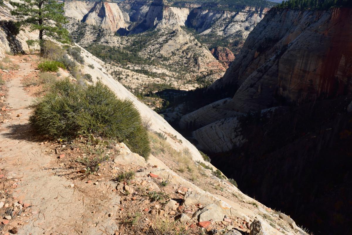
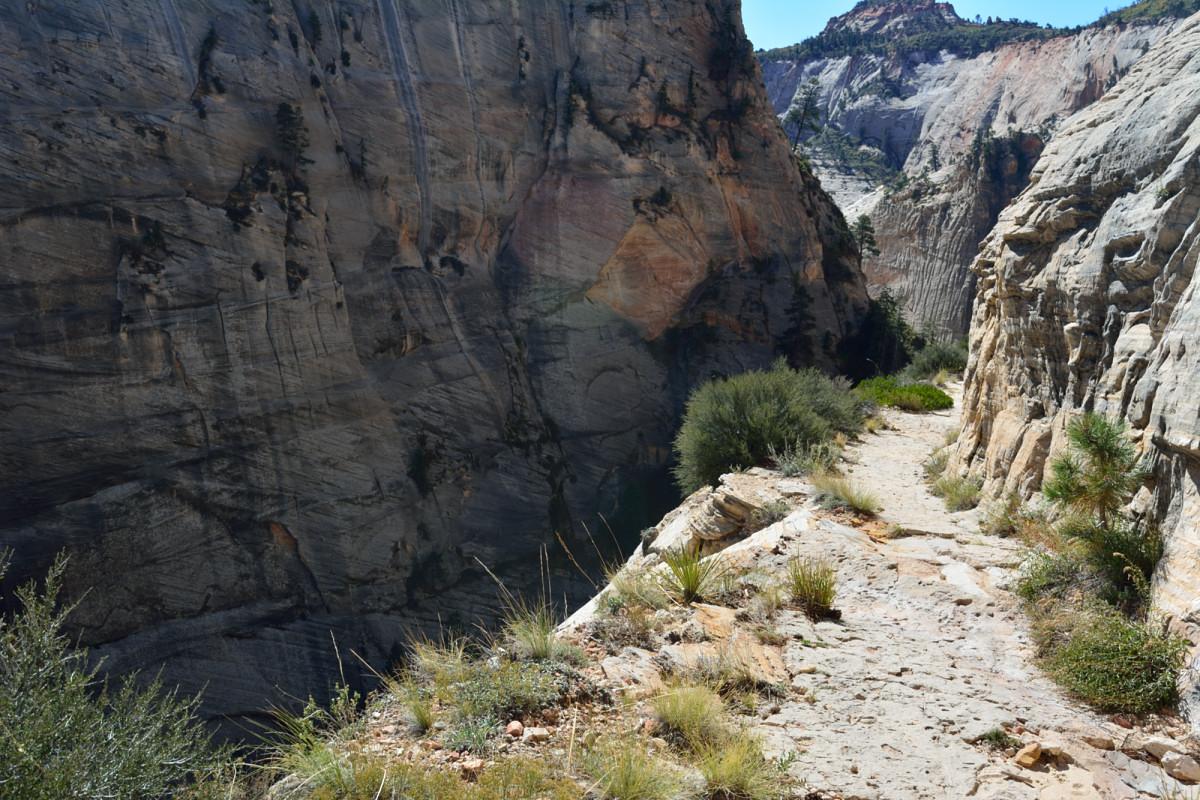
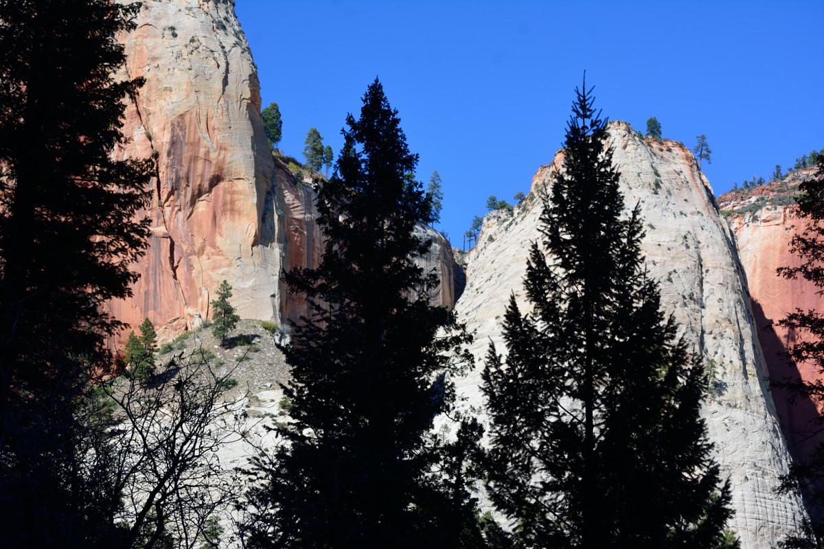
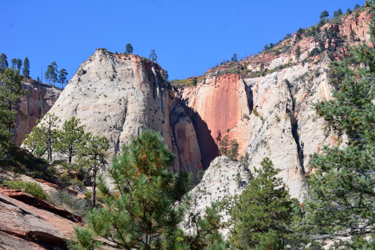
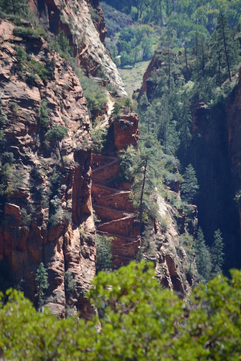
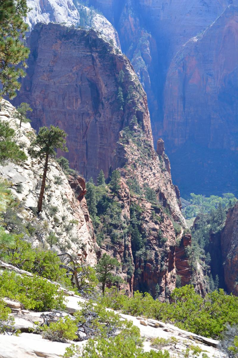
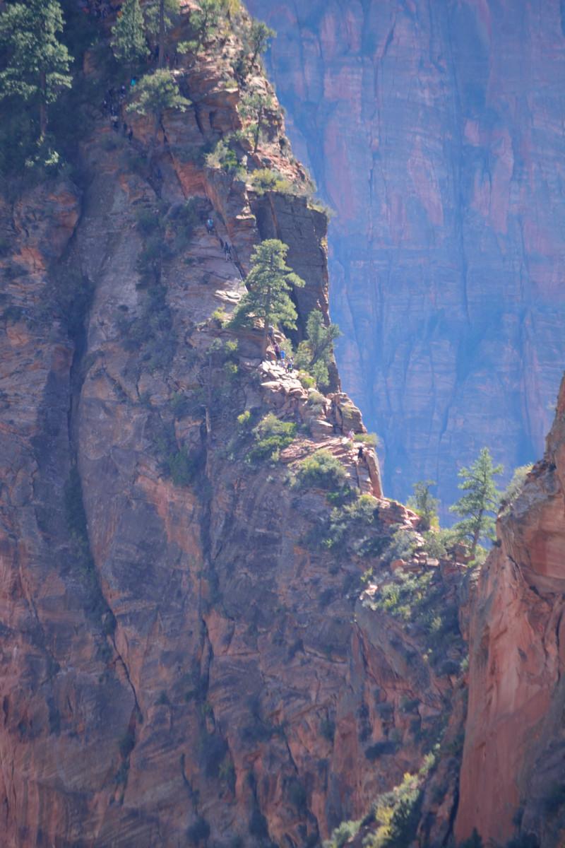
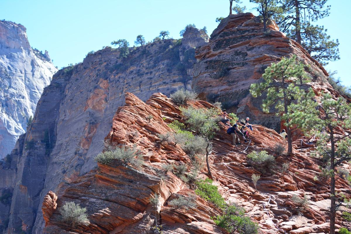
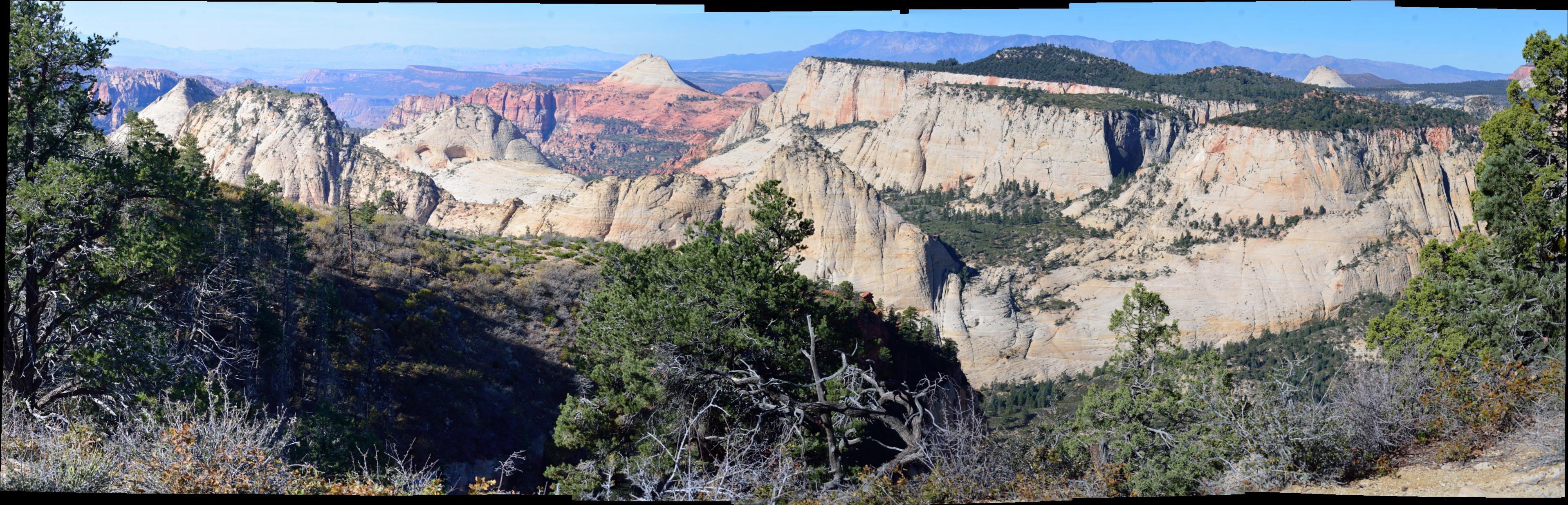
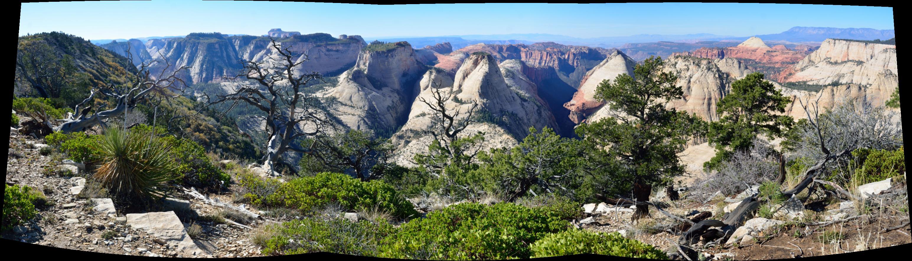
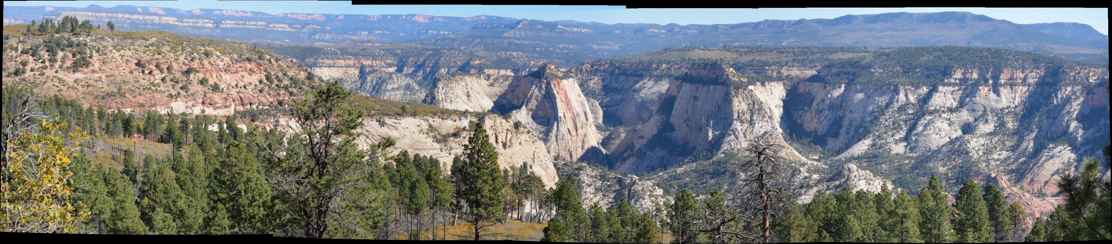
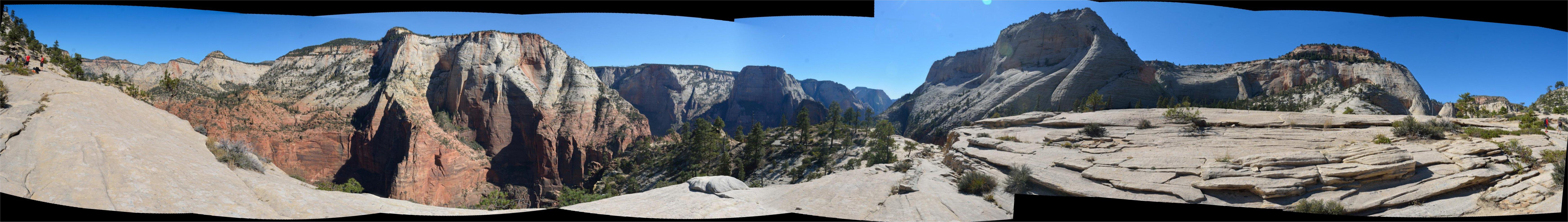
The shuttle got me to the West Rim trailhead early on Saturday, and I started the 15 mile hike a little after 7 AM from Lava Point. For the first seven miles or so, along the rim, I saw a total of four people. Two of those people had ridden in the shuttle with me, but were camping that night and carrying overnight packs, so I left them behind after a few miles. This trail starts in the high country in a pine forest, and then moves to the west rim of the mountain overlooking a large area of Zion that a lot of people never see, as it is not in the main Zion Canyon. The views are incredible, and then it turns eastwards and goes along the north rim of Zion Canyon itself for a few miles. It finally drops almost 3000 feet in the last several miles, descending into Scouts Lookout and Angels Landing above the Grotto. My legs told me that I would not be doing Angels Landing on this trip, as I was finishing up almost 24 miles of hiking over two days, and the last few miles had been very steep going down. Those last few miles walking down at a 25% grade hurt the most. I walked past Angels Landing, and dropped down through Walters Wiggles to Refrigerator Canyon for the final descent down to the bottom of Zion Canyon. I caught the shuttle bus at the Grotto back to the visitor's center, and walked from there to my car, which was parked at the shuttle office right outside the park entrance. I drove back to Salt Lake City that evening, and caught a flight home on Sunday. That was it for Utah on this trip; I felt like I had squeezed in a lot of hiking and photography in just a few weeks. My phone recorded the first 12 miles of the trail using My Tracks before the battery died. That plot of the trail is below, along with last few miles of the trail manually traced by hand.
