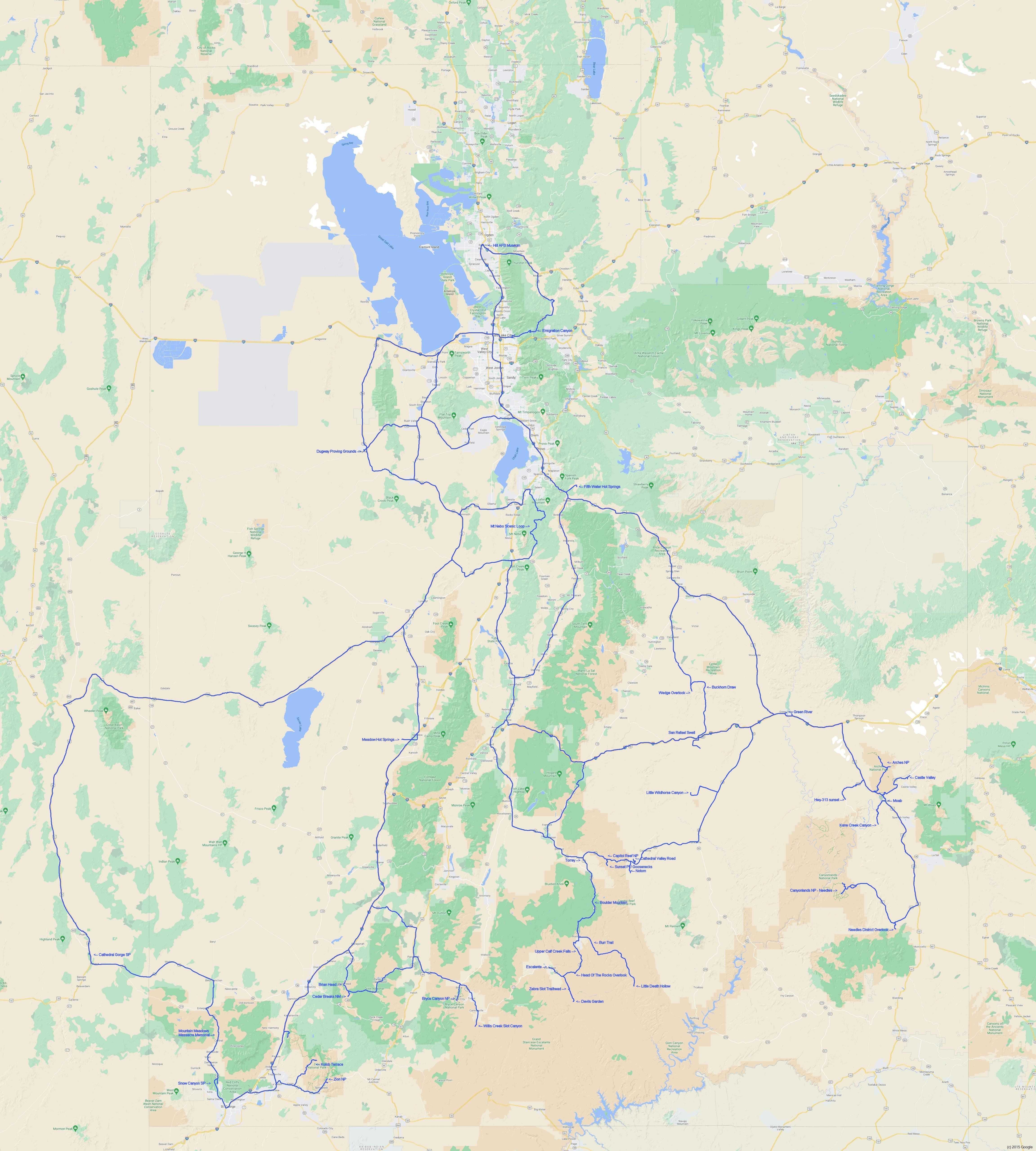
Chris had flight testing for two programs in
October and November 2021 at Dugway Proving
Grounds, Utah. He left a few days early to visit
parks on the weekend before flight testing
started, and then visited lots of parks on each
weekend for 7 weeks. He hiked new trails
at every place, and re-visited some trails he
had done before. By the end of the trip,
he had hiked over 160 miles, averaging 20 to 25
miles per weekend.
Chris made it to the big five national parks of
Utah, in this order: Capitol Reef National Park,
Canyonlands National Park, Arches National Park,
Bryce Canyon National Park, Zion National Park.
He also visited Grand Staircase - Escalante
National Monument, Cedar Breaks National
Monument, Cathedral Gorge State Park (Nevada),
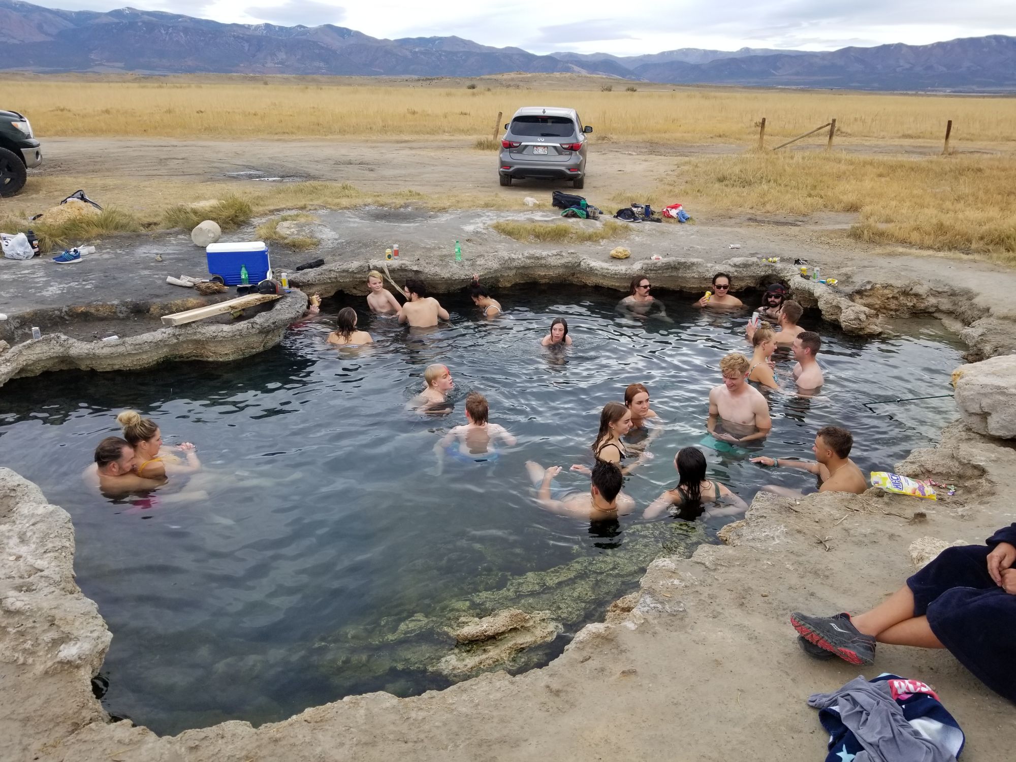
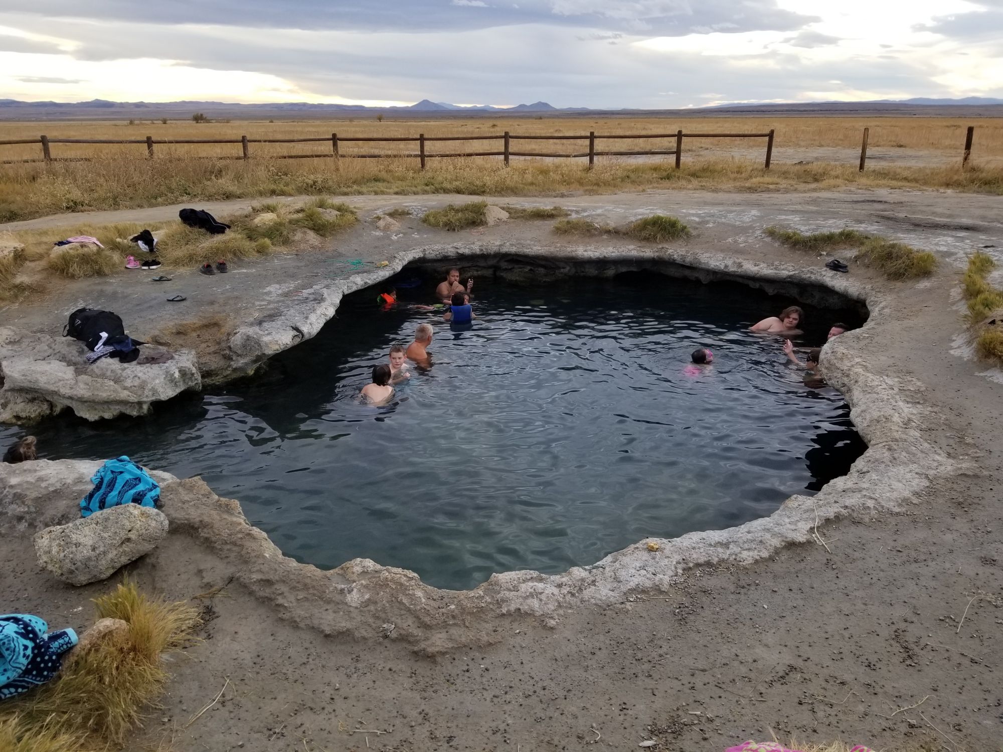
Snow Canyon State Park, Mt Nebo Scenic Loop, and relaxed in two
natural hot springs at Fifth Water Hot Springs
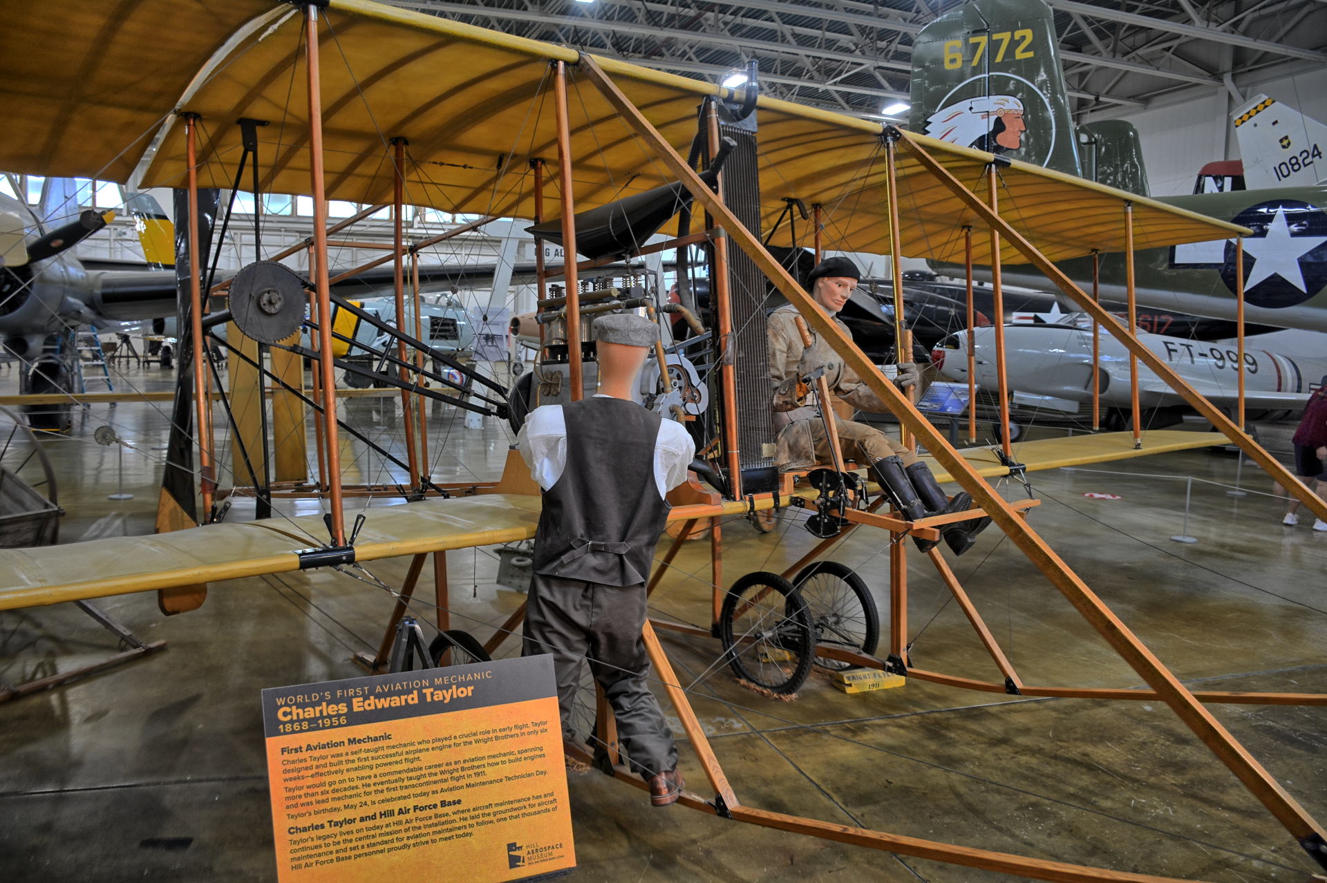
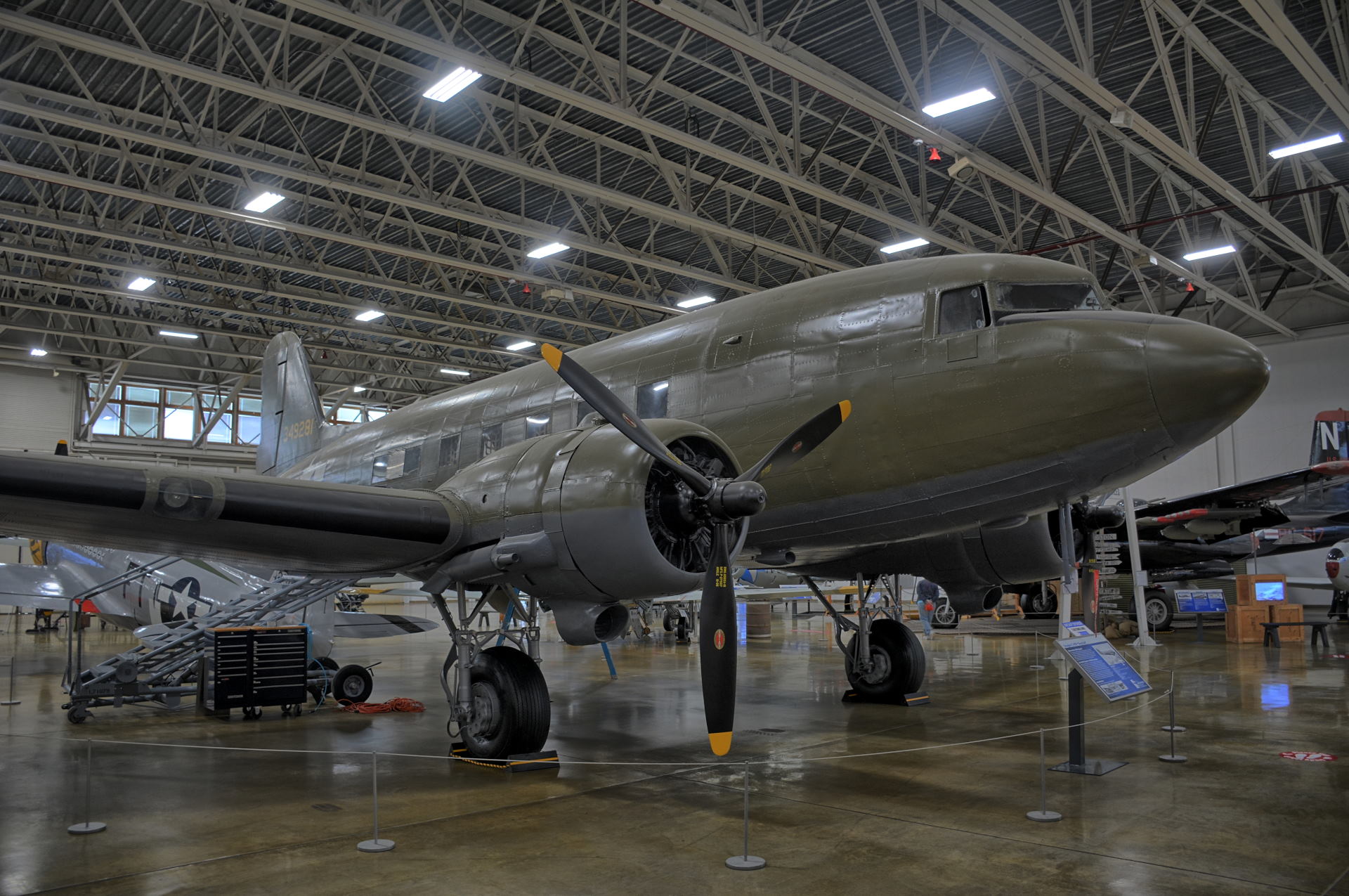
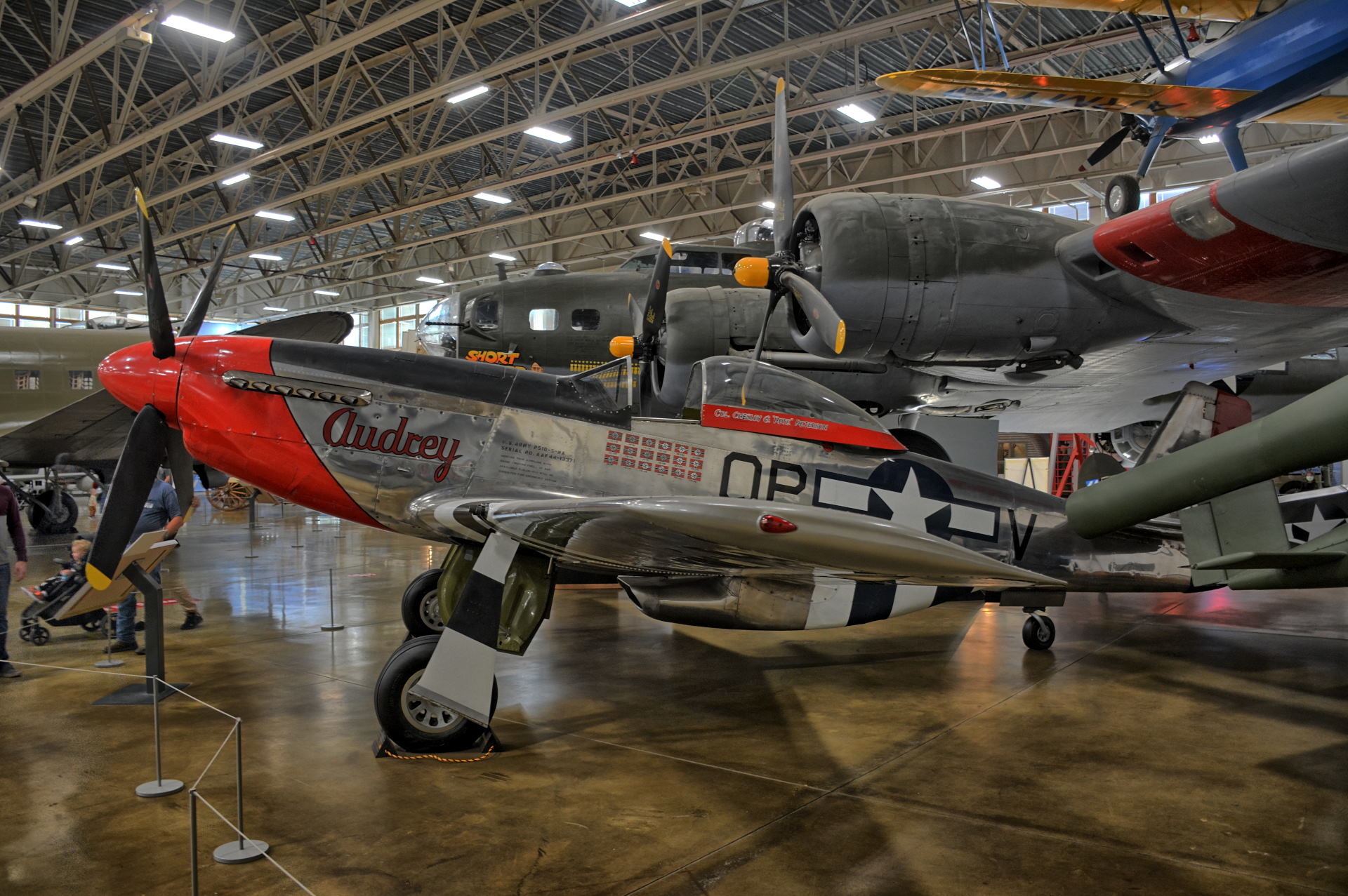
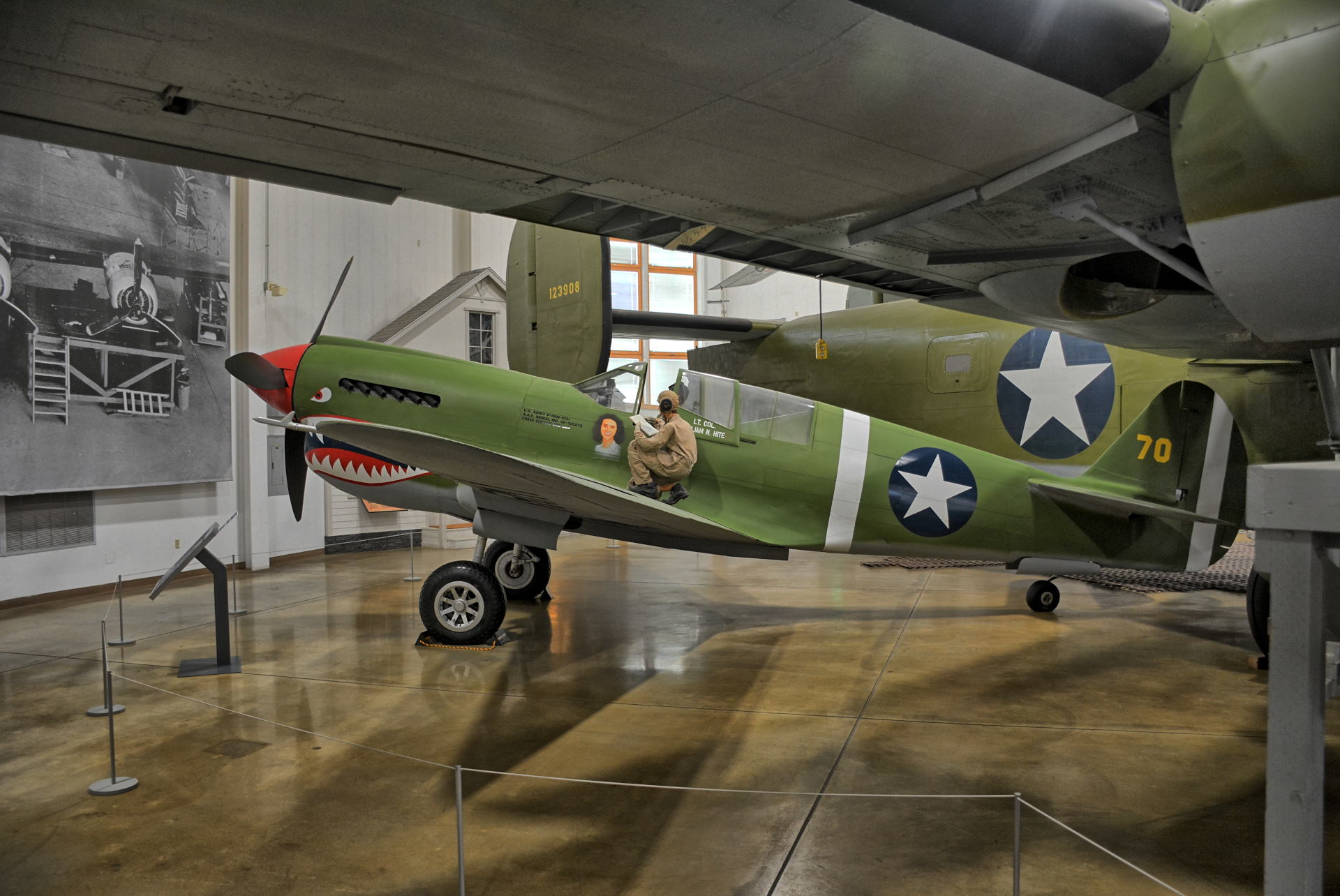
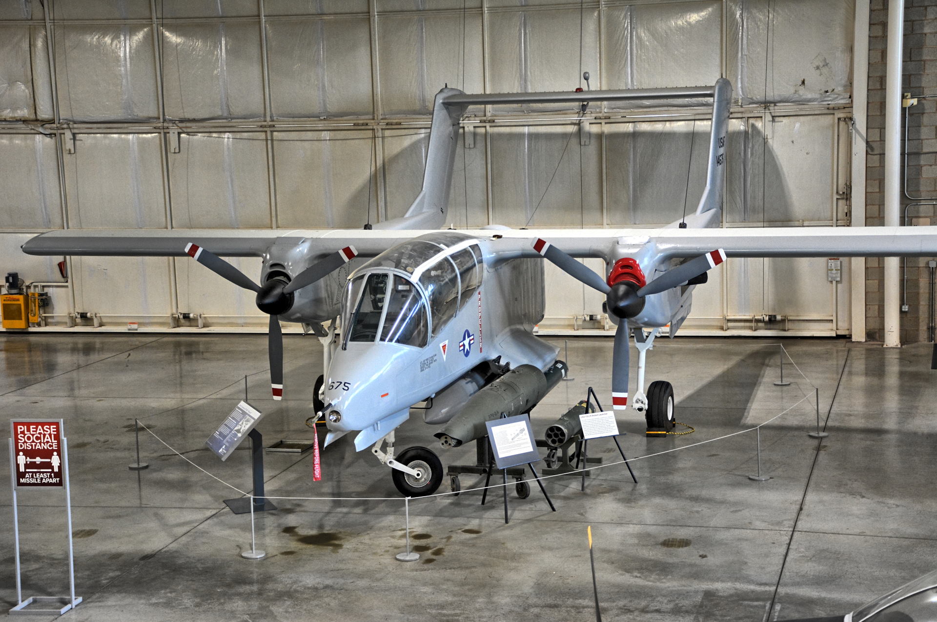
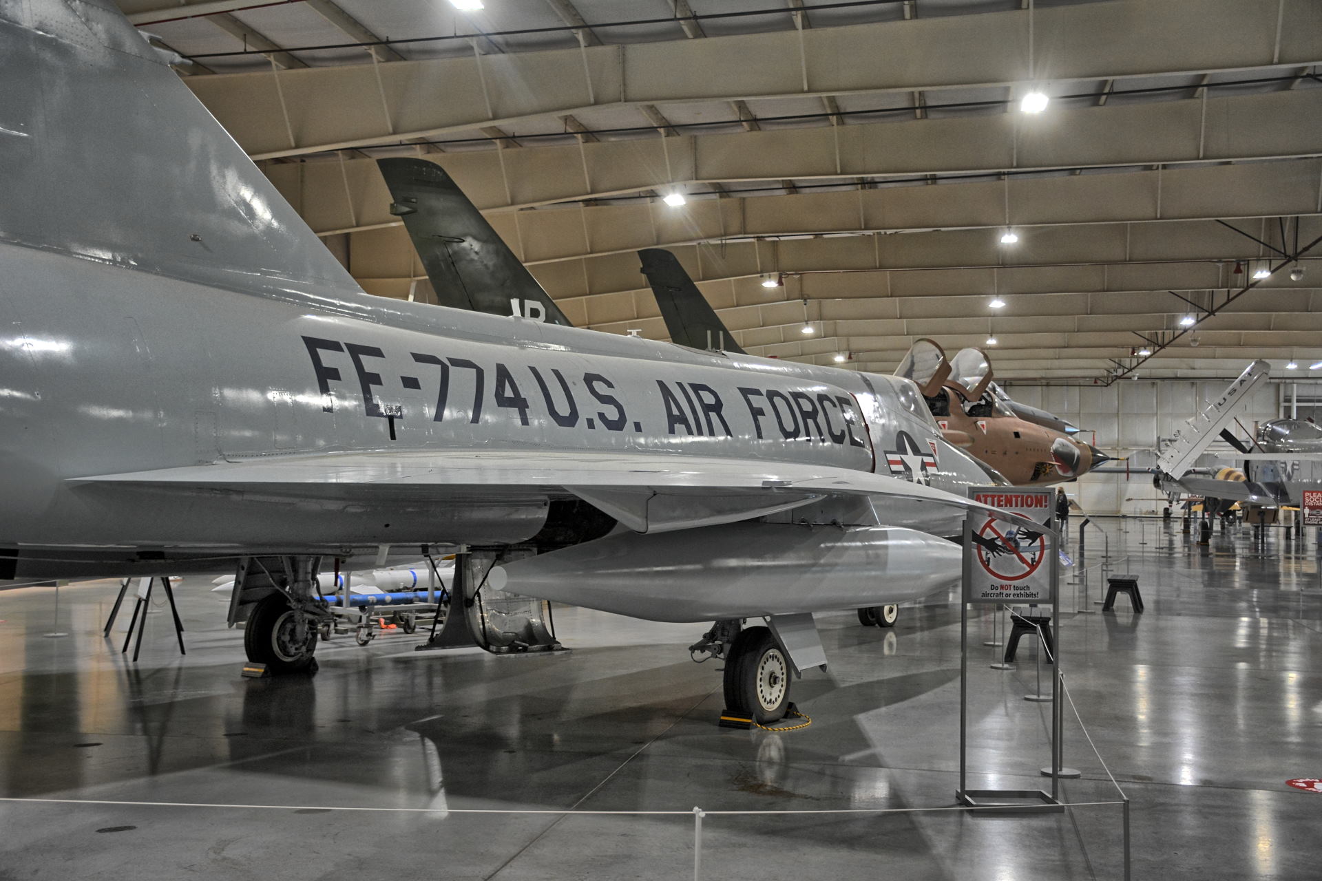
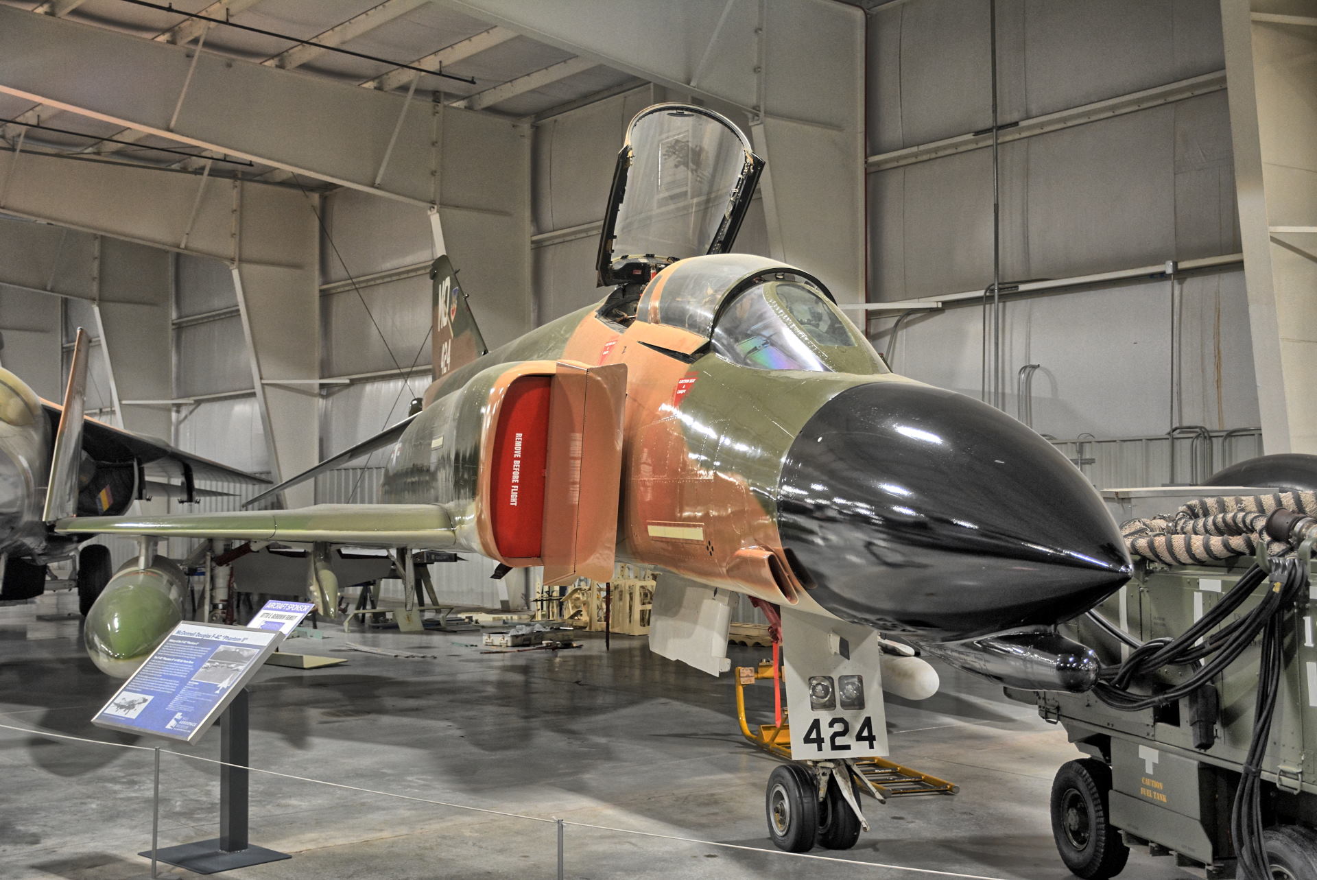
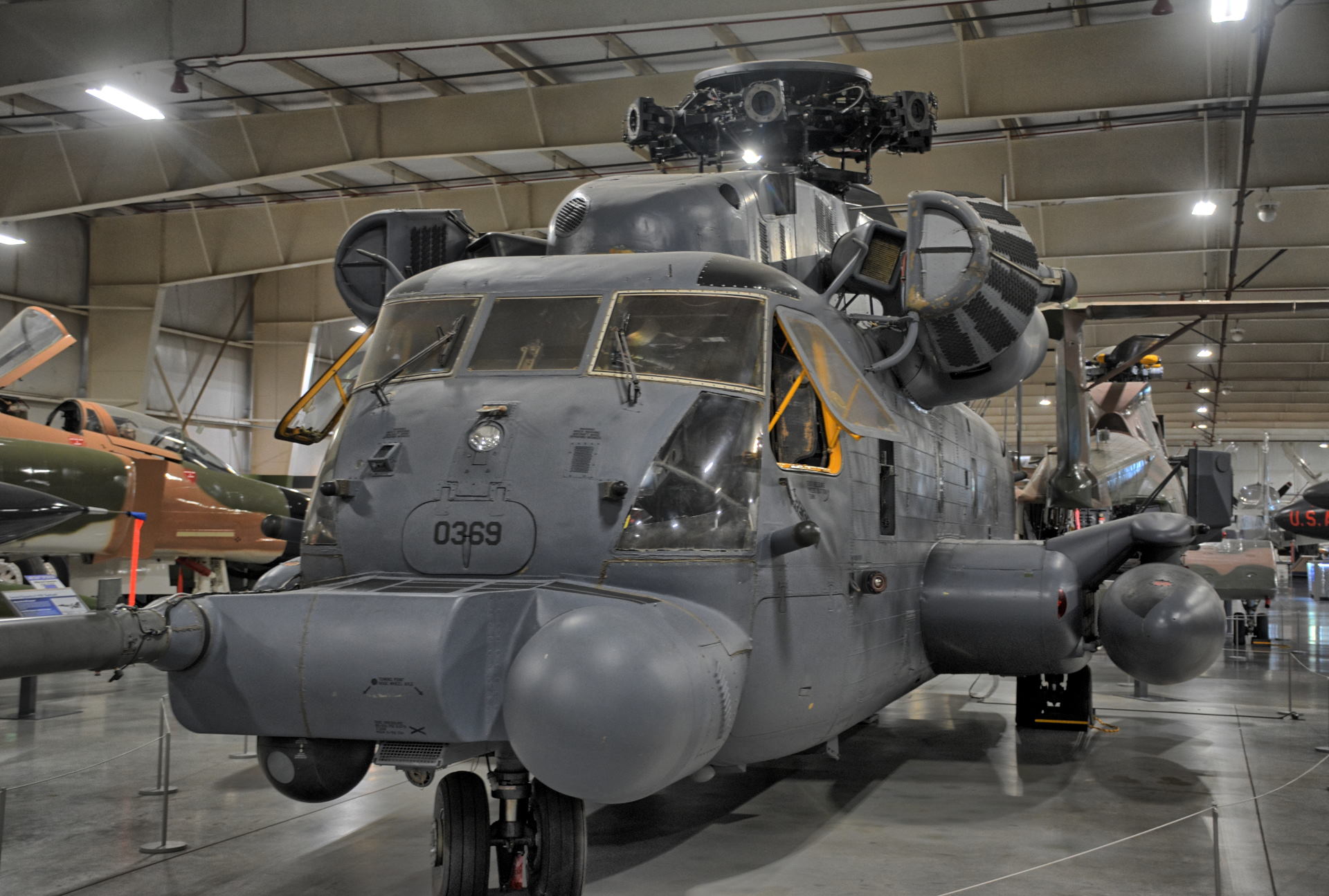
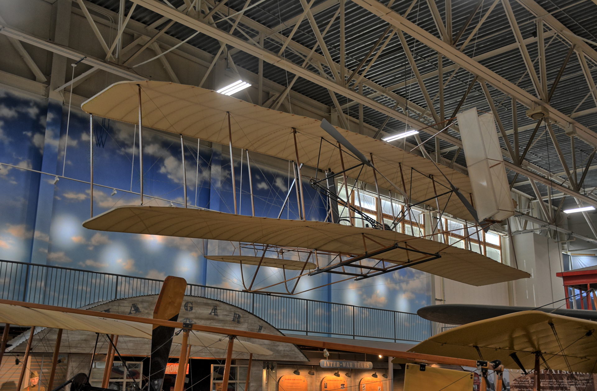
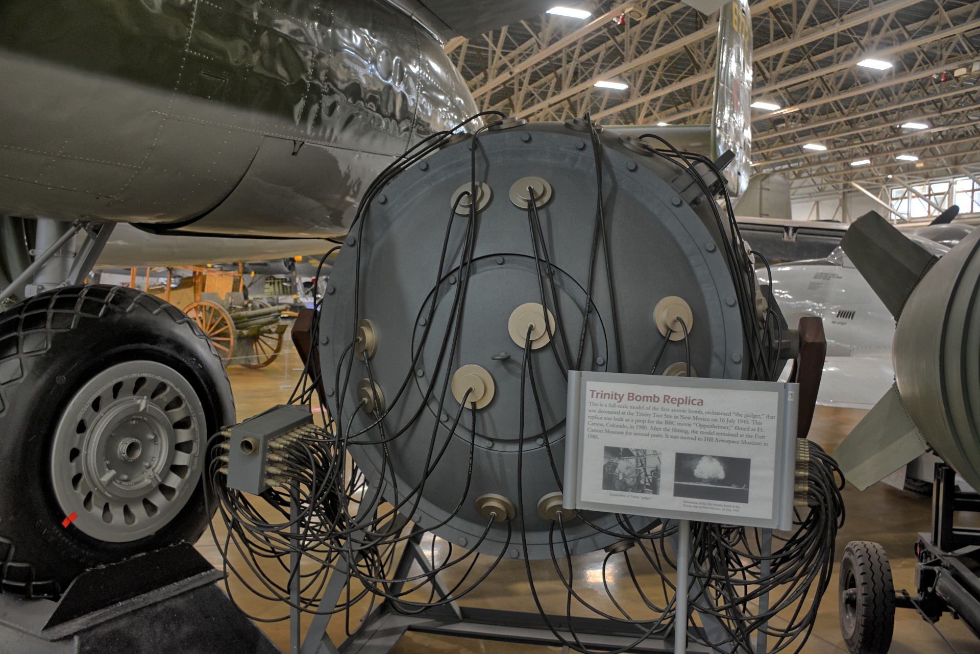
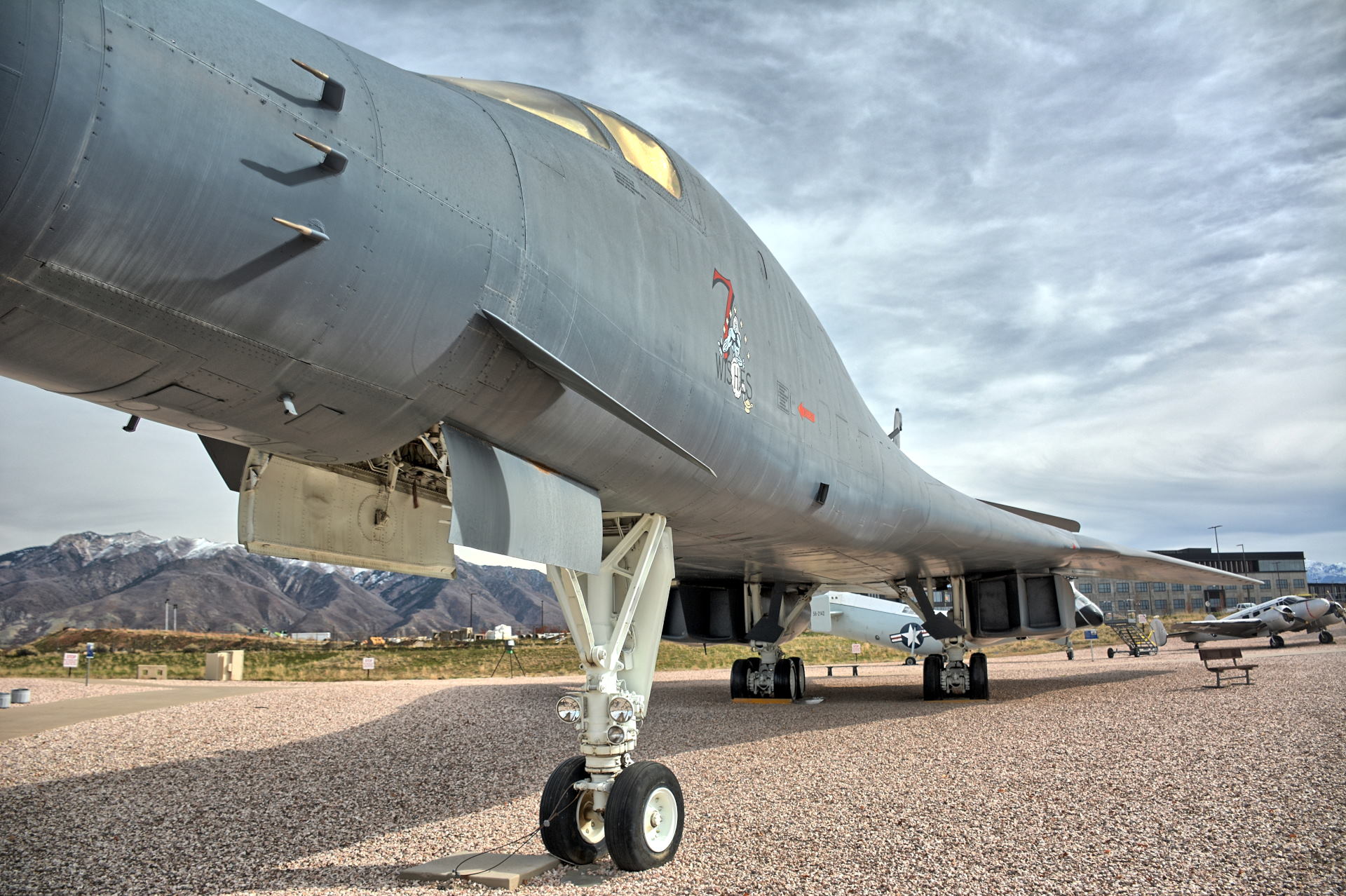
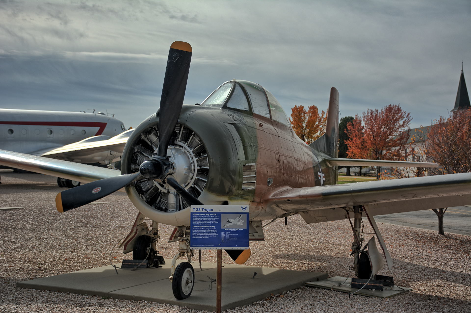
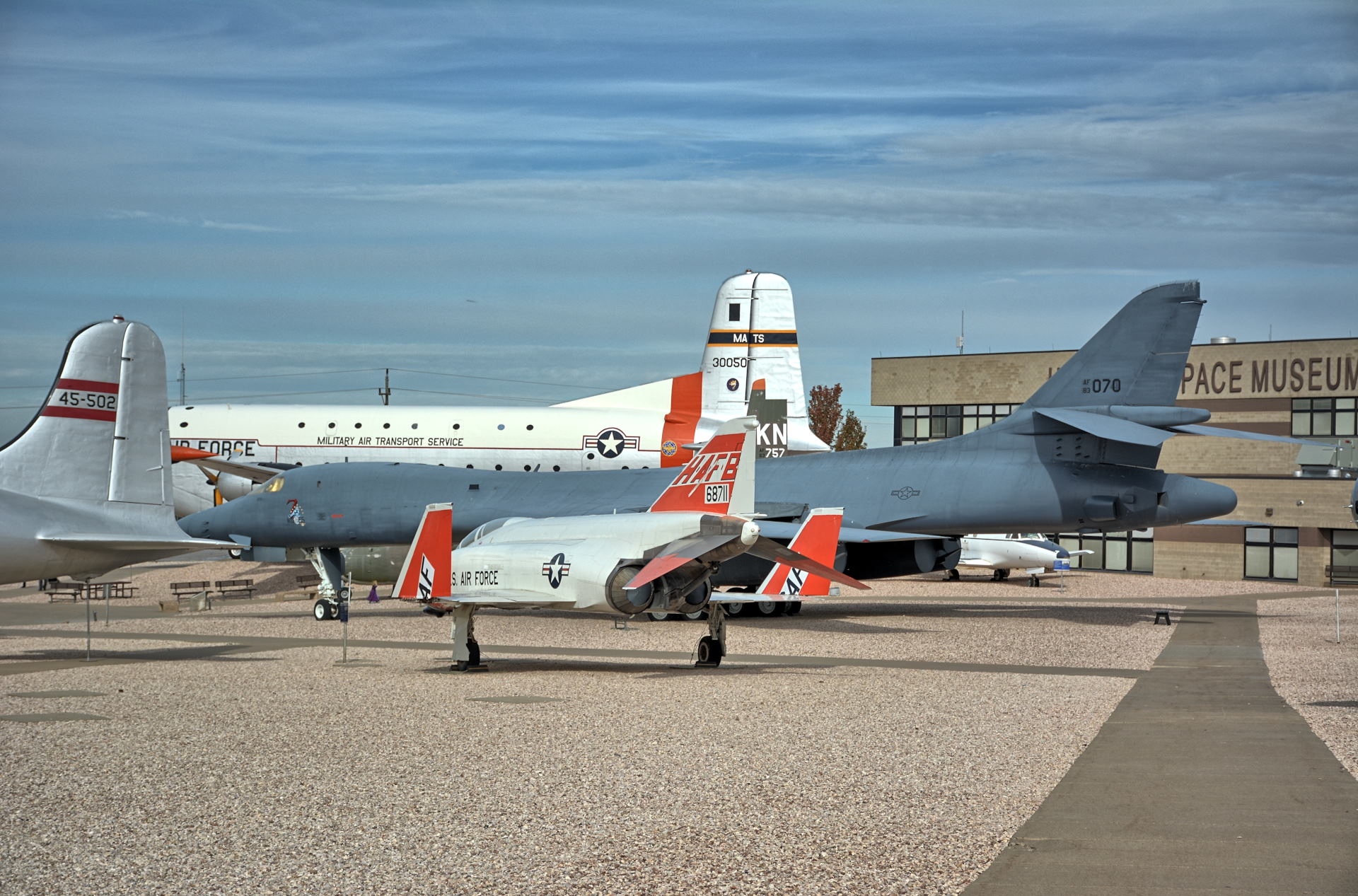
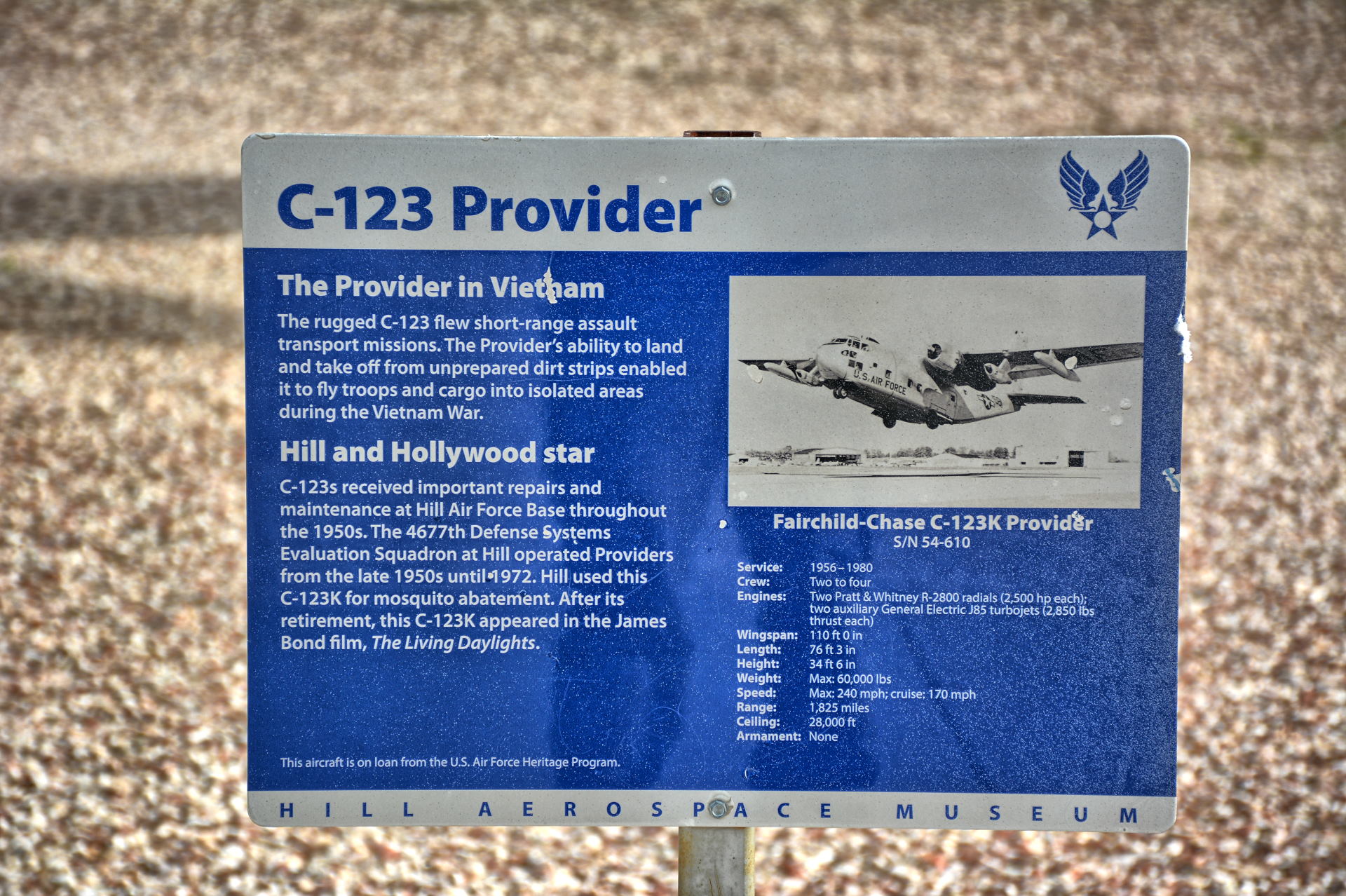
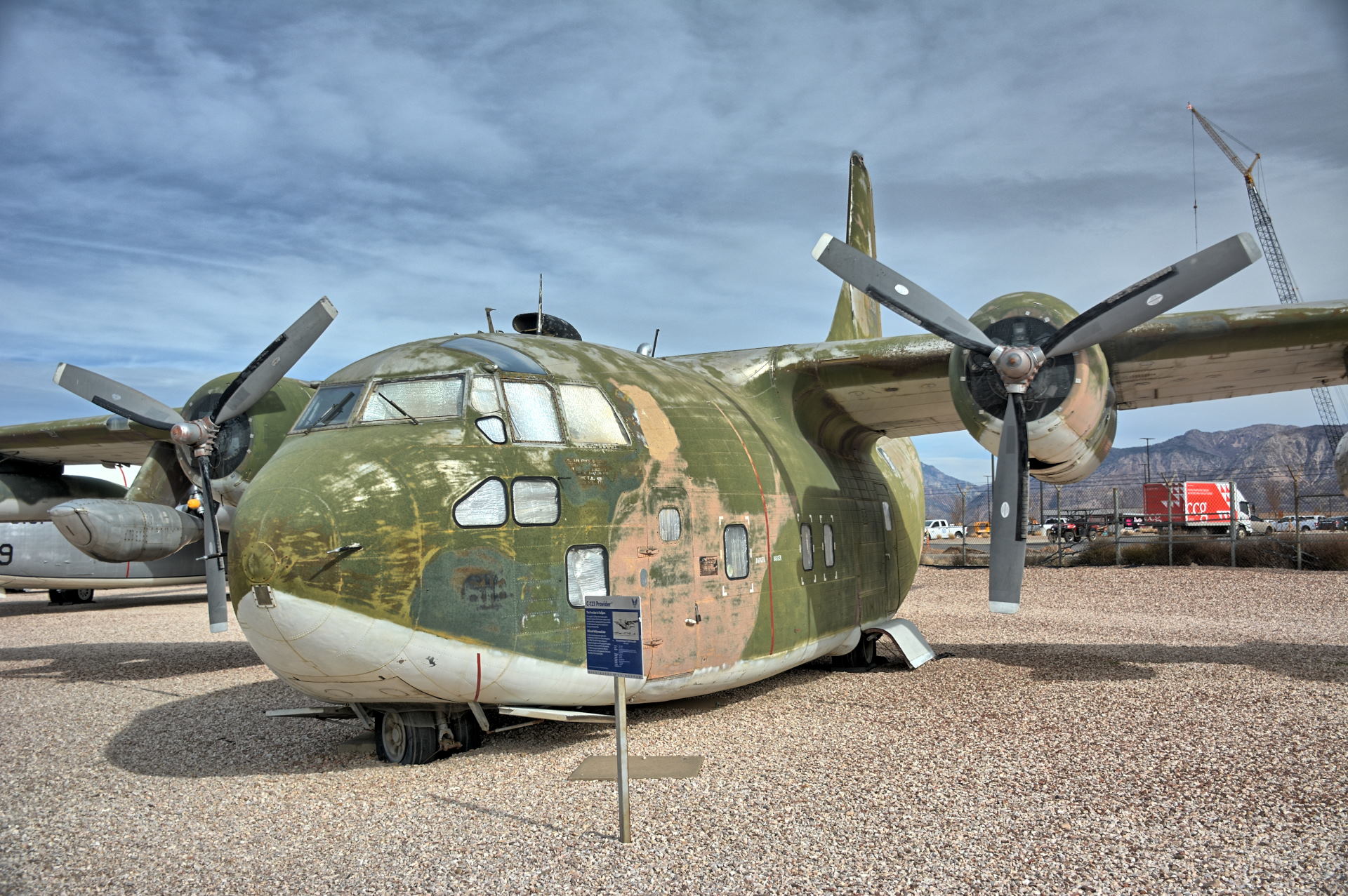
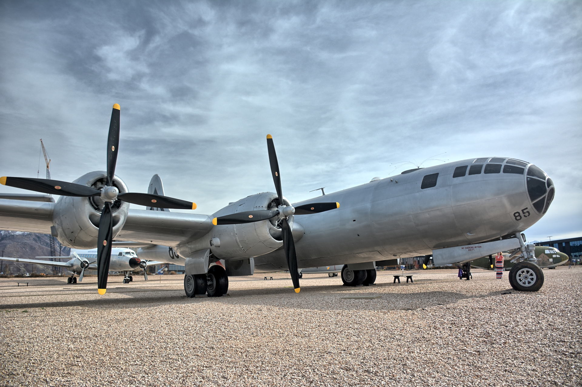
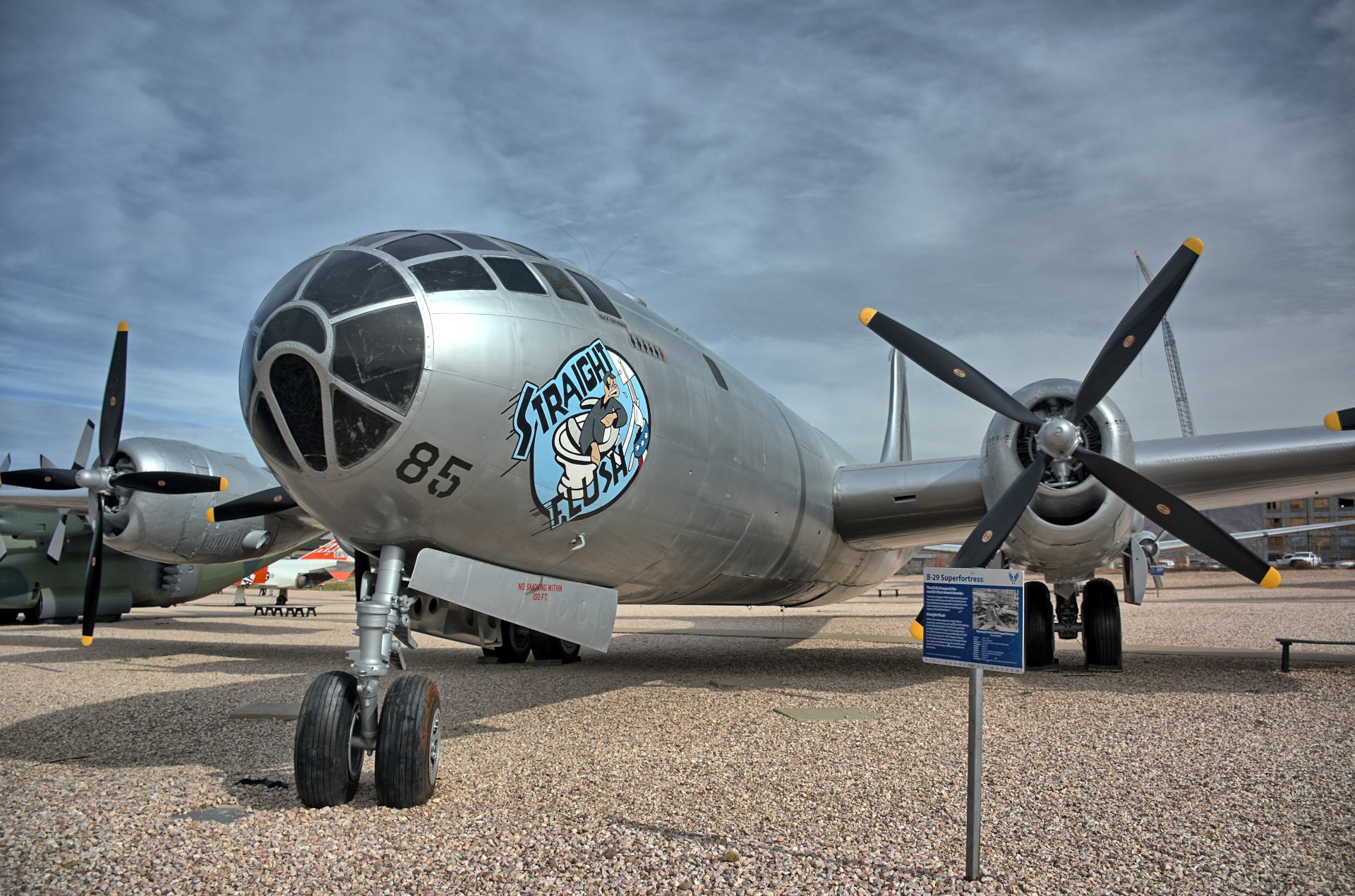
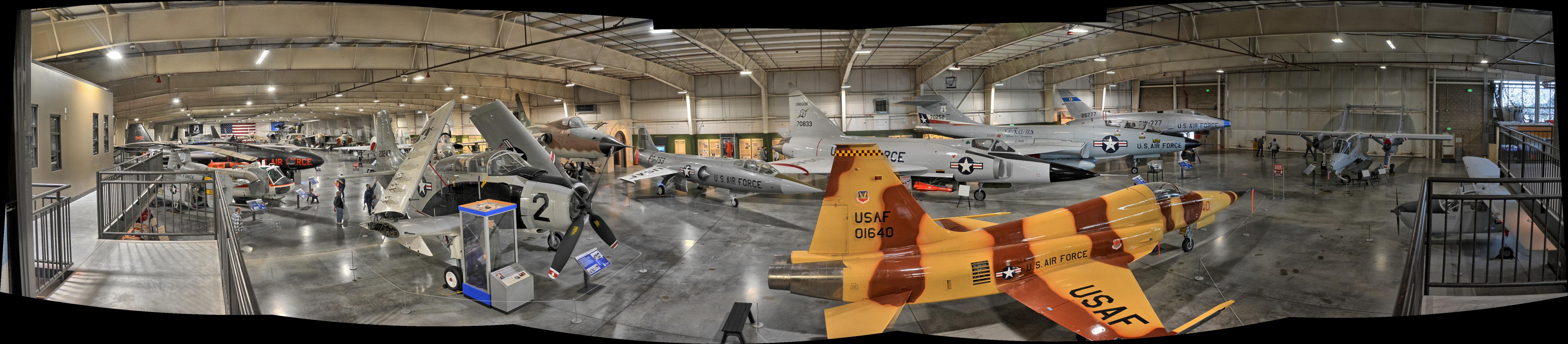
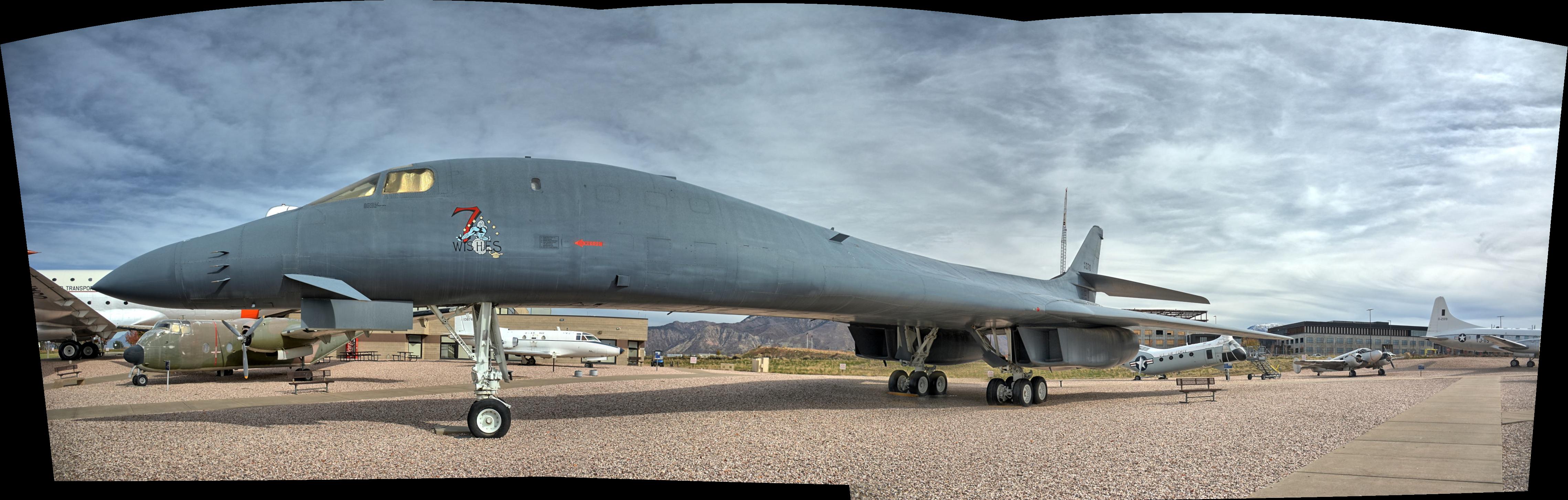
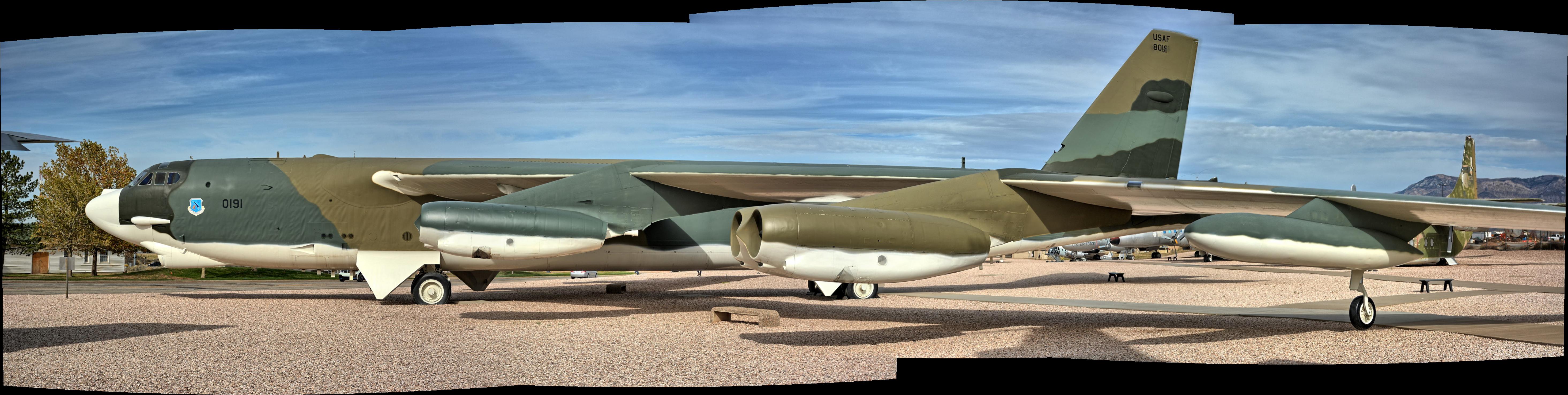
and Meadow Hot Springs. He toured the Hill
AFB Aerospace Museum and he flew his RC planes
and quadcopters to capture aerial video
everywhere he went (outside of national parks).
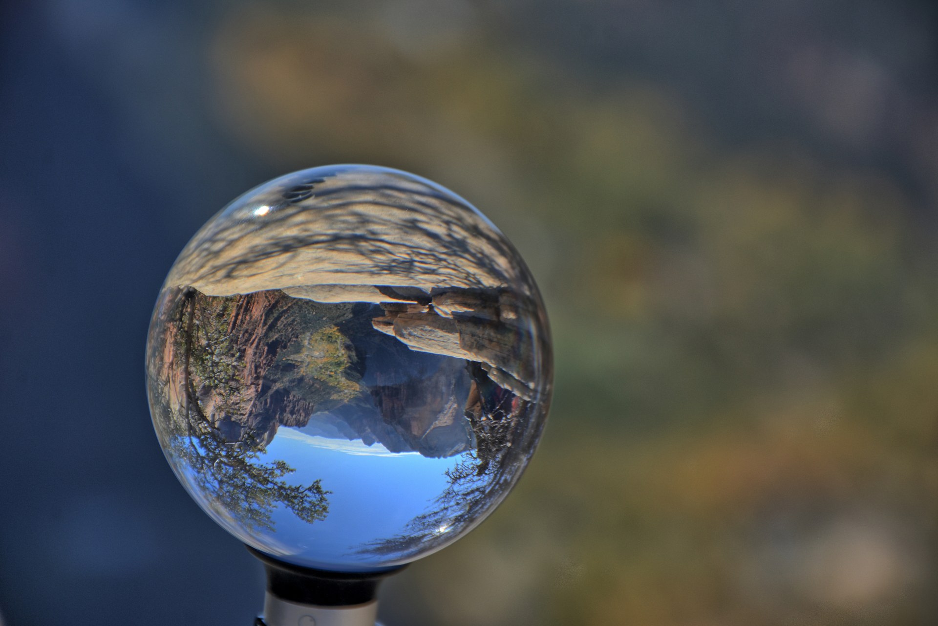
He took over 3400 high-dynamic-range (HDR)
photos with his Nikon D7100 DSLR on this trip.
HDR photos consist of 5 photos of the same image
taken at different exposure settings, and then
blended into a single photo that matches what
the human eye actually sees. Chris uses
EasyHDR
as his HDR blending software. It produces
excellent images that are vibrant yet true to
real life. Also shown below are airborne videos shot with his
RC aircraft, and ground videos shot with his GoPro, Gear360, and phone.
Sunday
Monday
Tuesday
Wednesday
Thursday
Friday
Saturday
26 September
Home
27
Home - work
28
Home - work
29
Home - work
30
Fly home to SLC
Drive SLC to Wedge Overlook
- camp
1 October
Buckhorn Draw
Green River
Little Wildhorse Canyon
Capitol Reef NP -
camp
2
Capitol Reef NP
Navajo Knobs
Torrey
hotel
3
Thousand Lakes Mountain -
northwest of Capitol Reef NP
Fifth Water Hot Springs
Dugway hotel
4
Dugway Flight Test
Lone Rock (fly)
SLC hotel
5
Dugway Flight Test
SLC hotel
6
Dugway Flight Test
Horseshoe Springs (fly)
SLC hotel
7
Dugway Flight Test
Dugway to Moab
Hwy-313 sunset
Moab : Zax dinner
Kane Creek Canyon - camp
8
Moab to
Canyonlands NP - Needles
Needles District Overlook
(fly)
Druid Arch
Camp just outside park
9
Canyonlands NP - Needles
Potholes Viewpoint
Big Spring & Squaw
Canyon Loop
Moab, Castle Valley - camp
10
Arches NP
Devils Garden Loop
Delicate Arch
Moab
to
Green River hotel
11
Drive Green River to San Rafael Swell
Crawford Draw (fly)
Dugway hotel
12
Dugway Flight Test
Dugway hotel
13
Dugway Flight Test
Dugway hotel
14
Dugway Flight Test
Dugway hotel
15
Dugway Flight Test
Dugway hotel
16
Dugway to
Bryce Canyon NP
Peek-A-Boo Loop
Bryce
City hotel
17
Bryce
City to
Grand Staircase – Escalante NM
Willis Creek Slot Canyon
Cedar Breaks NM
Brian Head
Dugway hotel
18
Dugway Flight Test
Dugway hotel
19
Dugway Flight Test
Dugway hotel
20
Dugway Flight Test
Dugway hotel
21
Dugway Flight Test
Dugway hotel
22
Dugway Flight Test
Dugway to Springdale - camp
23
Zion NP
West Rim Trail
Virgin
hotel
24
Zion NP - Kolob
Terrace
Lava Point
Northgate Peaks Trail
Meadow Hot Springs
Dugway hotel
25
Dugway Flight Test
Dugway hotel
26
Dugway Flight Test
Dugway hotel
27
Dugway Flight Test
Dugway hotel
28
Dugway Flight Test
Dugway hotel
29
Dugway Flight Test
Dugway hotel
30
Hill AFB Aerospace Museum
Wasatch Mountains, Emigration
Canyon
Living Room Trail - sunset
Dugway hotel
31
Mt Nebo Scenic Loop
Dugway hotel
1 November
Dugway Flight Test
Dugway hotel
2
Dugway Flight Test
Dugway hotel
3
Dugway Flight Test
Dugway hotel
4
Dugway Flight Test
Dugway hotel
5
Dugway Flight Test
Drive
to
Nevada, past Great Basin NP - camp
6
Cathedral Gorge SP
Mountain Meadows Massacre
Memorial
Snow Canyon SP
Springdale - camp
7
Zion NP
Angels Landing
Kolob Canyons
Dugway hotel
8
Dugway Flight Test
Dugway hotel
9
Dugway Flight Test
Dugway hotel
10
Dugway Flight Test
Dugway hotel
11
Dugway
to
Grand Staircase - Escalante NM
Upper Calf Creek Falls
Head of Rocks - sunset
Escalante hotel
12
Escalante
to
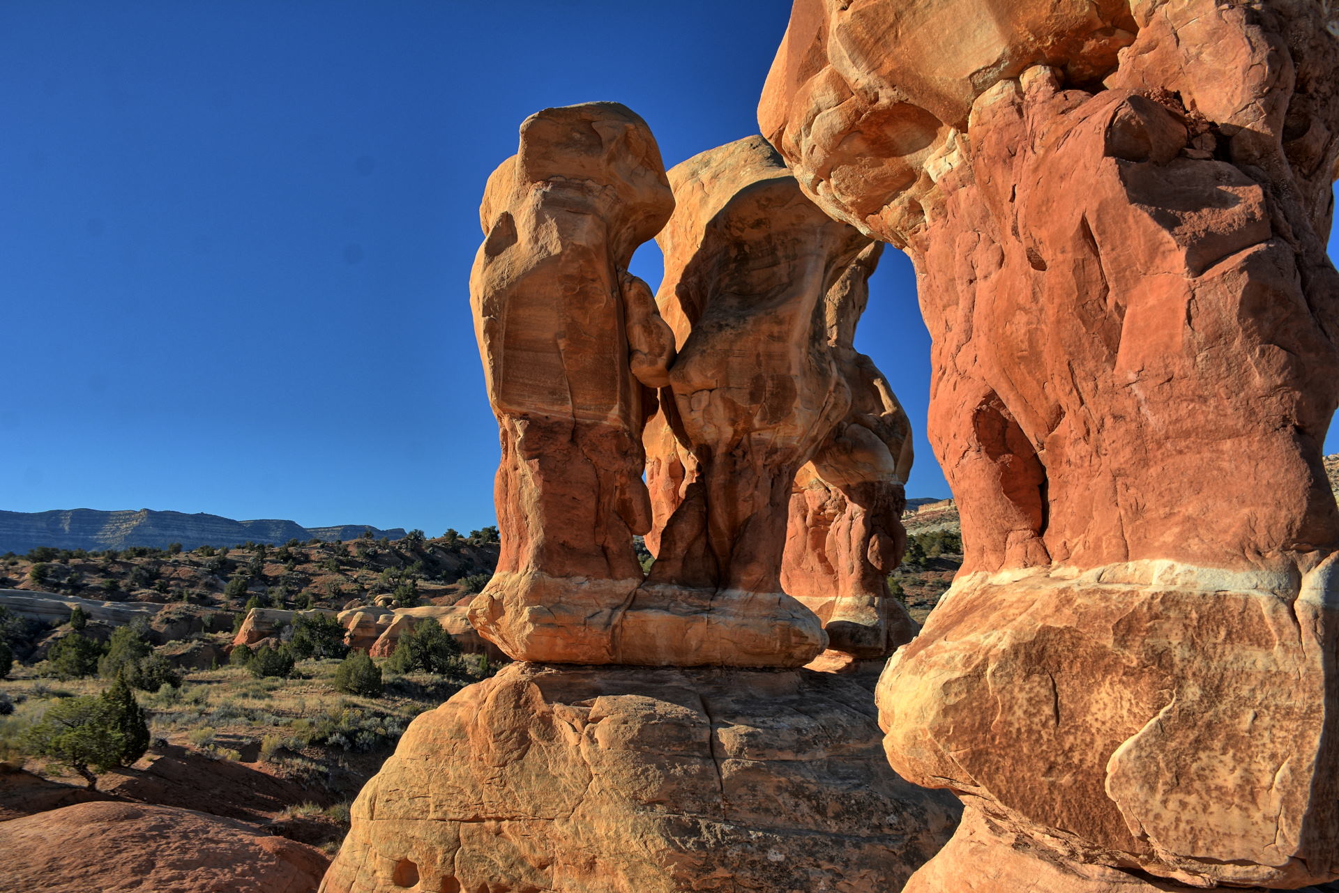
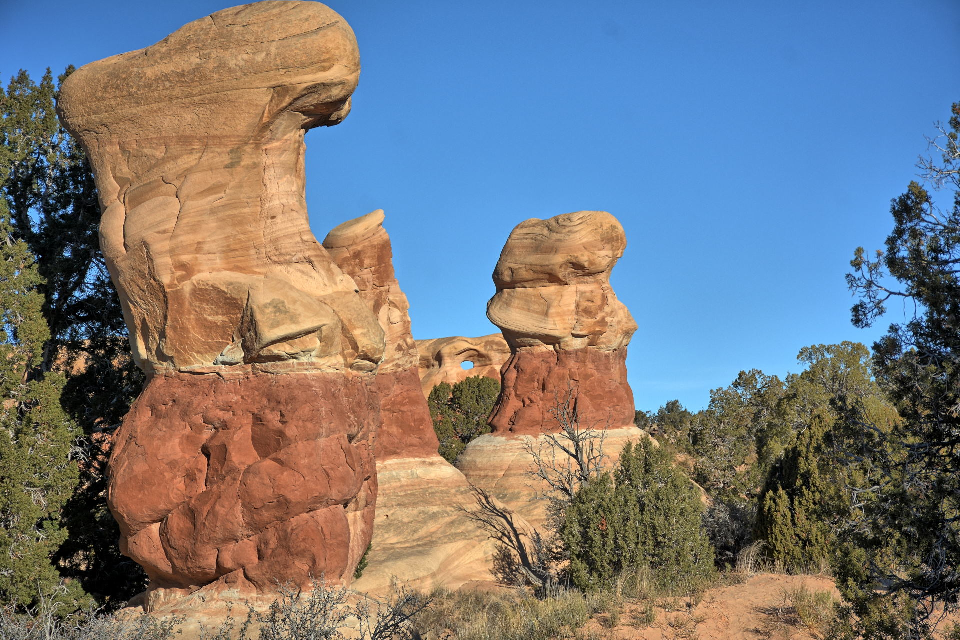
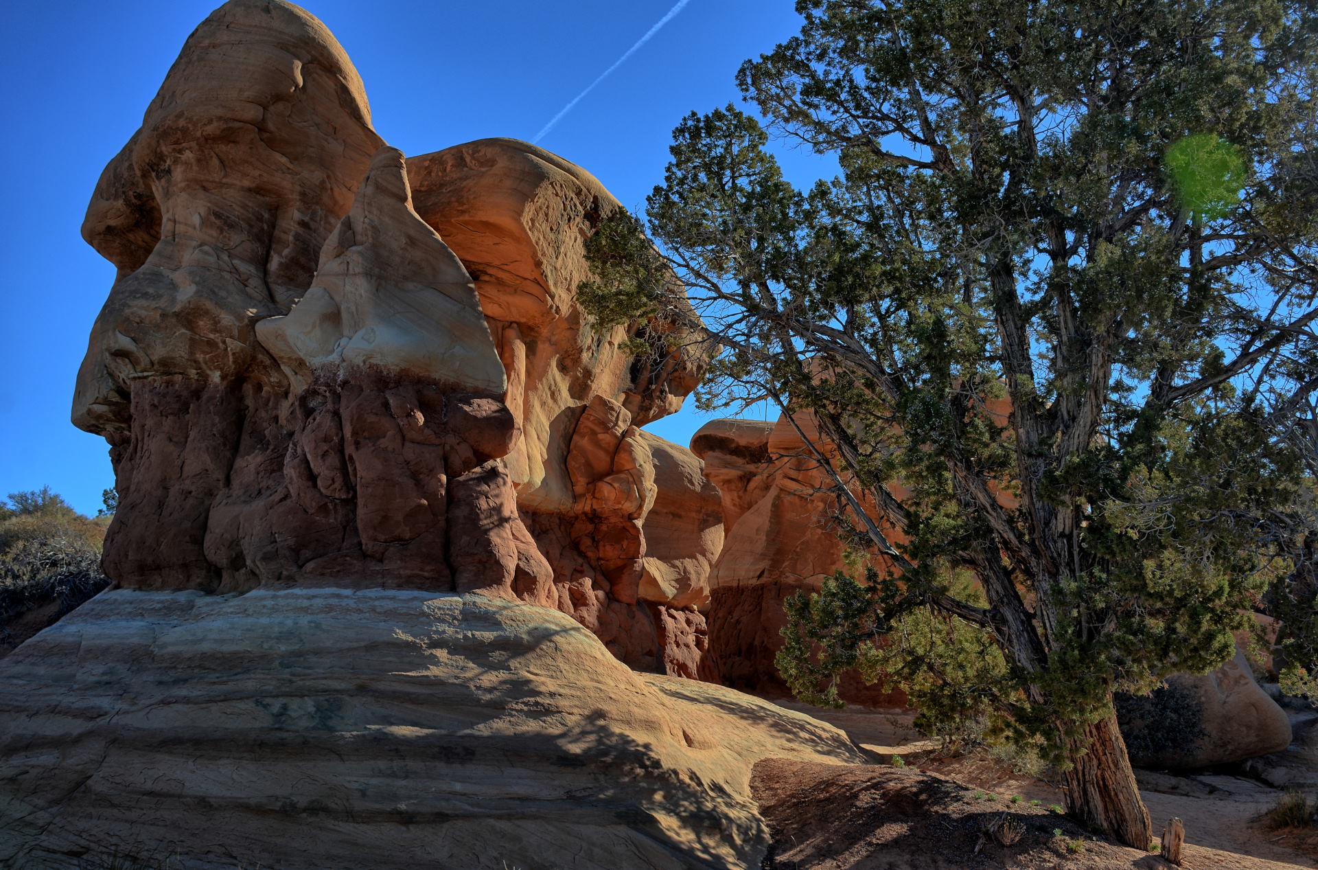
Hole In The Rock Road
Devils
Garden
Zebra Slot trailhead (fly)
Burr Trail Road: Singing
Canyon, Long Canyon
Wolverine
Loop Road
Little Death Hollow -camp
13
Horse
Canyon to Wolverine Canyon
Boulder Mountain - sunset
Torrey
hotel
14
Capitol Reef NP
Cathedral Valley Road
Notom, Goosenecks, Sunset
Point
Dugway hotel
15
Dugway Flight Test
Dugway hotel
16
Dugway Flight Test
Dugway hotel
17
Dugway Flight Test
Dugway hotel
18
Dugway Flight Test
Dugway hotel
19
Dugway Flight Test
Dugway hotel
20
Dugway Flight Test
Fly in Skull Valley & Saltair
Red Iguana 2 dinner
SLC hotel
21
Fly SLC
to home
22
Home – work
23
Home – work
24
Home – work
25 Thanksgiving
Home
26
Home
27
Home
Thursday, 30 Sep
Nathan dropped Chris off at Baltimore-Washington International
(BWI) Airport, and Chris flew to Salt Lake City, arriving in the early
afternoon. He was lucky when he pickup up his rental car; someone had just
returned a large 4WD SUV, and Chris got that car as his rental for the next 7
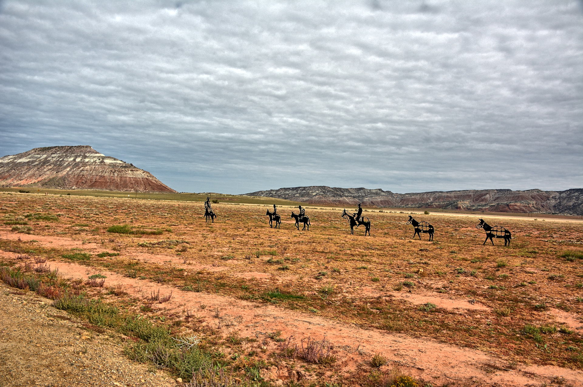
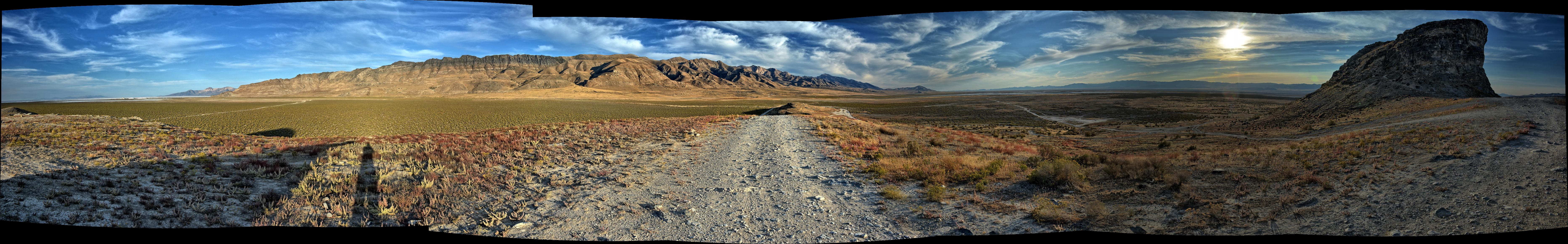
weeks. He drove south, through Spanish Fork and Price, reaching the
Wedge Overlook on the north edge
of the San Rafael Swell.
He had camped there twice before, in 2018 and 2019, and camped there again on
this night at almost the same place as the previous times.
Friday, 1 Oct
Chris got up, made breakfast, and assembled the RC airplanes
that he had brought with him; a NanoTalon and a 5' wingspan flying wing.
He flew the NanoTalon at the canyon edge, and then drove north and east to
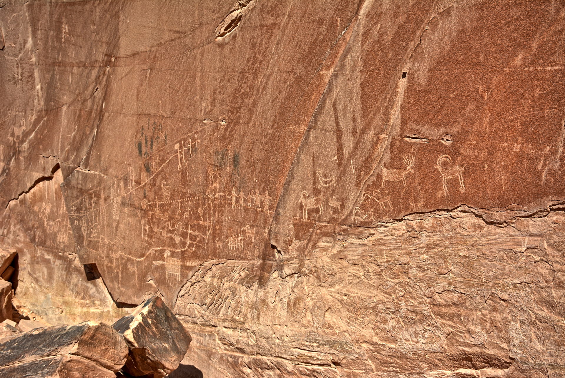
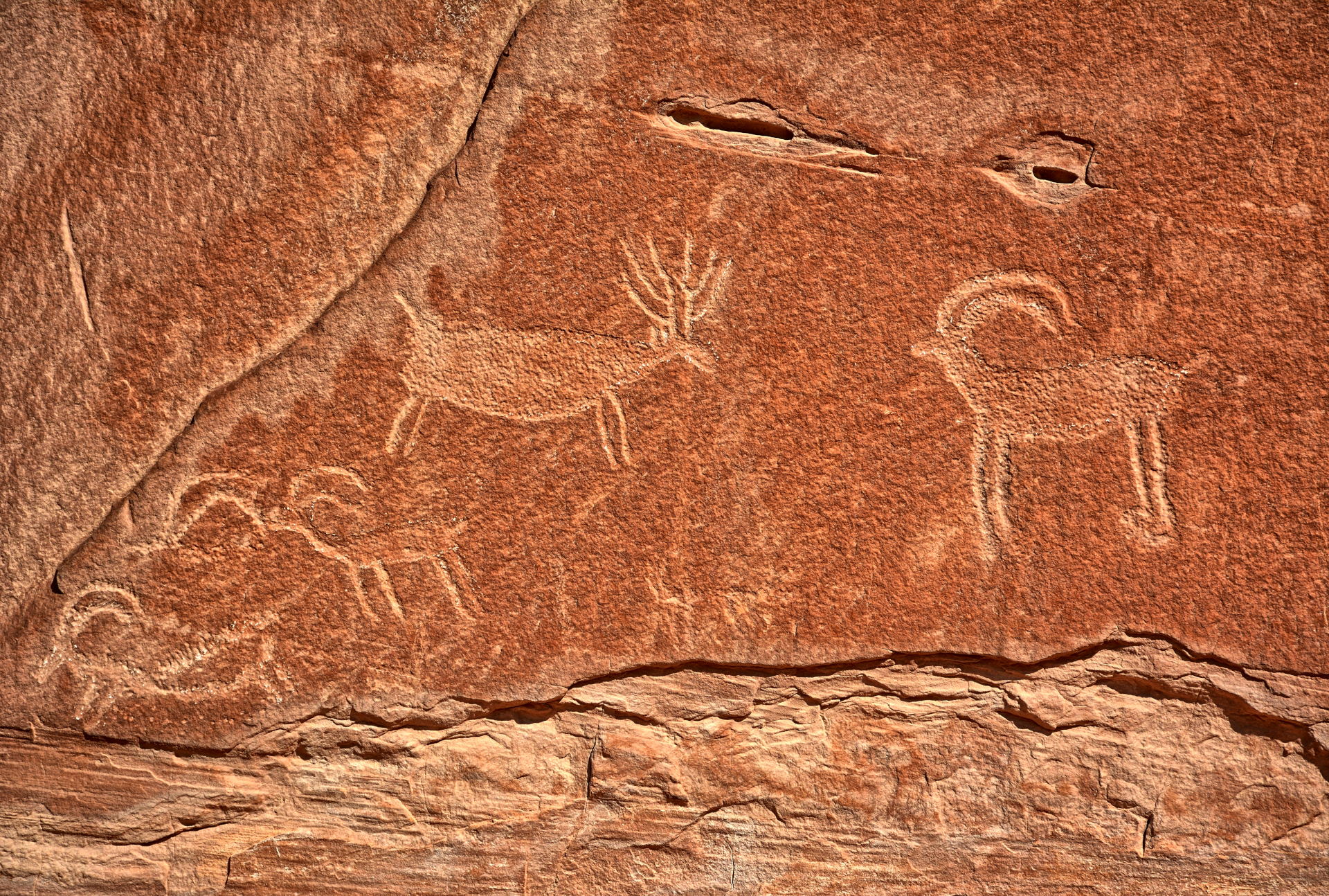
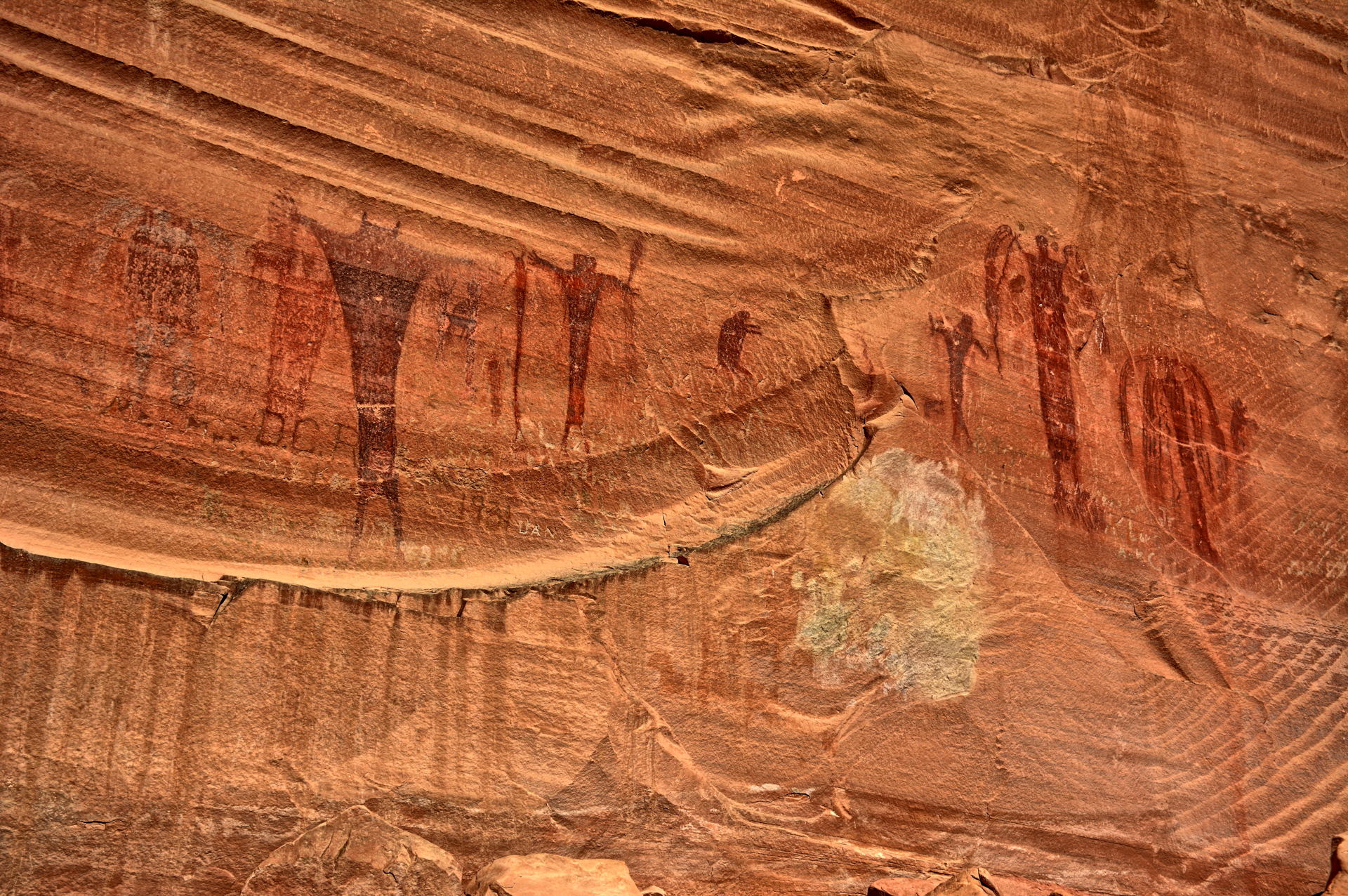
Buckhorn Draw Road. He headed south on Buckhorn Draw Road, stopping at
a couple
pictograph panels within Buckhorn Draw, and then flew his flying wing at the
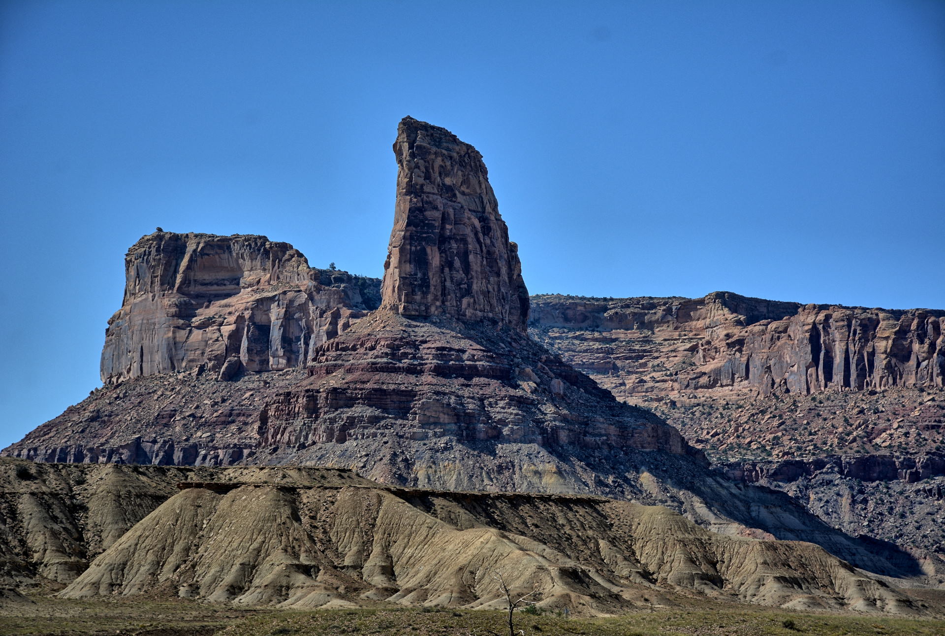
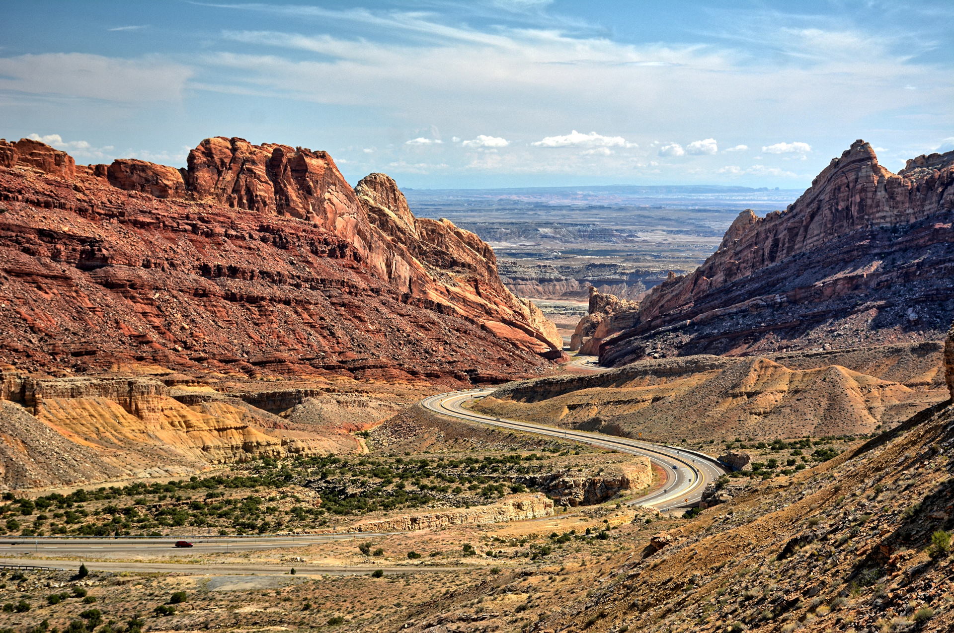
San Rafael River Bridge. He continued south to I-70, stopping at the
Spotted Wolf Canyon Overlook where you can see I-70 cut down and through the
eastern edge of the San Rafael Reef. He drove on to Green River for gas and
lunch, then came back west and then south towards Hanksville, stopping near
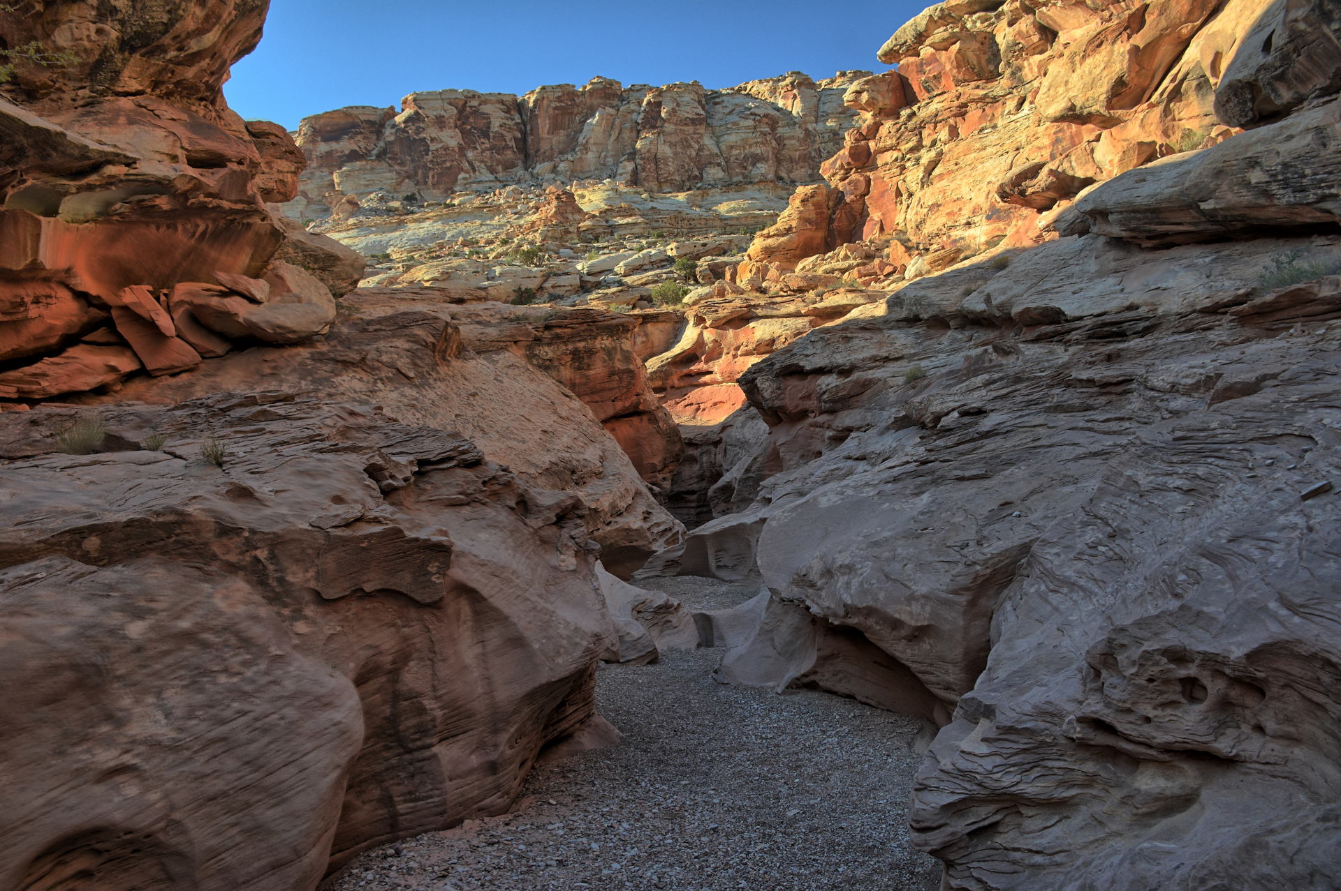
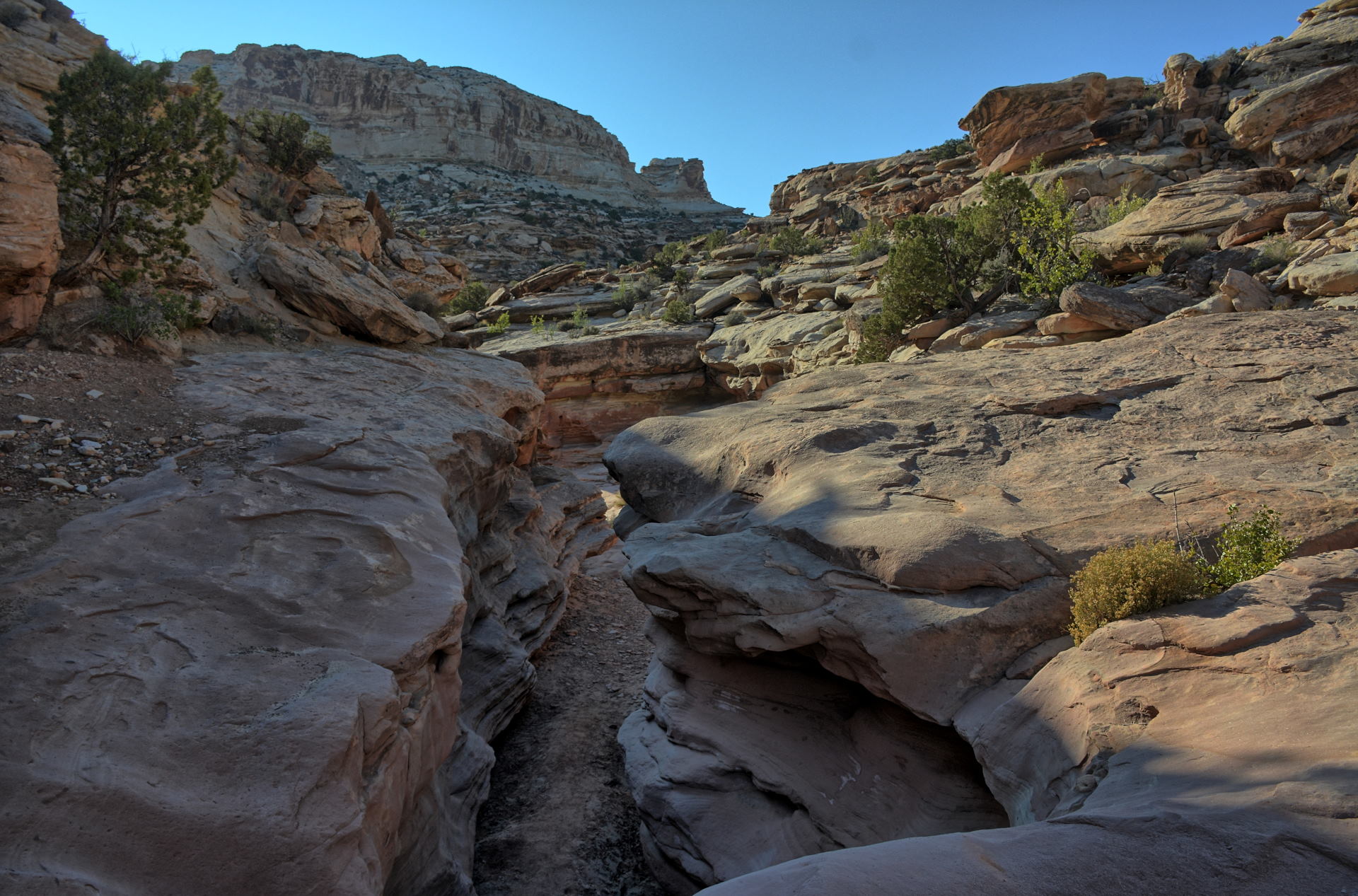
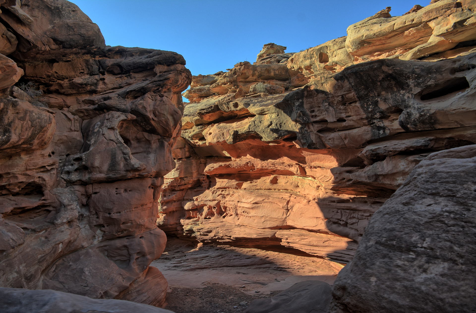
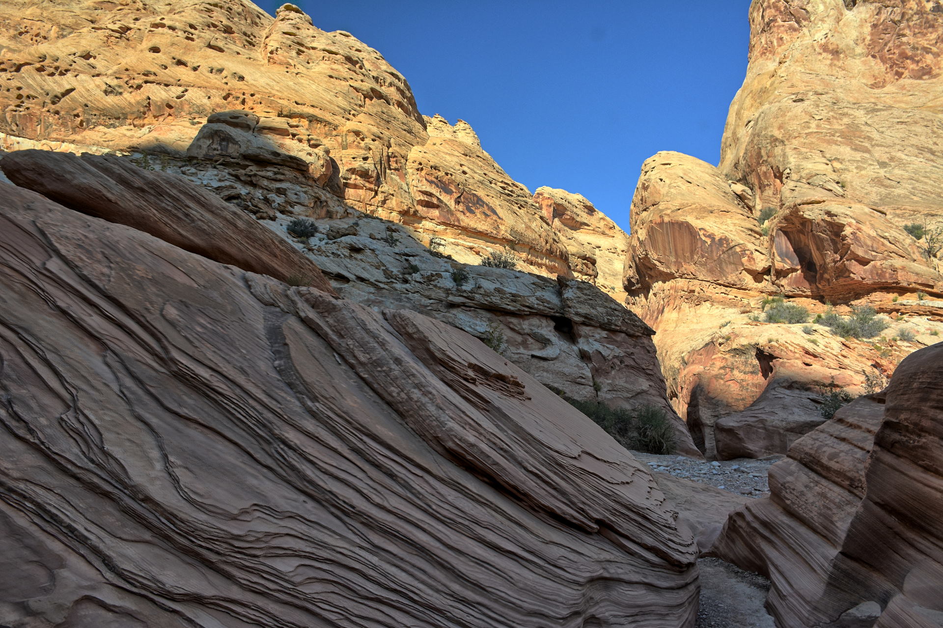
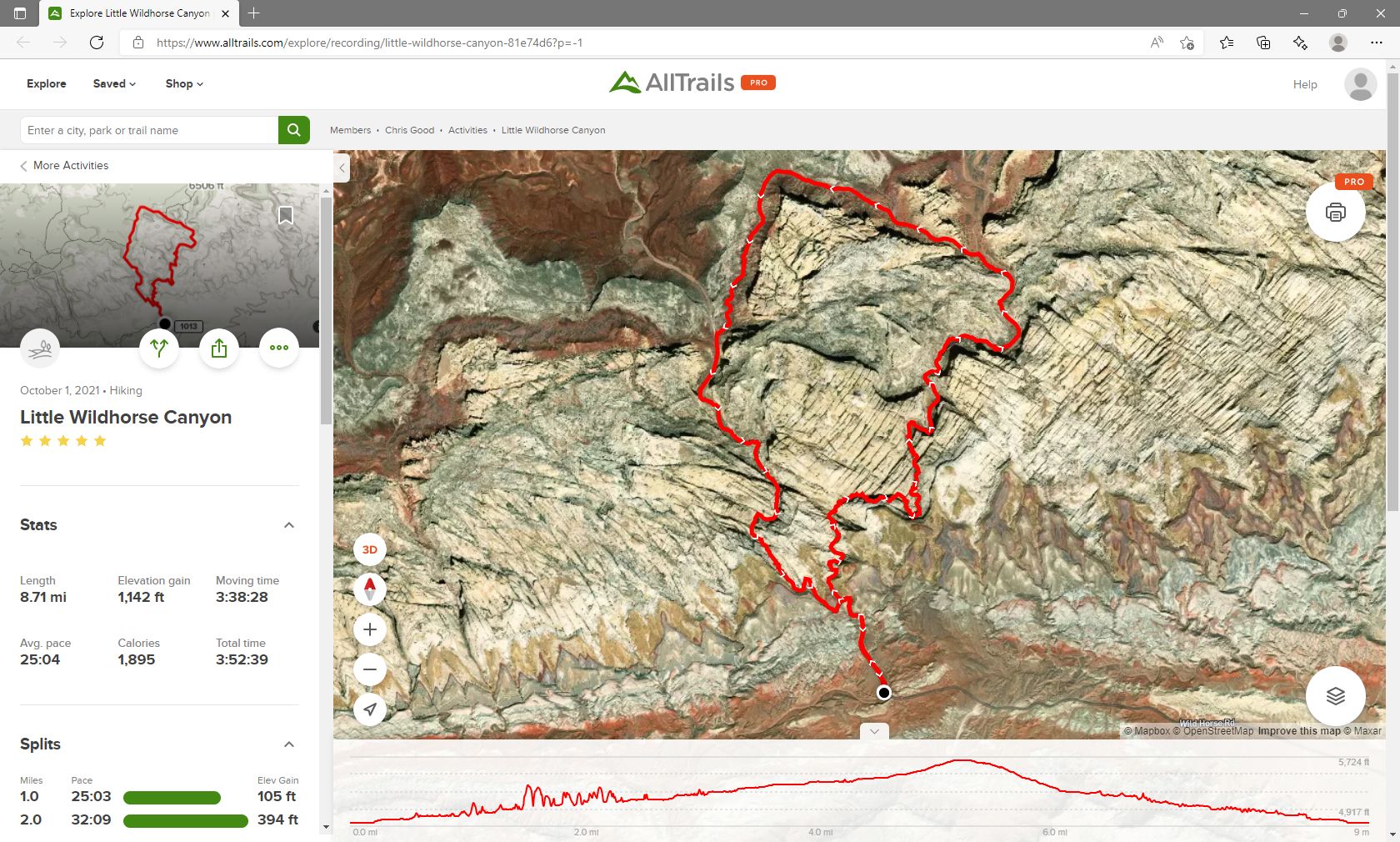
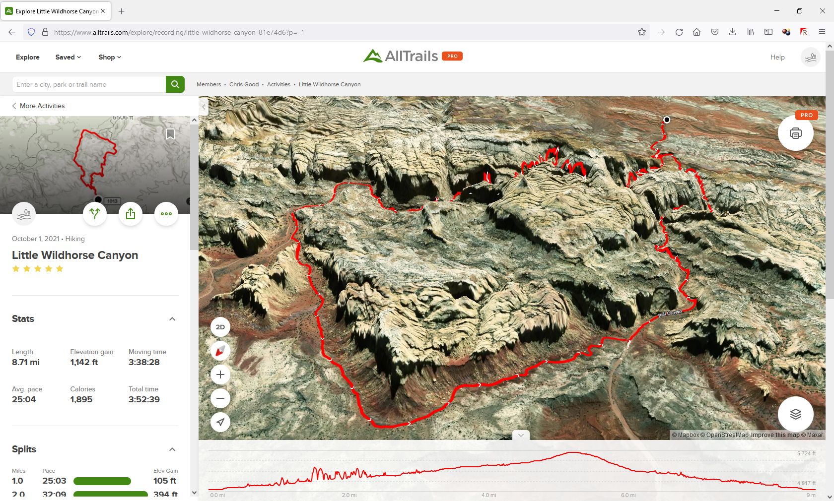
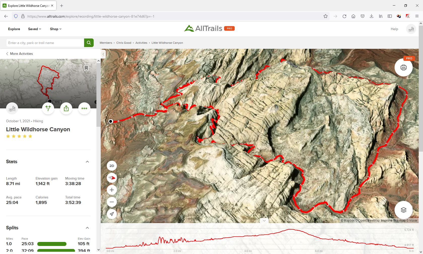
Goblin Valley State Park to hike the
Little Wildhorse Canyon and Bell Canyon loop trail. He had hiked this
same trail in 2018, but there were far fewer people on this circuit of the loop.
The trail was dry the last time he hiked it, but there were a few places with
water up to about a foot deep this time through. He recorded the full hike
on his phone with the All-Trails App; it was 8.7 miles long and recorded as 1142
feet of vertical climb. That vertical value is probably not accurate as
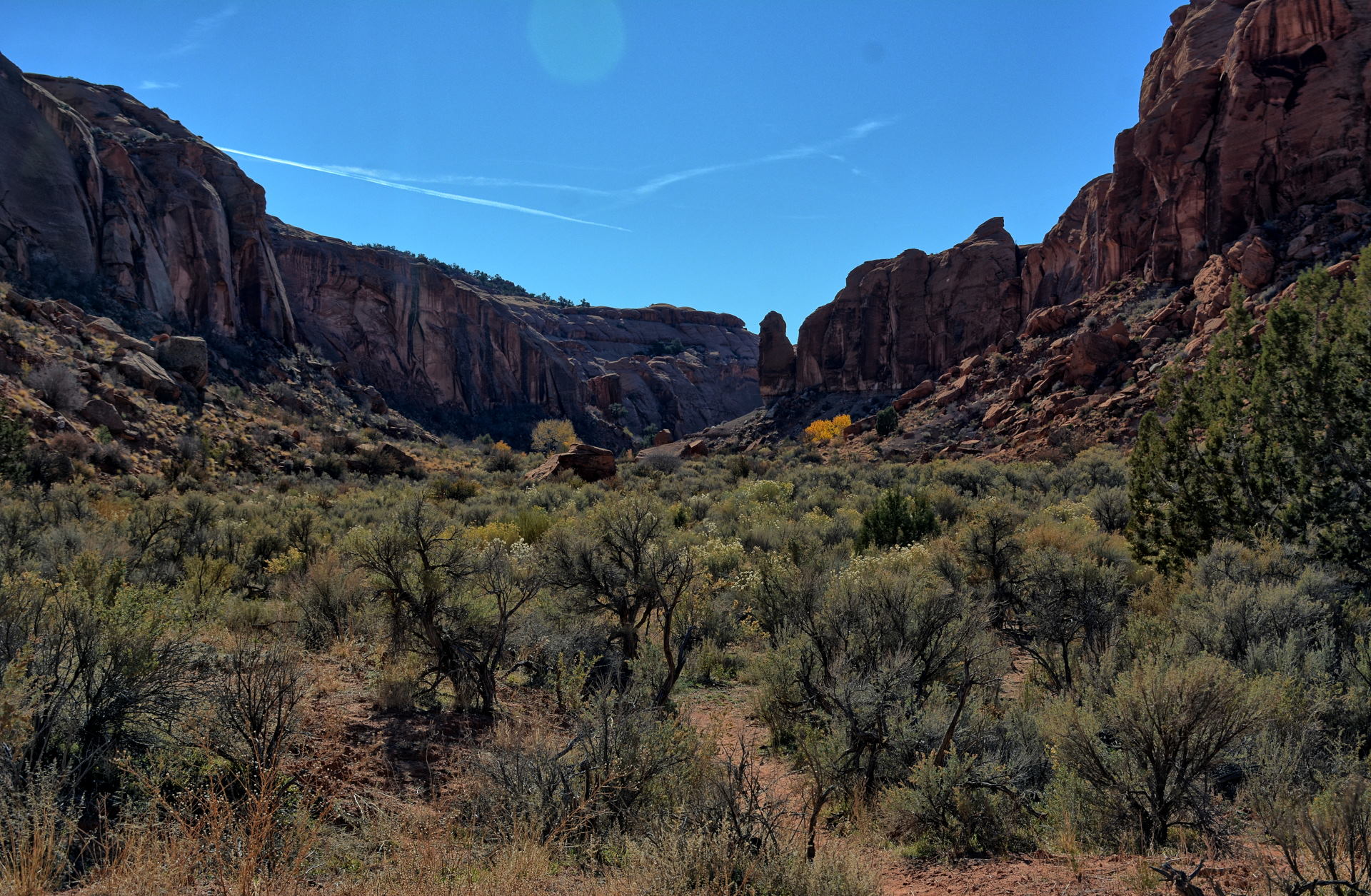
the GPS signals are bounced around a lot within the narrow slot canyon sections. After Chris finished the hike, he continue south
to Hanksville for dinner, then drove west to Capitol Reef National Park and
camped just outside the park's eastern boundary.
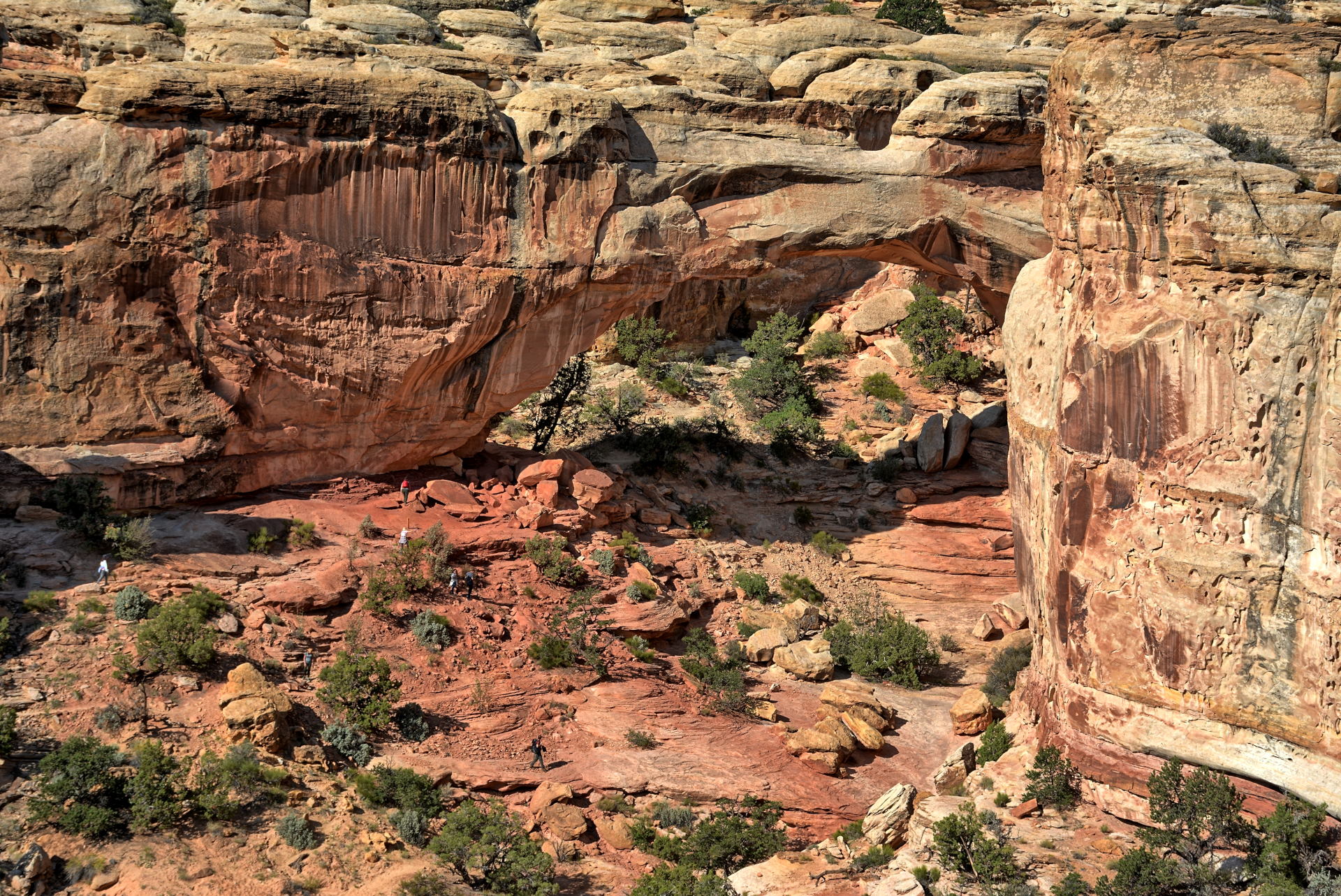
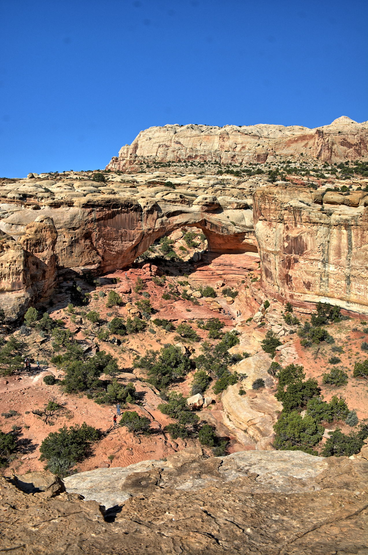
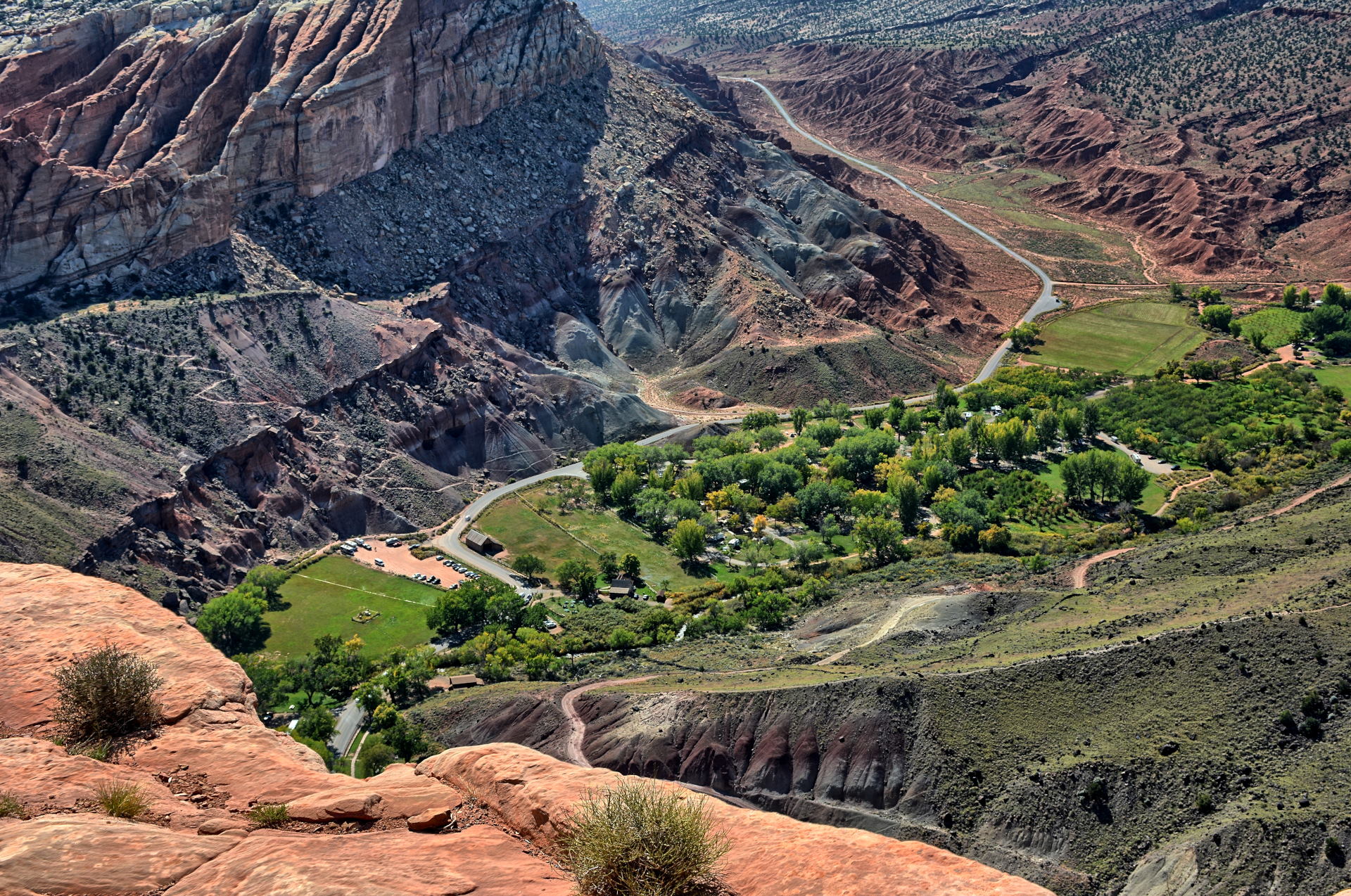
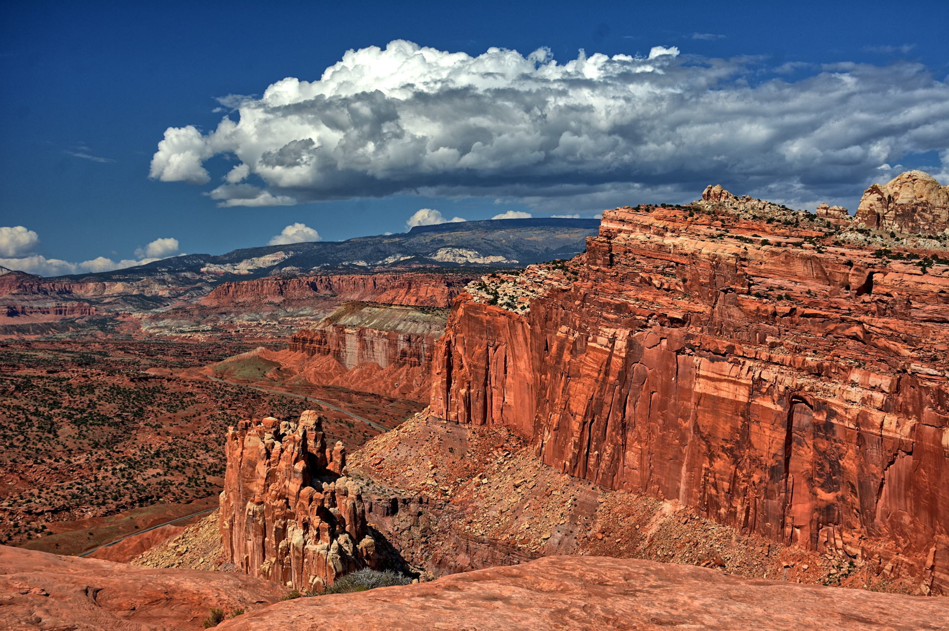
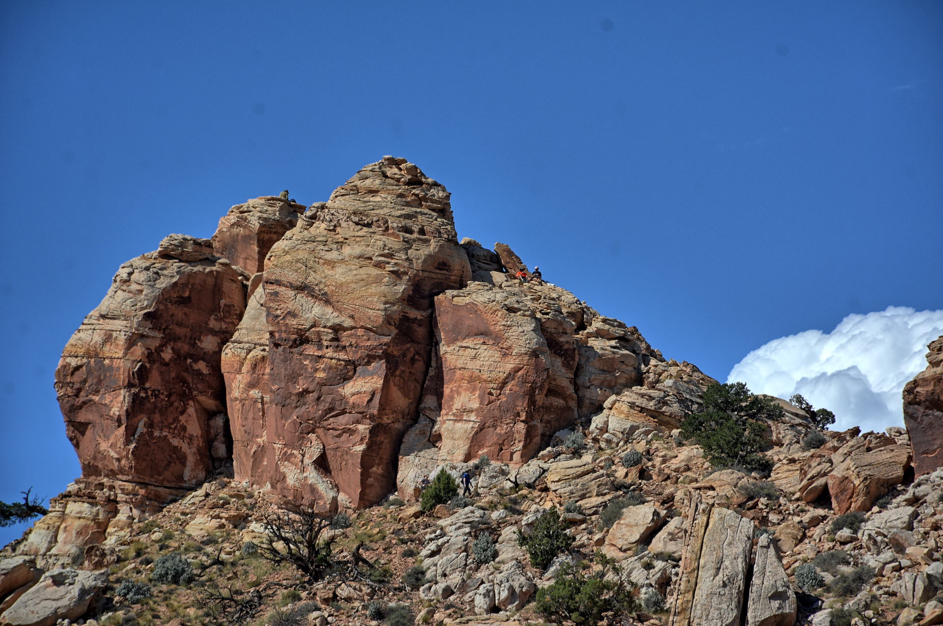
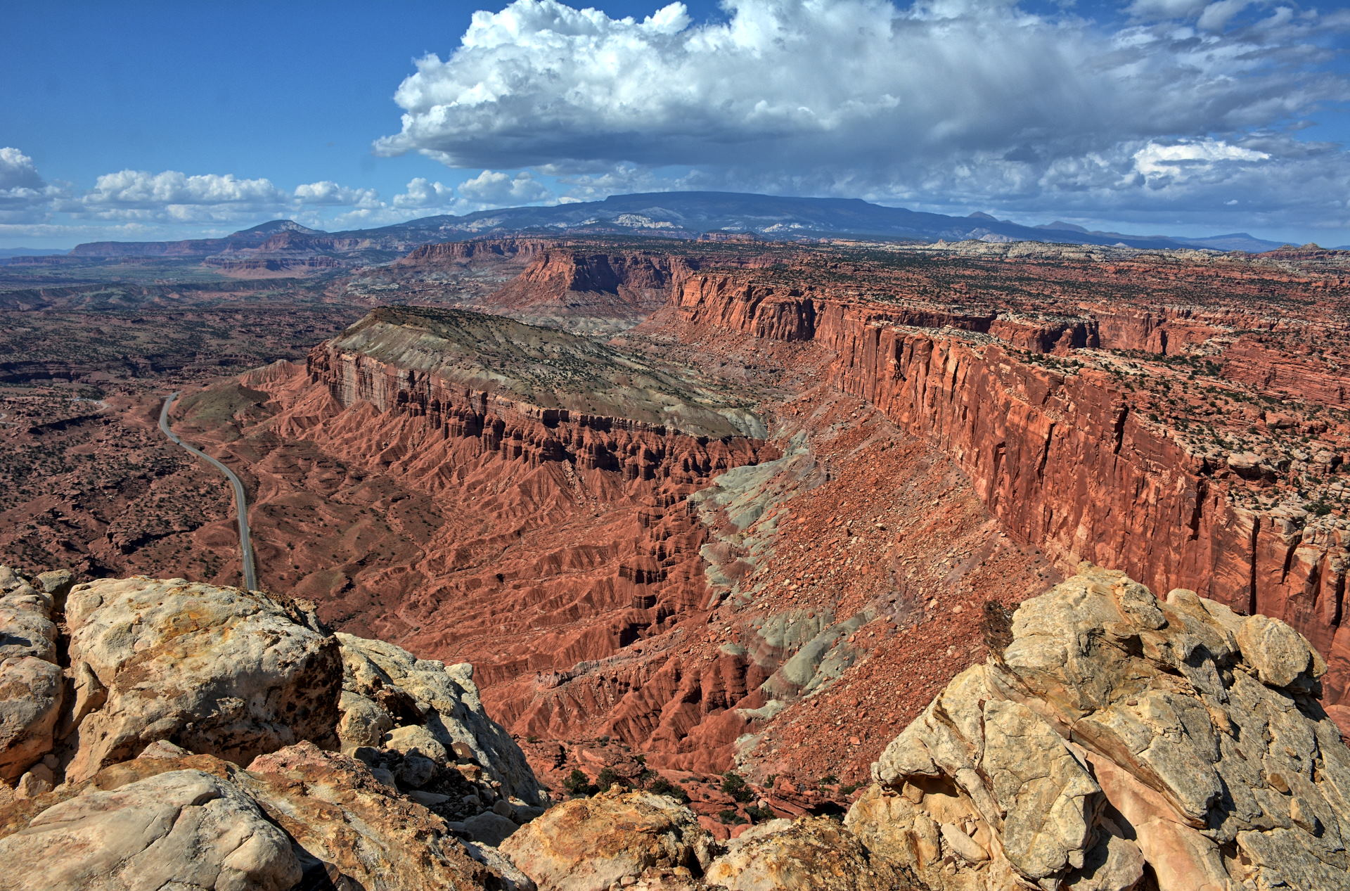
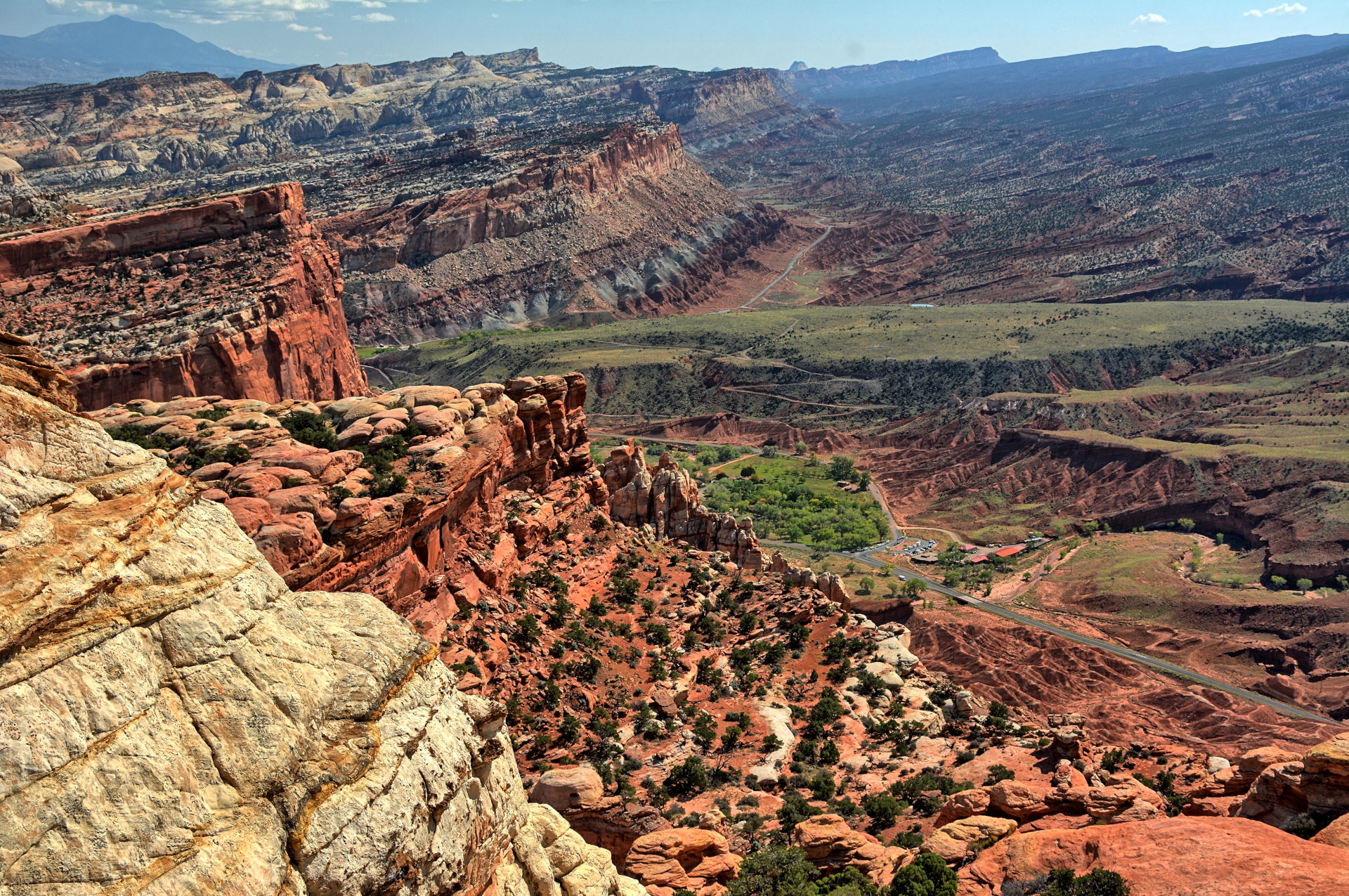
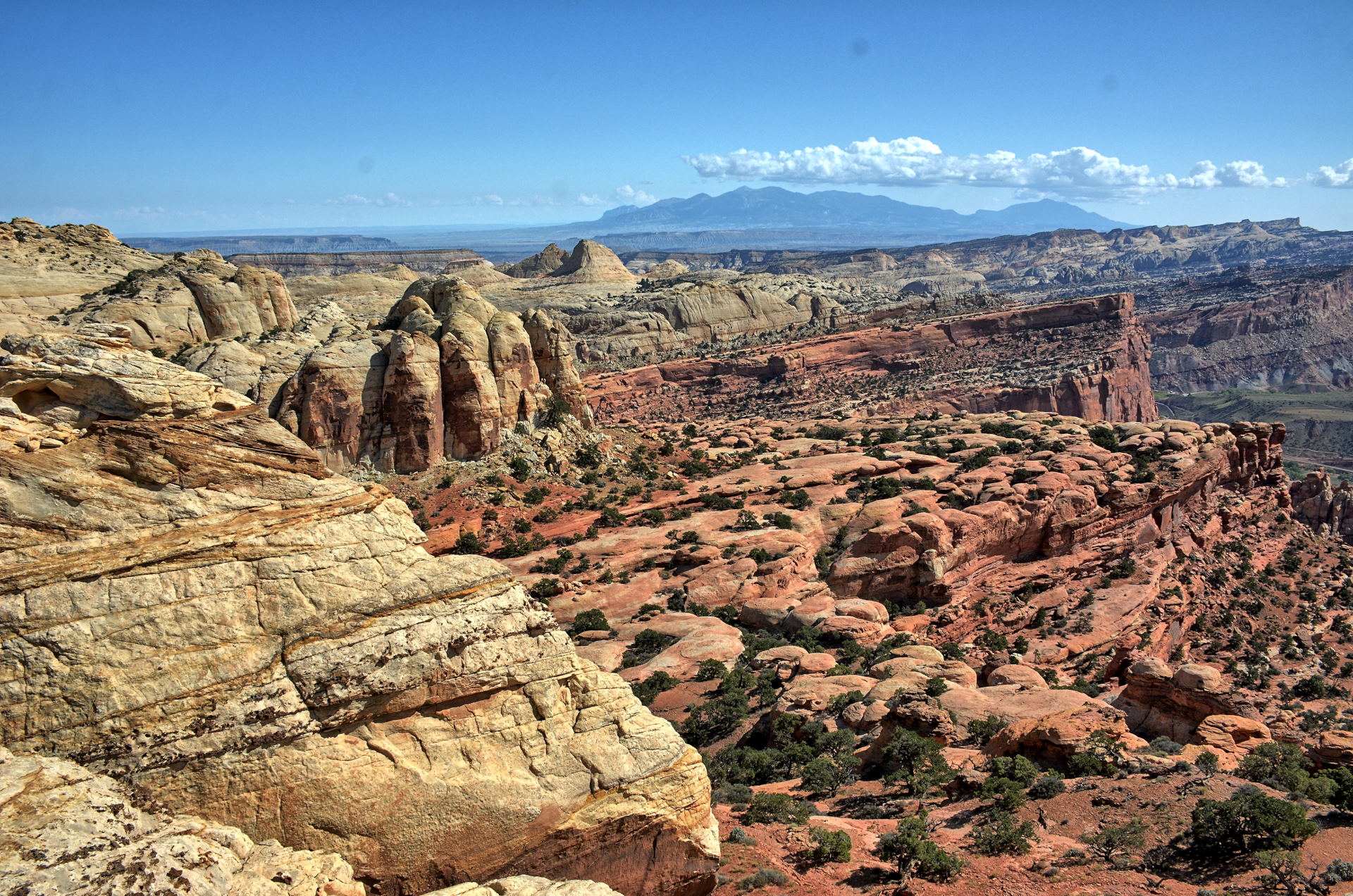
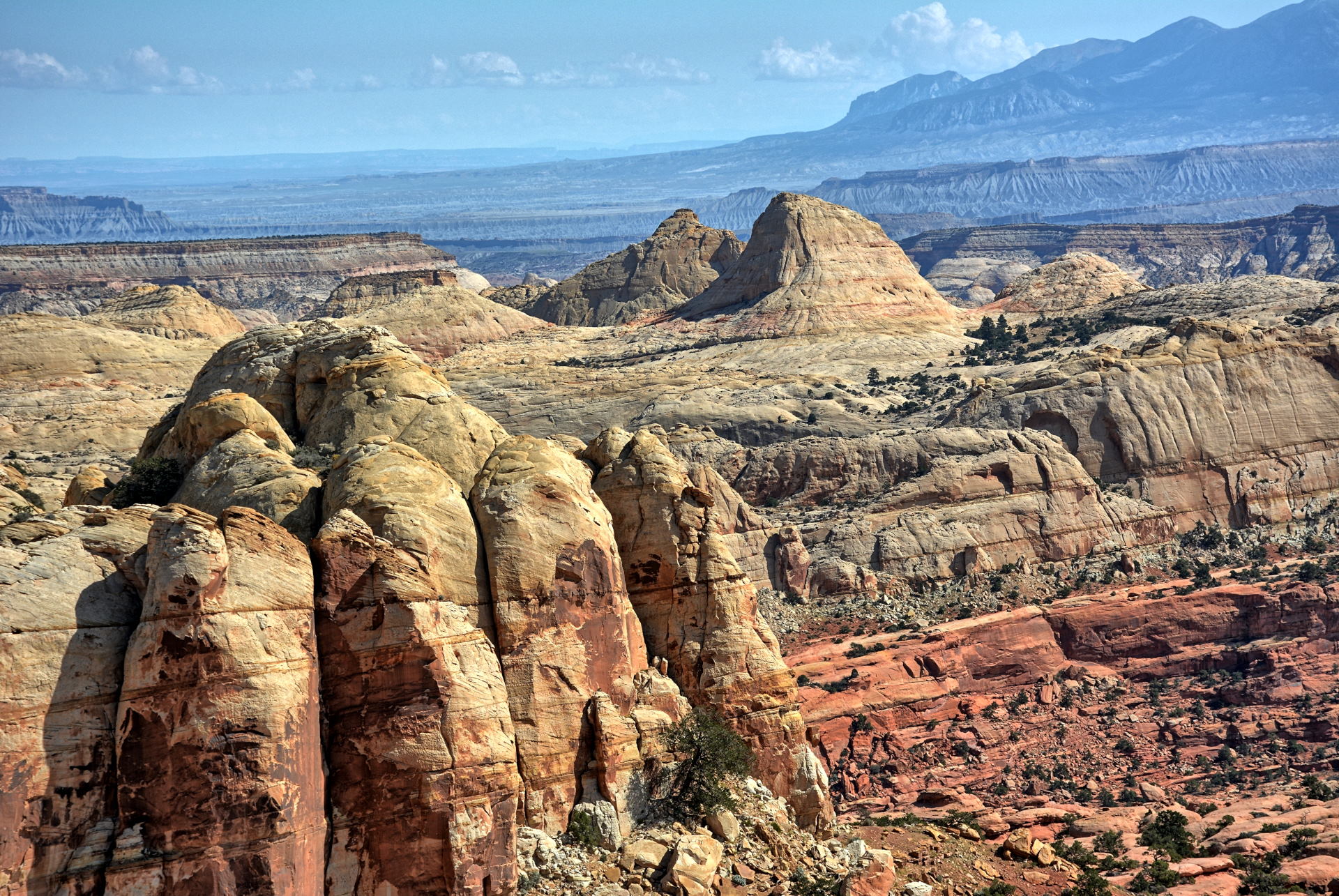
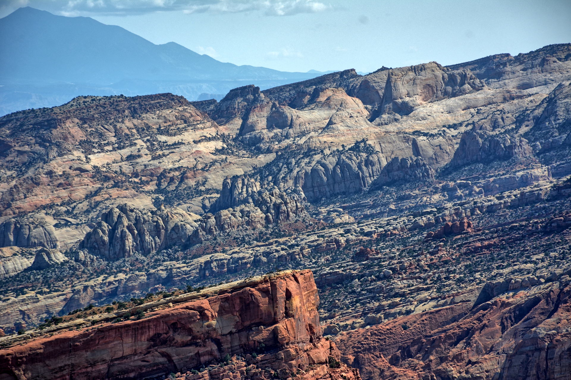
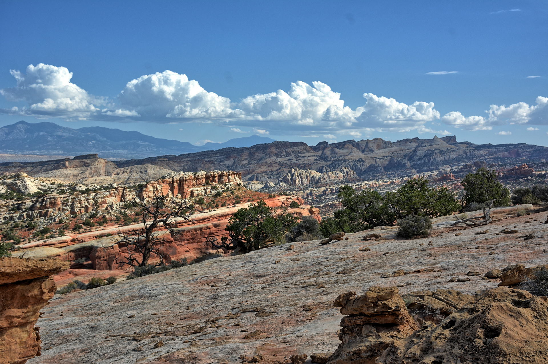
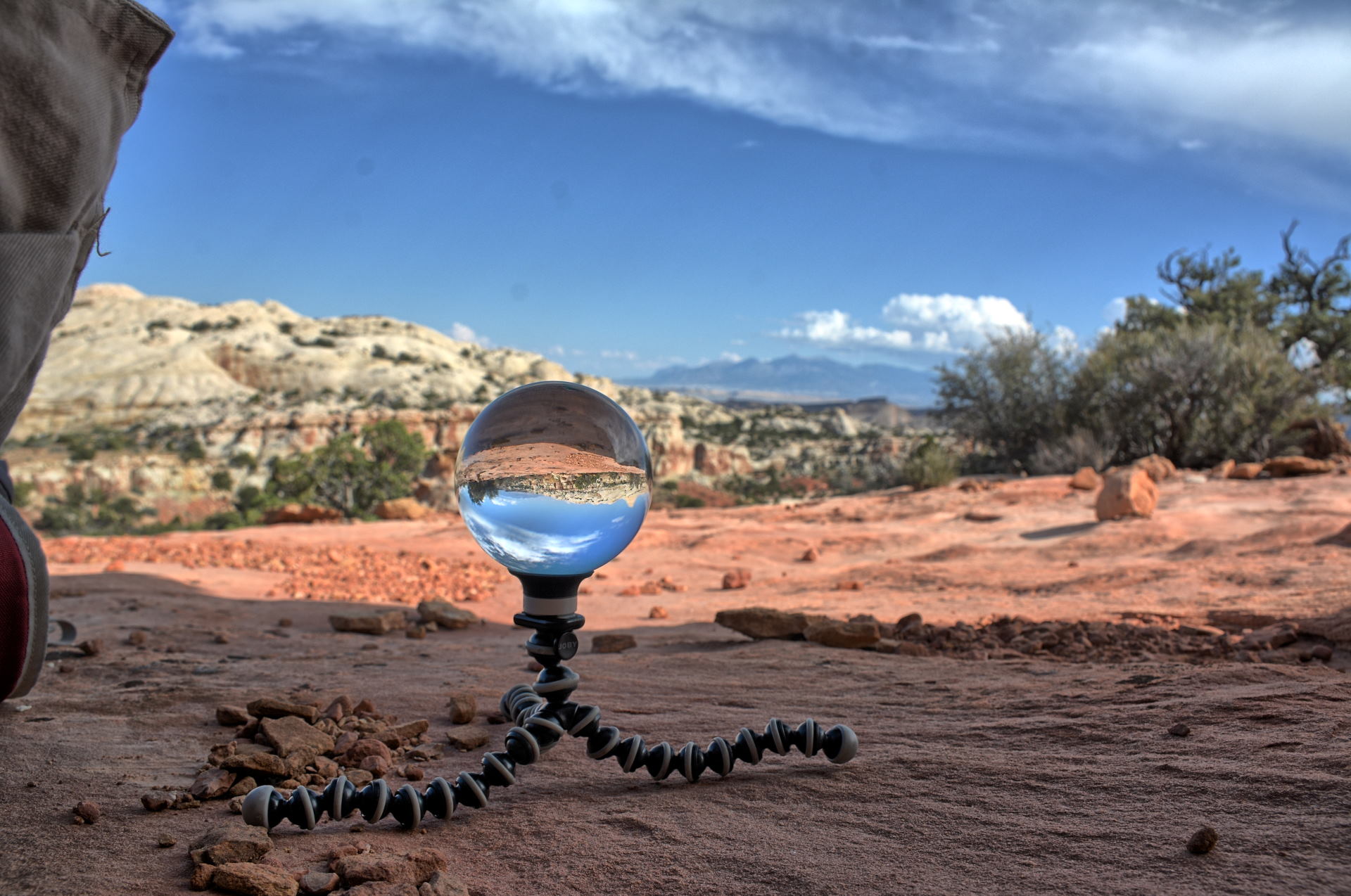
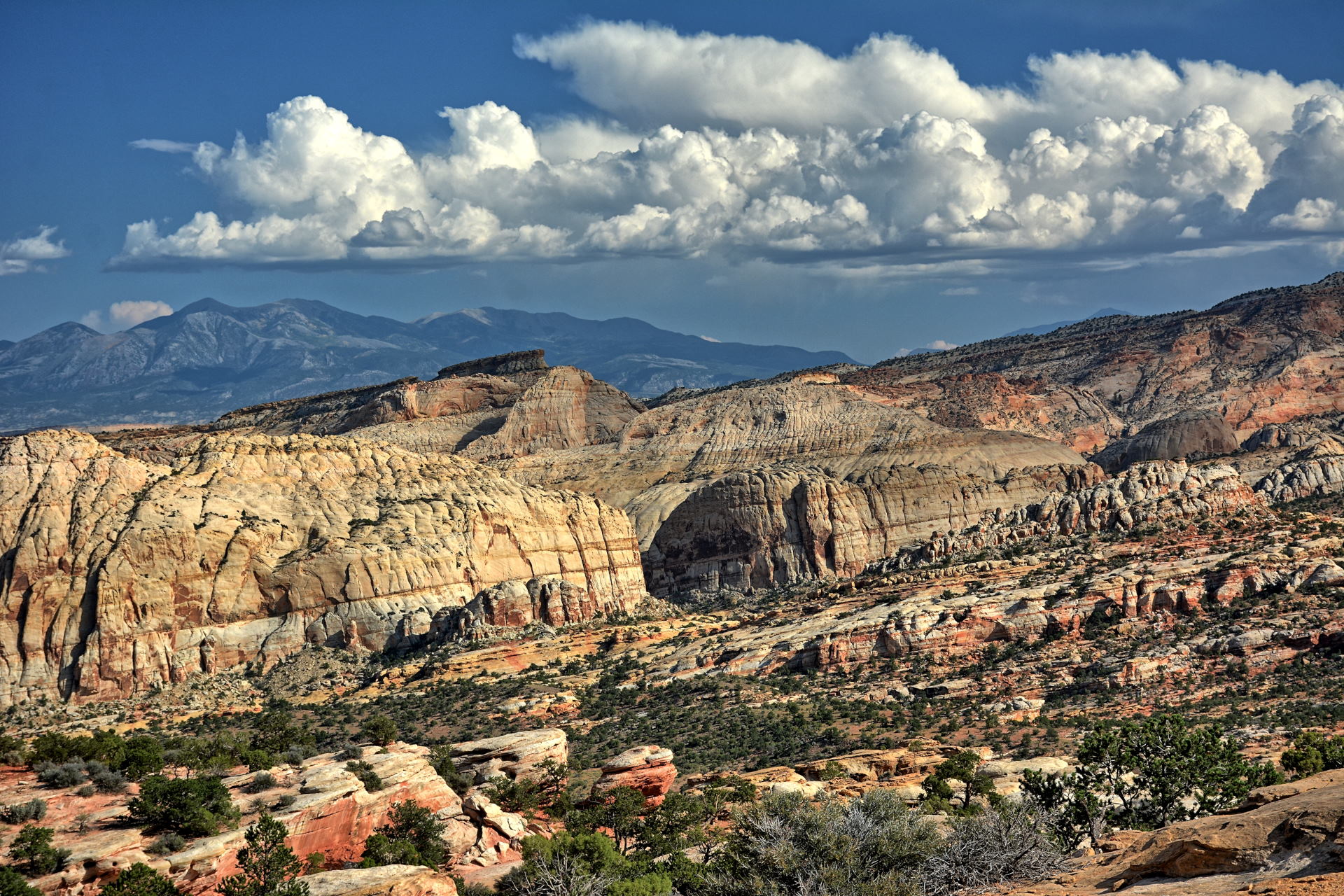
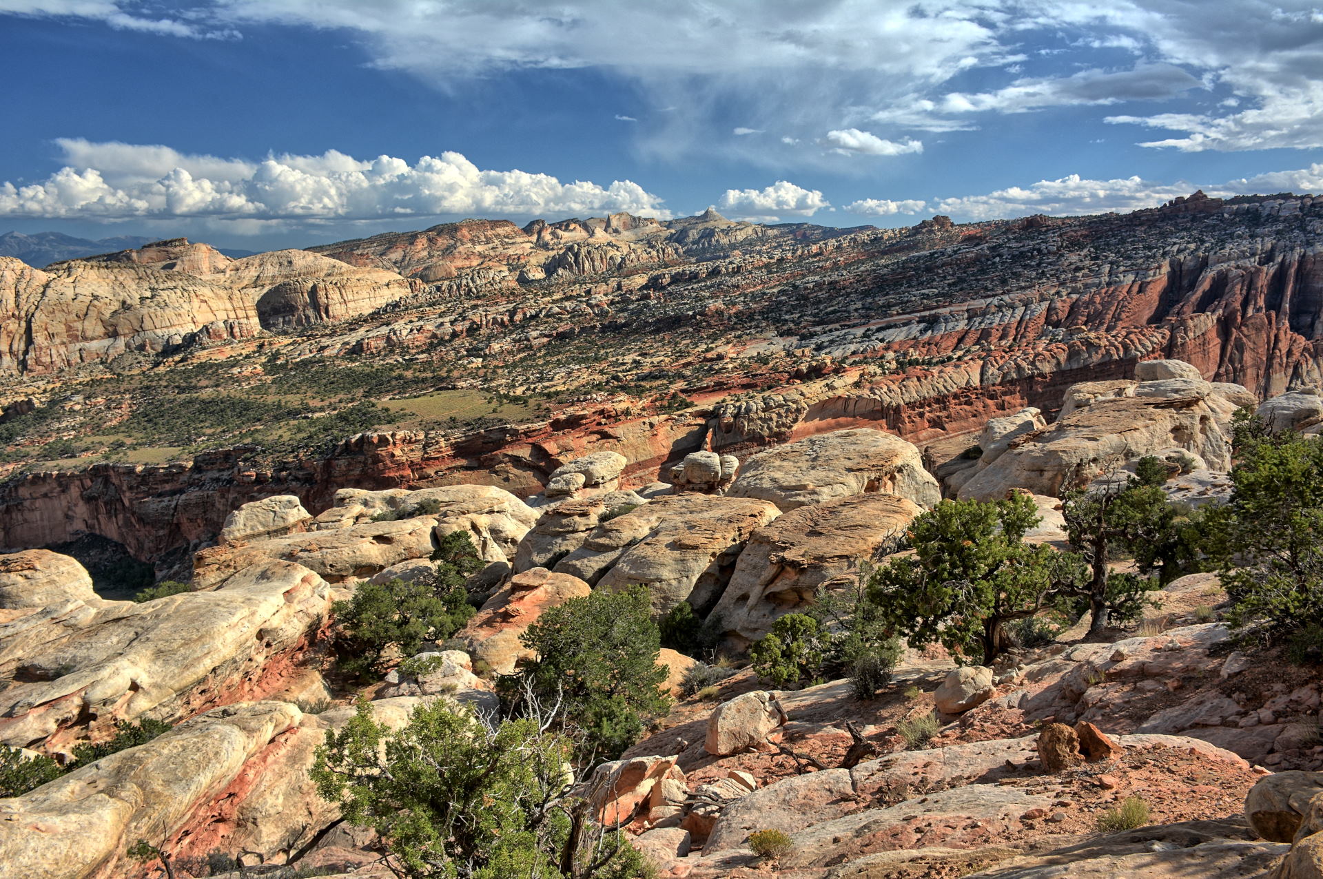
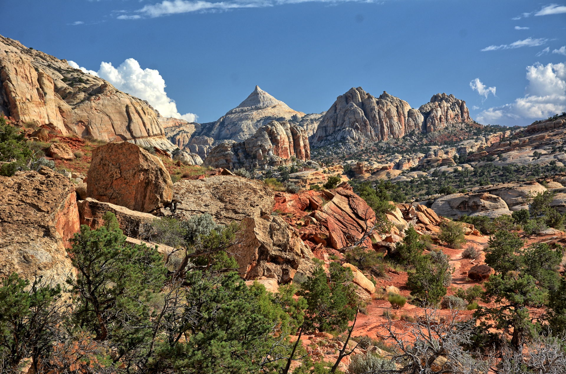
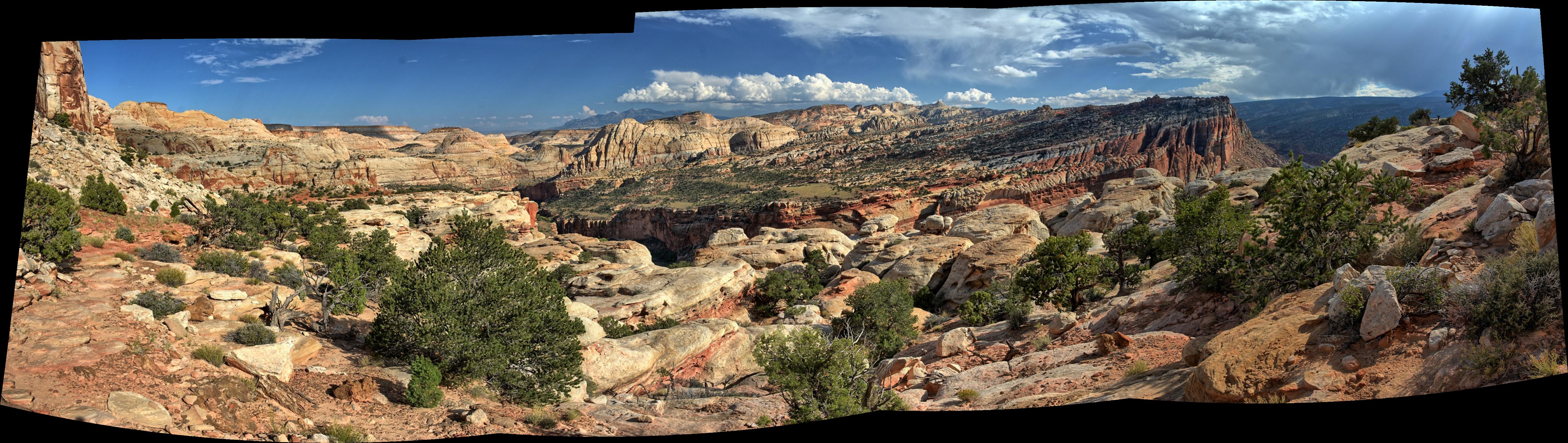
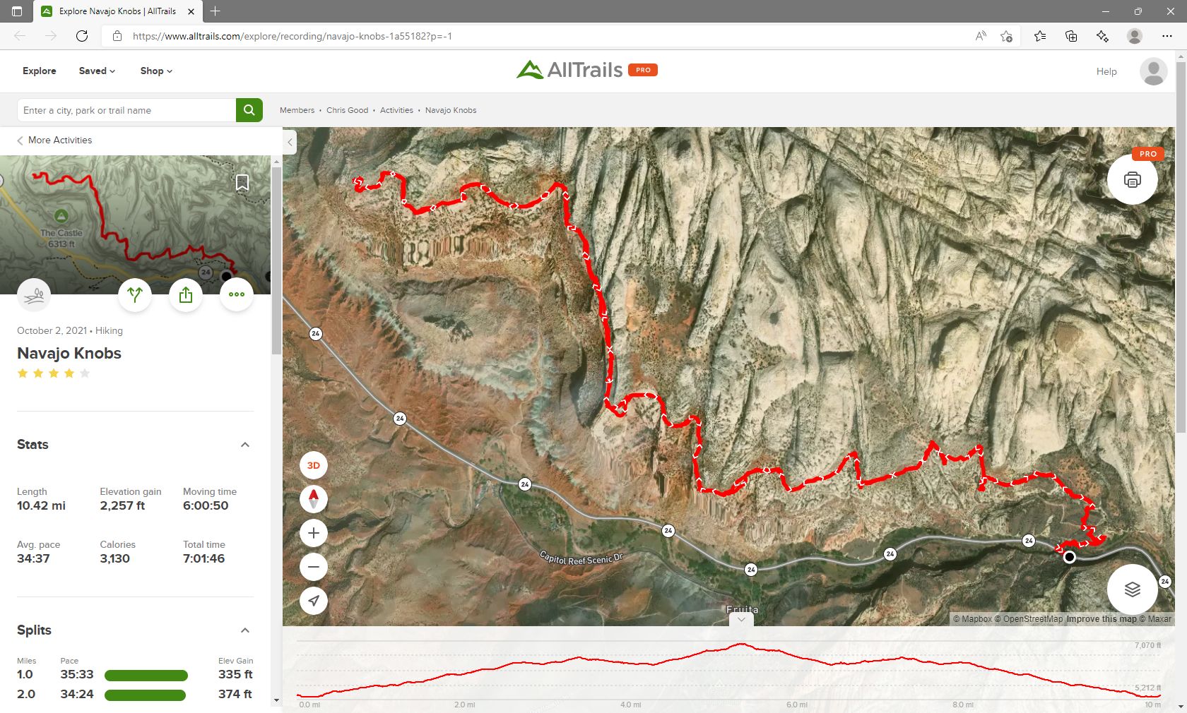
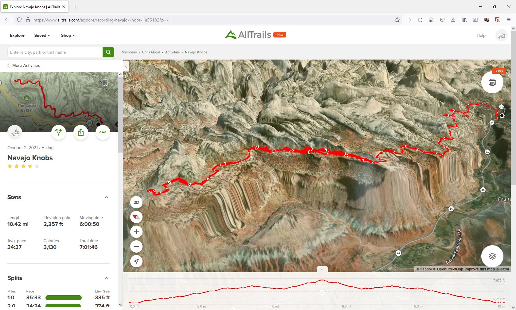
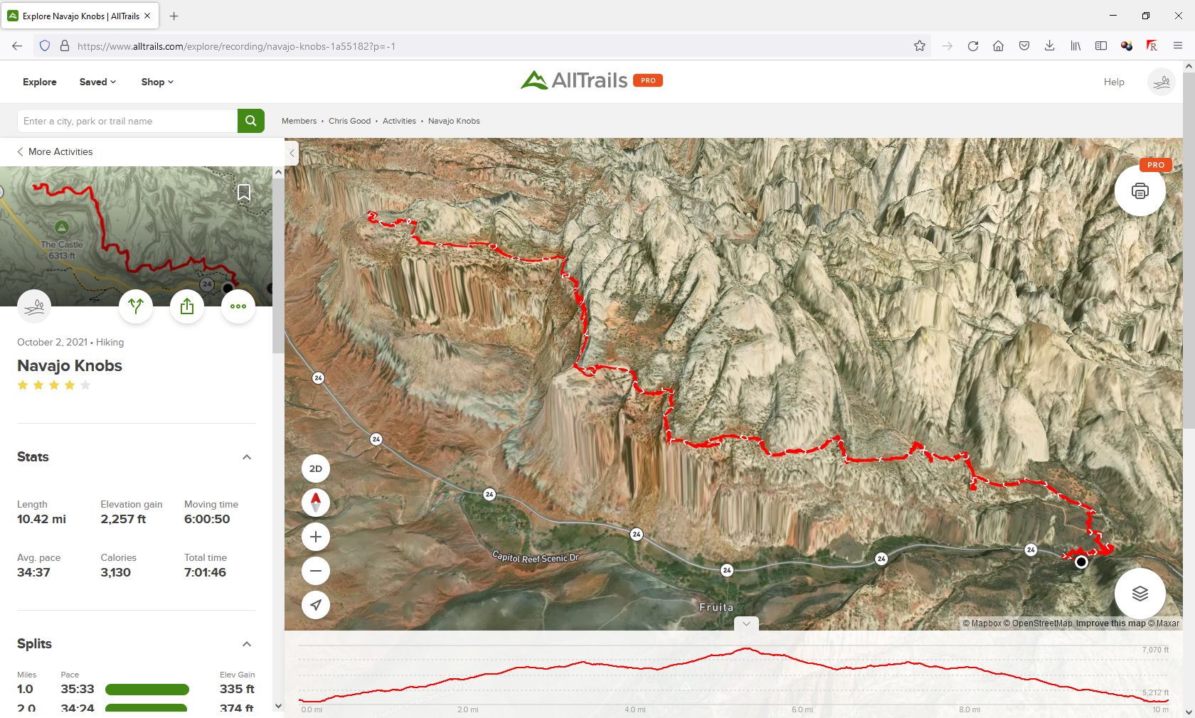
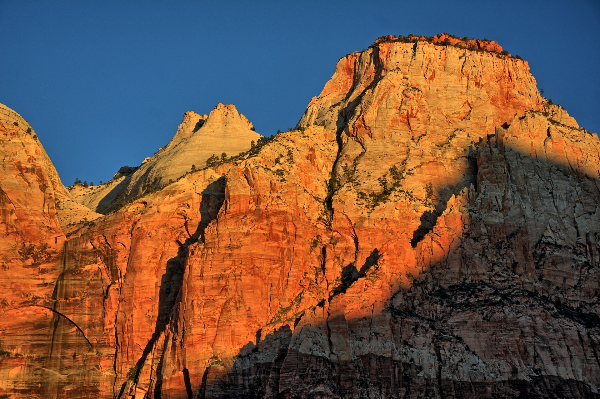
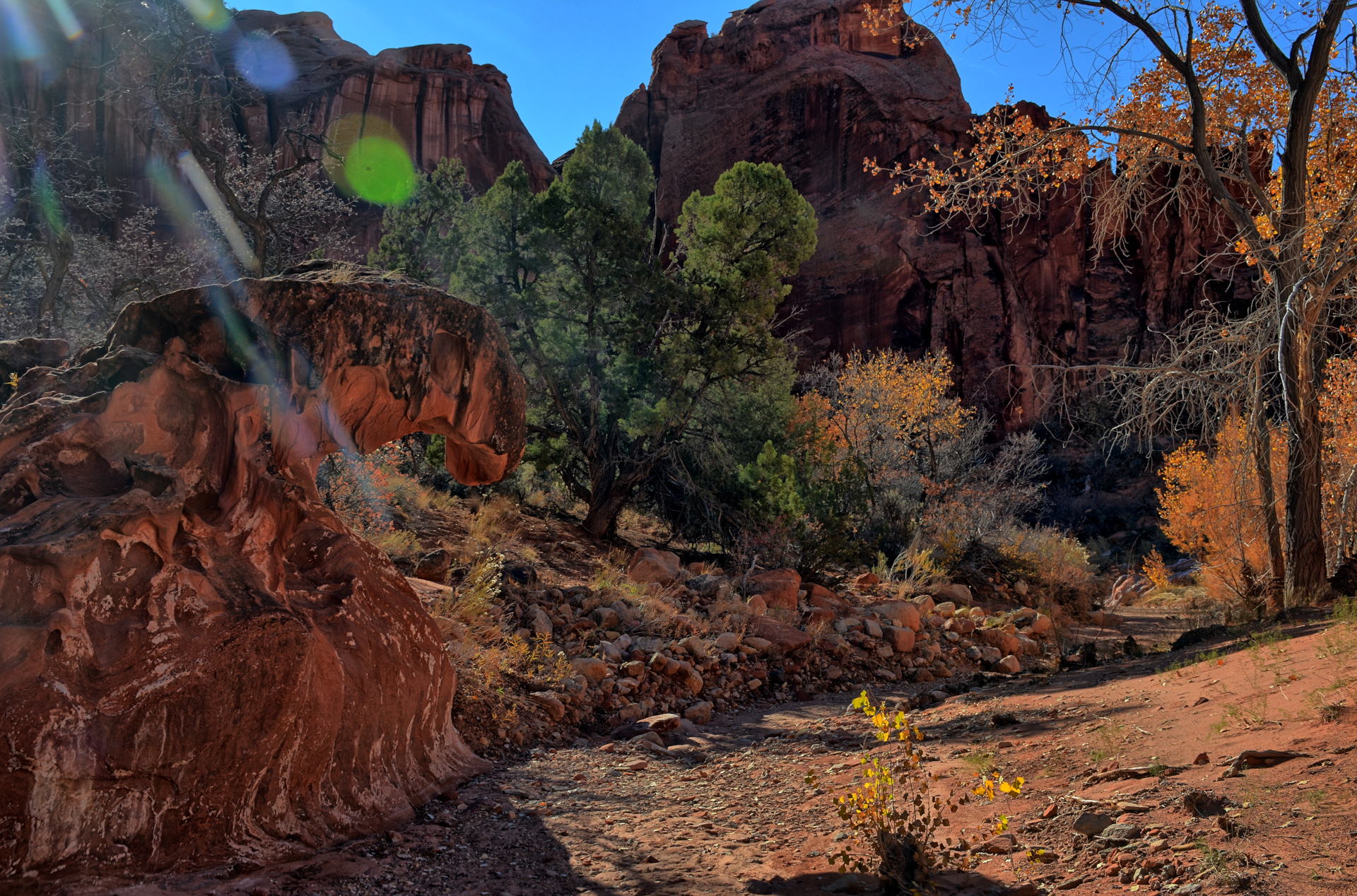
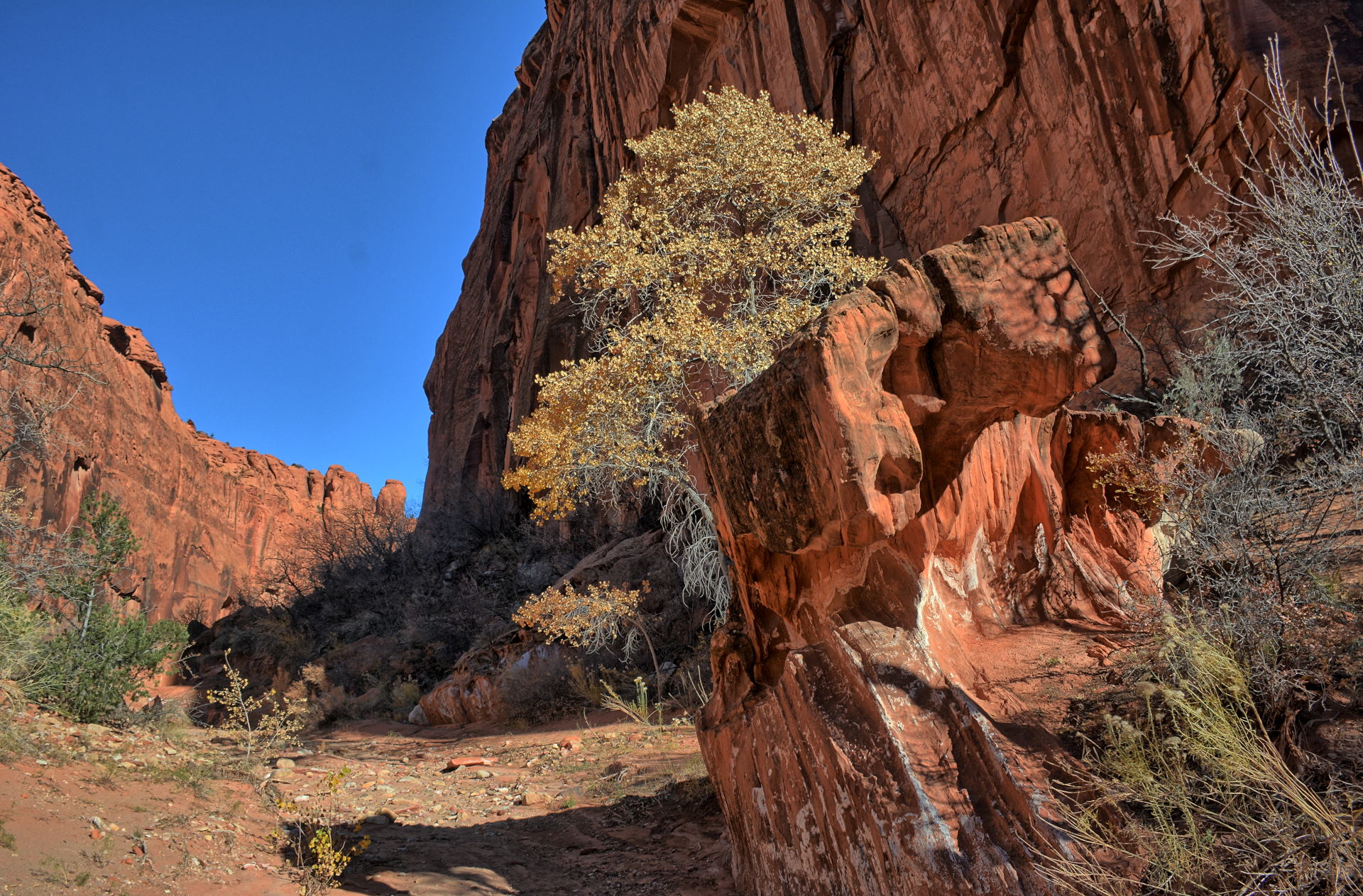
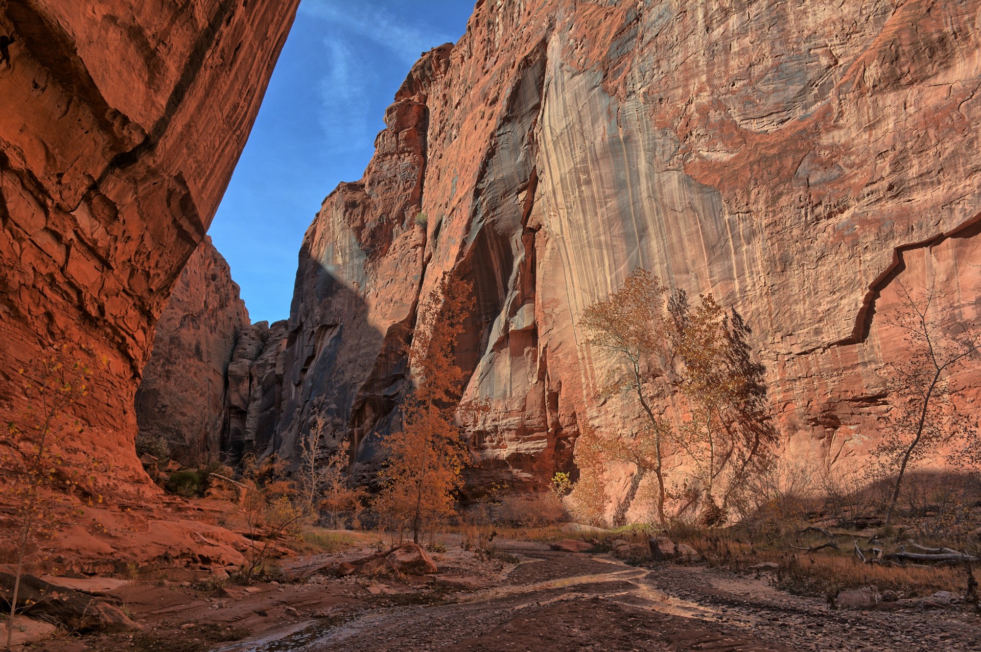
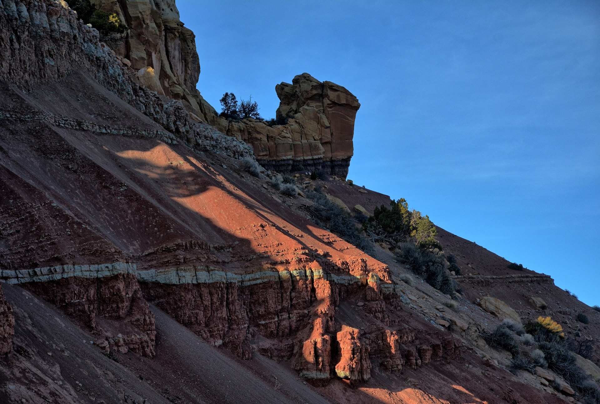
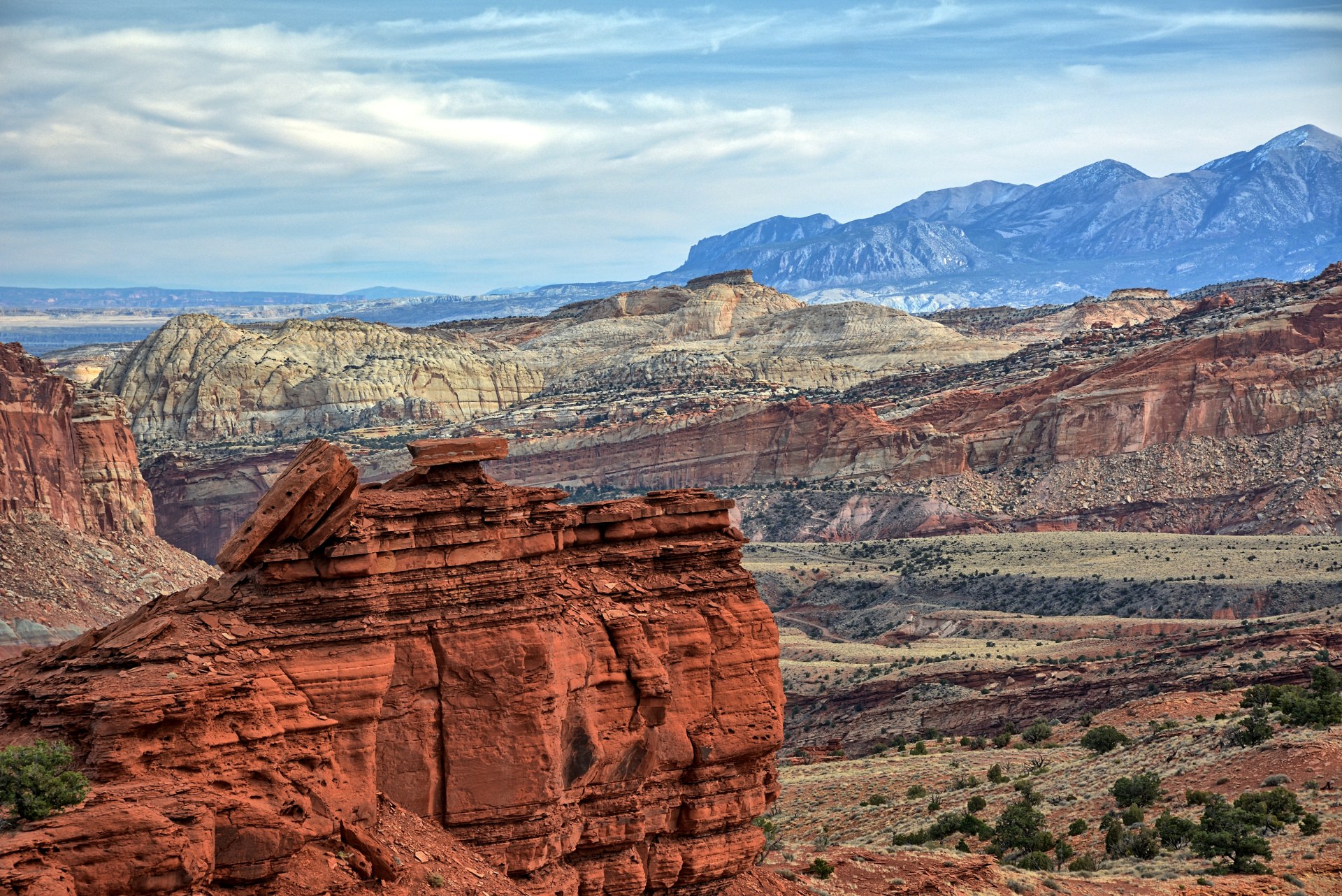
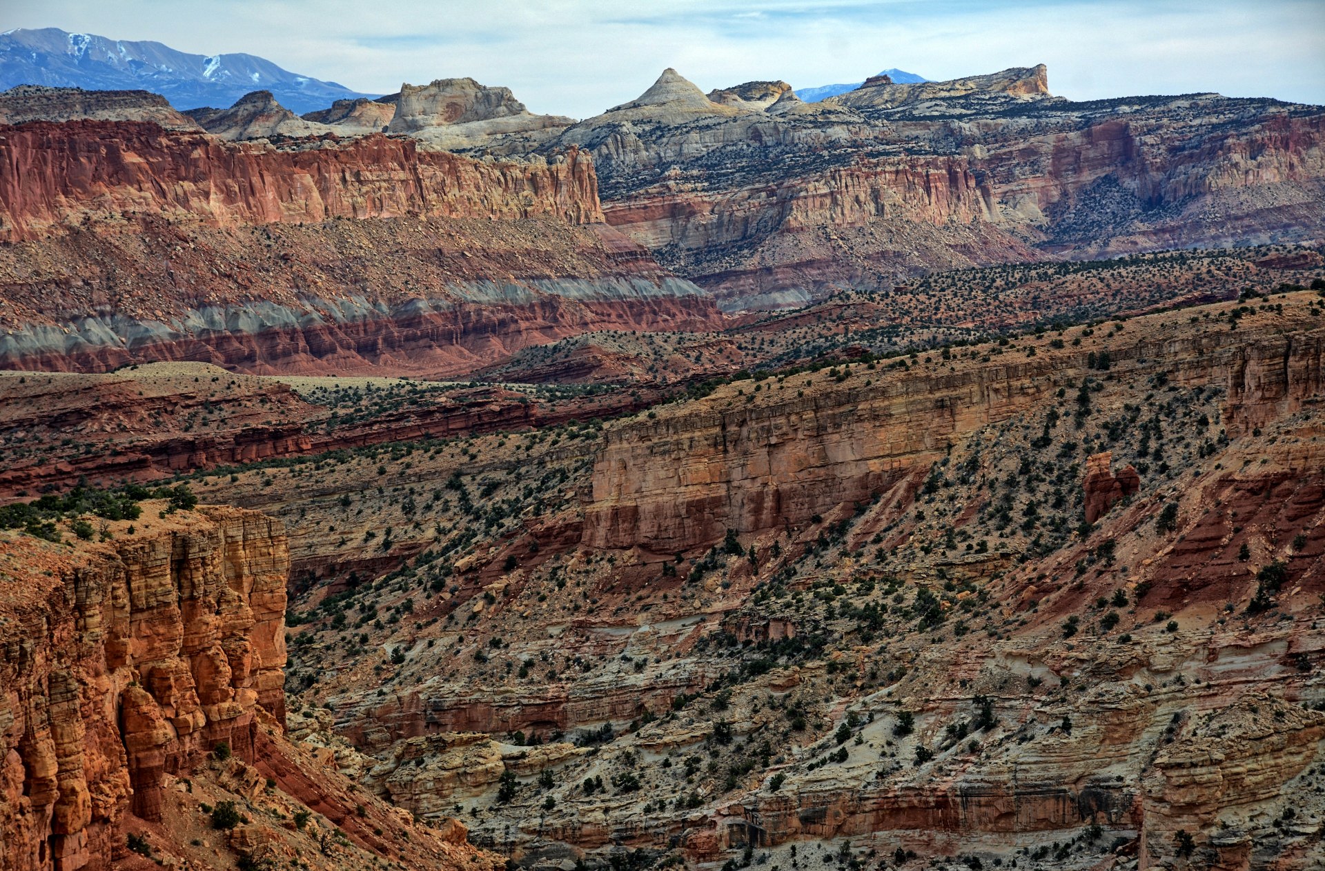
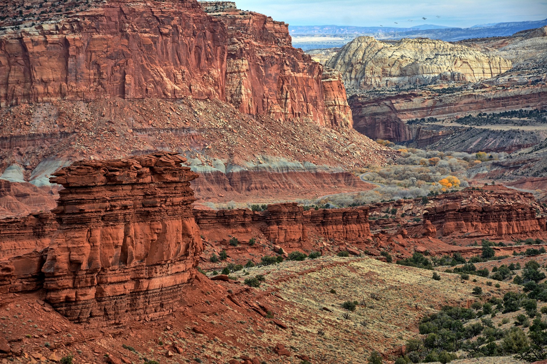
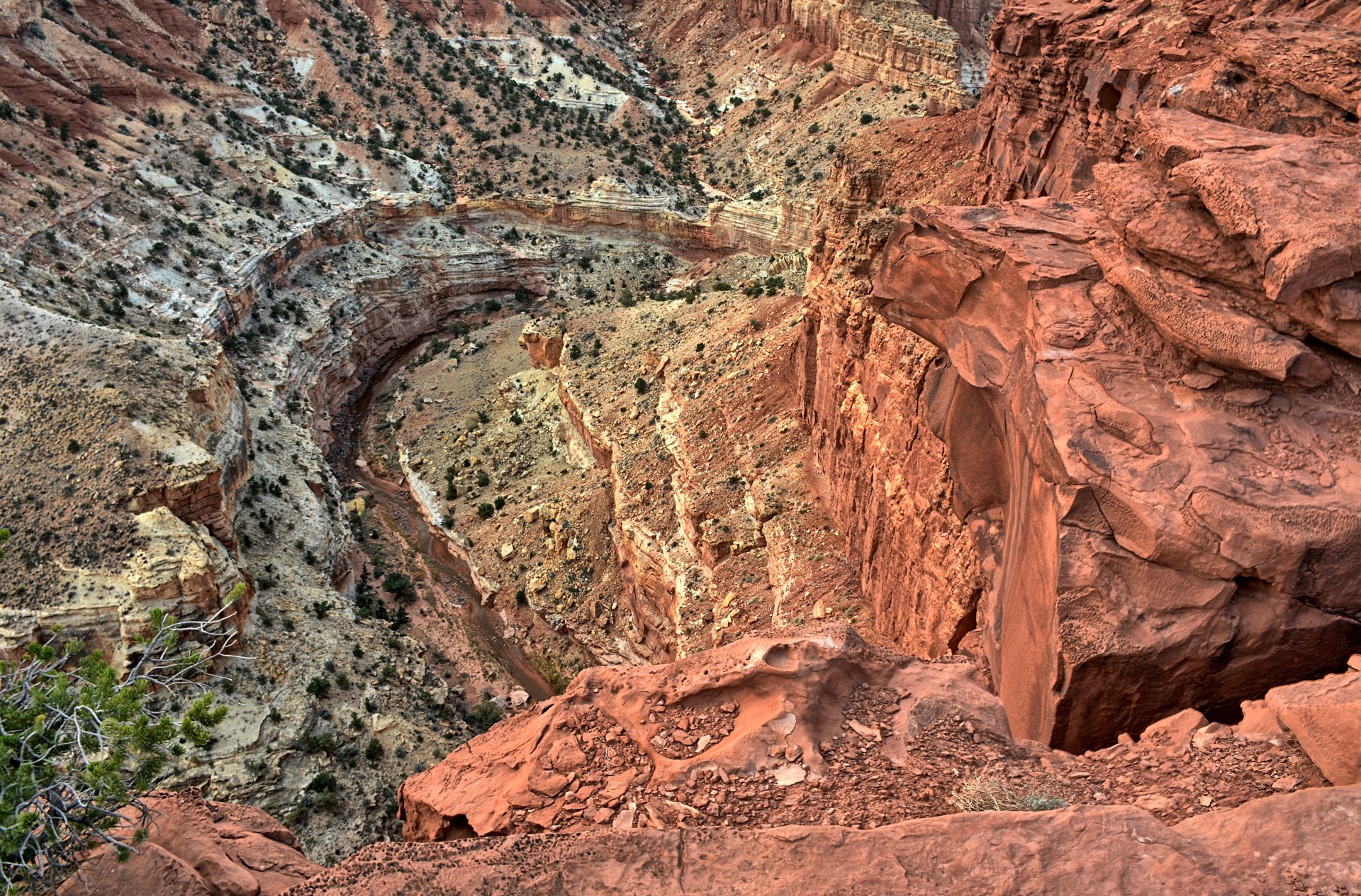
Chris planned on a long hike this day, but wanted a hotel to
relax and clean up after the hike, so he drove through Capitol Reef to Torrey
and got reservations at a hotel there. He then drove back into Capitol
Reef to the
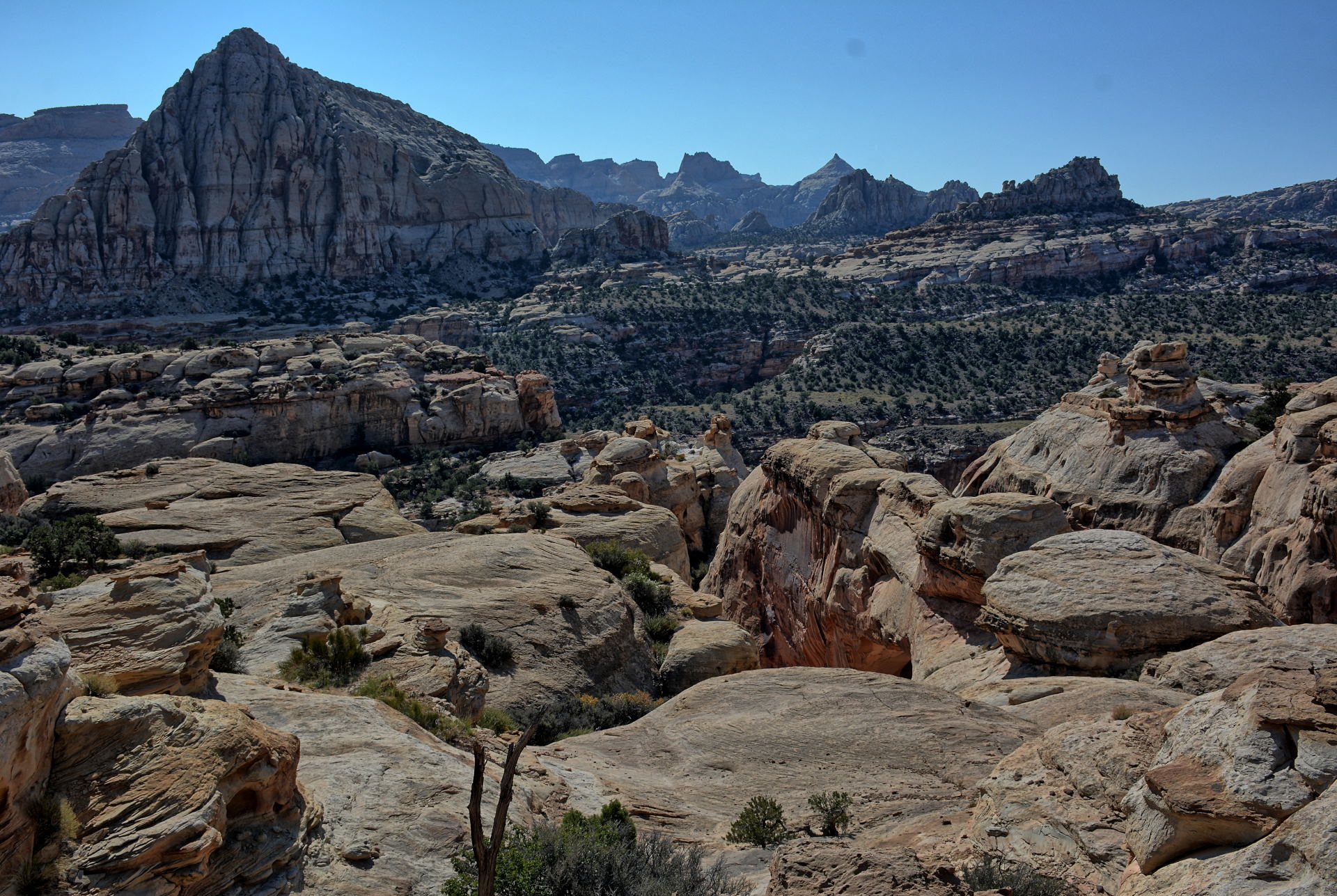
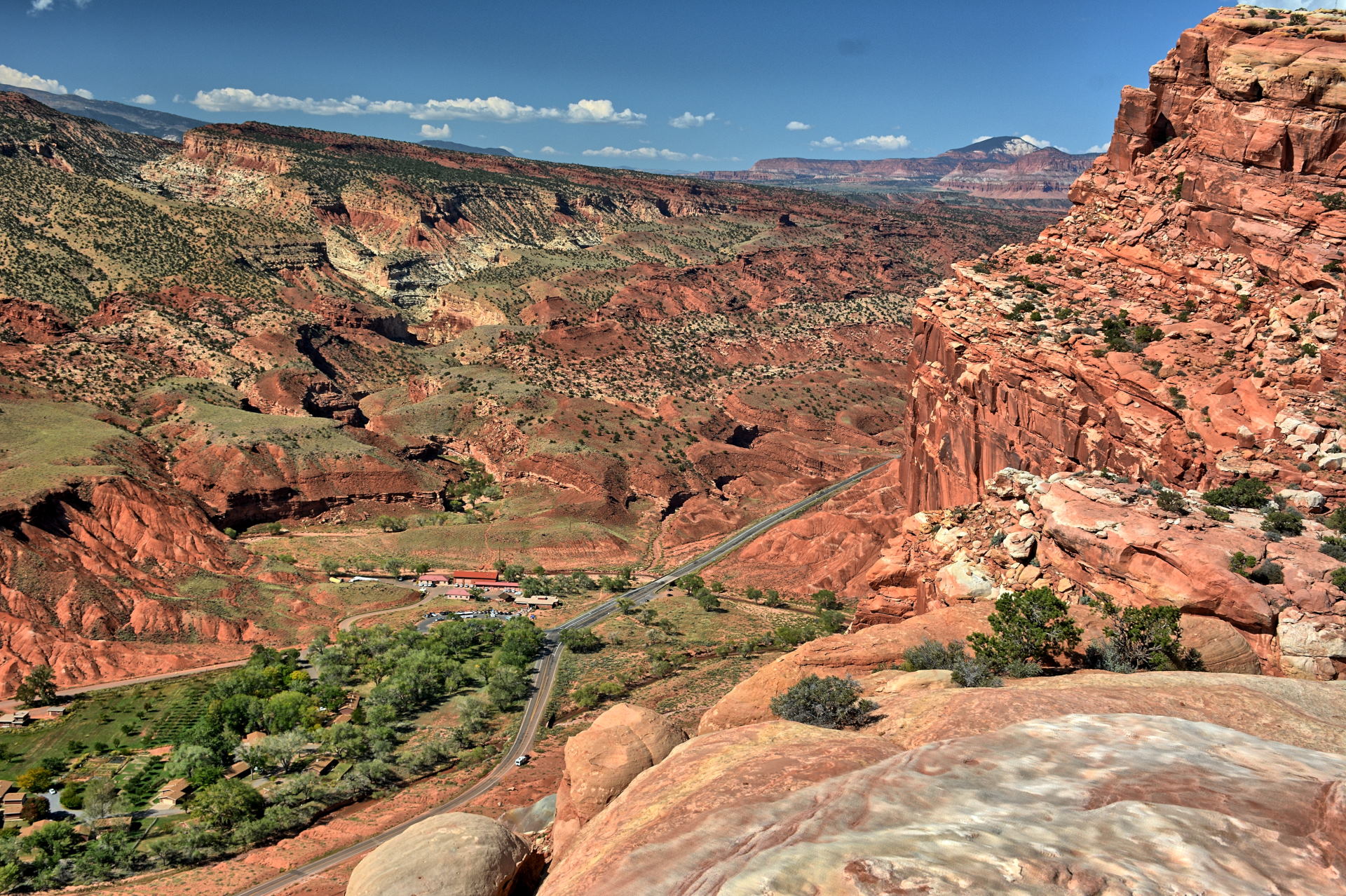
trailhead for Hickman Bridge & Navajo Knobs. He had hiked
to
Hickman Bridge a few times before, but on this day would be hiking all the way
to
Navajo Knobs,
which is the high point along the cliffs on the
north side of the main road (Utah 24) through Capitol Reef. There are incredible views for
almost the entire hike. He recorded the hike on the All-Trails App; it
was
10.4 miles round-trip with a 2257 foot vertical climb. At the end of the day,
Chris was dead tired. He returned to his hotel, showered, and then
just crashed.
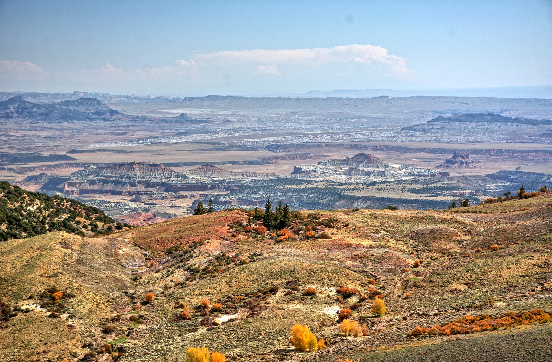
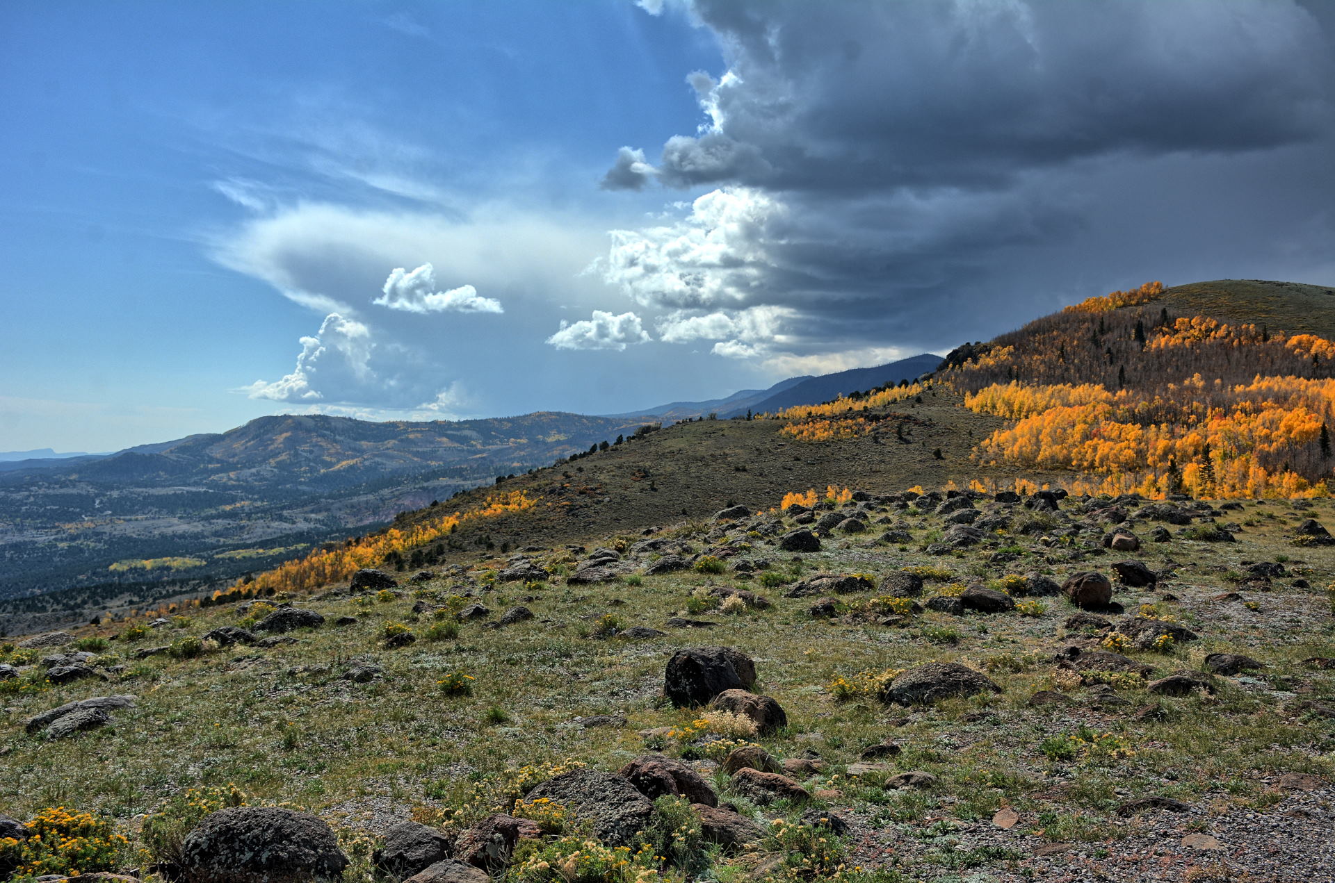
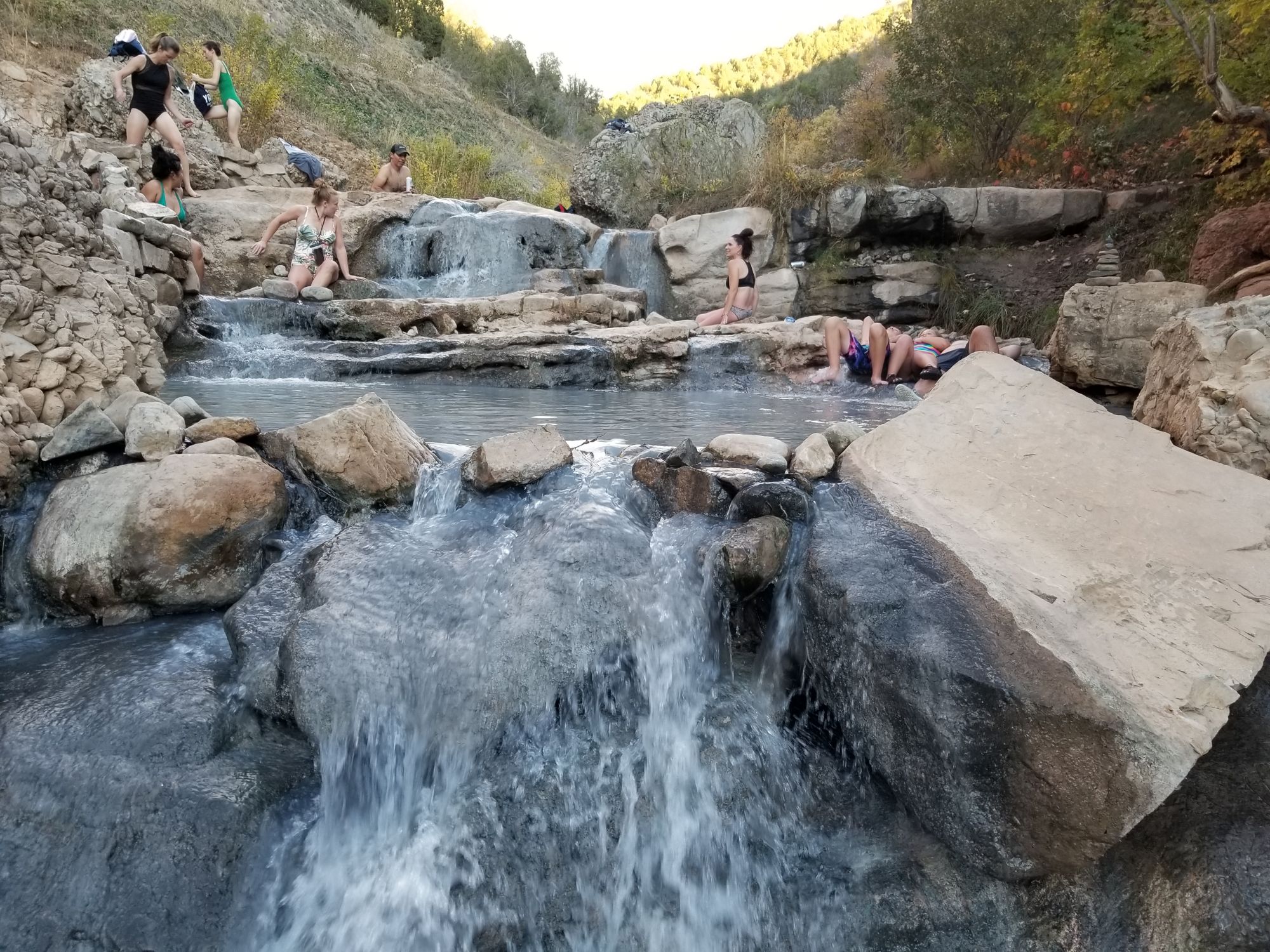
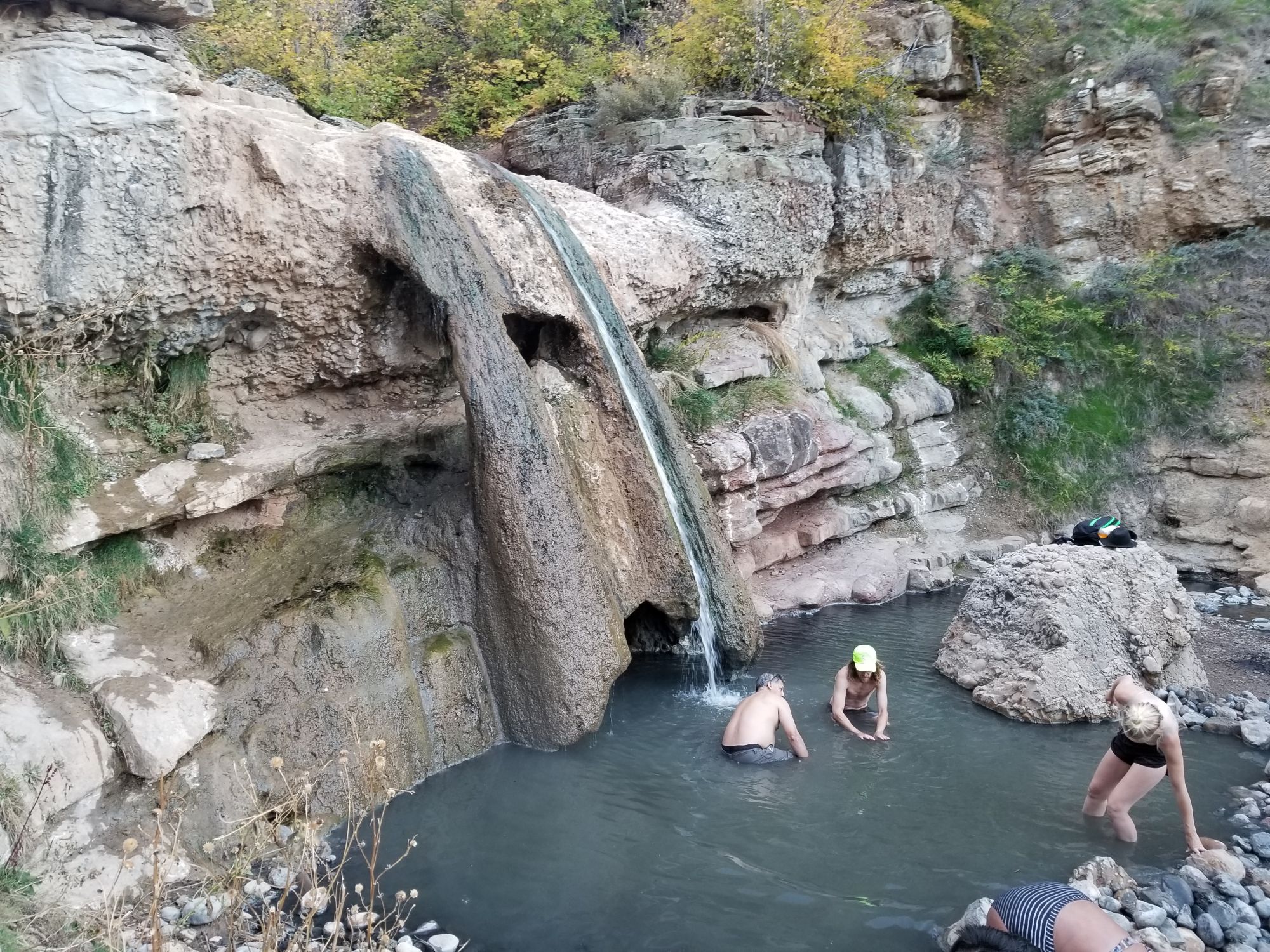
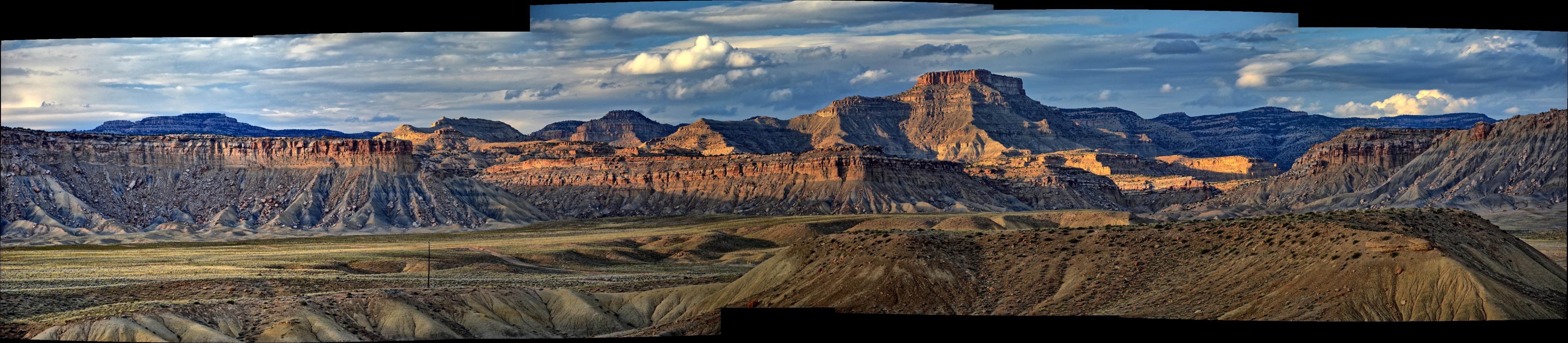
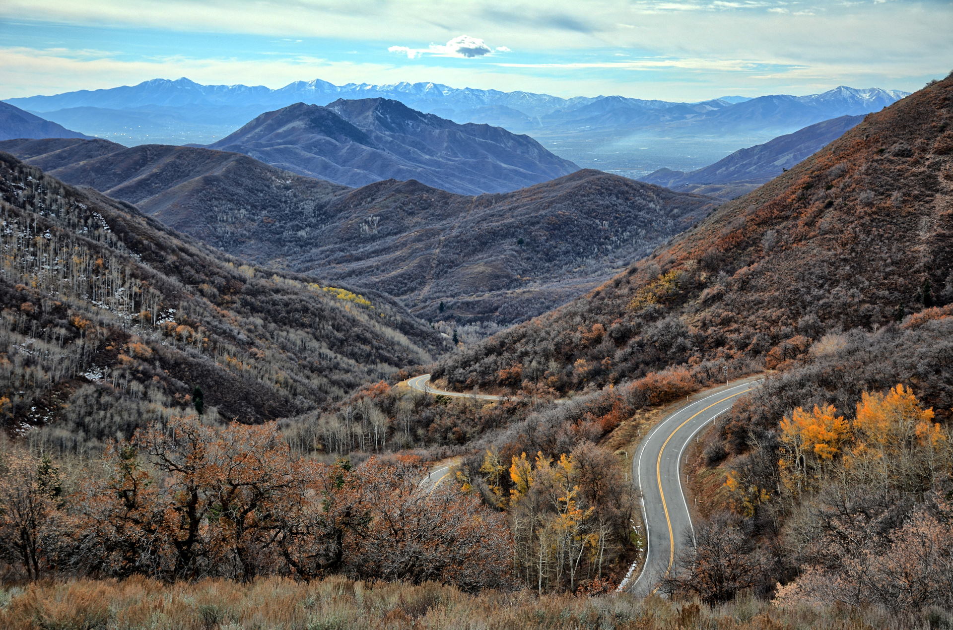
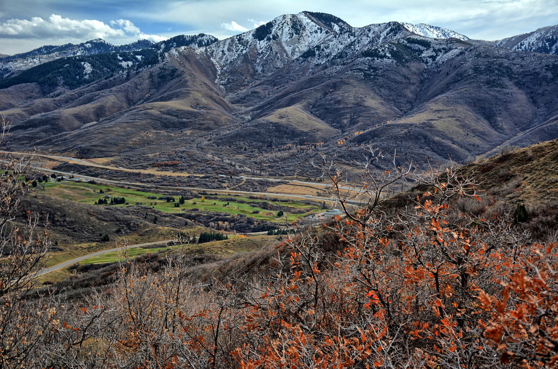
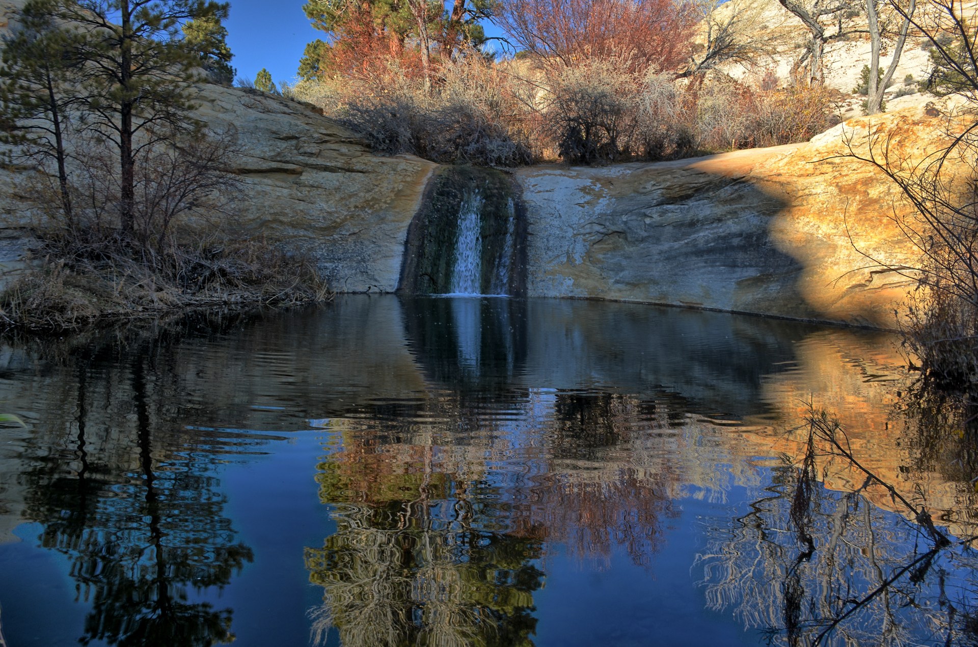
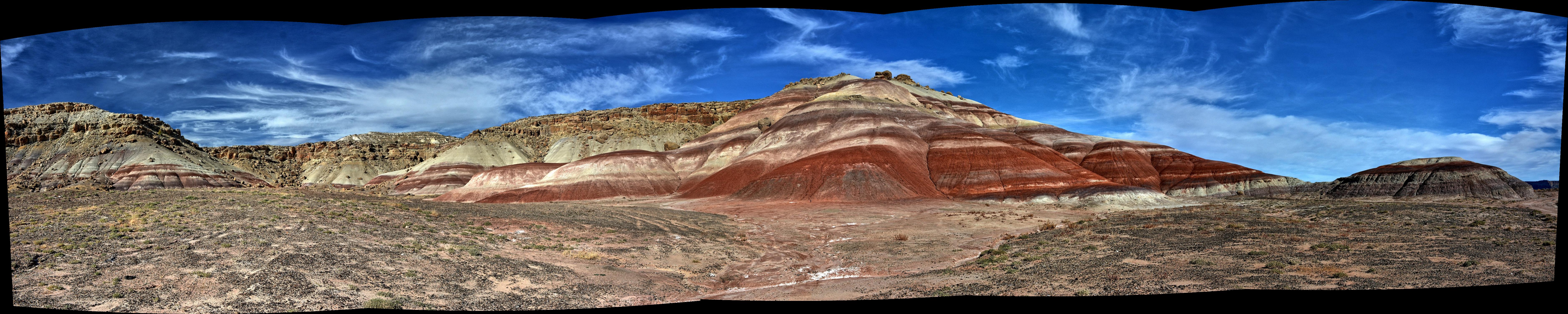
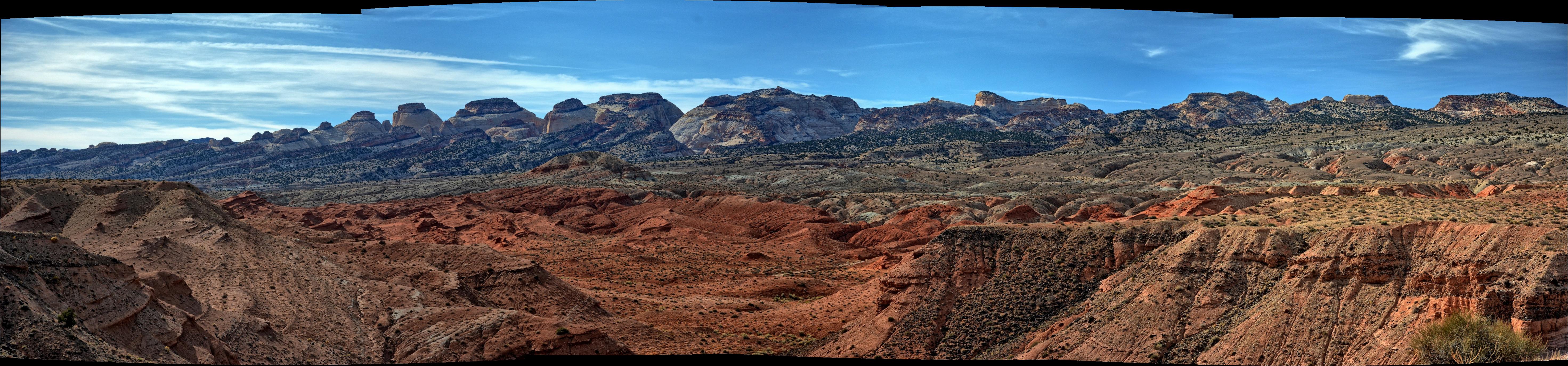
Chris drove west out of Torrey and then north on Utah
highway-72 across the mountains northeast of Capitol Reef, reaching I-70 around
noon. He flew his RC aircraft at several places as he was headed towards
Dugway Proving Grounds to begin flight test in Monday. He had visited the
Fifth Water Hot Springs a few years before and wanted to relax in the natural
springs again.
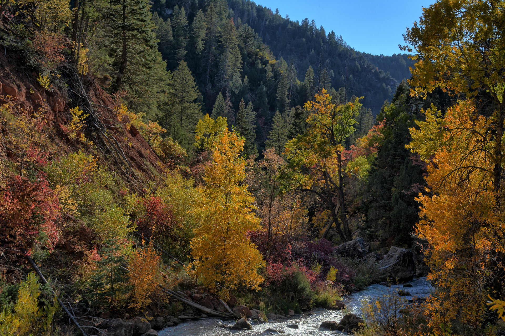
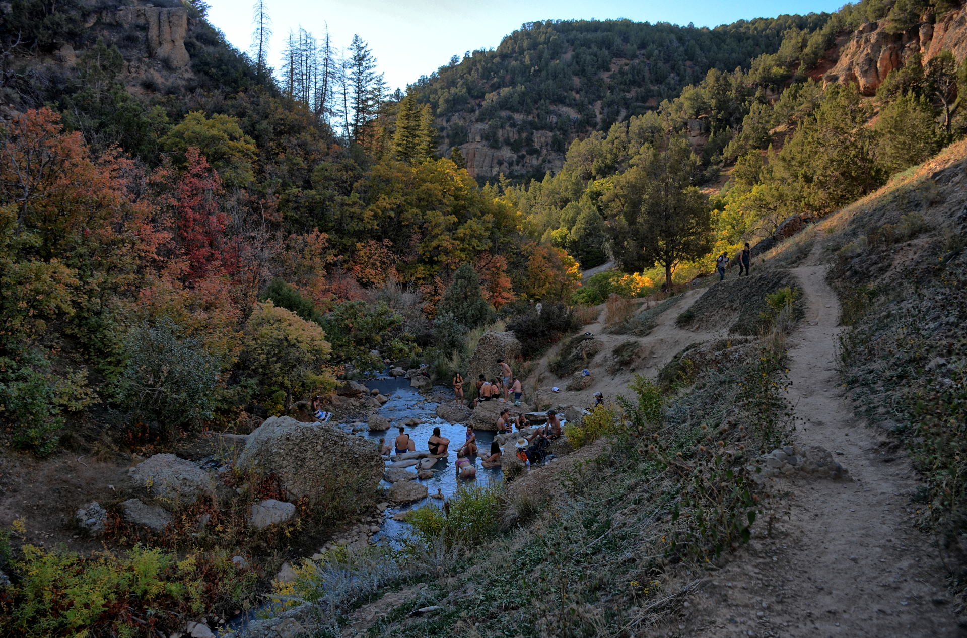
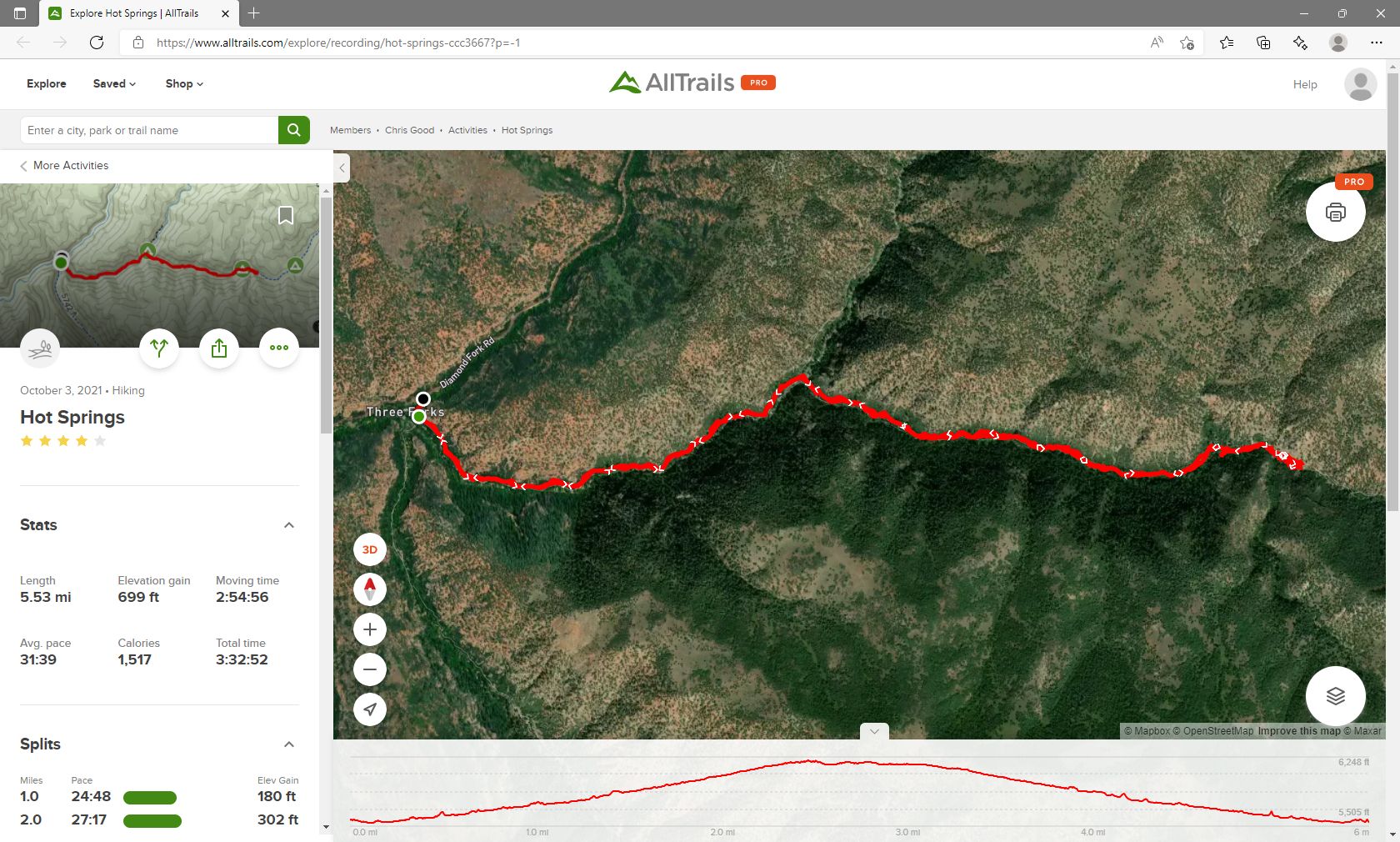
The springs are just southeast of Spanish Fork, slightly off the direct
route from Capitol Reef to Dugway. He drove to the trailhead and completed the
5.5 mile roundtrip hike with a 700 foot vertical climb on the way to the
springs. After sitting in the hot water for a couple hours, he returned to
his car and finished the drive to Dugway, where he checked into the post hotel
for the first night.
Flight testing for two different programs began on Monday and
would continue until almost Thanksgiving. The post hotel did not have any
rooms available for Monday to Wednesday nights on this first week of the flight
test, but after those first few days Chris would be staying on post for the
entire trip. Chris stayed at a hotel in Salt Lake
City for Monday through Wednesday nights, so he had to drive back and forth each
day from Salt Lake City to Dugway. It is a round trip of about 180 miles
each day from the hotel to Michael Army Airfield on Dugway.
On Monday and Wednesday after work, Chris stopped in northern
Skull Valley at Lone Rock and Horseshoe Springs to fly his flying wing.
Chris had also ordered a camera quadcopter called a Hubsan Zino Pro Plus, which
had arrived at home after he left for Utah. Tami shipped it to him at the
hotel on Dugway, so Chris picked that up on Tuesday and prepped it to be flown
on the following weekend. On Thursday morning he checked out of the hotel
in Salt Lake City, and after work was done in the afternoon at the flight-line he headed towards
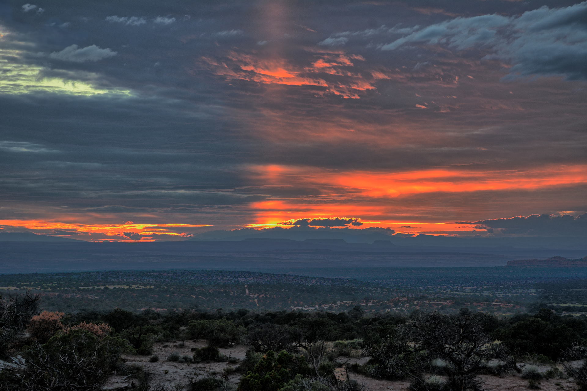
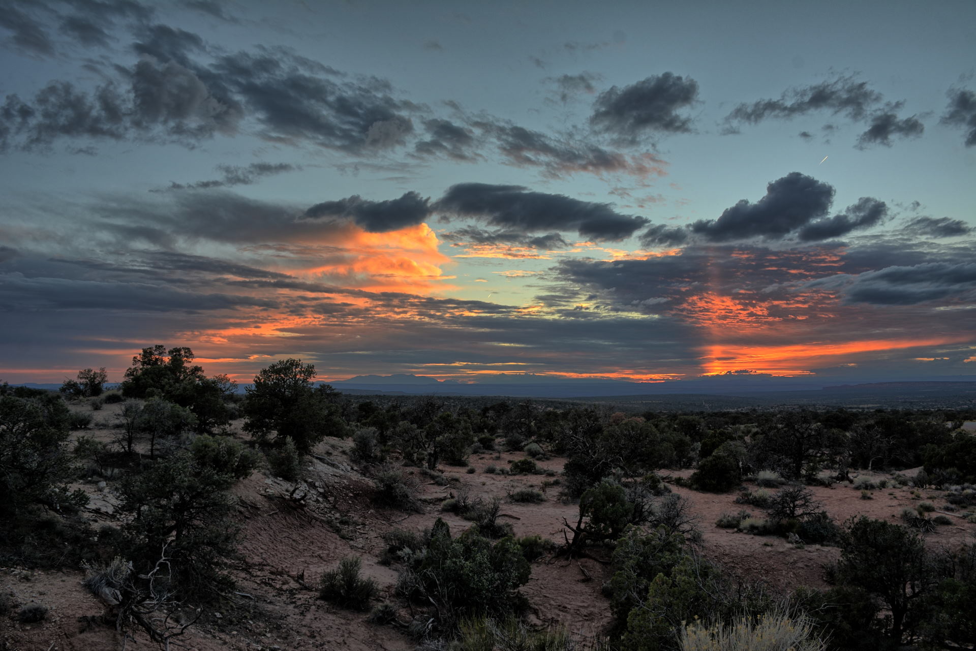
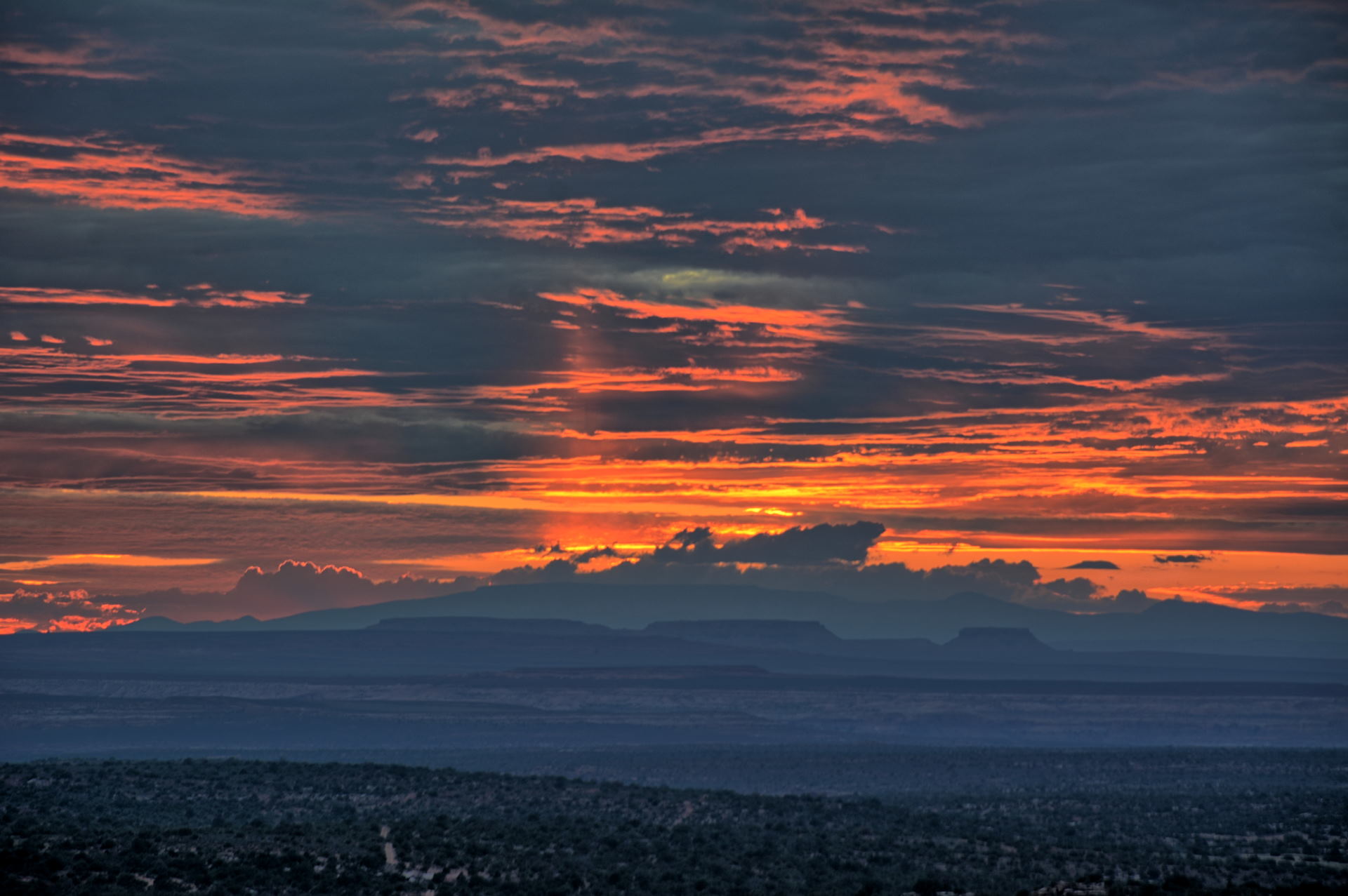
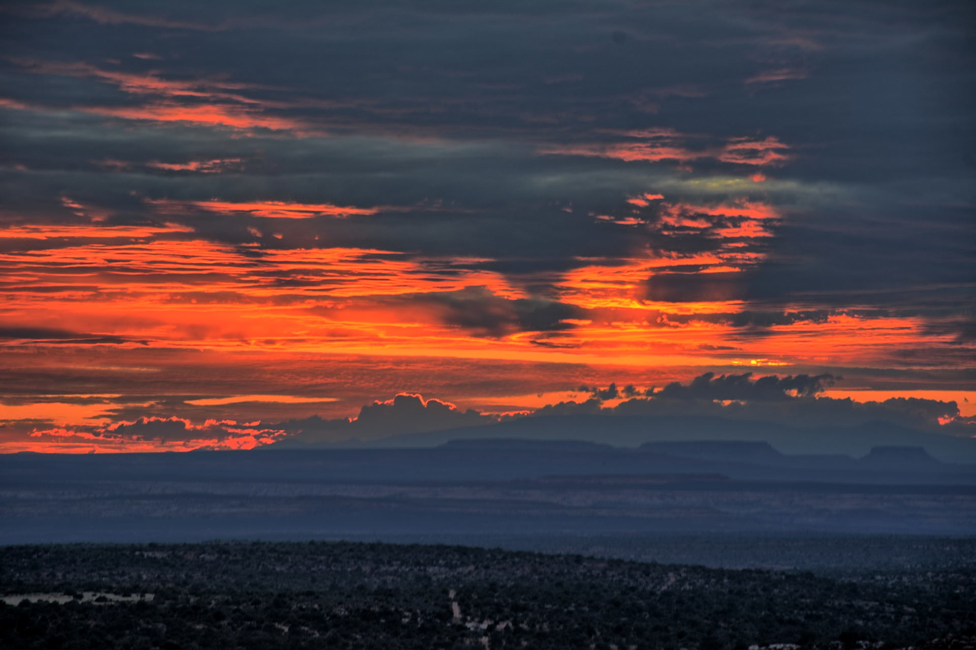
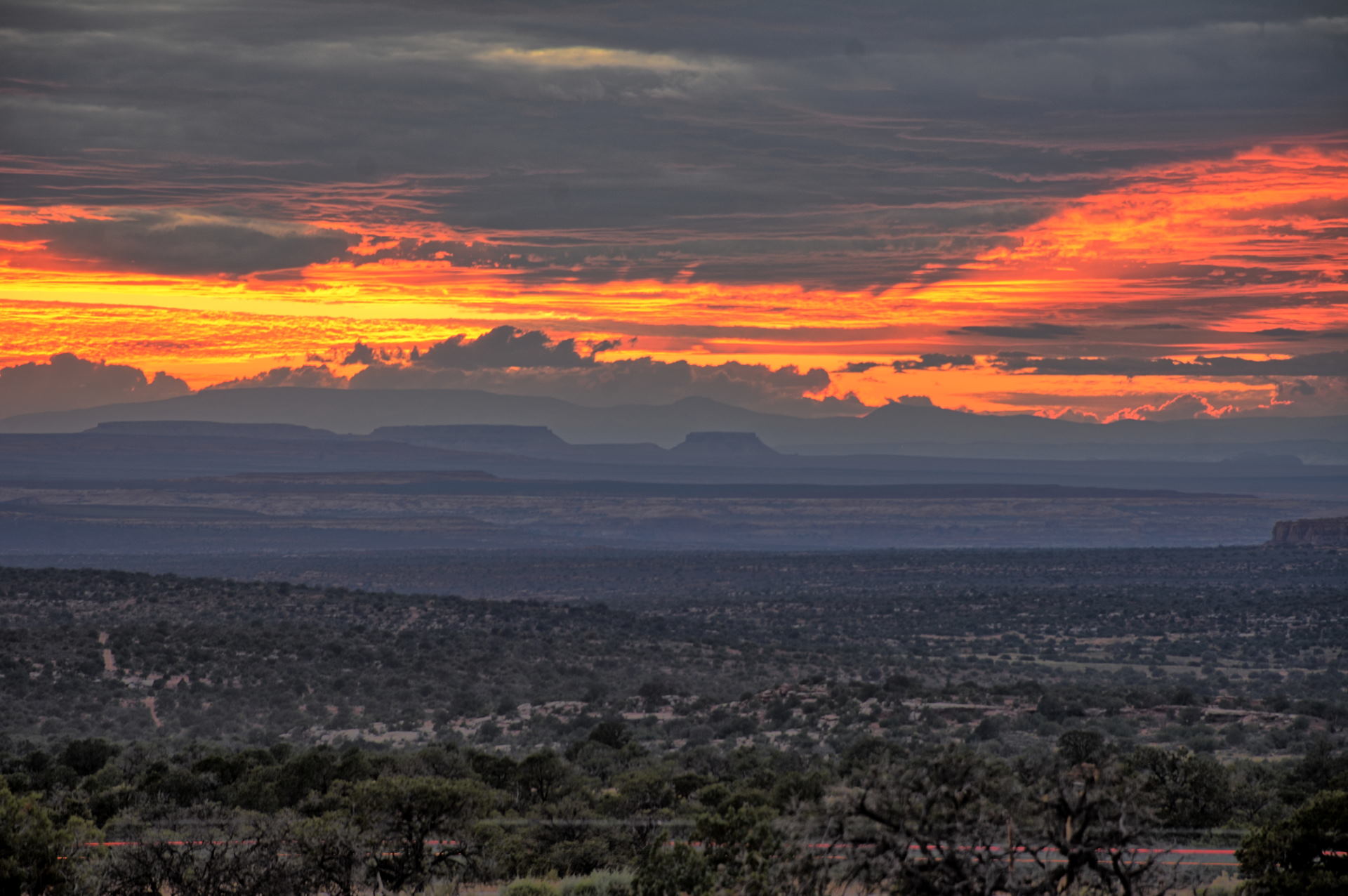
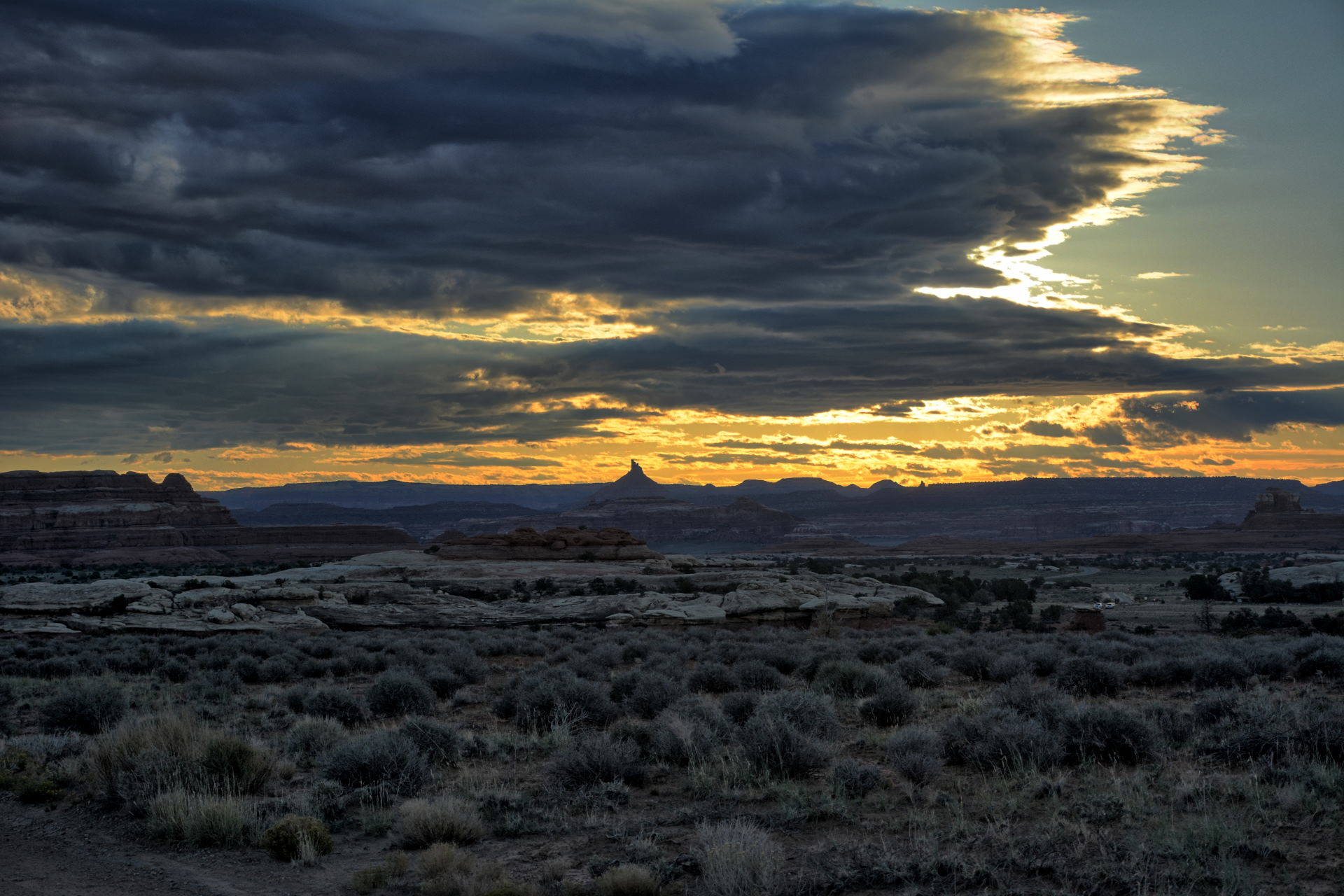
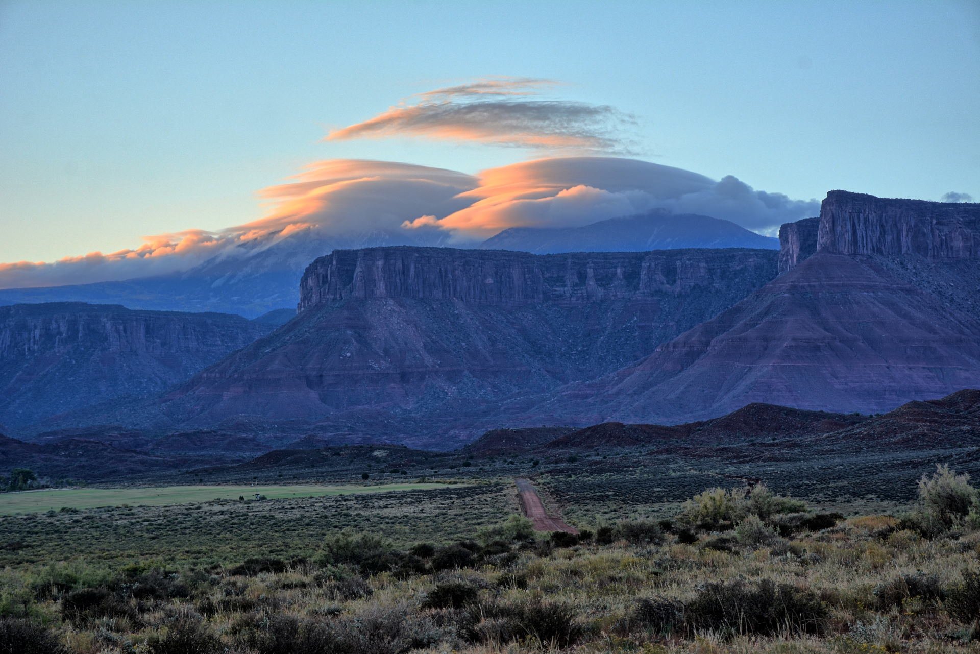
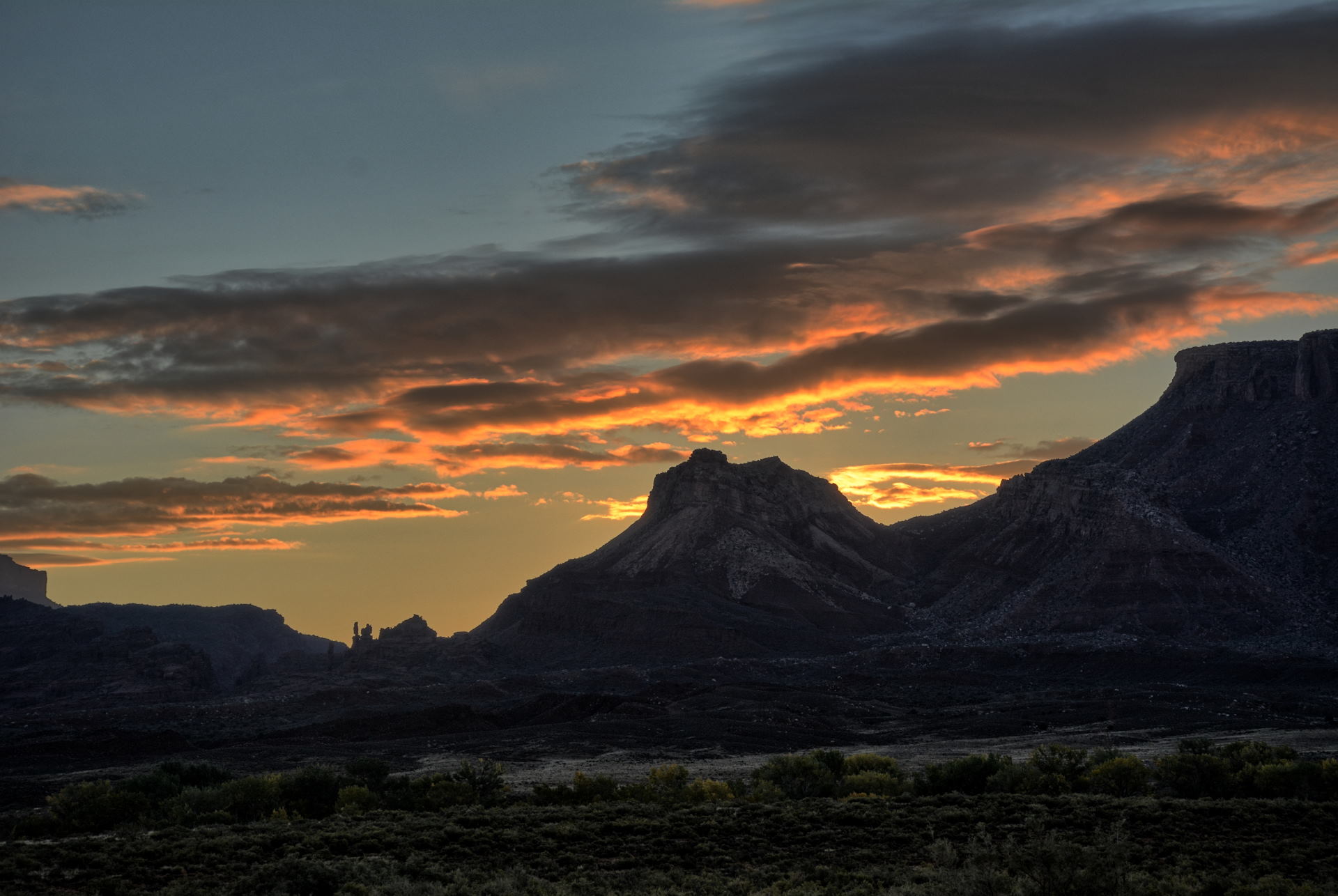
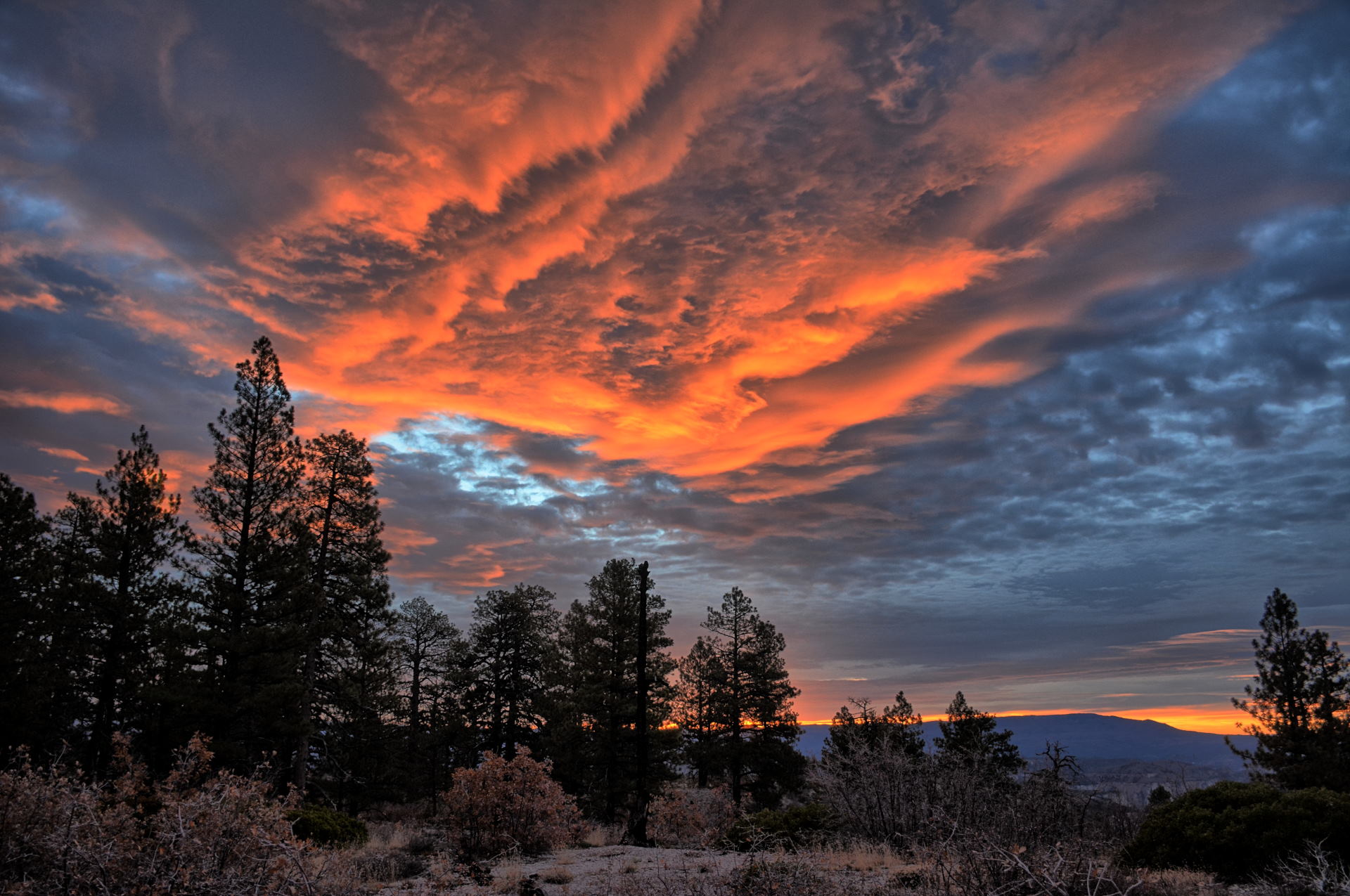
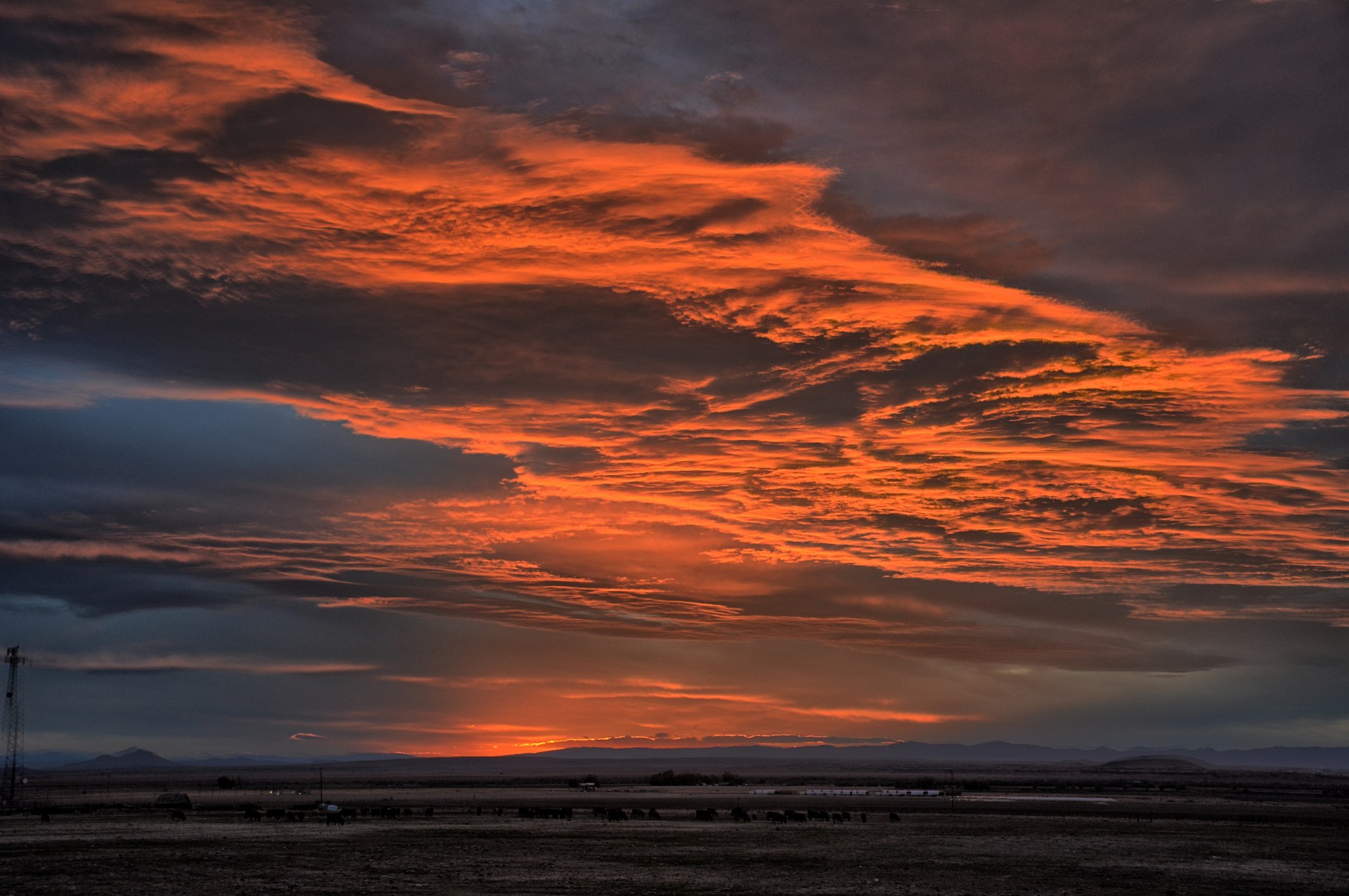
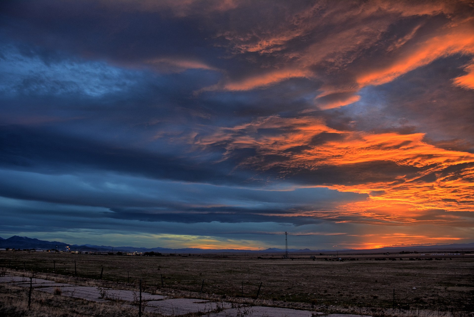
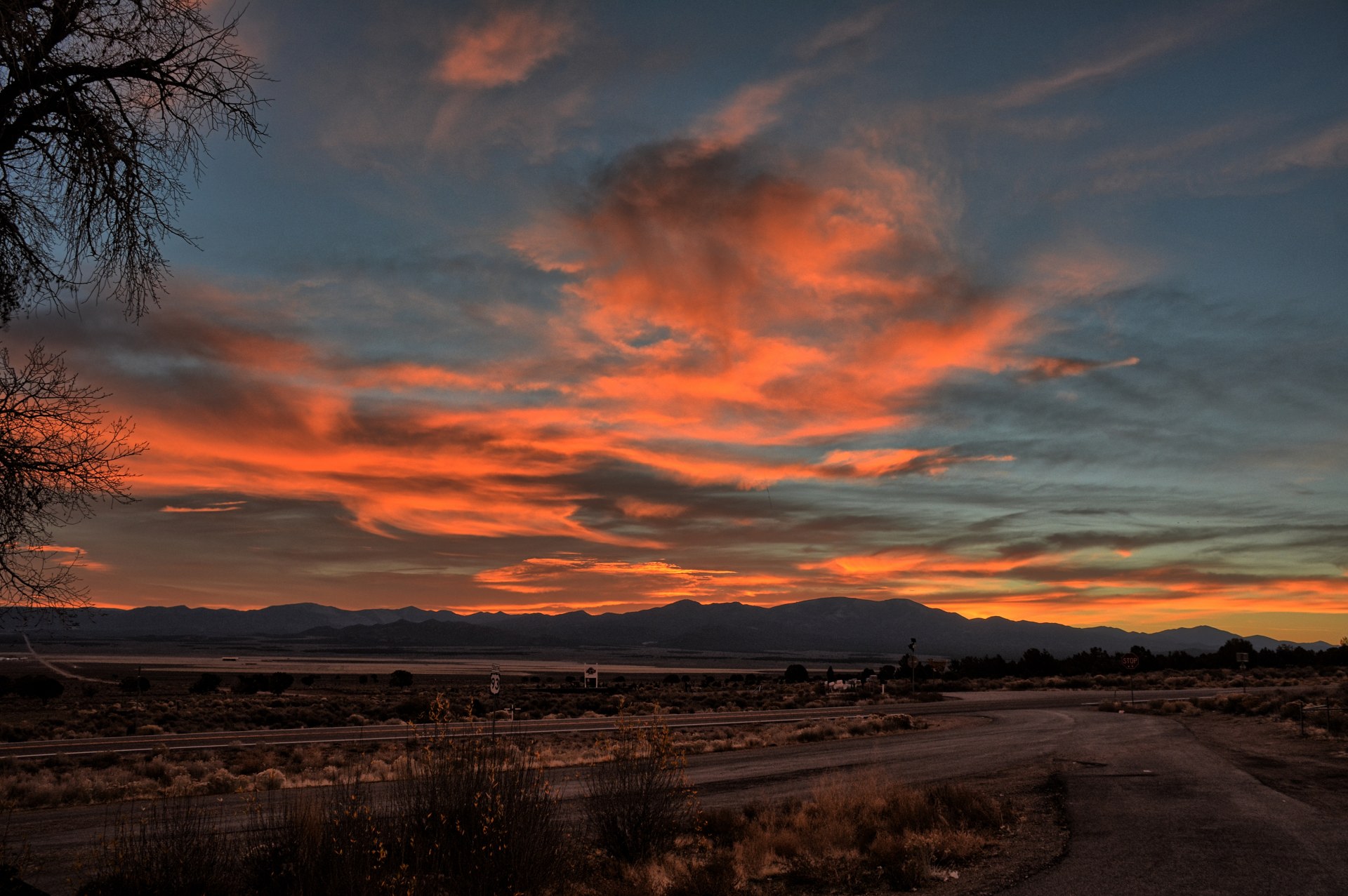
Moab for the long Columbus Day weekend. On the way to Moab, he stopped at several viewpoints, including
on Utah HWY-313, which is the road that goes to Canyonlands National Park -
Islands In The Sky. He took sunset photos along that road, and then went
into Moab to have dinner at Zax's. He had planned to drive over
Hurrah
Pass the next day, so he drove out to Kane Creek Canyon to camp on Thursday
night.
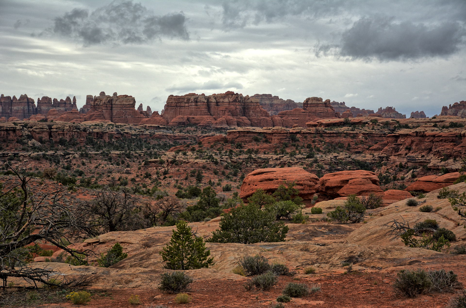
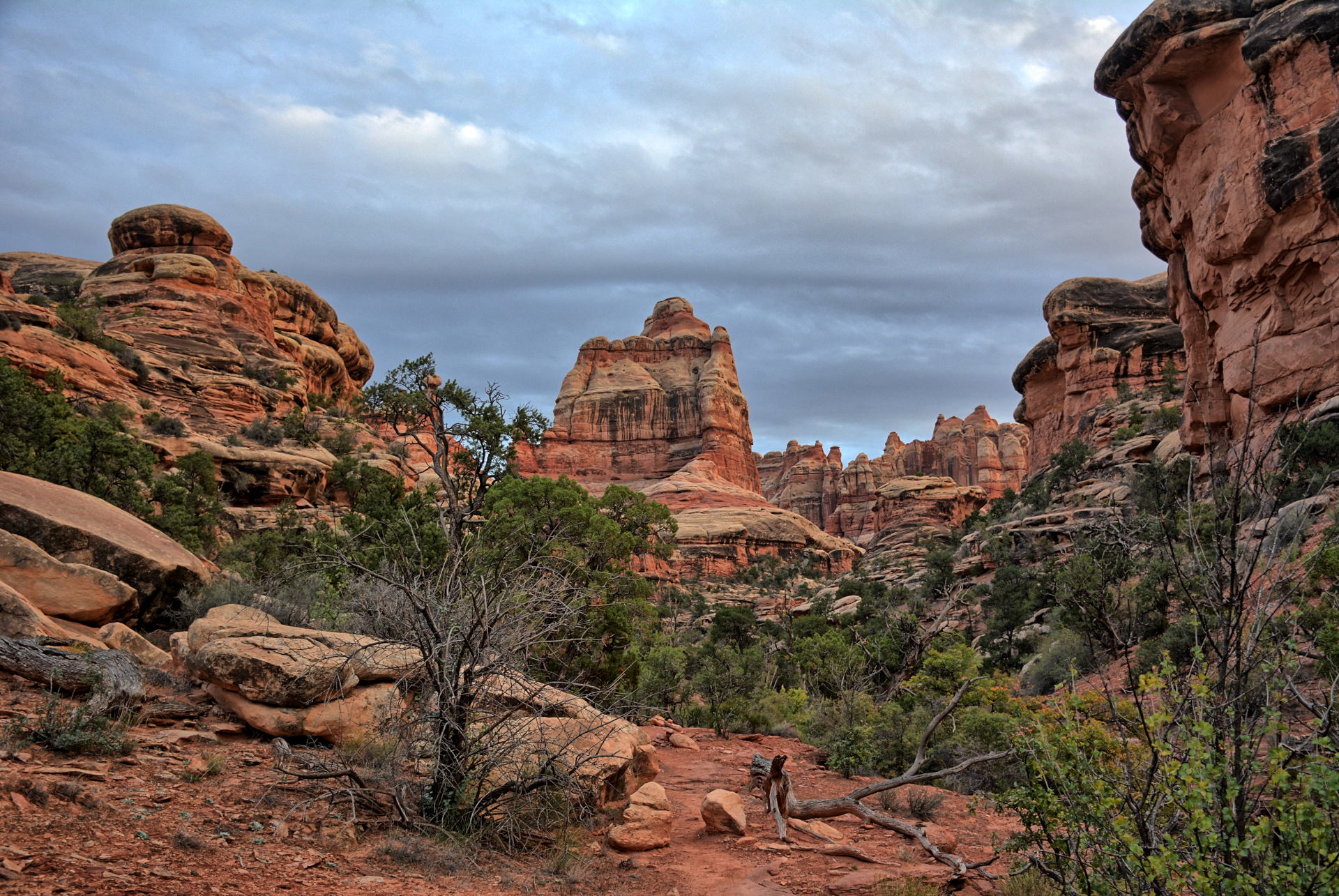
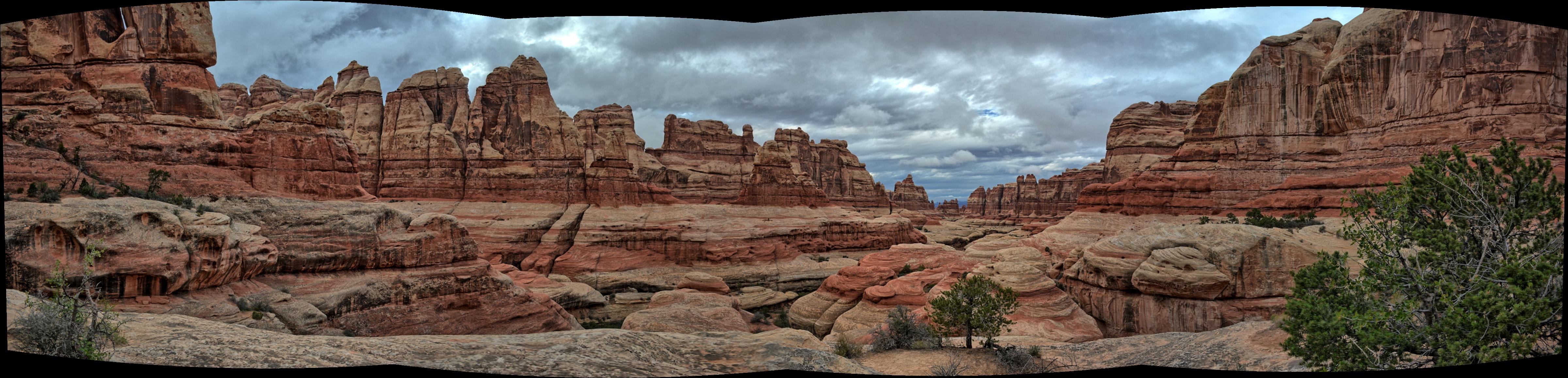
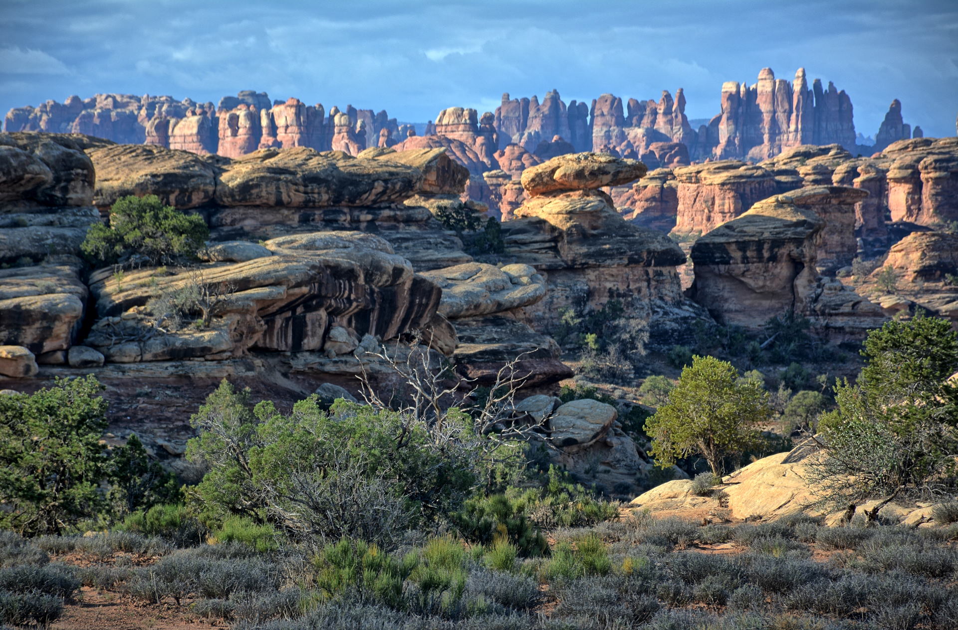
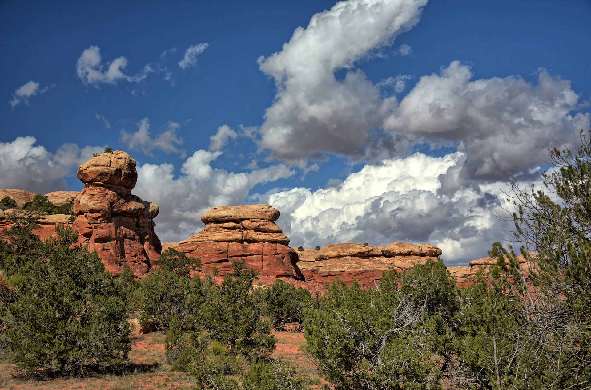
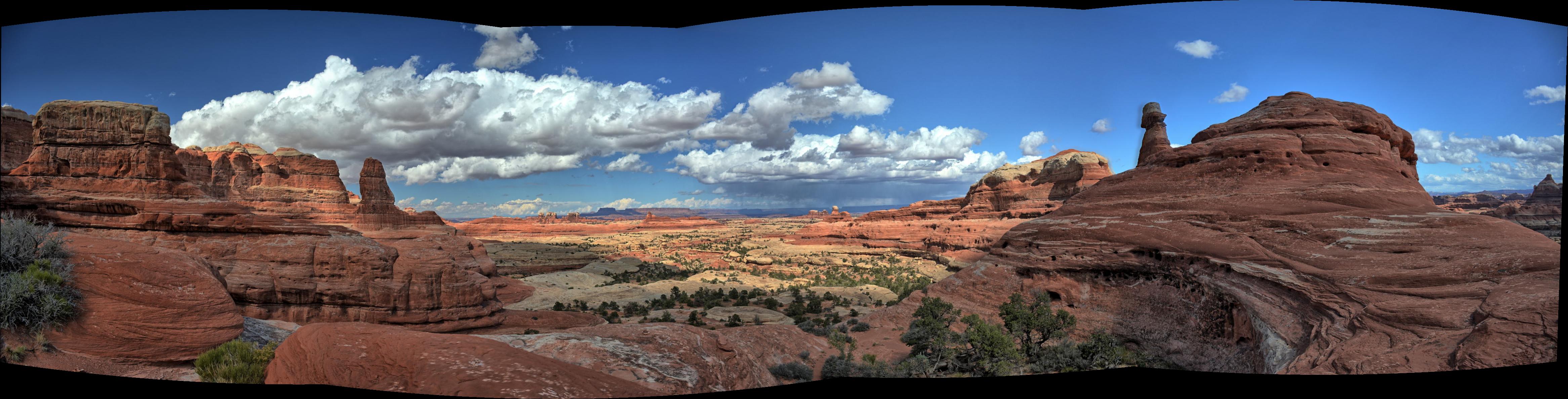
Chris woke up to find it raining, with the forecast in Moab to
continue raining all day. He decided to drive south to Canyonlands National
Park - Needles district, where the forecast had a little less rain. As he
drove back
from Kane Creek Canyon into Moab, it became apparent that Moab was incredibly busy on this
long weekend, so going to Needles made even more sense, as it is remote and never
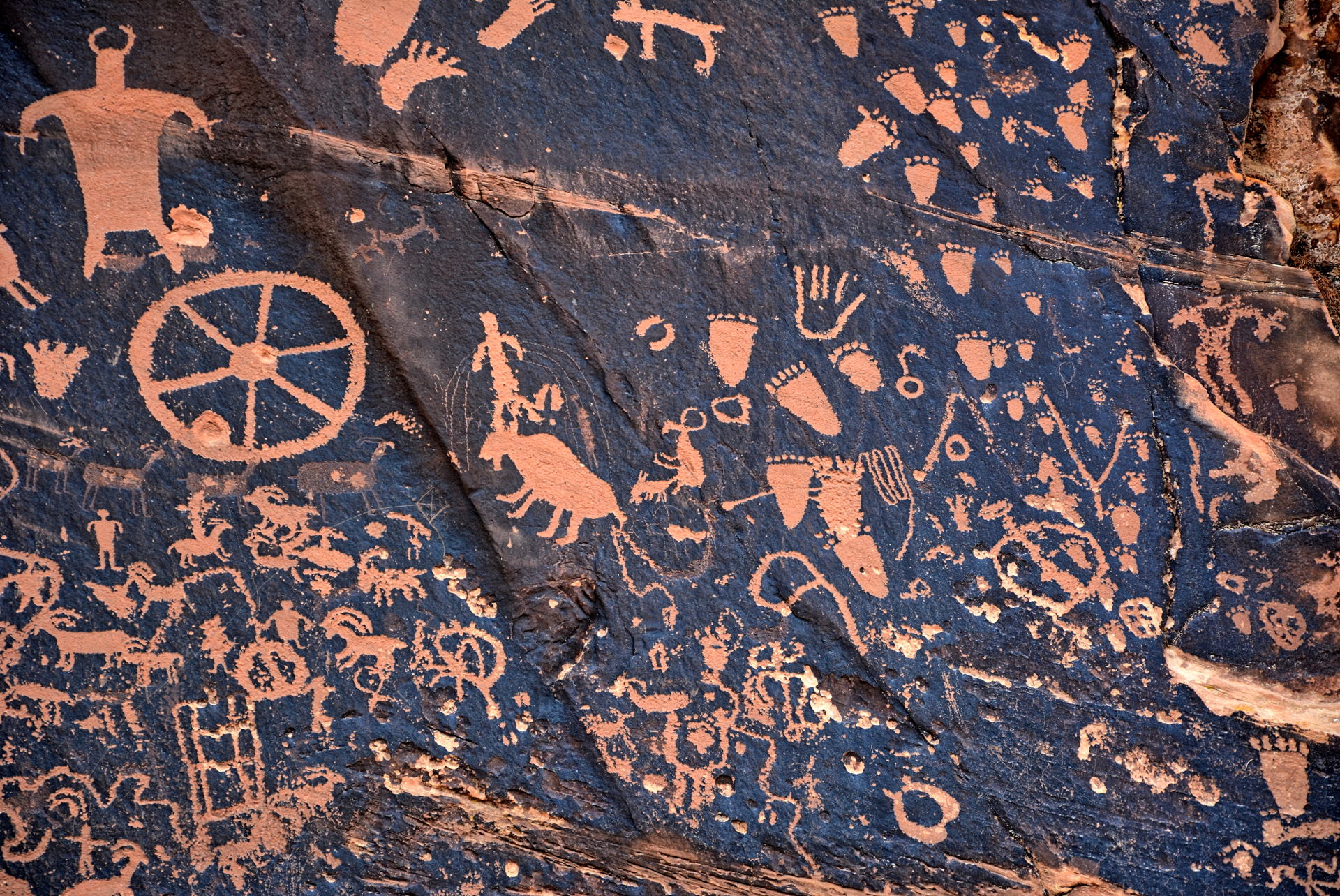
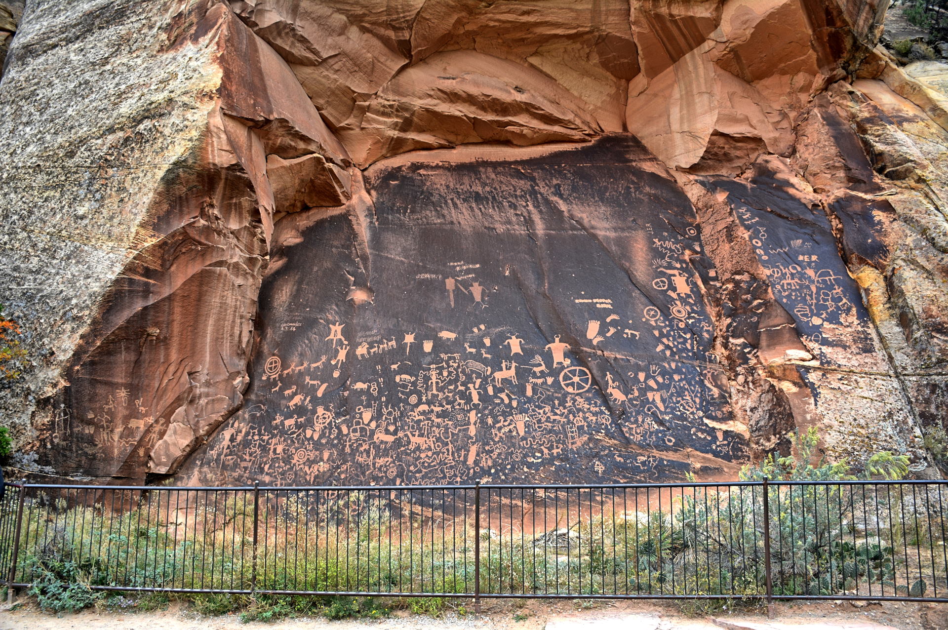
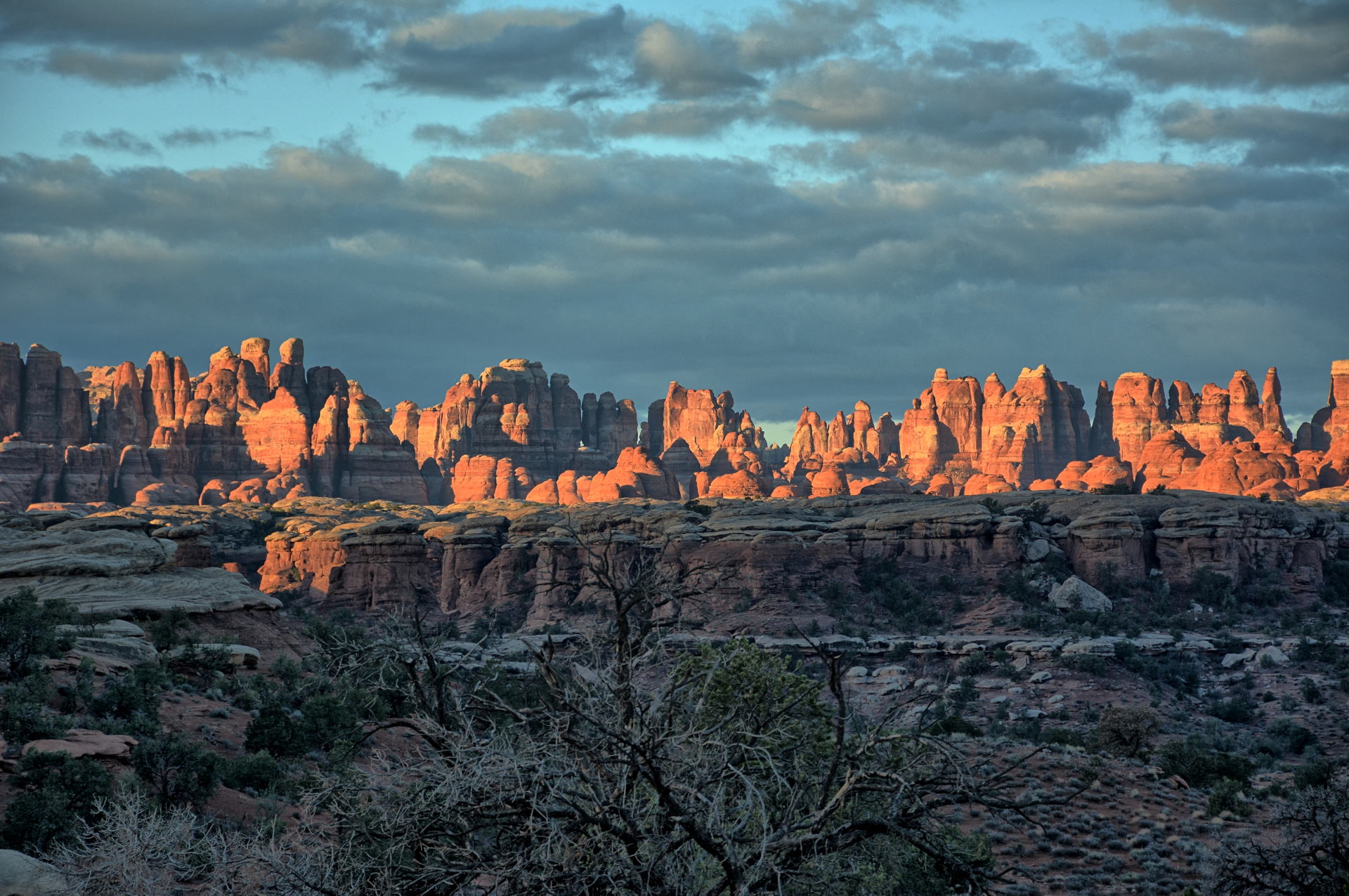
as busy as the parks right around Moab. He got breakfast and then went south,
stopping at an overlook of the Needles district to fly his flying wing, before continuing
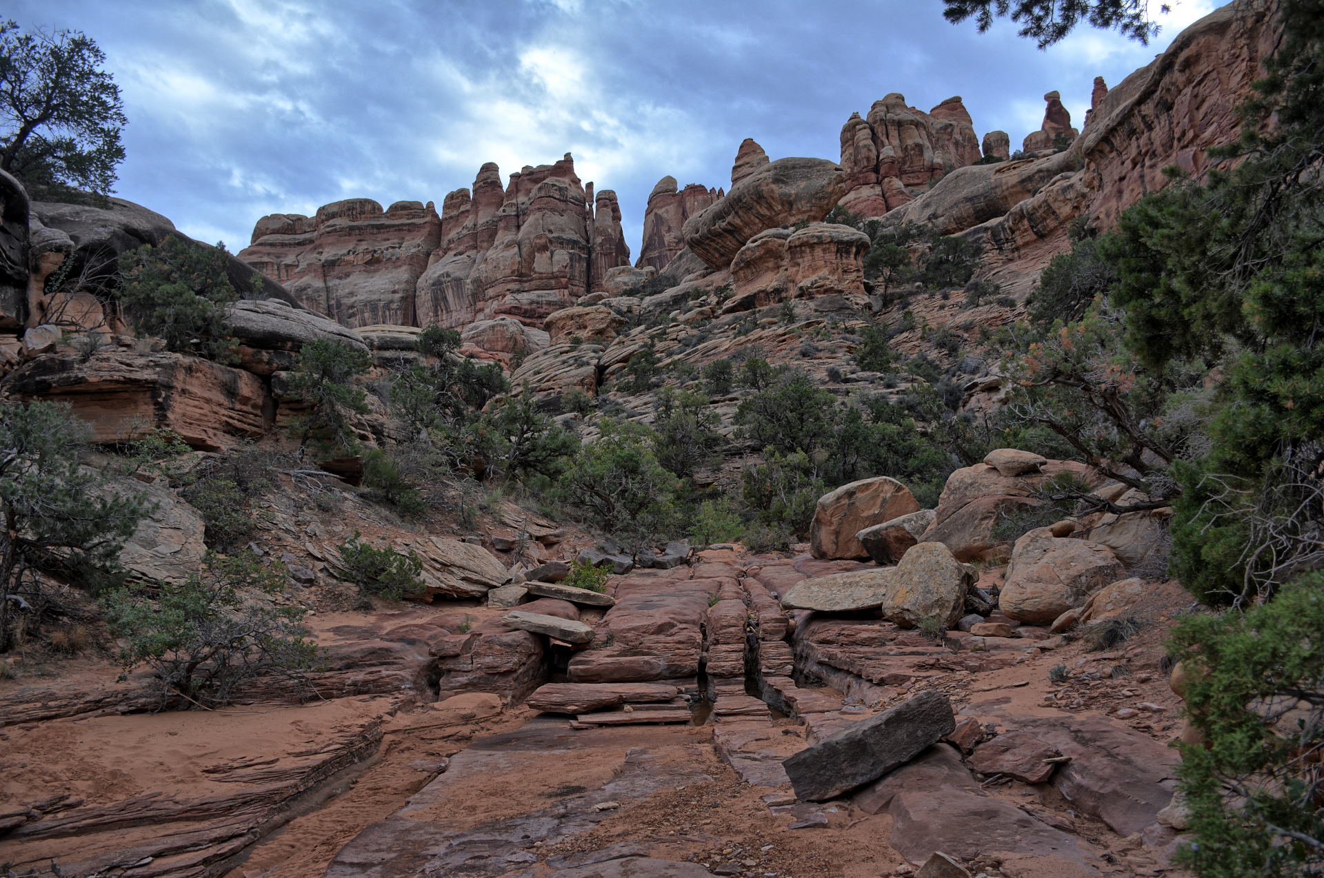
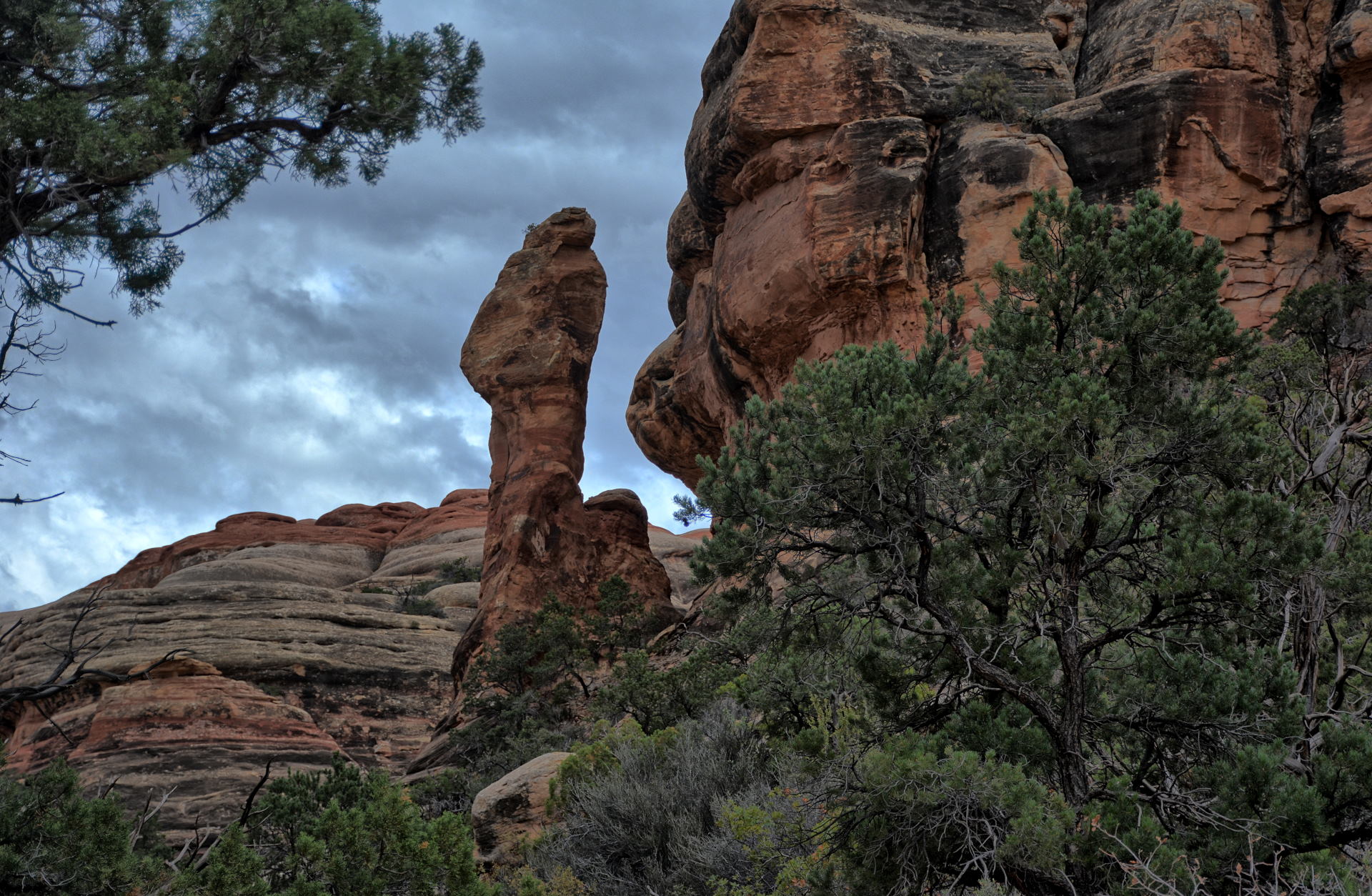
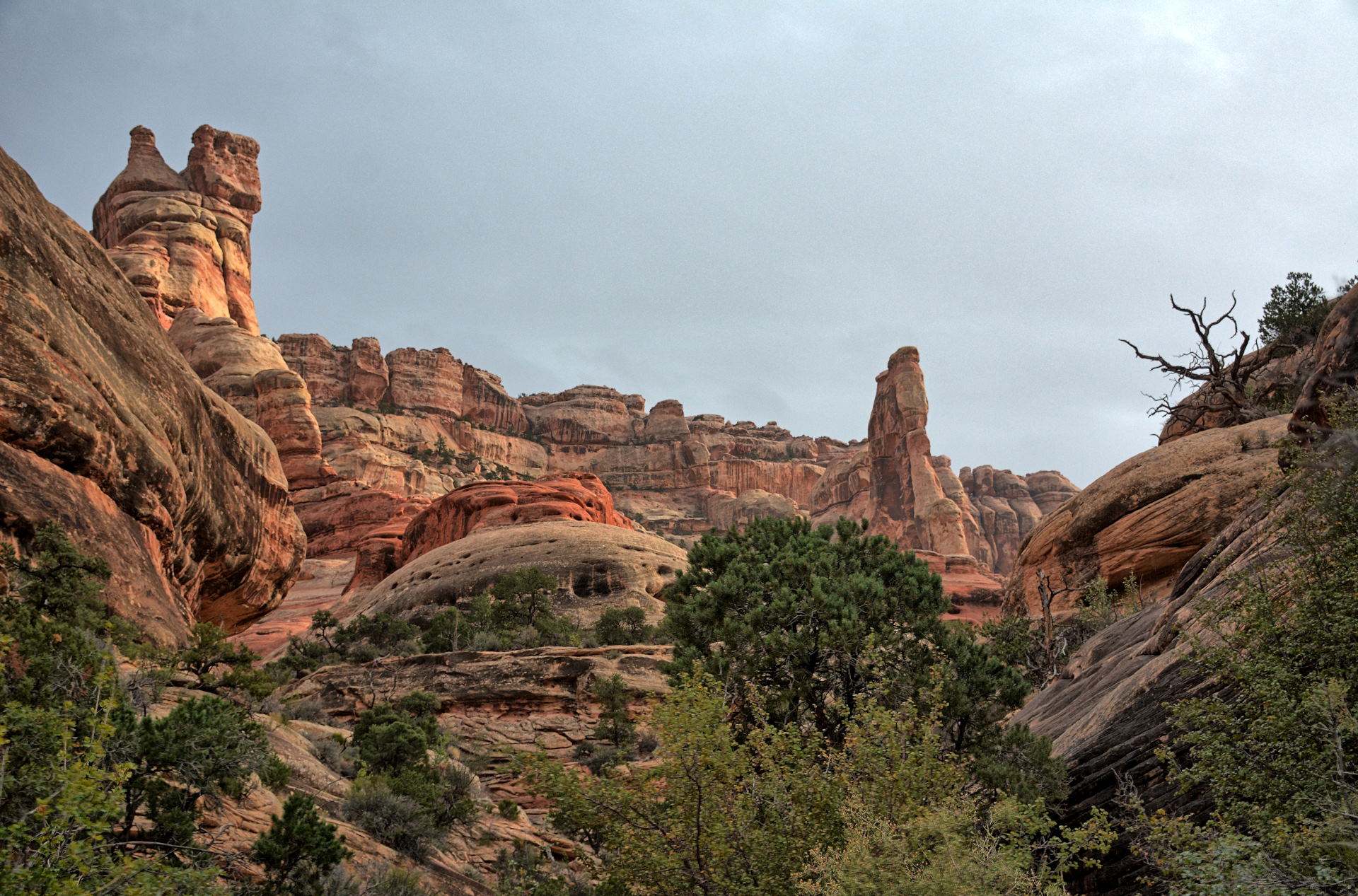
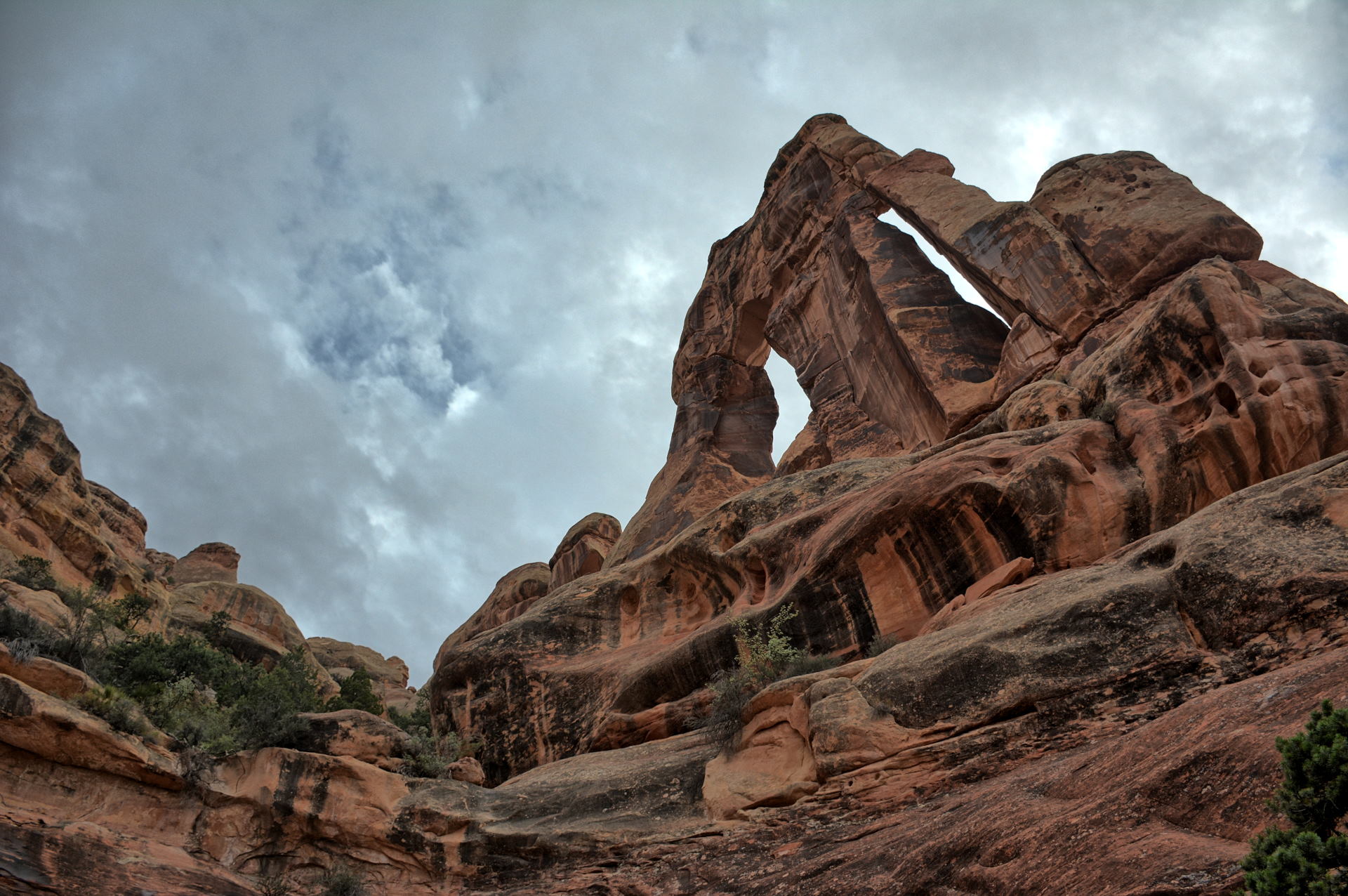
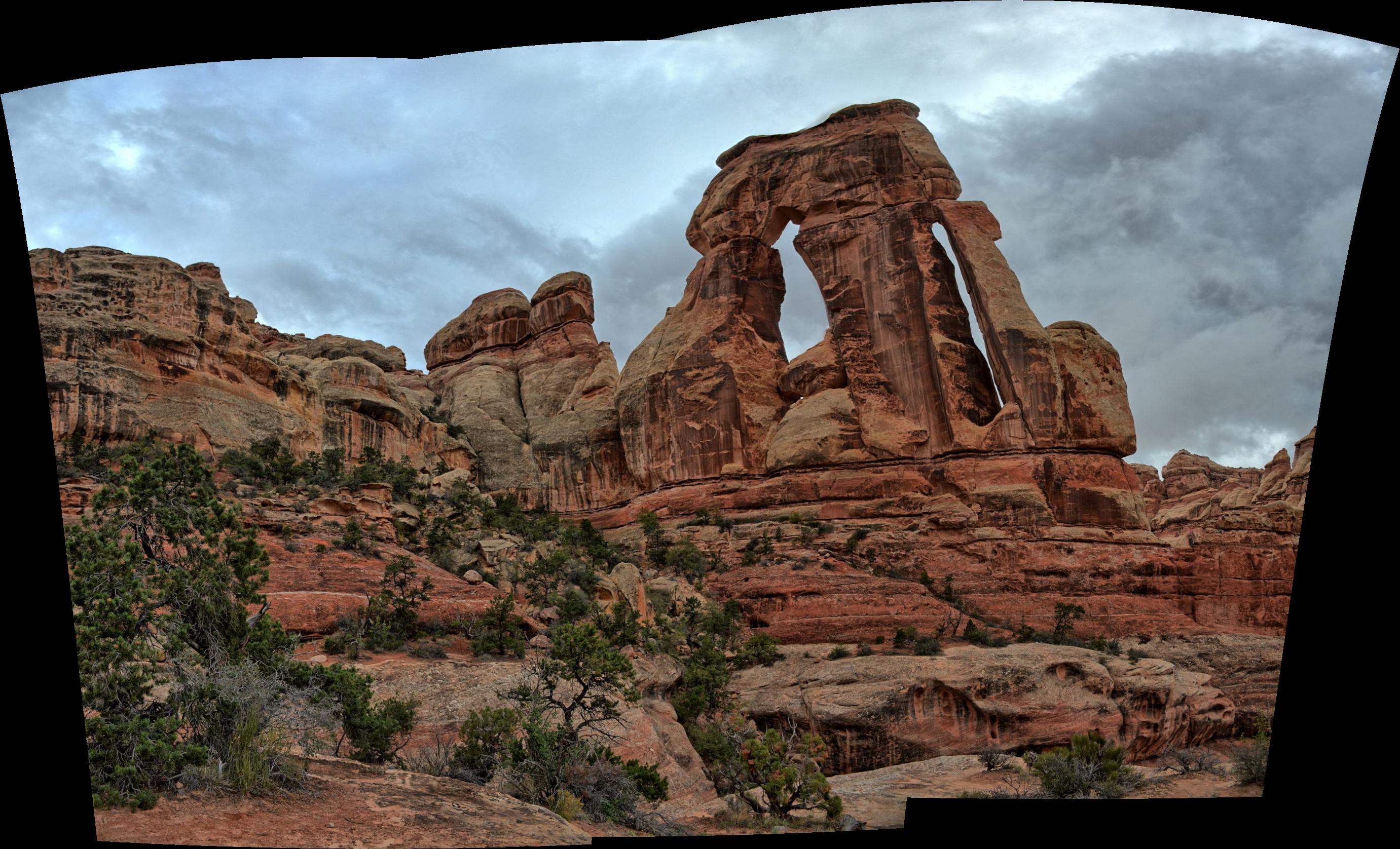
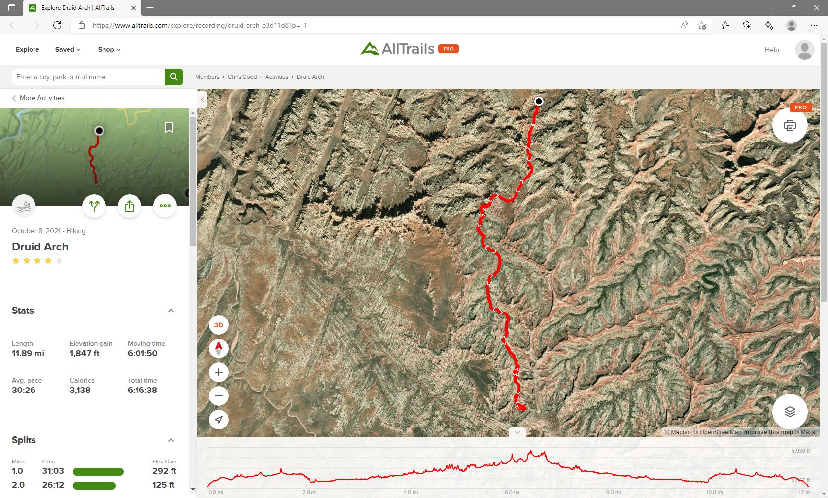
on to Newspaper Rock Historical Site and then to Canyonlands. He drove to
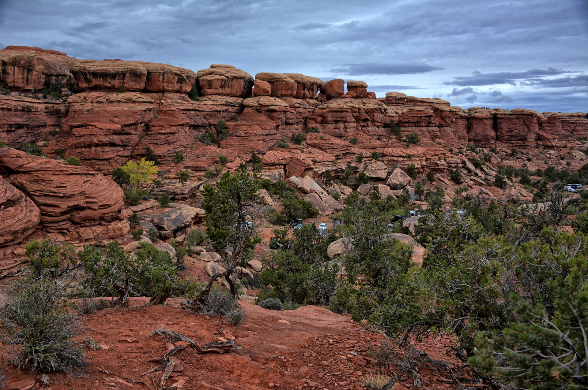
the Elephant Hill trailhead and began the hike out to
Druid Arch. It was
overcast and light rain fell occasionally through the day. He made
it all the way to Druid Arch, seeing only a couple other hiking groups all day
long. Just before the last climb up to the viewpoint for Druid Arch is a
sand-stone slick rock section that is pretty steep, but fortunately does not
really have any exposure - you just slide back down the slick rock if you slip.
Chris struggled with this, as it had been raining and the rocks were sandy and
slippery. With the help of a group coming back from the Druid Arch viewpoint, he
managed to make it up the last steep part of this section, and made it all the
way to Druid Arch. He had Druid Arch to himself, as it was late in the day
and few people were hiking this day anyway. On the return hike, the last two miles back to
Elephant Hill were completed in the dark, but Chris had expected this so he had
a flashlight with him to see the way. He drove just outside the park and
camped nearby for the night.
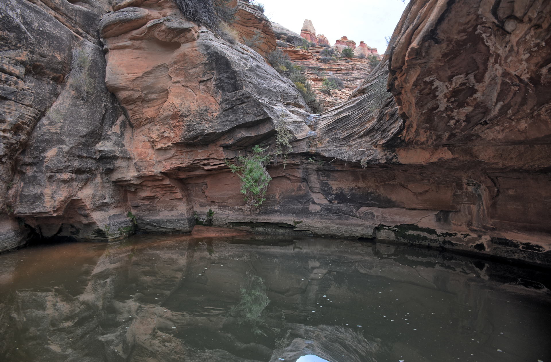
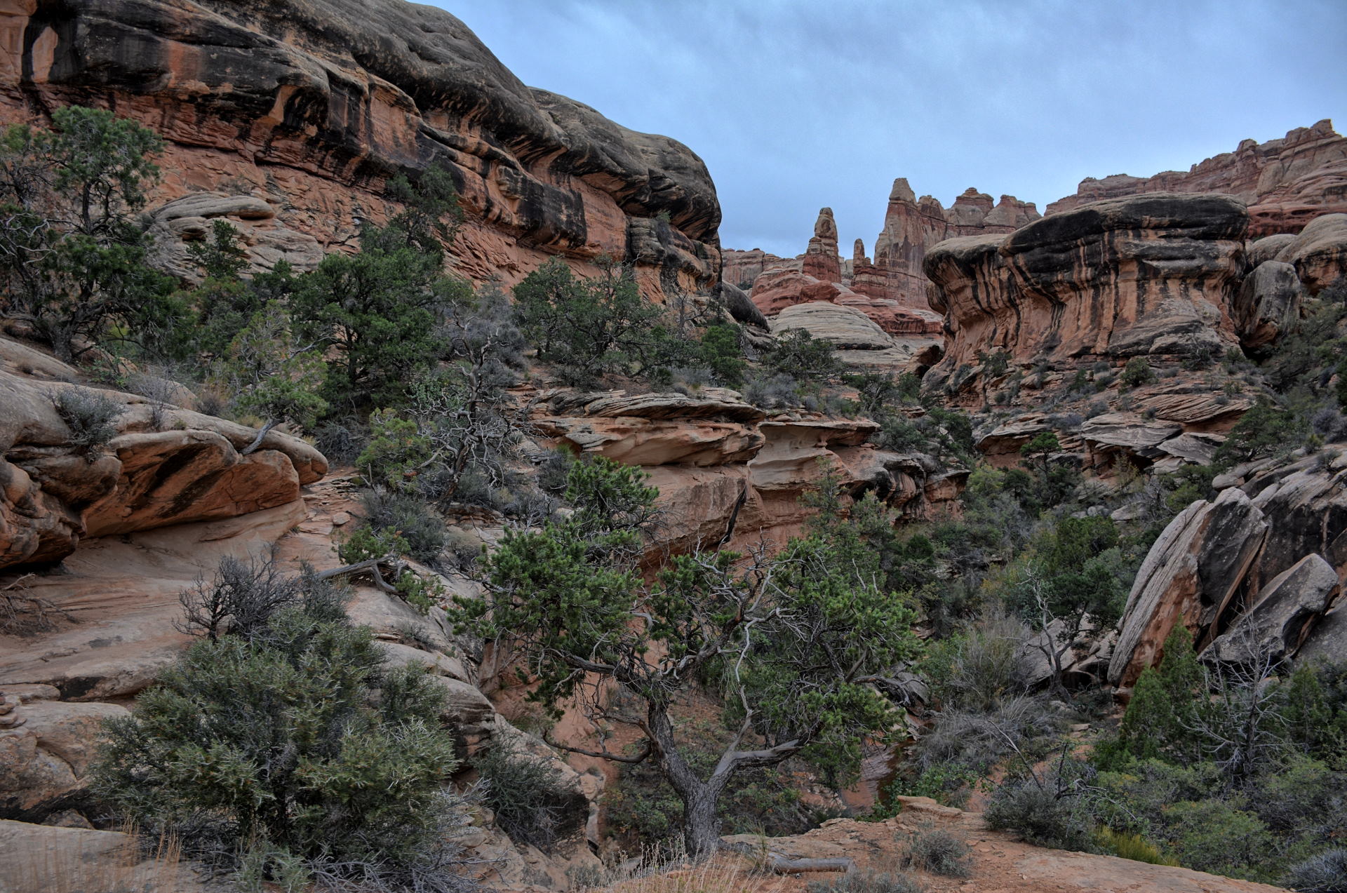
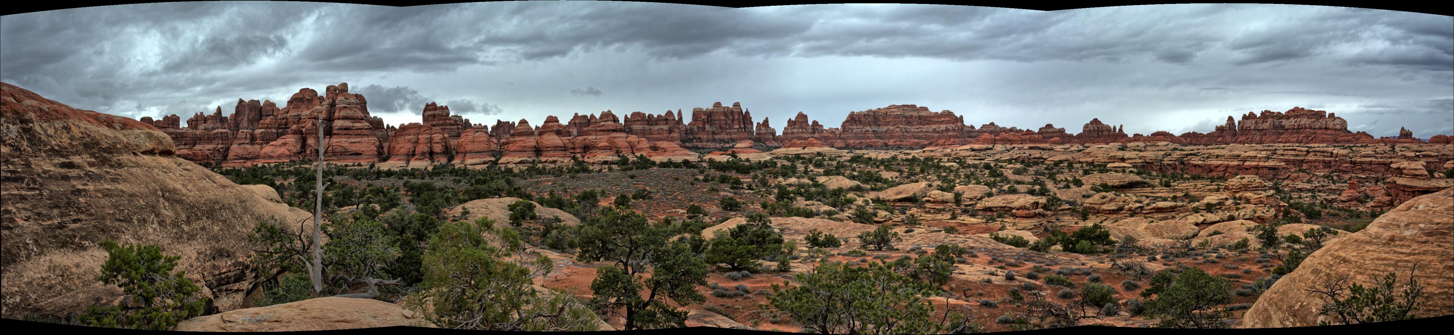
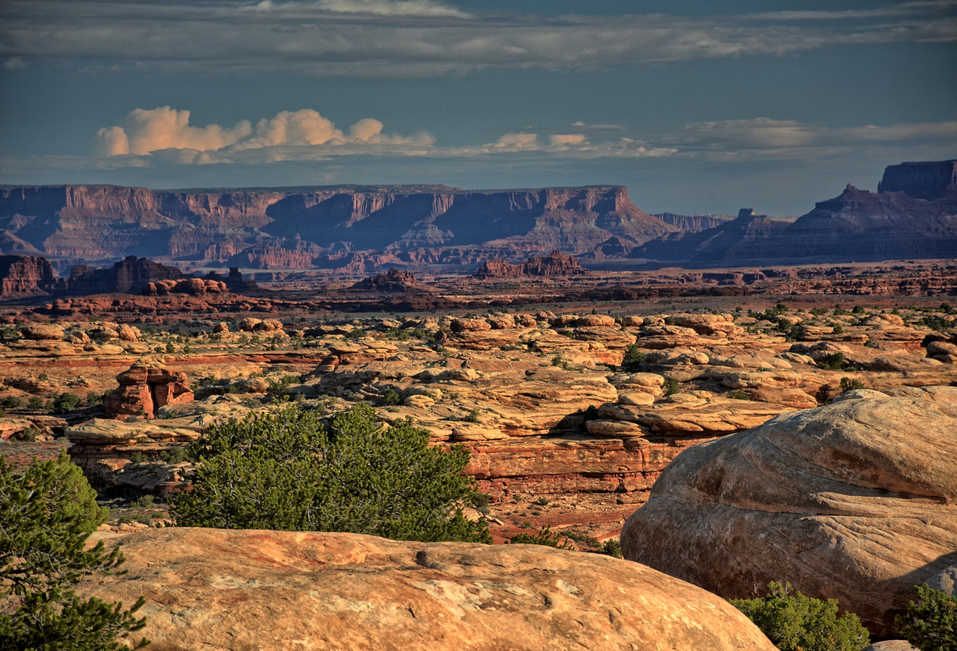
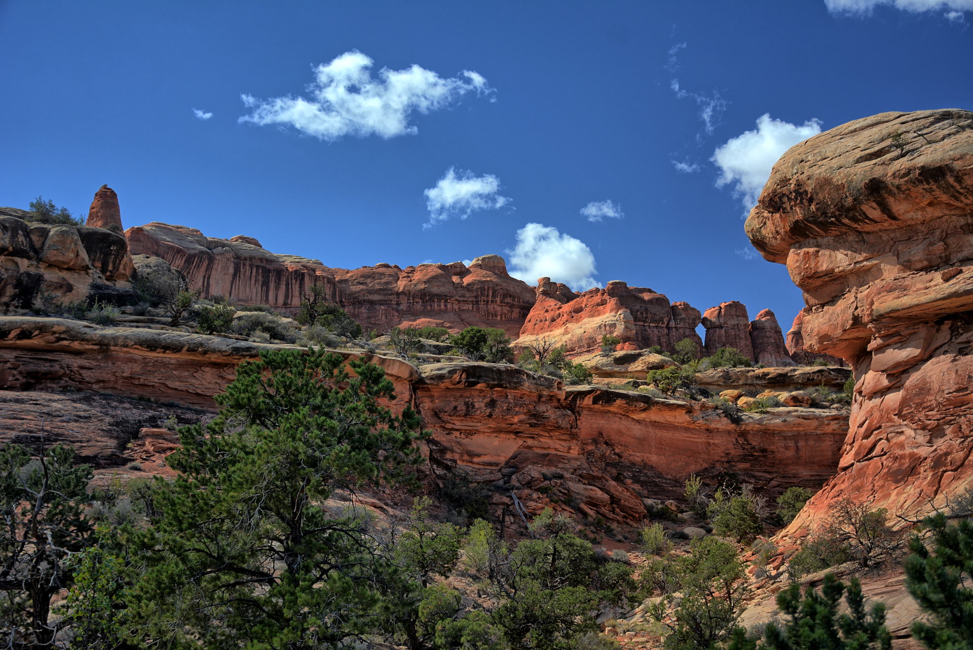
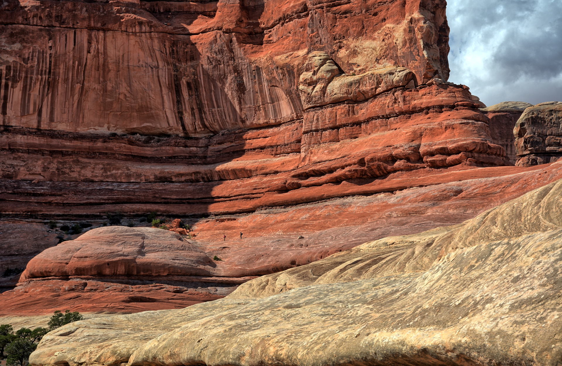
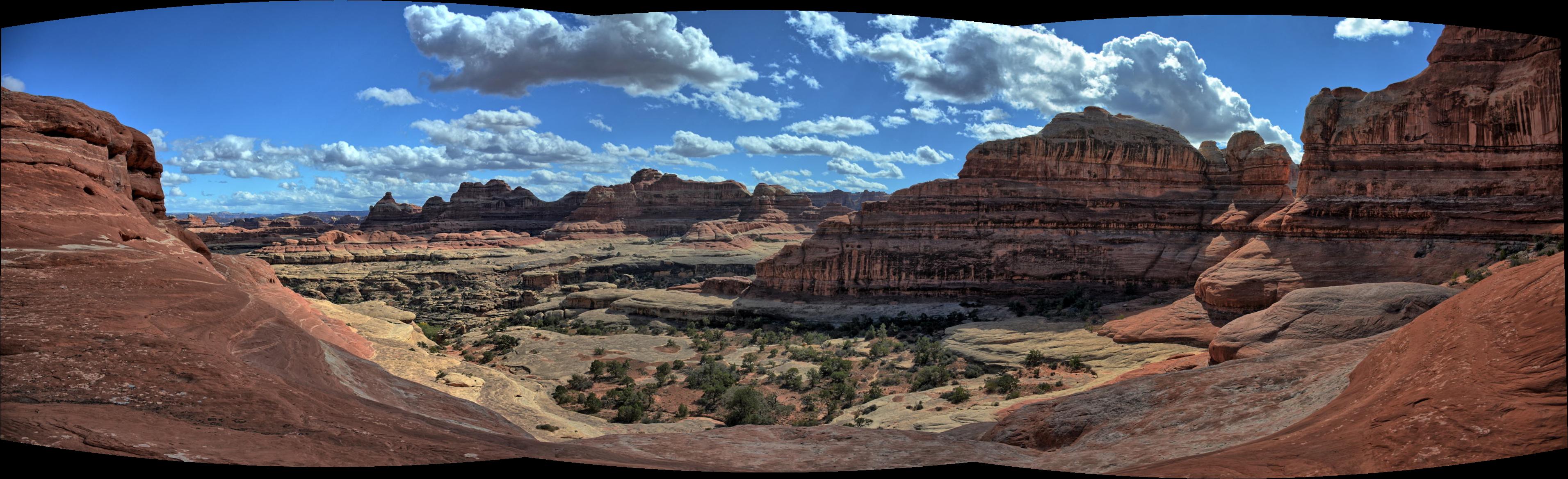
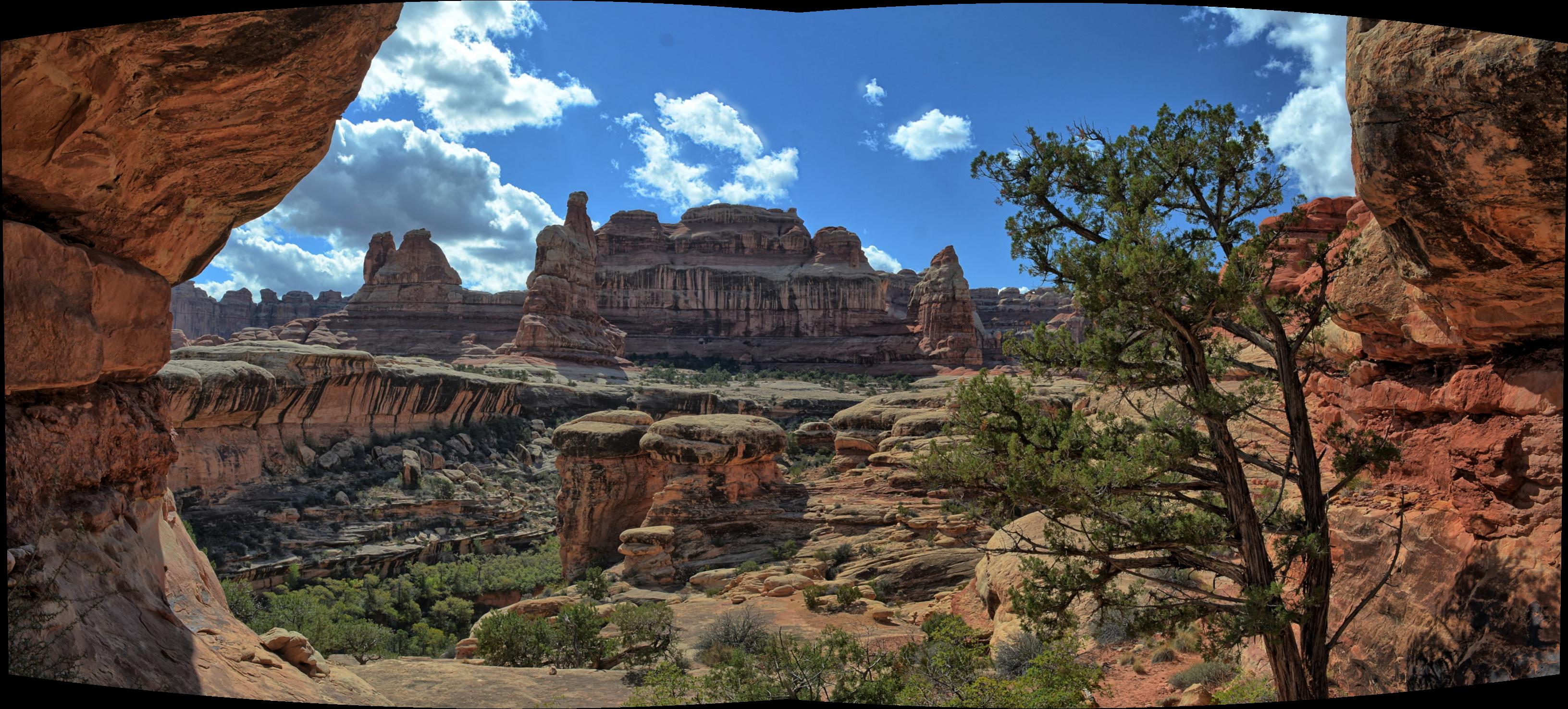
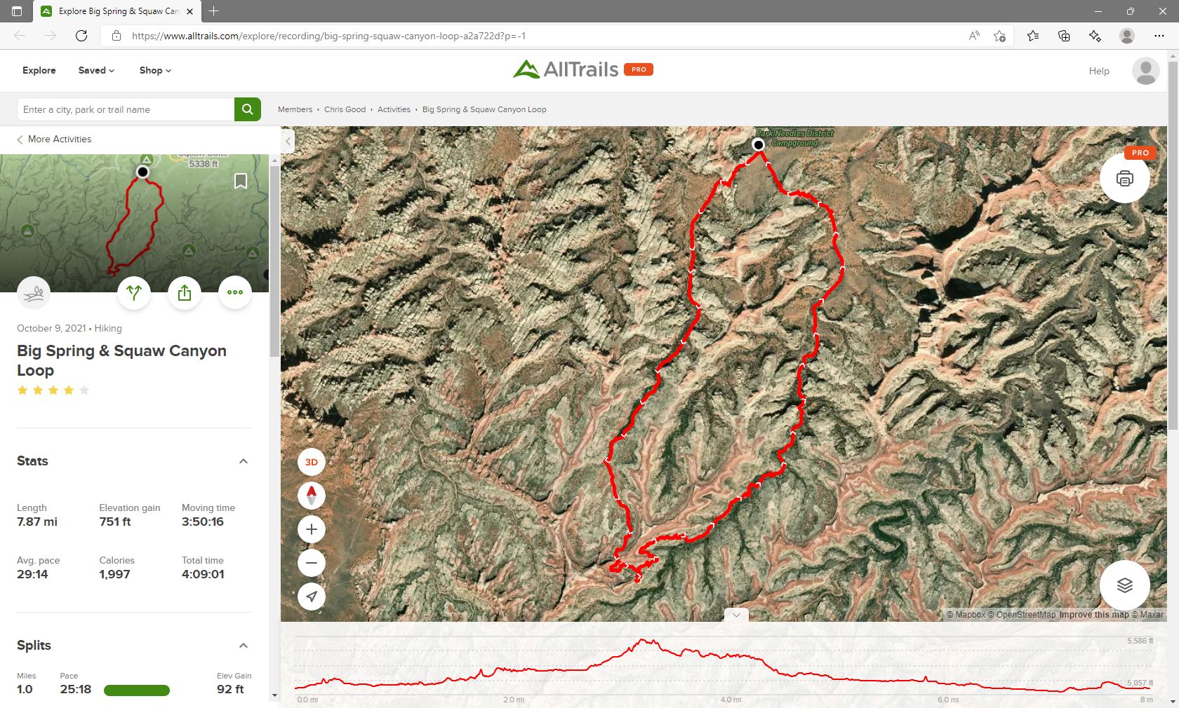
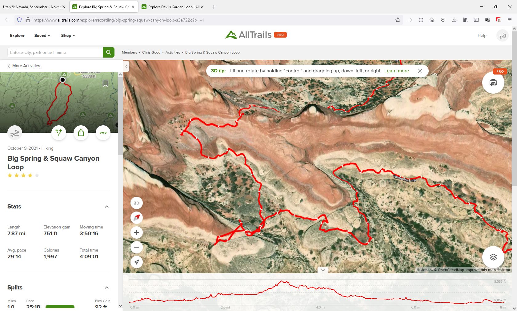
Chris drove back into the park and cooked breakfast at a
picnic area at the Potholes Viewpoint. He drove to the Cave Springs
trailhead and completed that short trail before going to the visitor's center
for a recommendation for a good hike for the day. The ranger recommended
the Big Springs & Squaw Canyon Loop trail, which begins near the Canyonlands -
Needles campground. Chris hiked this trial over the next several hours and
enjoyed it very much. There is one small section with scrambling and some
exposure over slick rock. If was a sunny dry day, so it was not slippery.
Chris would not recommend that trail if there was any moisture in the forecast,
as you hike along slick rock with exposure at the far end of the loop. One
slip could drop you over a cliff on both sides of the approach to the pass
between the two canyons at the far end of the loop. This hiking route and
the views are excellent; if you would like a birds-eye view of this hike, Chris
built a Google Earth tour of this loop as
he hiked it on 9 October. After finishing this long hike, Chris
drove back to Moab, stopping to fly his RC aircraft at a couple places along
the way. He got dinner in Moab then drove along the Colorado River to
Castle Valley, where he camped for the night.
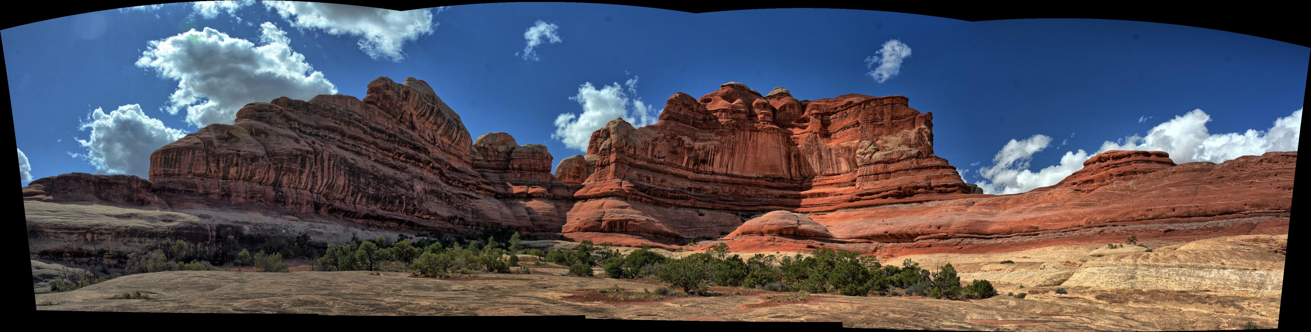
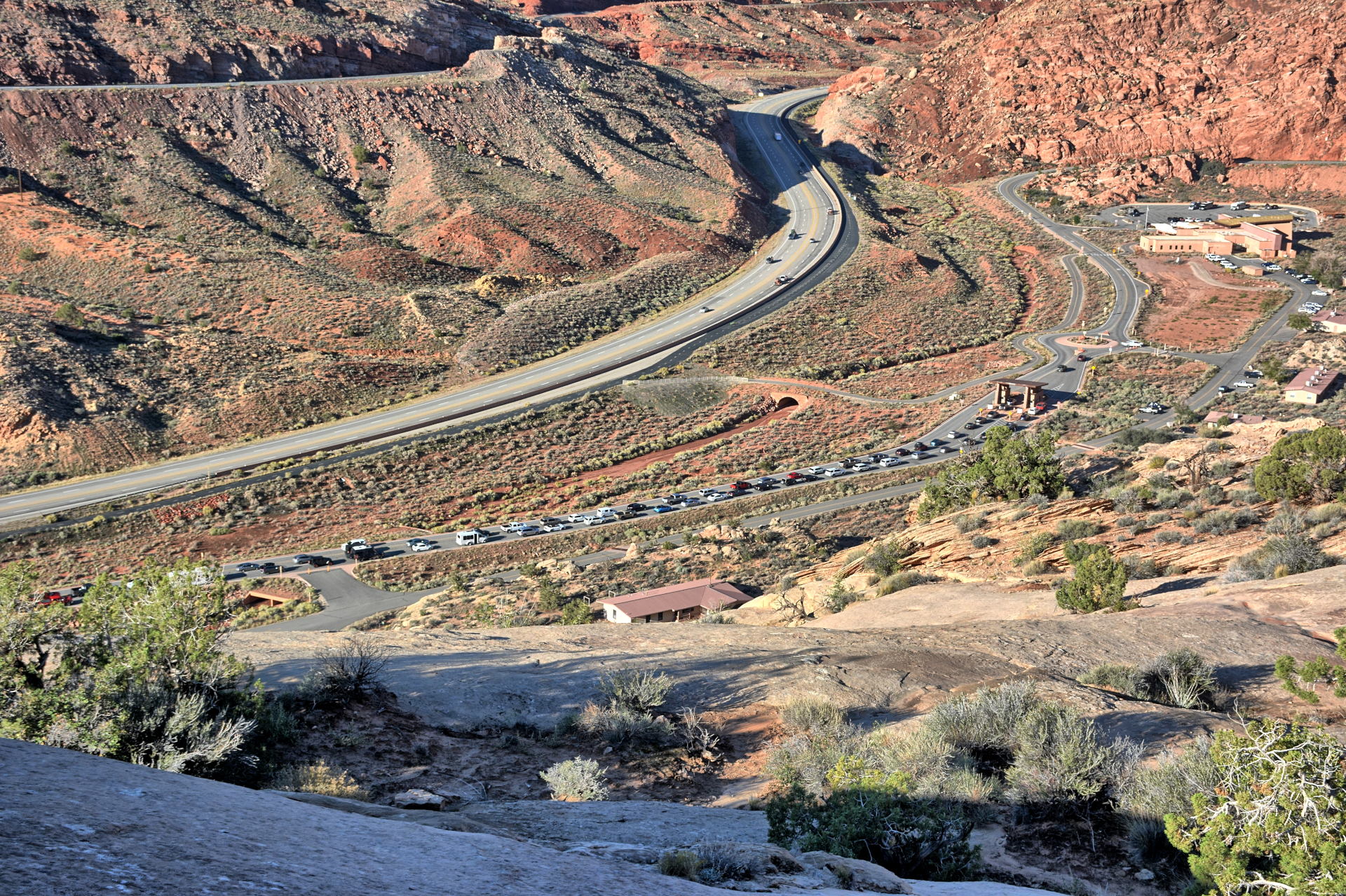
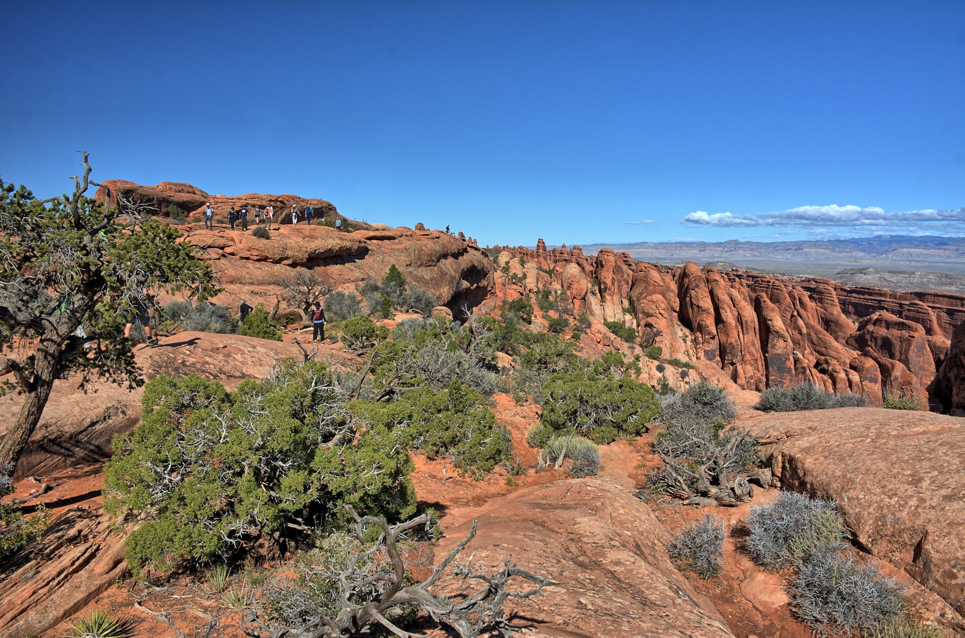
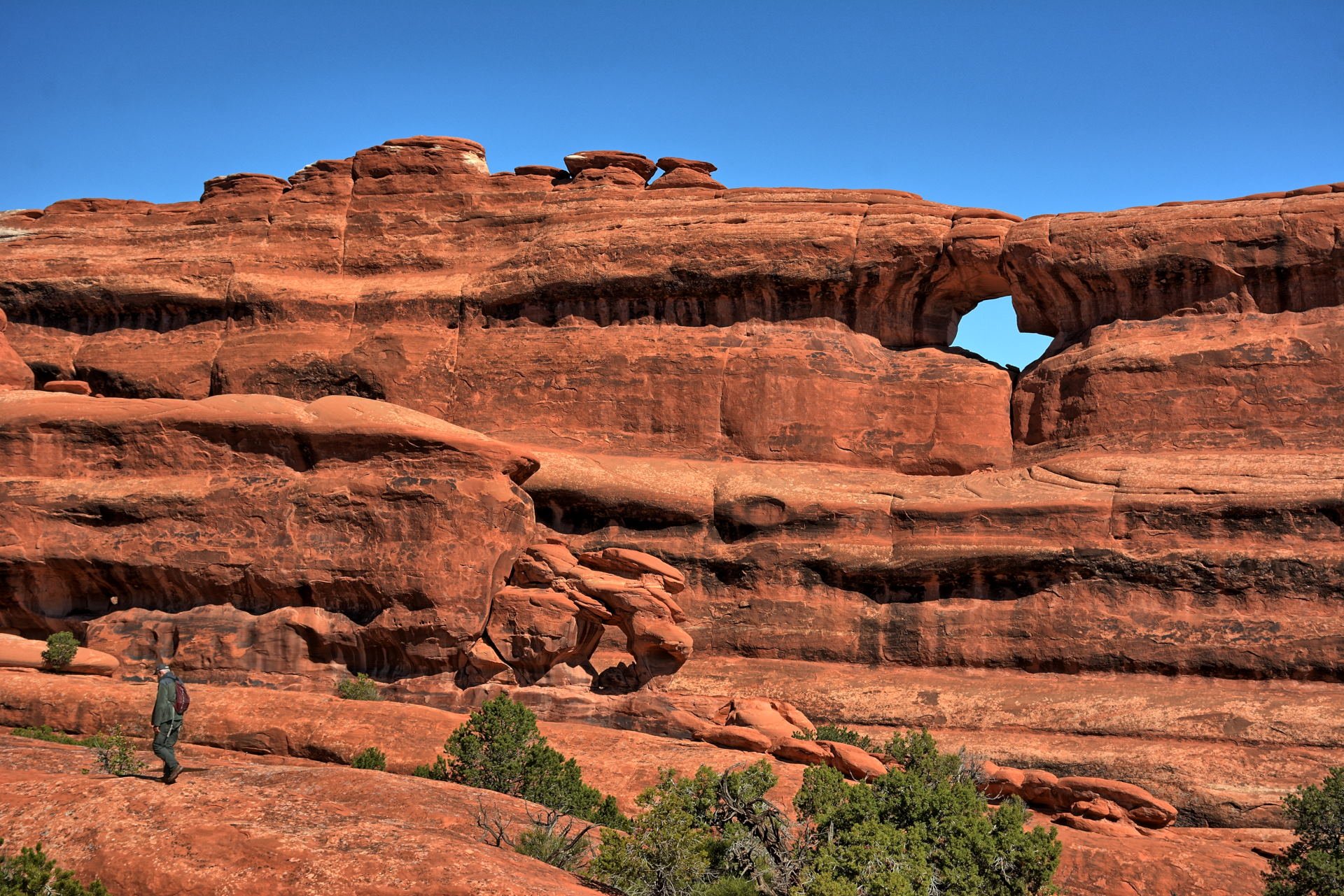
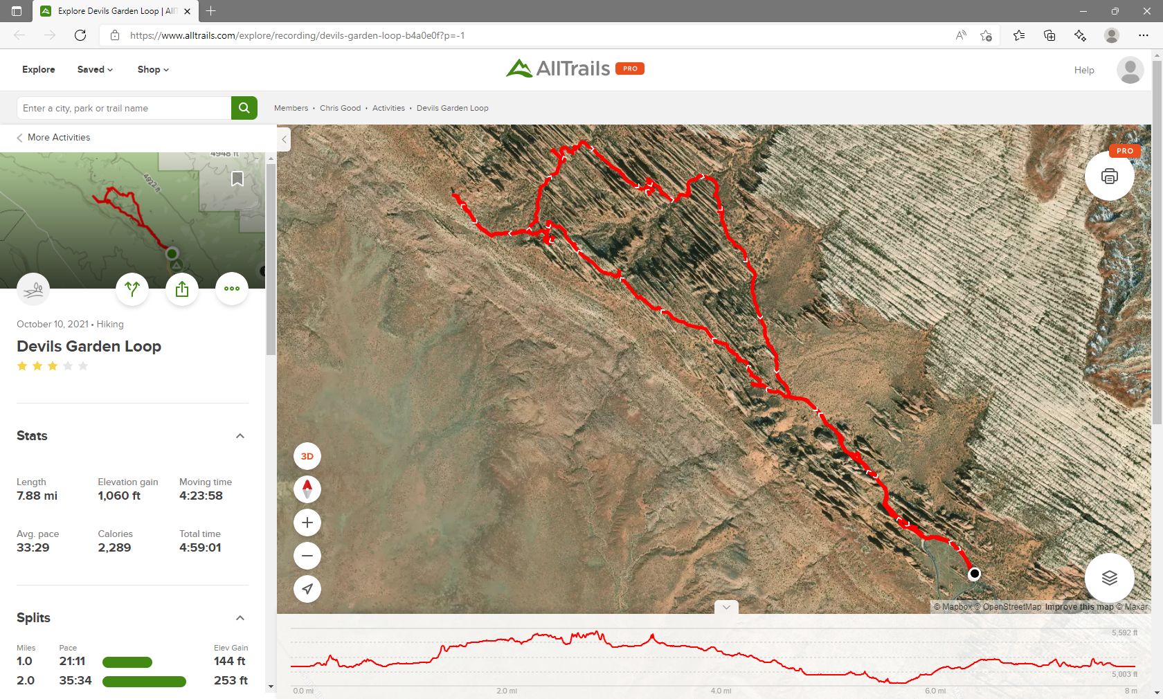
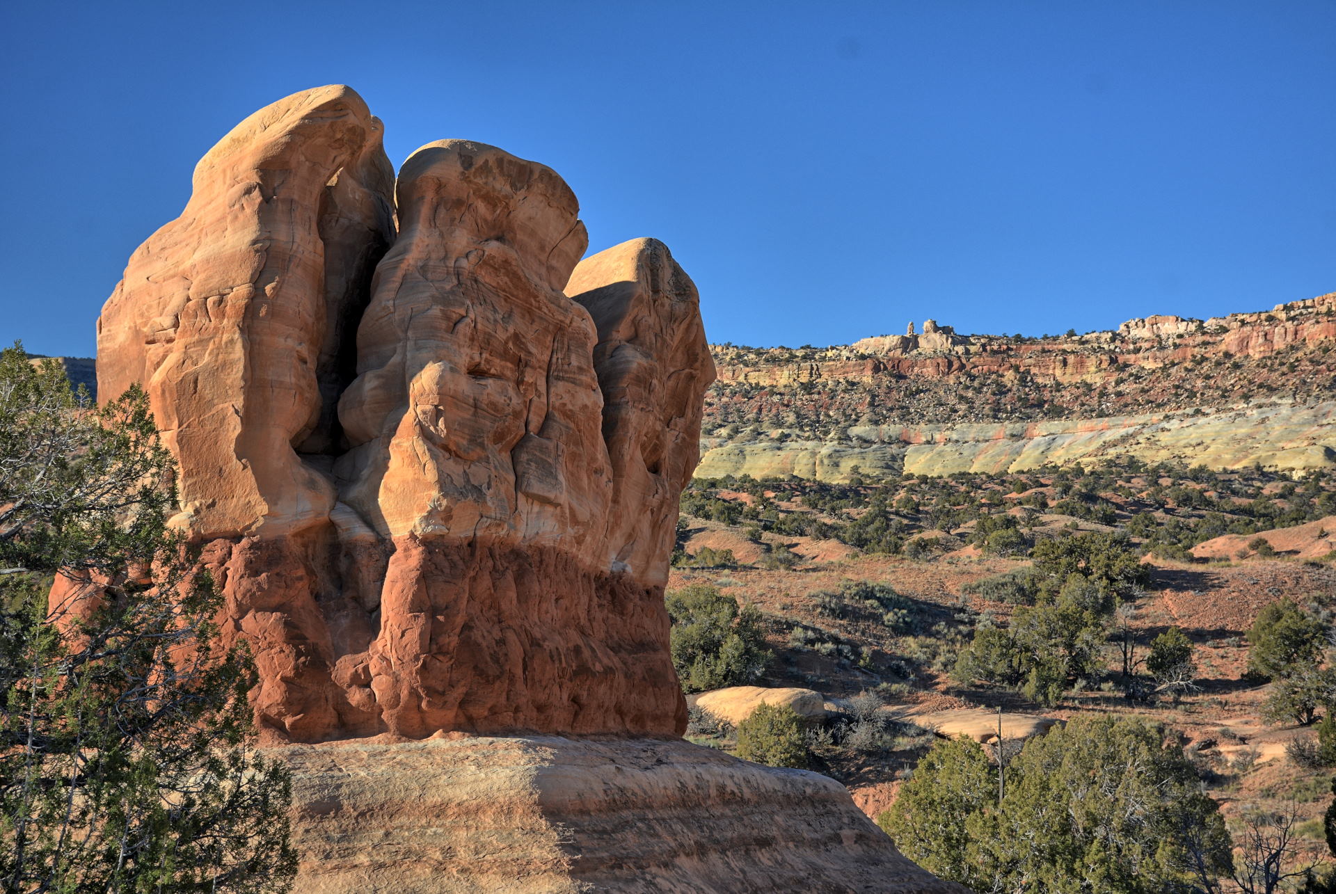
Chris flew his wing
in Castle Valley right next to the Colorado River on Sunday morning, then drove
to Arches National Park. Arches National Park has become VERY busy in the
last few years, getting most of the crowds that come to Moab. The car line
to get in on this Sunday morning in October was about 30 minutes long. You
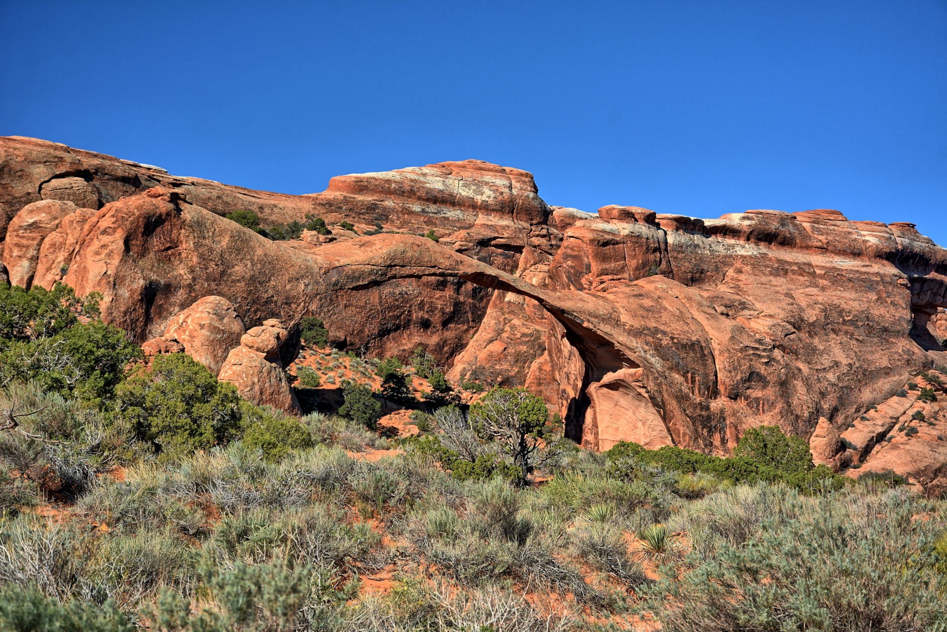
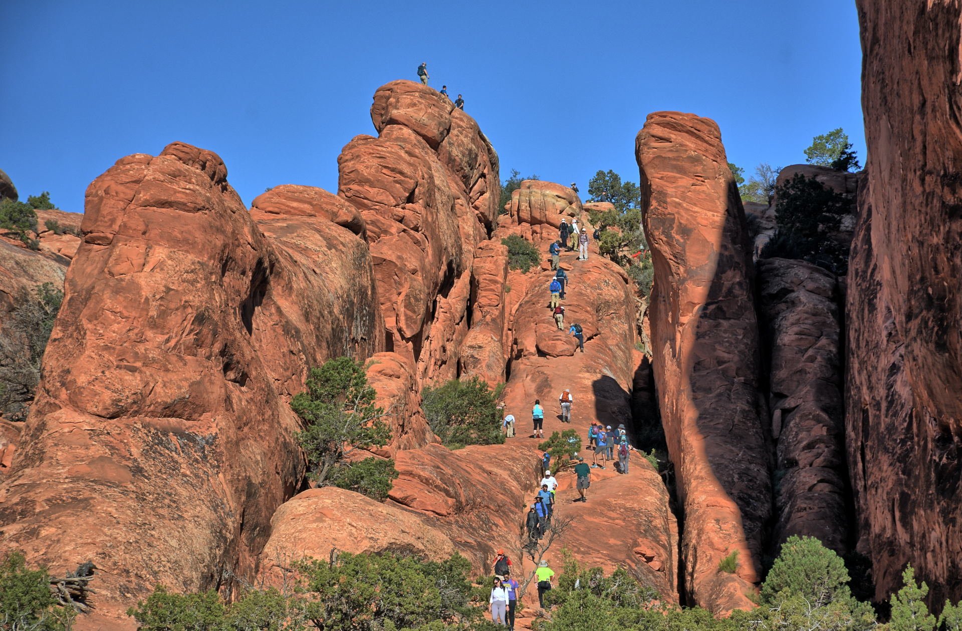
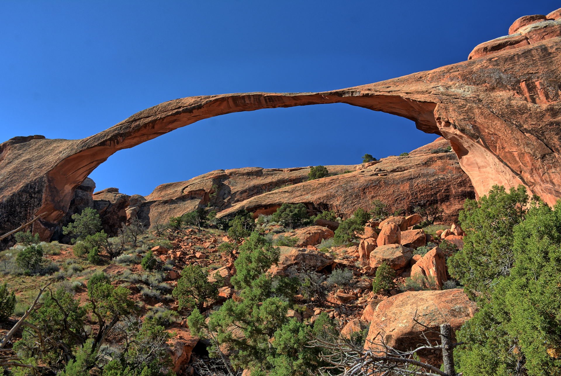
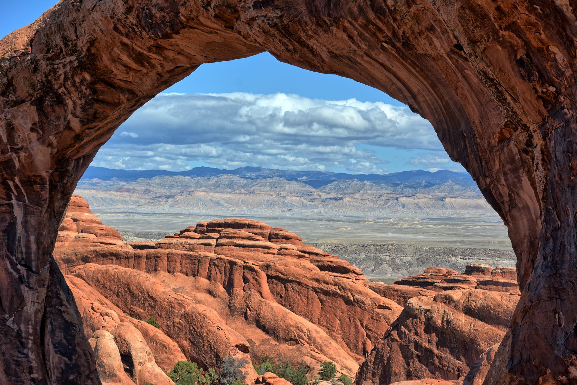
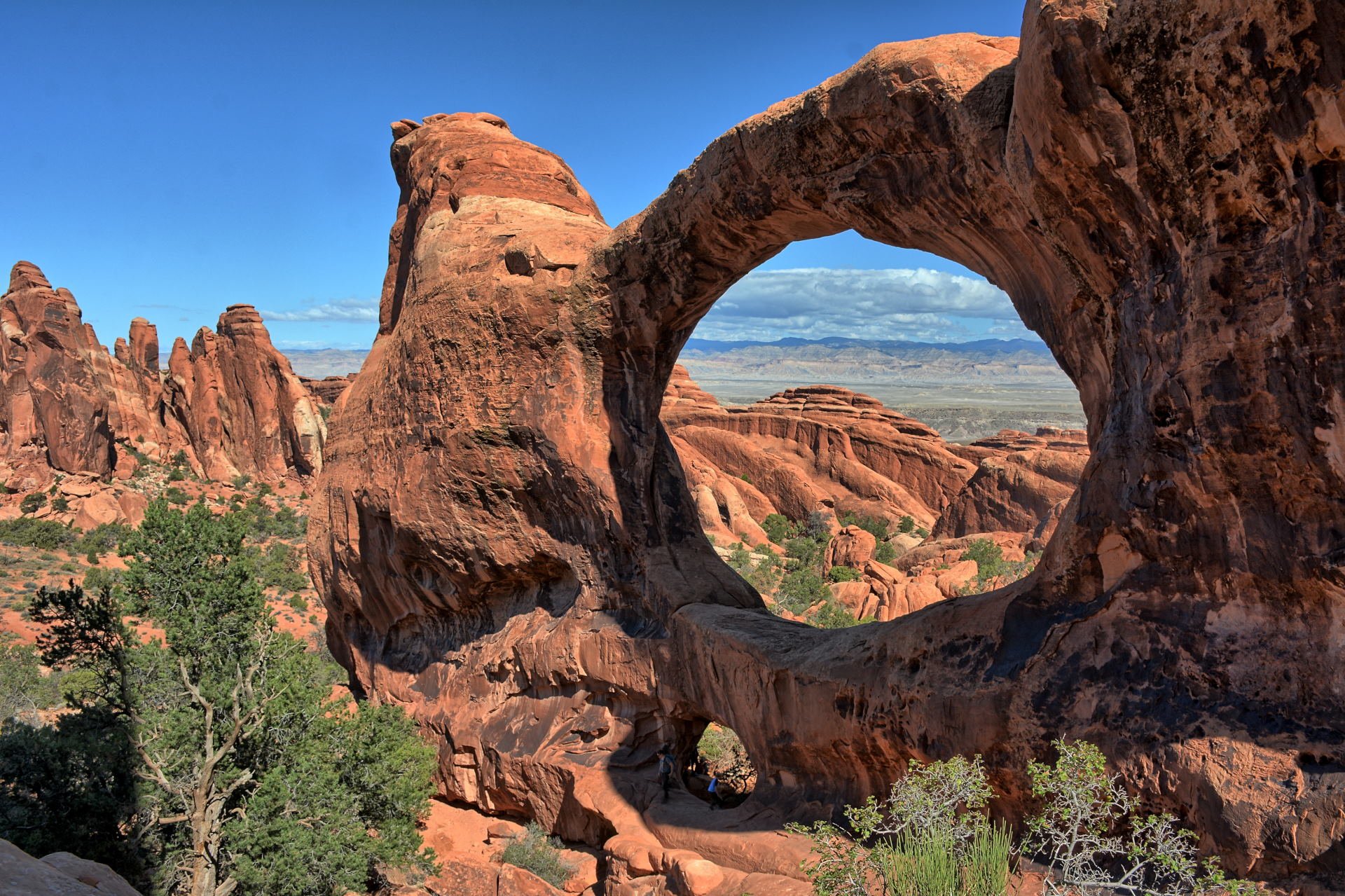
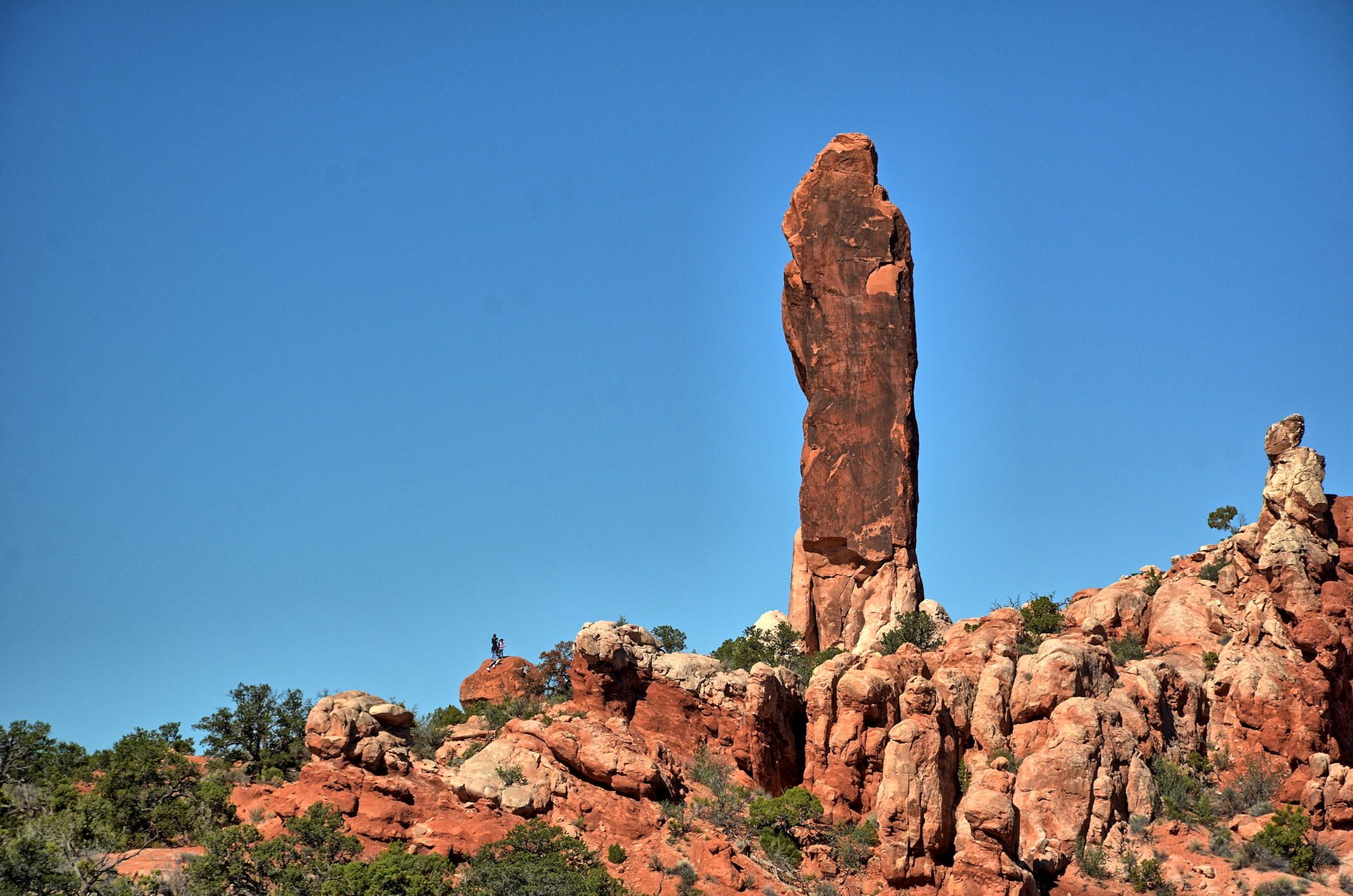
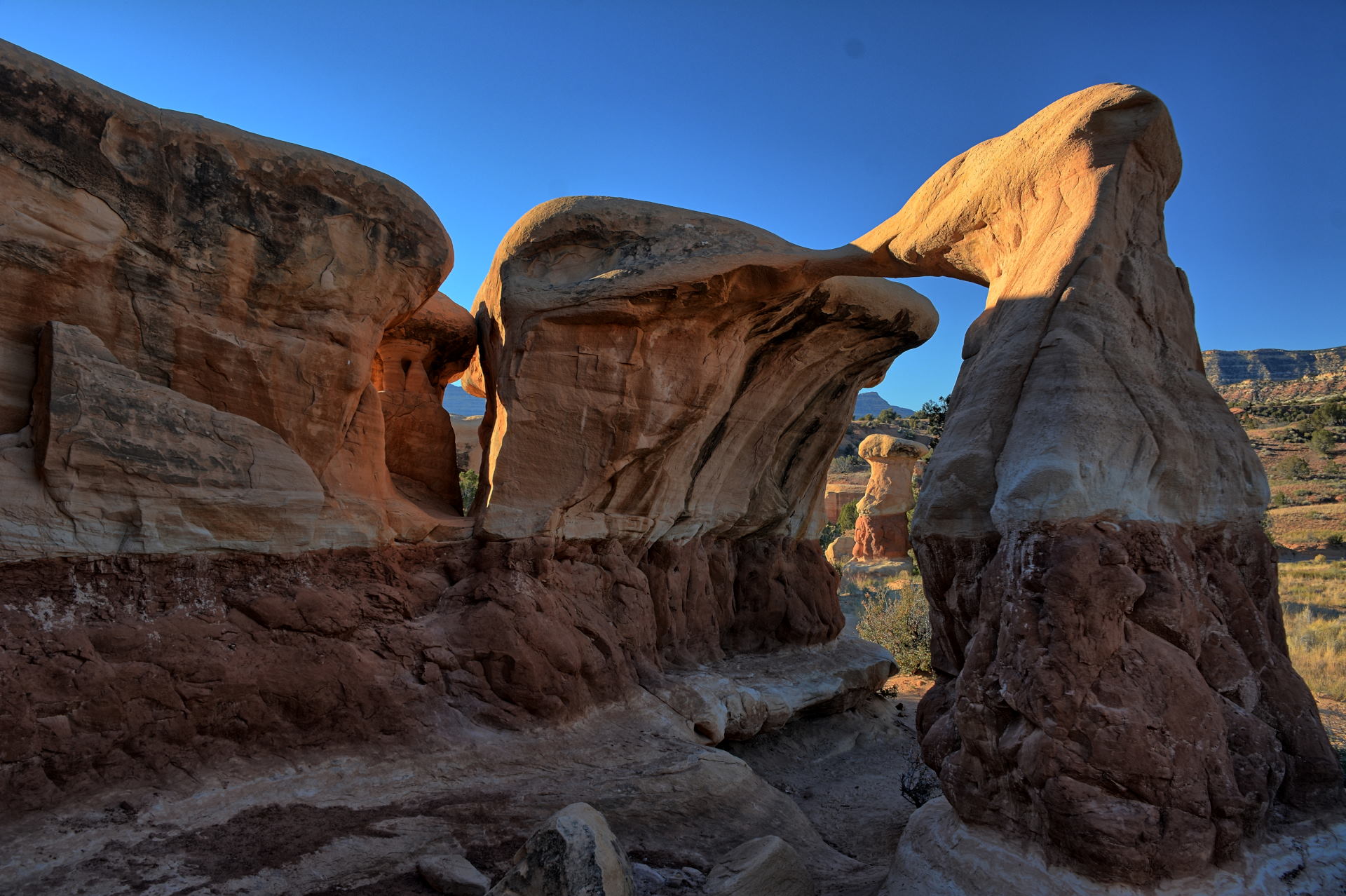
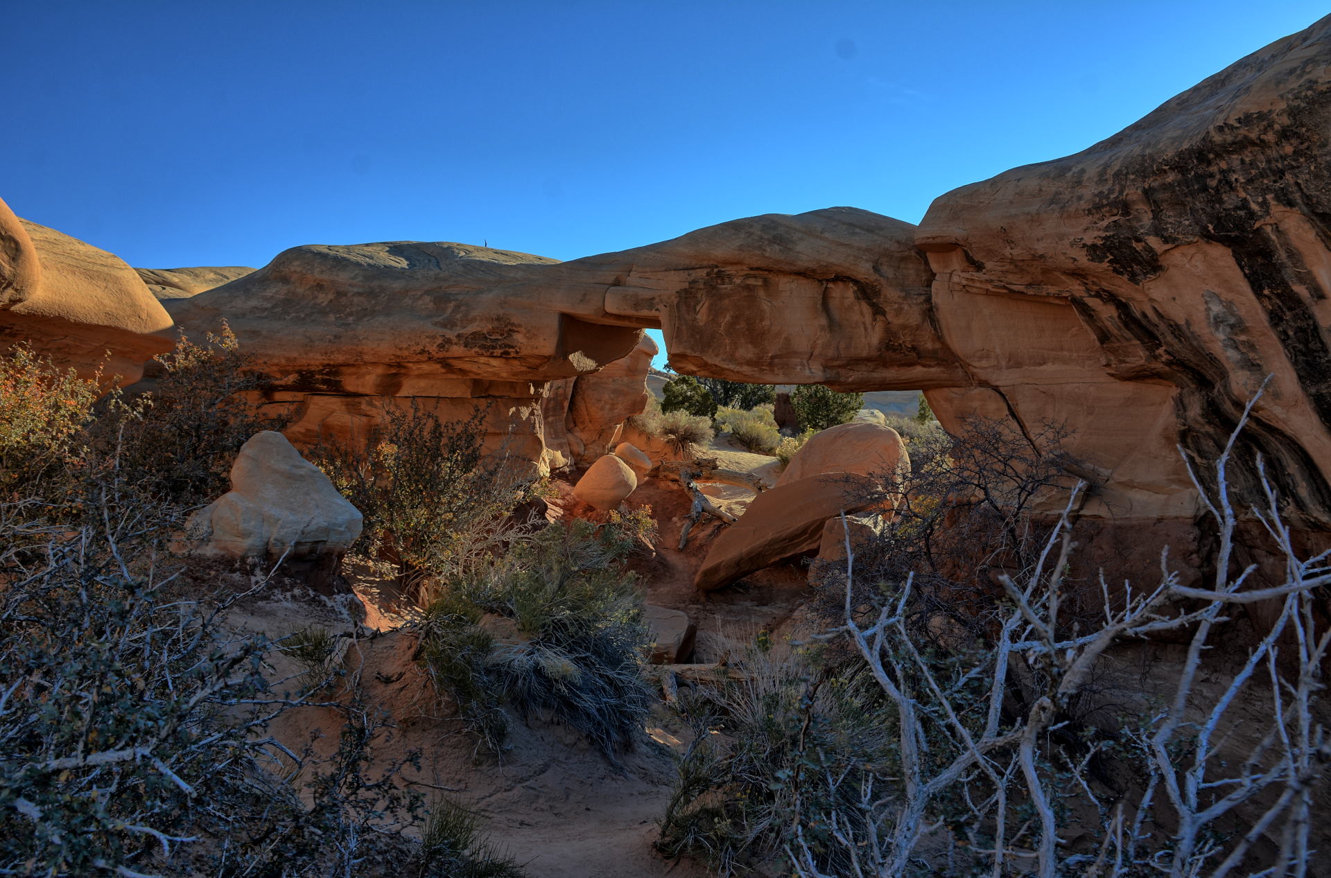
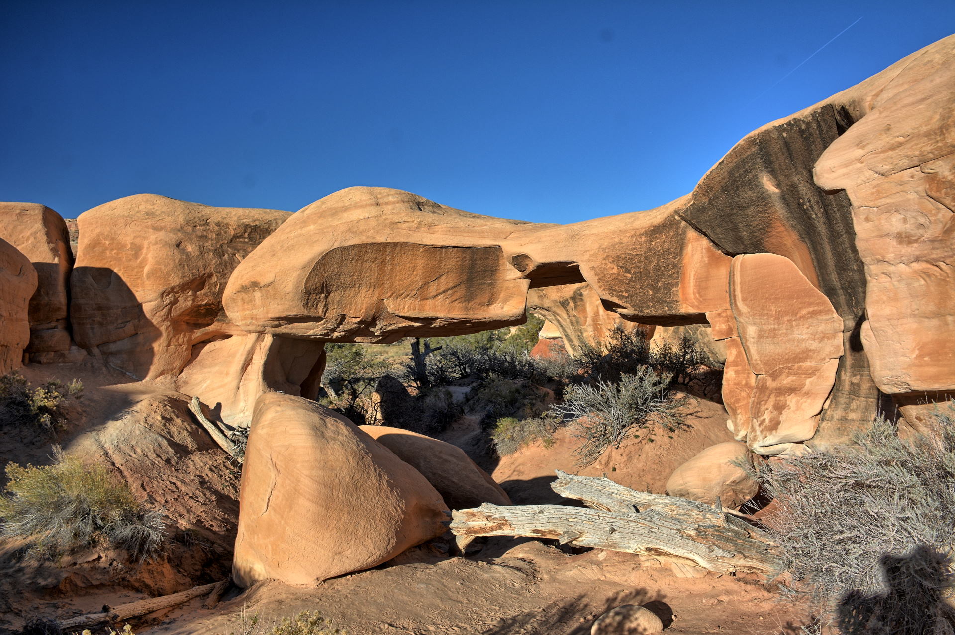
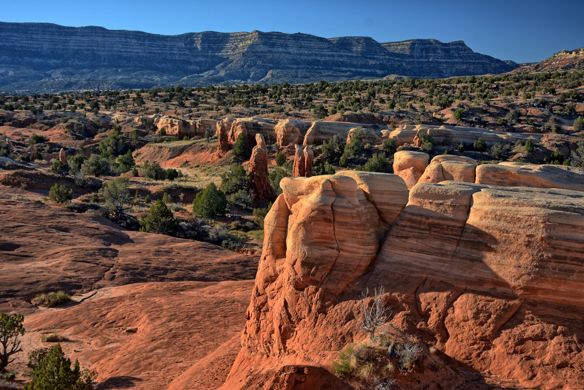
can see that line in one of the photos below. He hiked the Devils Garden loop trail (also
called the 'Primitive Trail'), visiting Landscape Arch, Double-O-Arch, and Dark
Angel. Chris had hiked this loop several years before, with no problems on
the previous hike. On this day there was one difficult part with
minor exposure because the slick rocks were VERY sandy and slippery from
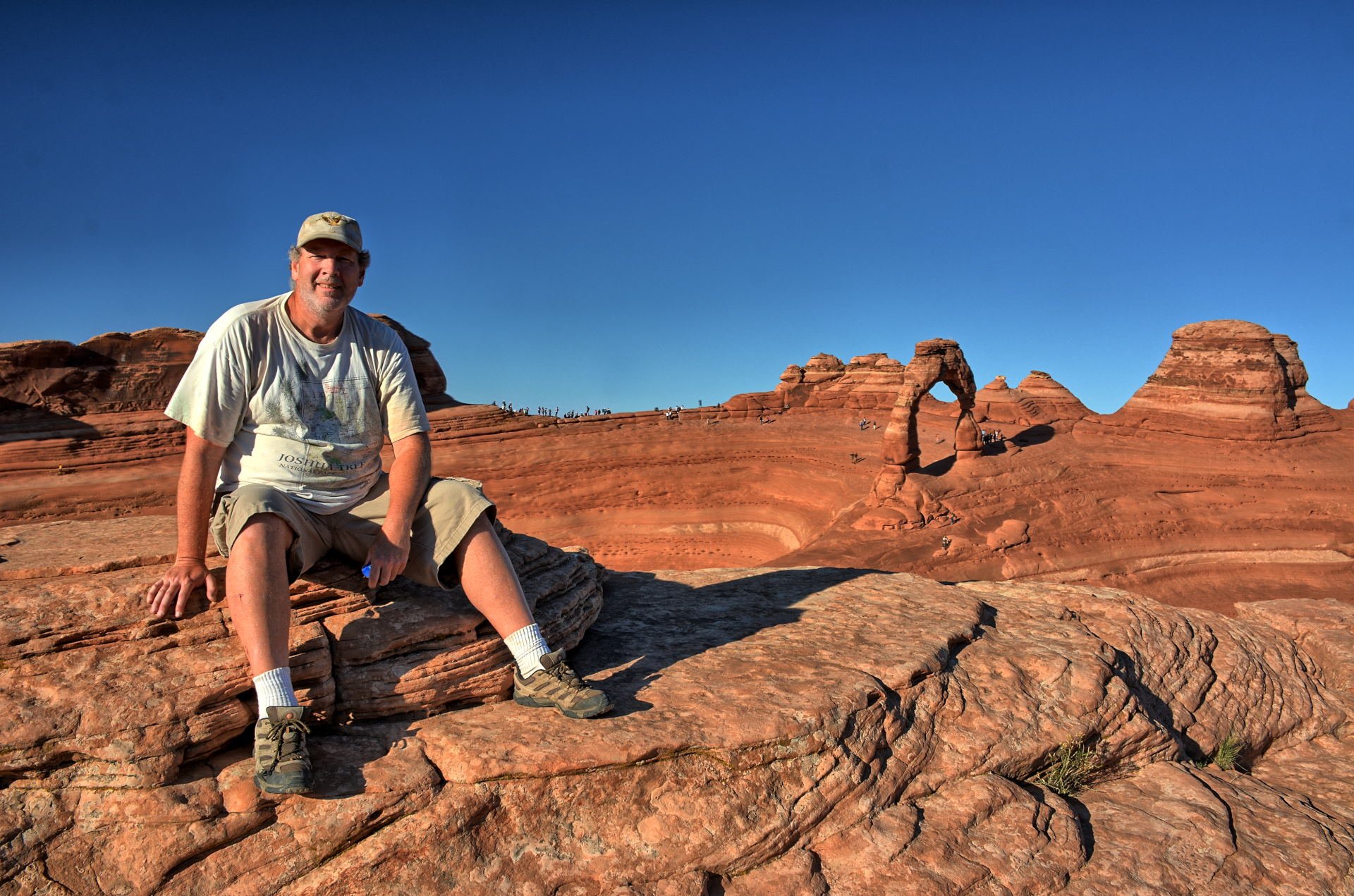
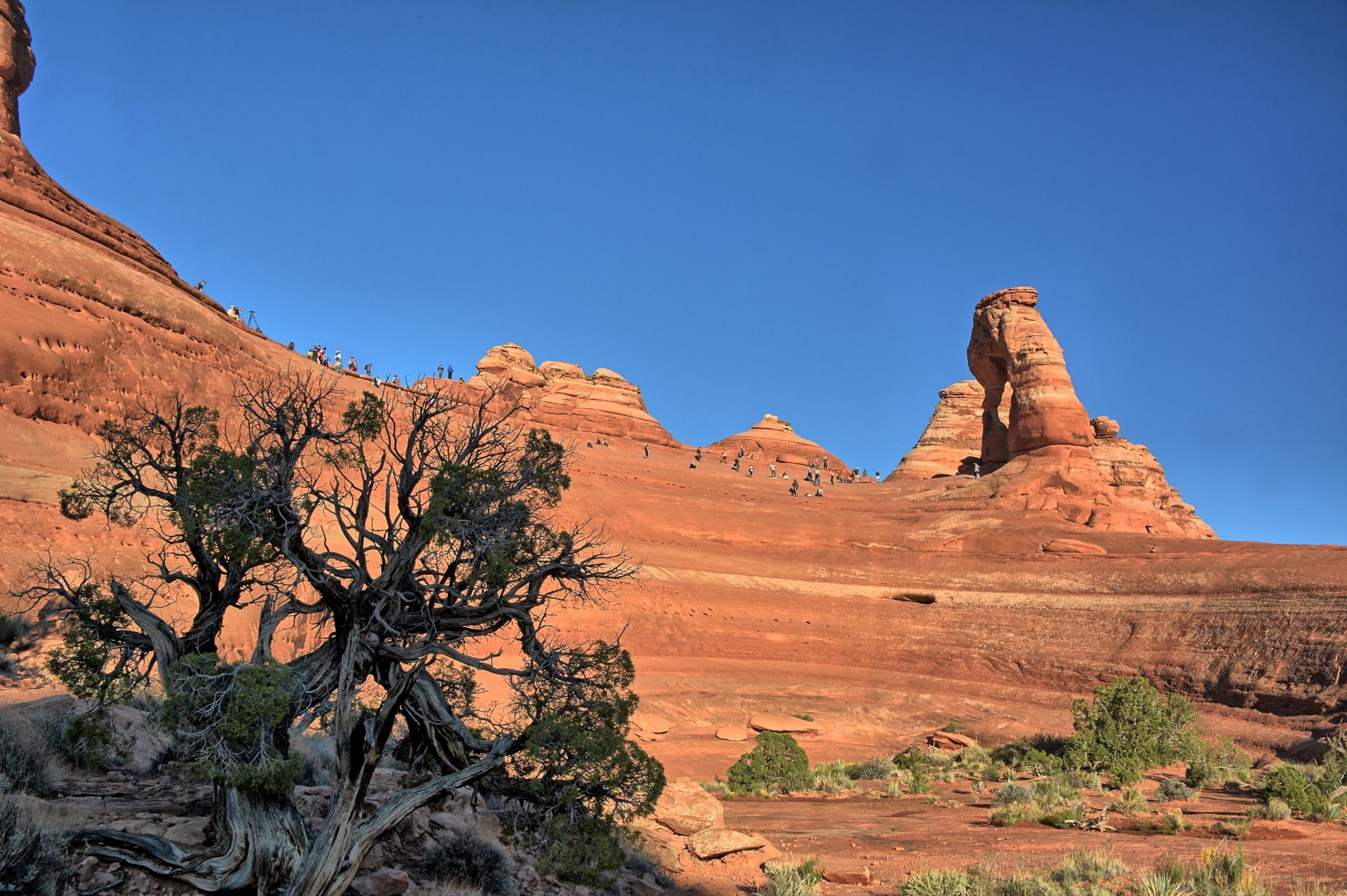
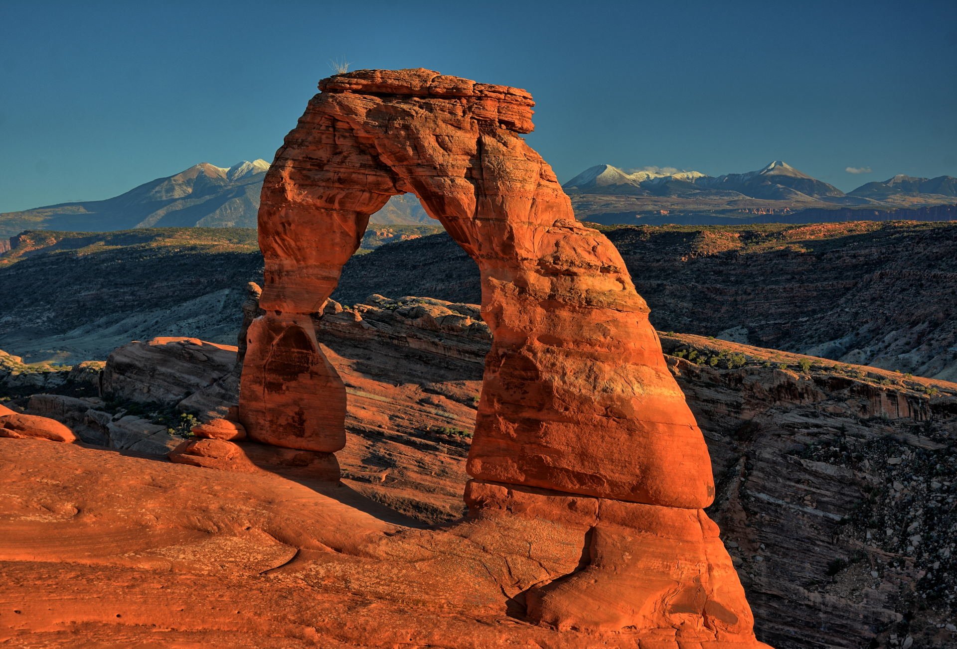
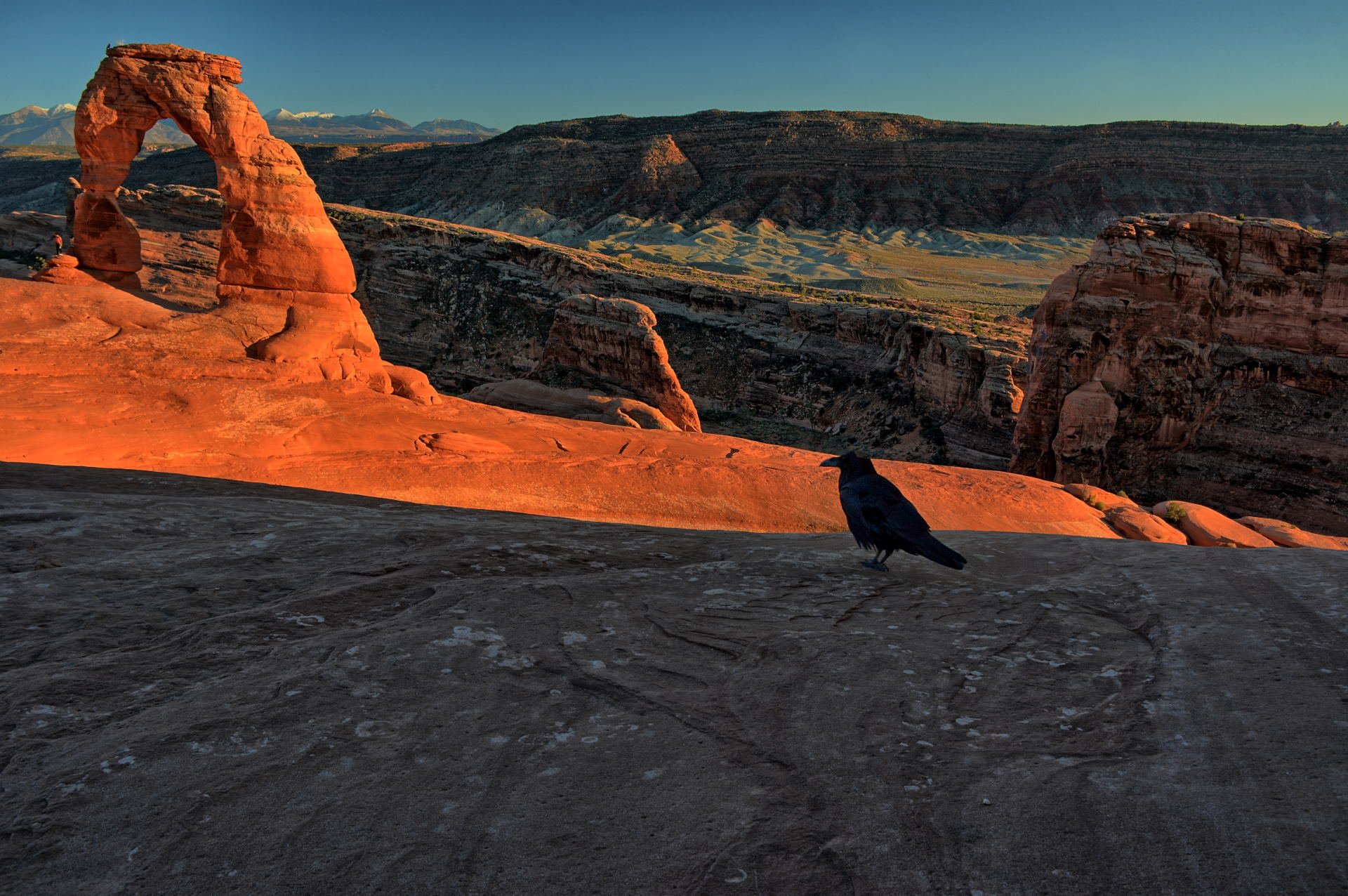
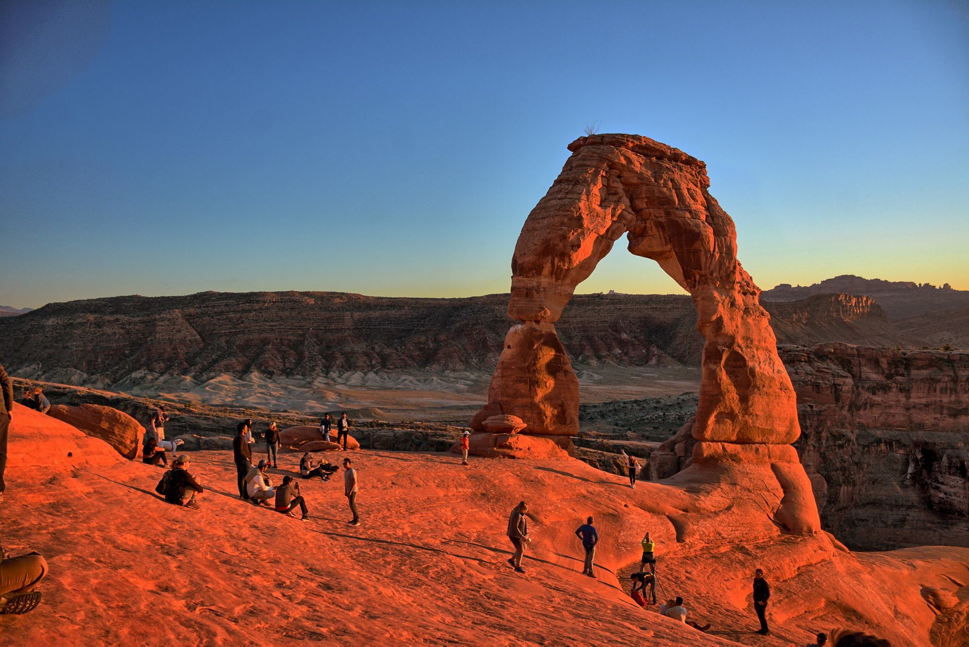
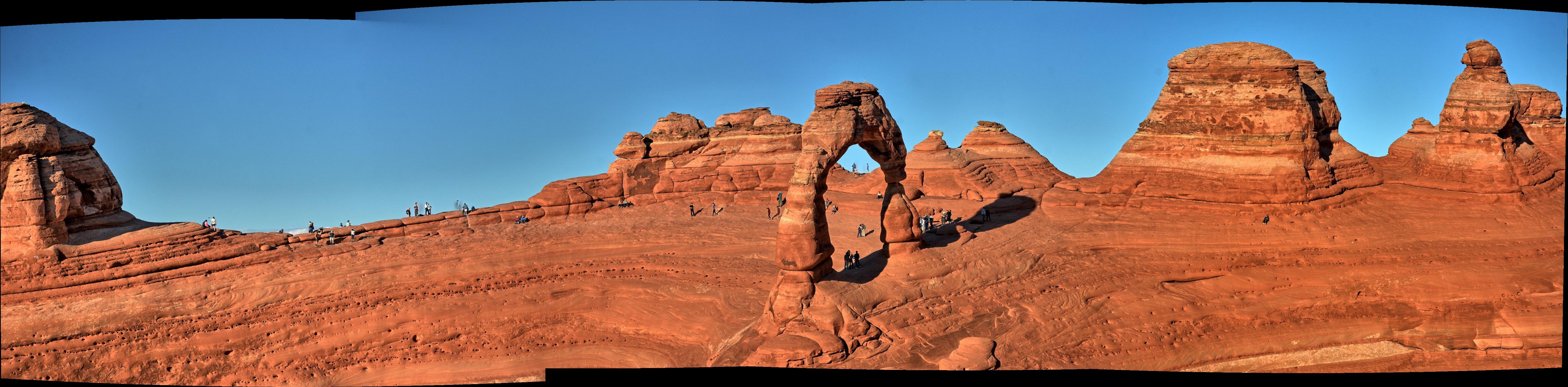
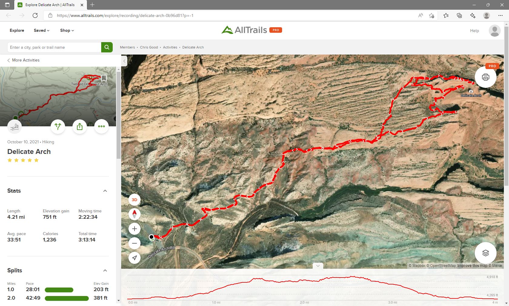
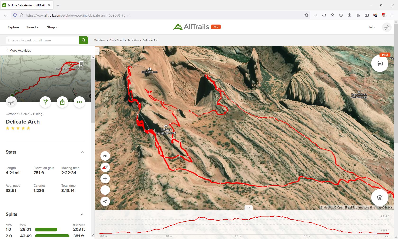
the rain over the last few days. He then hiked up to Delicate Arch for
sunset, spending several hours hiking all over the slick rock for different
viewpoints of Delicate Arch. The main viewpoint for Delicate Arch is
always crowded, but very few people leave the trail to go to the bowl below the
Arch or the cliffs on the high-ground across from the Arch. These viewpoints are
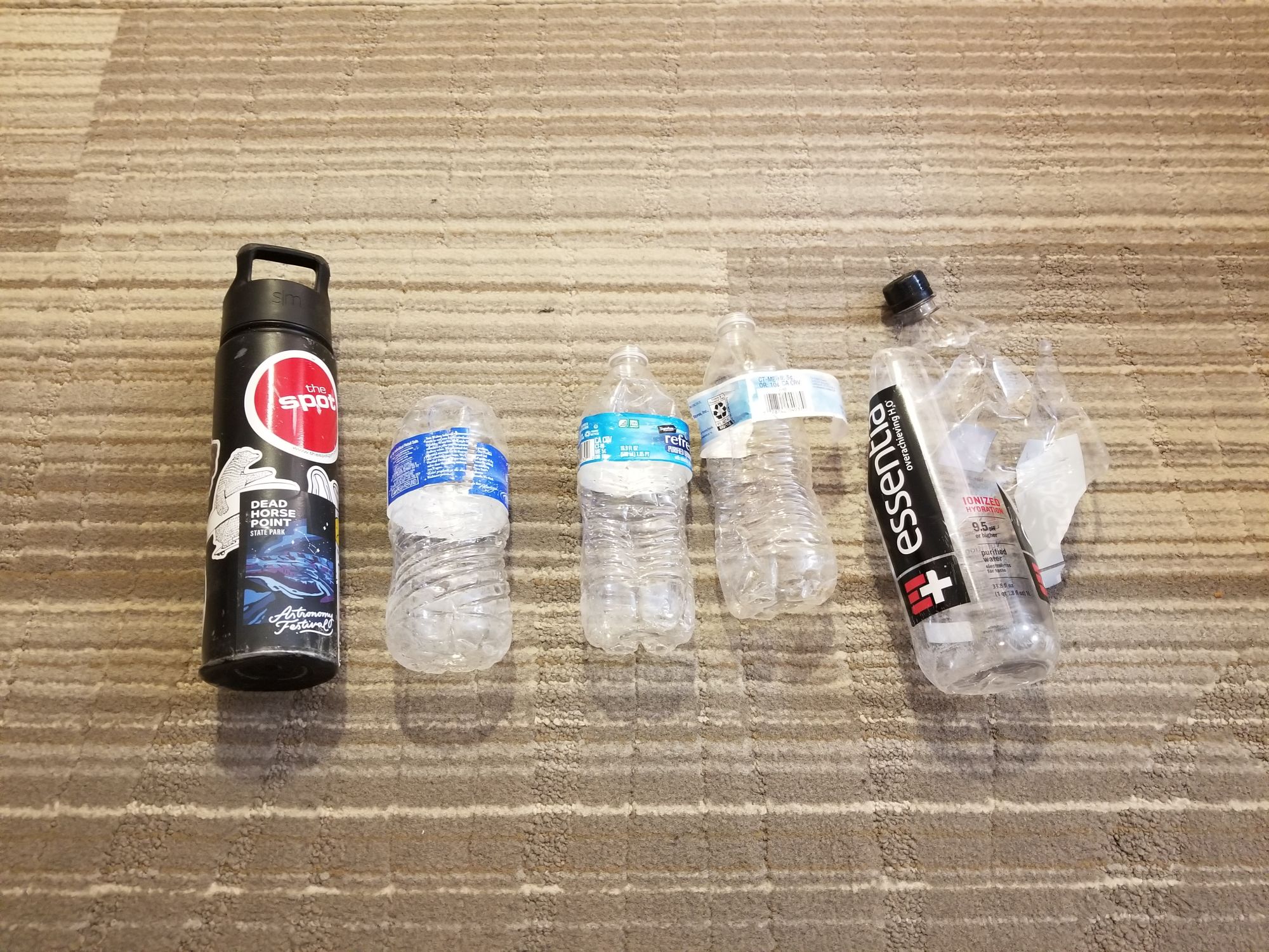
great, and provide alternate photo opportunities. Whenever Chris descends
into the bowl below Delicate Arch, he always finds and picks up trash that has
been dropped from above; usually it is water bottles that have rolled away from
people. The photo below shows Chris' haul for this day. Chris drove to Green
River on Sunday night for dinner and a hotel.
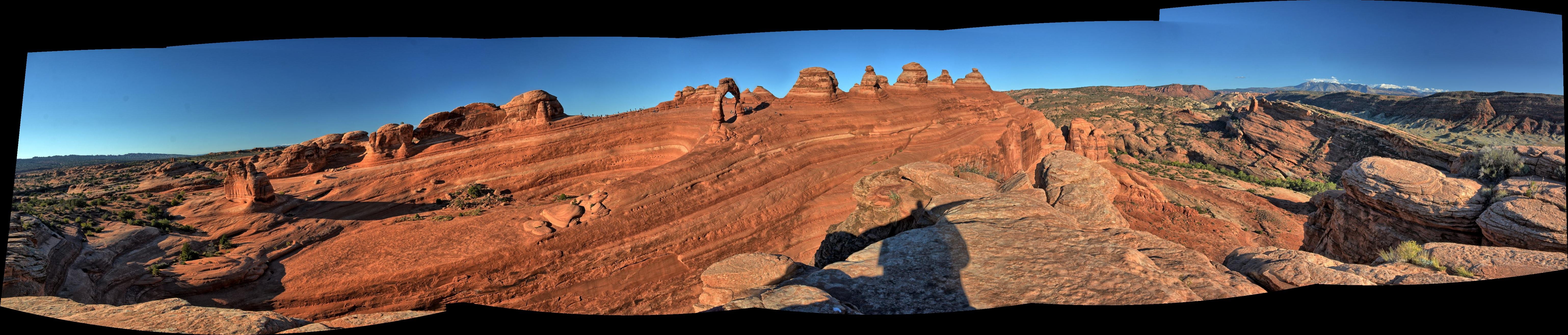
The trail shown here is the normal trail to
reach Delicate Arch, and then it follows a
seldom-followed path to the bowl below the arch,
then to some cliffs on the south side of the
arch, and then back across some slick rock to
rejoin the normal trail back to the parking lot.
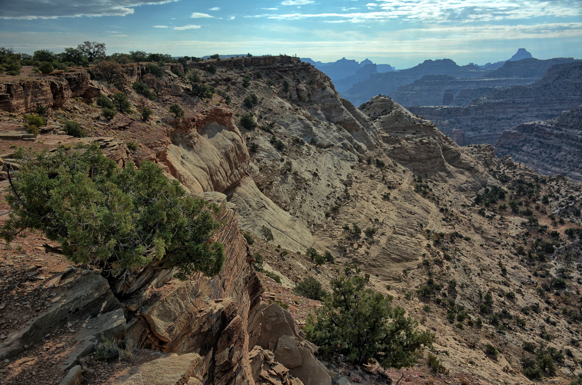
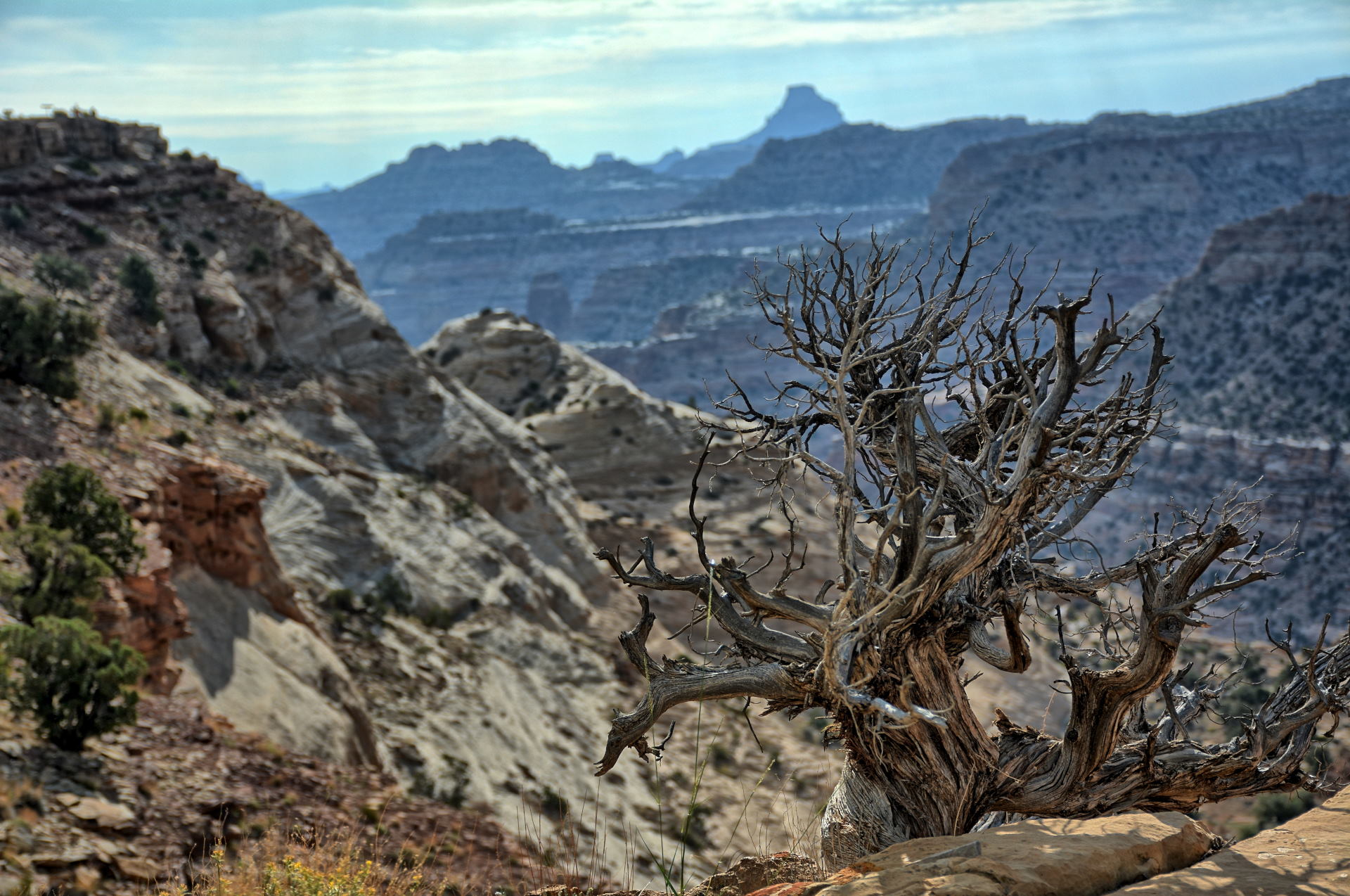
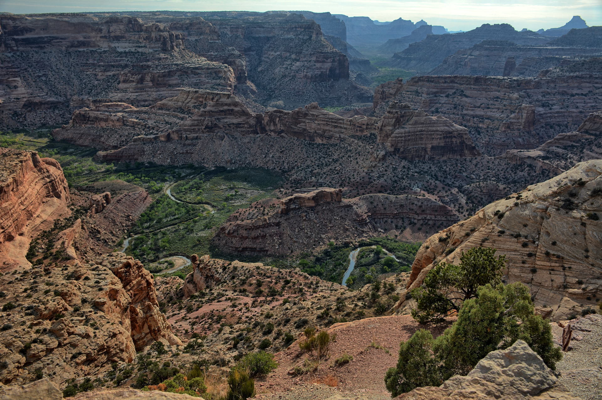
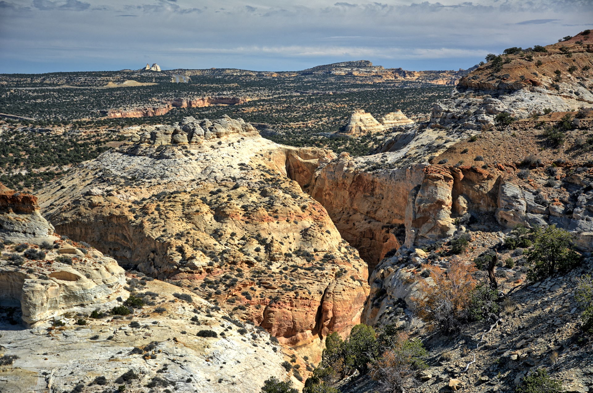
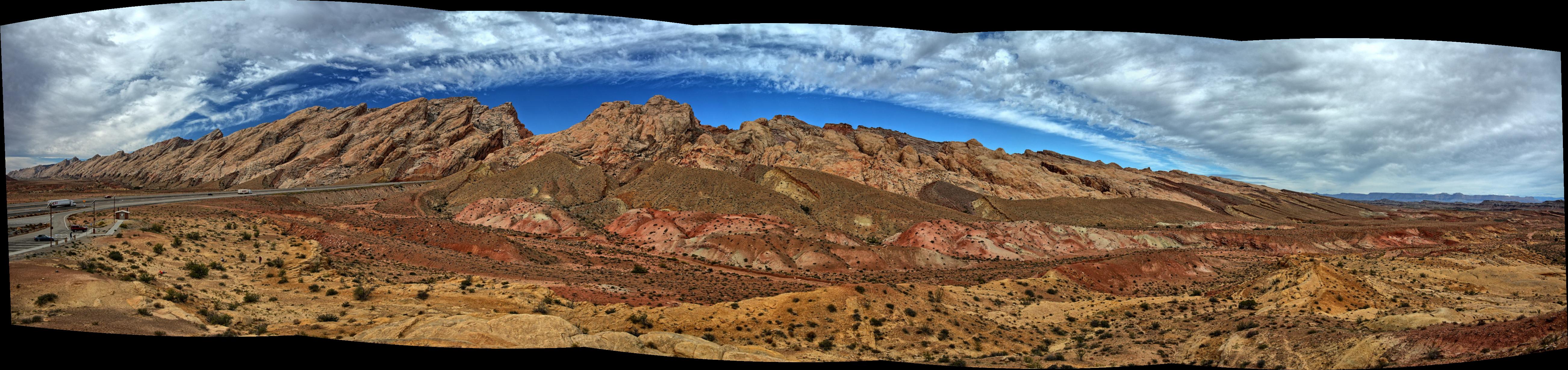
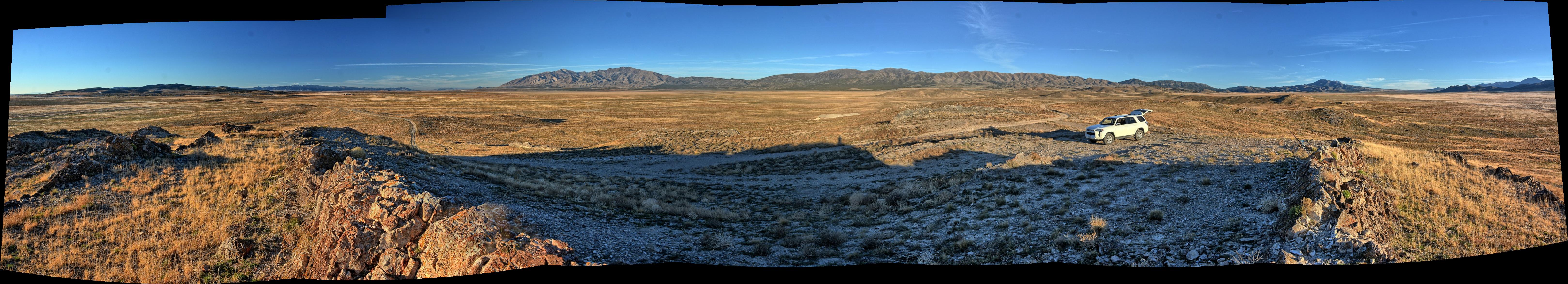
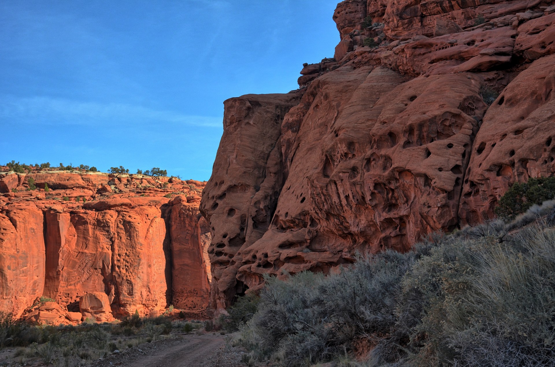
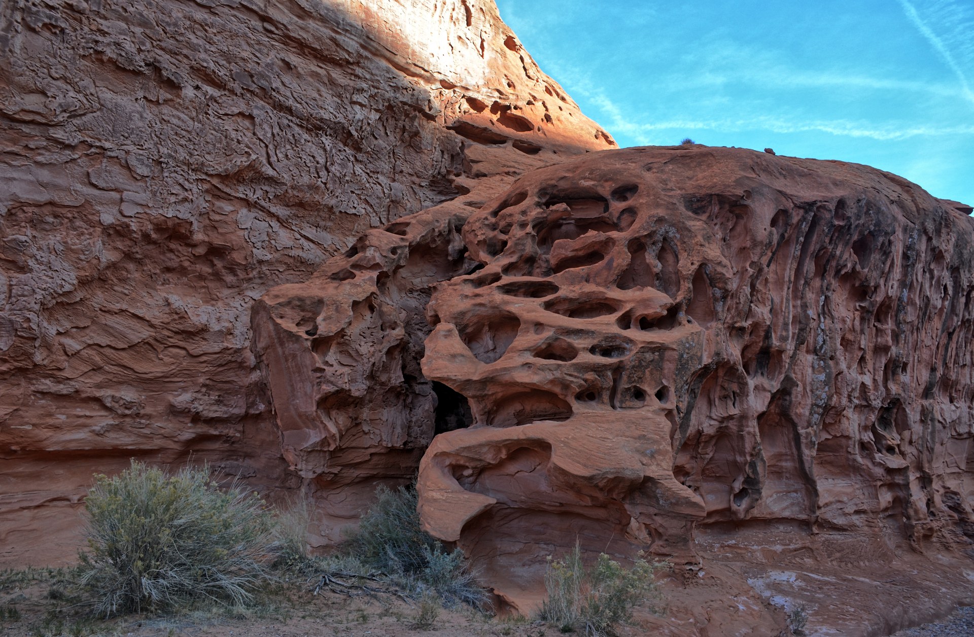
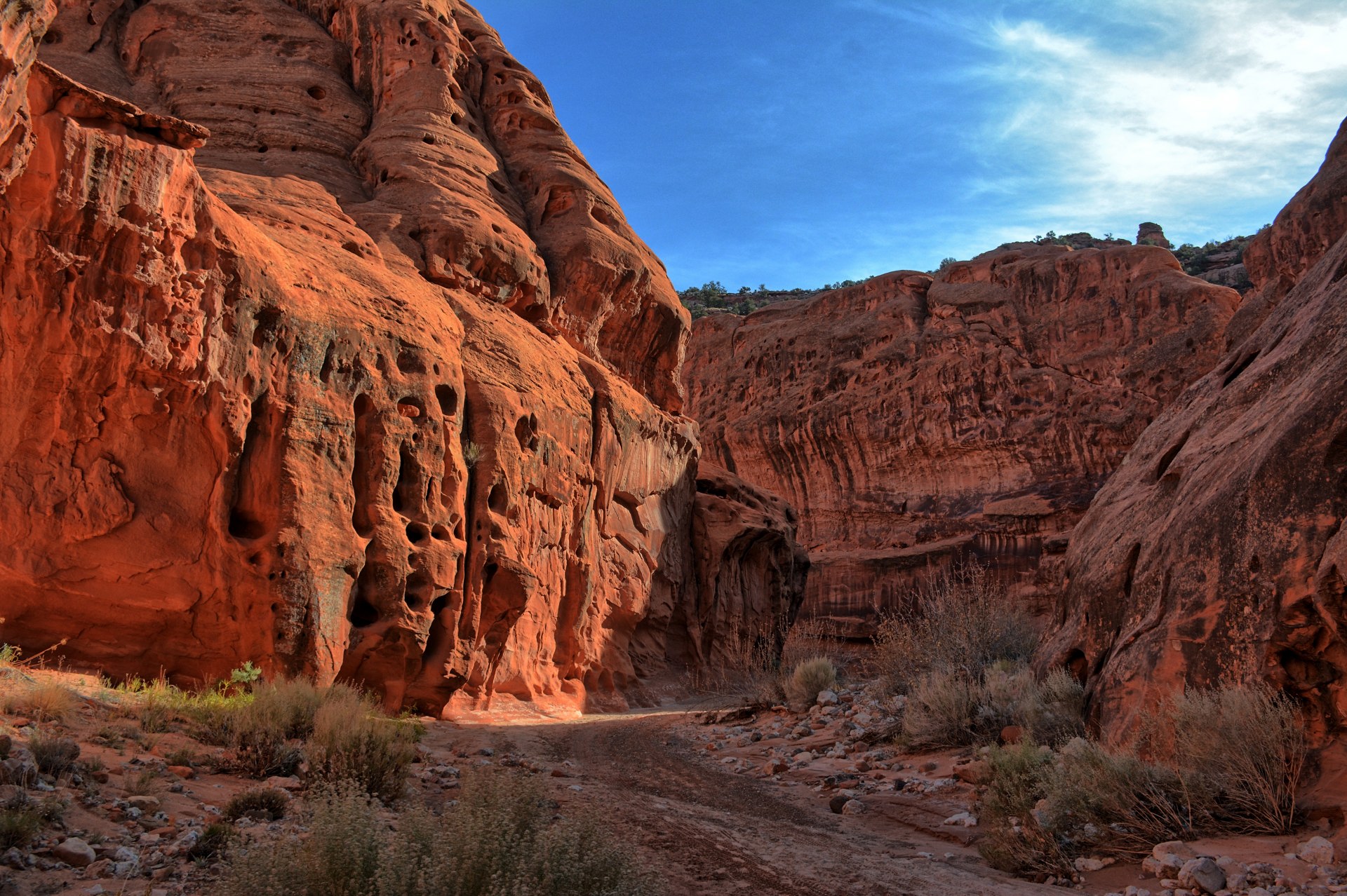
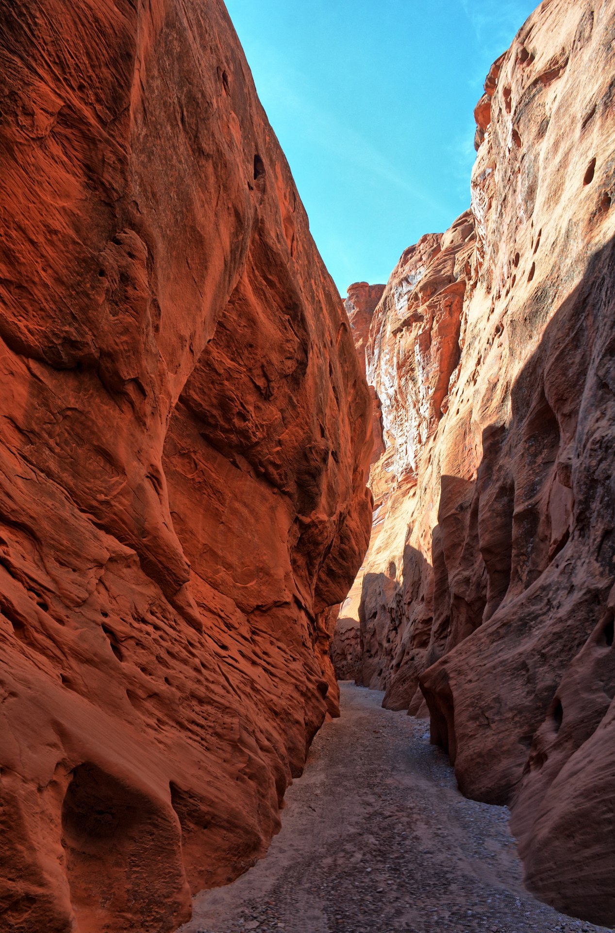
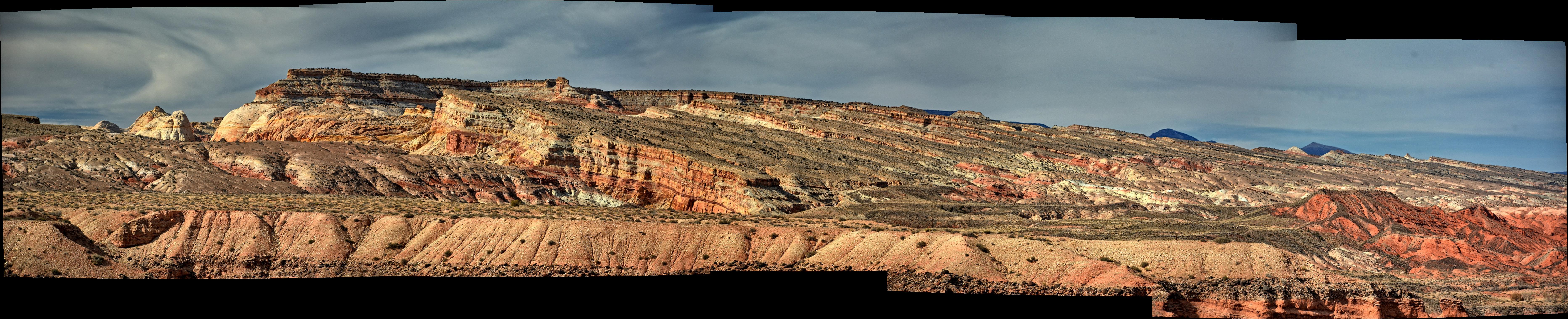
Chris decided to relax on this day, slowly driving back to
Dugway while crossing the San Rafael Swell on I-70. He left the
Interstate for a short drive out to Crawford Draw slot canyon,
which he
had hiked in 2018. He did not hike the slot canyon this time, but he knew
that it was remote and would provide a good place to test his new camera quadcopter,
a Hubsan Zino Pro Plus. He test flew that quadcopter, and also flew his flying wing at
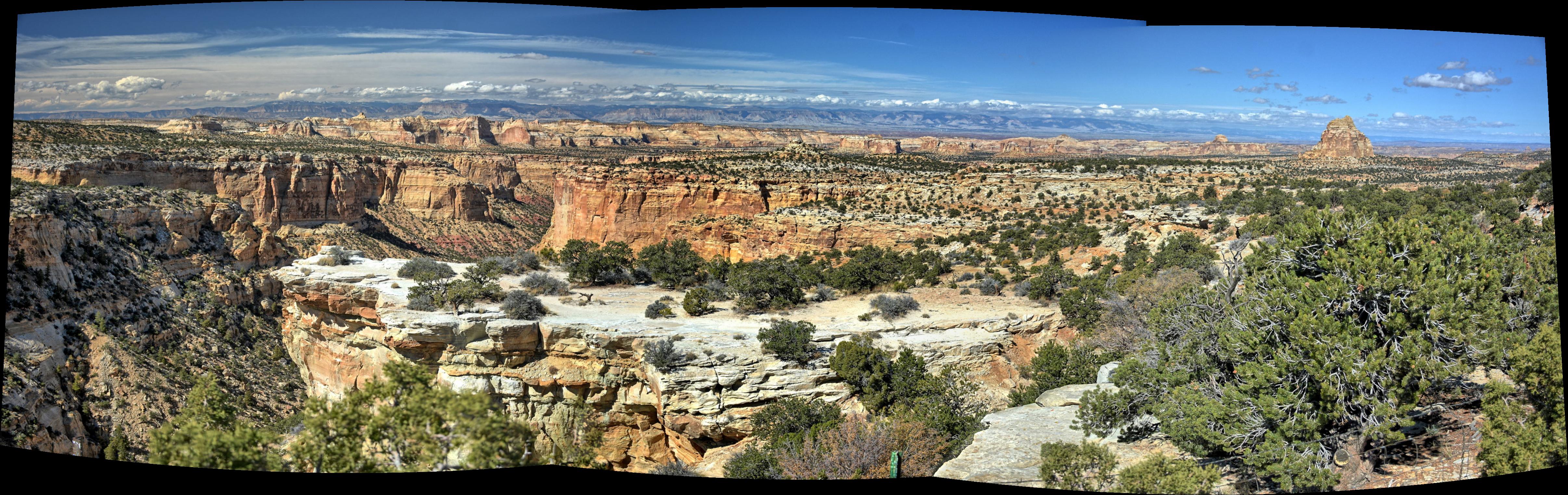
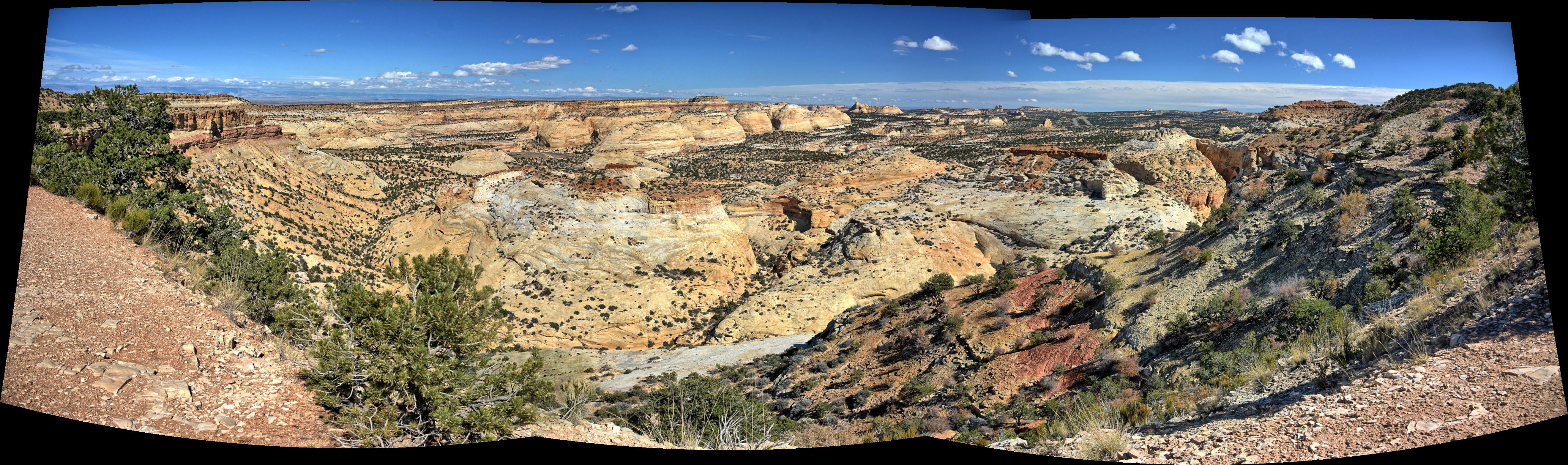
Crawford Draw. He then drove on across the San Rafael Swell, stopping at most of
the viewpoints along I-70 (viewpoint
#1,
viewpoint #2,
viewpoint #3,
viewpoint #4) to get photos. He stopped in Nephi for dinner, and drove
back to Dugway via the unpaved Pony Express Route over Lookout Pass. This
is a shorter route to Dugway when coming from the south, than
the normal paved Johnson Pass route, so Chris wanted to see if the road was in
good condition for all the weekend trips he would be taking to the south over
the next several weeks. The first part of the road was in good shape, but
later sections had washout due to rain, so this was the only time Chris
used this 'short-cut' during the whole trip. Chris checked into the post hotel
on Dugway, where he stayed for the remainder of the entire flight test series.
Dugway flight test continued on both programs. Friends from
other flight test programs (from other companies) were also on Dugway for there
own flight tests, and they visited and planned for hikes the next weekend.
On Friday night, Chris and a friend shared a bottle of wine and chips with salsa in the hotel
lobby and prepared for a weekend visit to Bryce Canyon National Park.
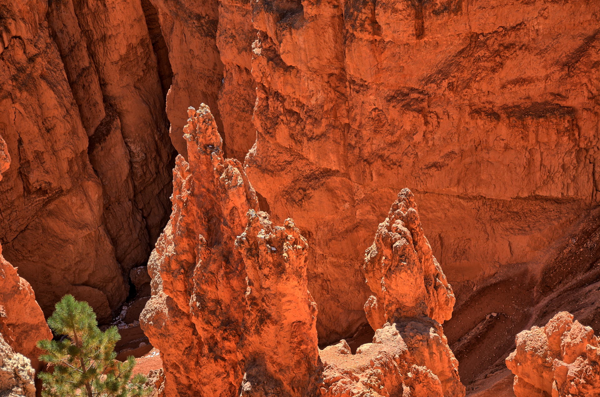
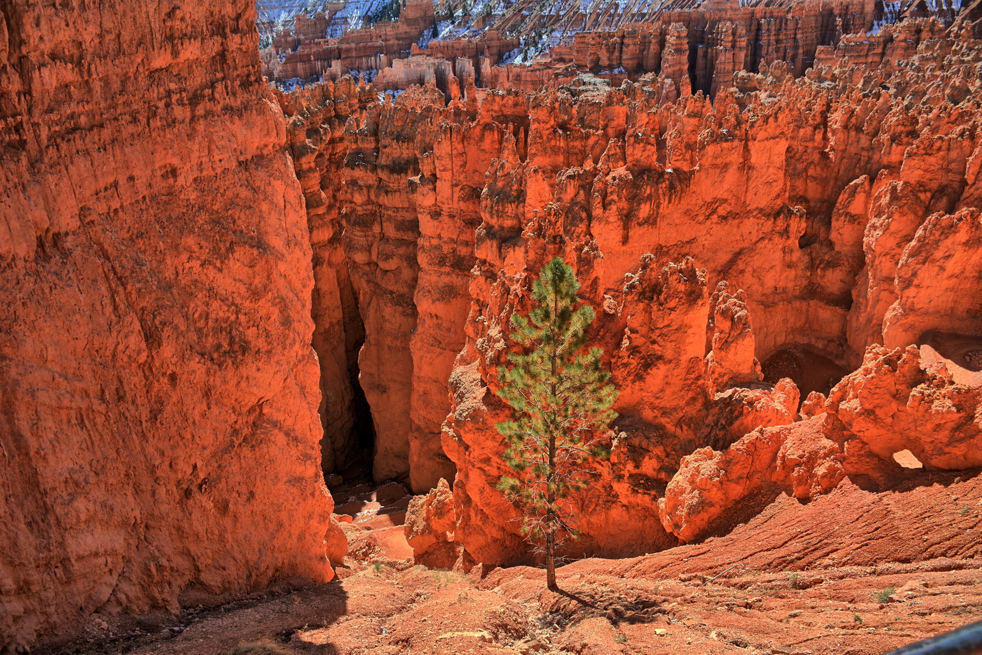
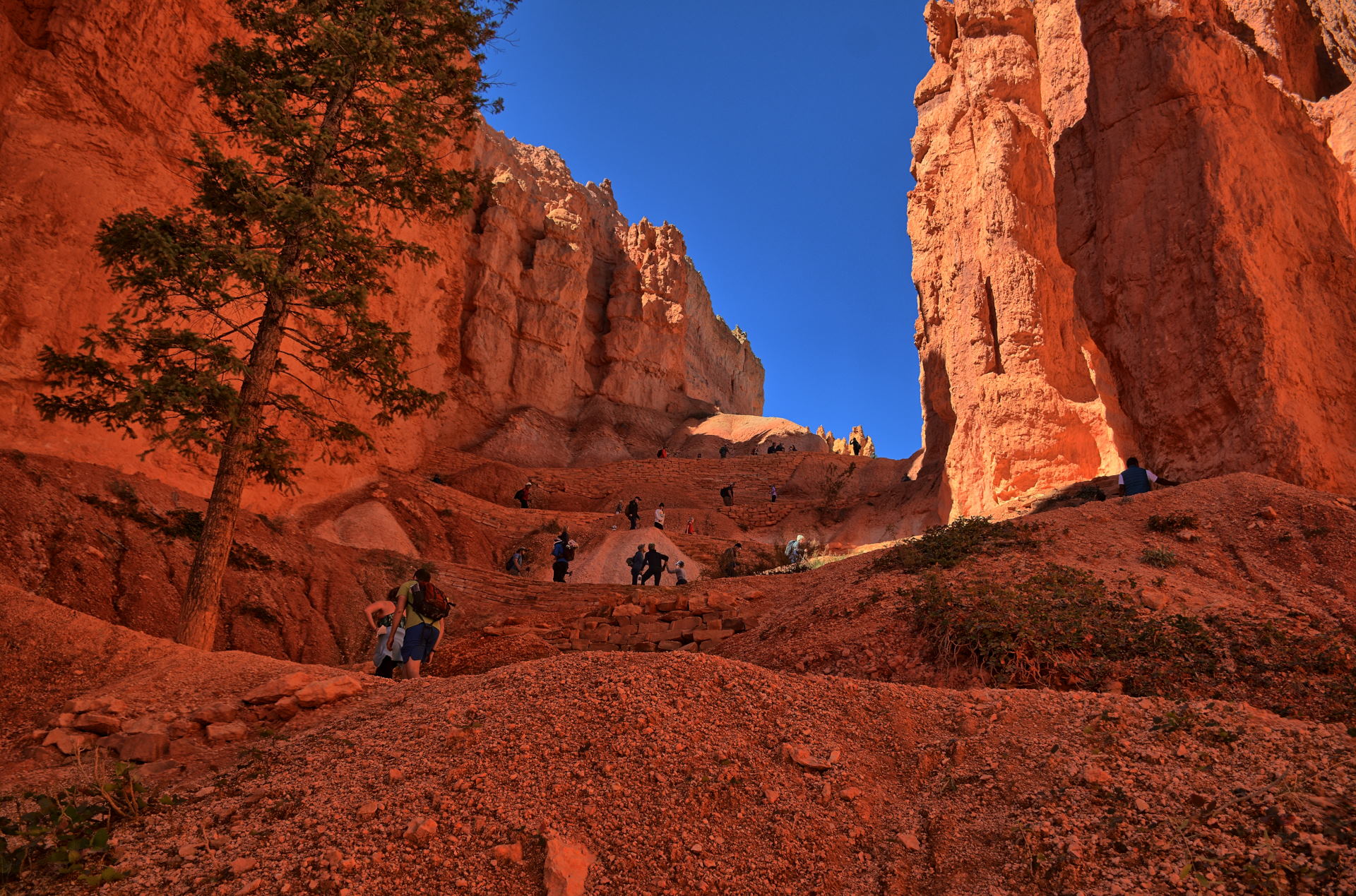
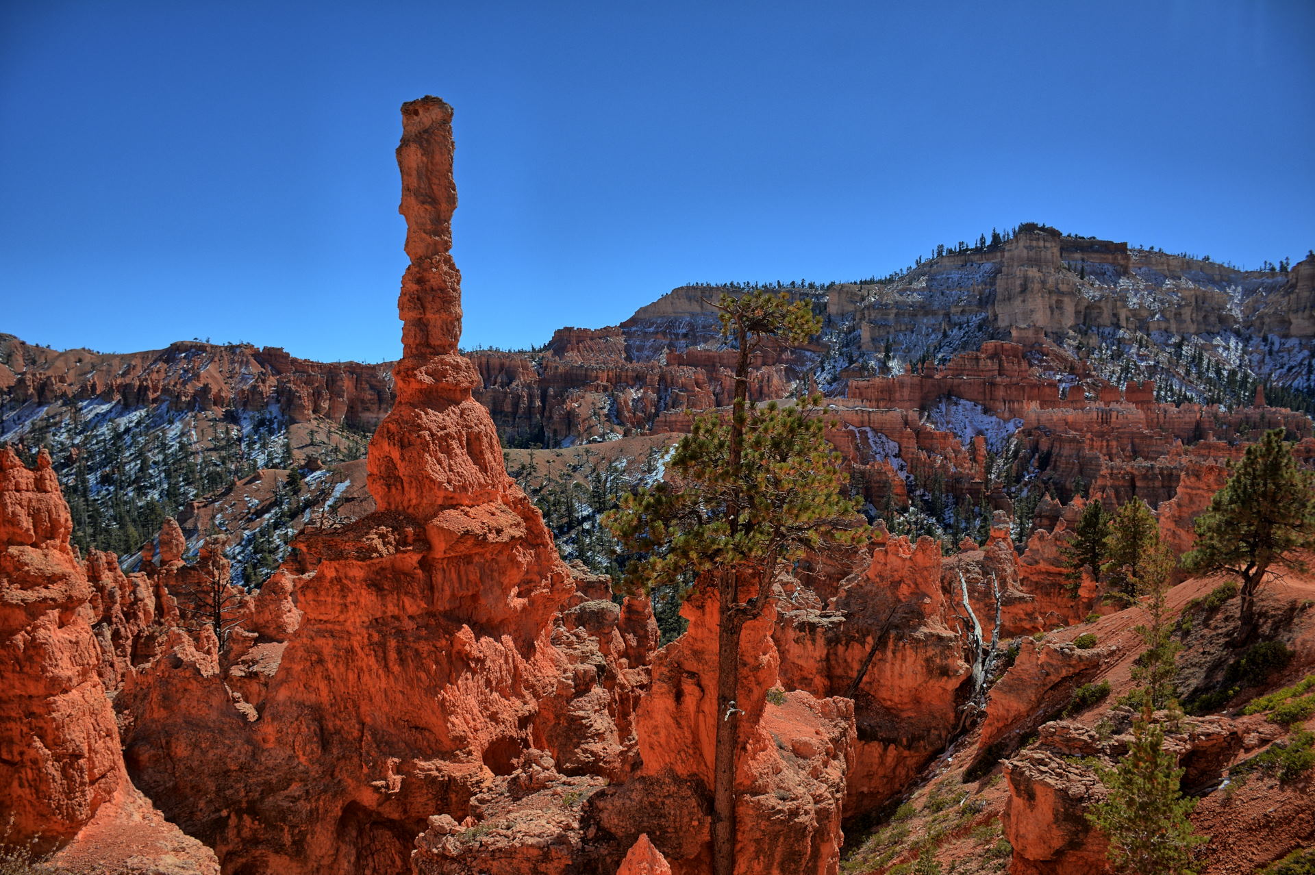
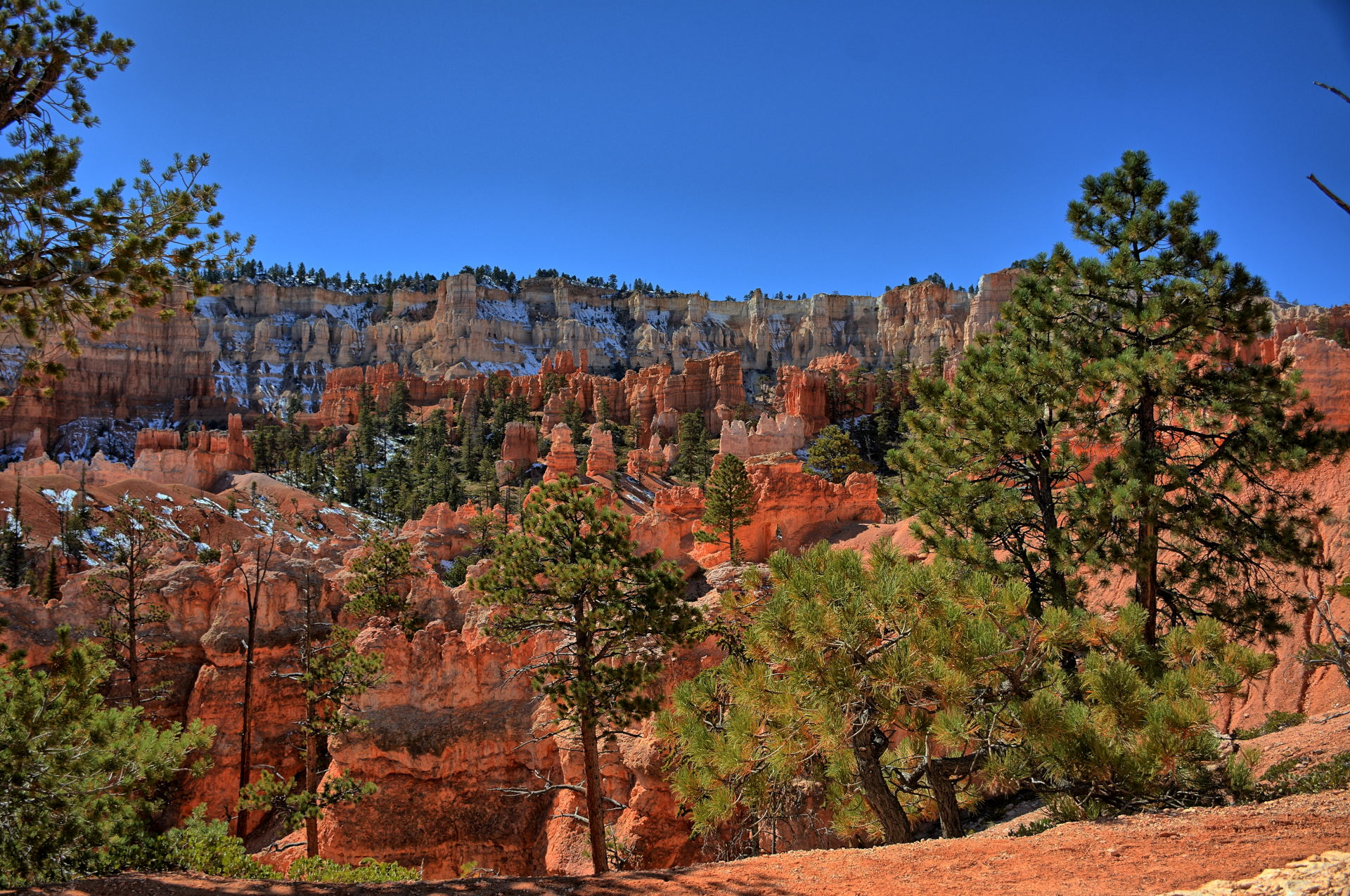
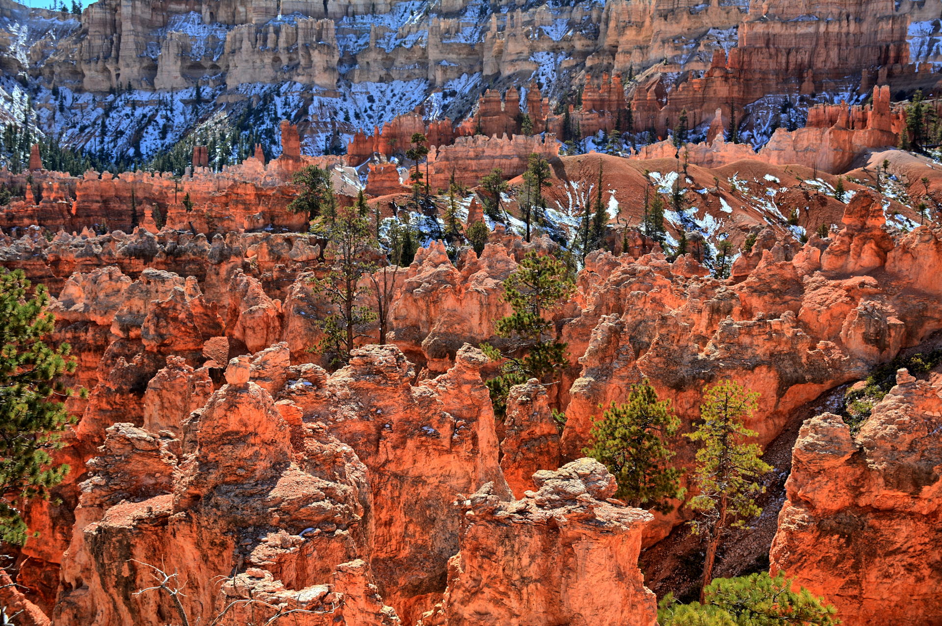
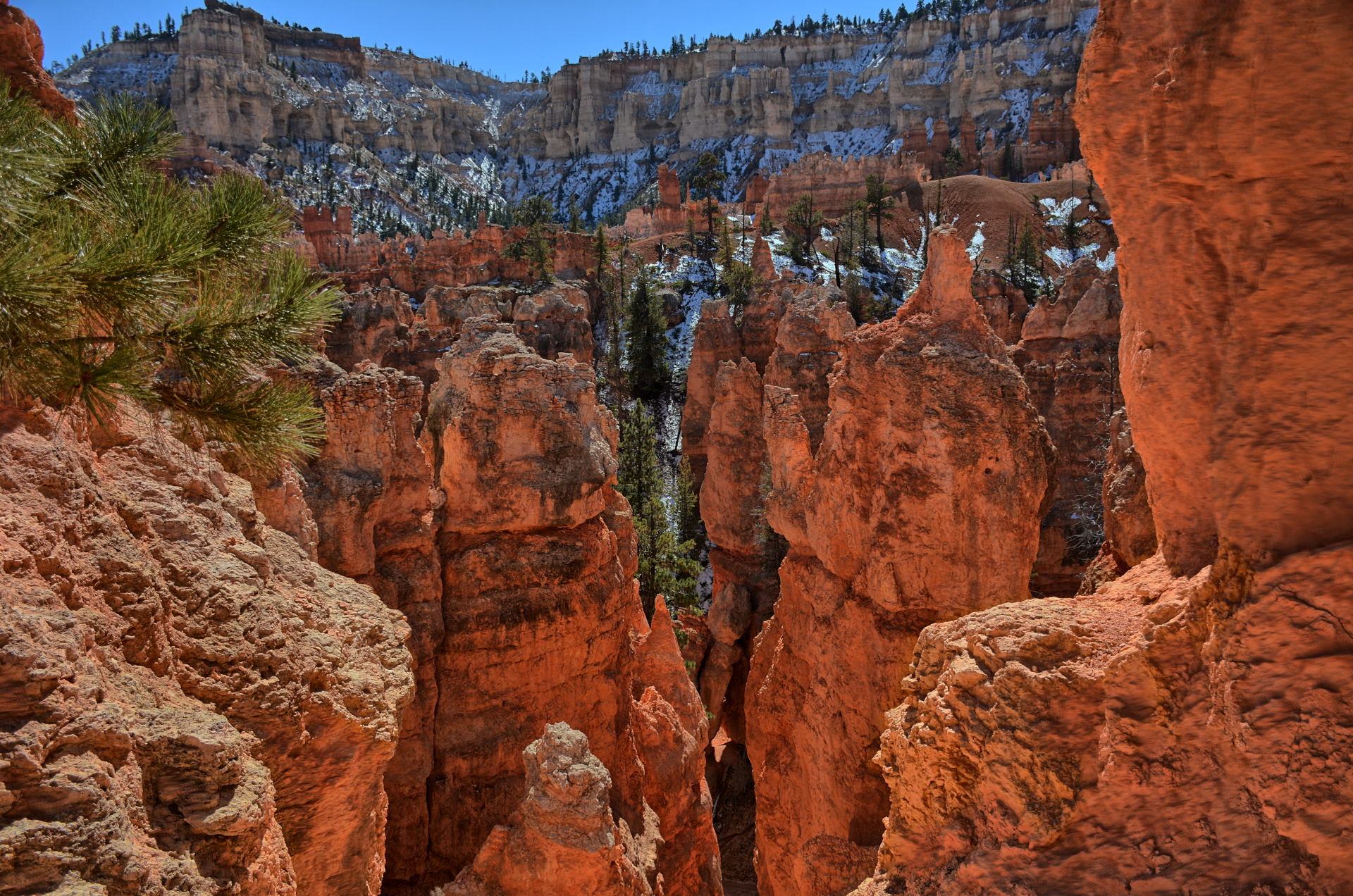
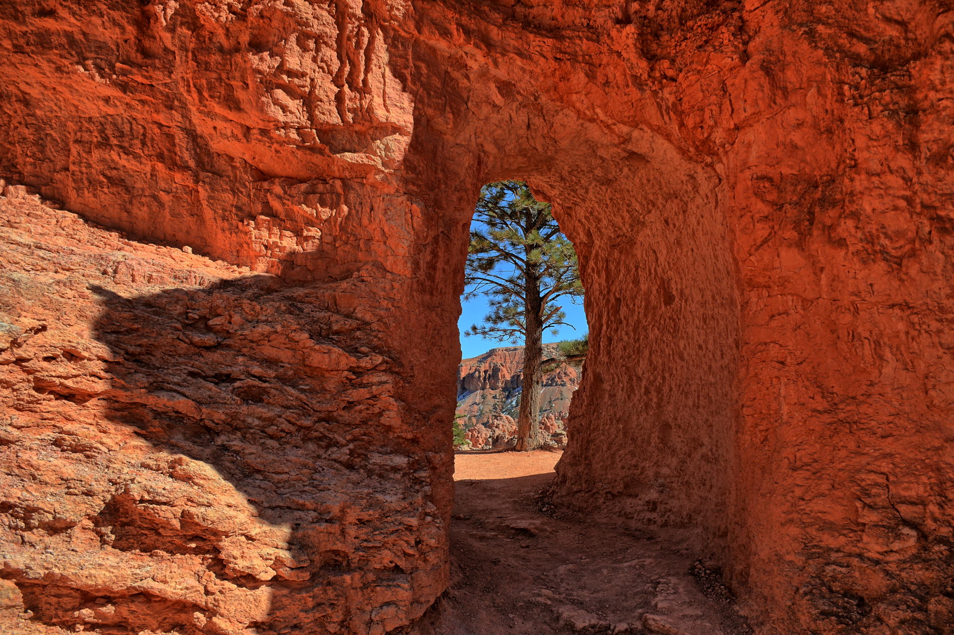
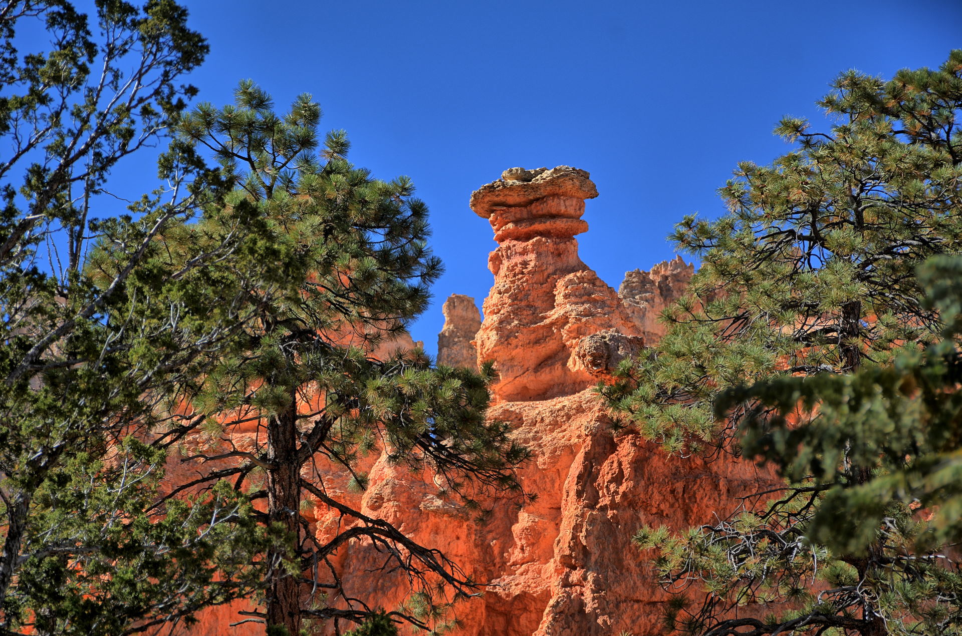
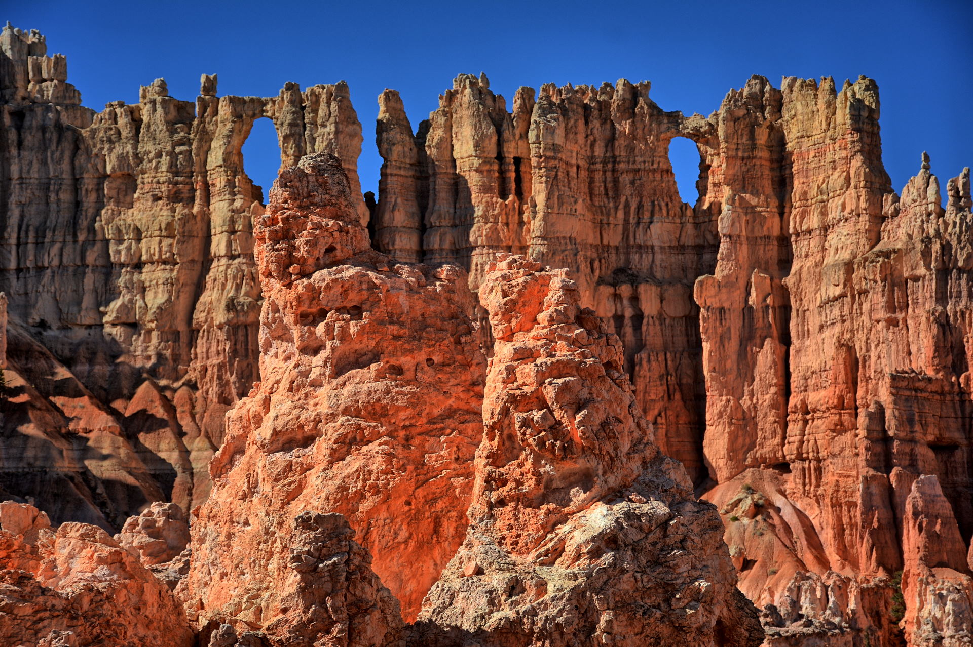
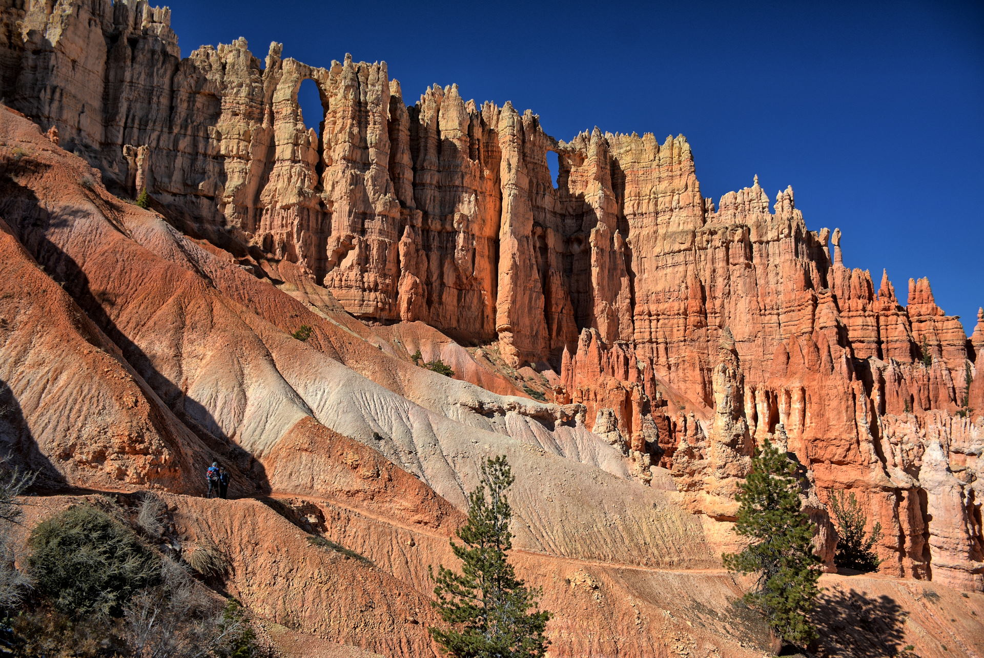
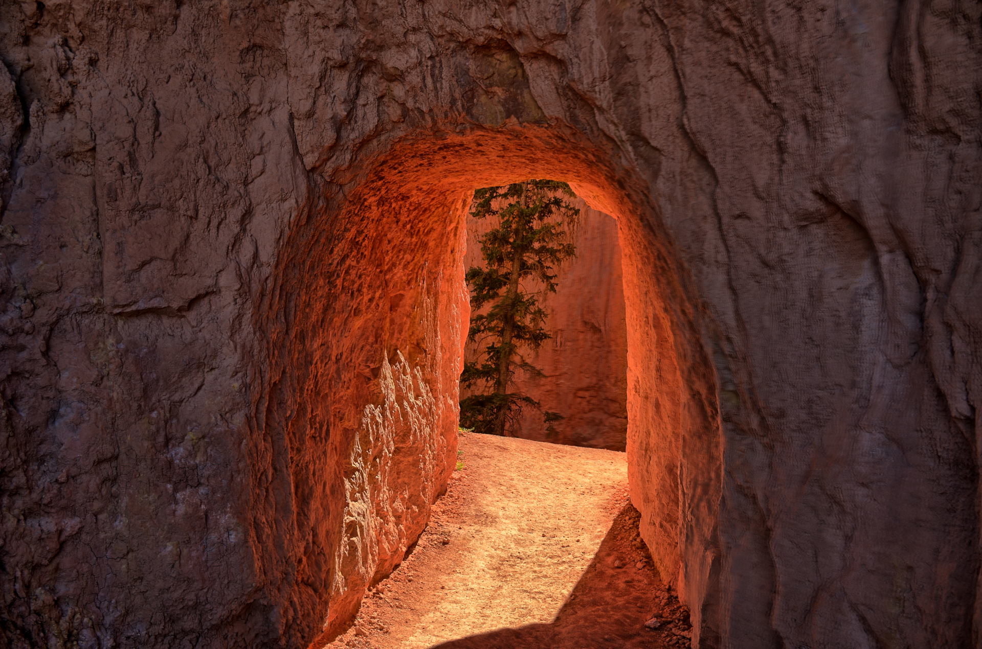
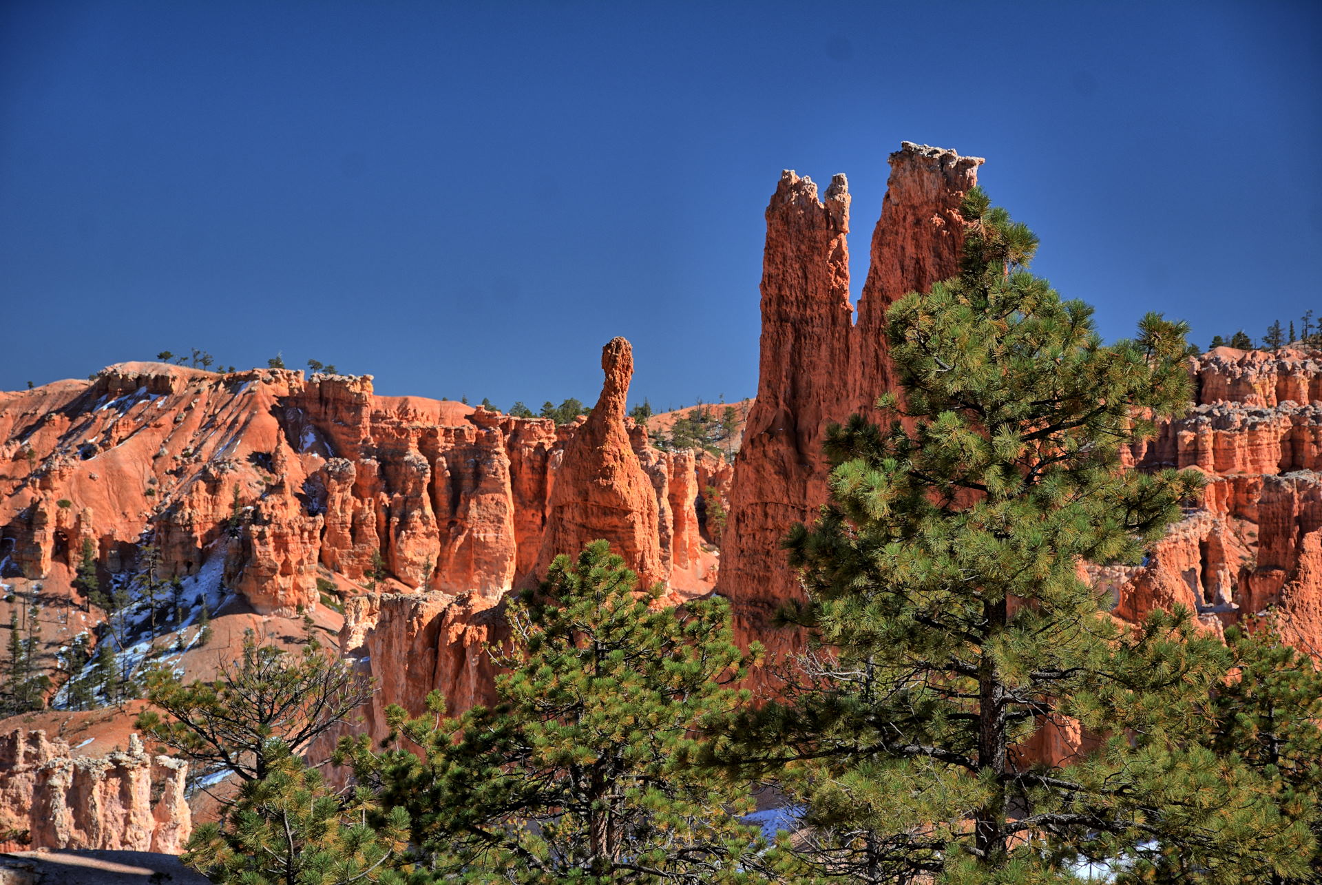
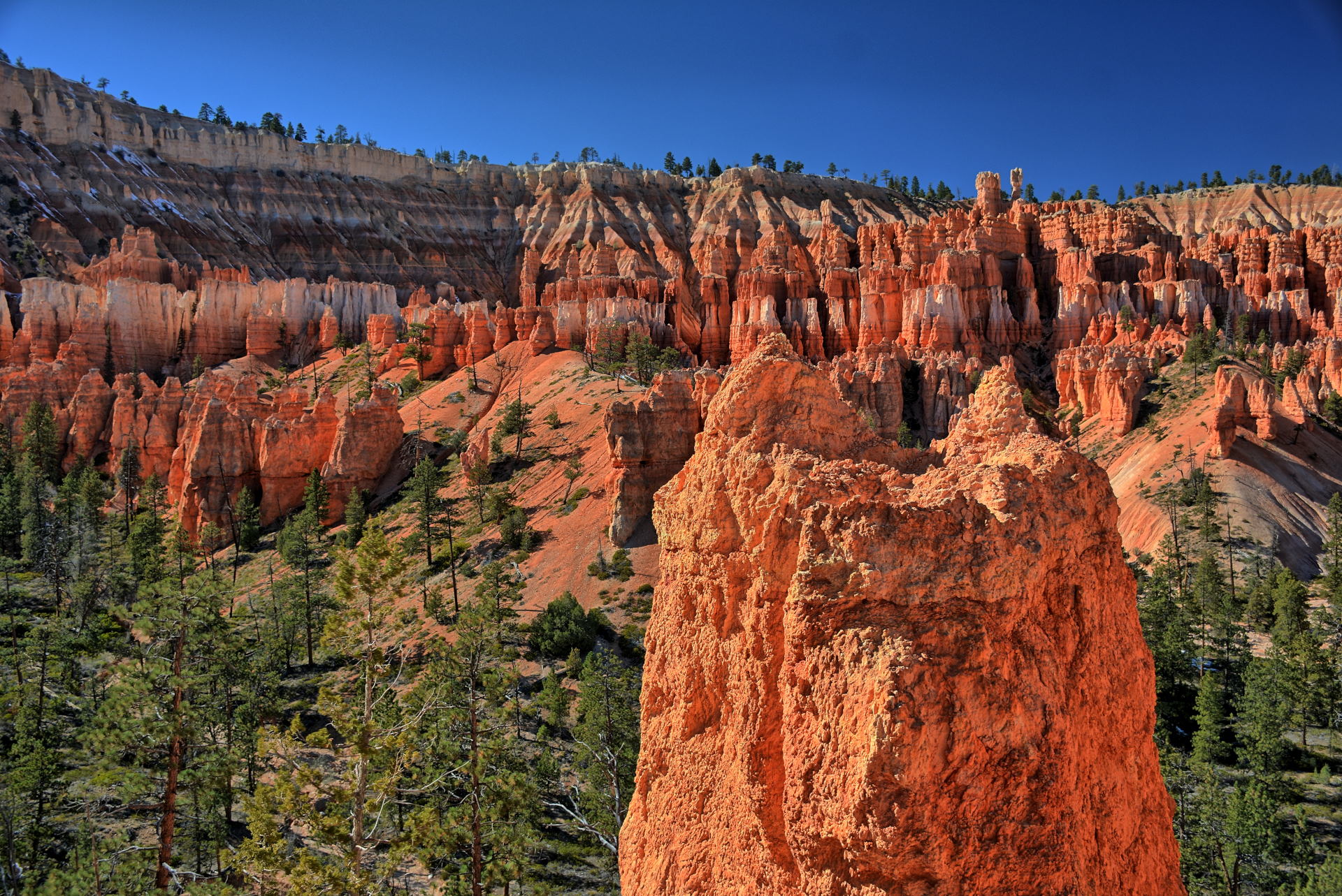
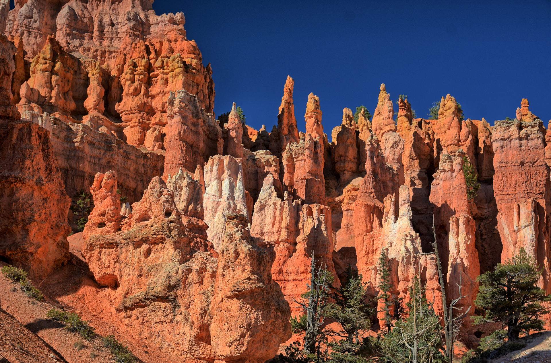
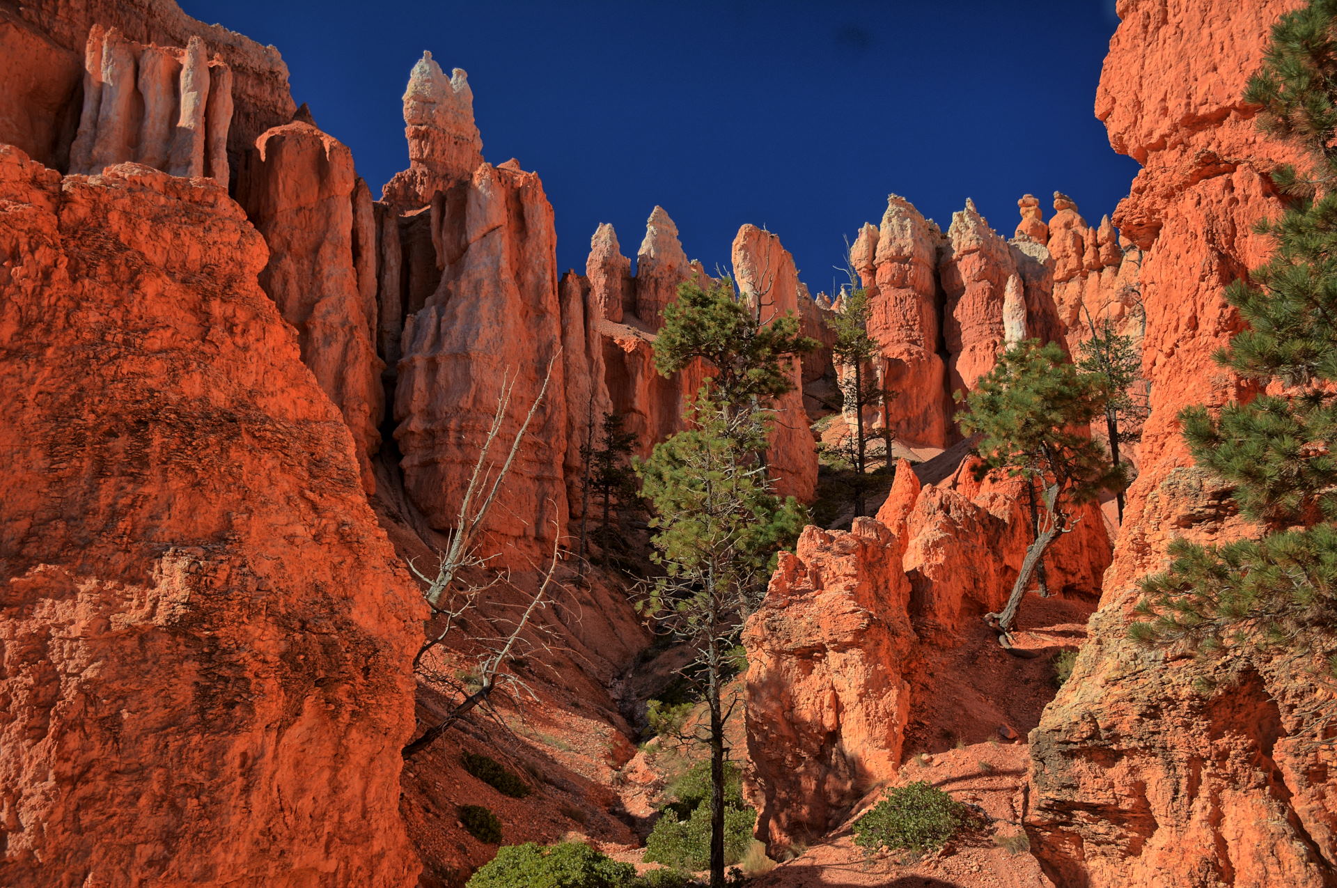
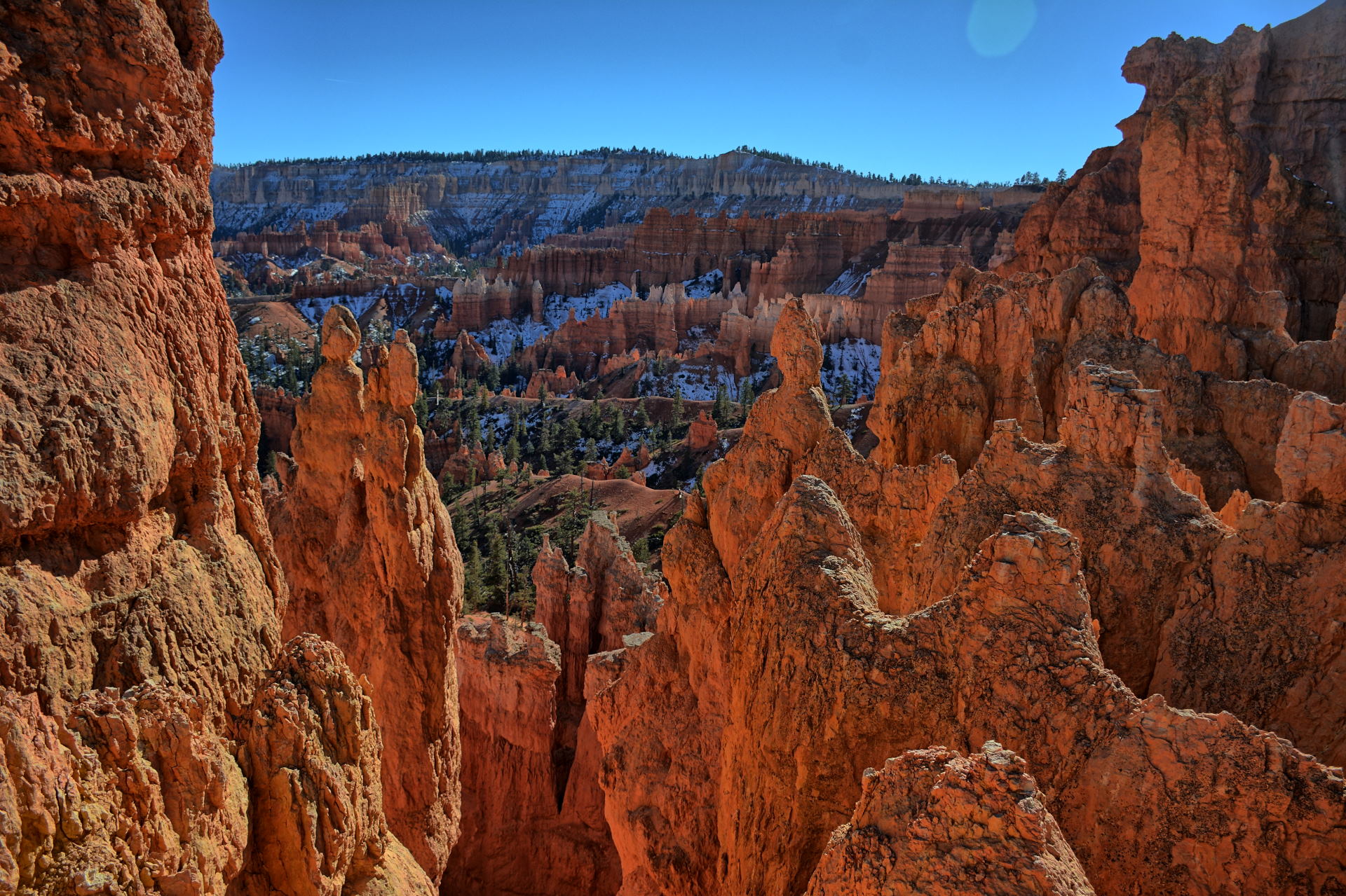
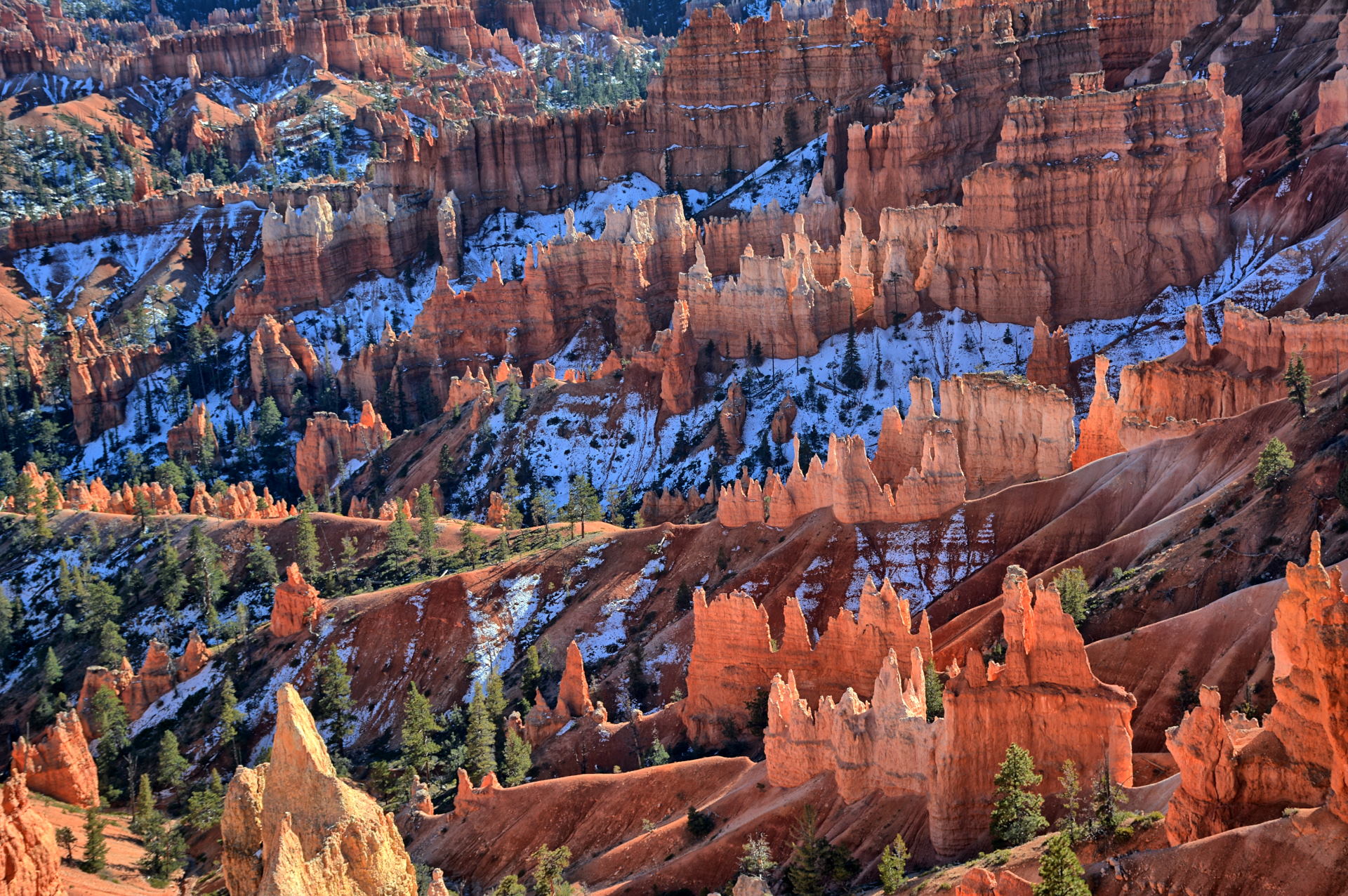
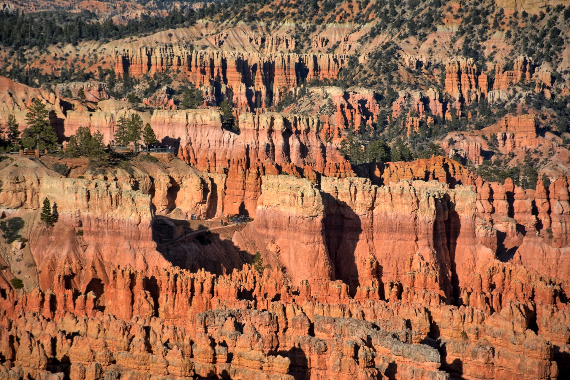
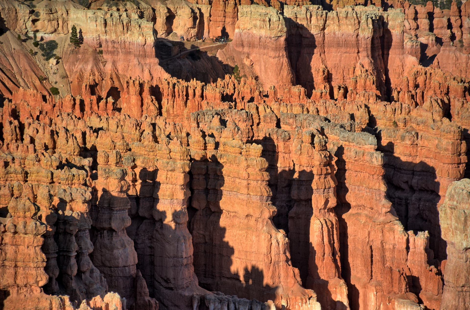
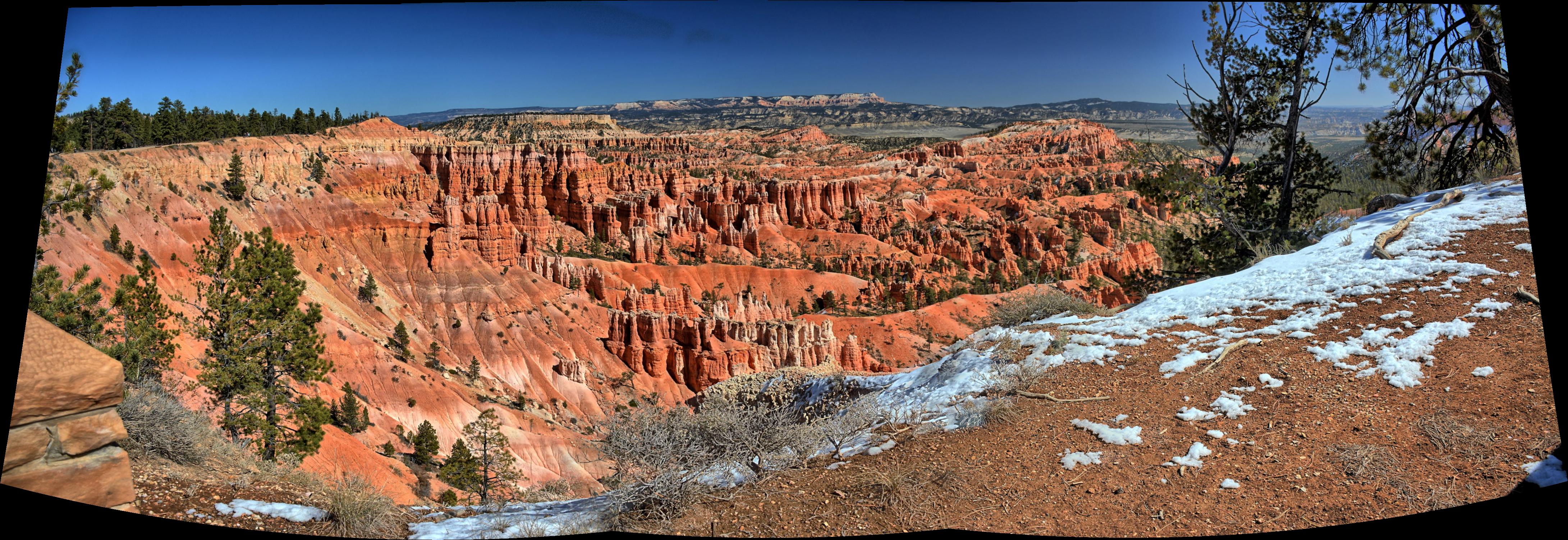
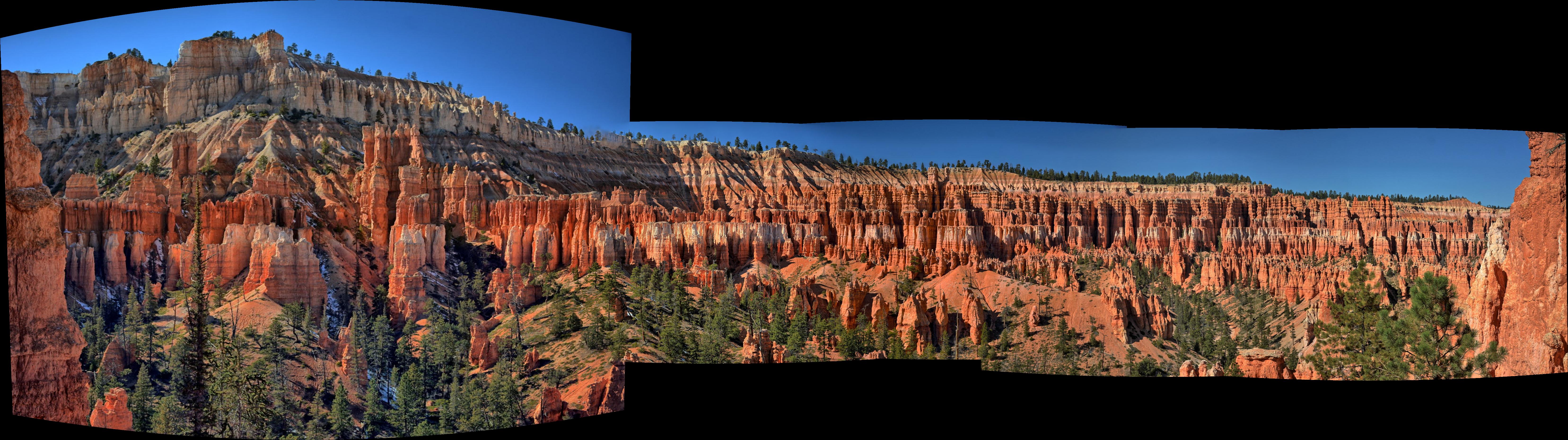
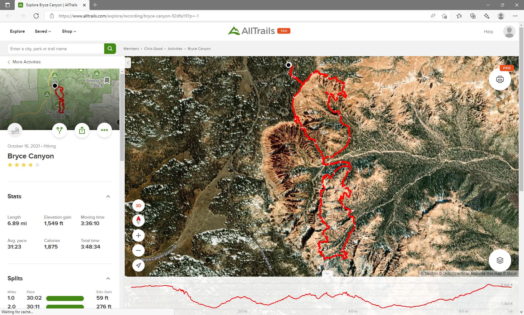
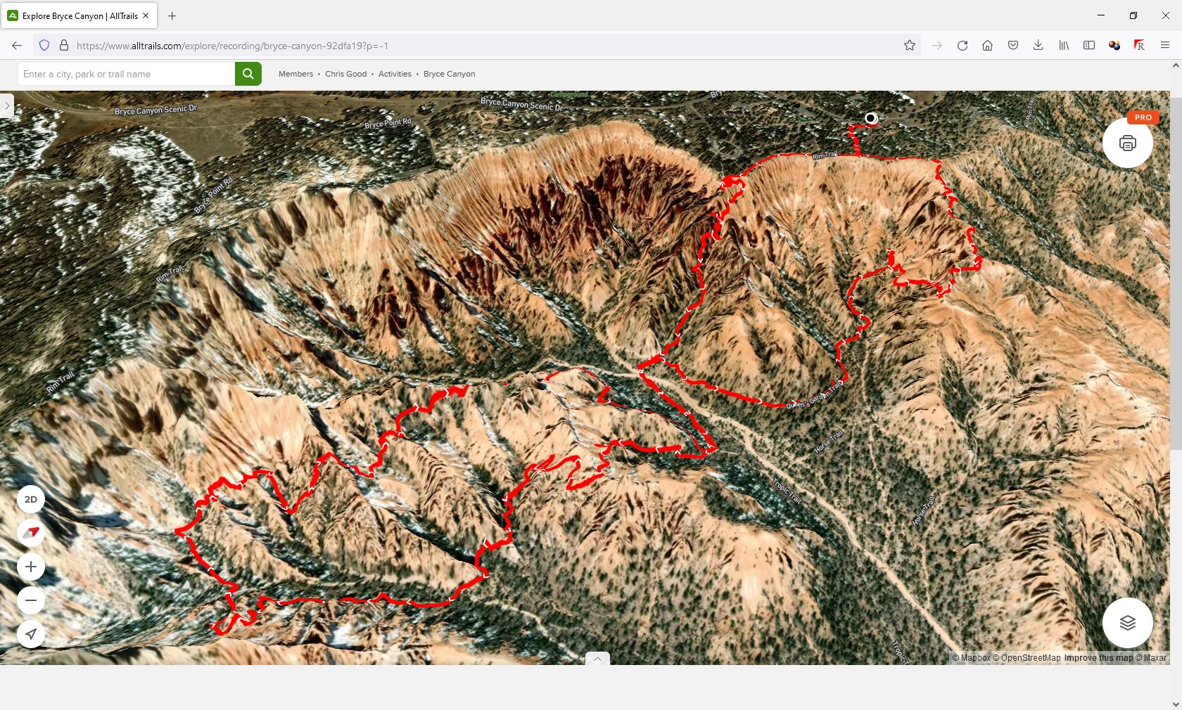
Saturday, 16 Oct
Chris and his friend drove to Bryce Canyon National Park,
where they hiked Sunset Point to
Navajo Loop-Two Bridges to Peekaboo Canyon Loop to Queens
Garden to Sunrise Point. The hike was 7 miles long and 1550 feet of vertical gain.
They had both reserved rooms at Bryce View Lodge in Bryce City for the night.
Chris' friend was playing the whole COVID infection possibility very carefully,
so he declined dinner at Ruby's, but that food was too good to pass up after a
long day hiking, so Chris had dinner at Ruby's on Saturday night.
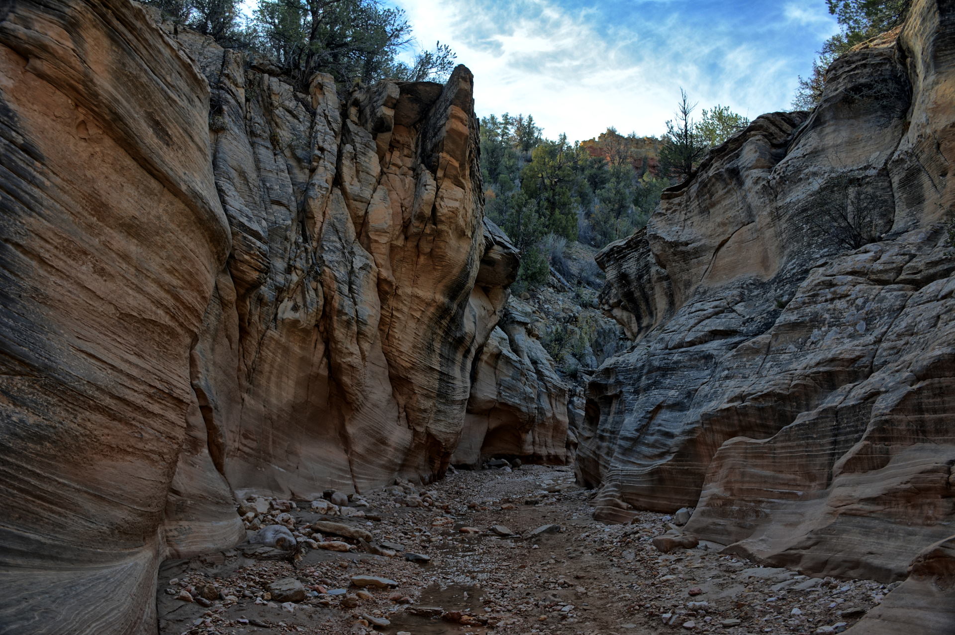
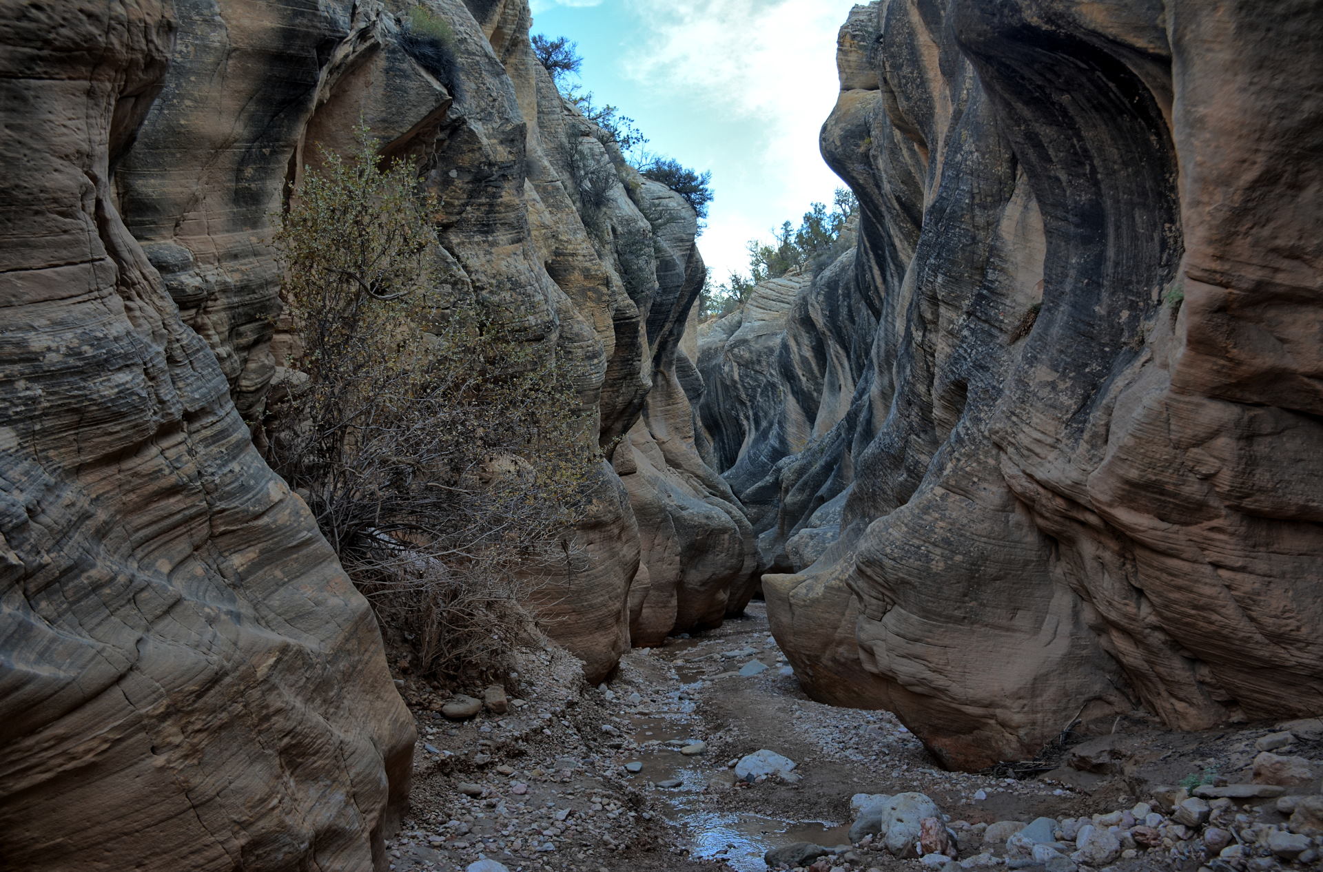
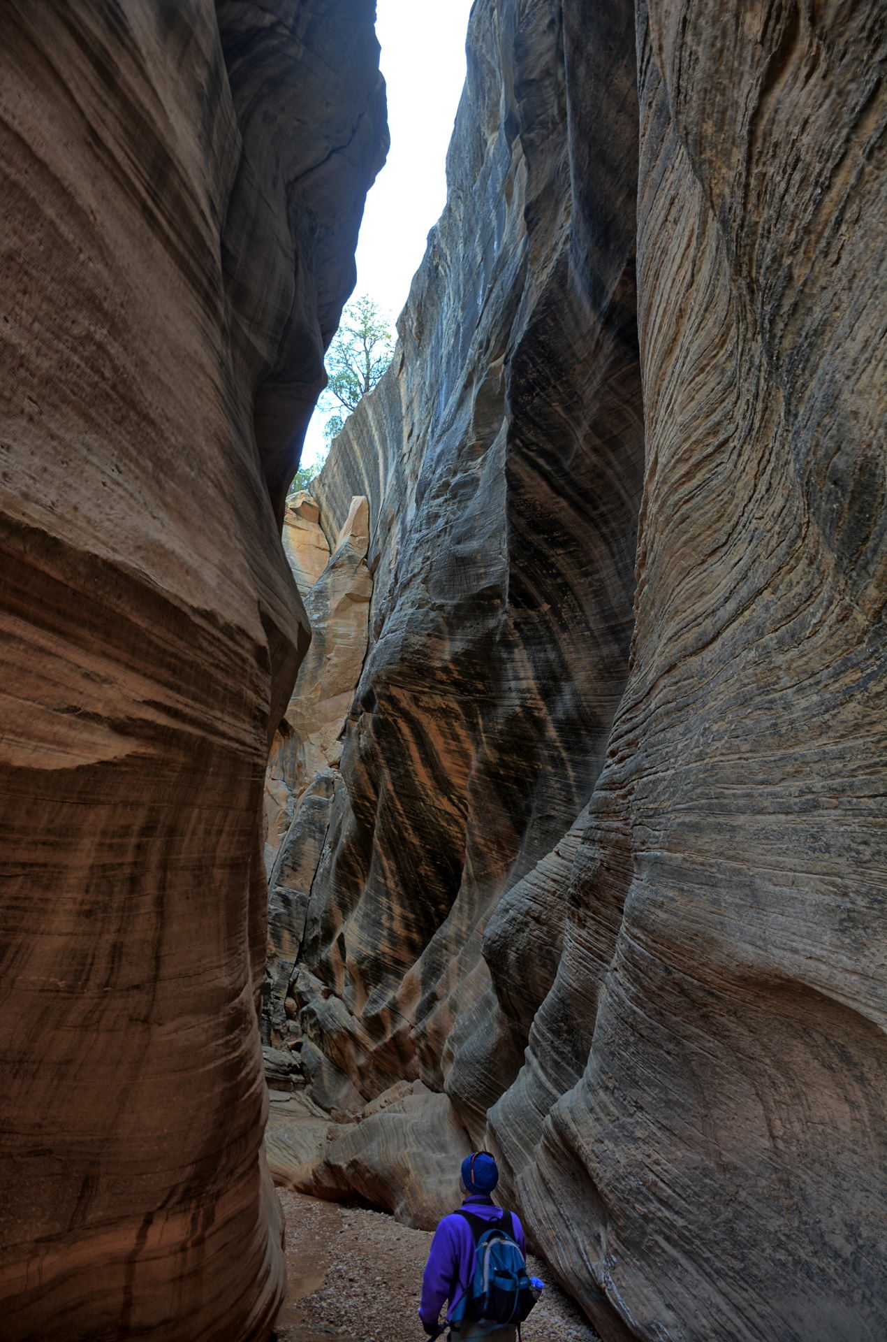
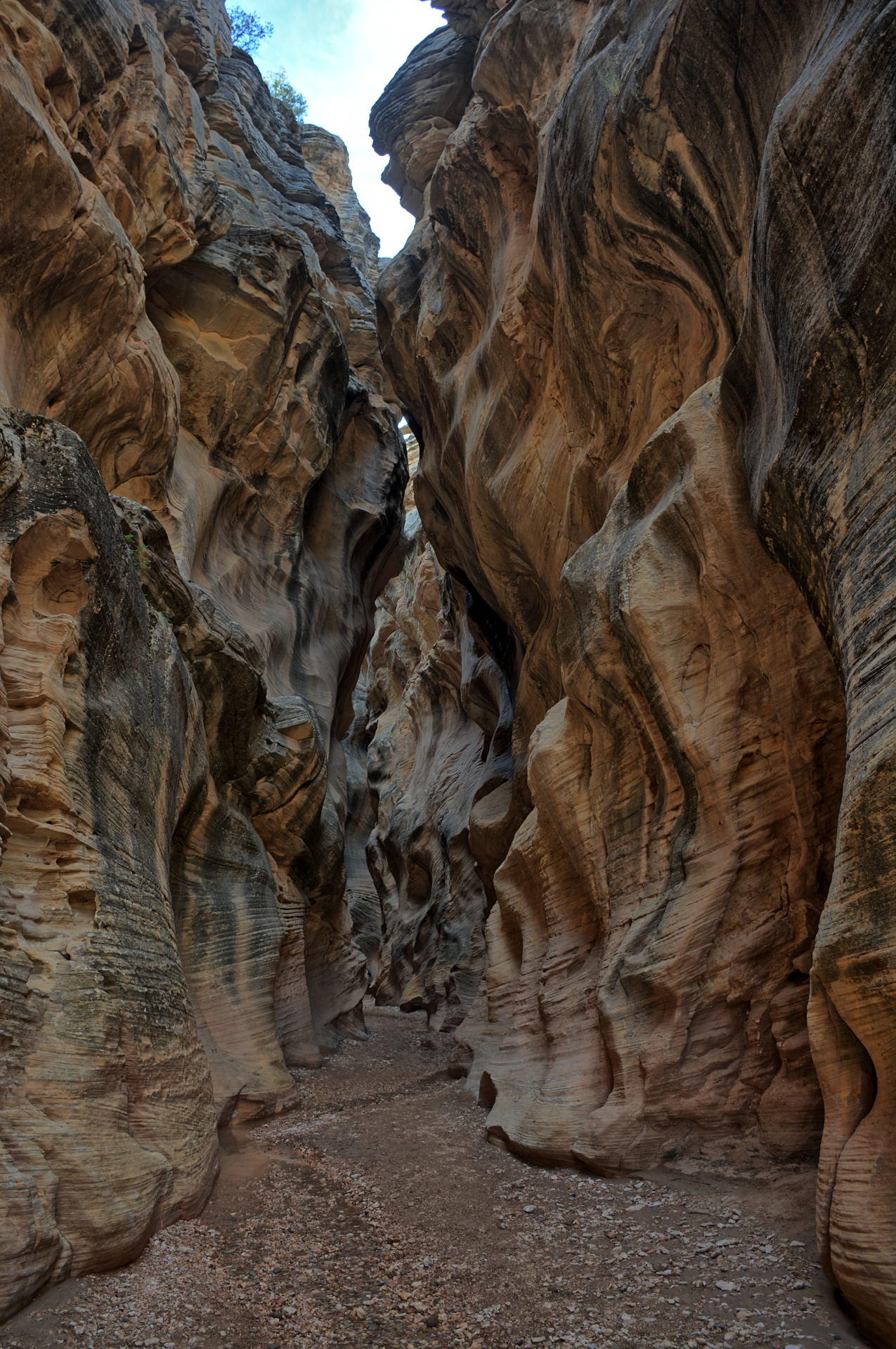
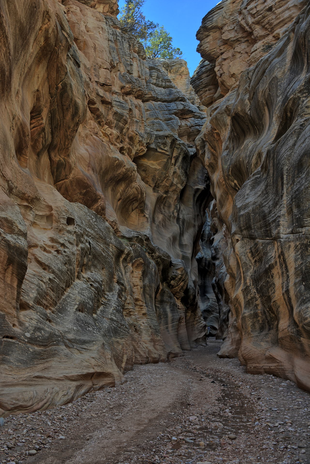
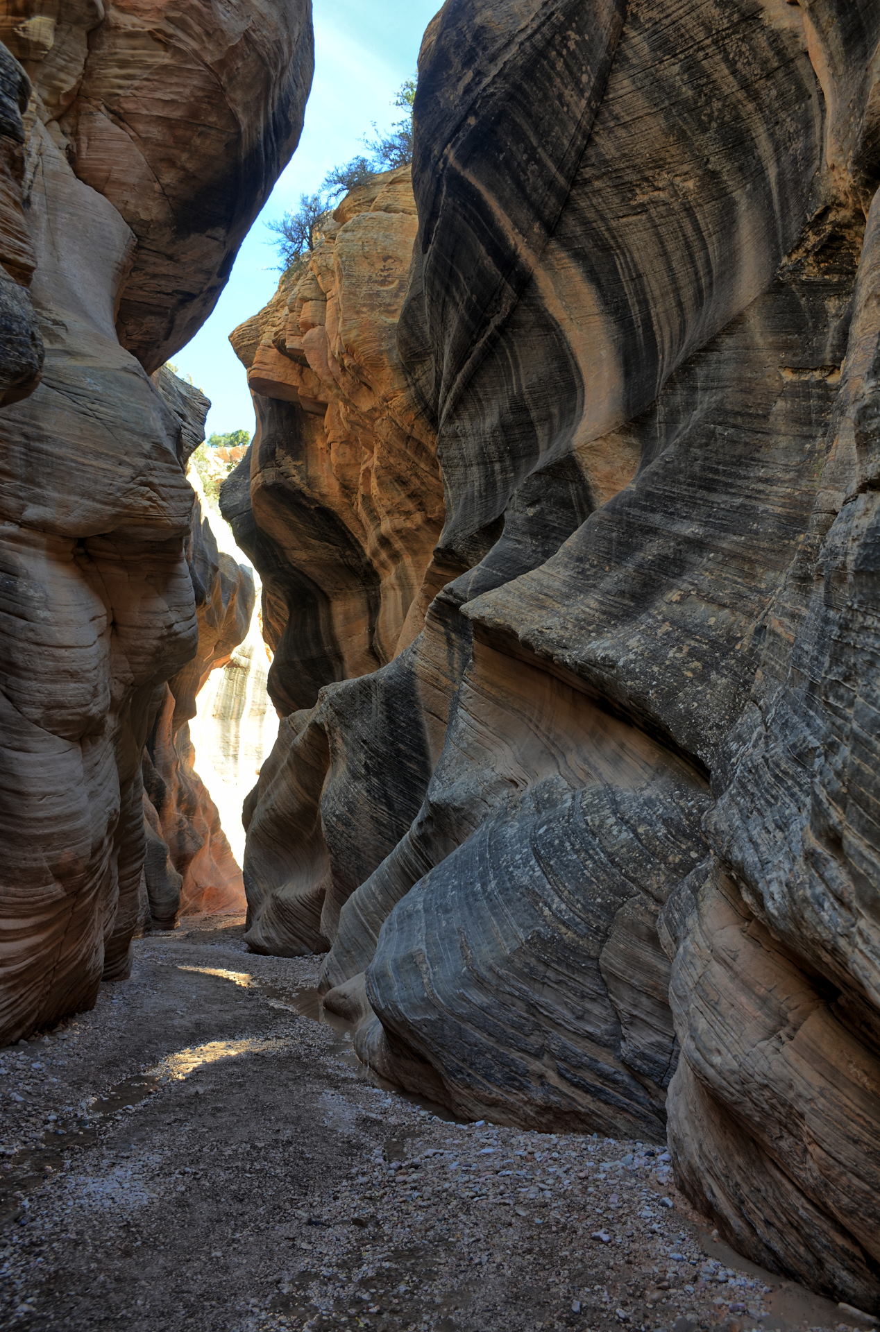
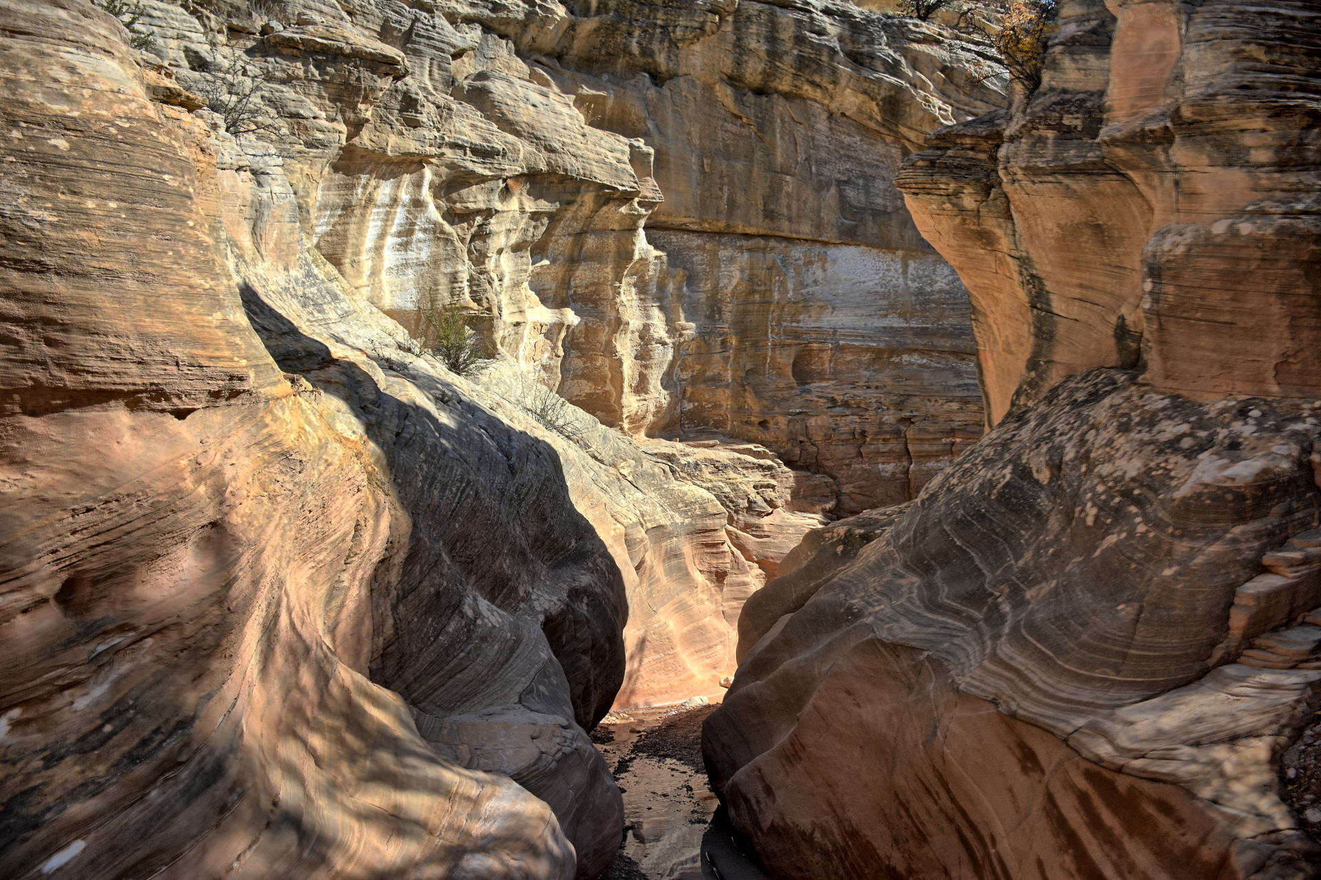
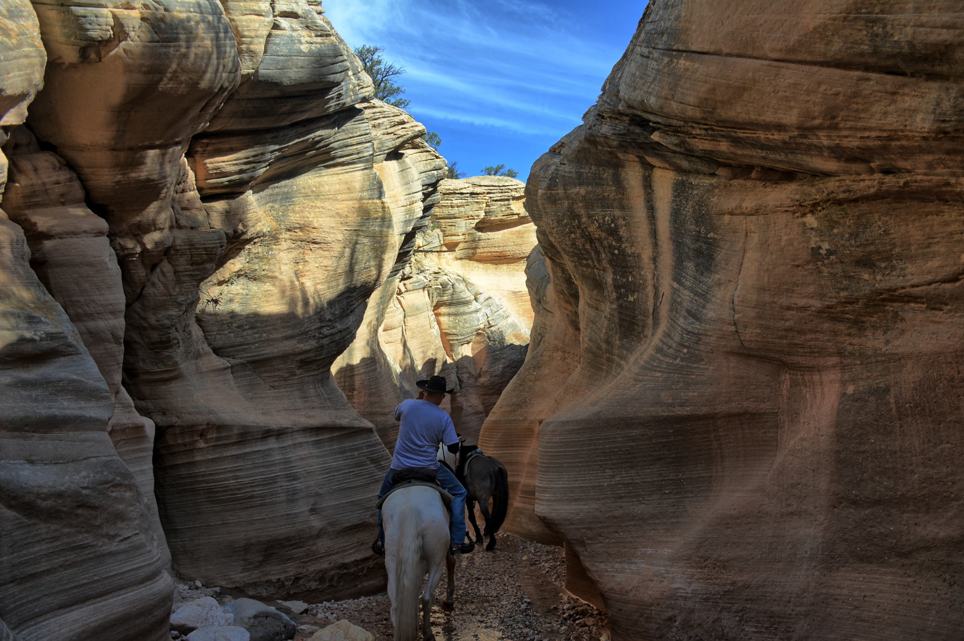
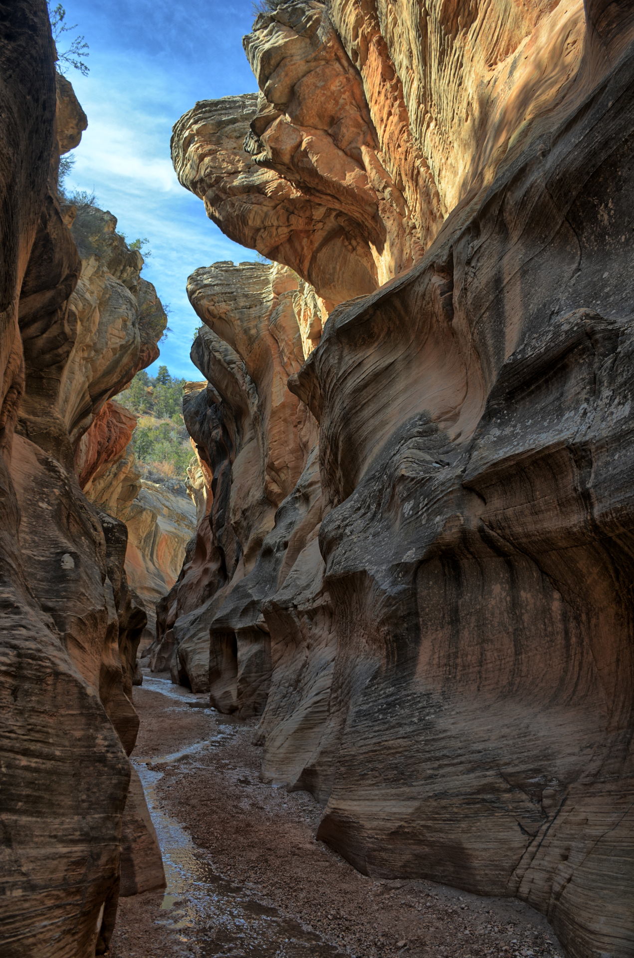
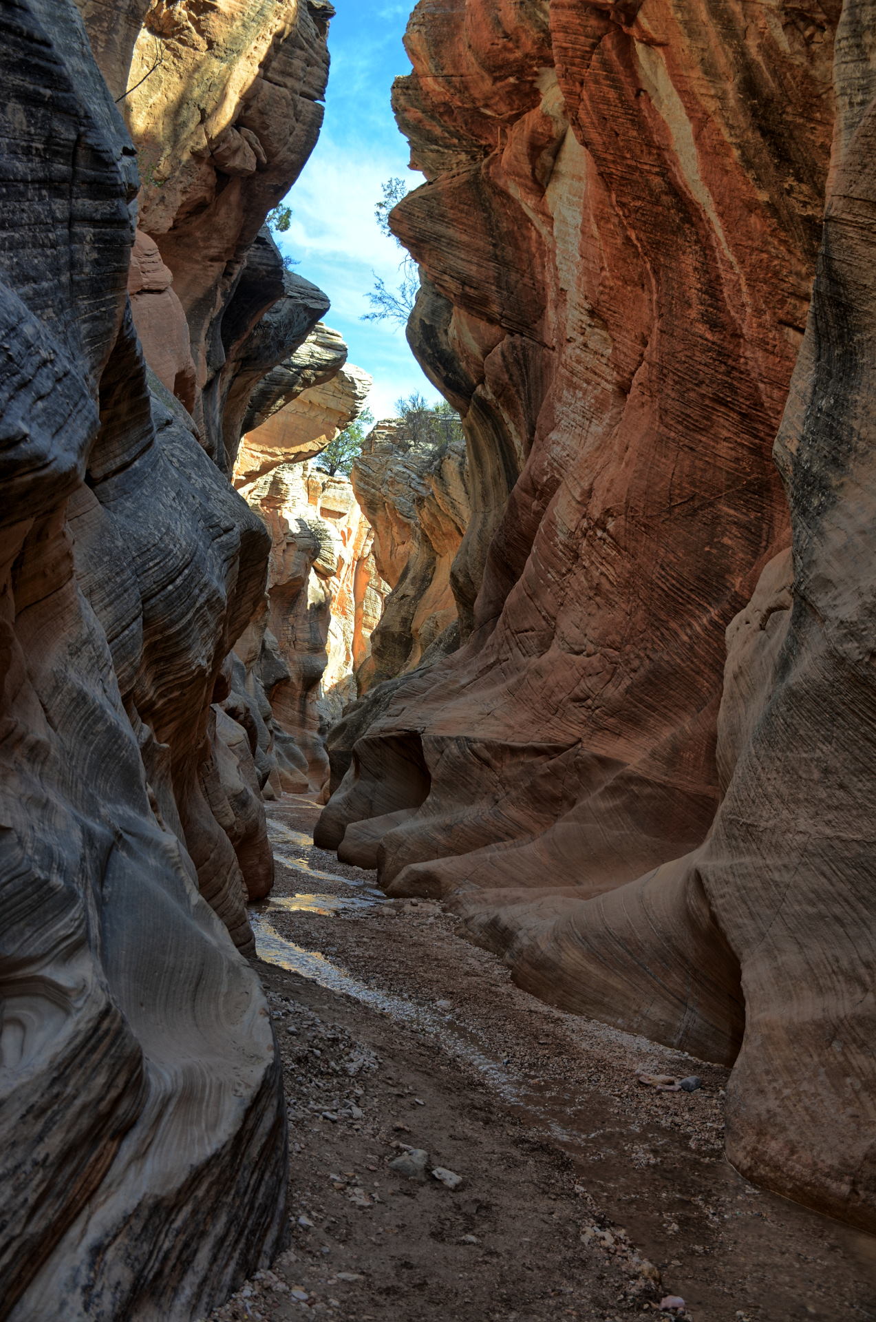
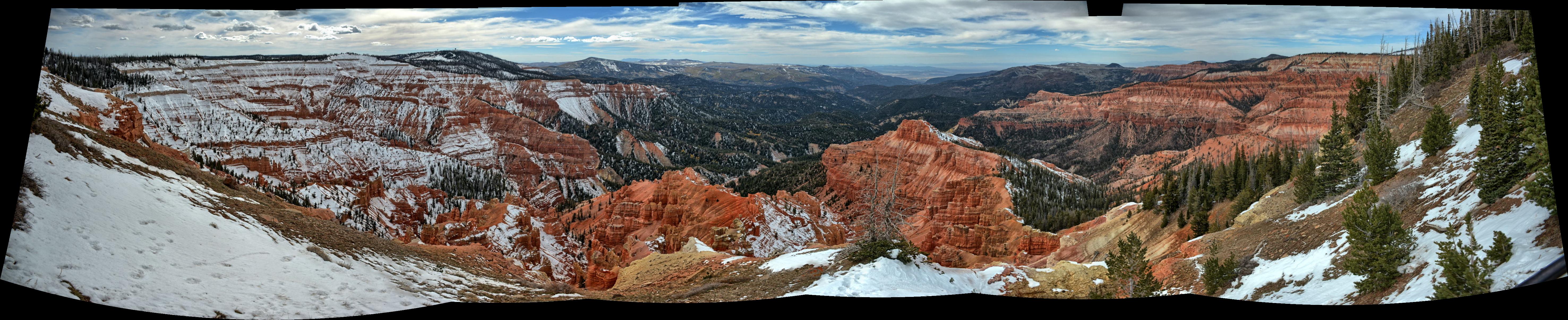
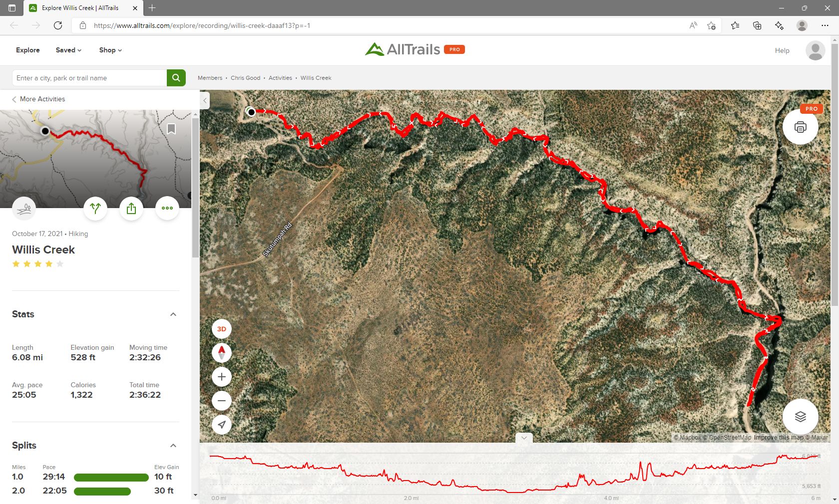
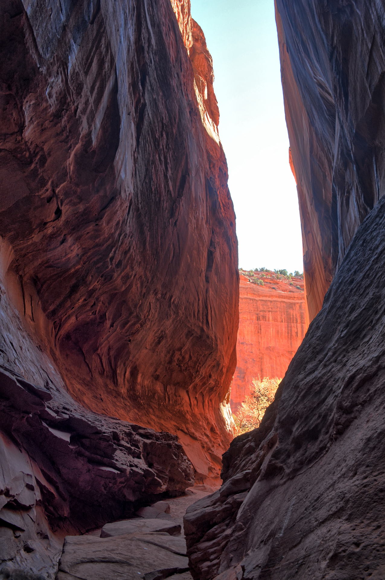
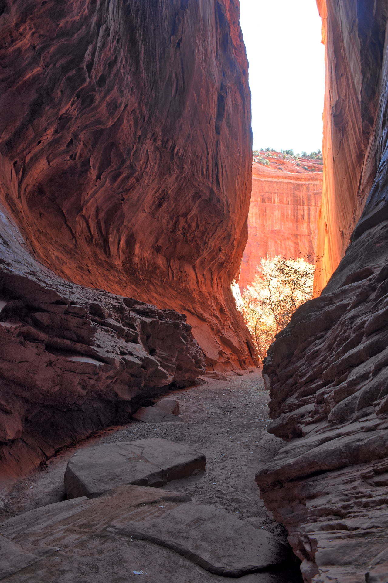
On Sunday they drove from Bryce City to Grand
Staircase-Escalante National Monument, and hiked the Willis Creek Slot Canyon
all the way to Sheep Creek. They measured it as
6 miles round-trip hike with 300 feet of vertical gain on the return back to the
trailhead. Chris set up his GoPro on the windshield of the car for the
drive on the Skutumpah Road back to Cottonwood Canyon Road. That video is
linked below, and the
route shown in the video is linked in Google Map here. They picked up
lunch in Tropic and ate at a picnic area in Red Canyon, while enjoying the red
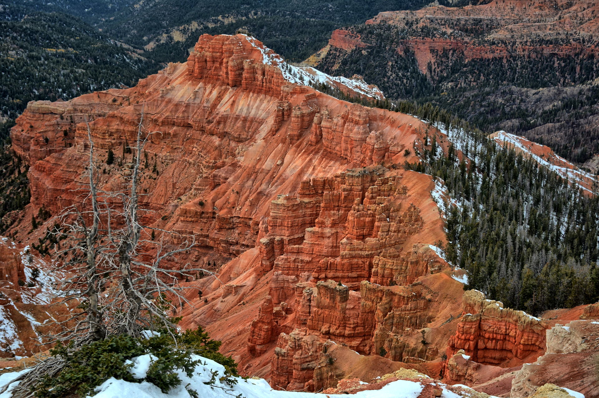
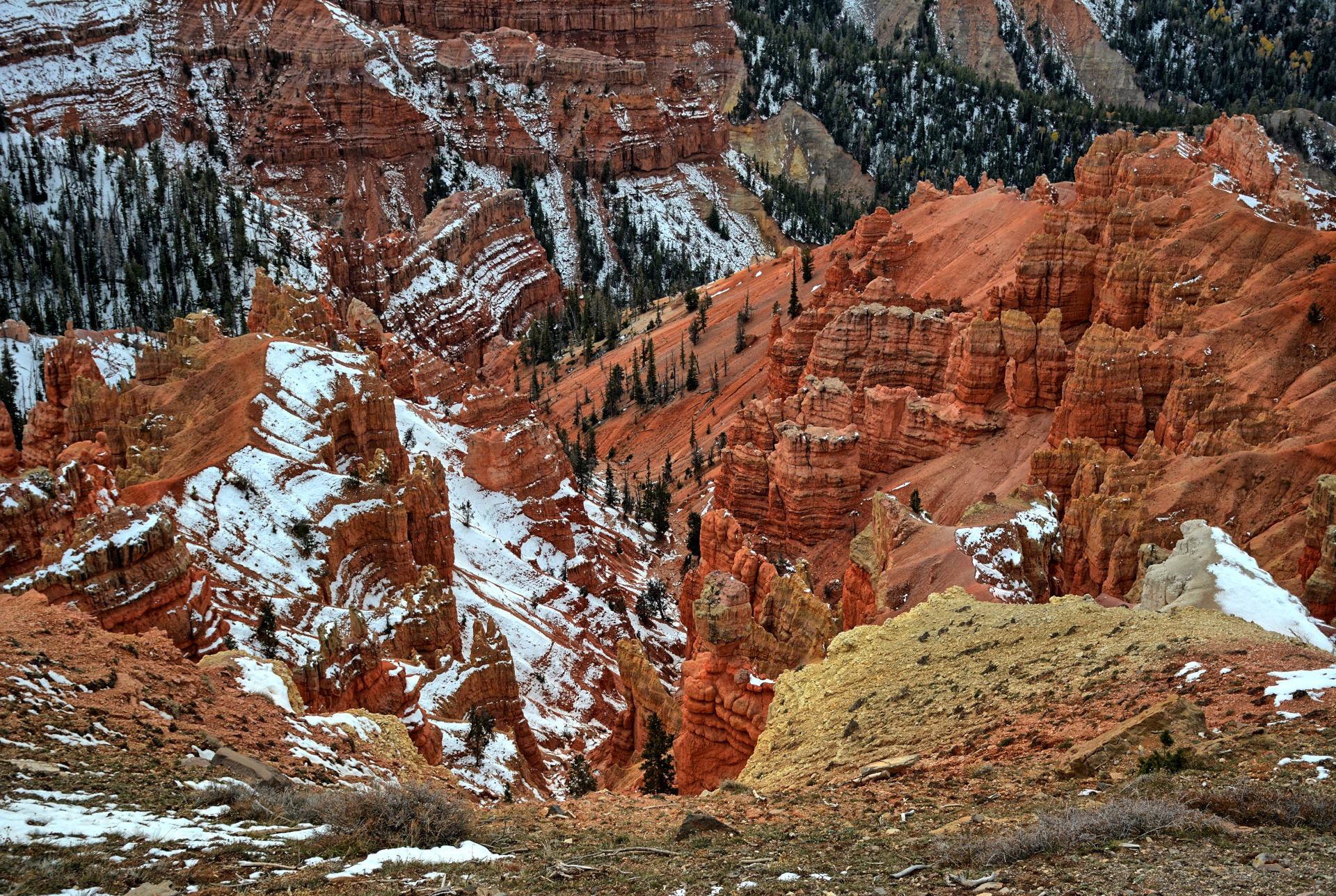
rocks around them. They drove on through Panguitch, and then turned
southwest to visit Cedar Breaks National
Monument and Brian Head, and made it back to Dugway just before
sunset.
Flight testing continued on both programs all week. On
Friday after work, Chris drove to Springdale and camped. He would be
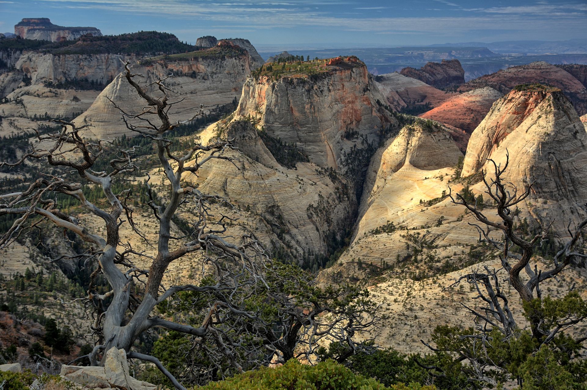
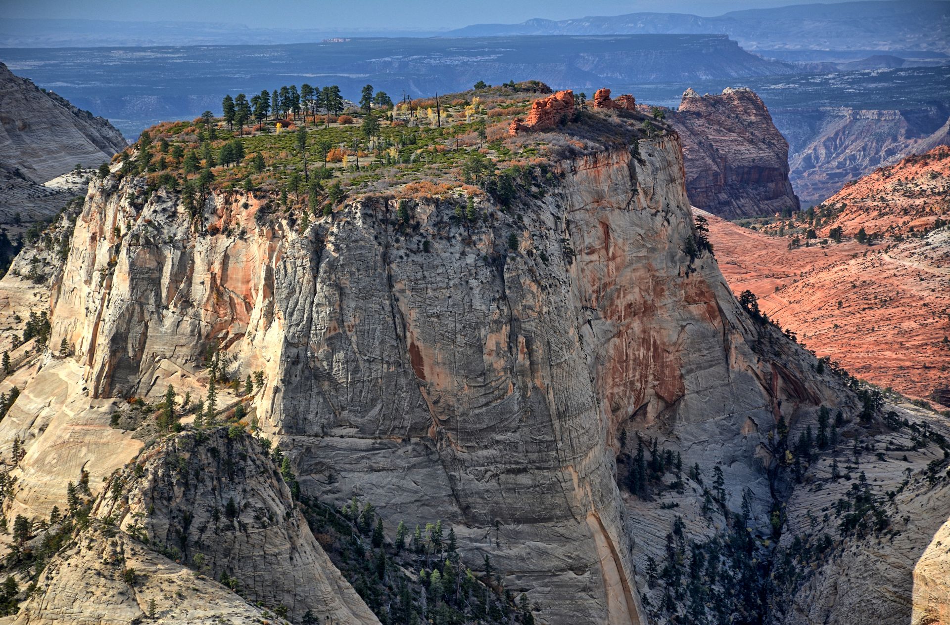
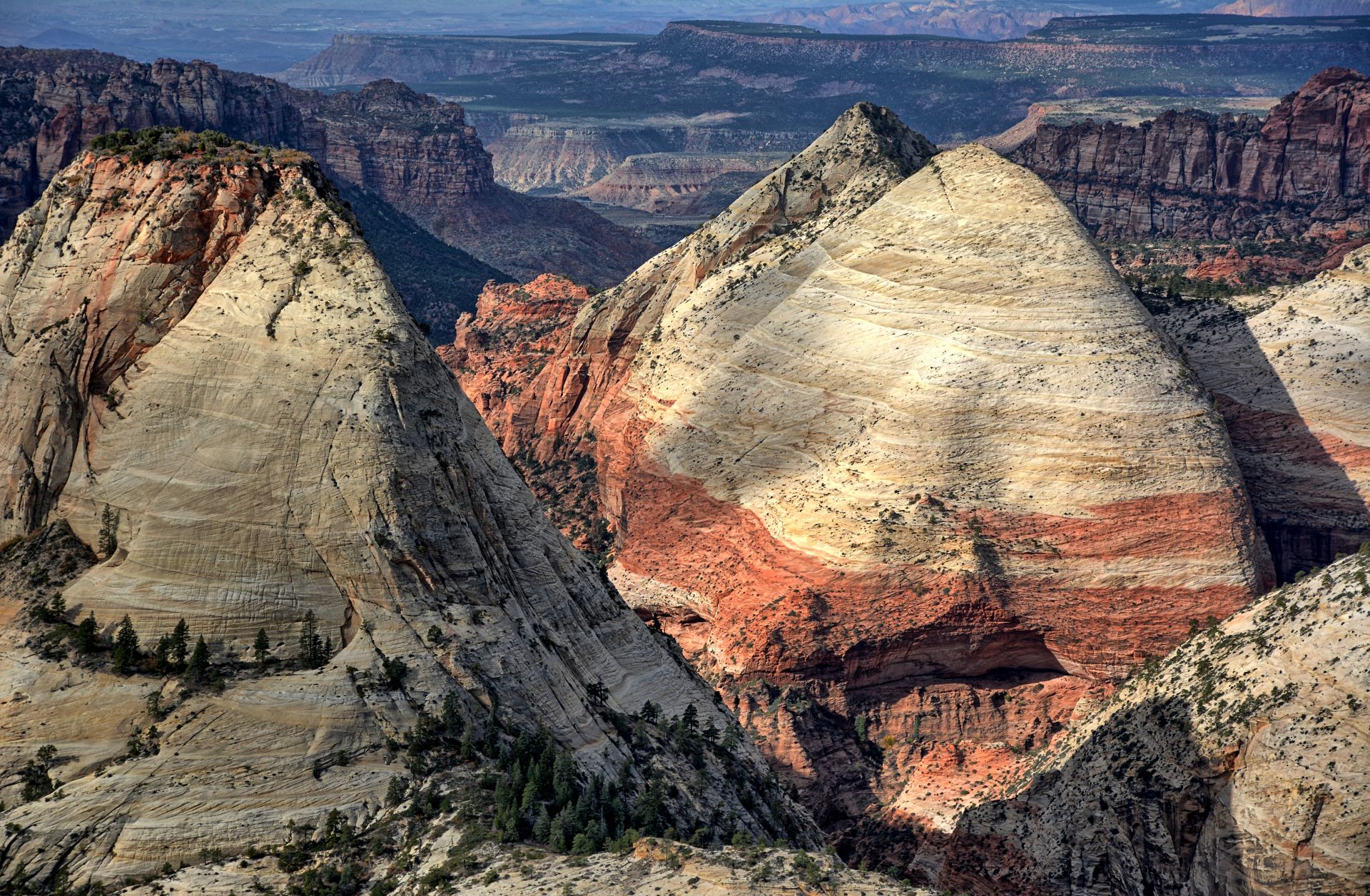
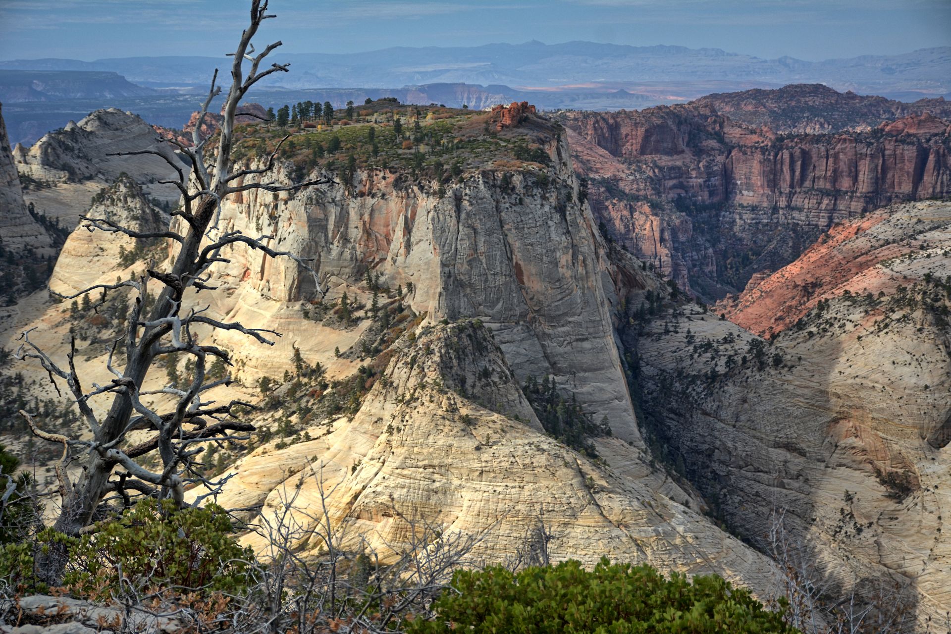
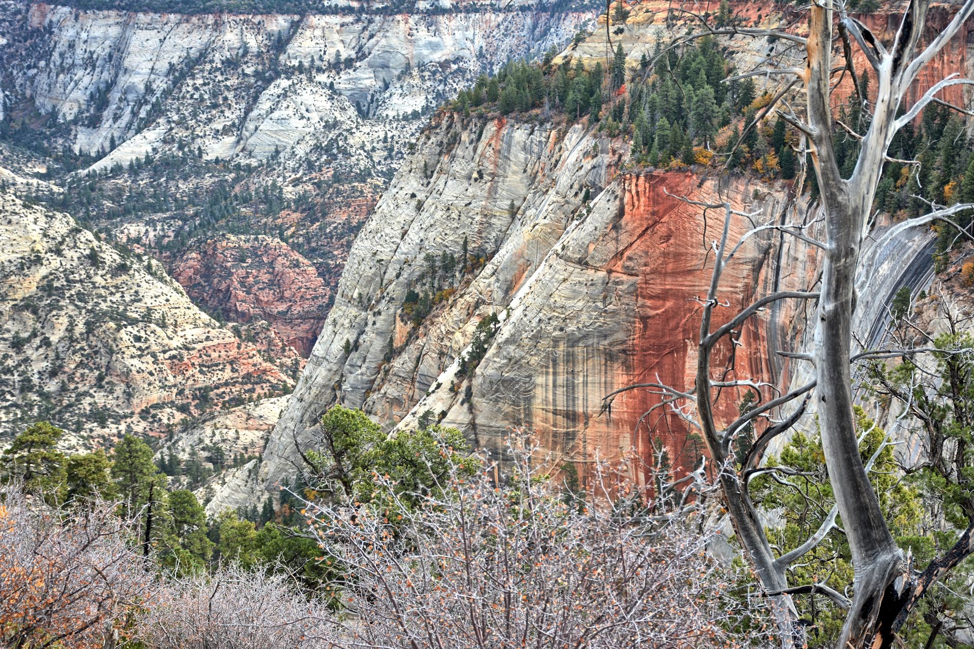
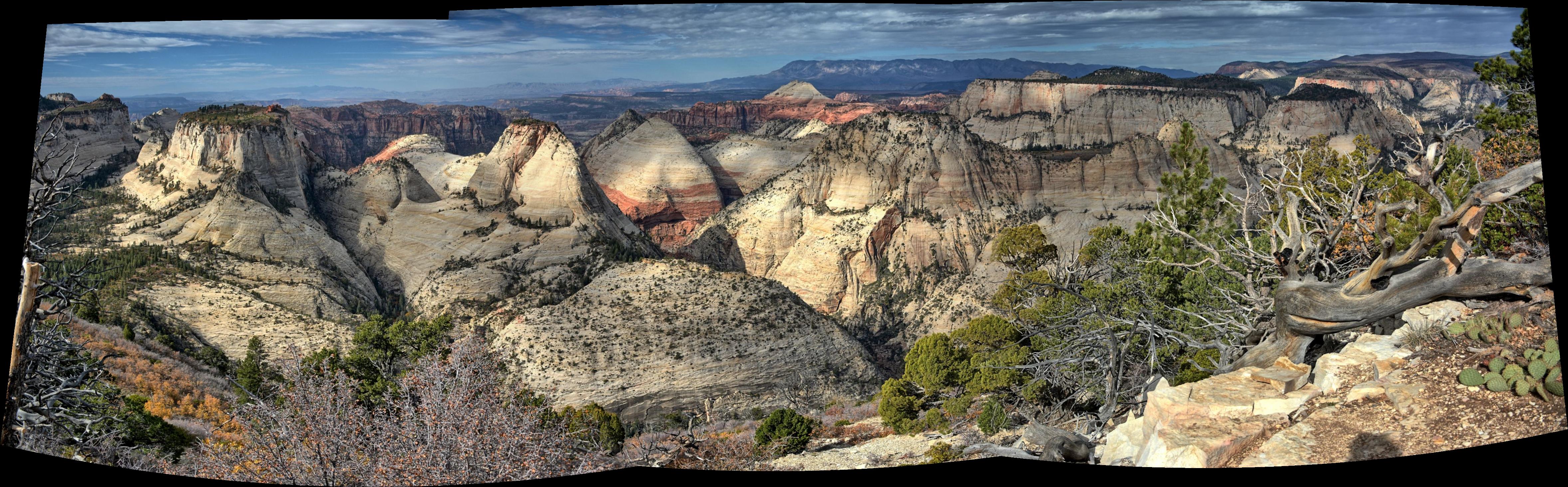
hiking the West Rim Trail at Zion National Park on Saturday.
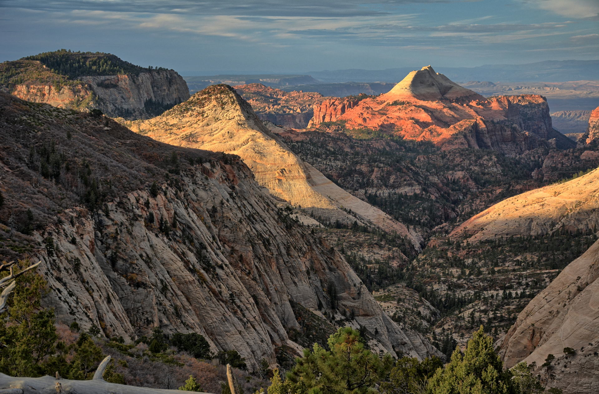
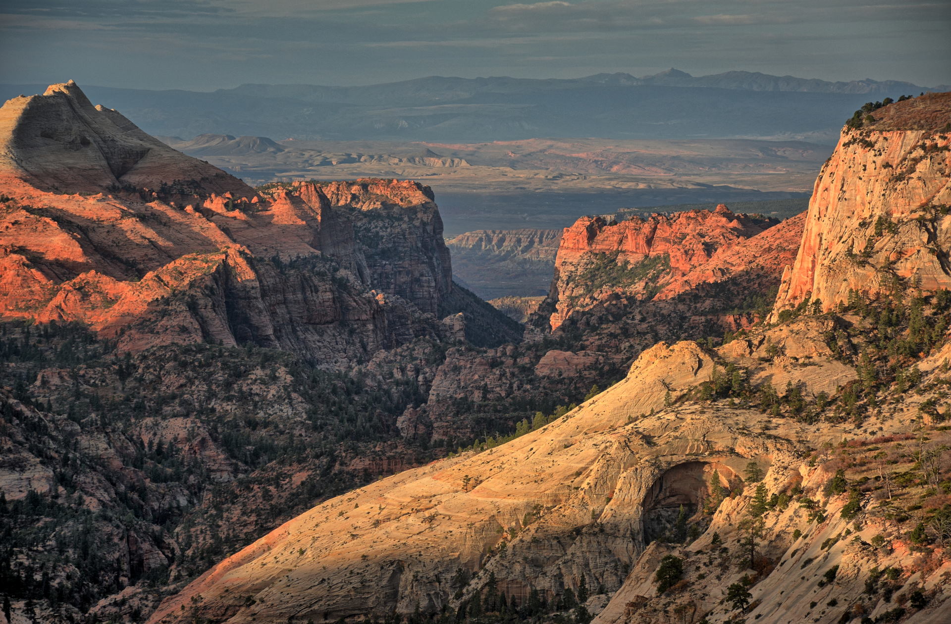
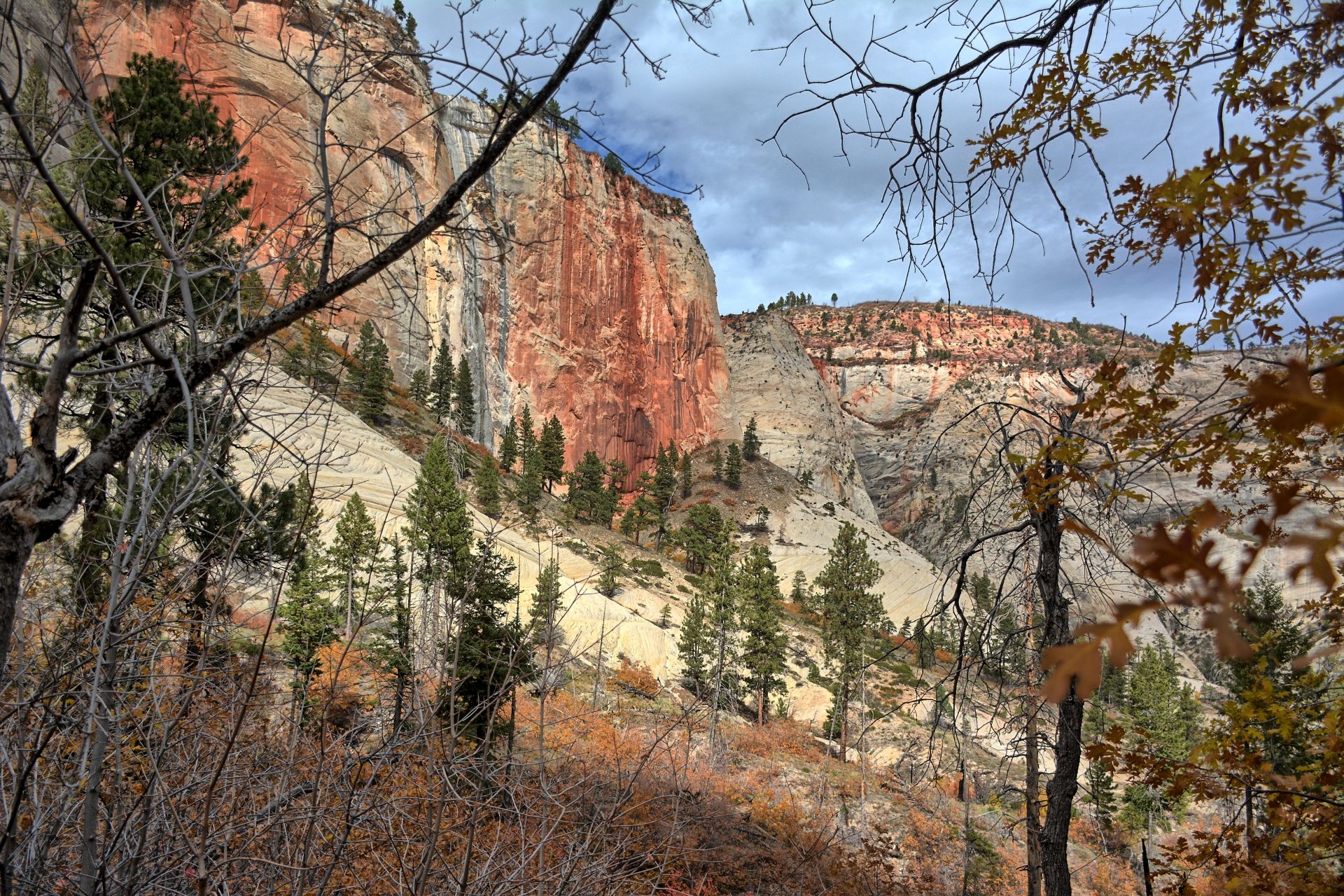
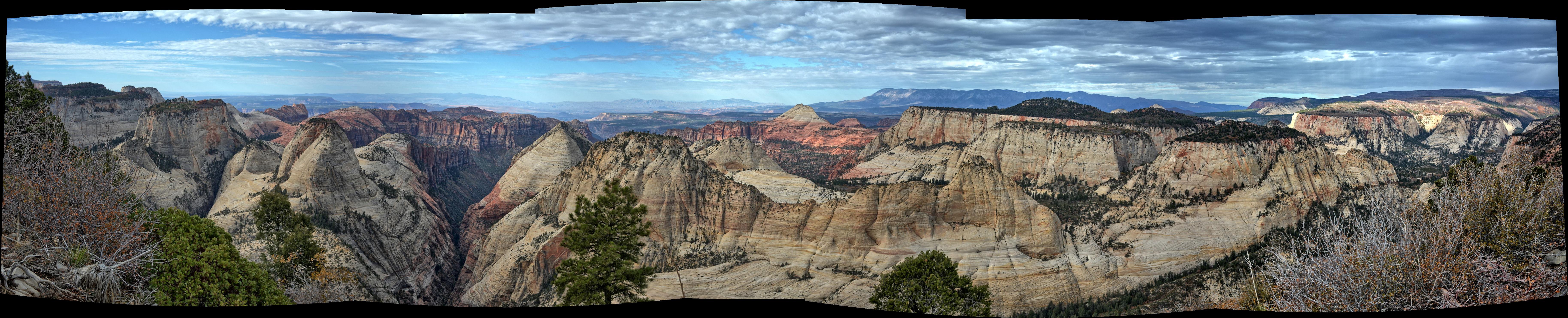
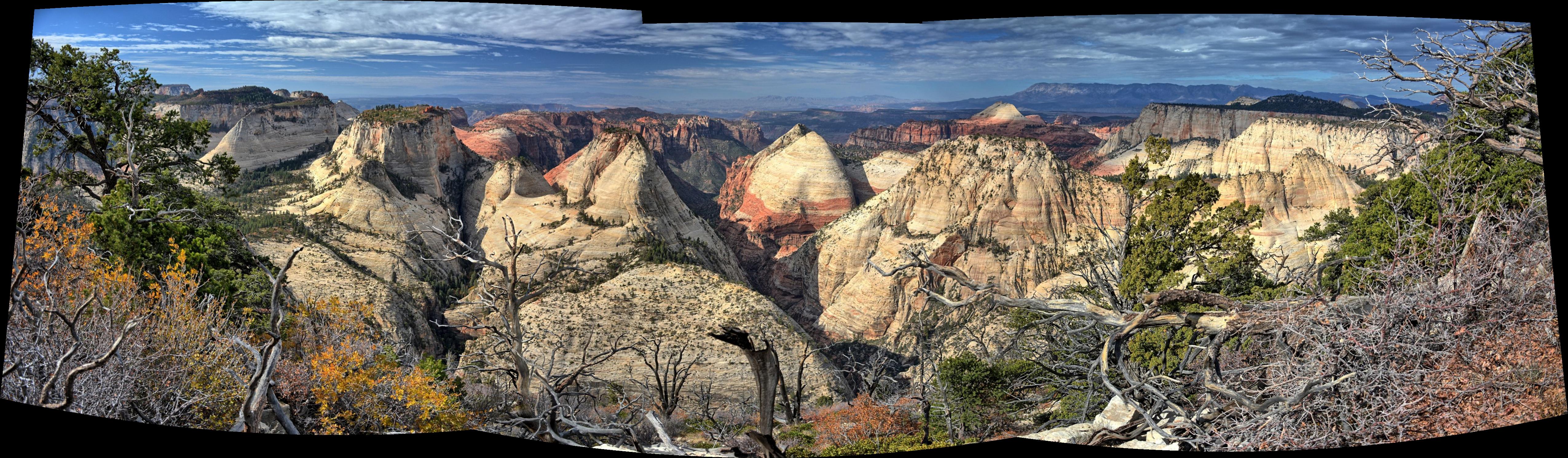
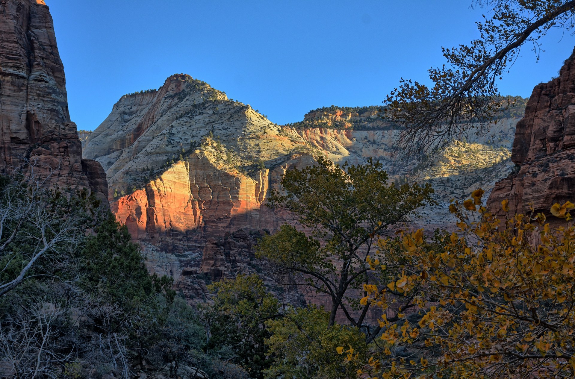
Saturday, 23 Oct
Chris drove into Zion National Park and parked at the visitor's center.
He packed for the long day-hike, and walked over to Zion Adventures in Springdale. He had reservations on their
private
shuttle for the ride to Lava Point to begin the hike. As he arrived at Zion
Adventures, fortunately about 30 minutes early, he realized he had forgotten his
facemask which was required to ride the shuttle. He walked back to his car
to get the facemask, and returned; that round-trip walk added abut 2 miles to
his hiking total for the day. He made it back with about 10 minutes to
spare before the van left, and got on the van for the ride to
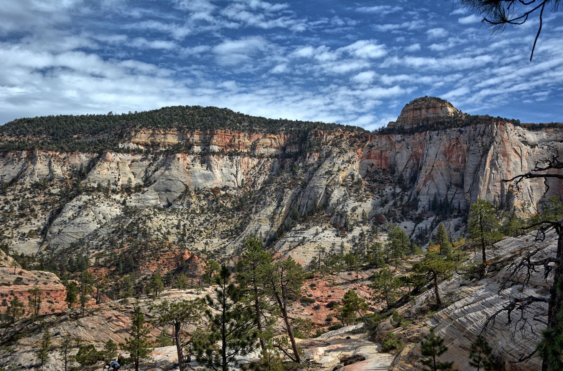
Lava Point. The drive is about 45 minutes along the Kolob Terrace Road,
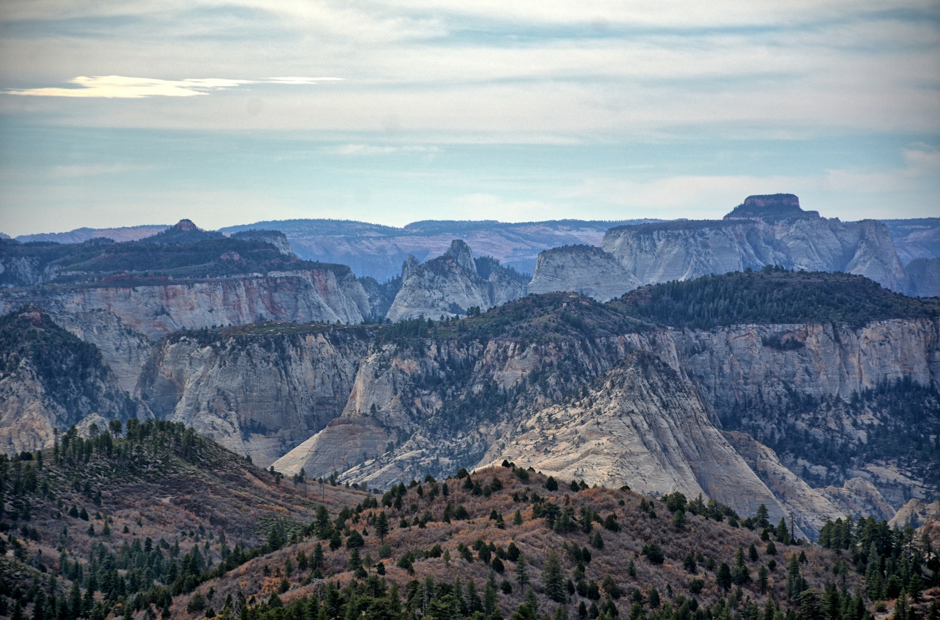
stopping at the west trailhead for the West Rim Trail. This was the third
time Chris has hiked this trail; the van driver knew Chris had hiked the trail
before and asked him to give his opinion to the other hikers (the van was full);
it is Chris' favorite hike in the world and the last half of the hike is nothing
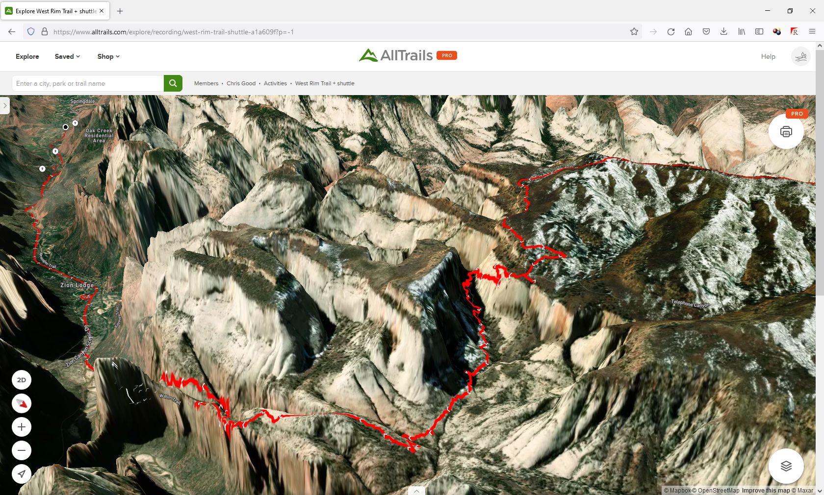
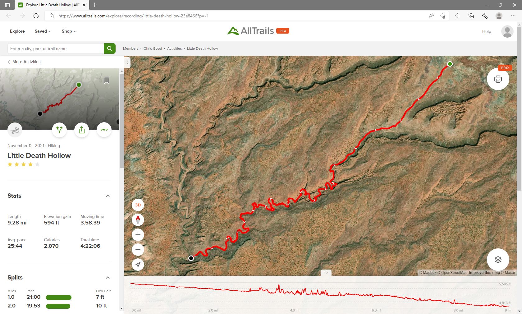
less than breath-taking. He recorded the hike on the
All-Trails App. Depending on how much you believe of the recording, it is
15 - 17 miles long.
Chris forgot to turn off the recording when he got on the
shuttle bus, so the All-Trails recording below also includes the 5
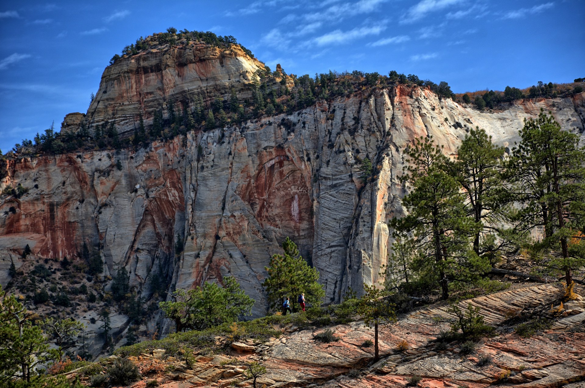
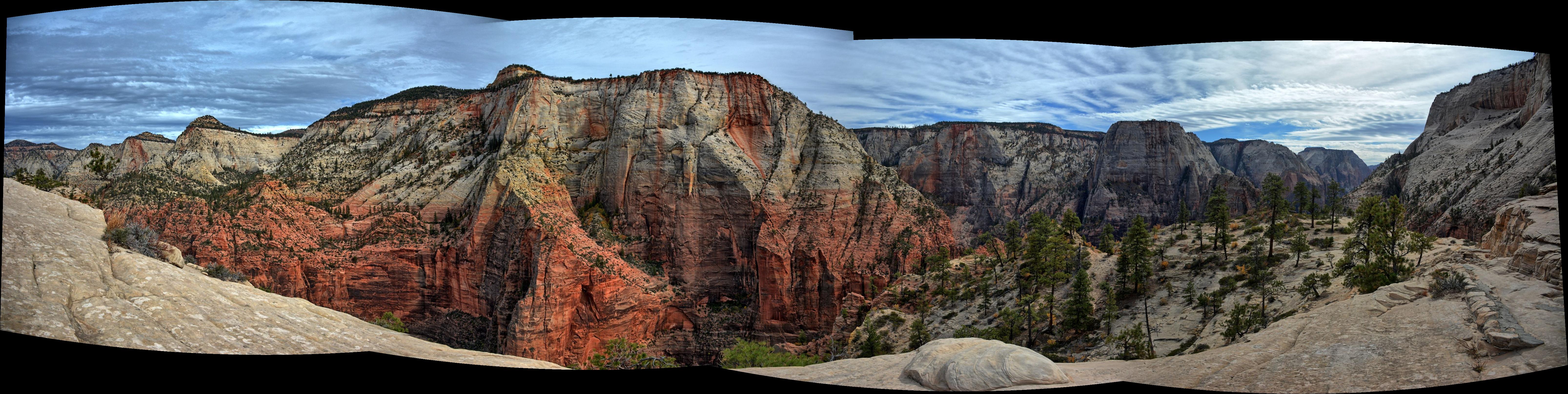
mile shuttle ride back to the visitor center from the Grotto. Most of the West Rim Trail is downhill, but there
is a section in
the middle at Potato Hollow and a section at the end at the west edge of Zion Canyon
where you climb up several hundred
feet, so those climbs and the overall length of this hike can be tiring.
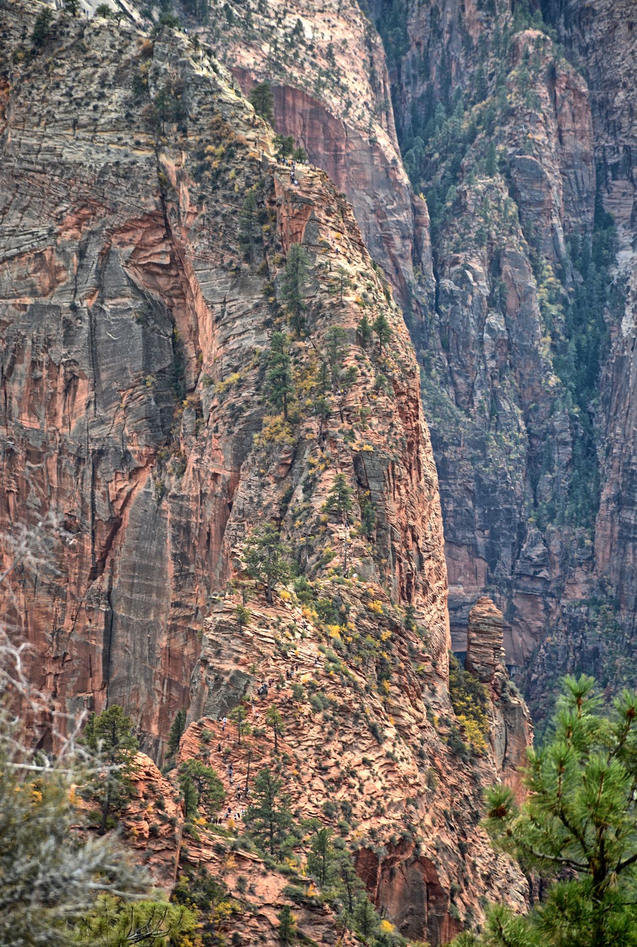
After this very long day-hike, Chris made it past Angels Landing and down to the
Grotto, where he caught the park shuttle back to the visitor's center and his
car. He walked around a few minutes to stretch his legs, and then drove to
his hotel in Virgin and had dinner at a nearby restaurant.
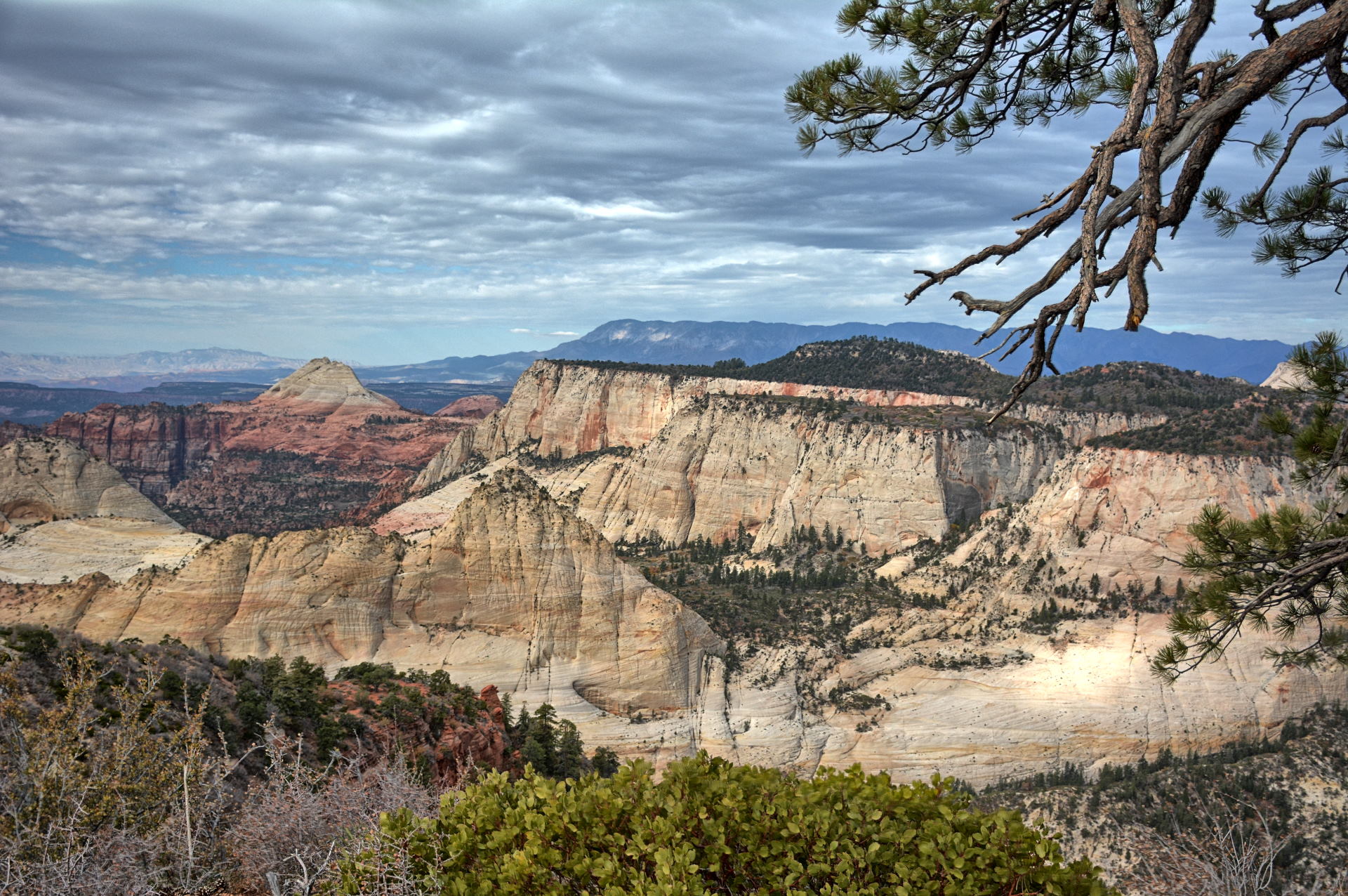
Chris drove up Kolob Terrace Road all the way to Lava Point.
On the way back off of Kolob Terrace, he flew his flying wing just outside the
park boundary. He stopped at the Wildcat Canyon trailhead and hiked the Northgate Peaks Trail.
It is only a few miles long and mostly flat. He drove back to Dugway,
stopping at Meadow and visiting Meadow Hot Springs which is just a few minutes
from the Interstate. After soaking in the water at two of the hot spring
pools, he flew his flying wing again just before sunset, then finished driving
back to Dugway.
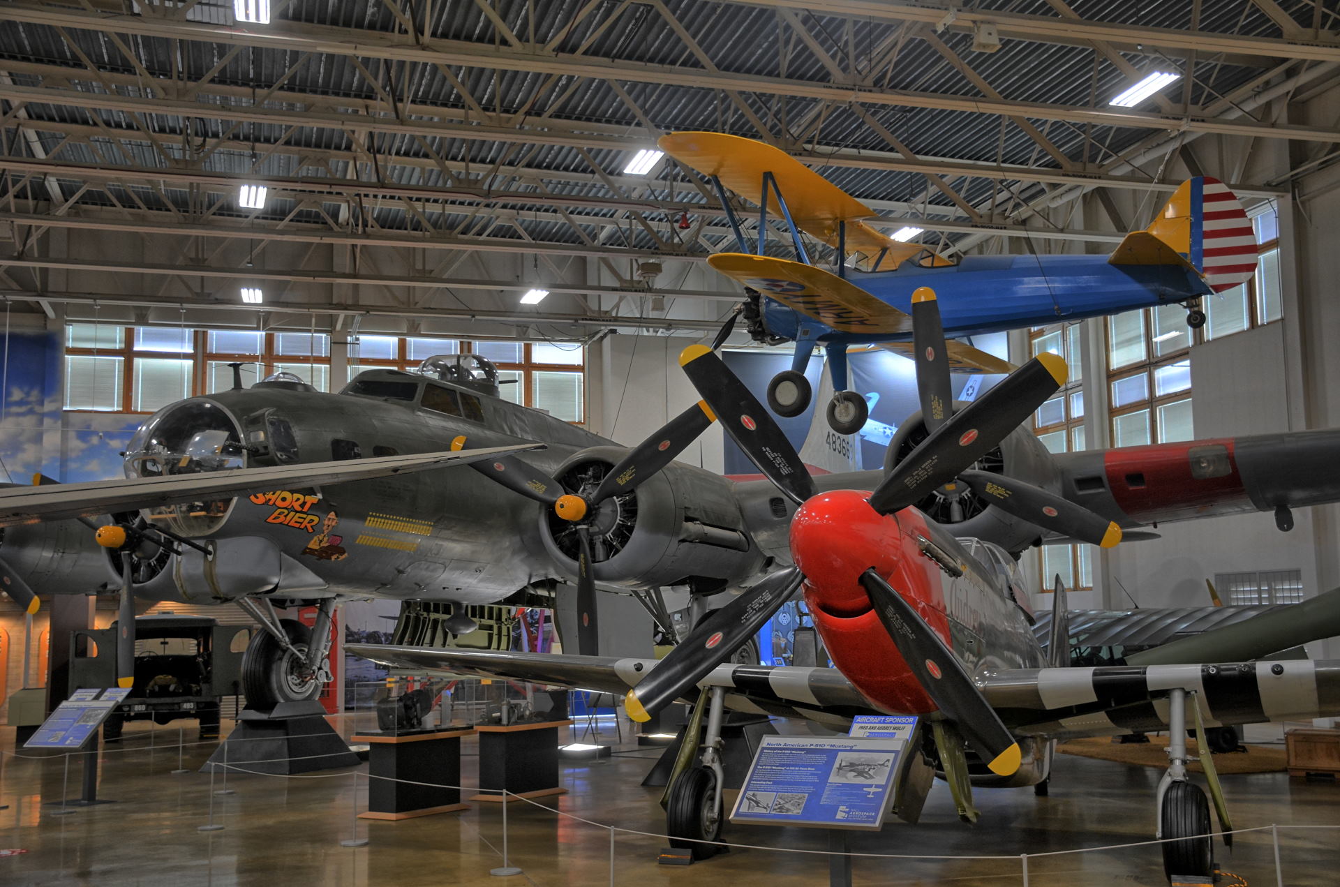
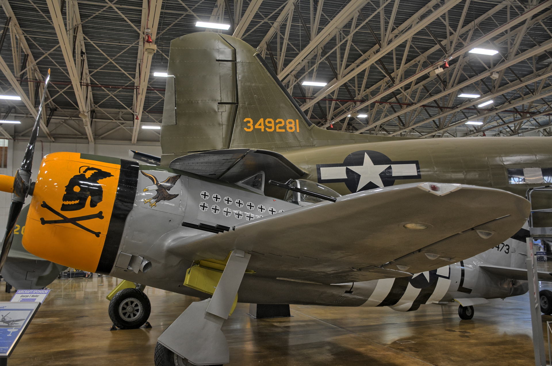
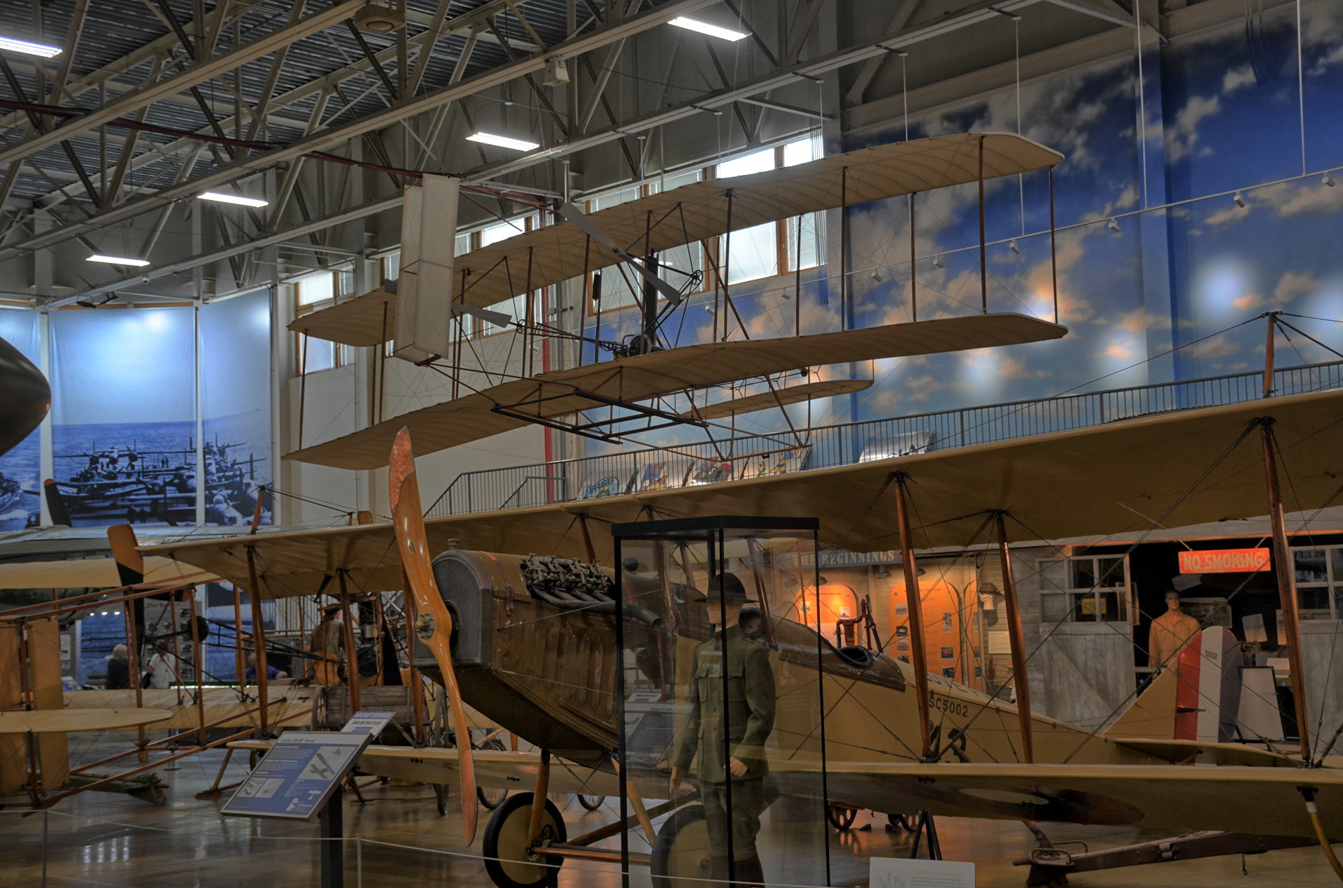
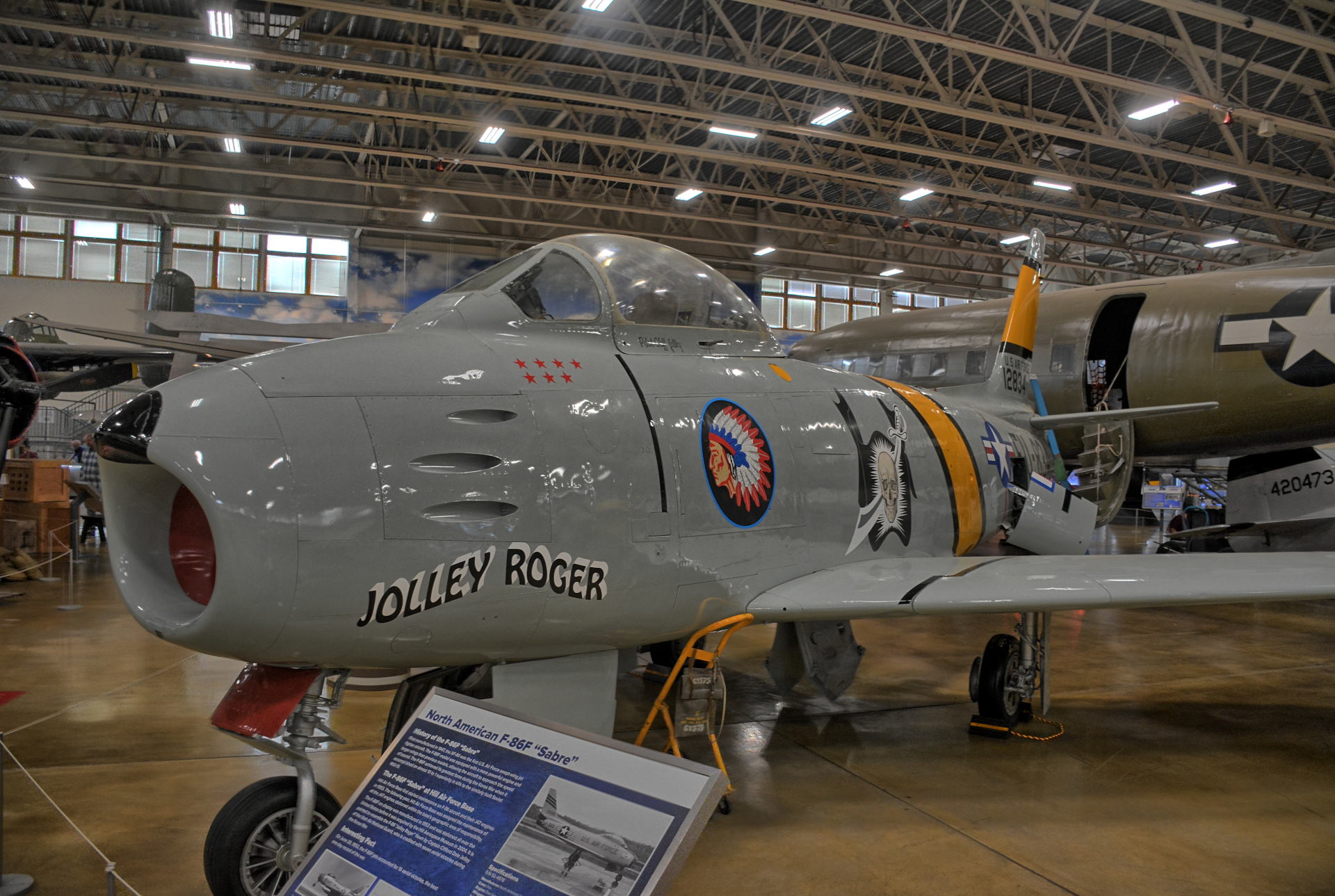
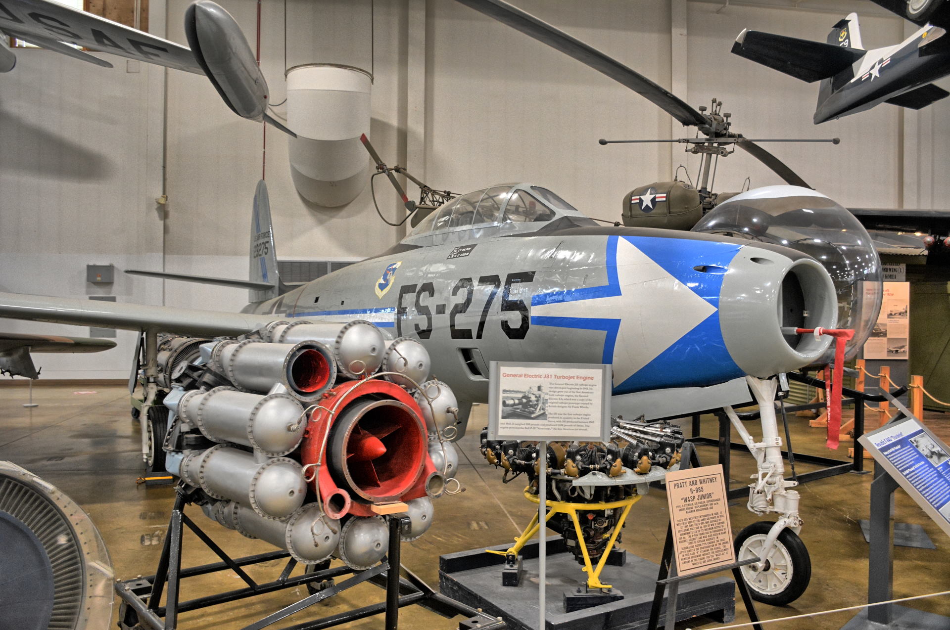
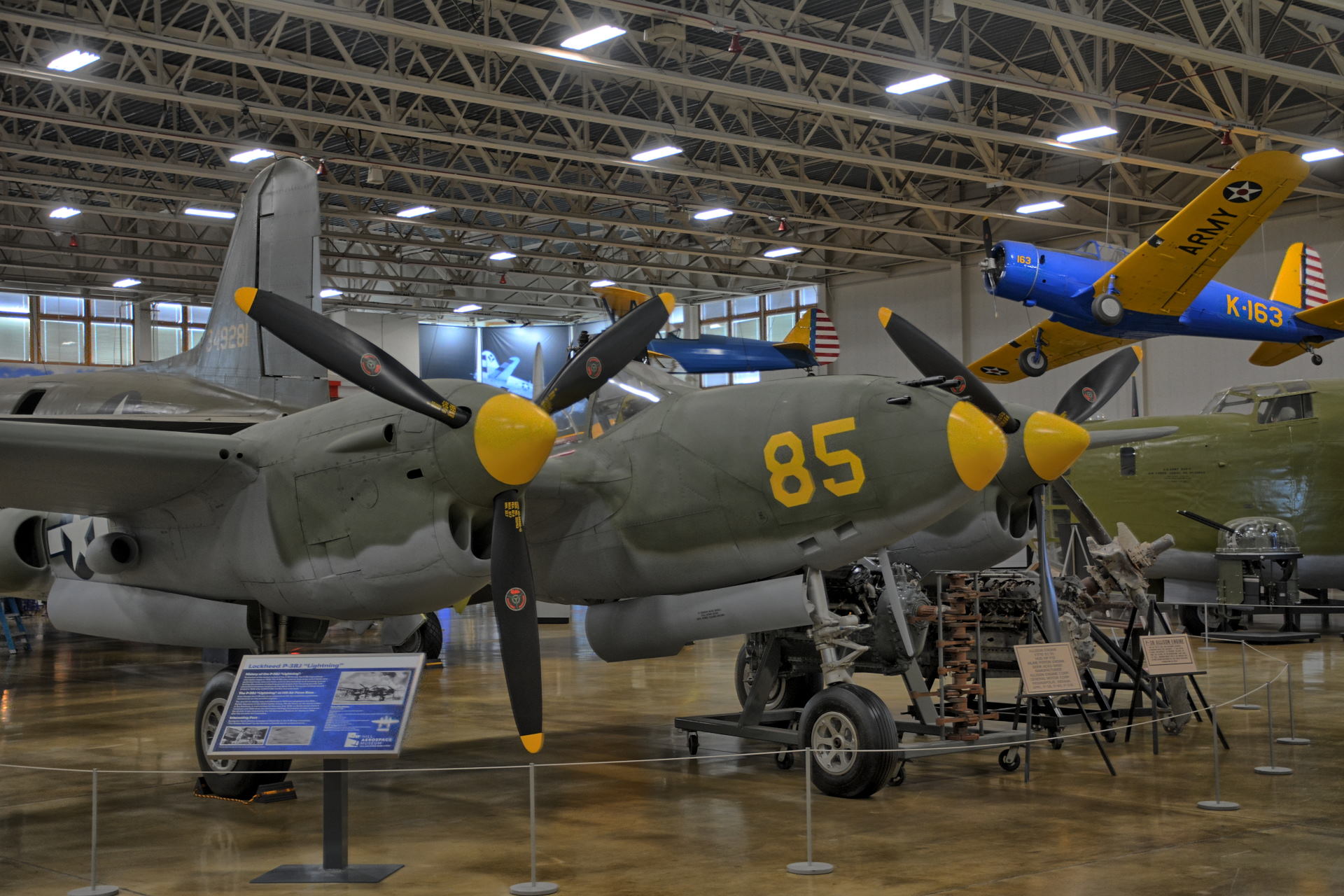
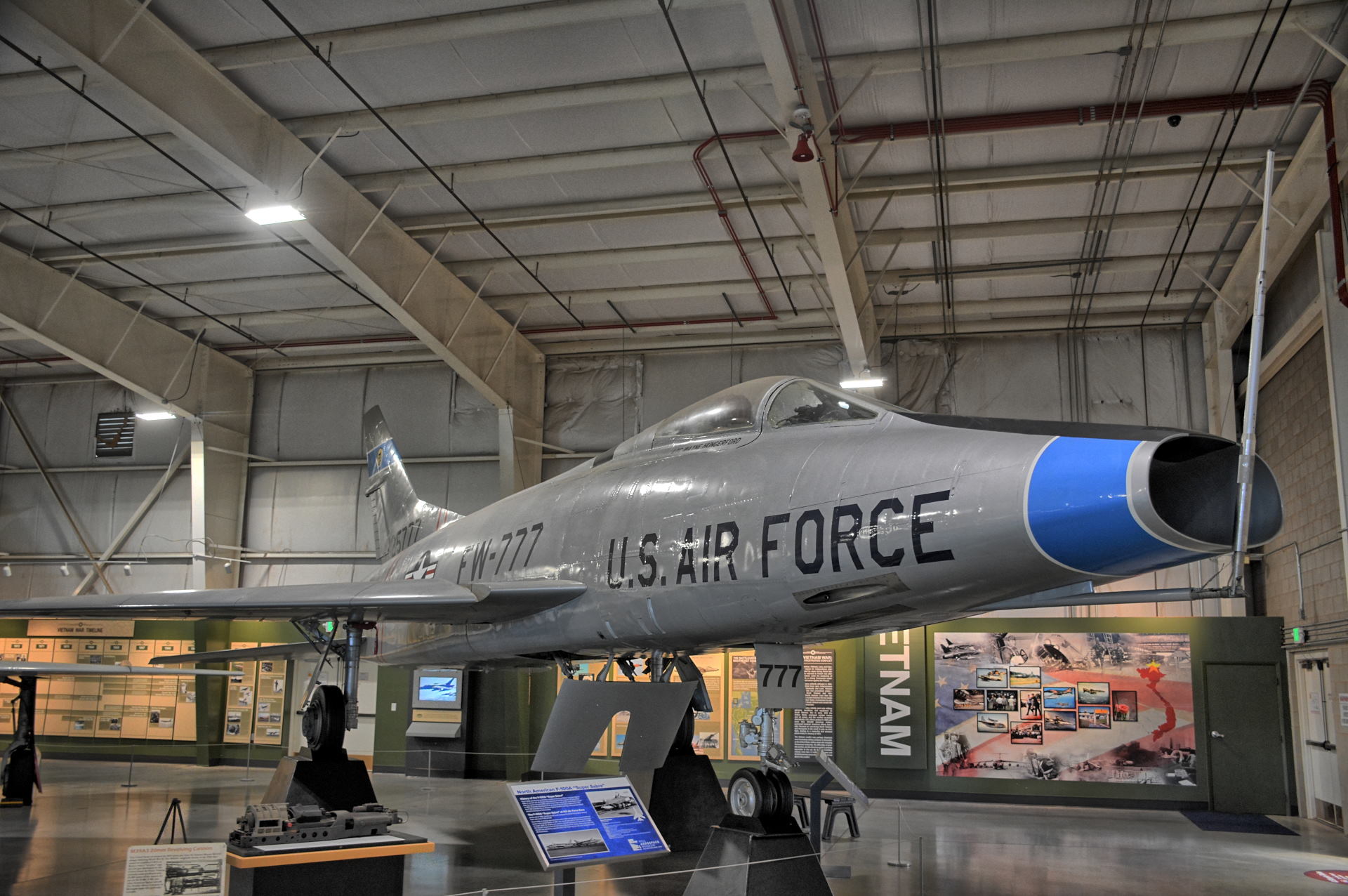
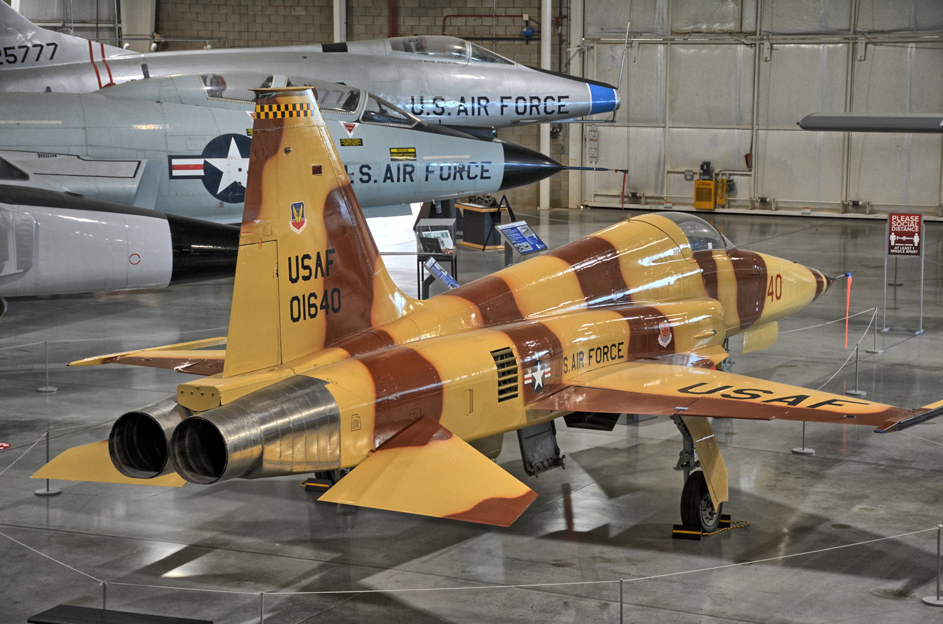
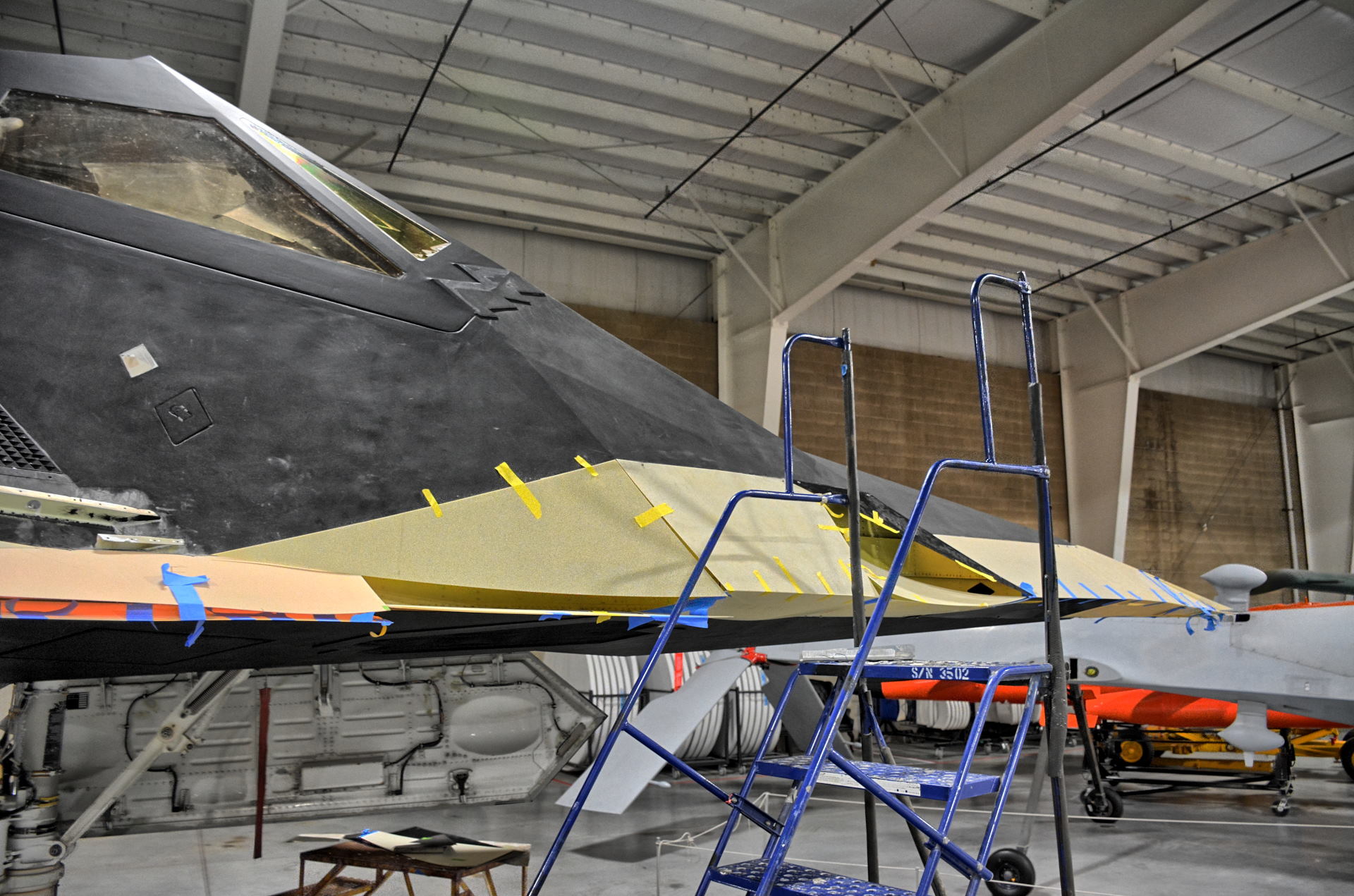
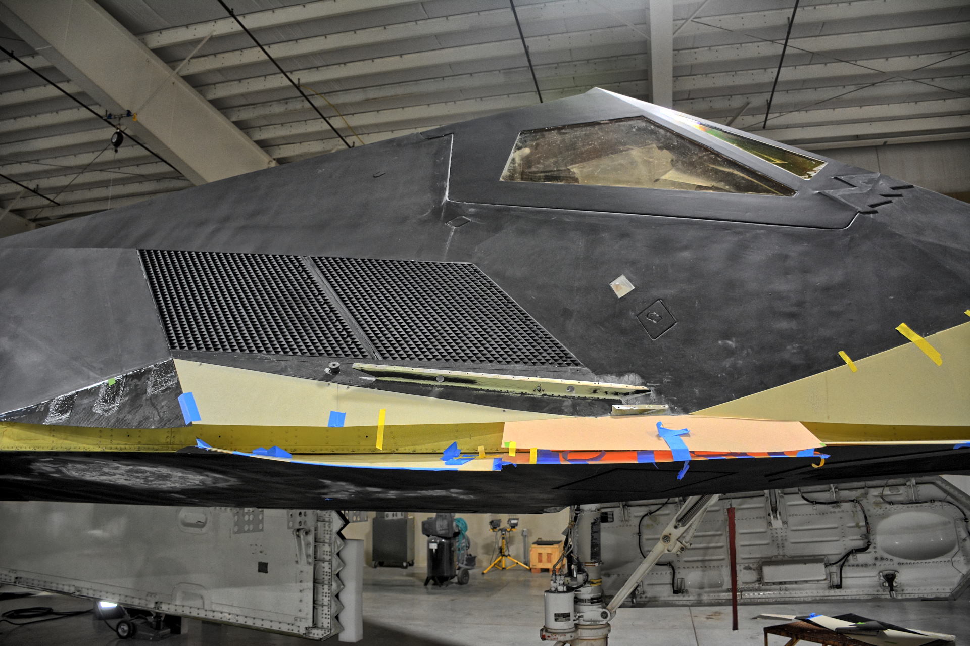
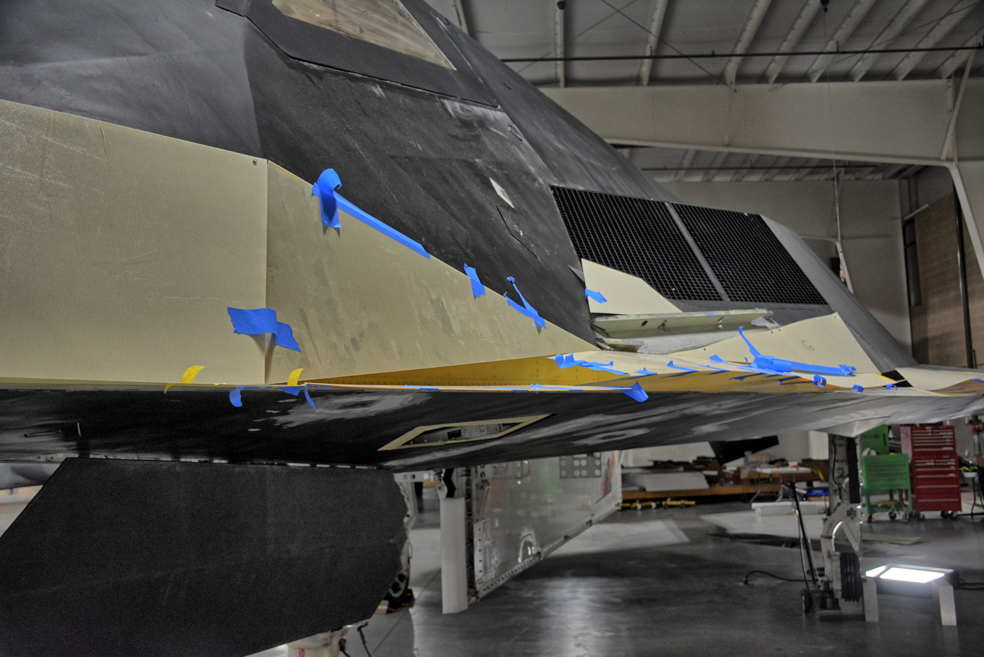
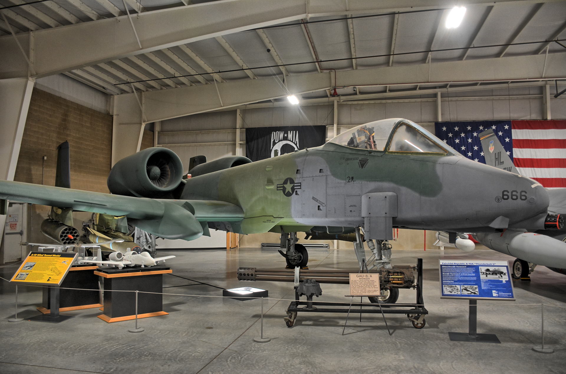
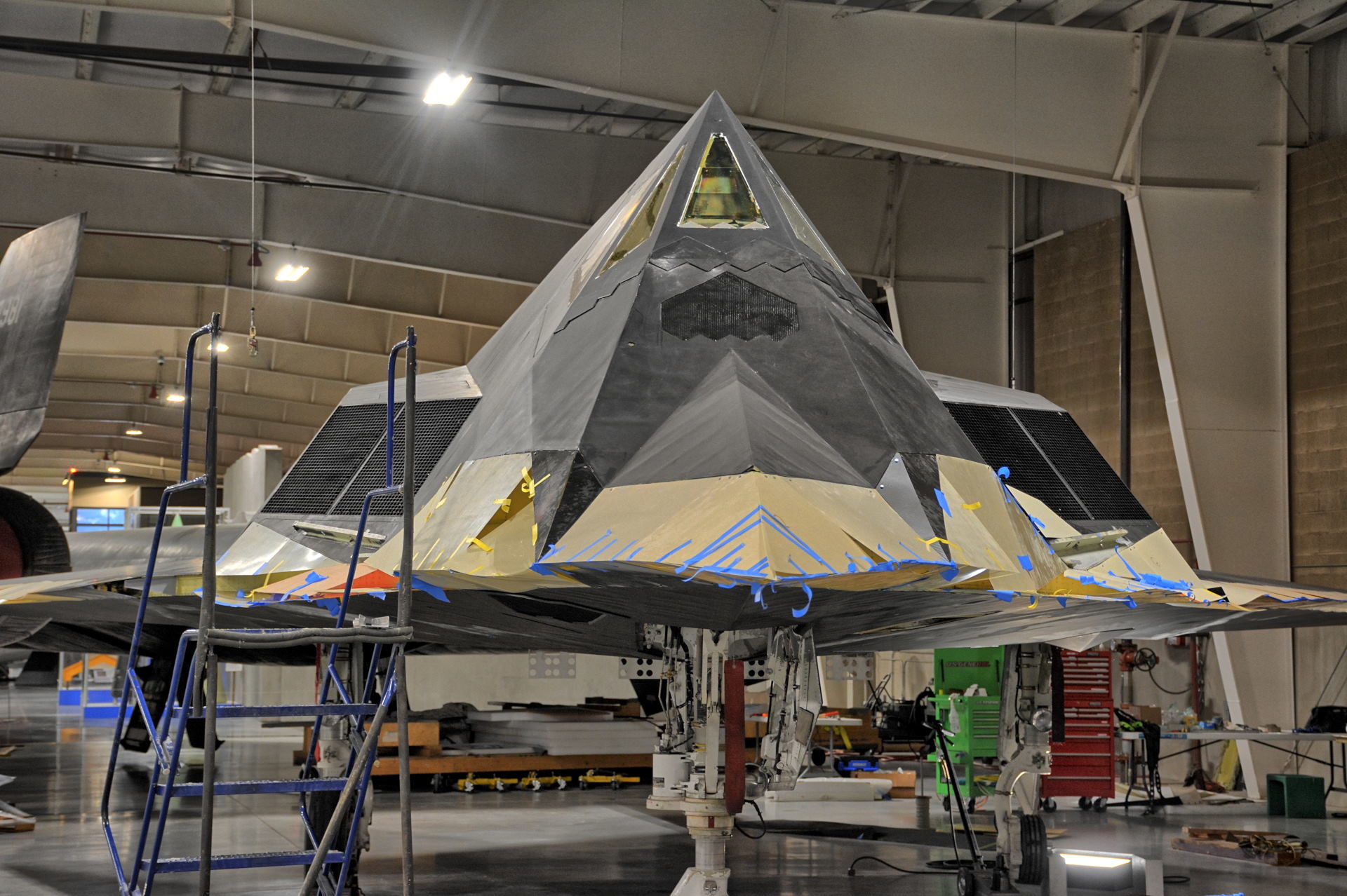
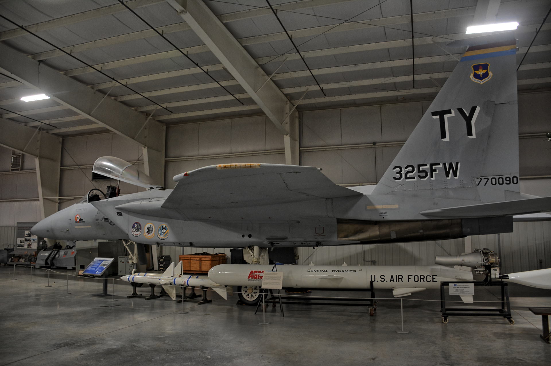
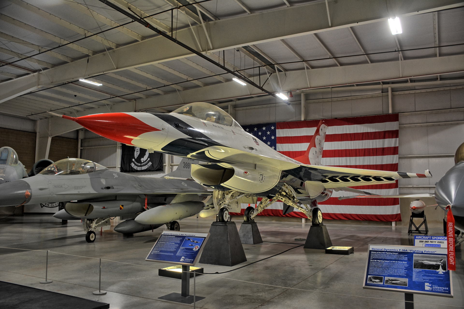
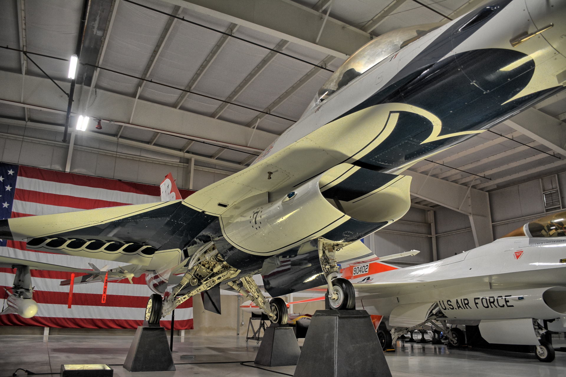
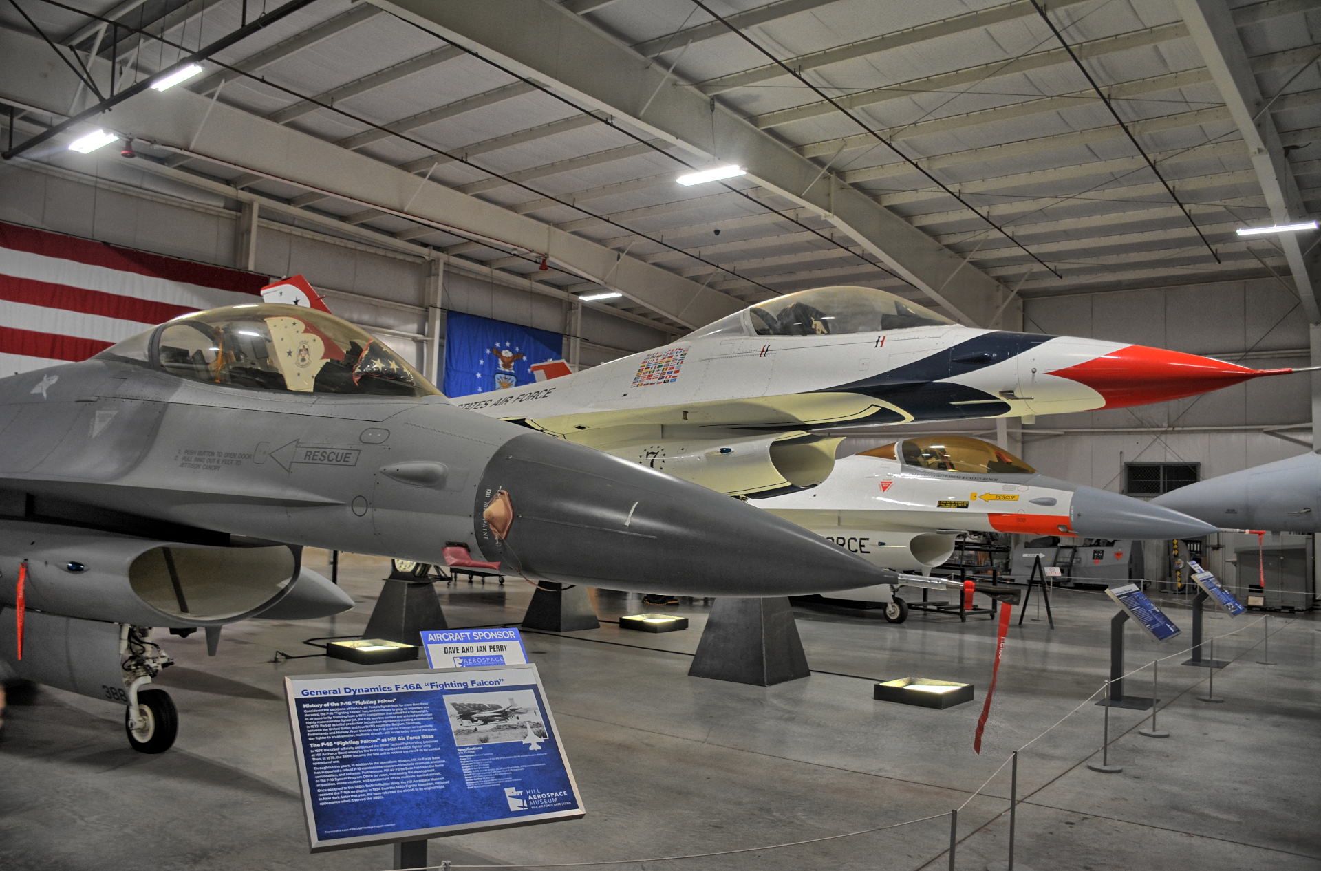
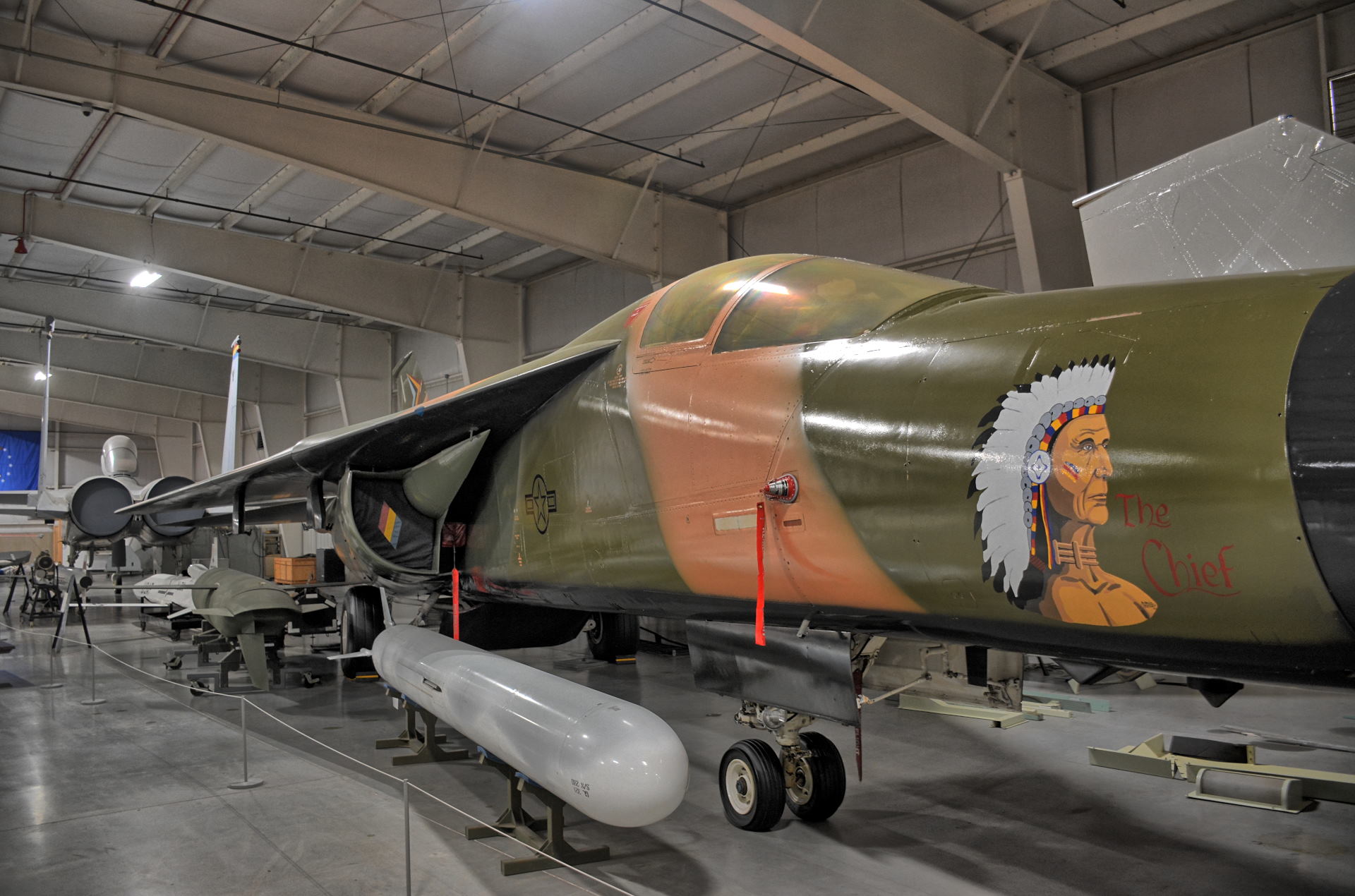
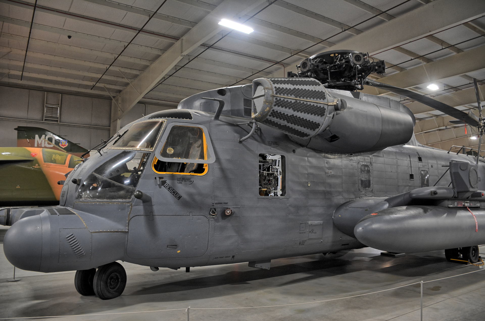
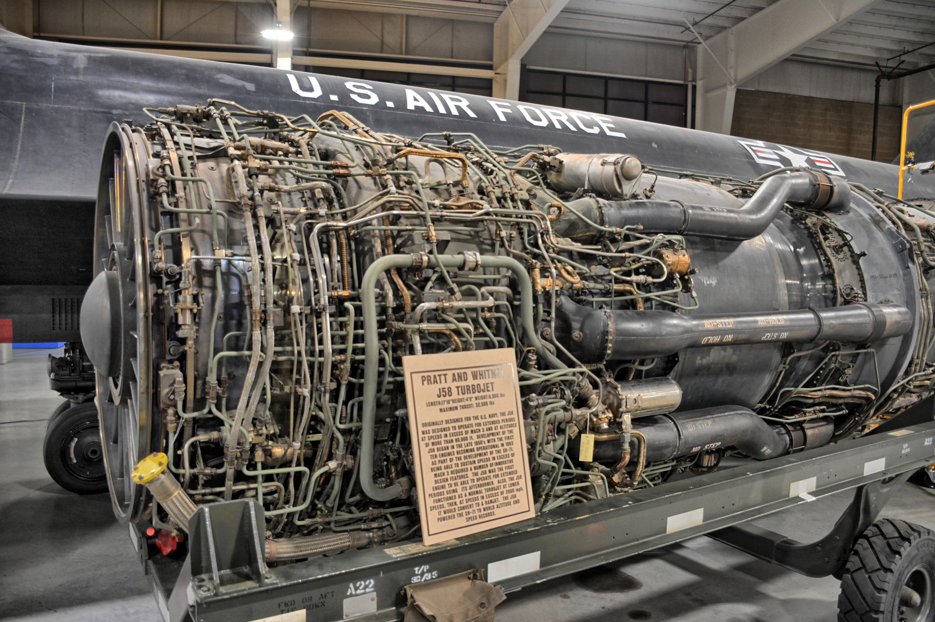
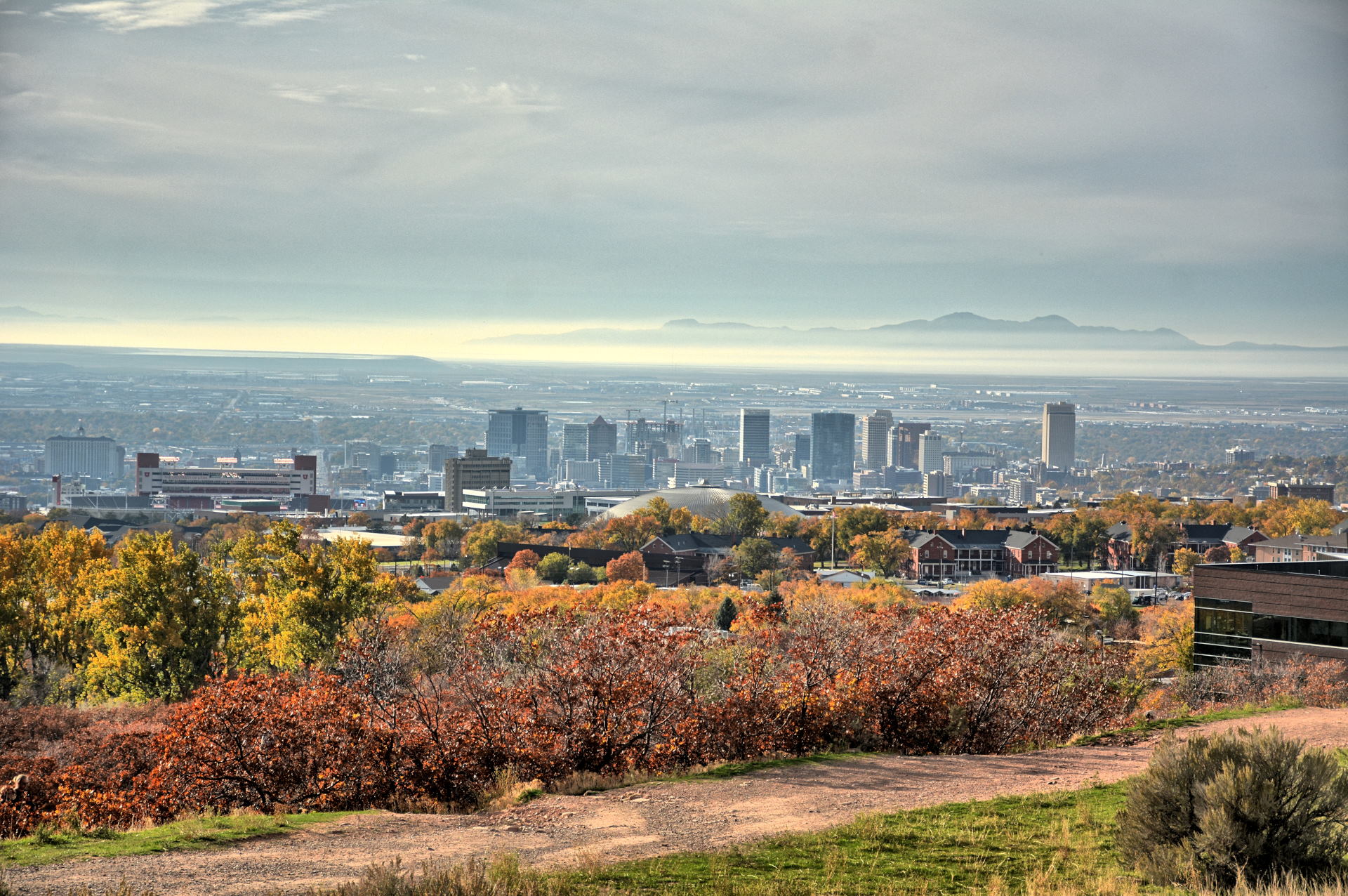
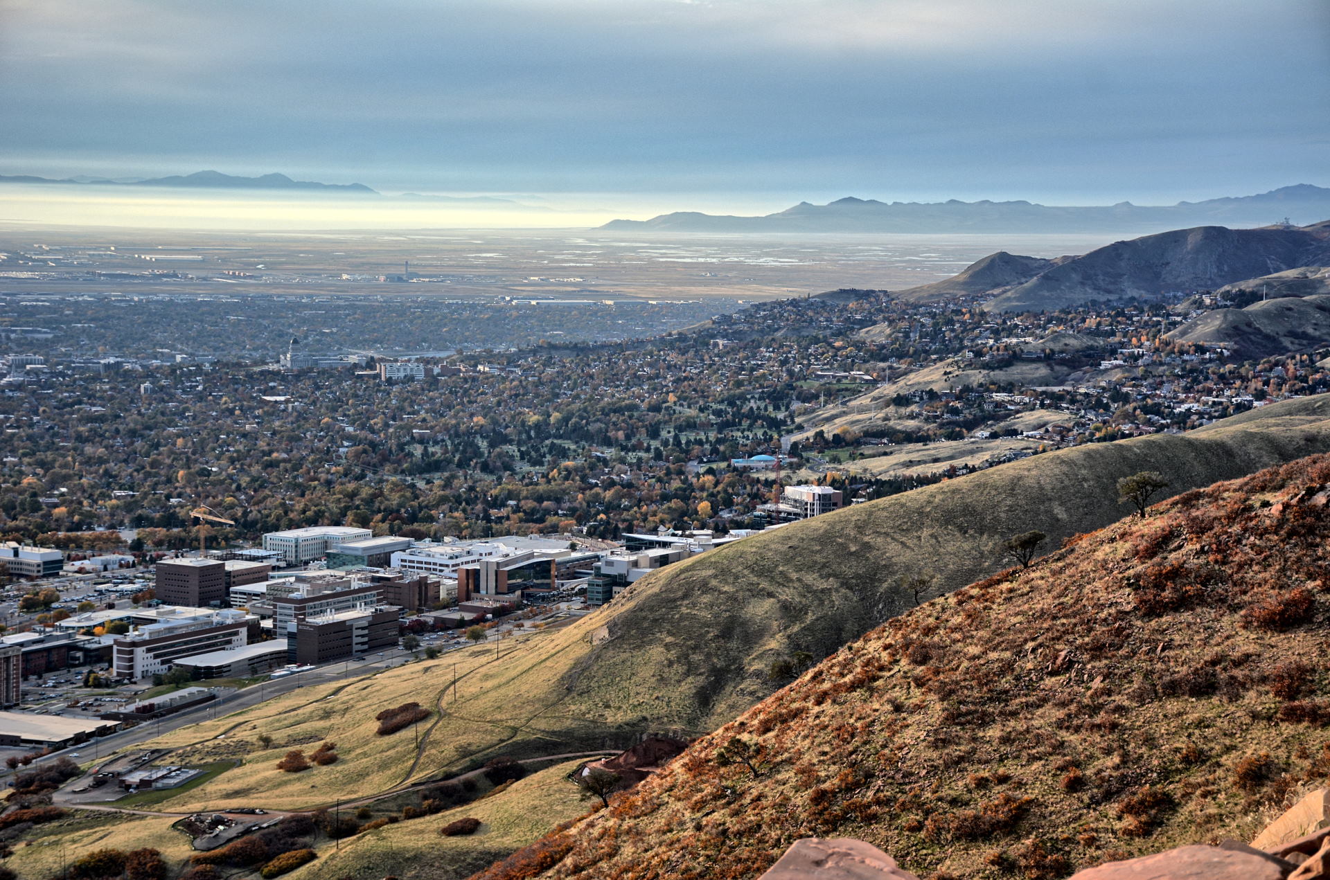
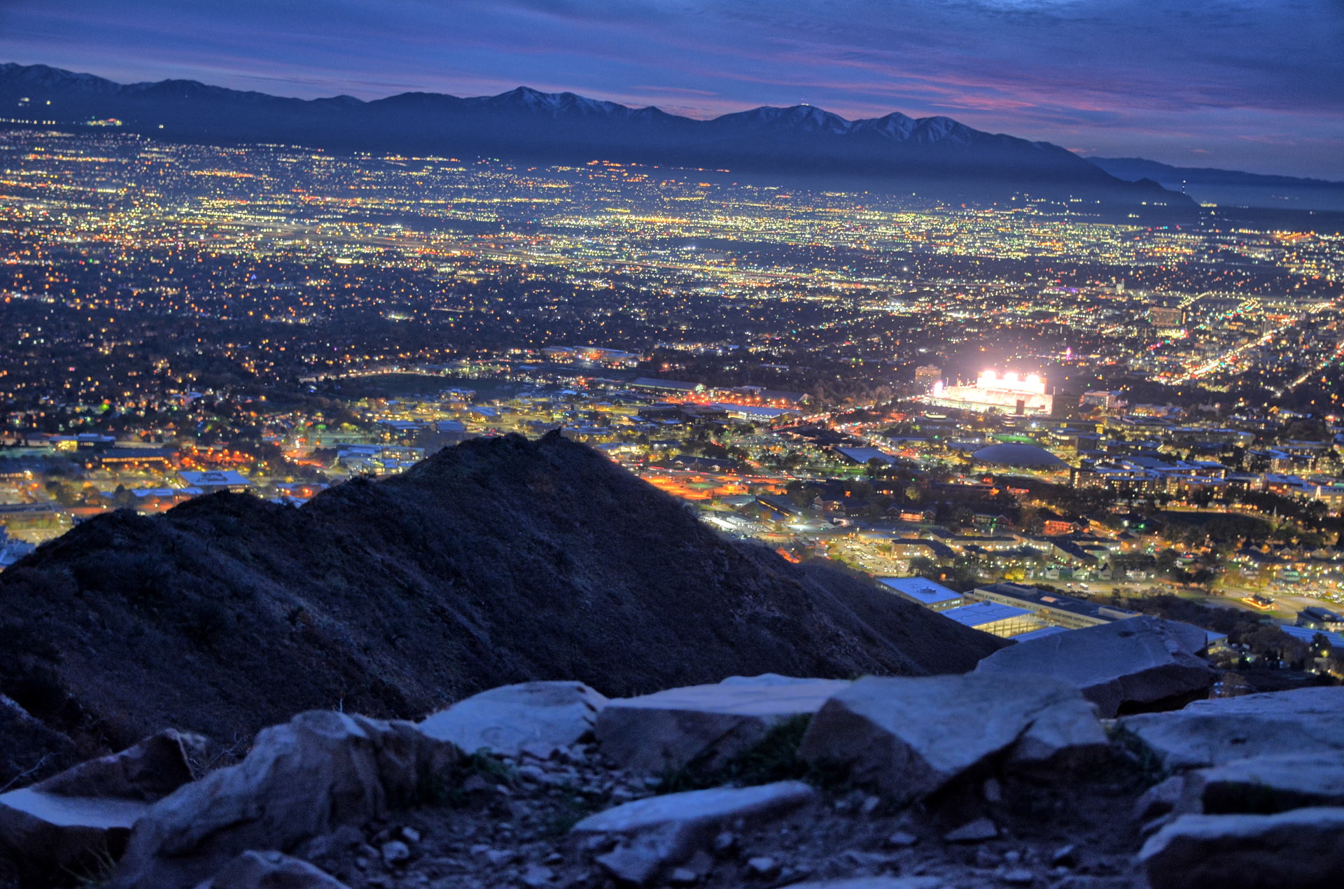
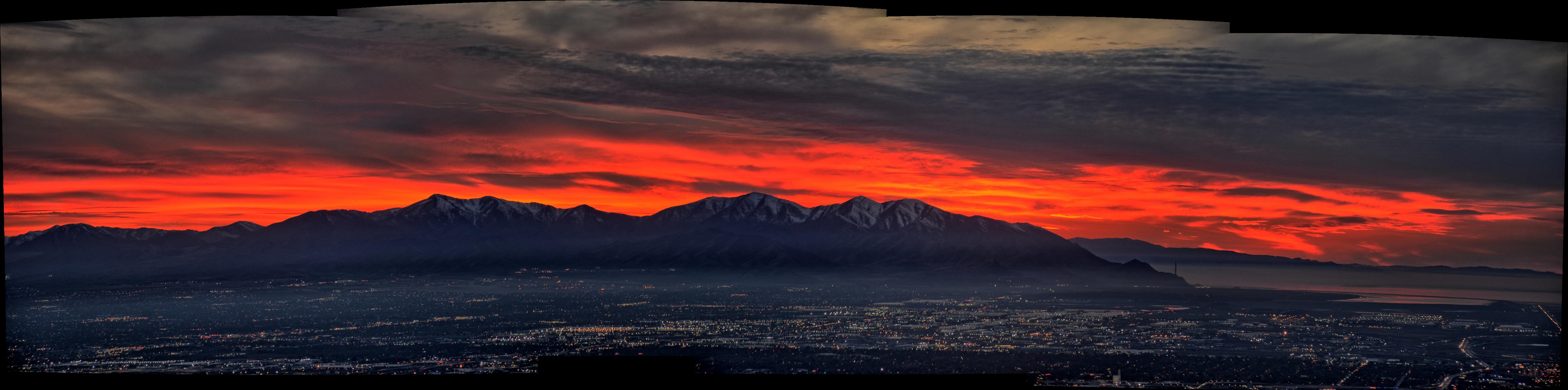
Chris decided not to drive anywhere distant on this weekend,
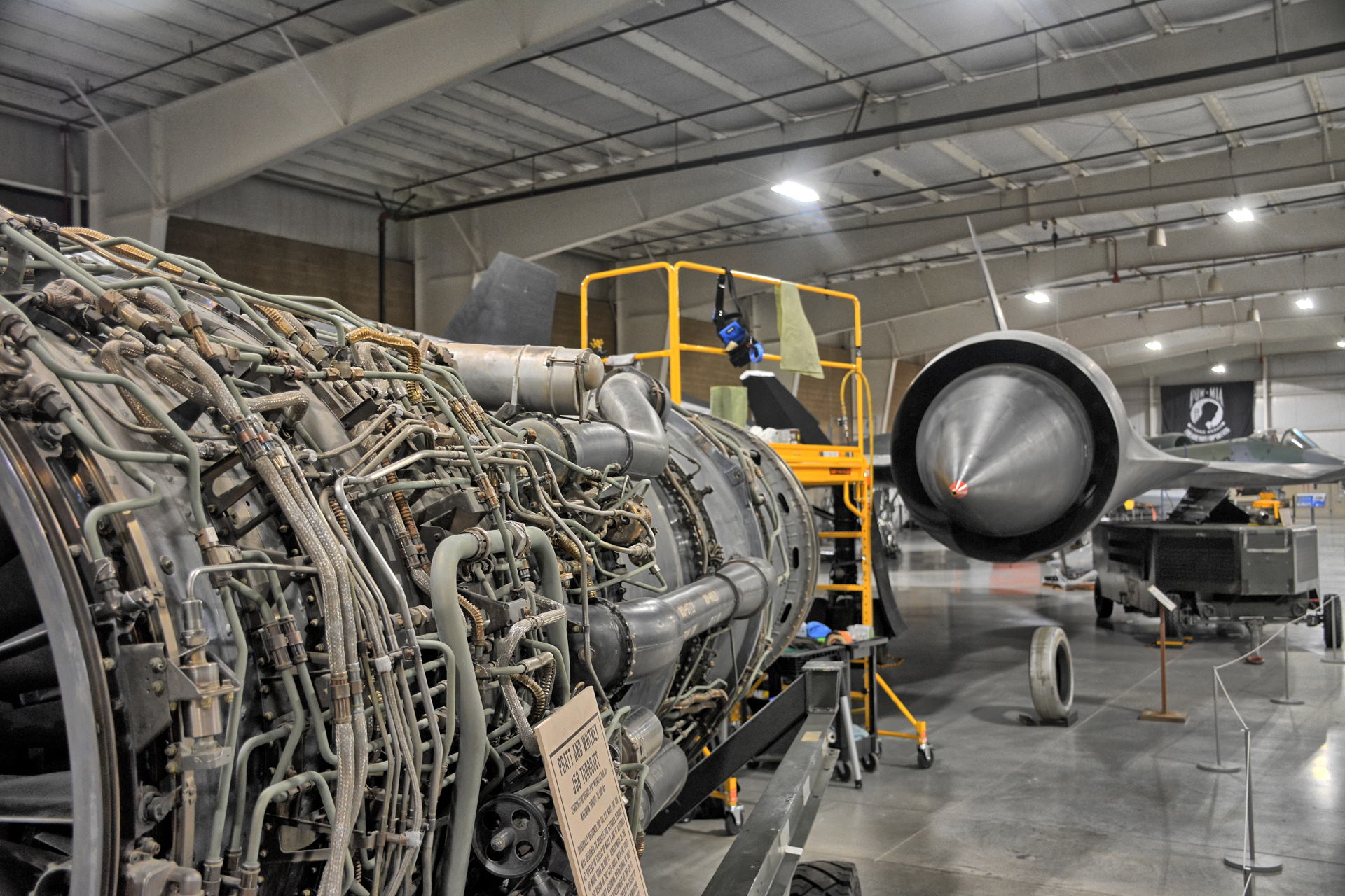
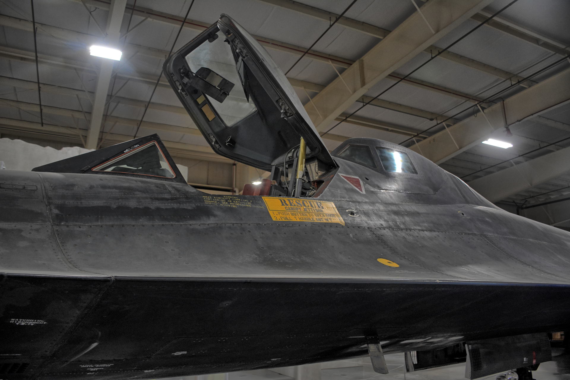
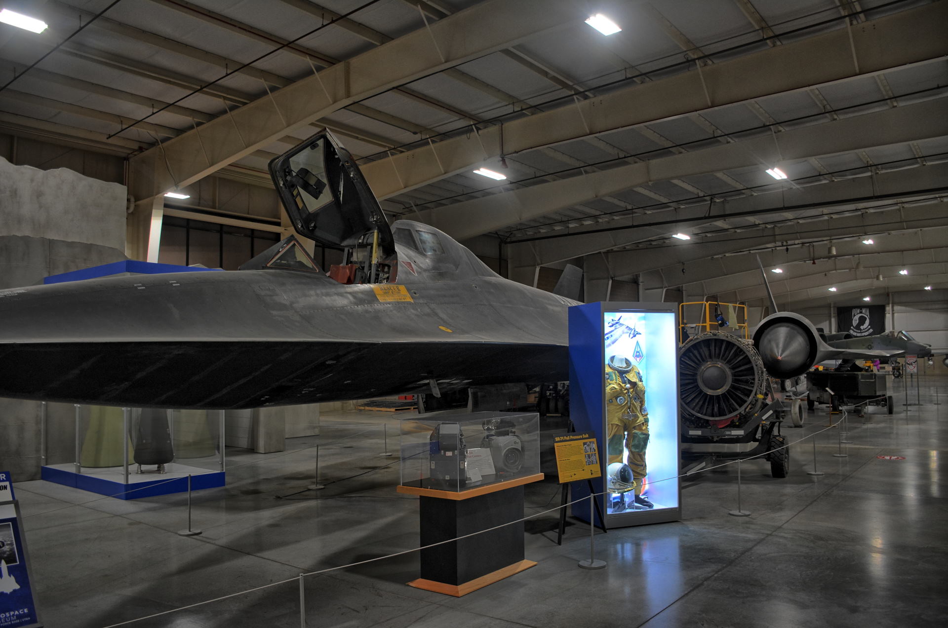
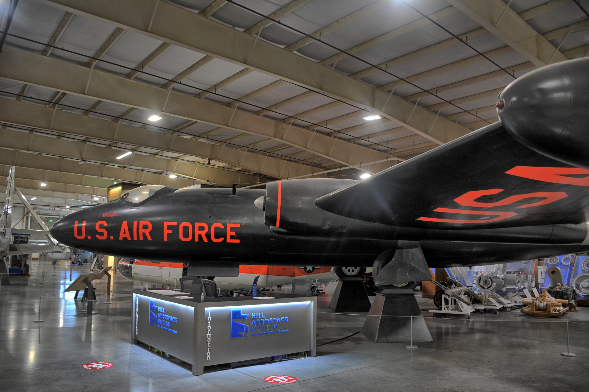
and did two short day trips from Dugway on Saturday and Sunday. He drove to Hill
Air Force Base on Saturday morning and visited the Hill AFB Aerospace Museum, which
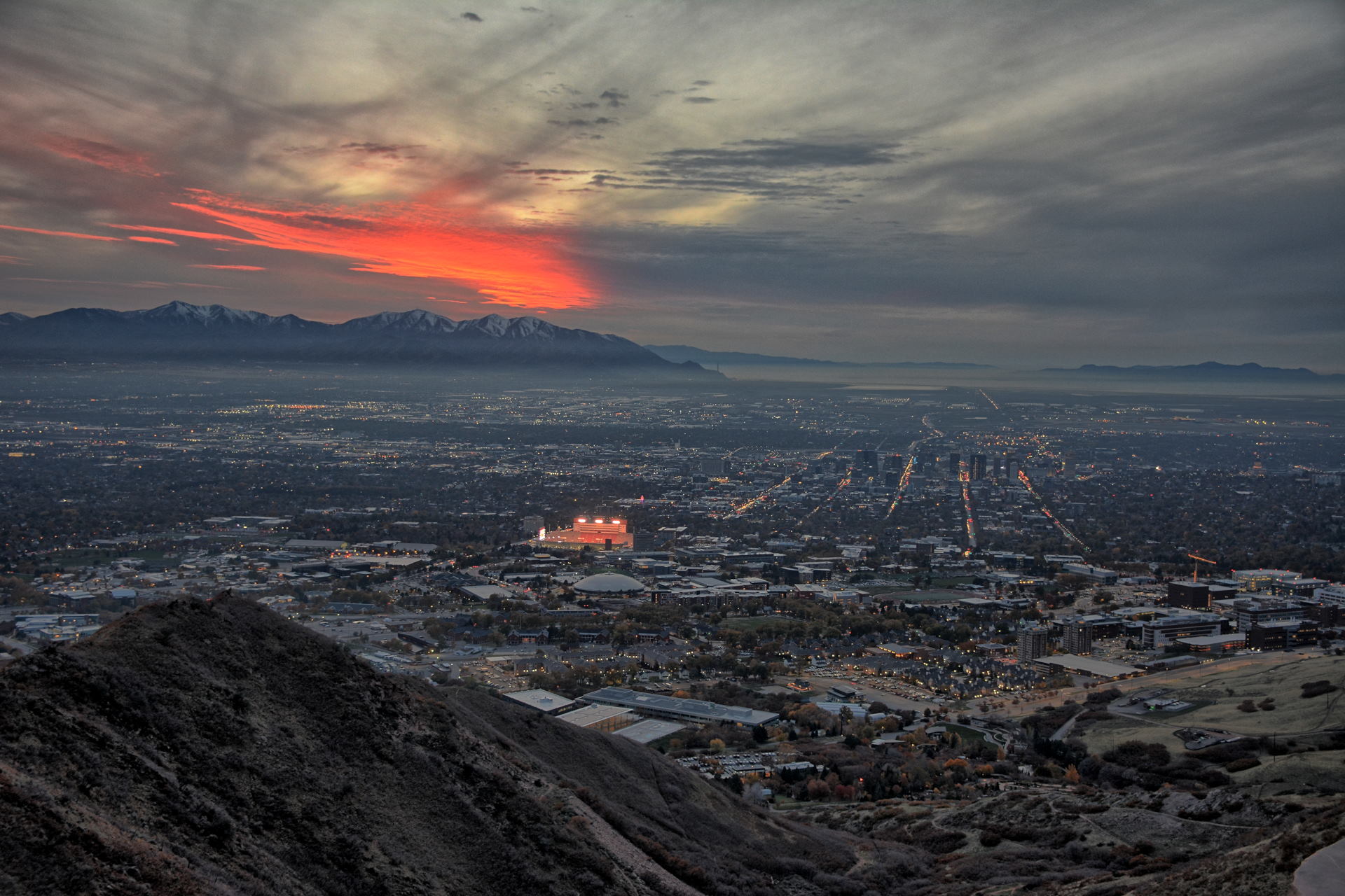
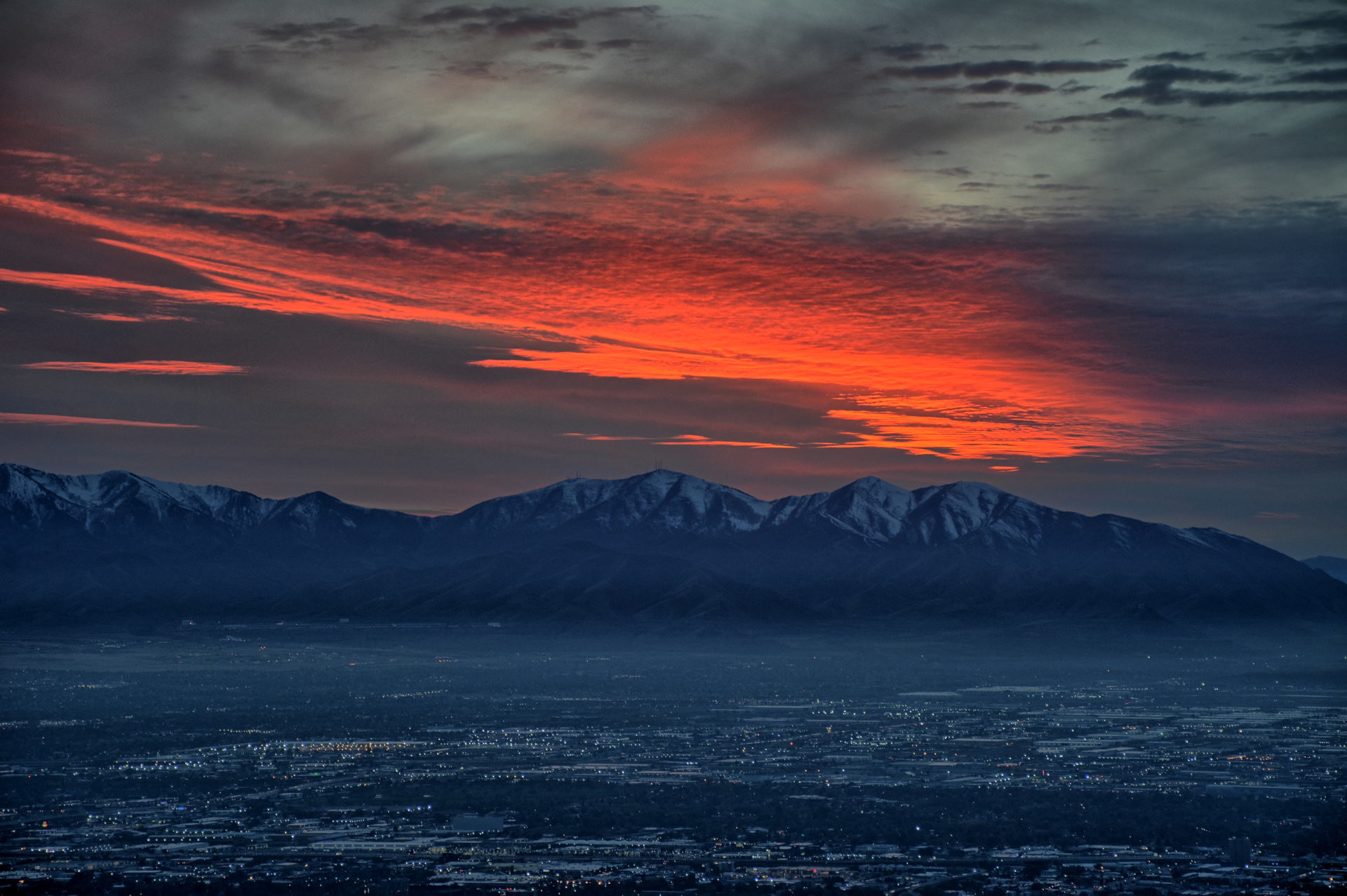
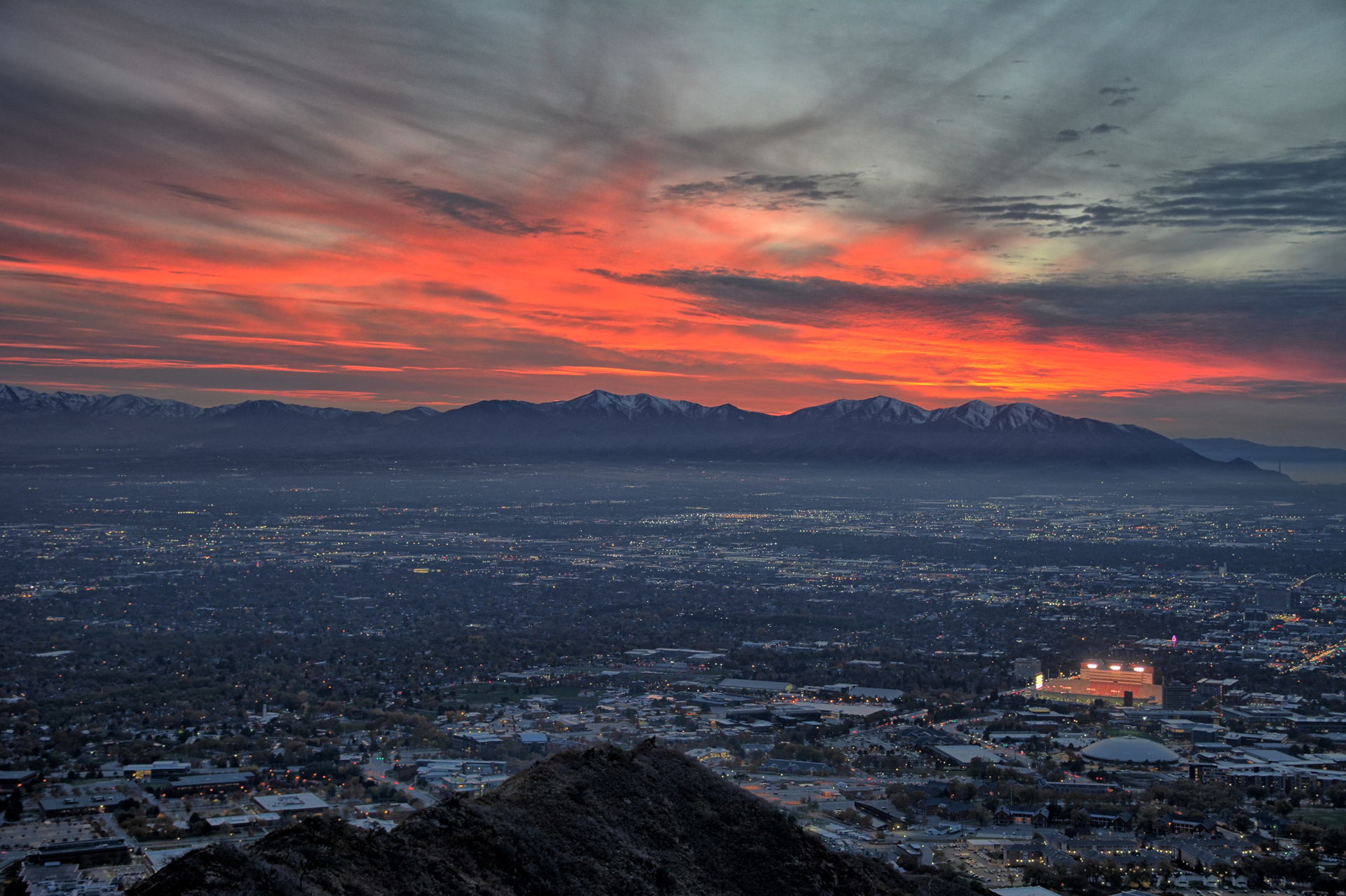
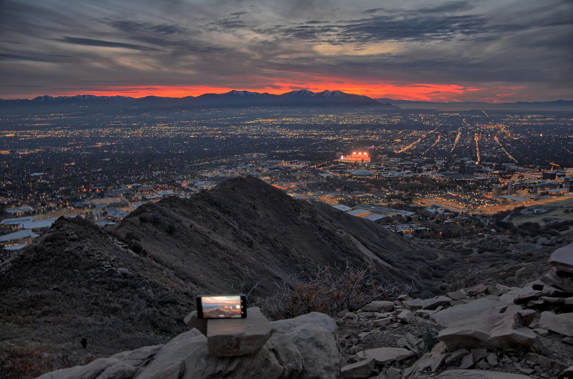
has a large collection of aircraft. After getting lunch, he drove east on
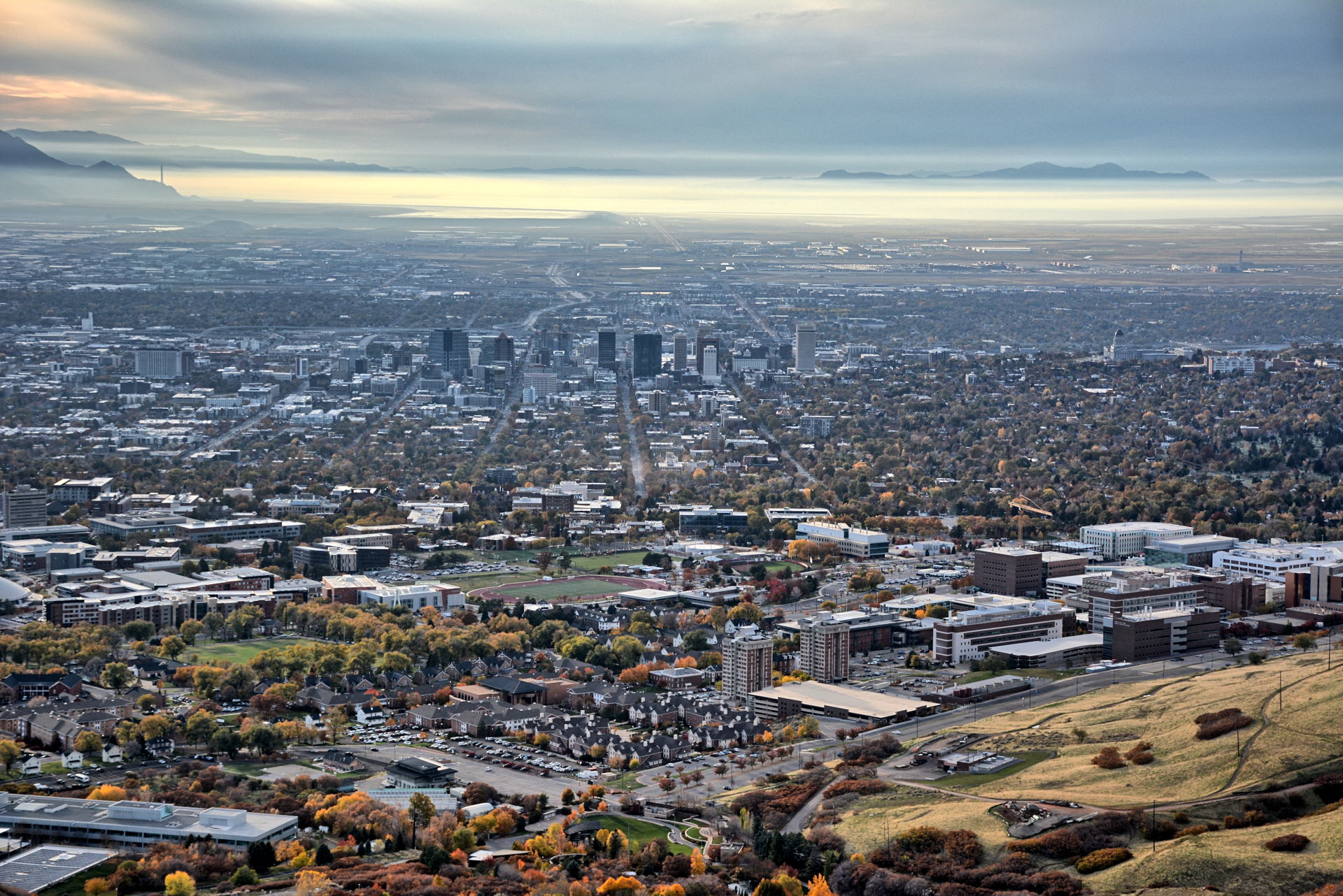
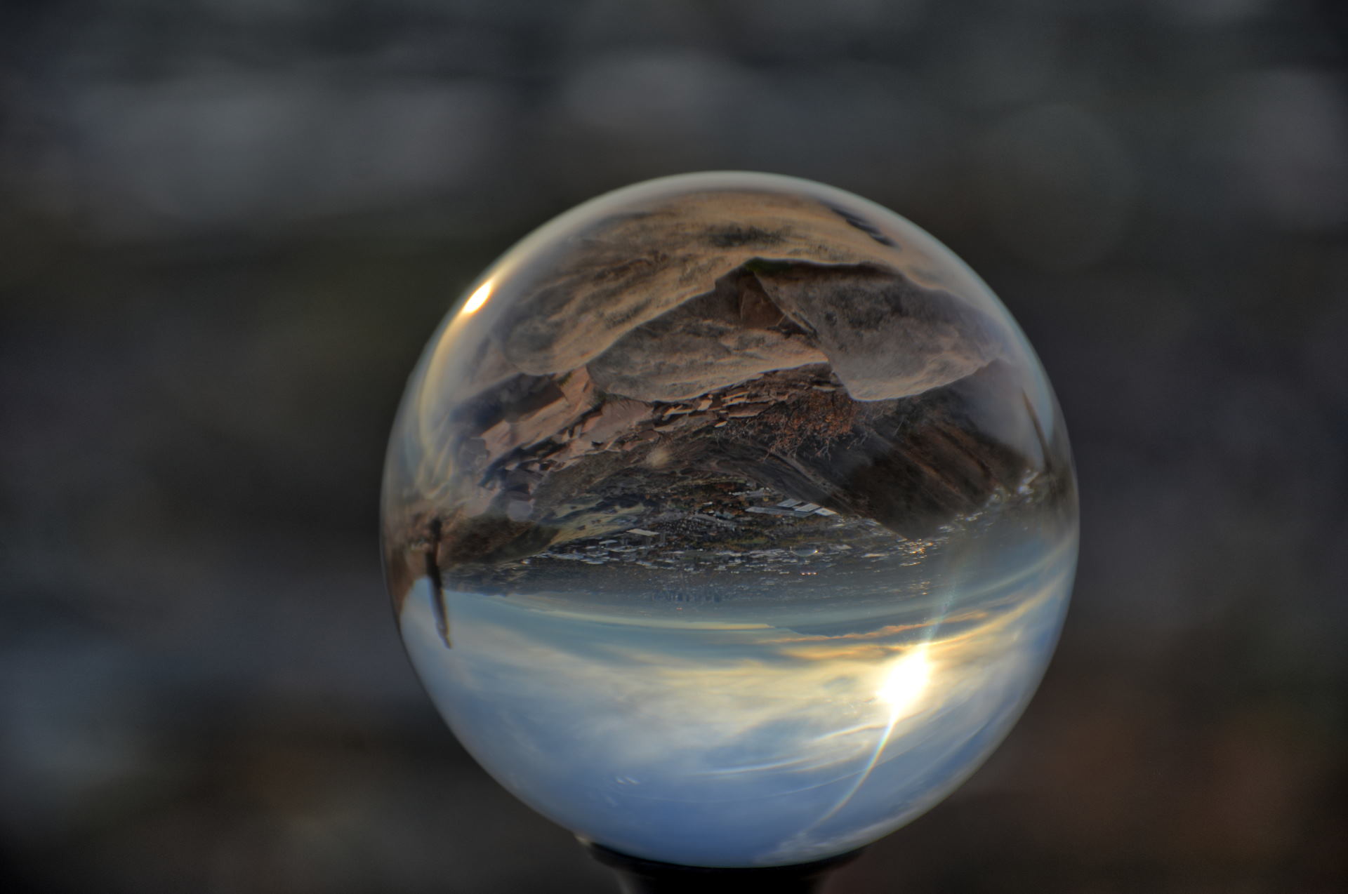
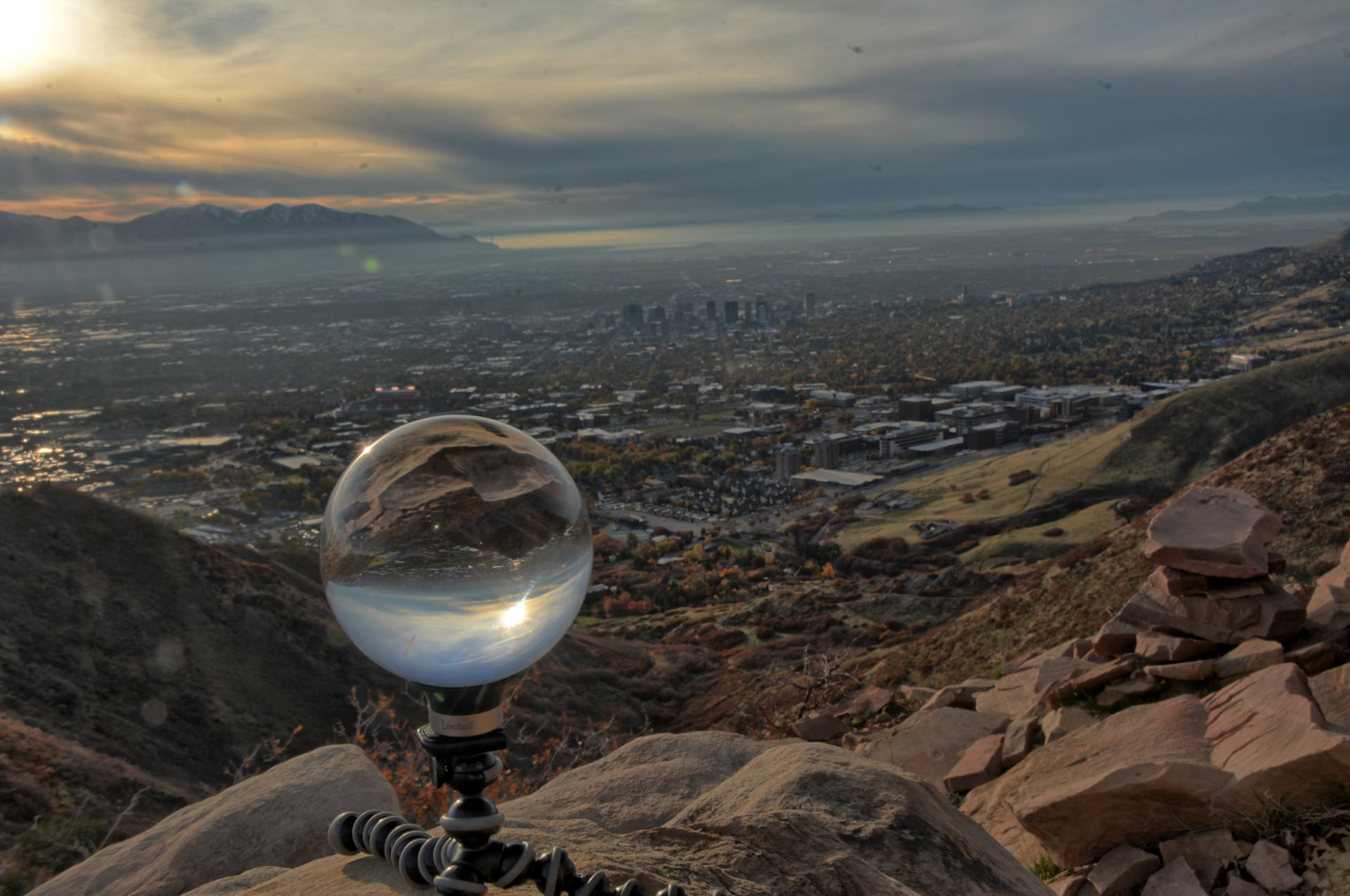
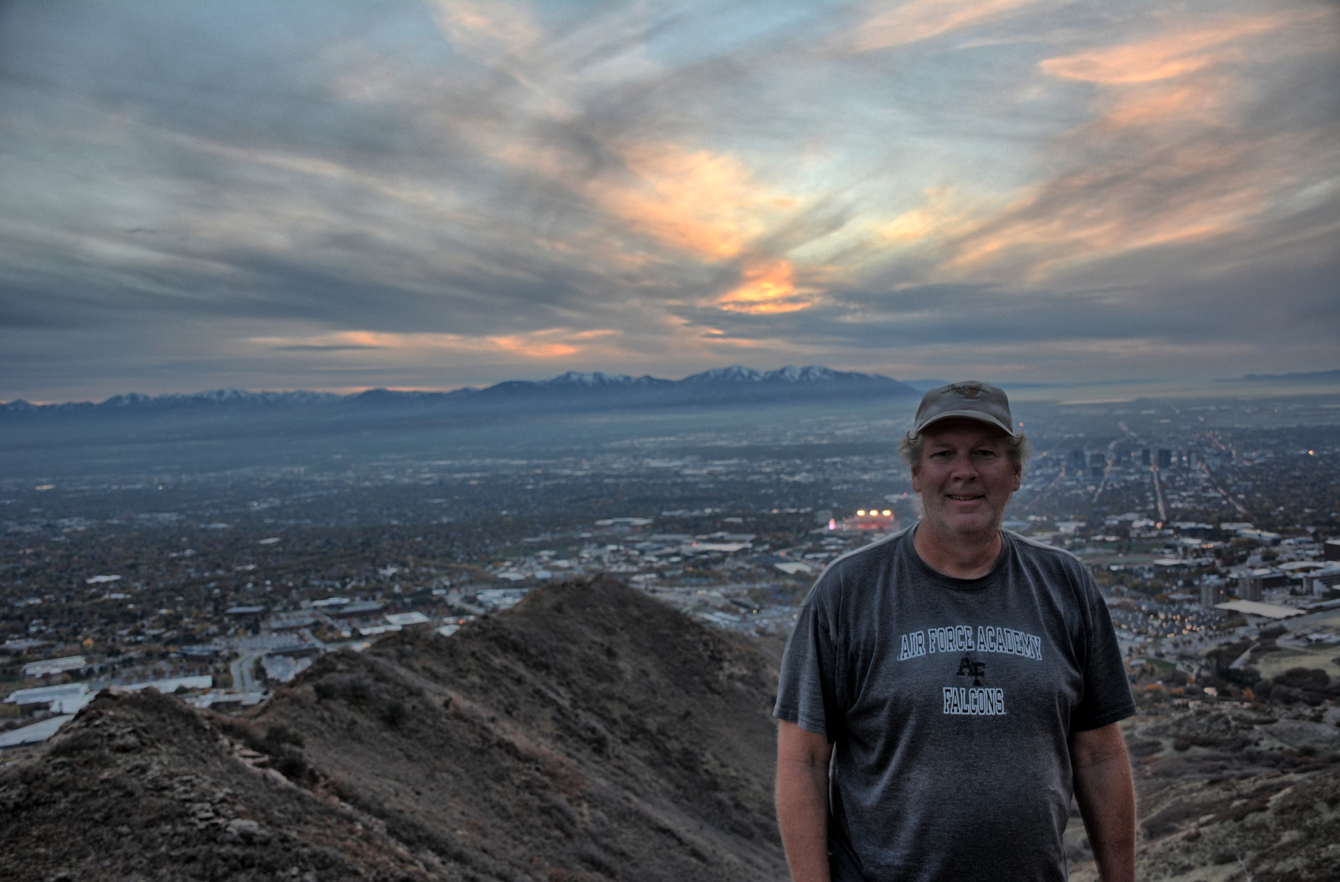
I-80 and up into the Wasatch Mountains. He flew his flying wing at
the east end of Emigration Canyon overlooking Salt Lake City, and then drove
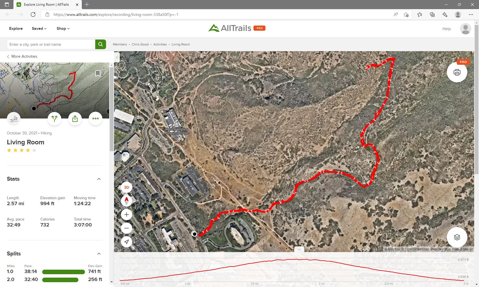
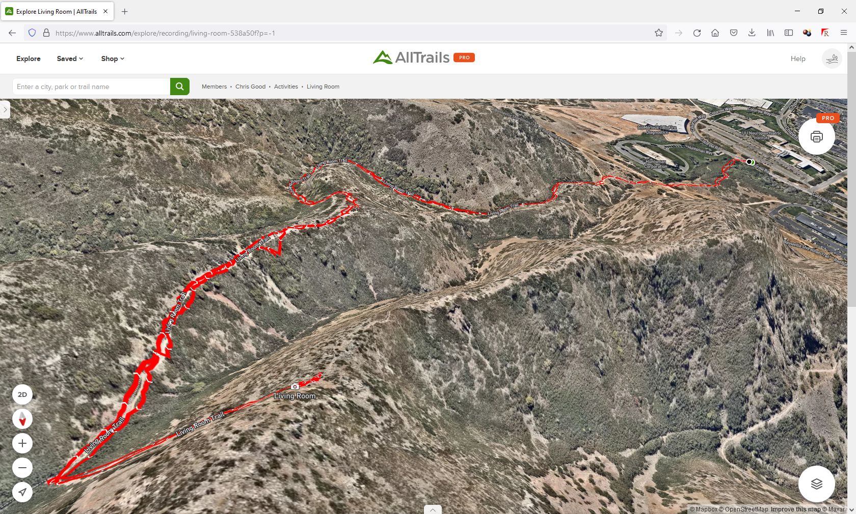
down the canyon to
the trailhead for the "Living Room" trail. It is only 1.3 miles
one-way to the top of the trail, but is 1000 feet of vertical climb in that
short distance. He stayed there until dark, filming a beautiful sunset on
his phone, and then hiked back in the dark. There are three time lapse
versions of the sunset video linked below. Chris went back to Dugway for the
night.
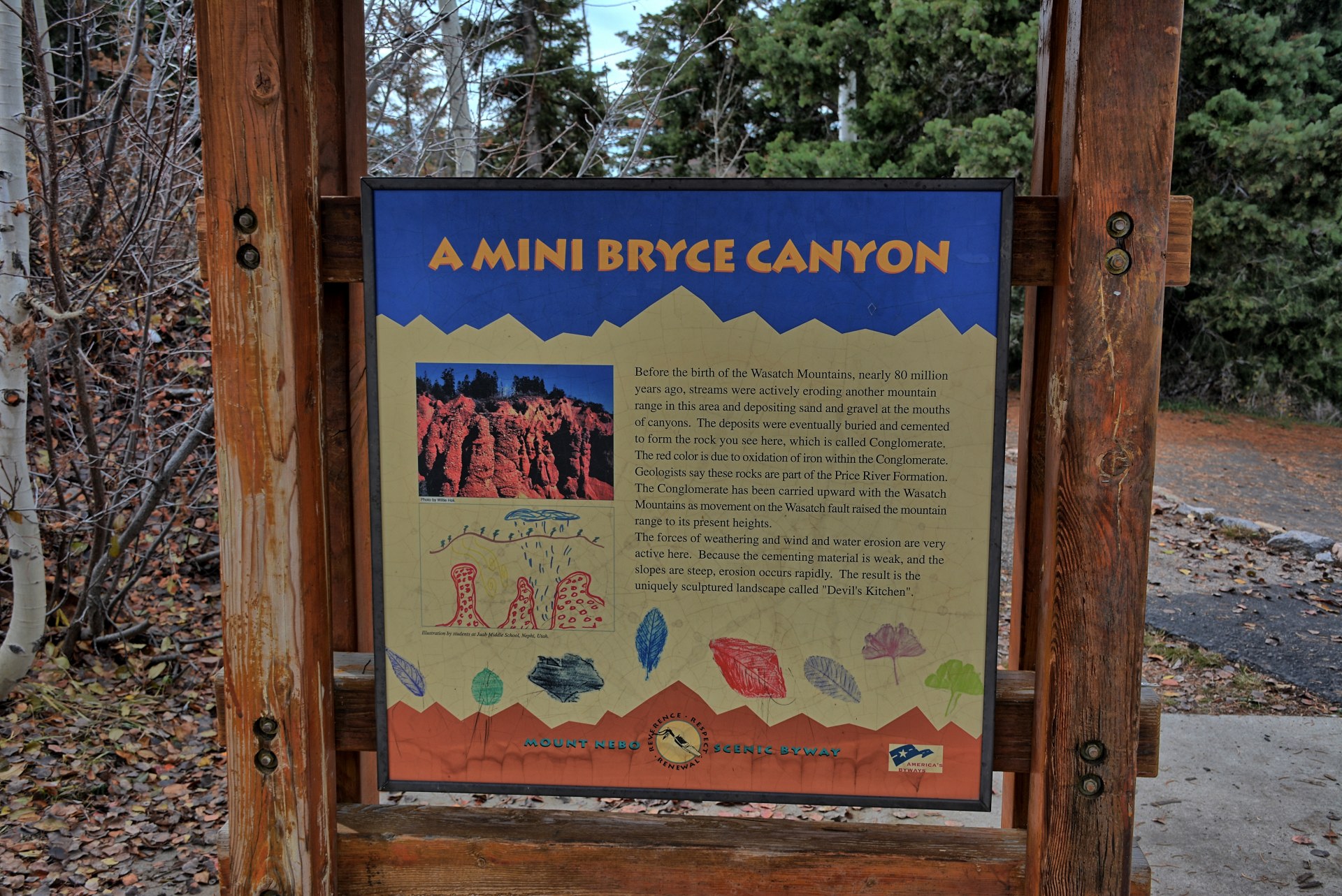
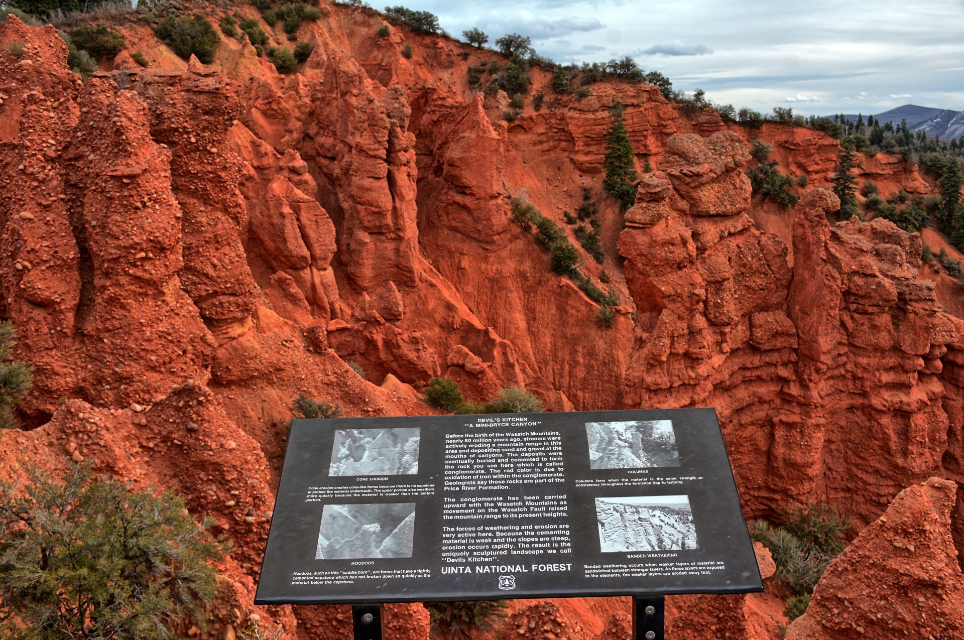
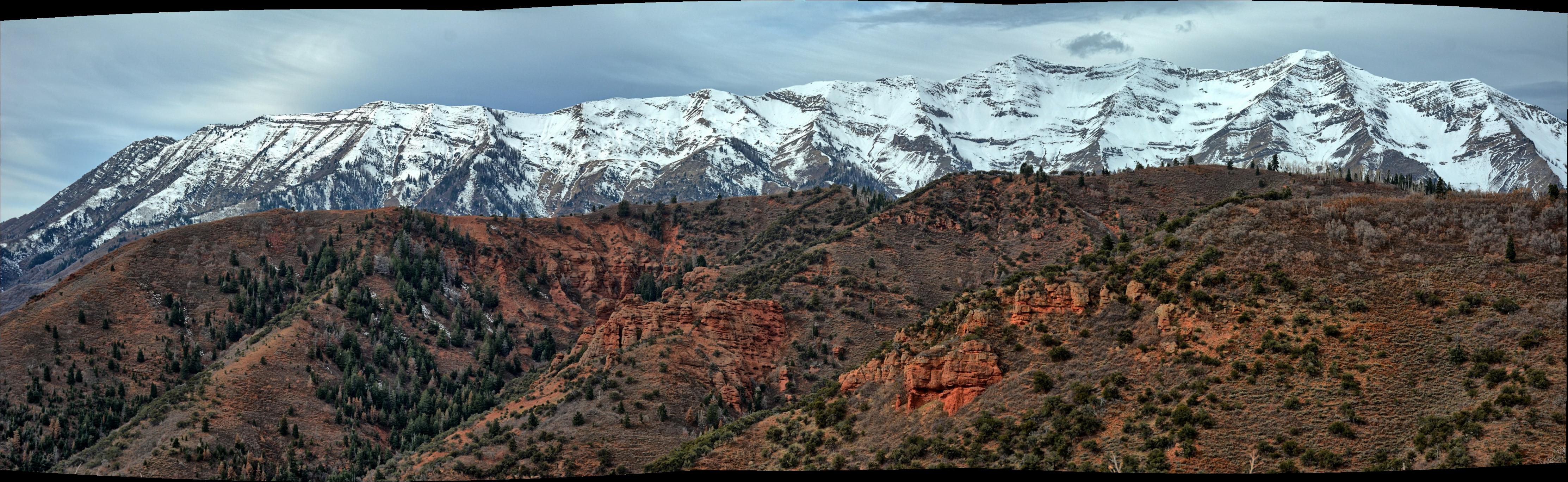
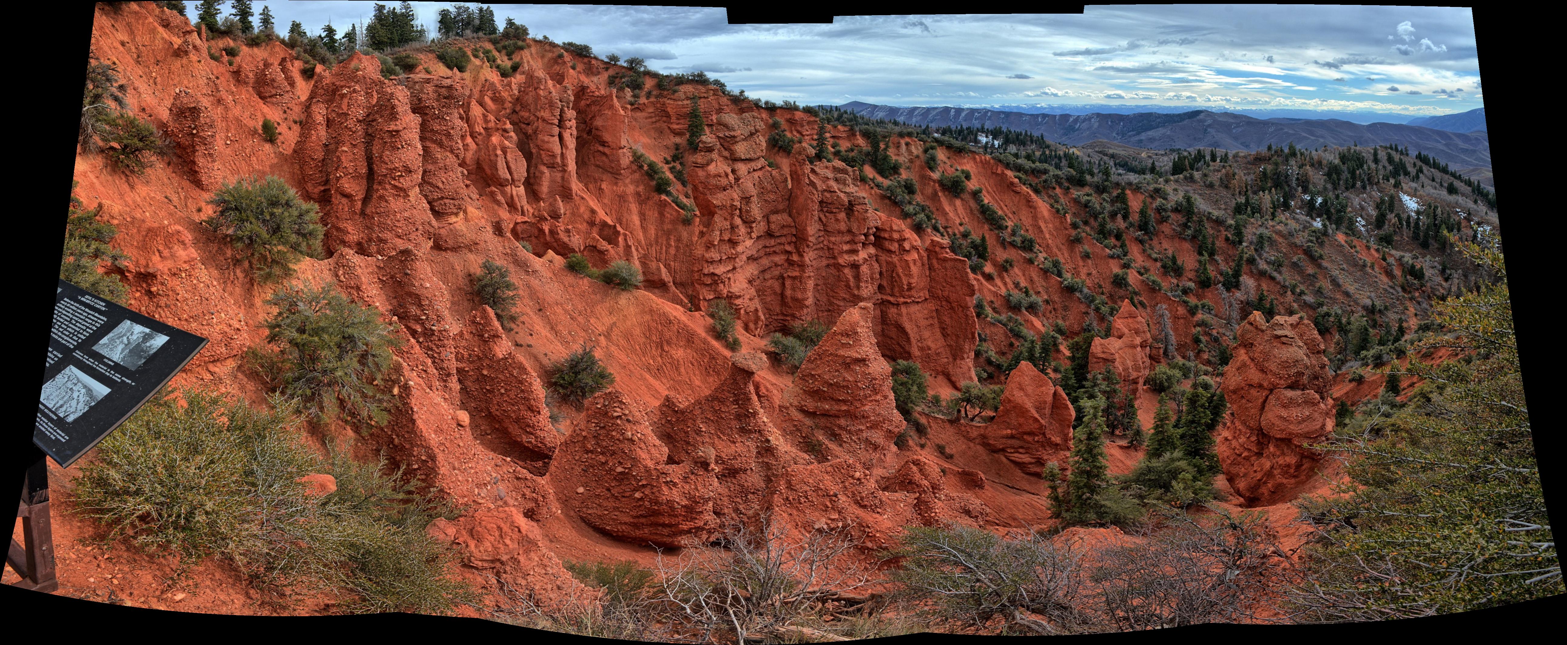
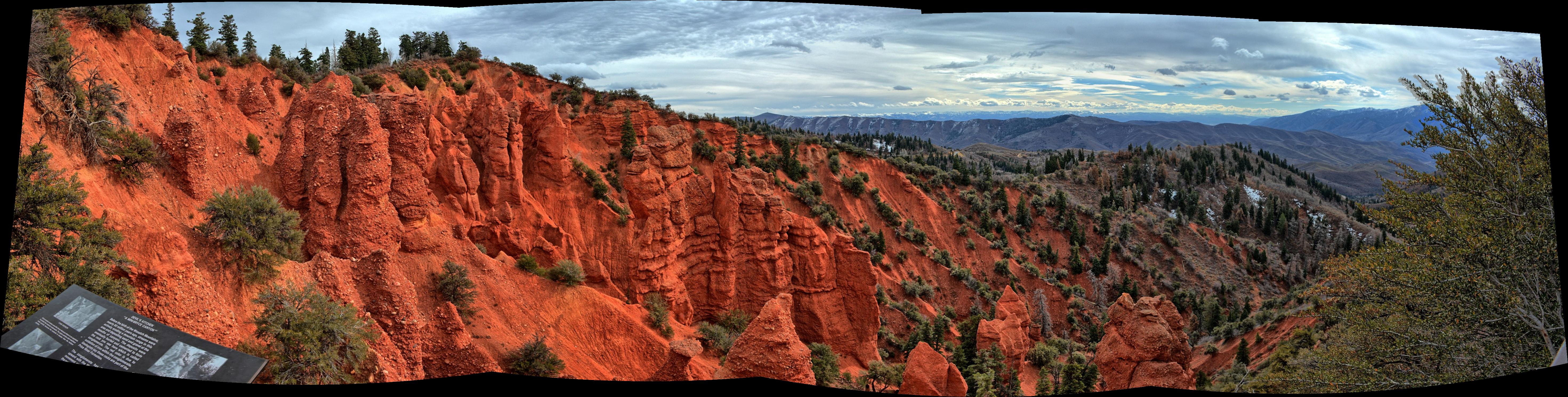
Chris drove to Nephi, picked up lunch, and then on to the Mt Nebo Scenic
Byway, which he completed going from south to north. There is a small
section of red rock hoodoos on this drive called Devil's Kitchen. It is billed
as a "Mini Bryce Canyon" - it is a very mini Bryce Canyon. He ended the
drive in Payton
and then returned to Dugway. He
flew his flying wing twice on this drive, once on the Mt Nebo Scenic Byway, and
at Johnson Pass just before arriving back to Dugway.
One program had finished flying for a few weeks, while the
other program was confined to ground testing during this week. A skeleton
crew remained for this week to conduct the ground testing. Chris flew his
180 sized quadcopter, flying wing, and camera quadcopter after work on 3
November 2021 in Skull Valley. Chris and the
crew finished the ground testing on Friday afternoon. After they
finished putting the plane away for the weekend, Chris began a drive south and
west into Nevada, where he planned to visit Cathedral Gorge State Park on Saturday
morning. He
drove past Great Basin National Park on the route into Nevada, and camped for
Friday night in his car at the
Pony Springs Rest Area in eastern Nevada.
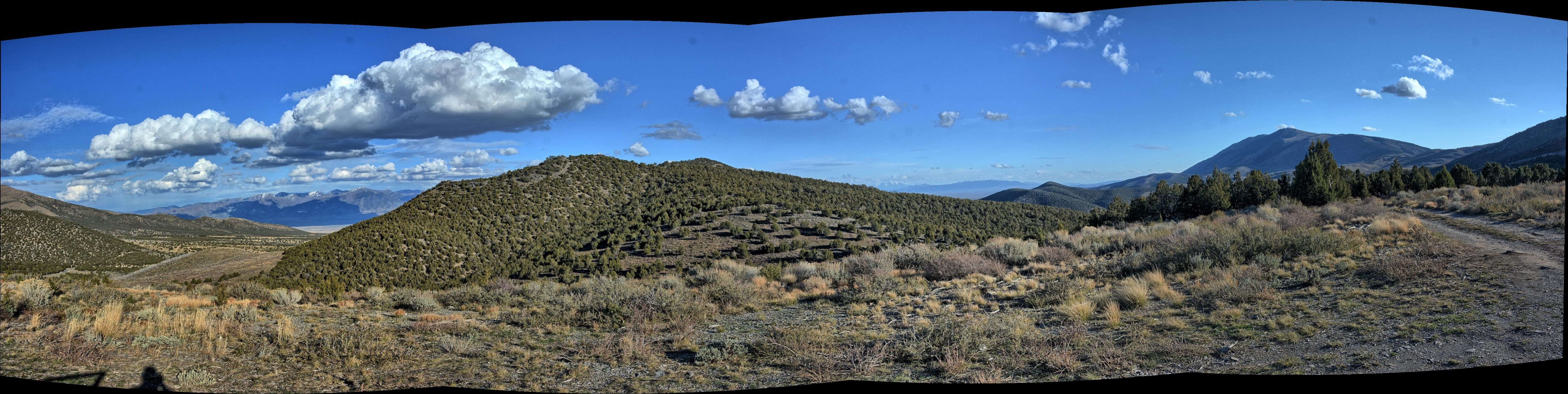
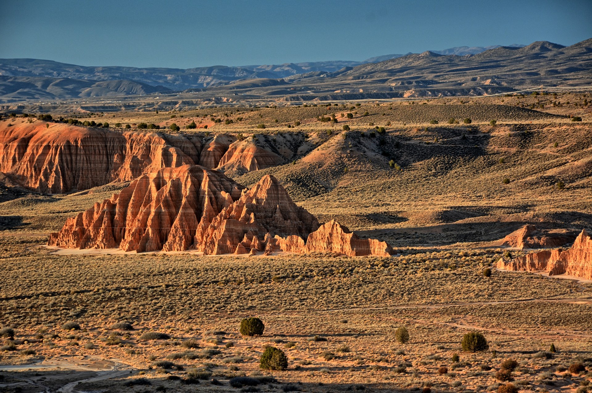
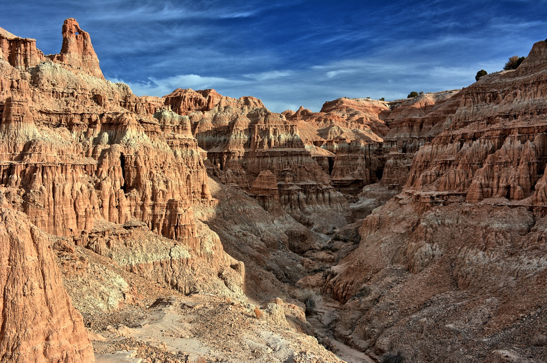
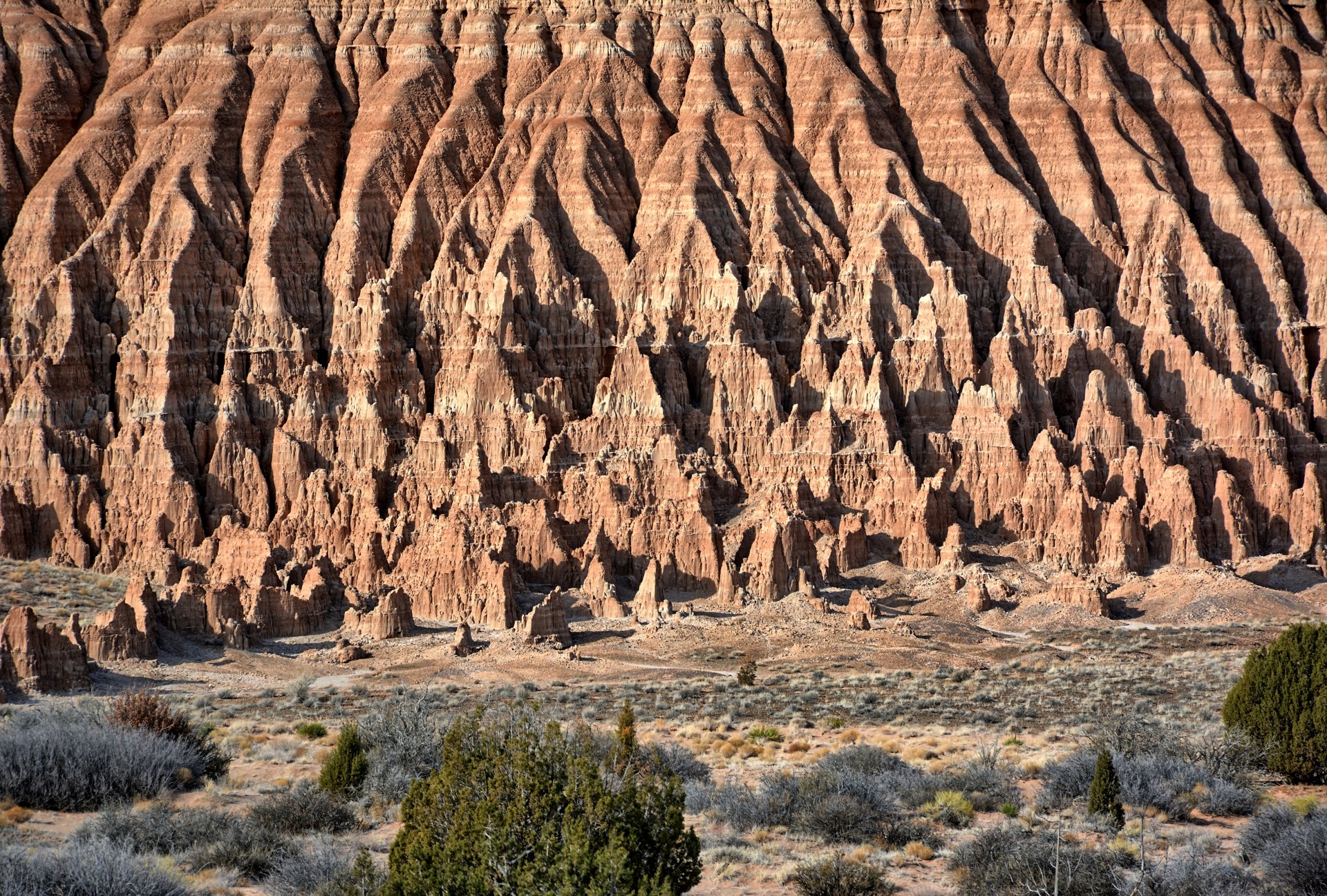
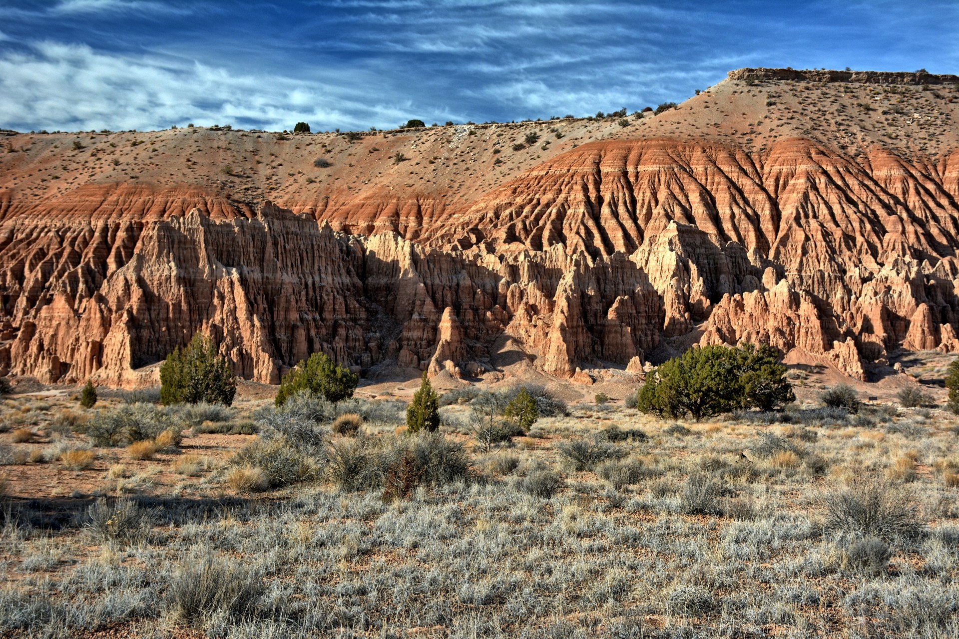
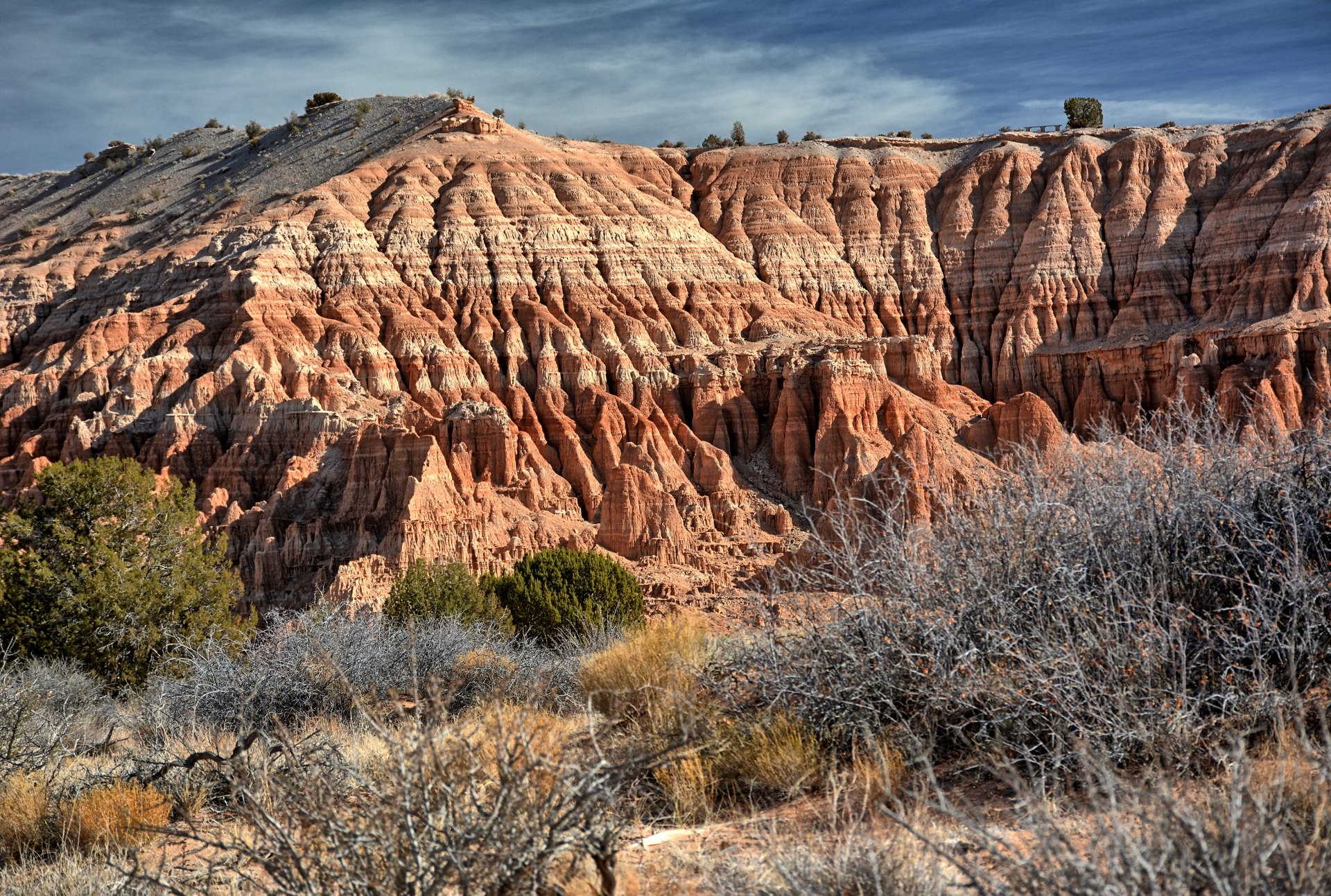
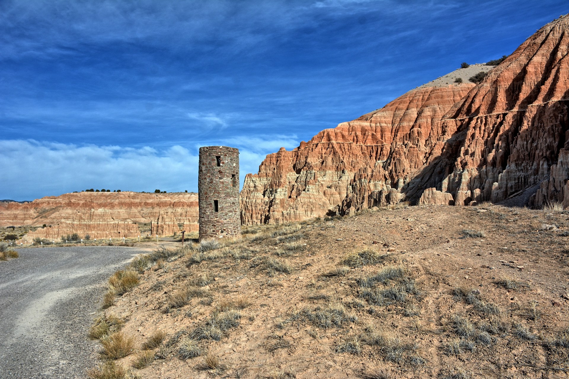
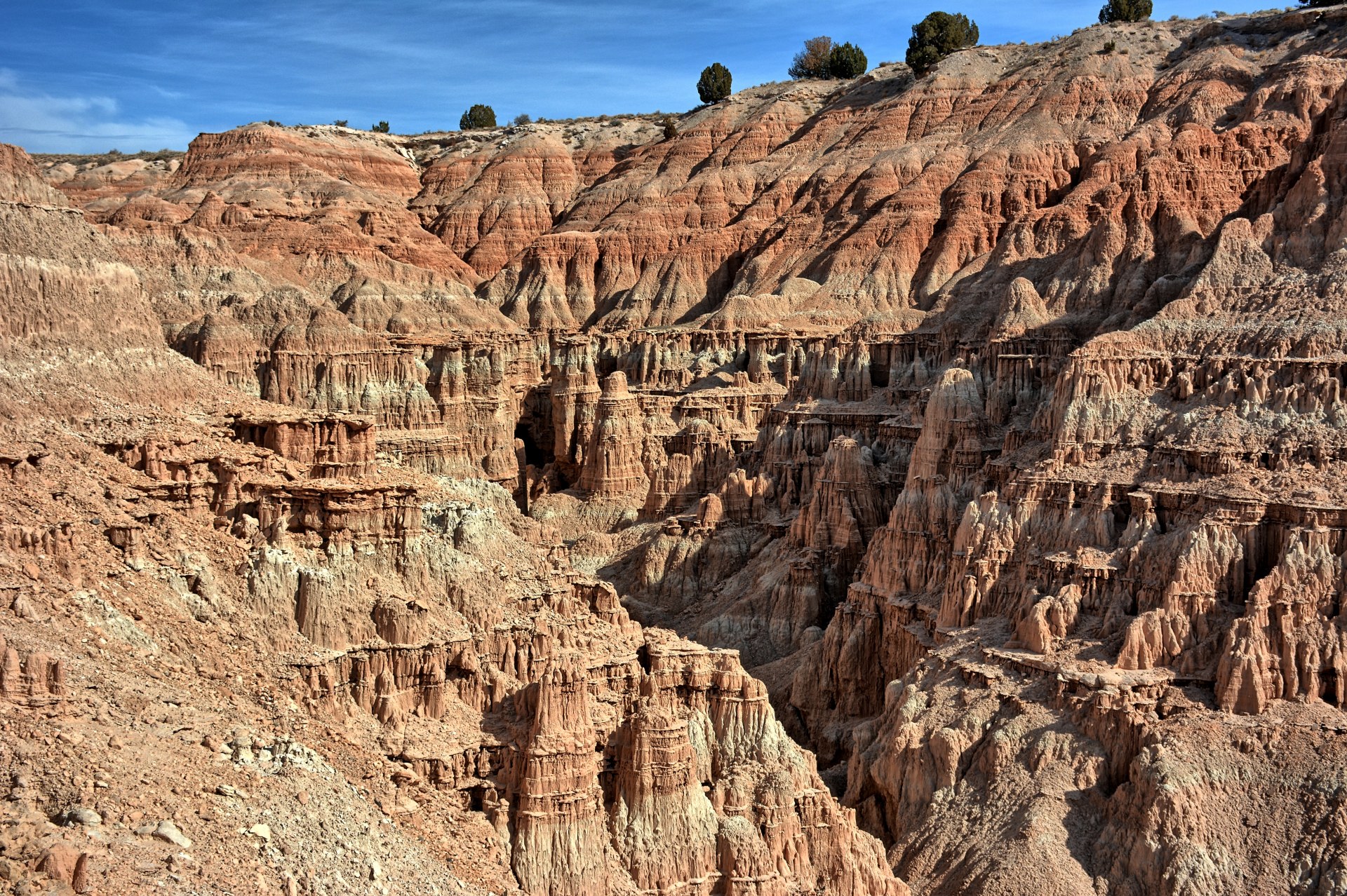
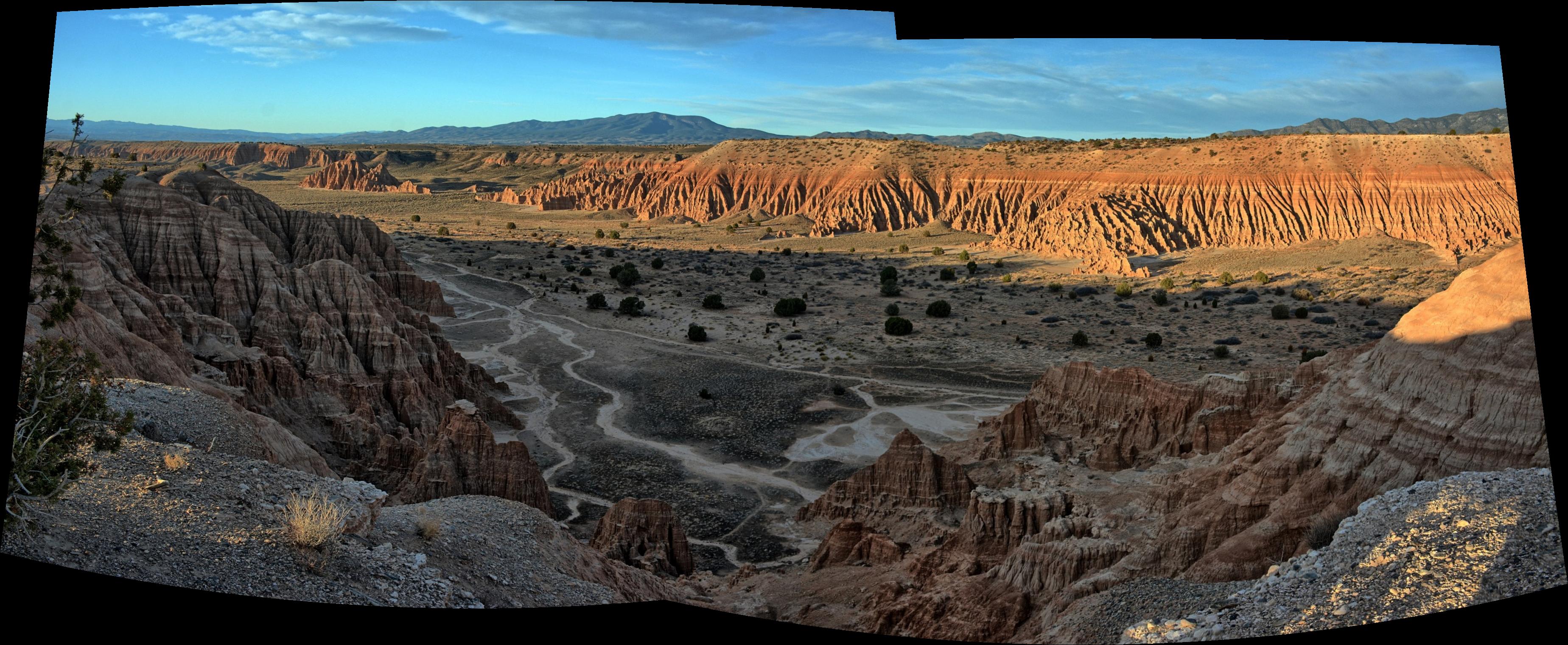
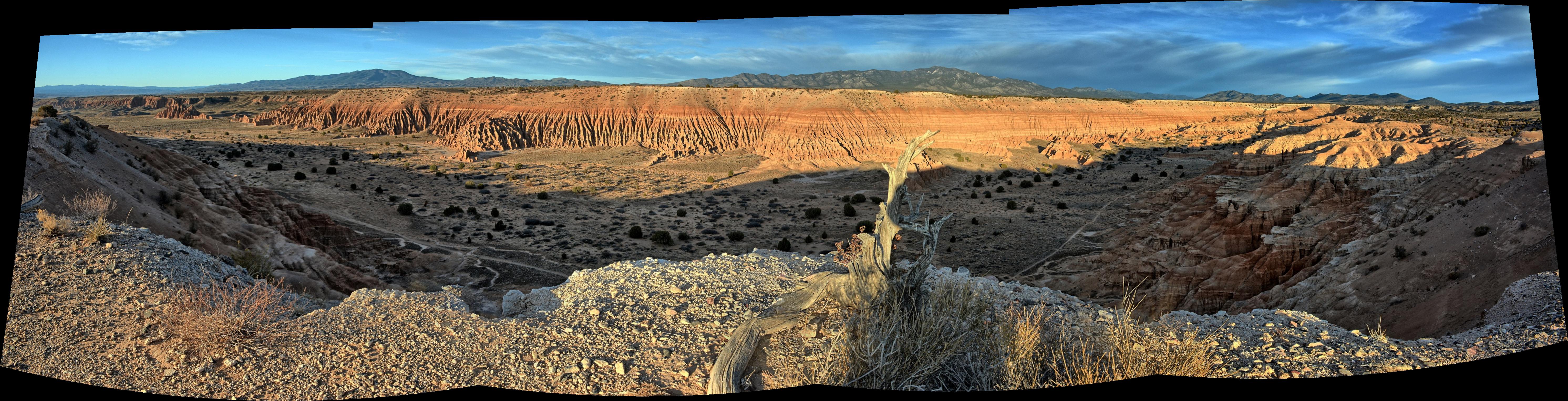
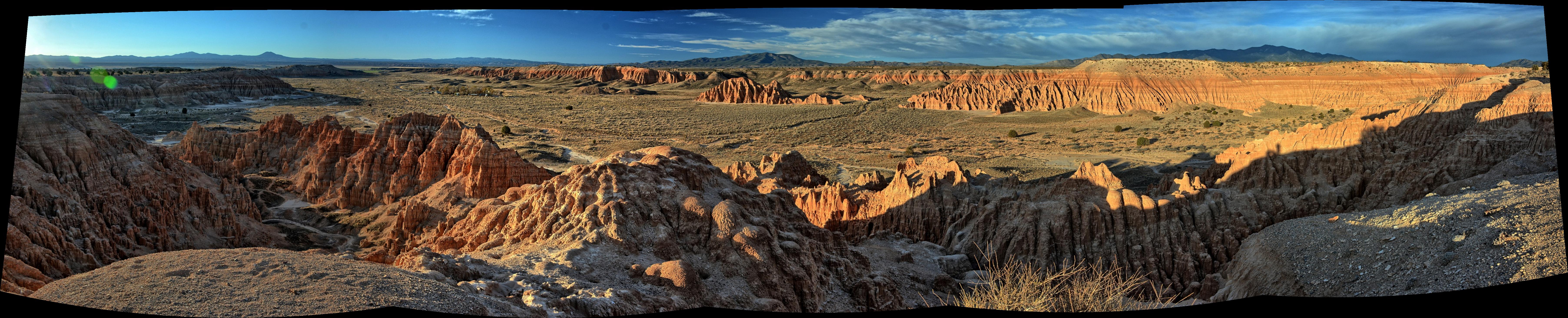
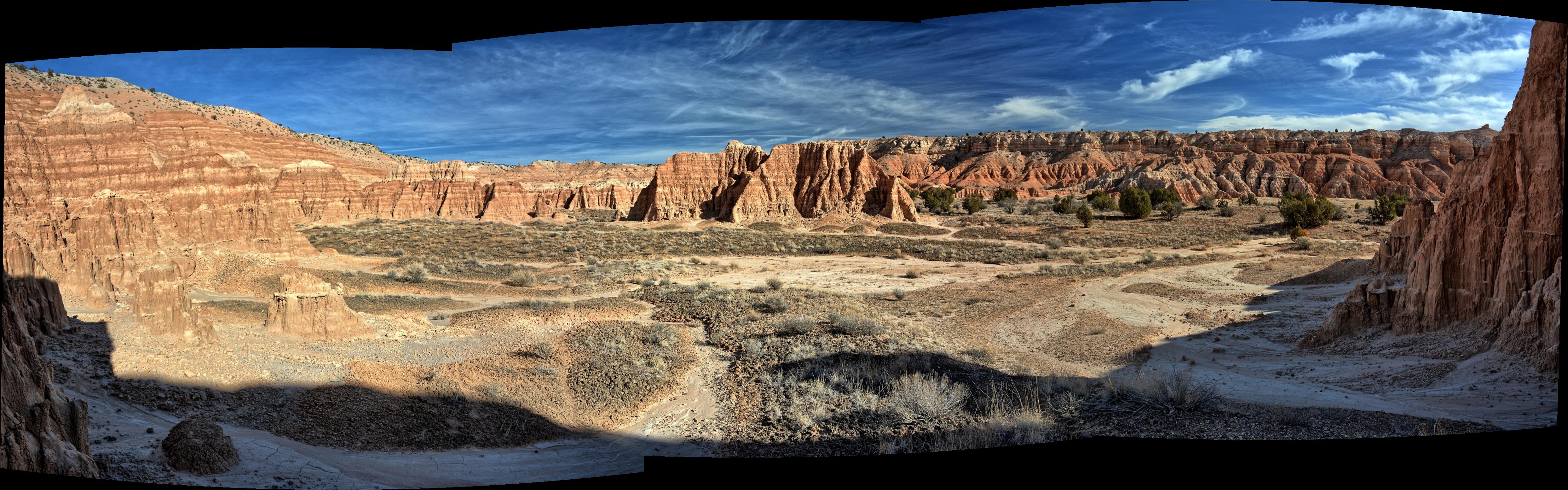
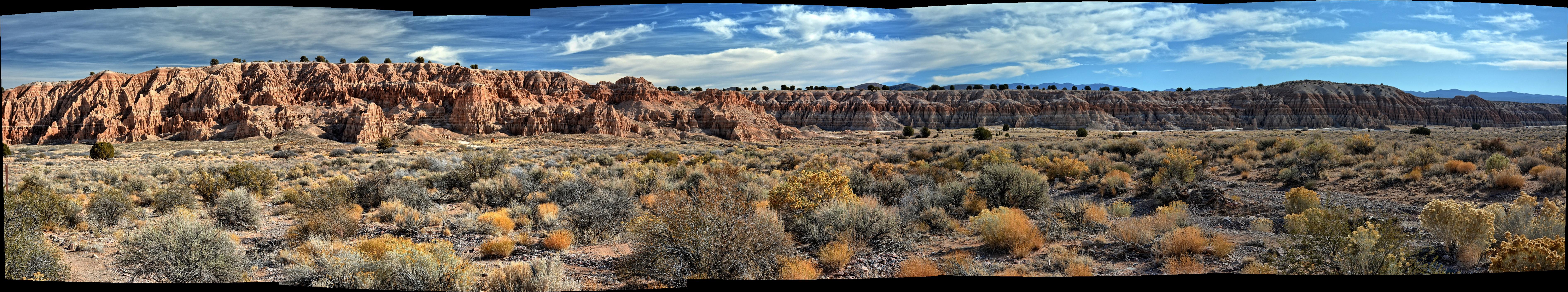
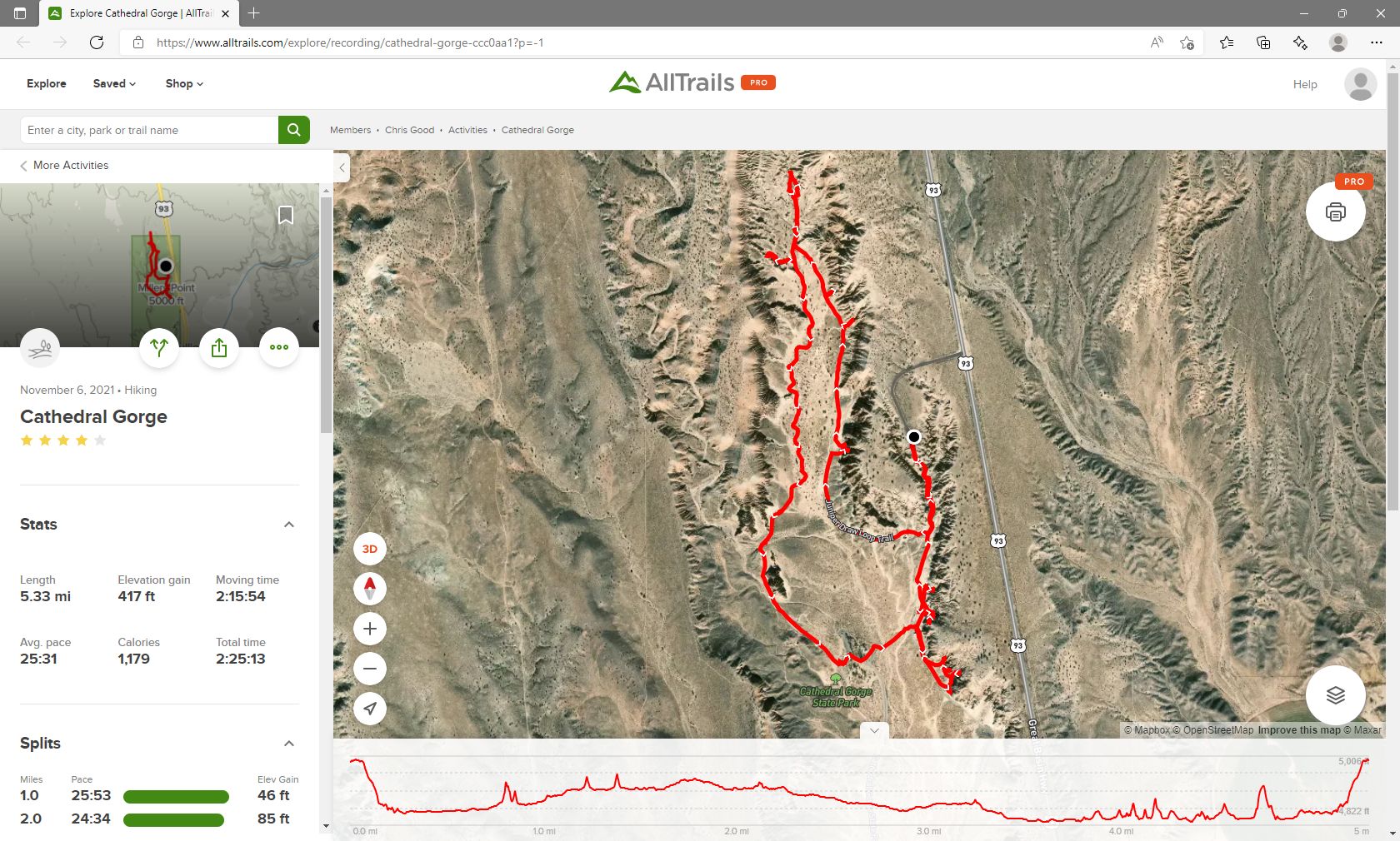
Chris woke up and
drove the last hour to Cathedral Gorge State
Park,
Nevada. He hiked the very short Eagle Point trail overlooking the
gorge, flew his flying wing at the Eagle Point trailhead, made breakfast at
Miller Point, and then hiked the 5.3 mile loop trail through and around the
gorge. When he finished the loop trail and returned to his car, he flew
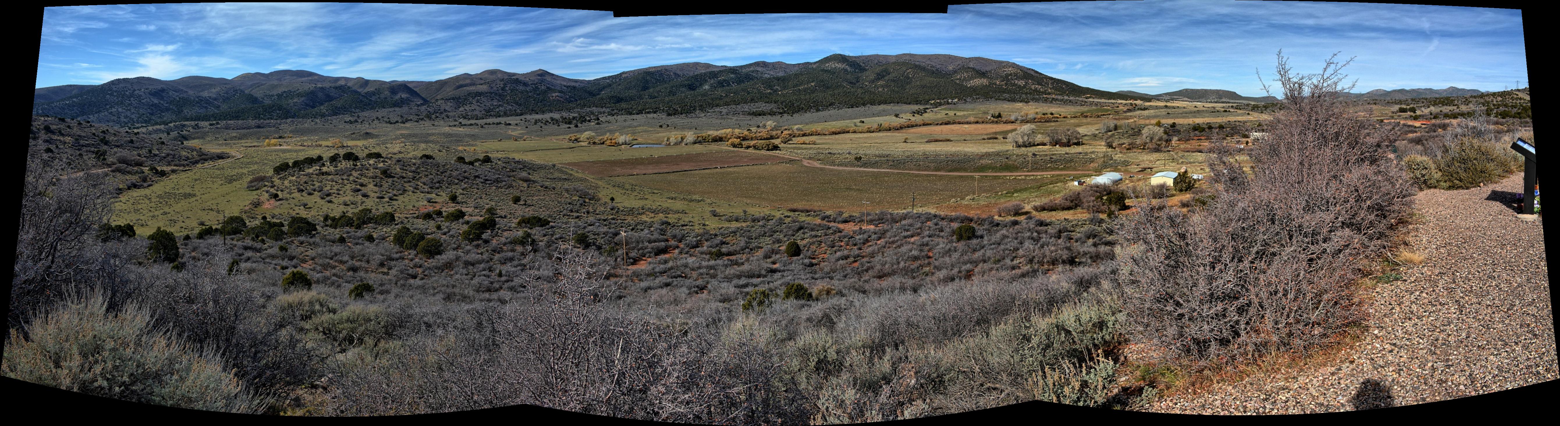
his camera quadcopter at Miller Point. He drove on, headed towards St
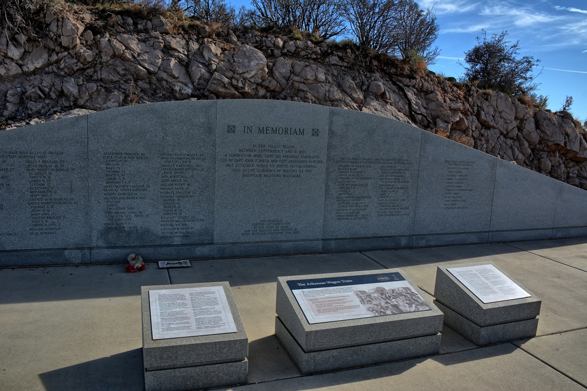
George, Utah. He stopped at the Mountain
Meadows Massacre Memorial Site,
here in Utah. In 1857 a group of Mormon militia had attacked and
killed a large group of settlers headed towards California in this small mountain
valley. One of the leaders of that attack was John D Lee. After the
massacre, Lee and others had hidden to avoid prosecution. Lee's Ferry
on the Colorado River, just below Page, Arizona at
the beginning of the Grand Canyon was colonized by Lee and his wives as a ferry crossing during this
time, and that is where Lee had hidden before he was arrested in 1874, tried,
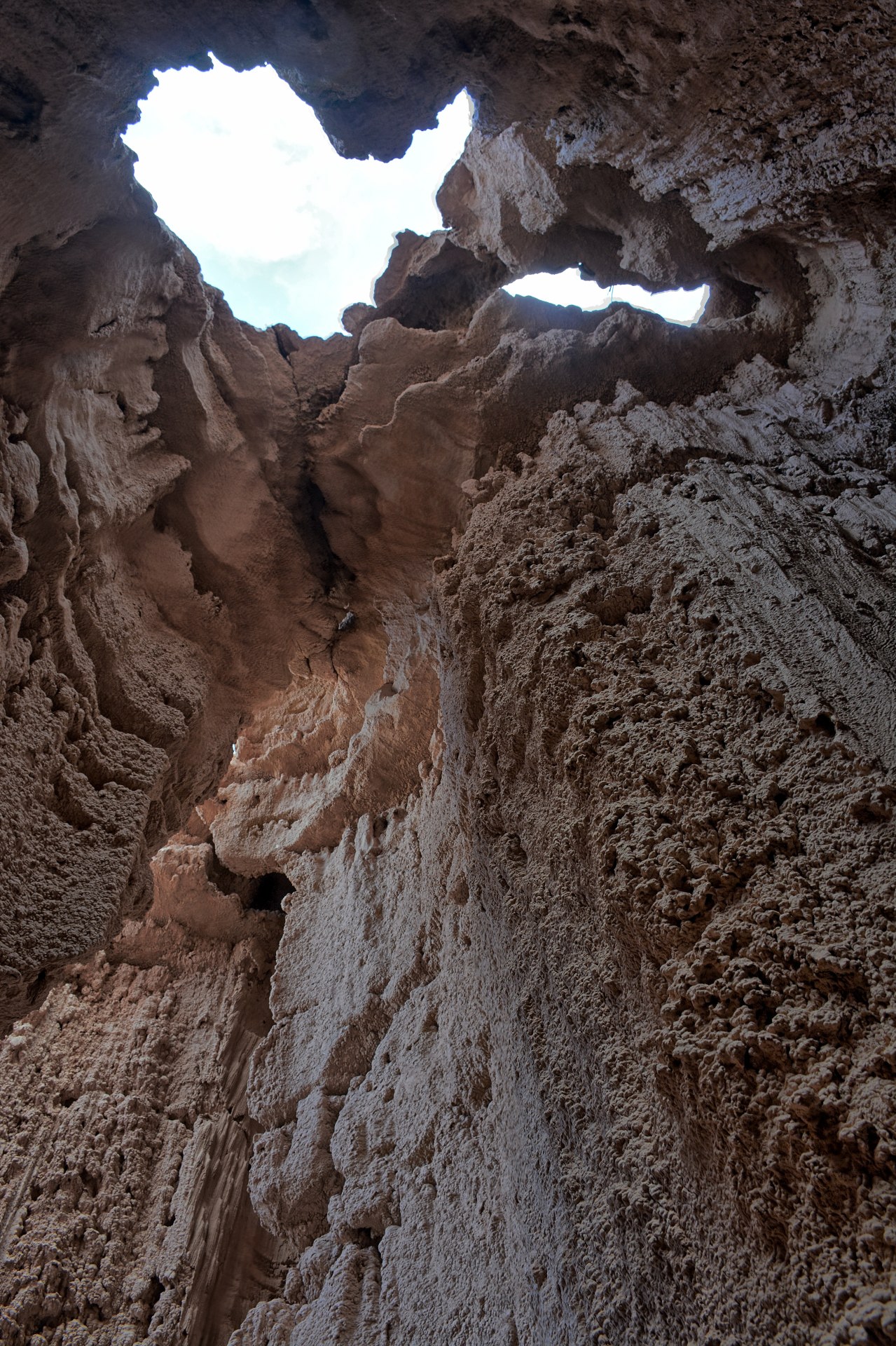
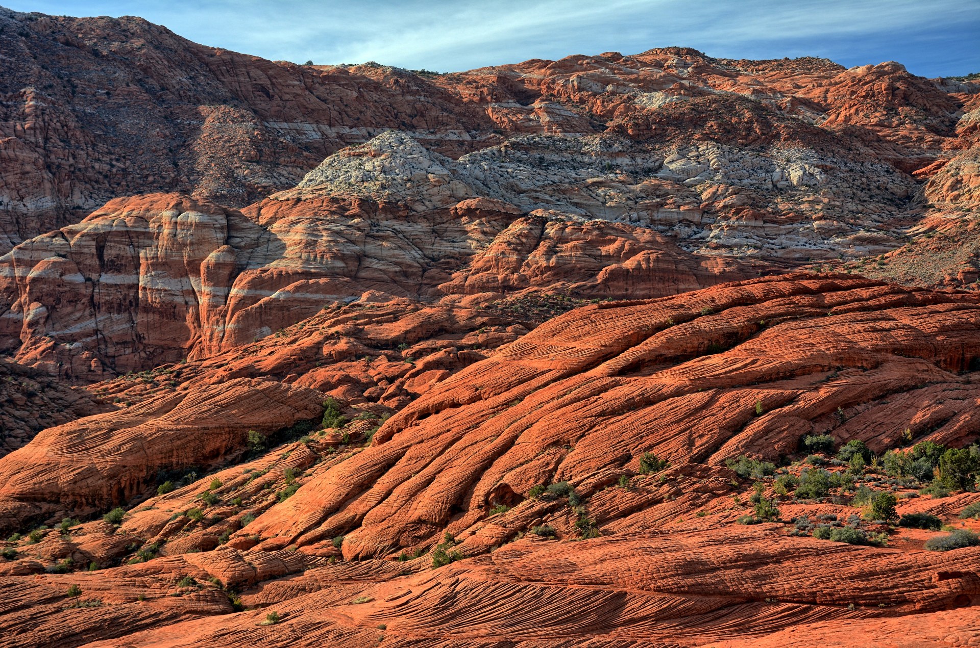
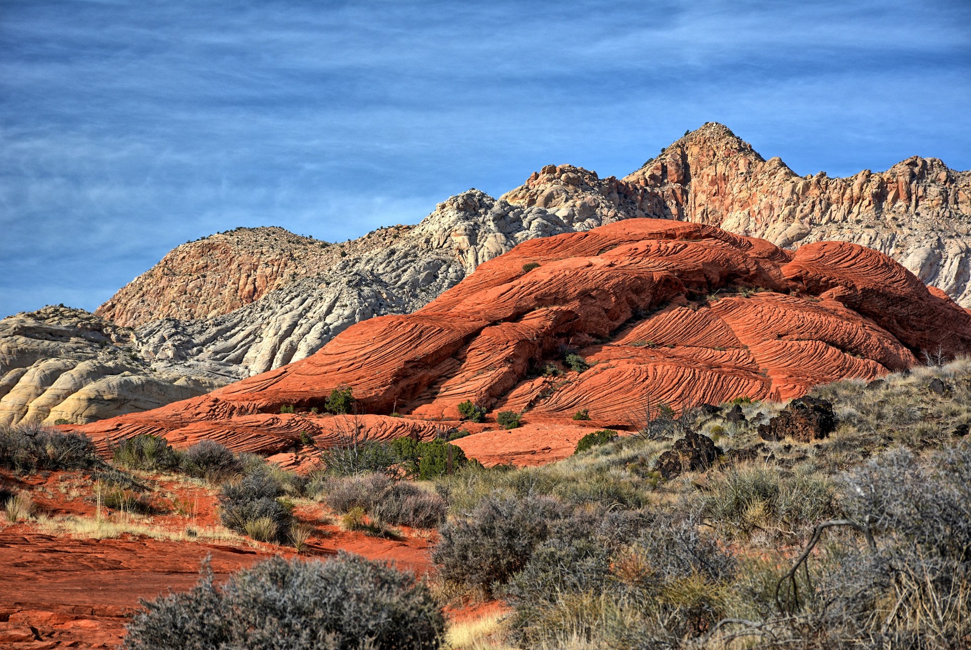
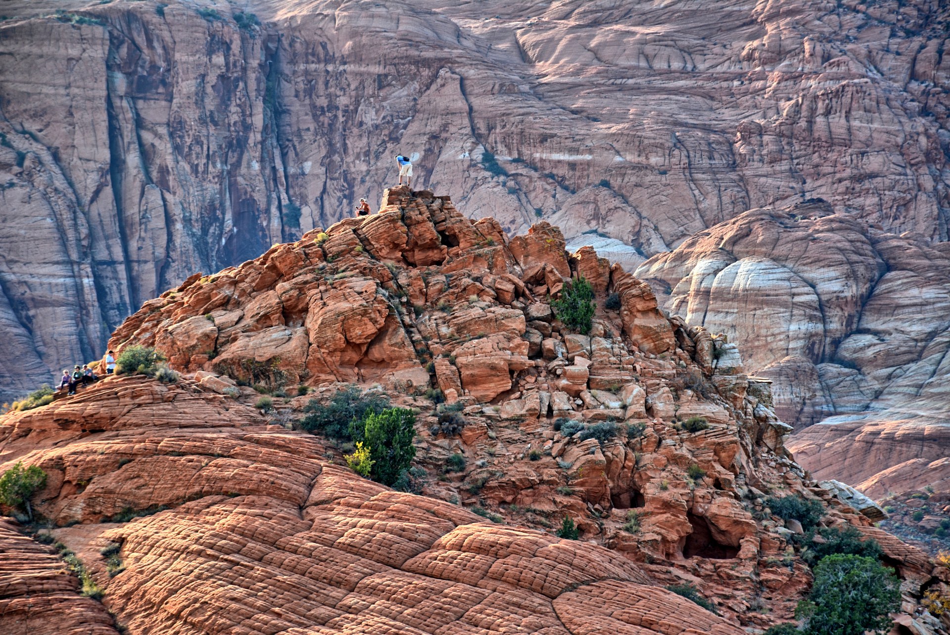
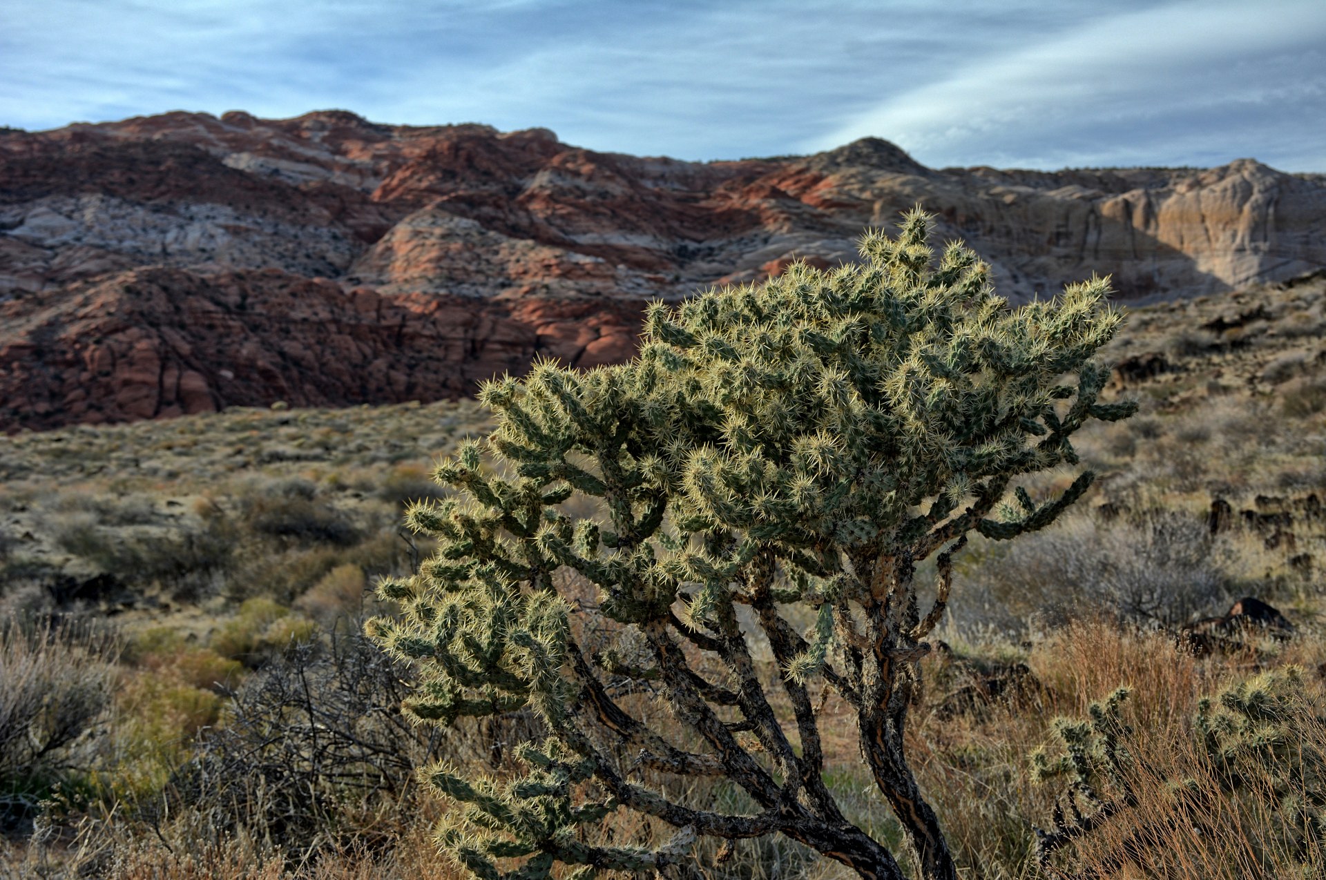
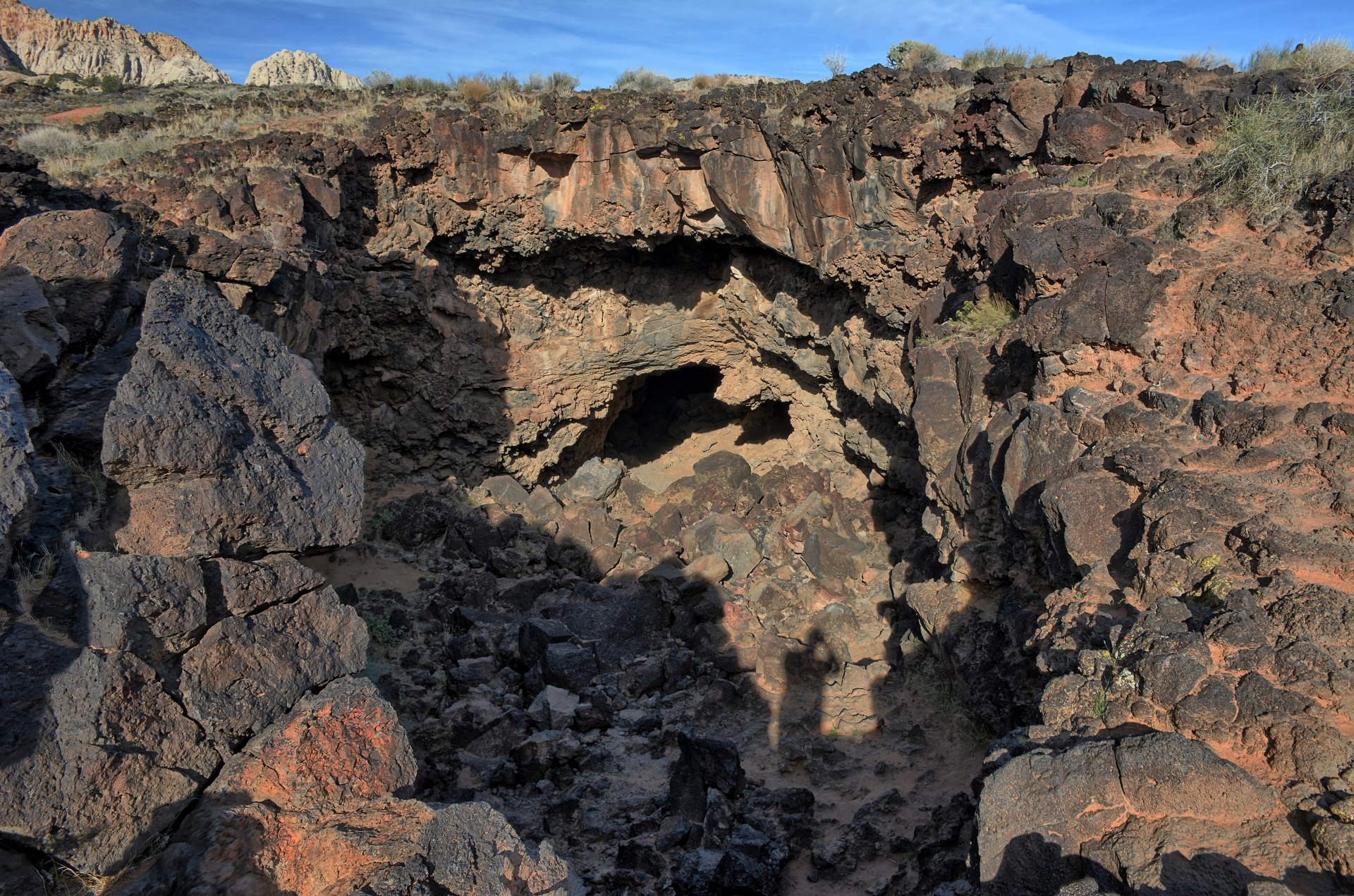
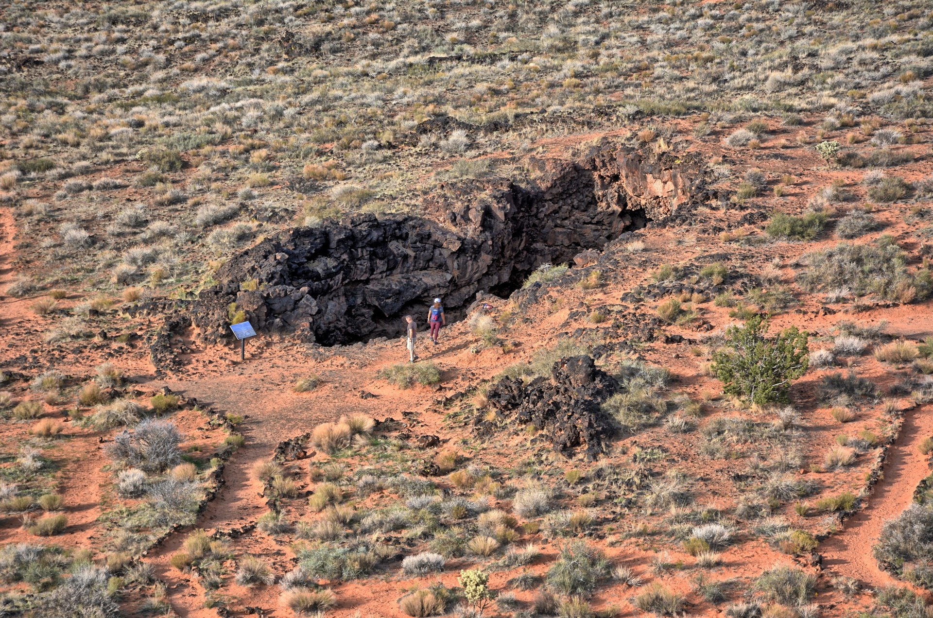
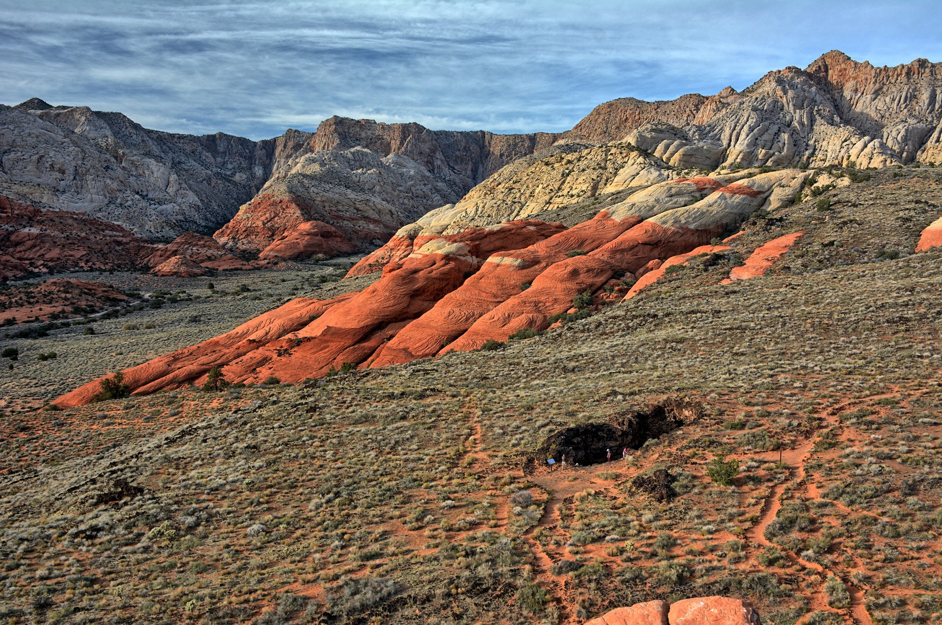
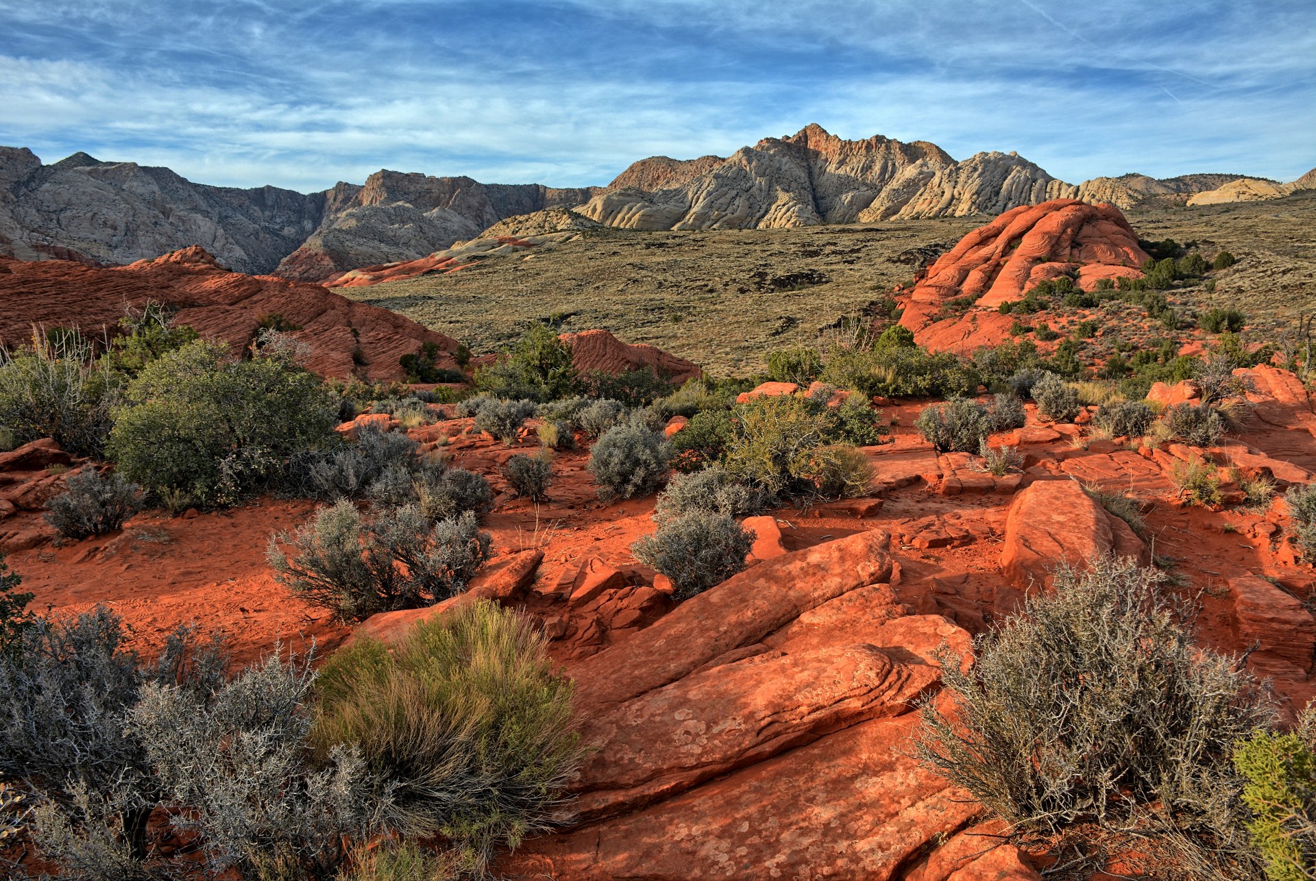
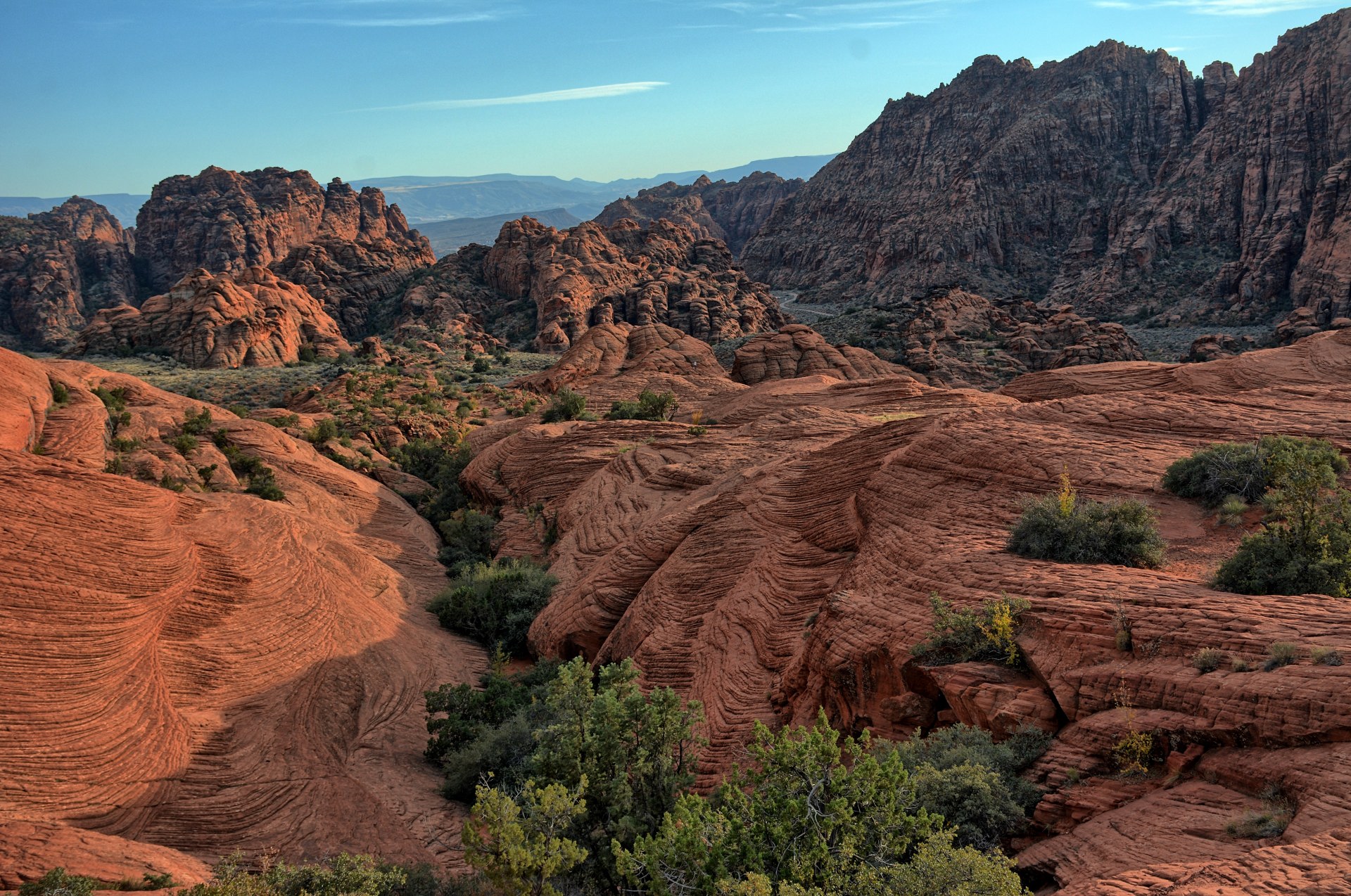
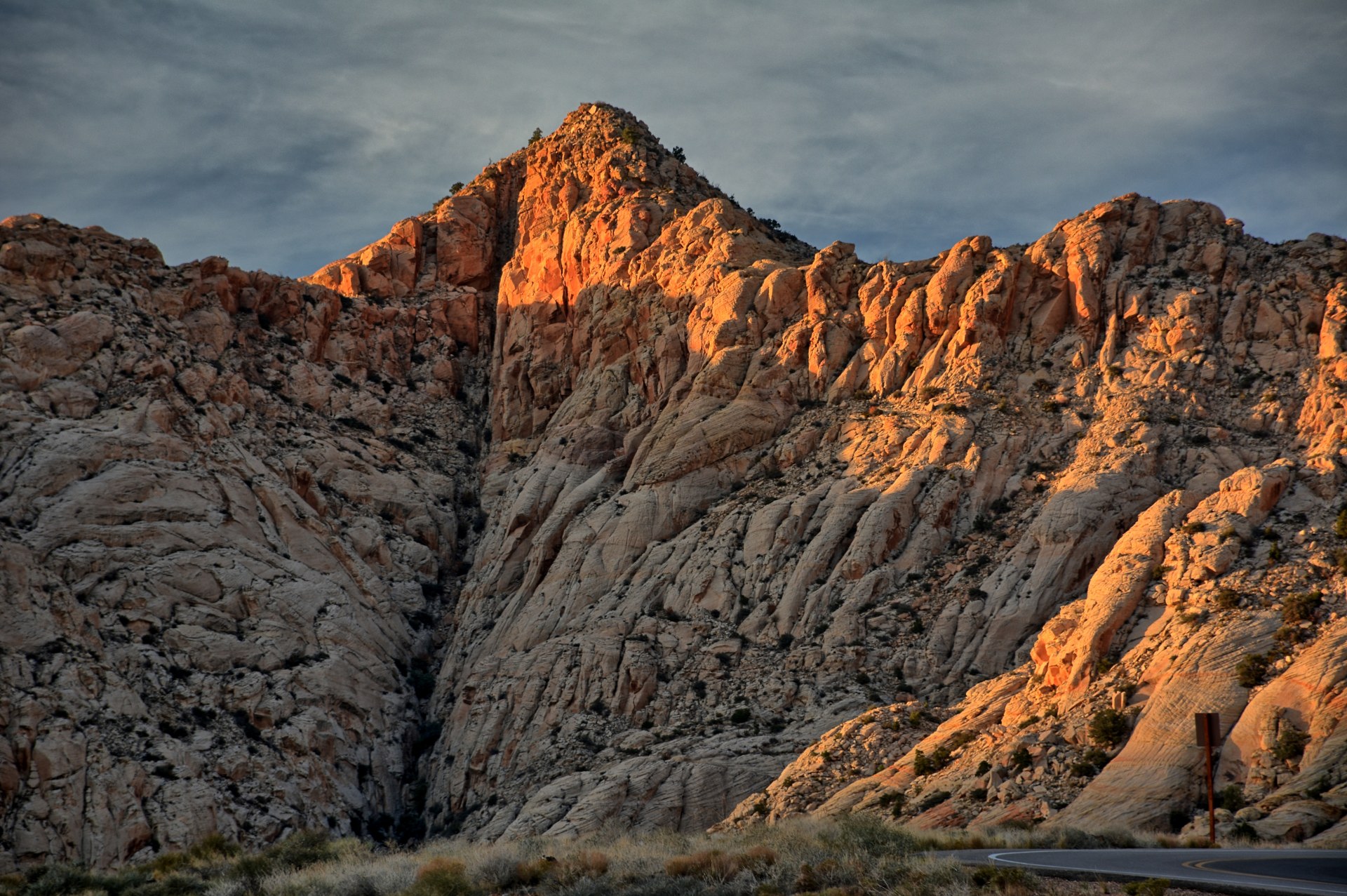
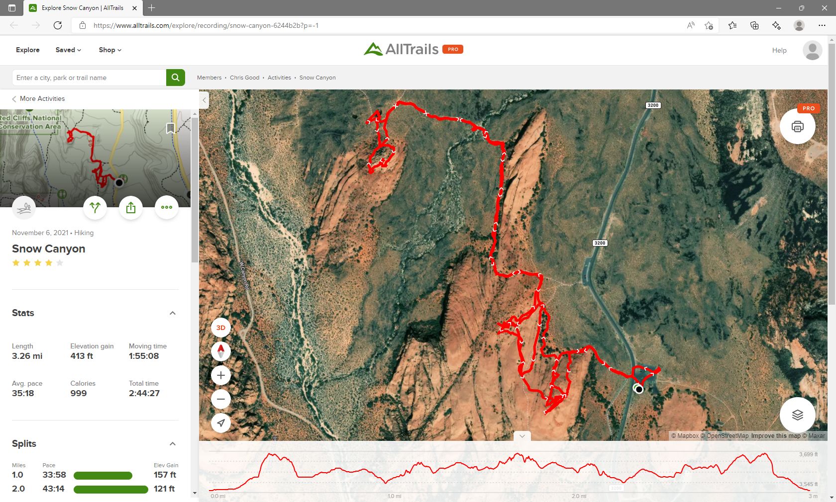
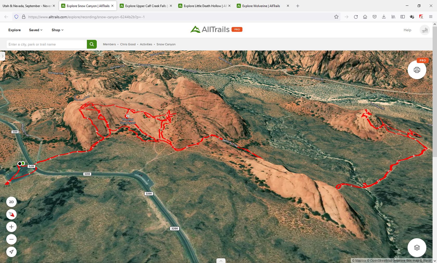
and finally executed in 1877. Chris continued on to
Snow Canyon State Park,
and hiked several miles over the slick rock and into a lava tube cave.
Snow Canyon is not large, but has incredible scenery and diversity in such small
area. He drove into St George for dinner, and then on to Springdale where he
camped for the night at the same place he had camped on 22 October.
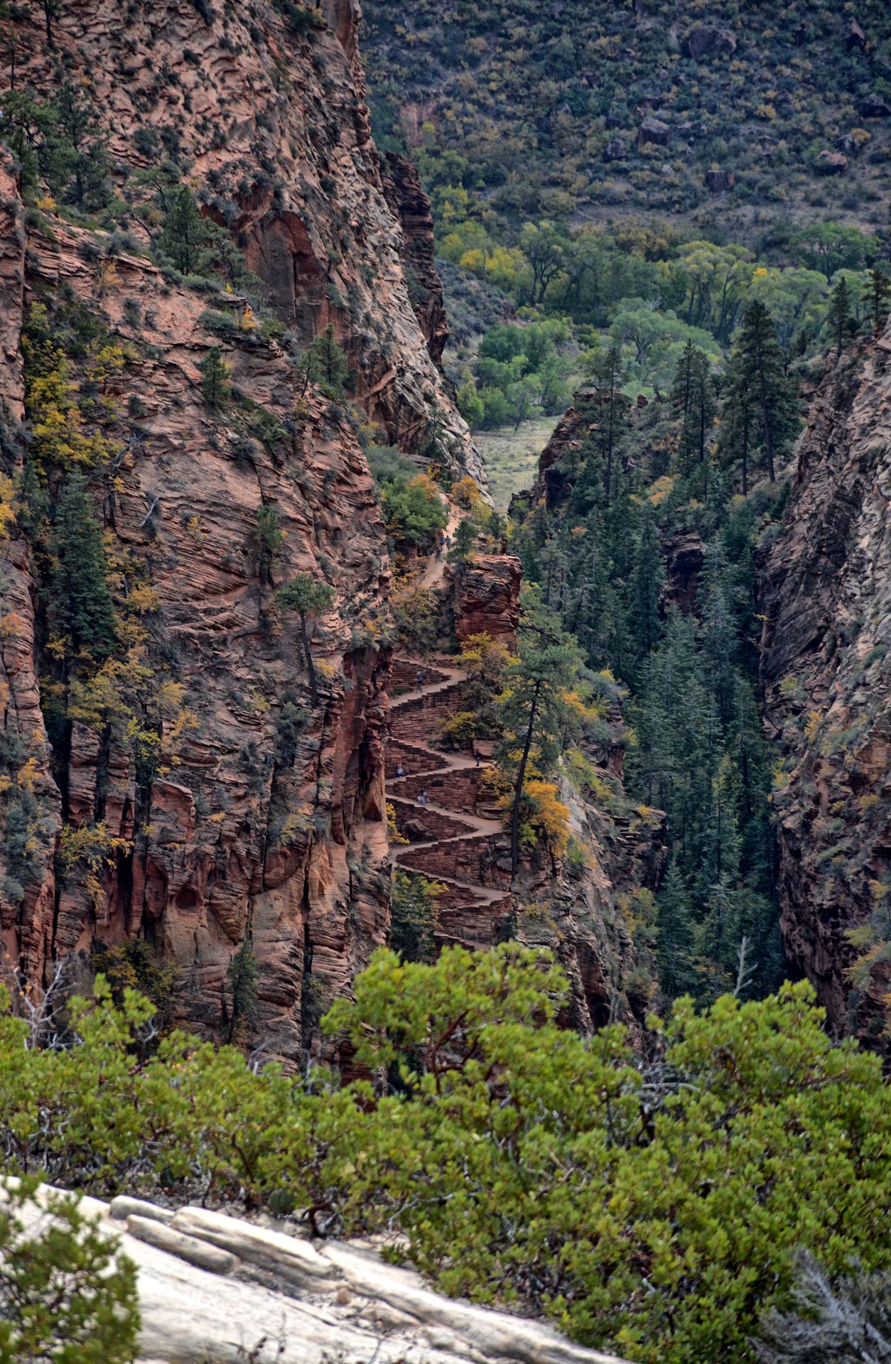
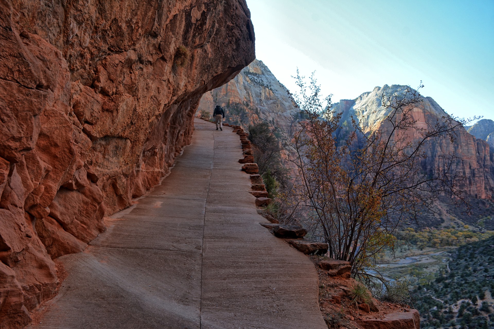
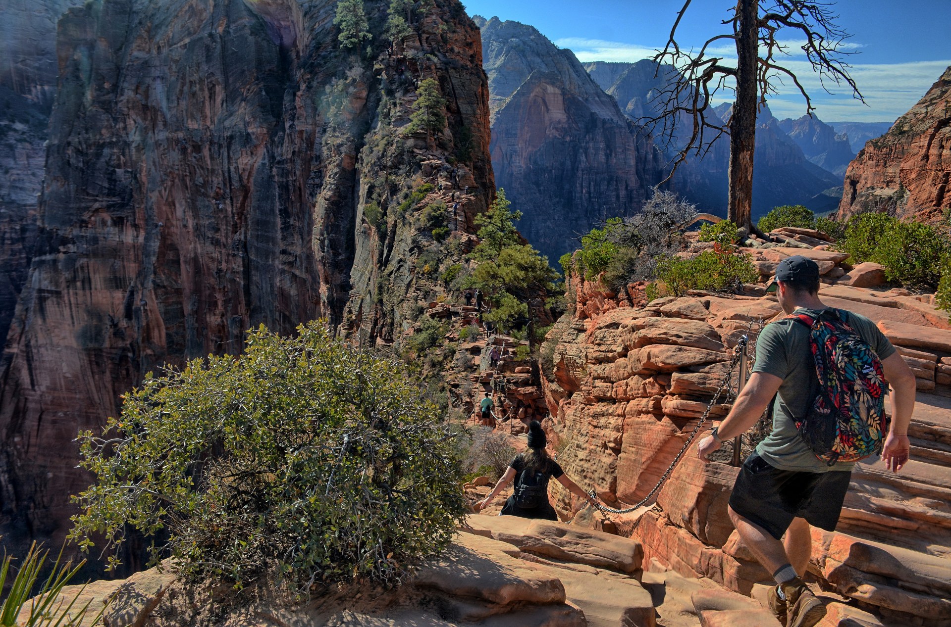
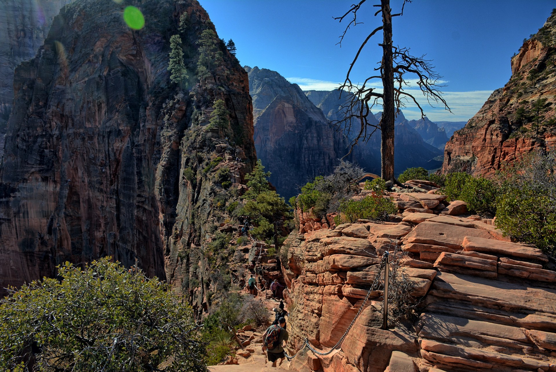
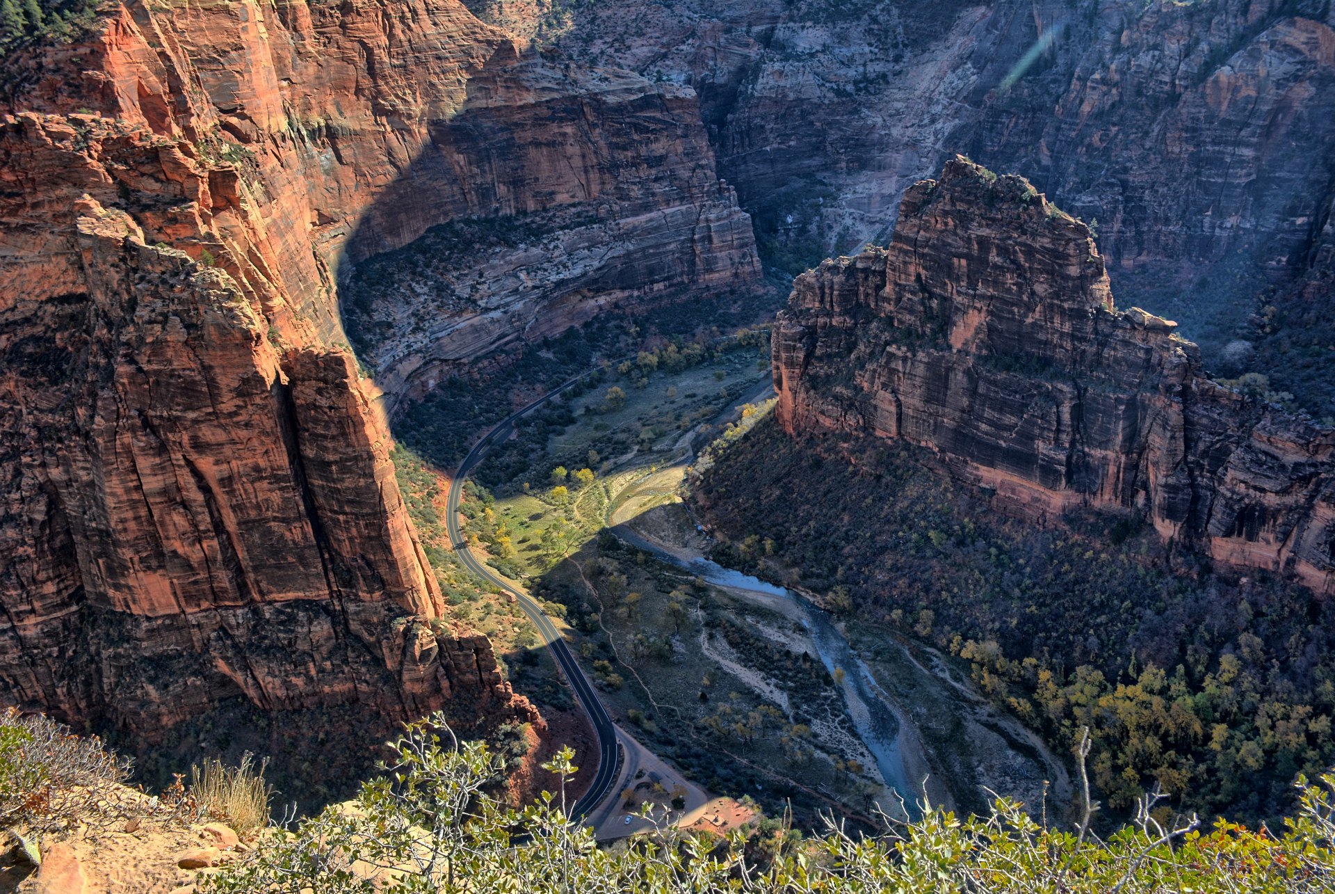
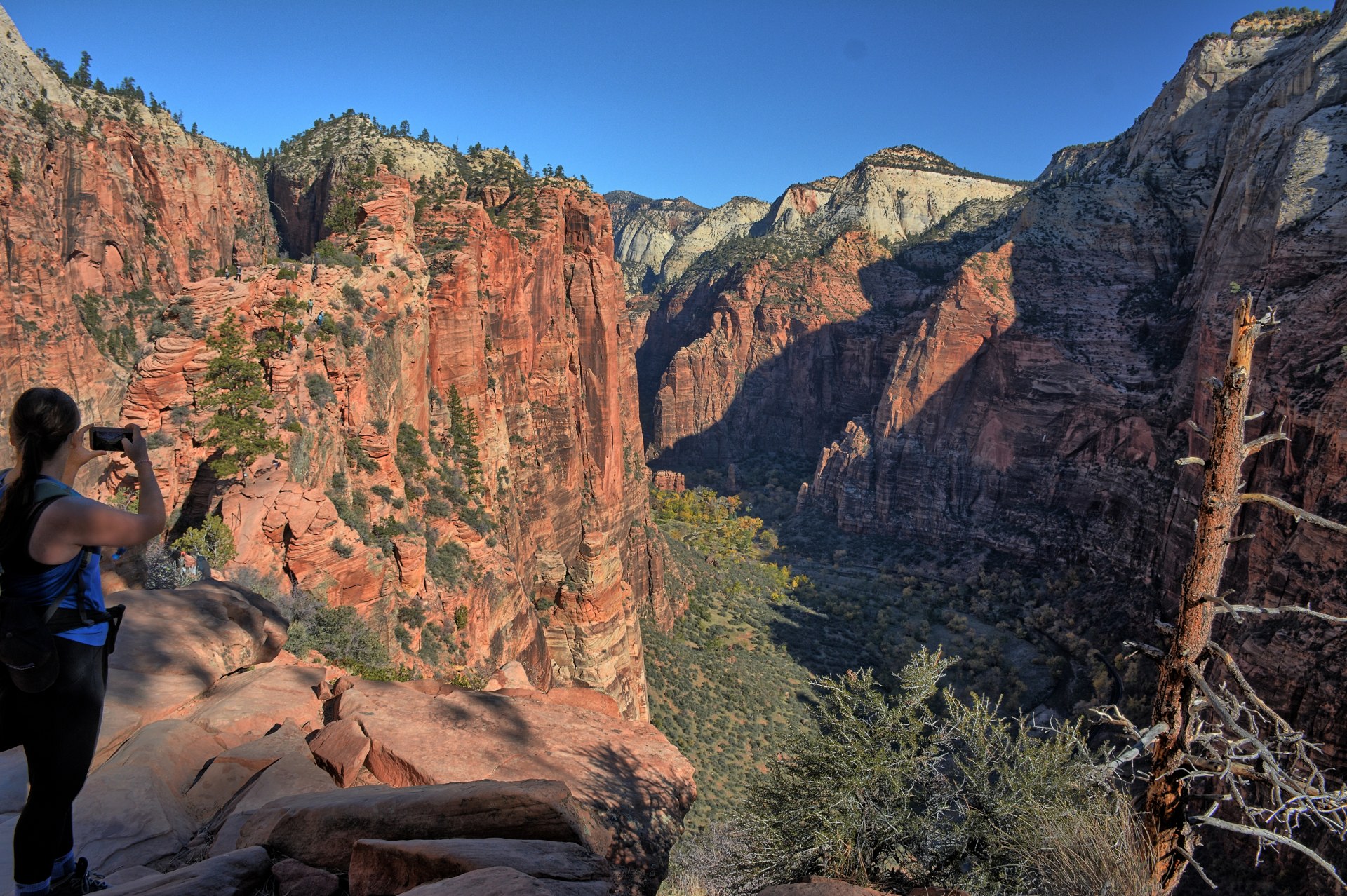
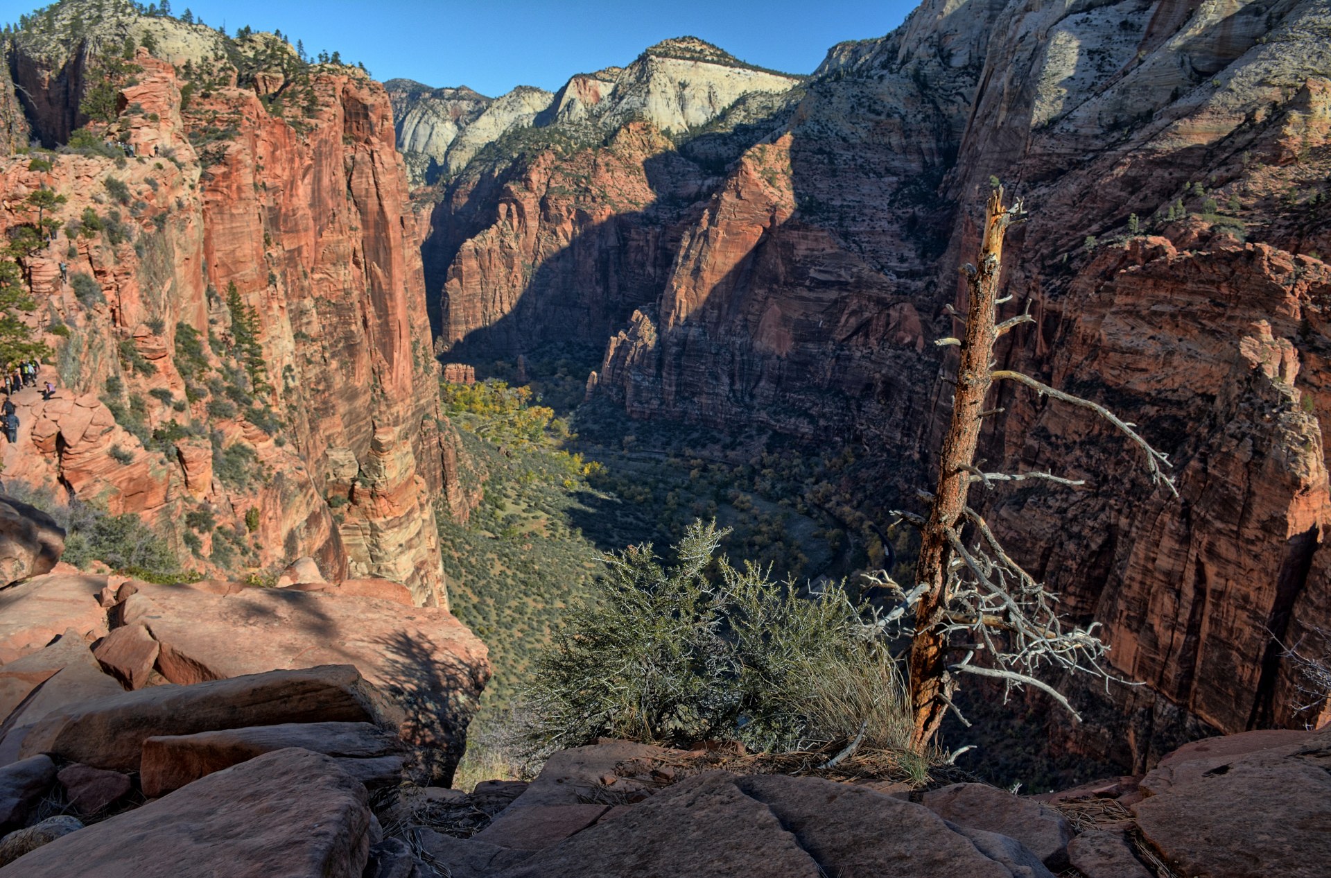
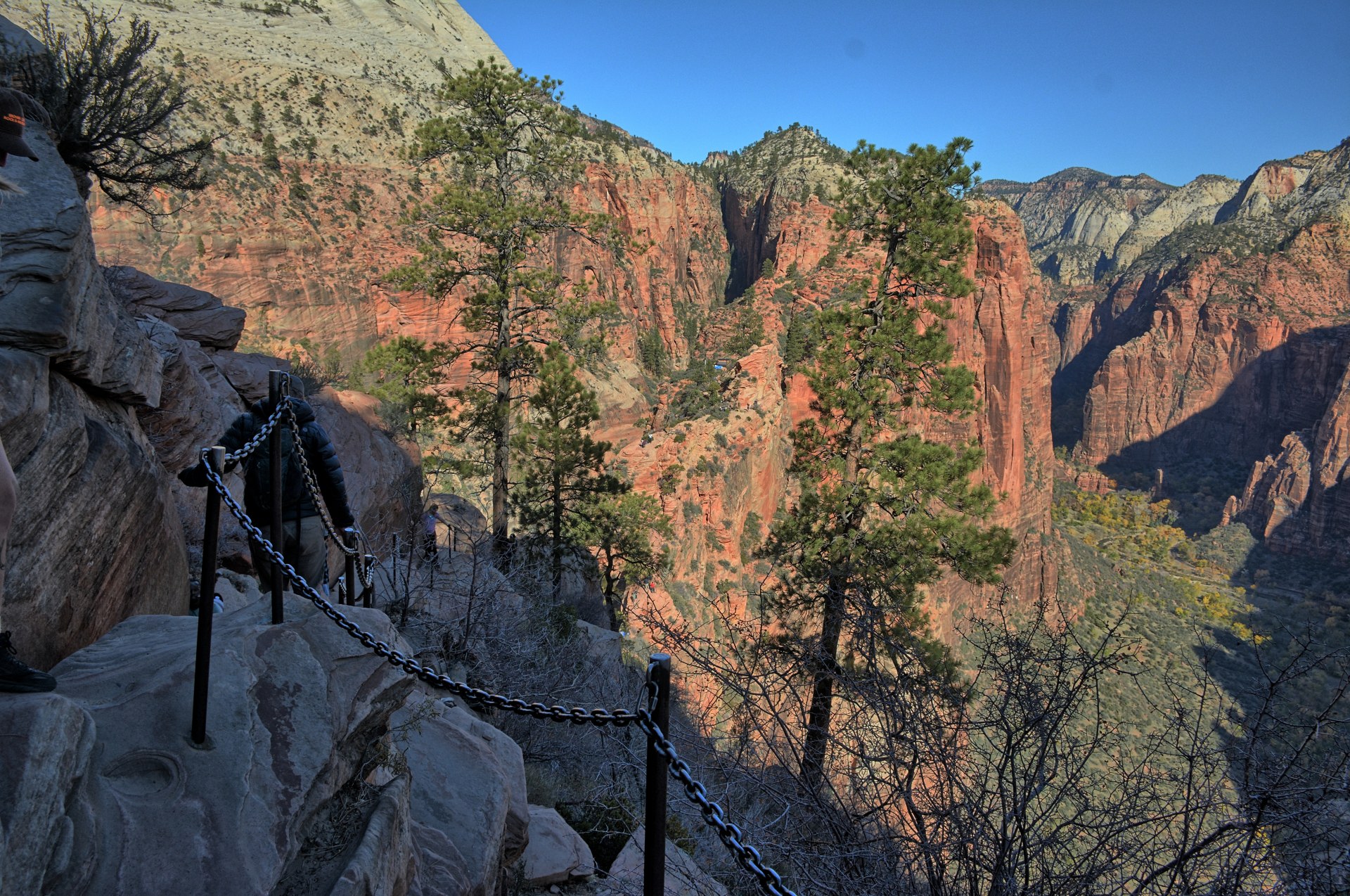
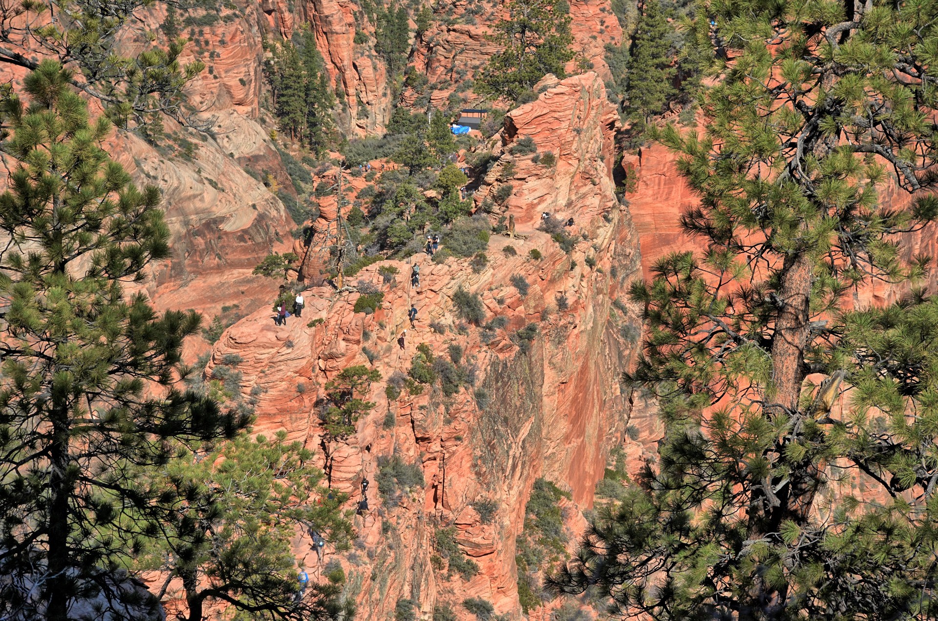
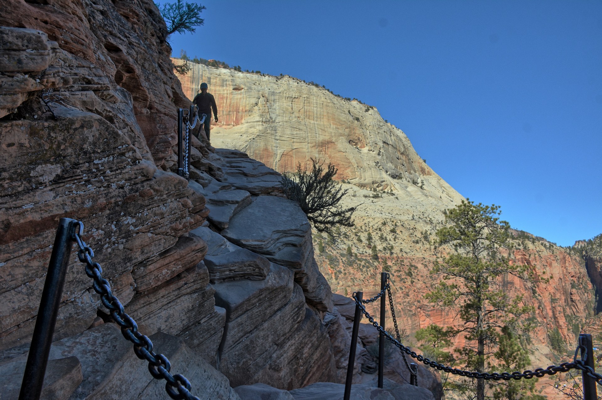
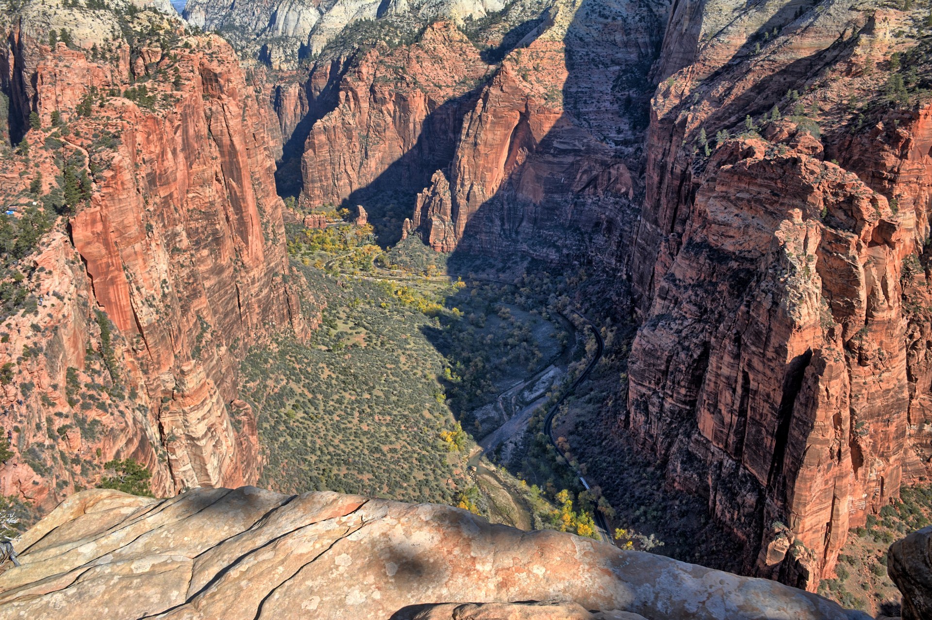
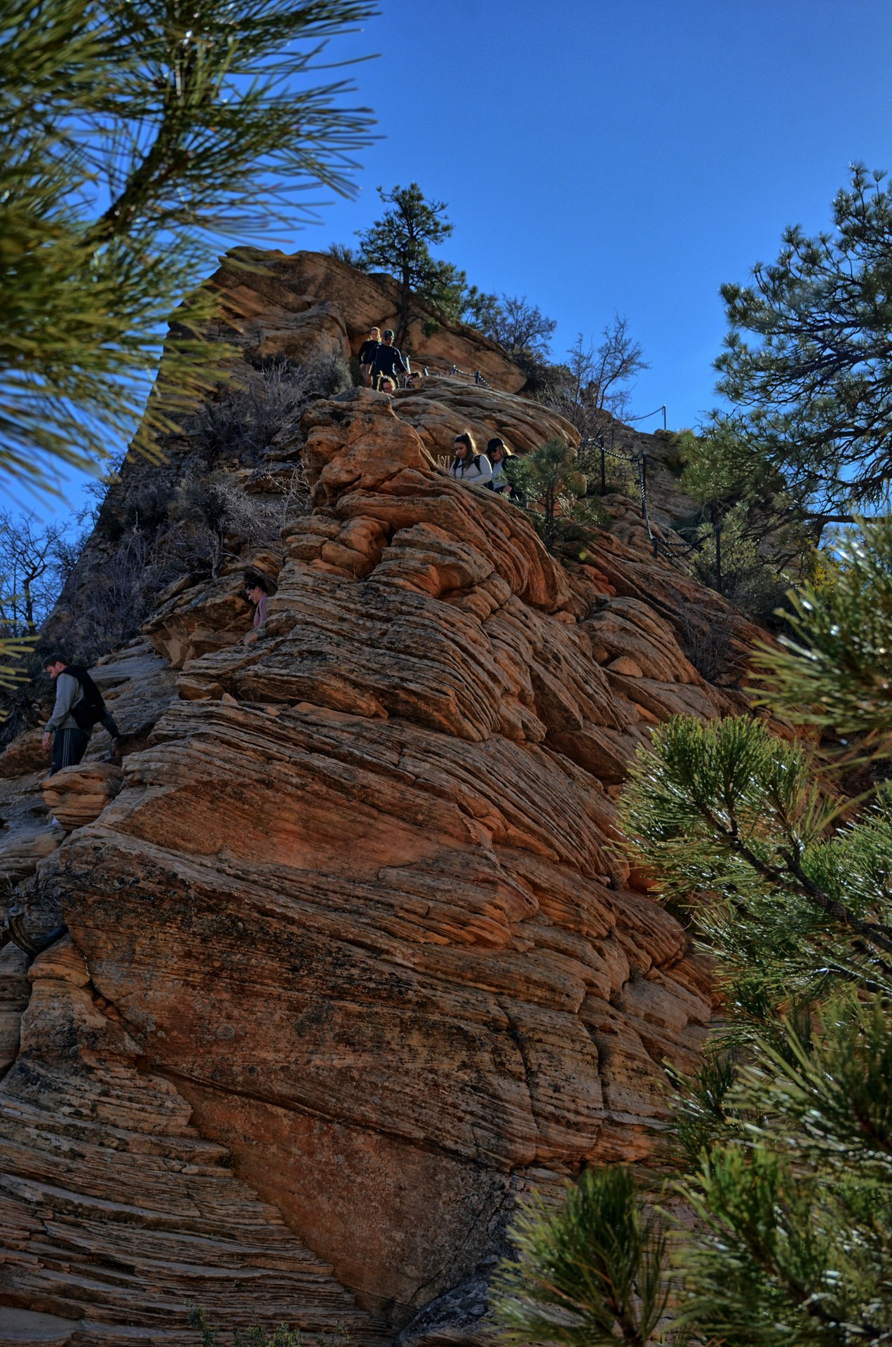
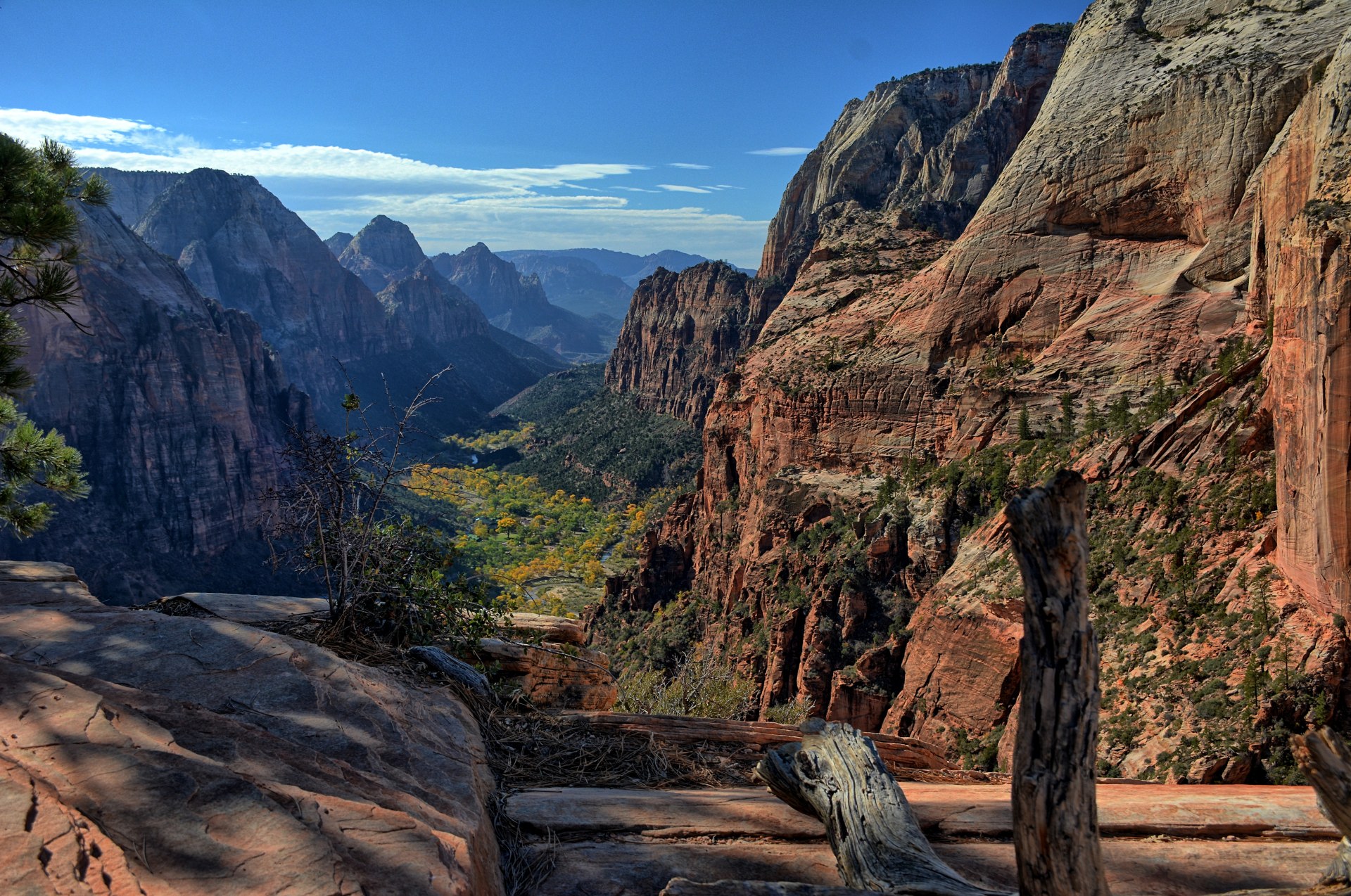
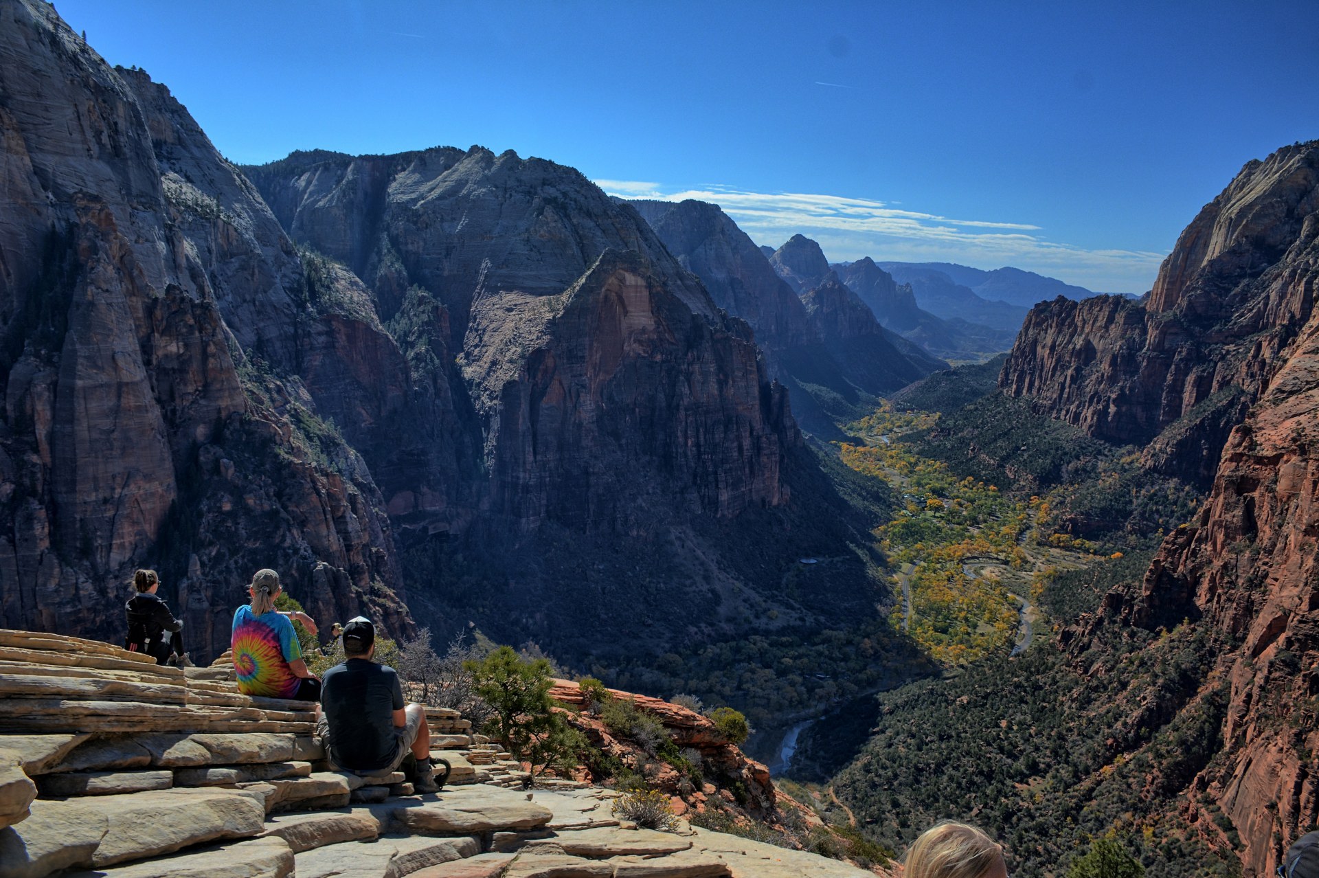
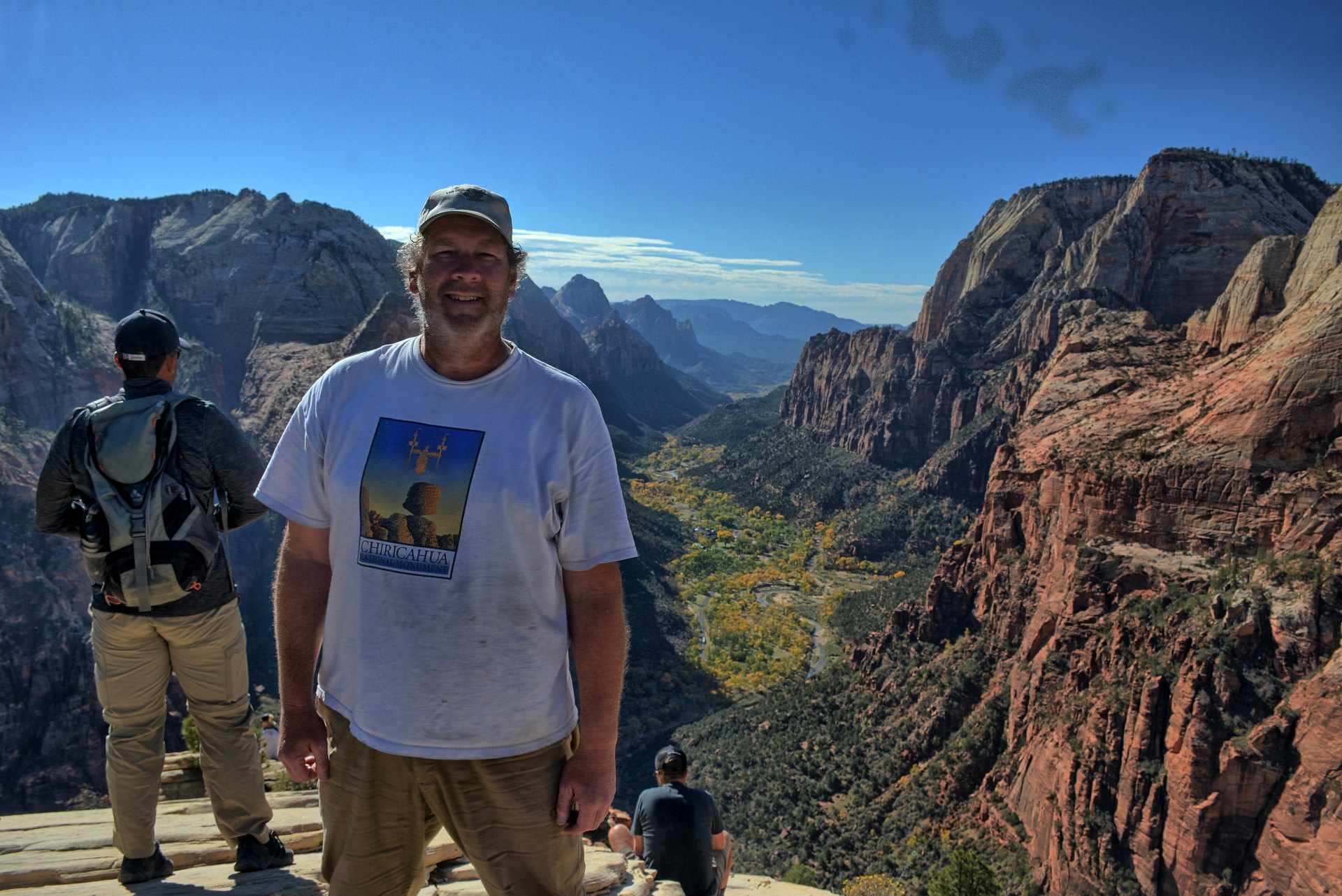
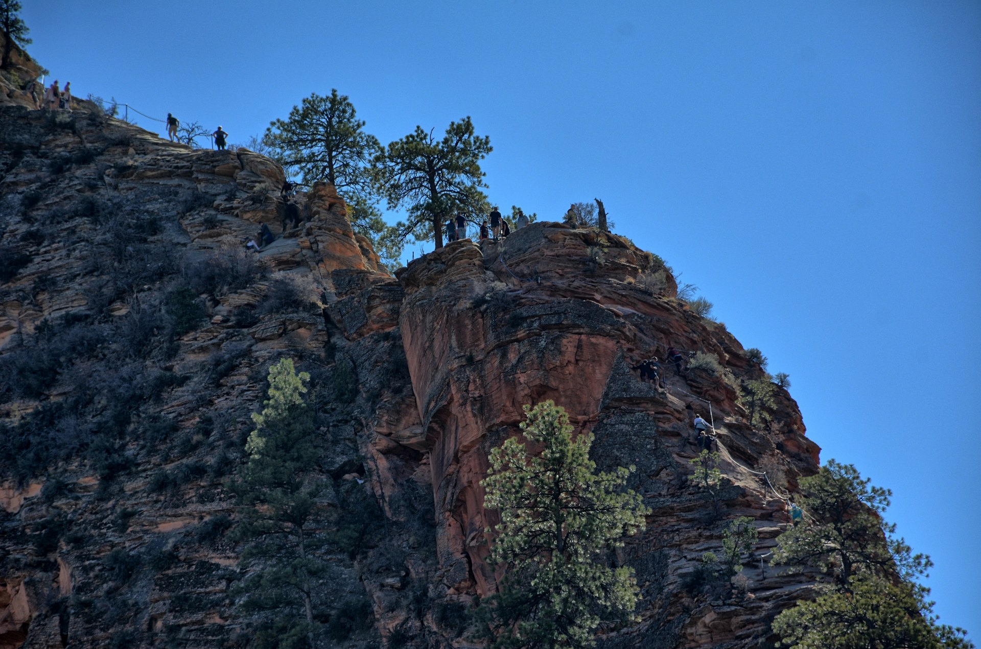
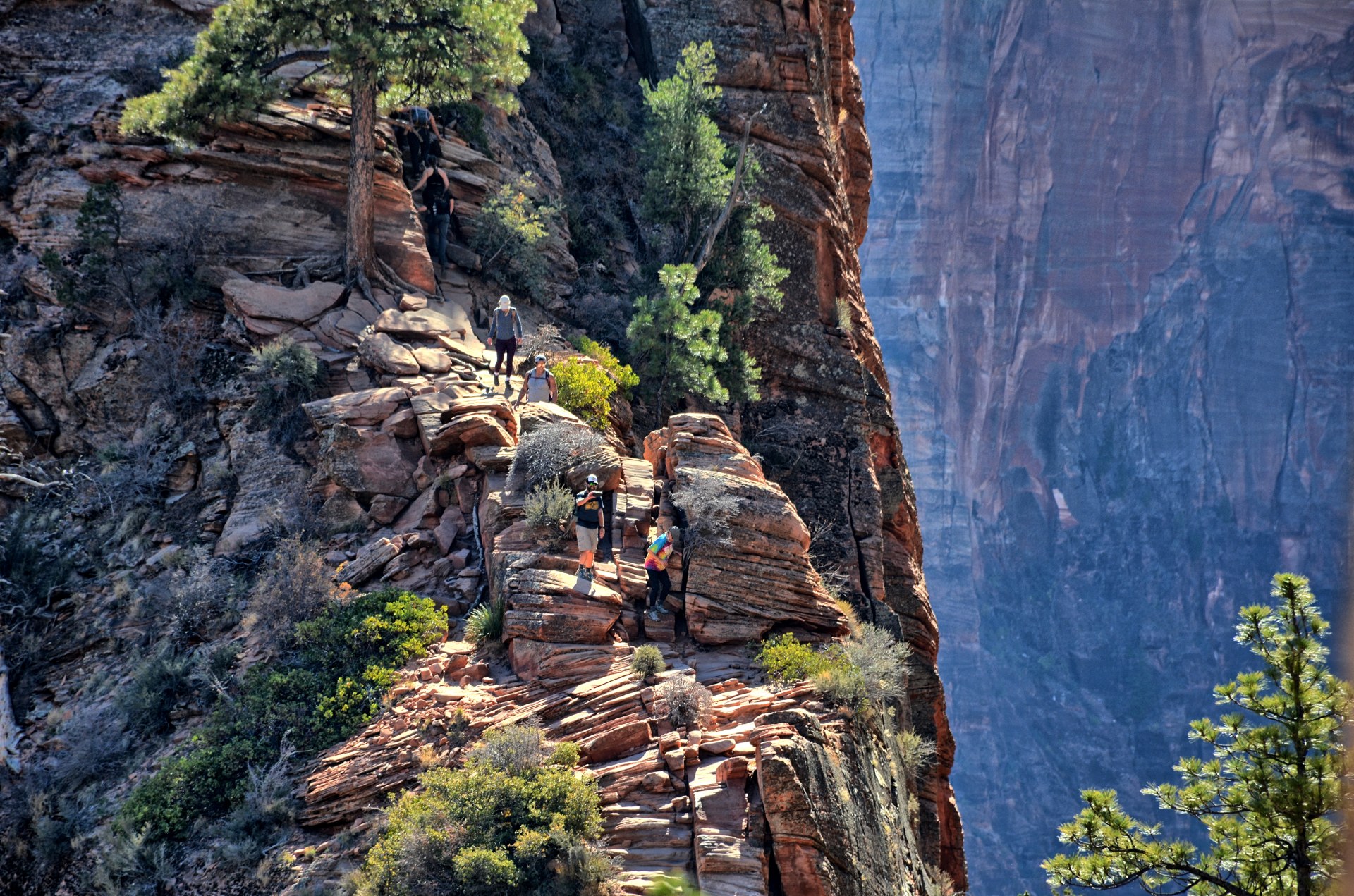
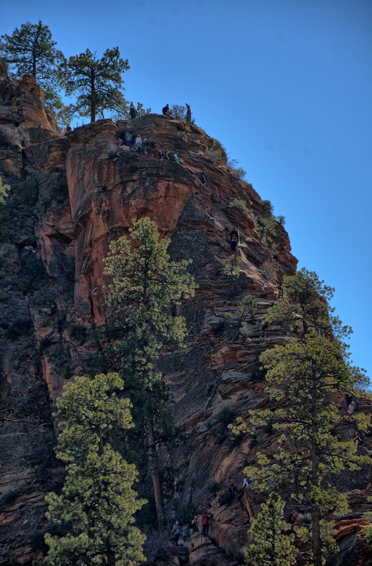
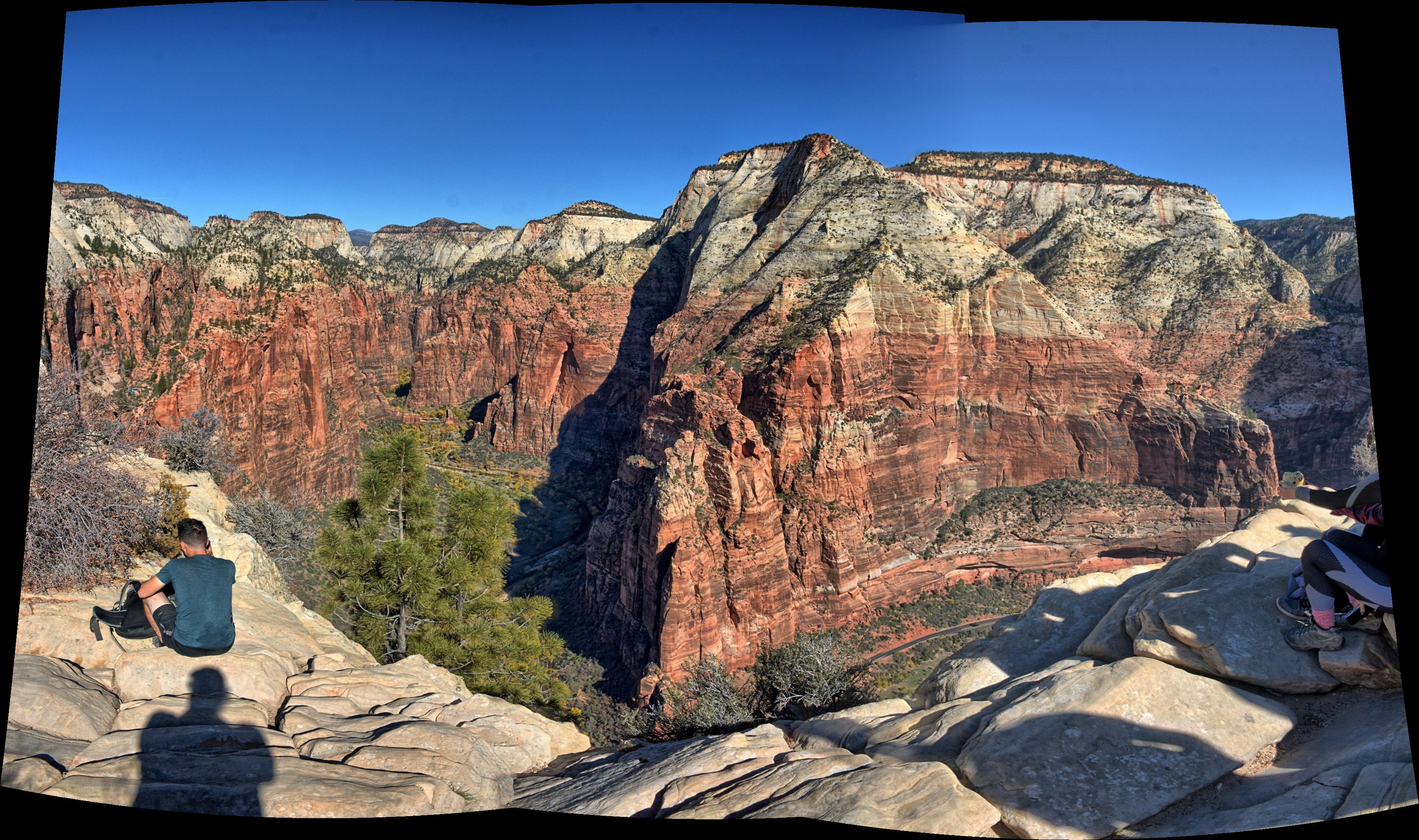
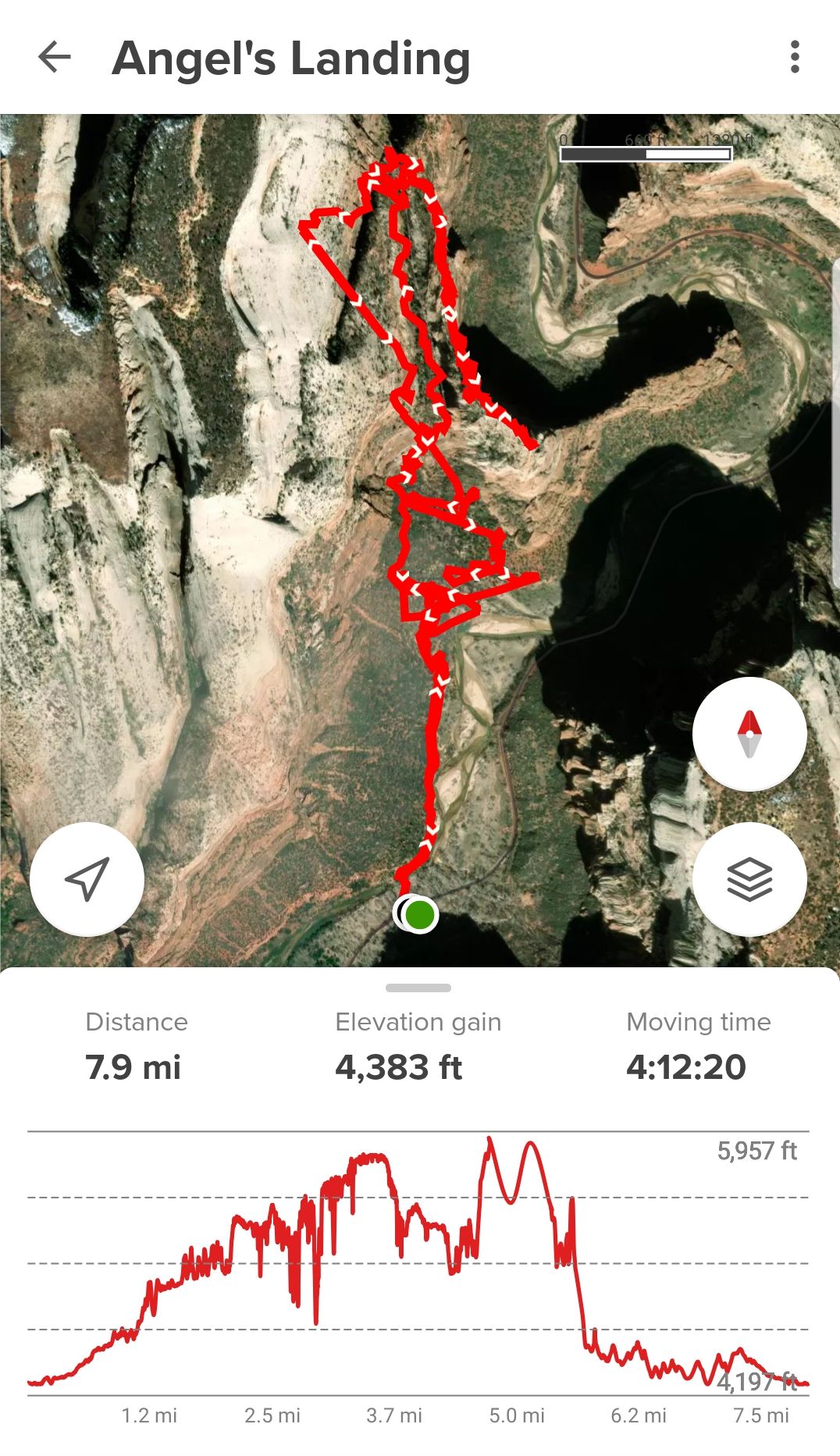
Chris drove to the Zion National Park visitor's center and got
the park shuttle to the Grotto. He climbed to the top of
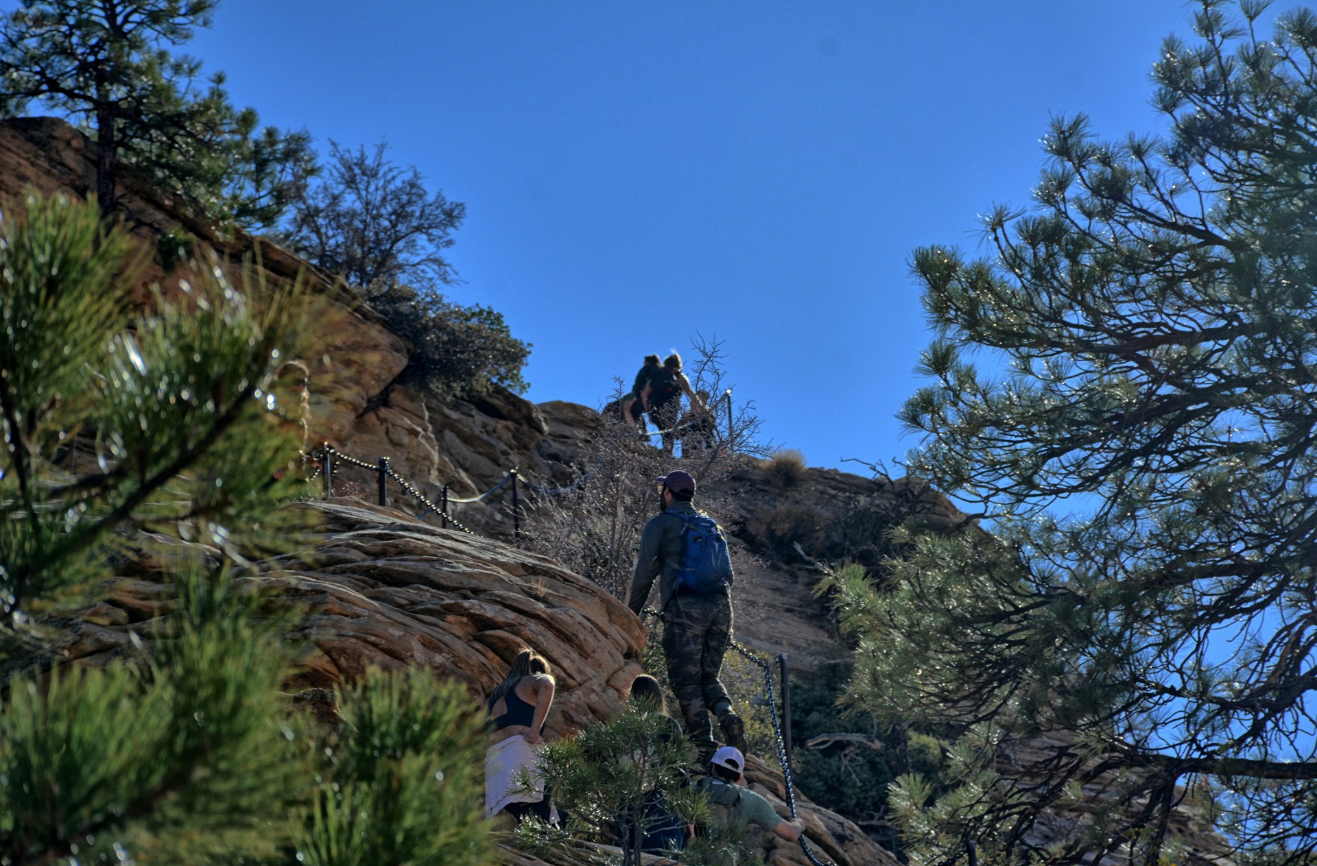
Angels Landing;
this was the fifth time he has climbed Angels Landing.
He recorded the climb on his GoPro. It seems to get
steeper and more difficult each time he climbs it as he gets older; the park
service must be rearranging the rocks over the years to make it steeper, and
gravity must be getting turned up higher at Zion National Park as time goes by.
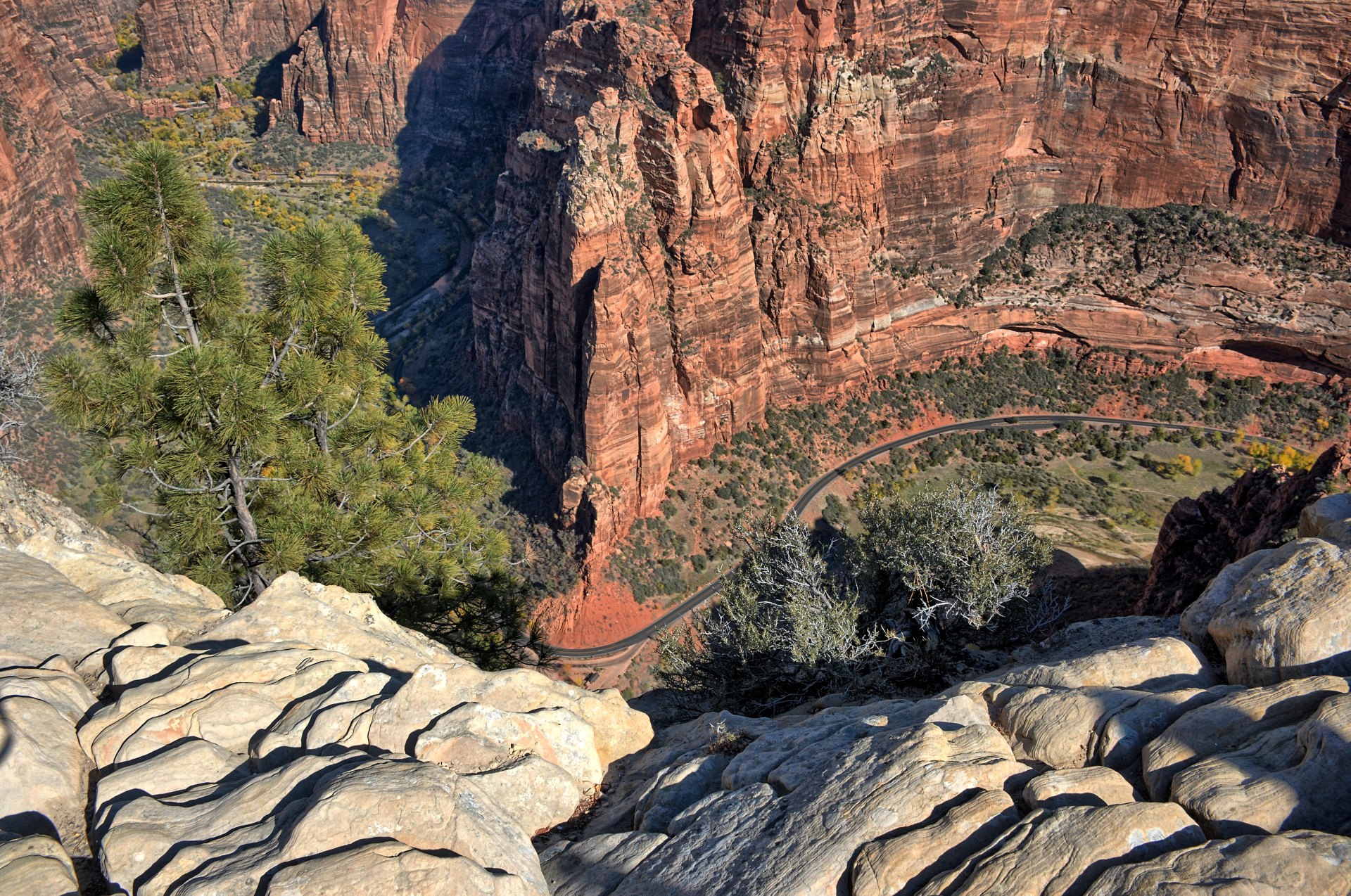
The All-Trails recording below is very inaccurate for elevation gain and a lot
of the actual route, as the high canyon walls of
Zion Canyon and Refrigerator Canyon don't allow clean GPS signals to reach the
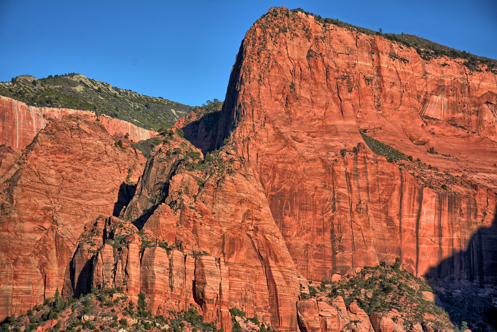
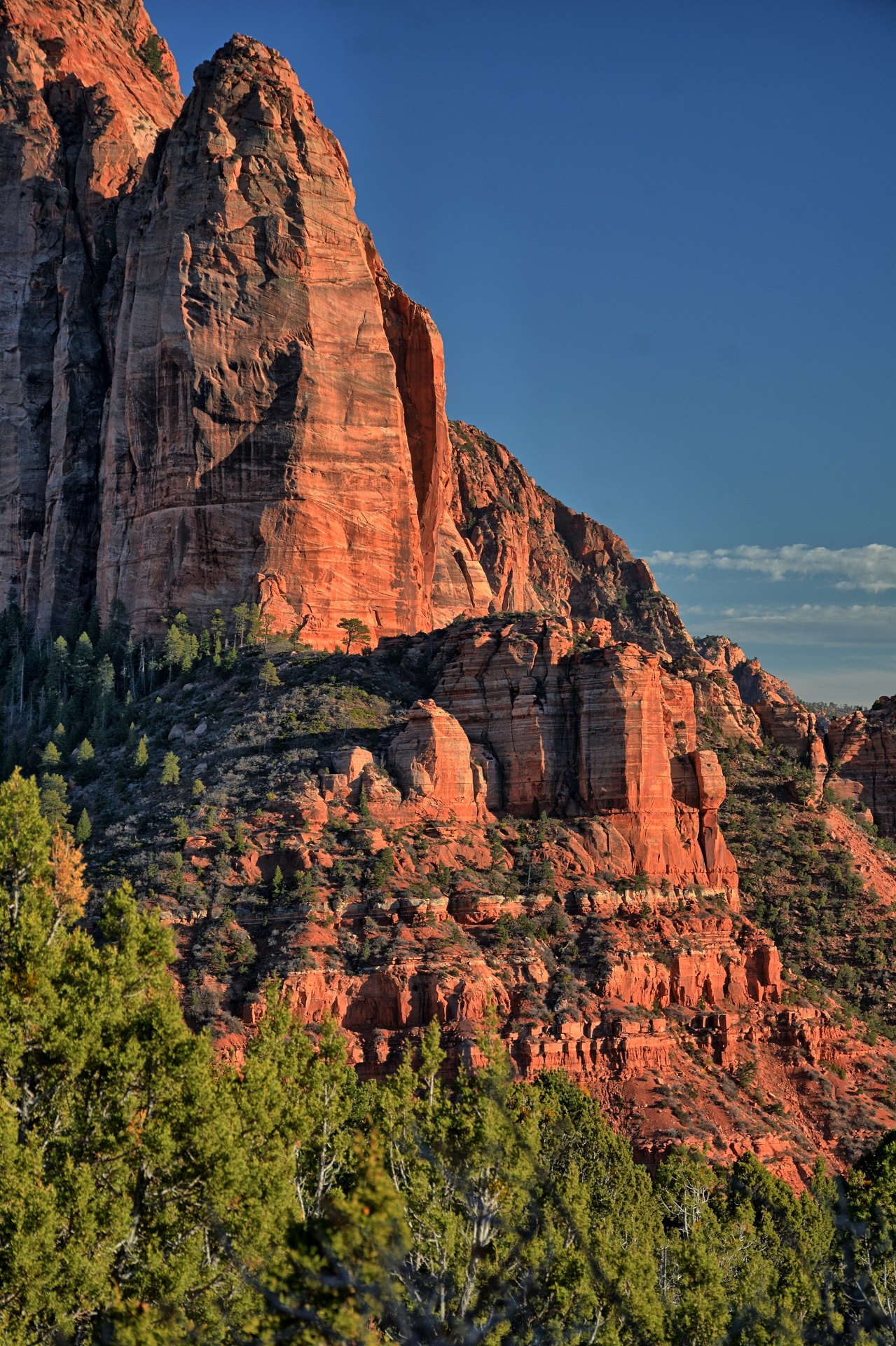
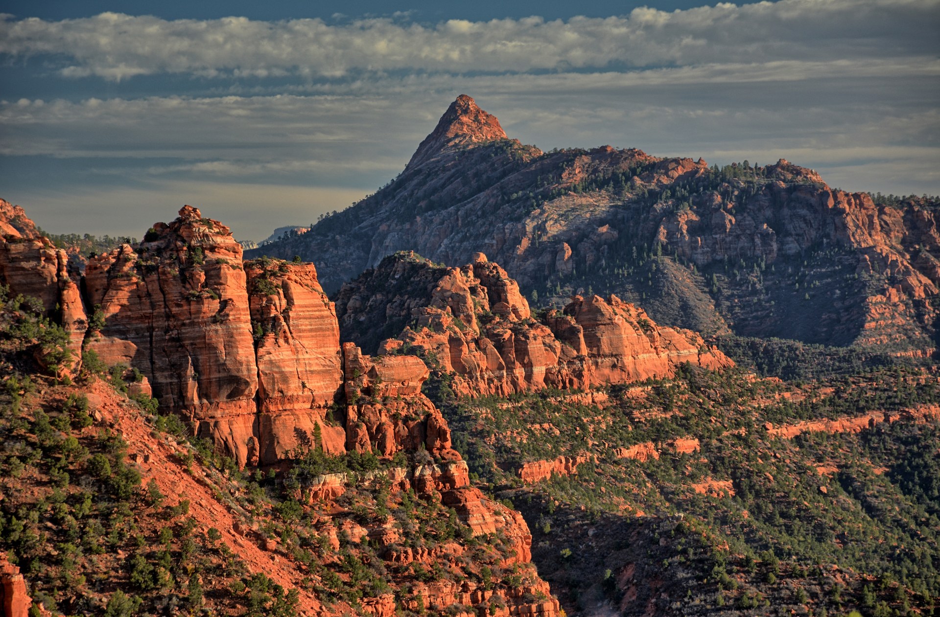
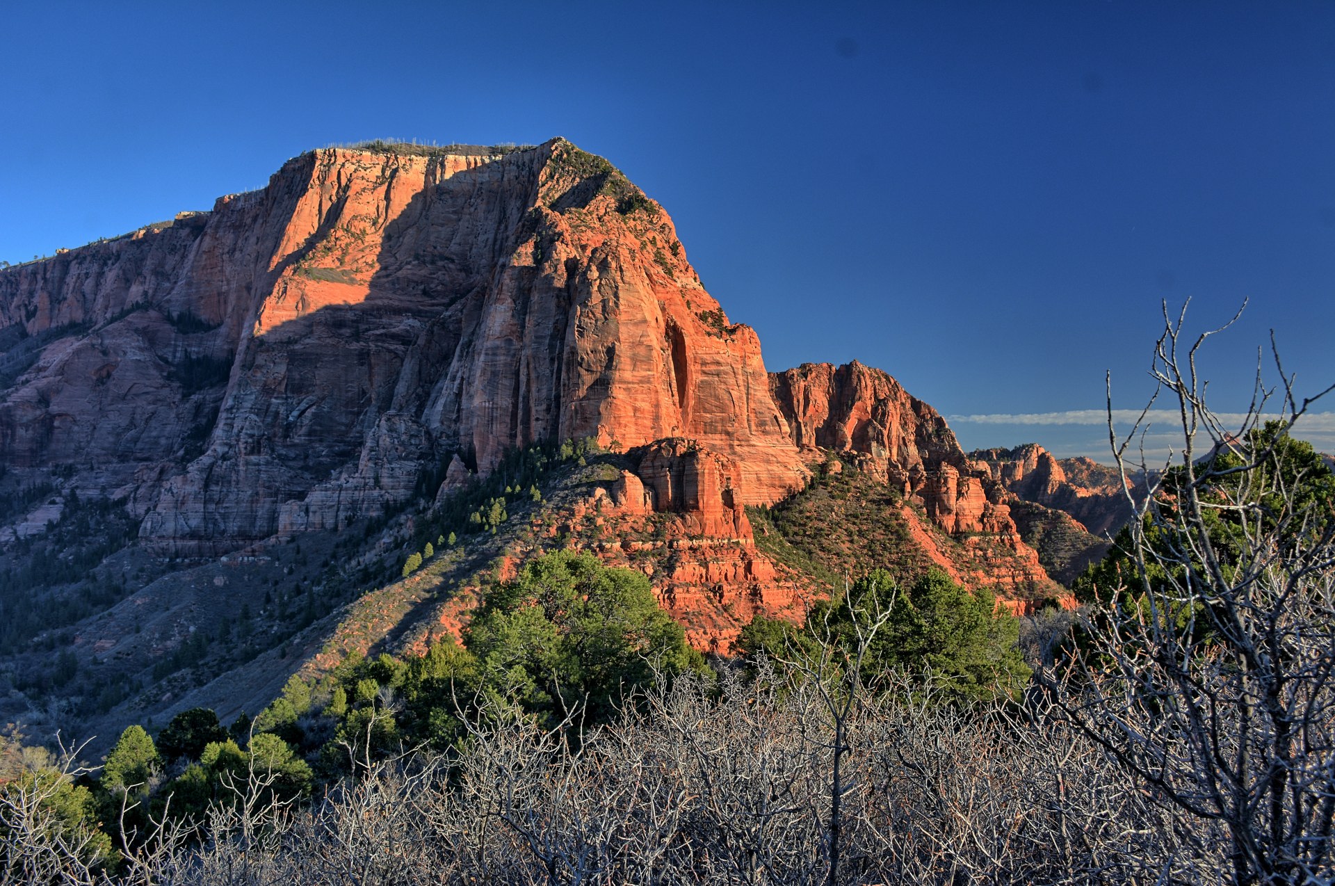
ground. On the way back to Dugway, Chris drove up into Kolob Canyons off of I-15 and
hiked the
Timber Creek Overlook Trail at sunset.
Chris remained at Dugway this week to support other flight
test series and conduct an avionics training class for the Dugway crew. Thursday, 11
November was Veterans Day, so Dugway was closed for flight operations on
Thursday and Friday. Chris took advantage of this and planned a trip to Grand
Staircase - Escalante National Monument for the 4-day weekend.
Here is the driving route for this long weekend.
Thursday, 11 Nov
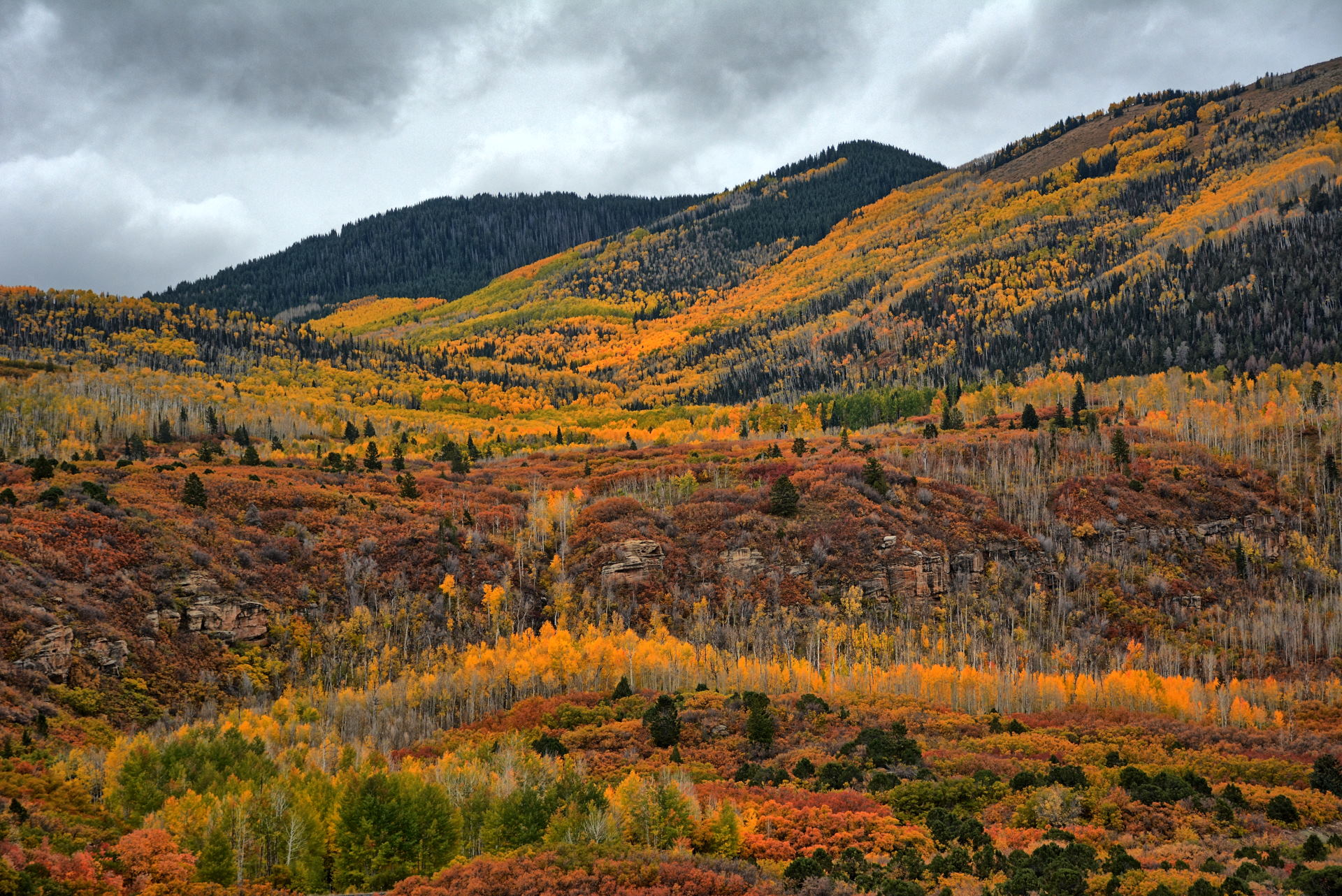
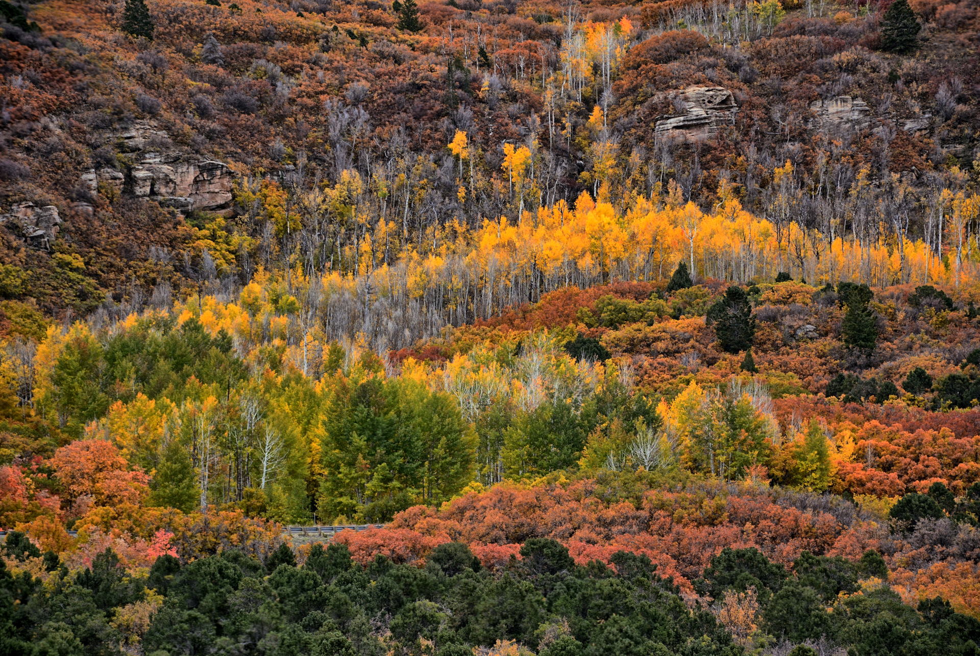
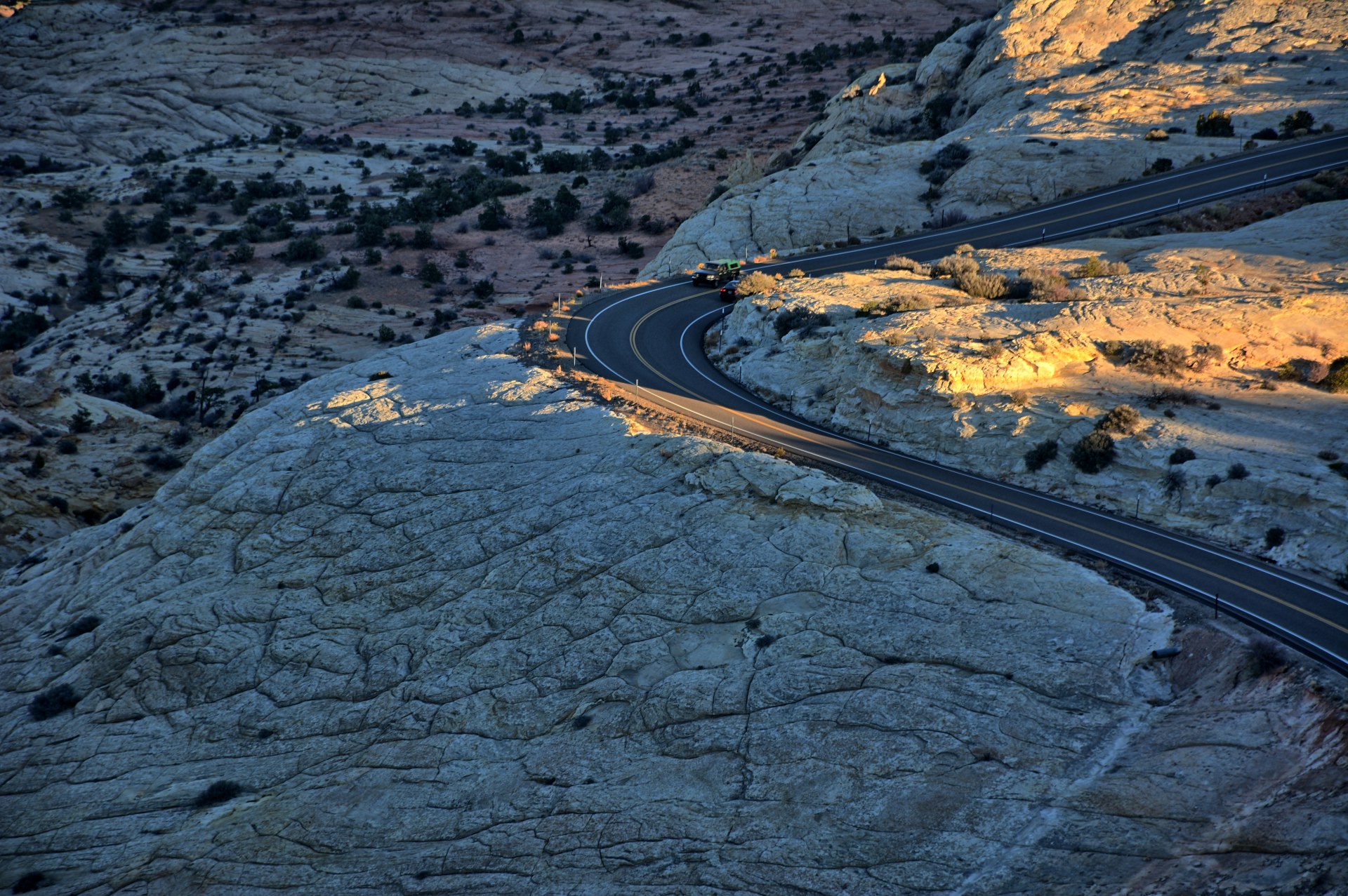
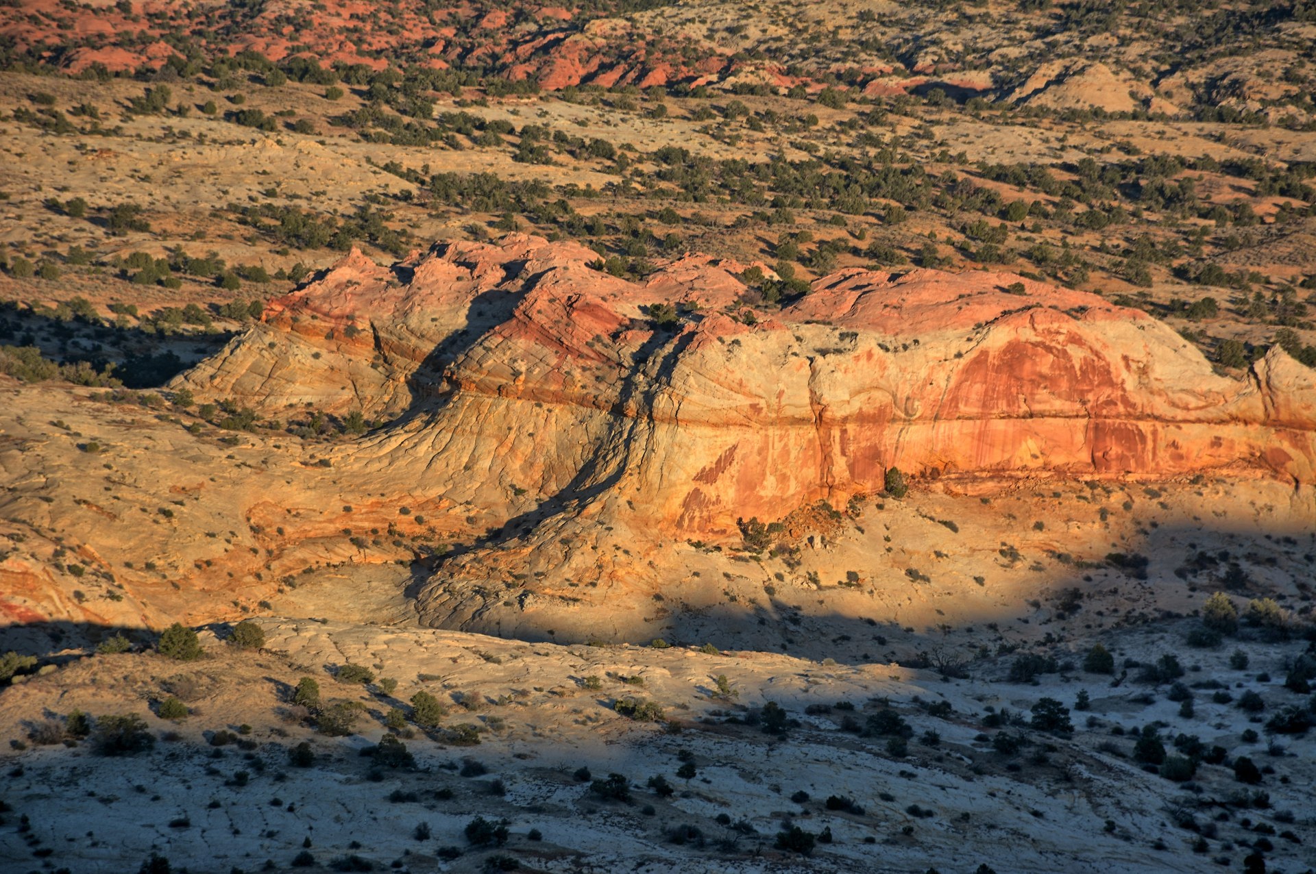
Chris drove to Torrey, south over Boulder Mountain, and to the Upper Calf Creek Falls
trailhead in the Escalante River Gorge. He hiked to the falls, seeing only
one person the whole way and that person was headed back to the trailhead.
With the falls all to himself, he flew his
camera quadcopter at the falls. He returned to his car, and drove across the Hogbacks
on the
Utah State Highway-12 Scenic Byway to the Head-Of-The-Rocks
Overlook for sunset. After sunset he continued on into Escalante, had
dinner at Escalante Outfitters,
the same restaurant he and Tami have eaten at before, and had one of the best
pizzas he has ever had. He had planned to camp on Thursday night,
but instead found an inexpensive, clean hotel in Escalante.
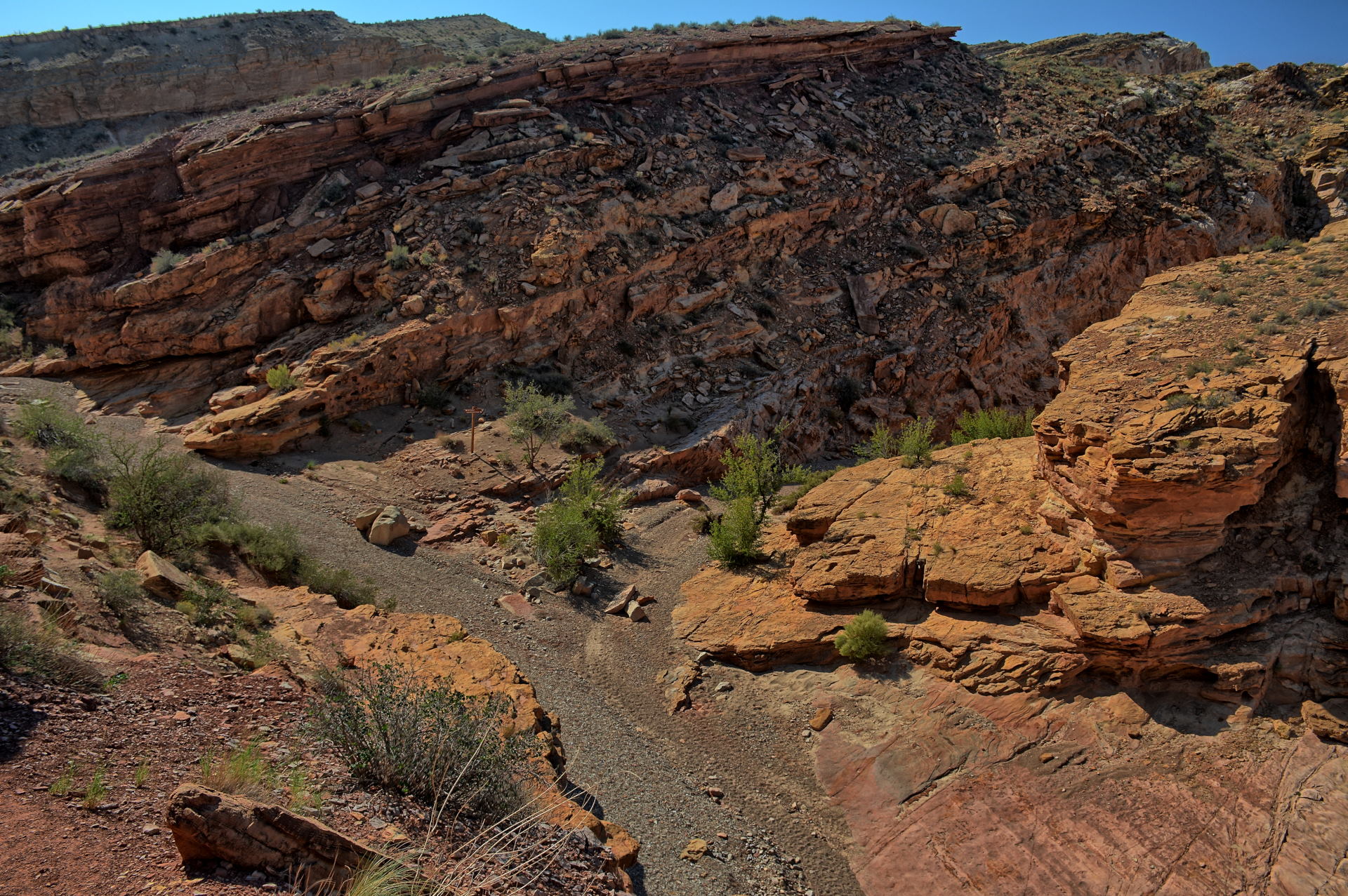
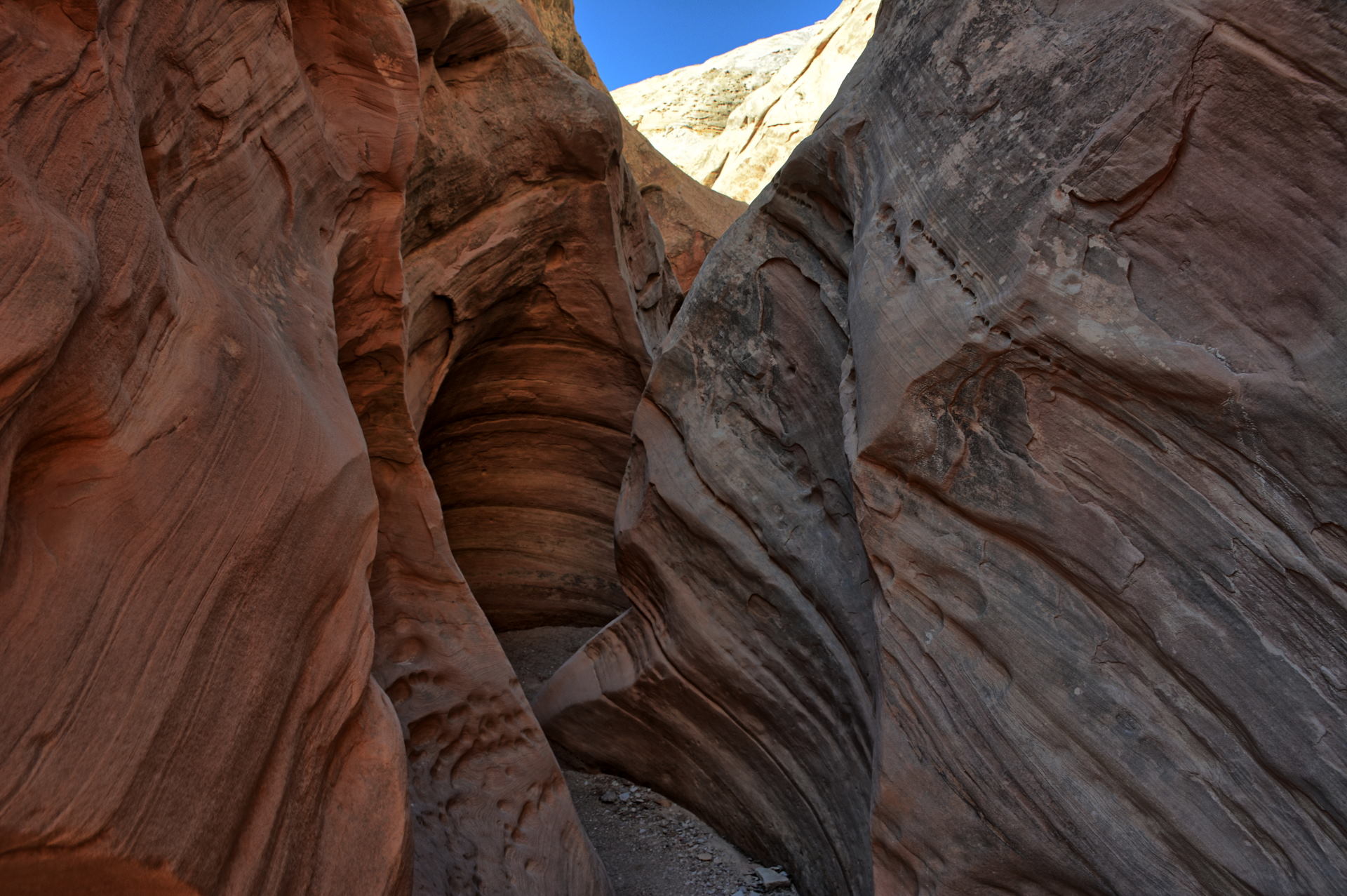
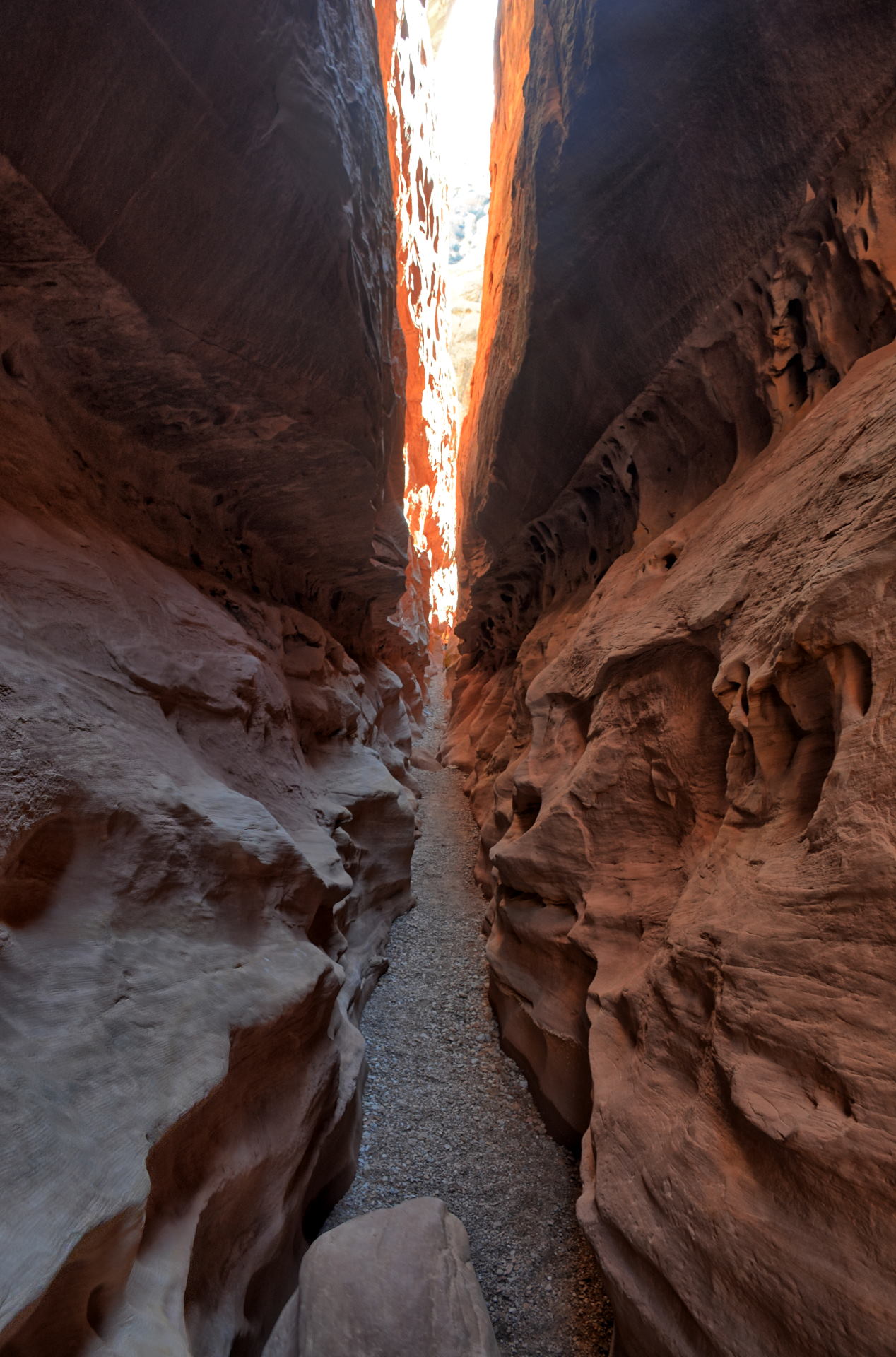
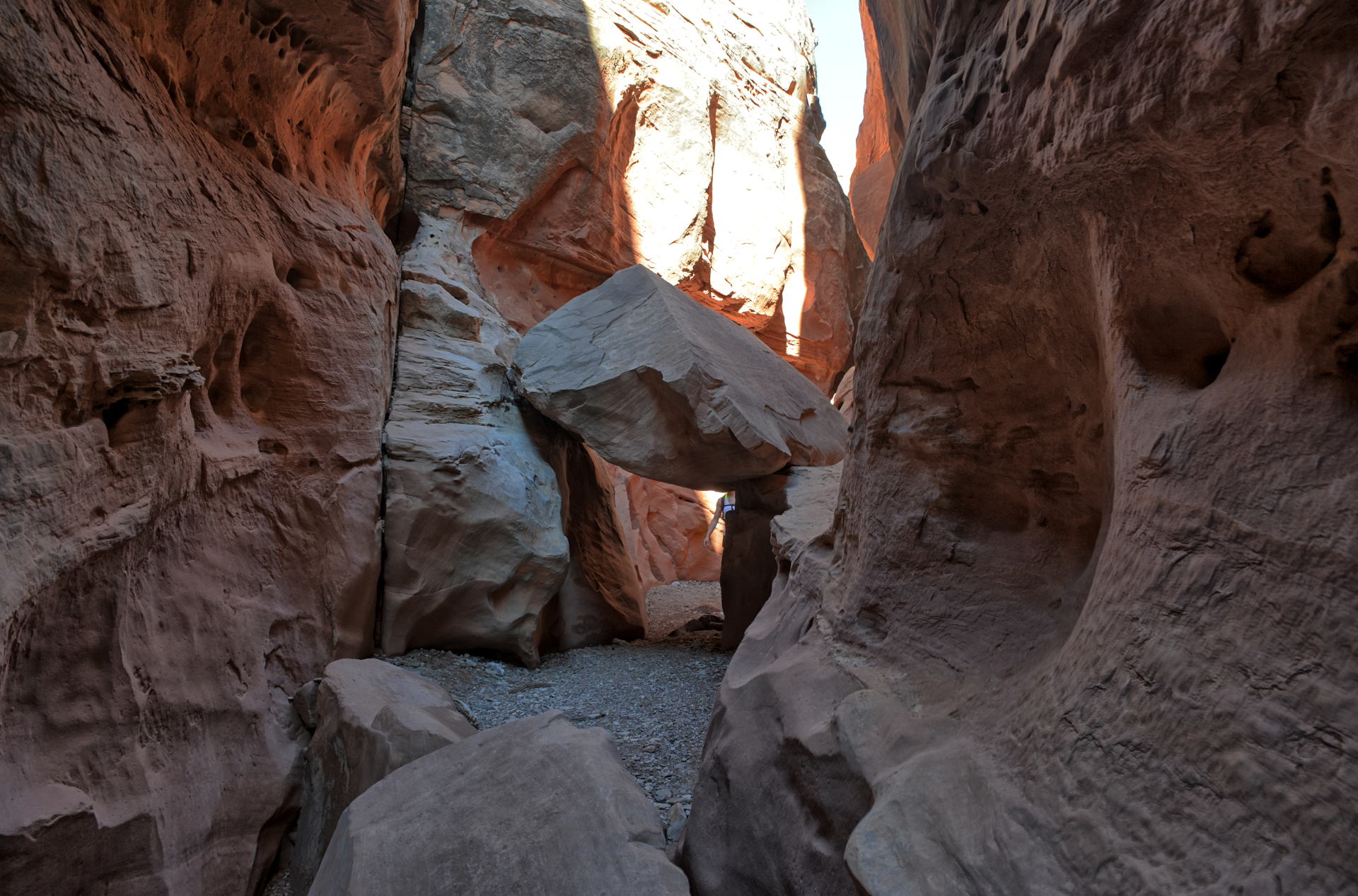
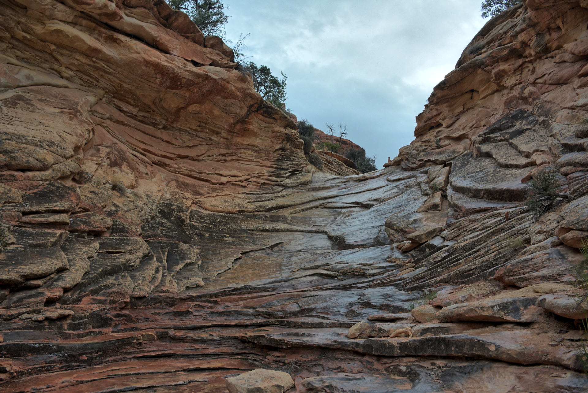
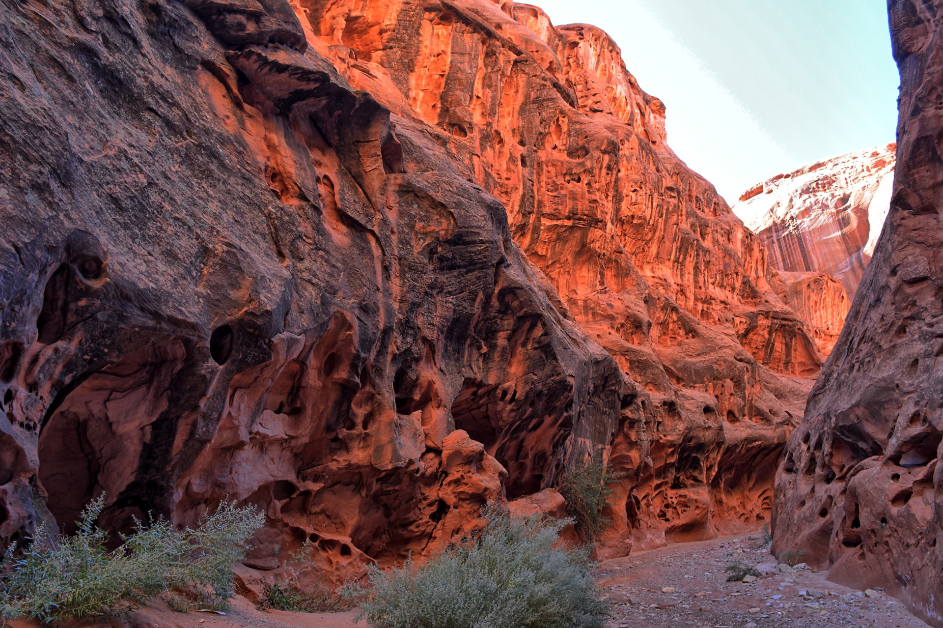
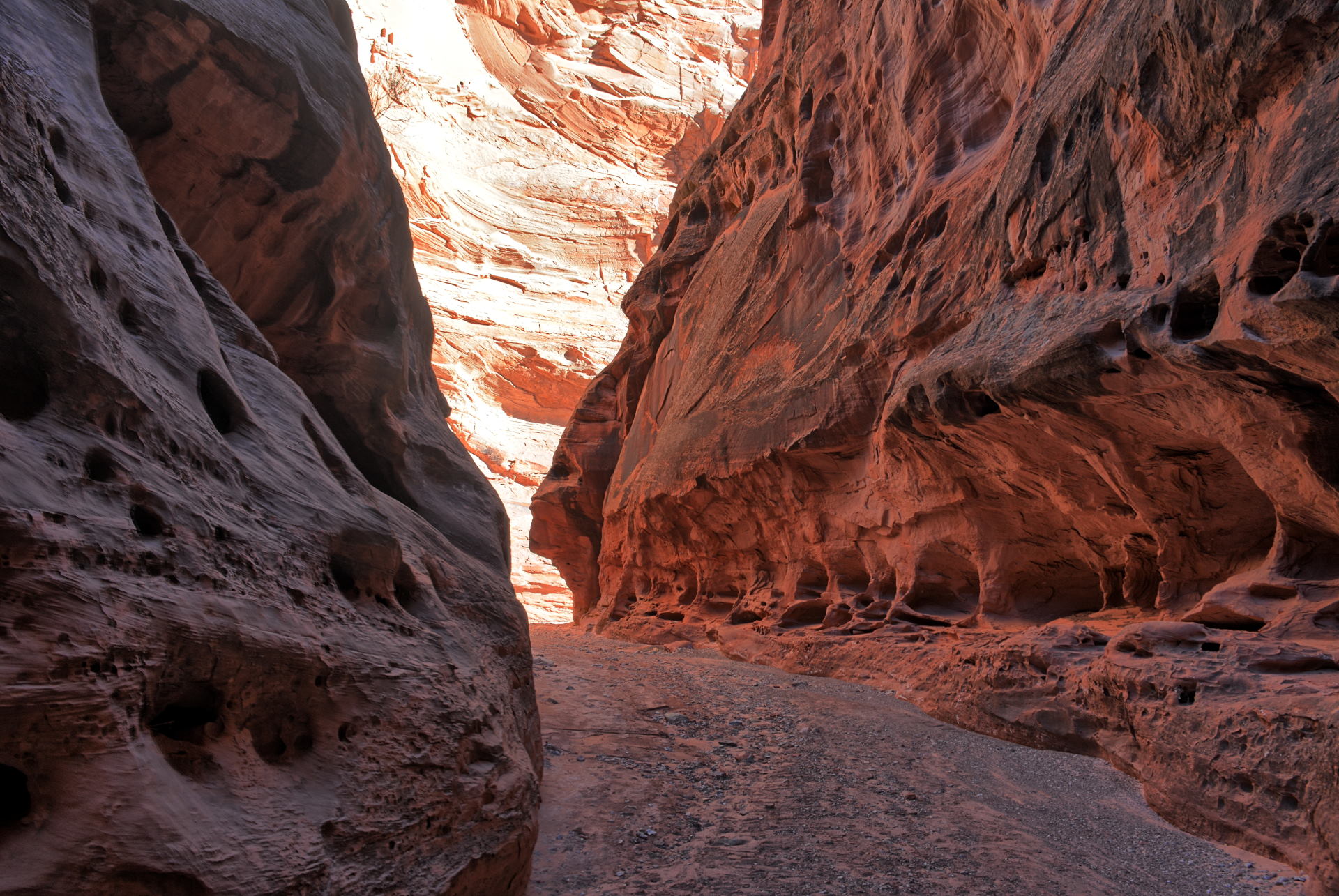
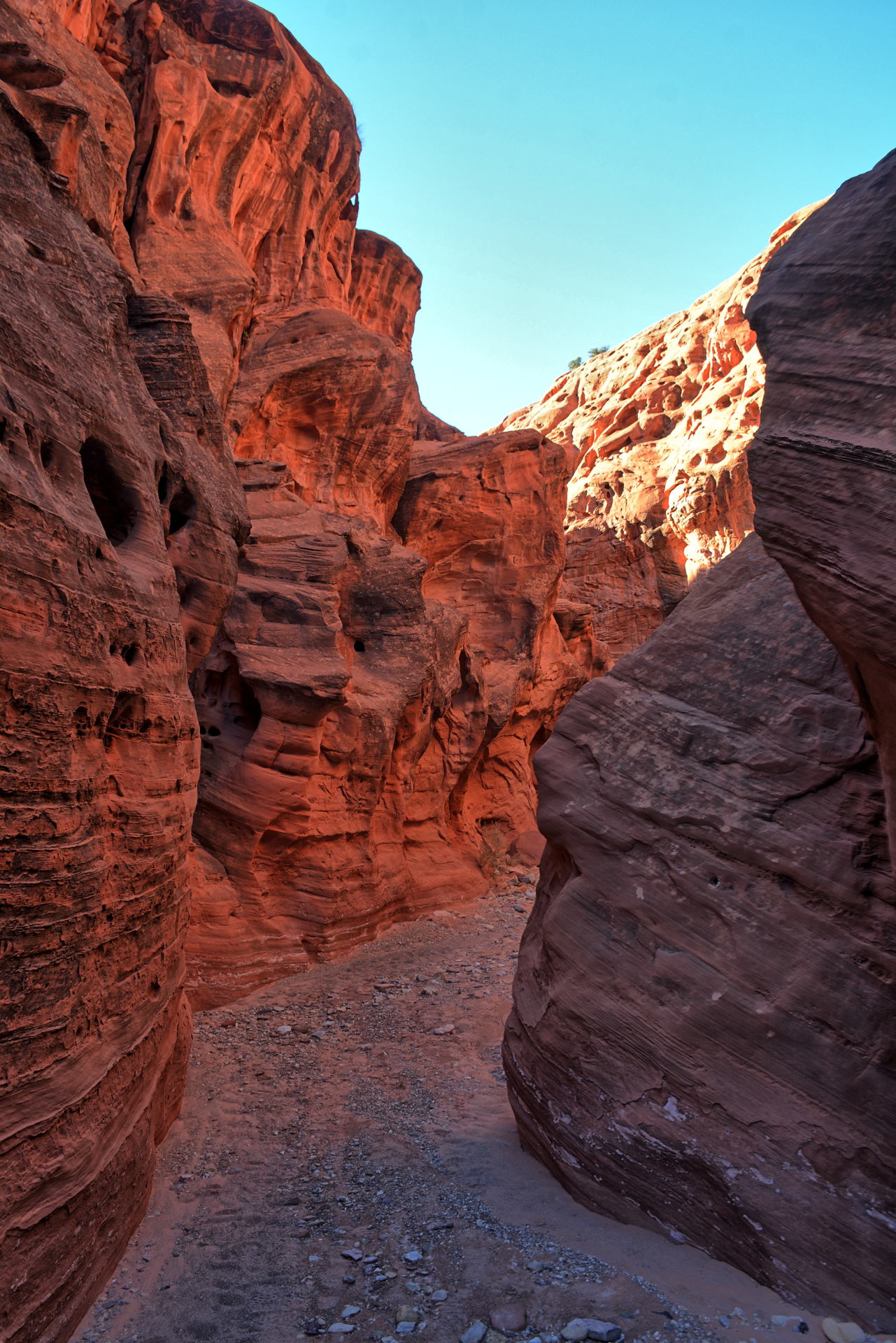
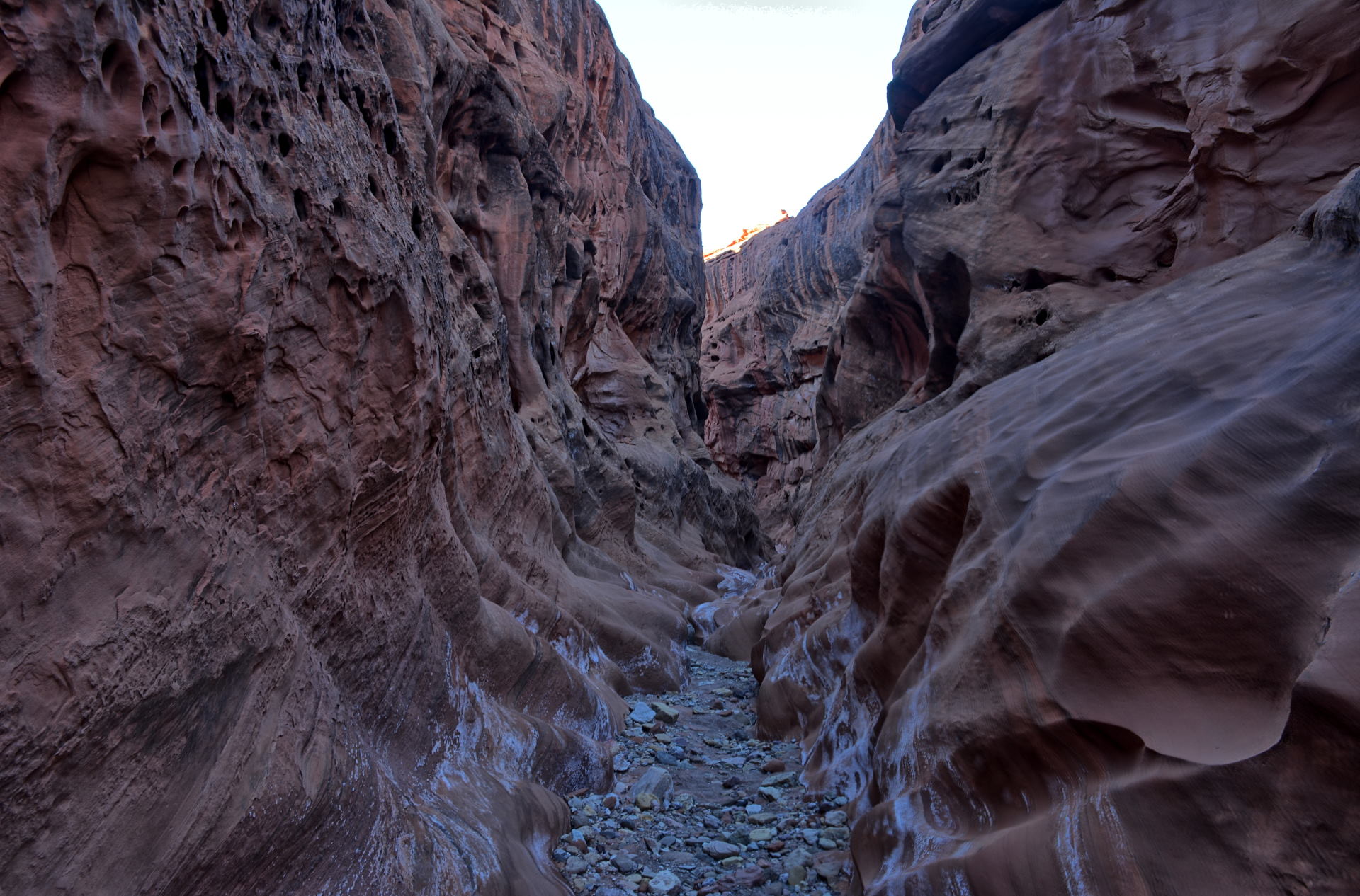
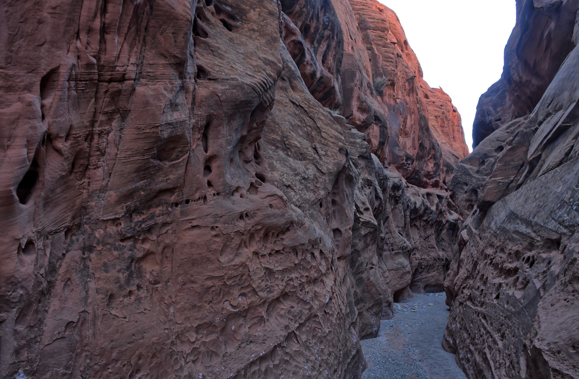
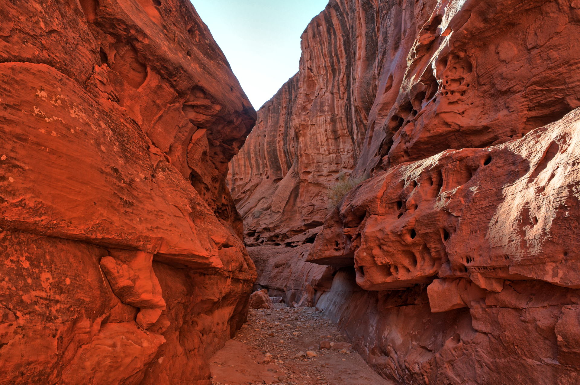
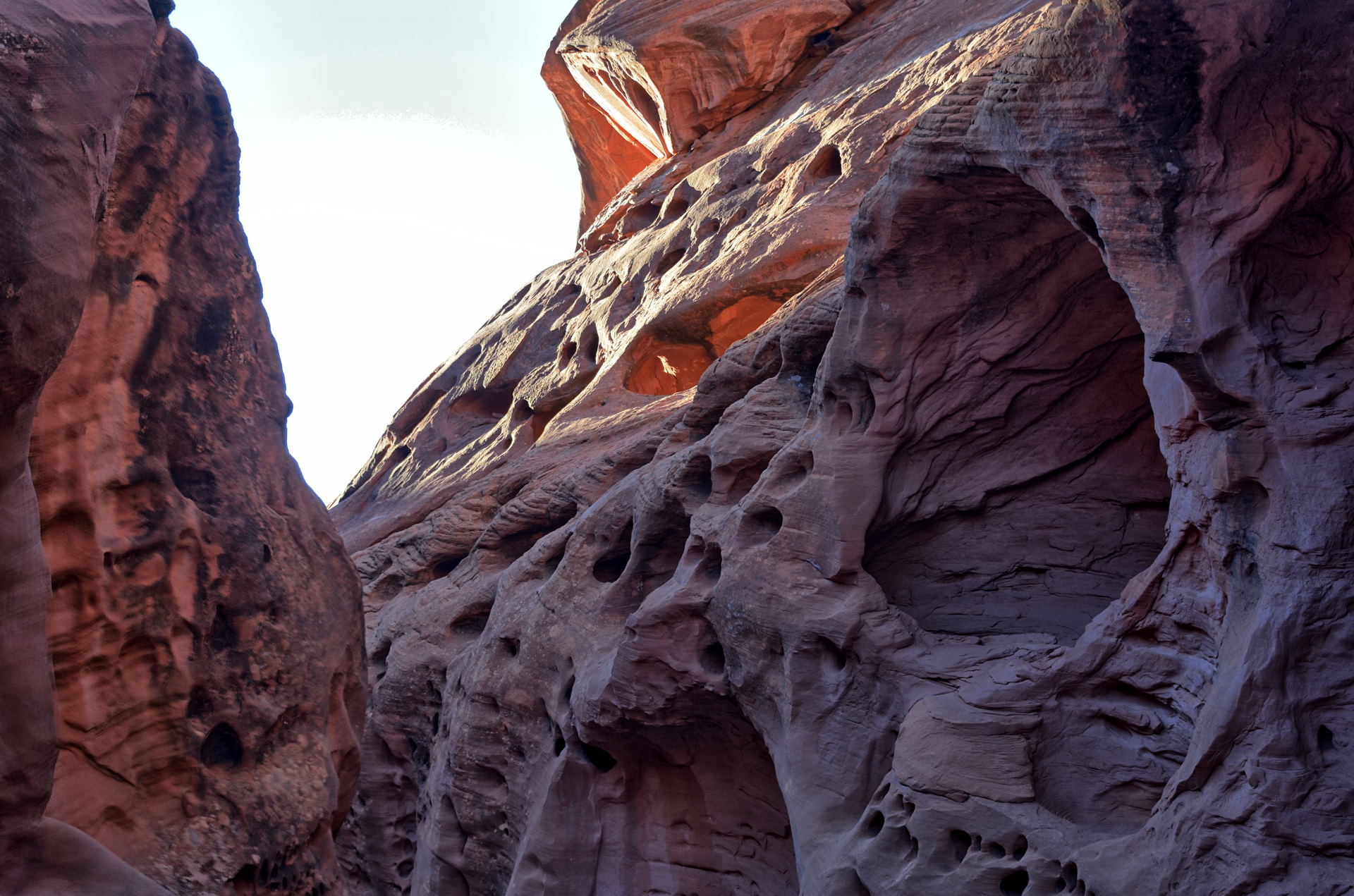
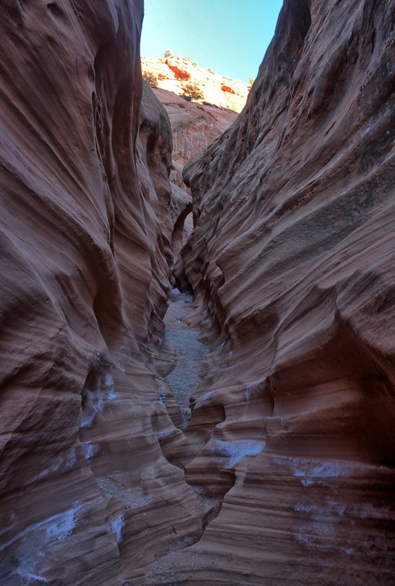
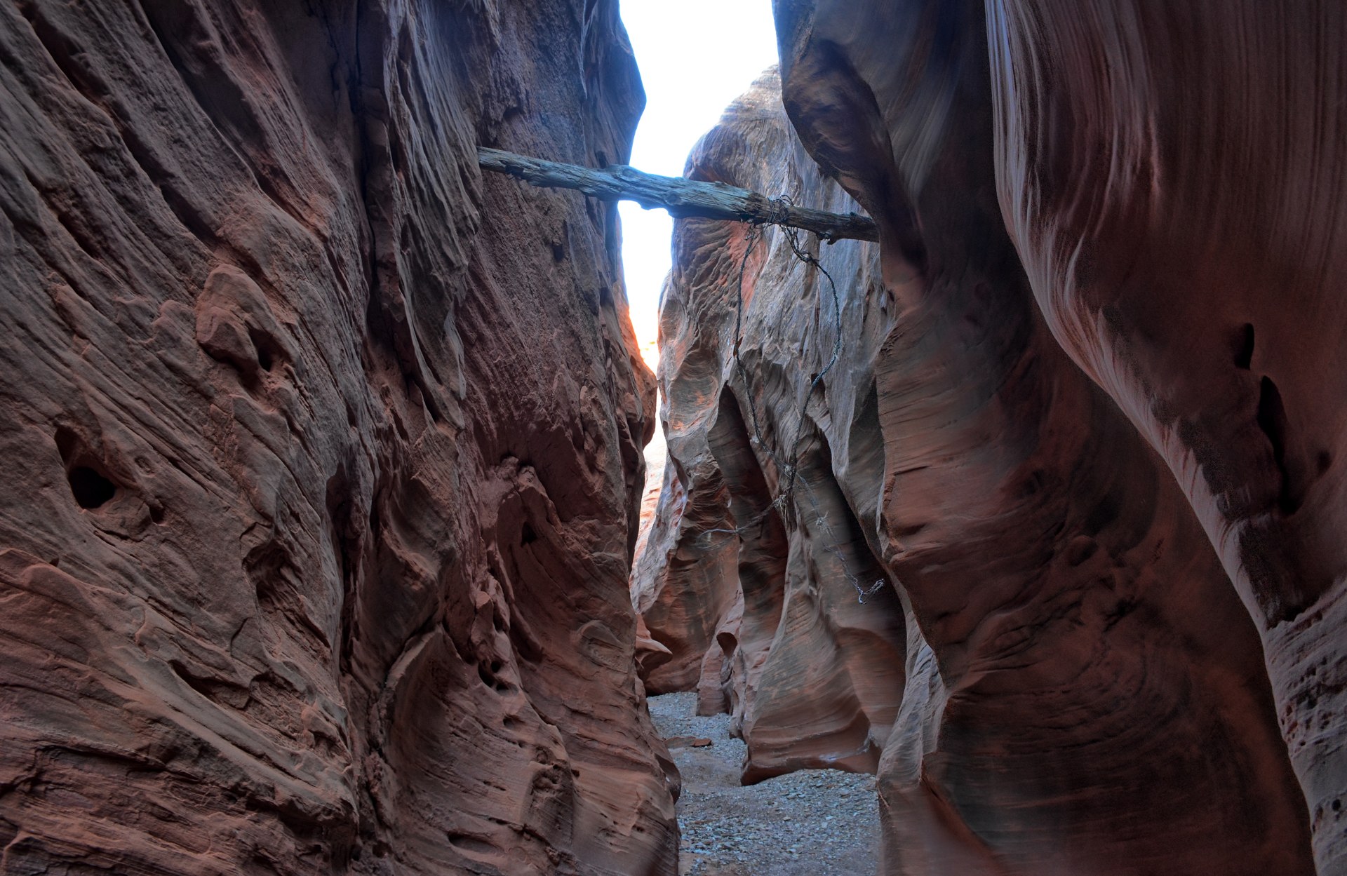
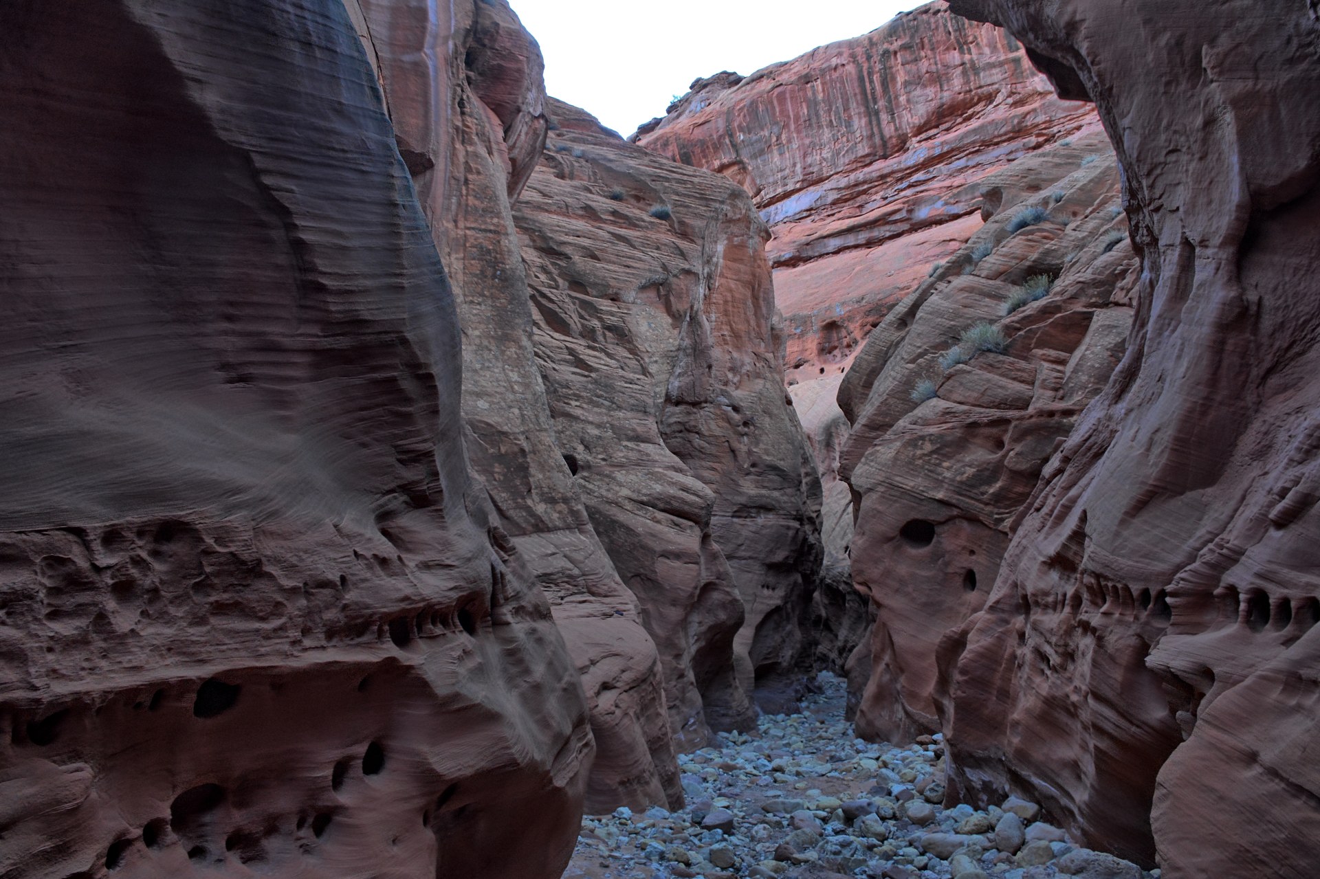
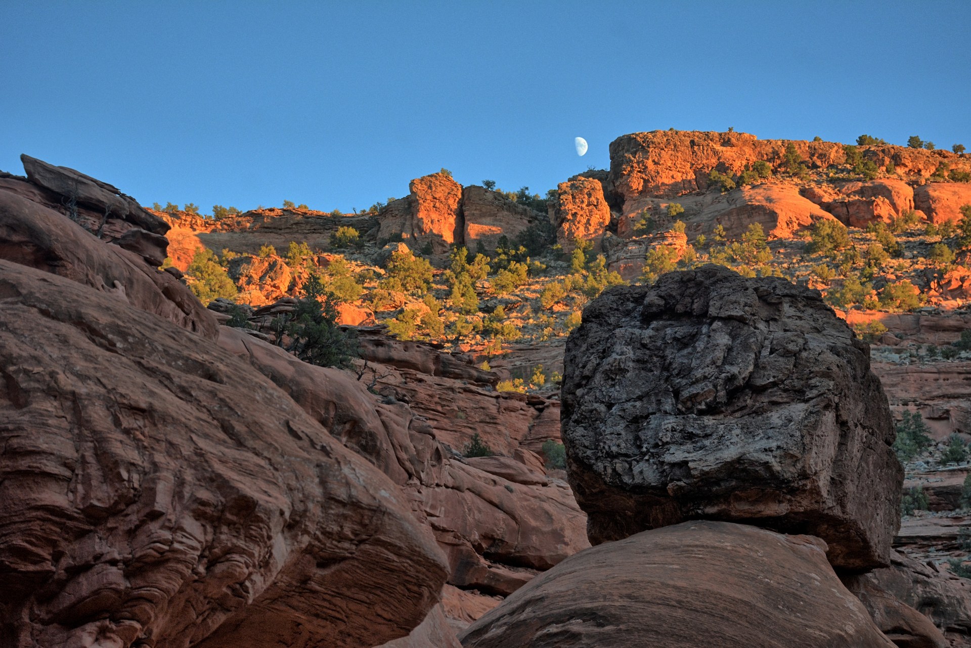
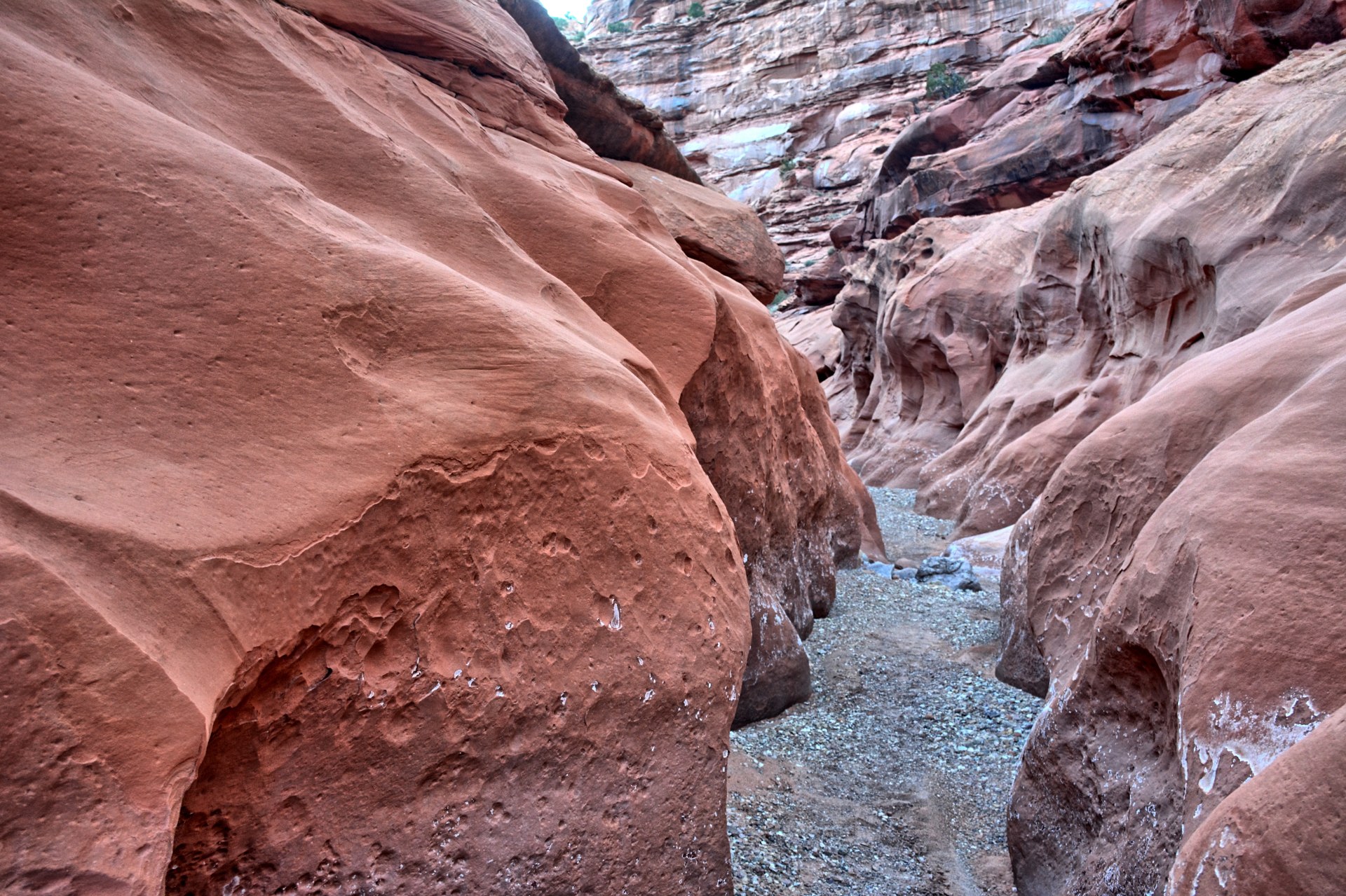
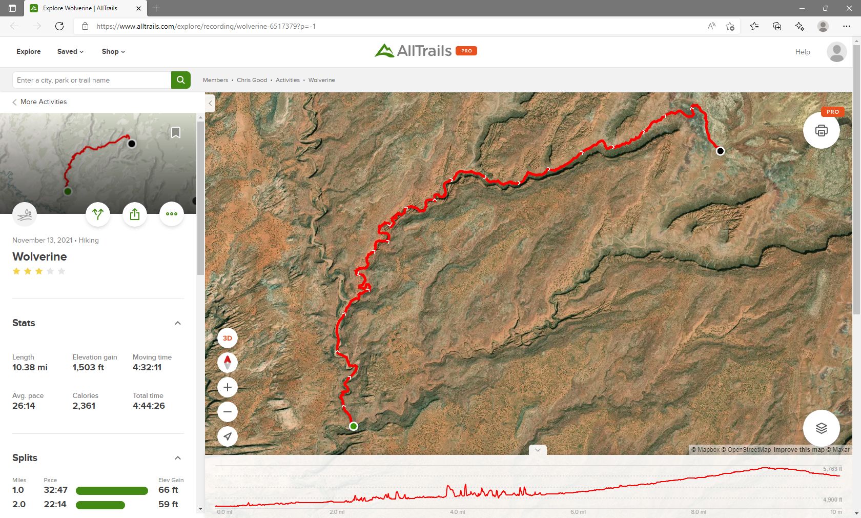
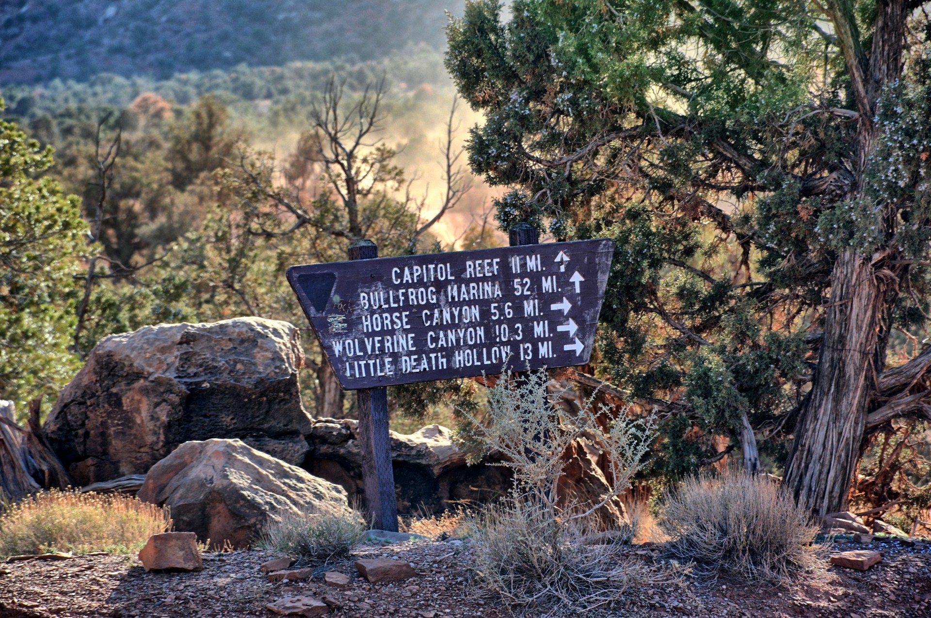
Little
Death Hollow is about 10 miles long, with several miles of that being a very
narrow slot canyon. Chris made it to the trailhead and packed his big backpack
for an overnight trip, with tent, sleeping bag, food, camera quadcopter, and lots of water.
All the write-ups on the Internet state there are no major obstacles in this
slot canyon, so no technical gear is needed. What the guides don't tell you is
that while there are no major obstacles, there are LOTS of smaller obstacles.
Chris found there are several dry-falls from 4 to 10 feet tall, and if it has
rained recently there will be water at bottom of the dry-falls and other low
spots, so he recommends
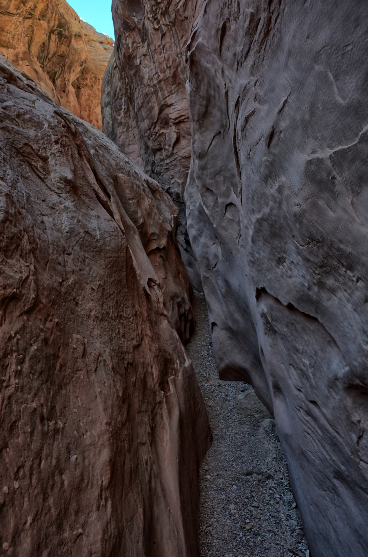
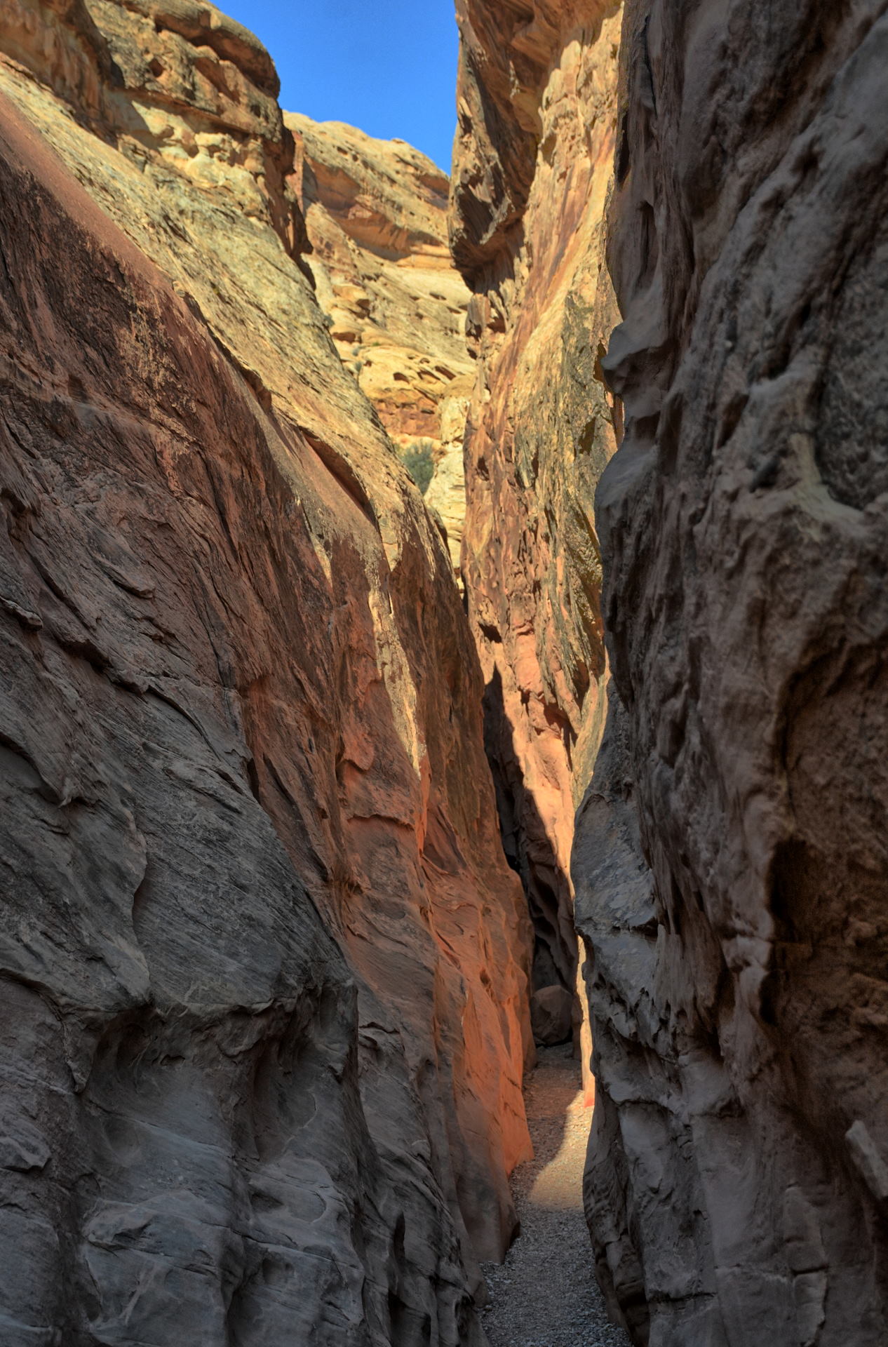
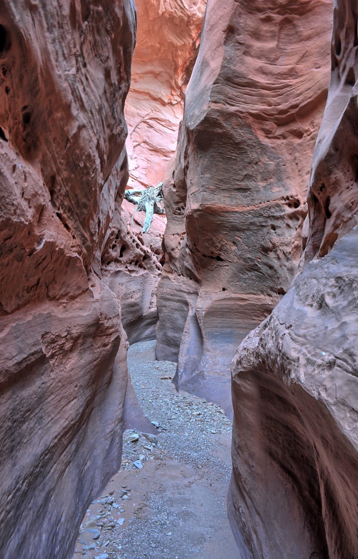
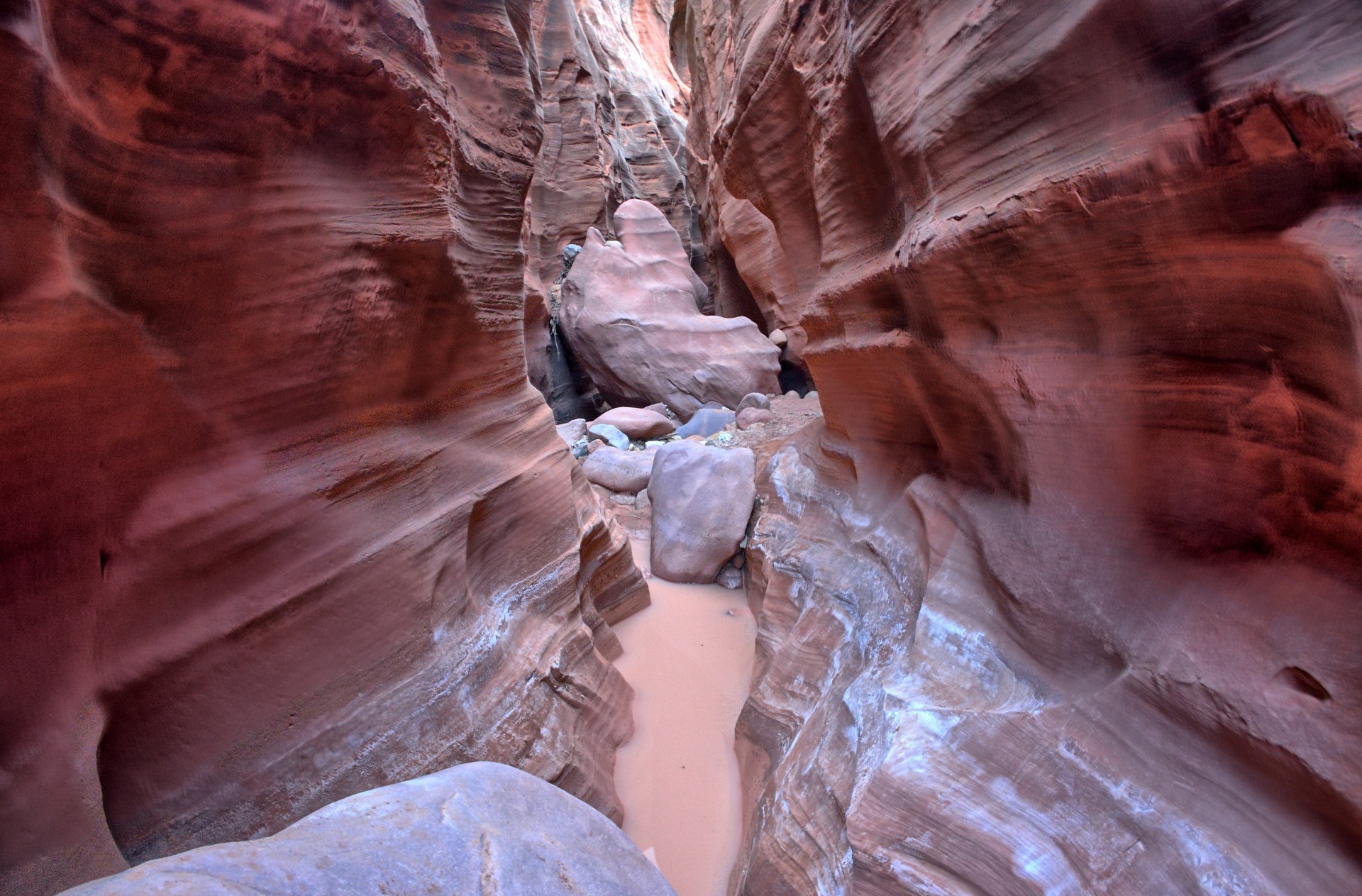
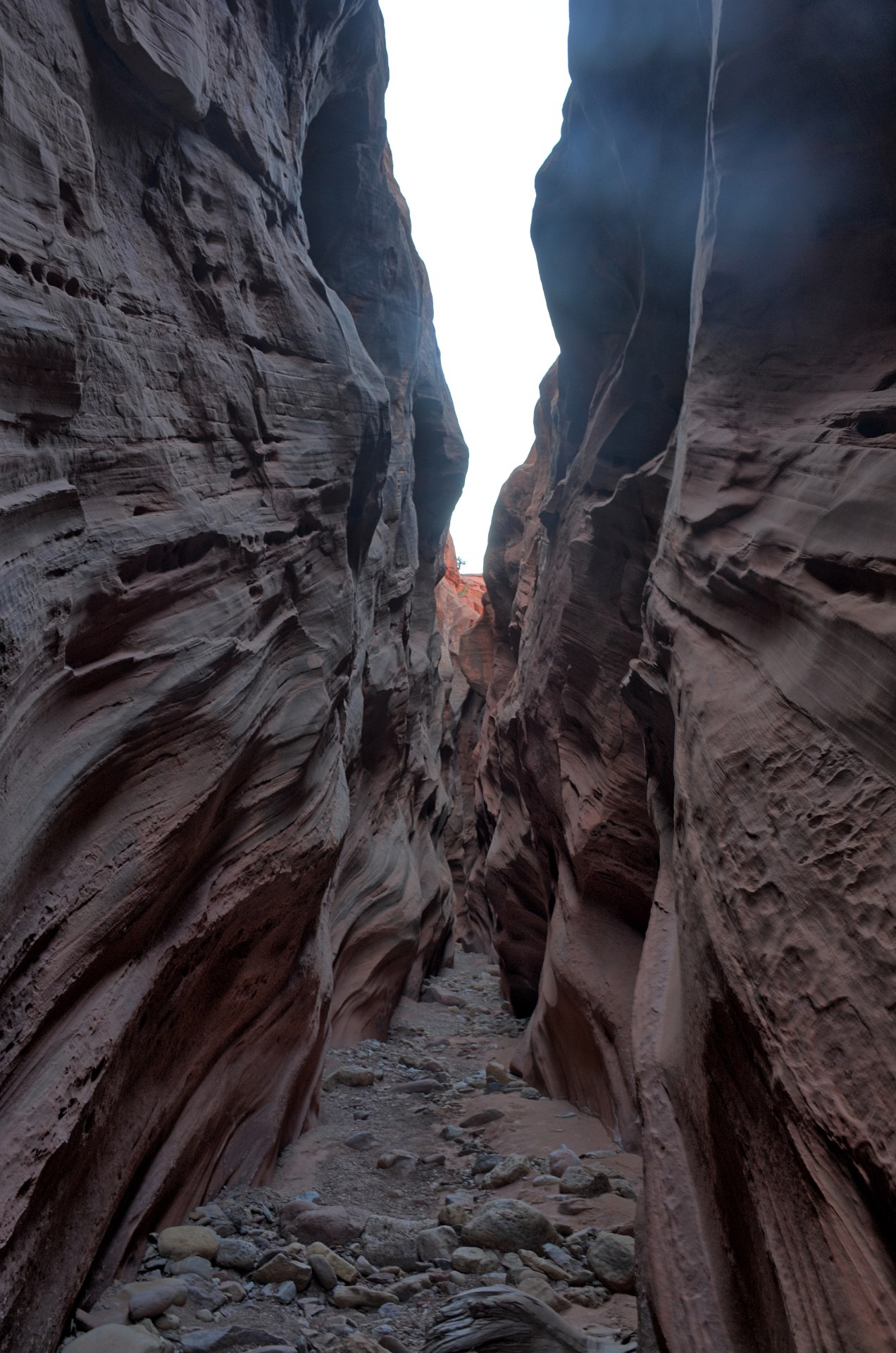
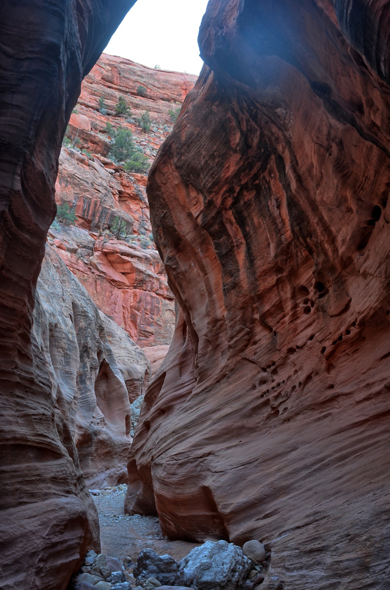
you definitely hike Little Death Hollow going downhill. Chris hiked it
this direction on Friday, and then returned uphill to his car on Saturday via
Wolverine Canyon, which does not get nearly as narrow as Little Death Hollow and
has no obstacles. It is a long hike at 20 miles, but if you make it an overnight
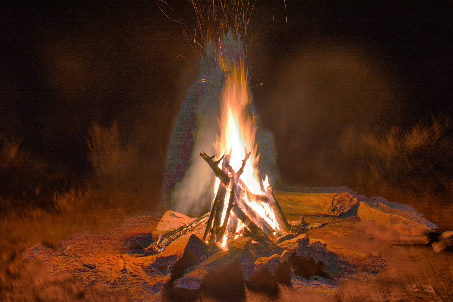
camping trip, and it is very doable. When Chris had completed Little Death
Hollow by Friday evening, having to climb through cold thigh-deep water in
several places, he had enough of slot canyons and was glad he would be walking
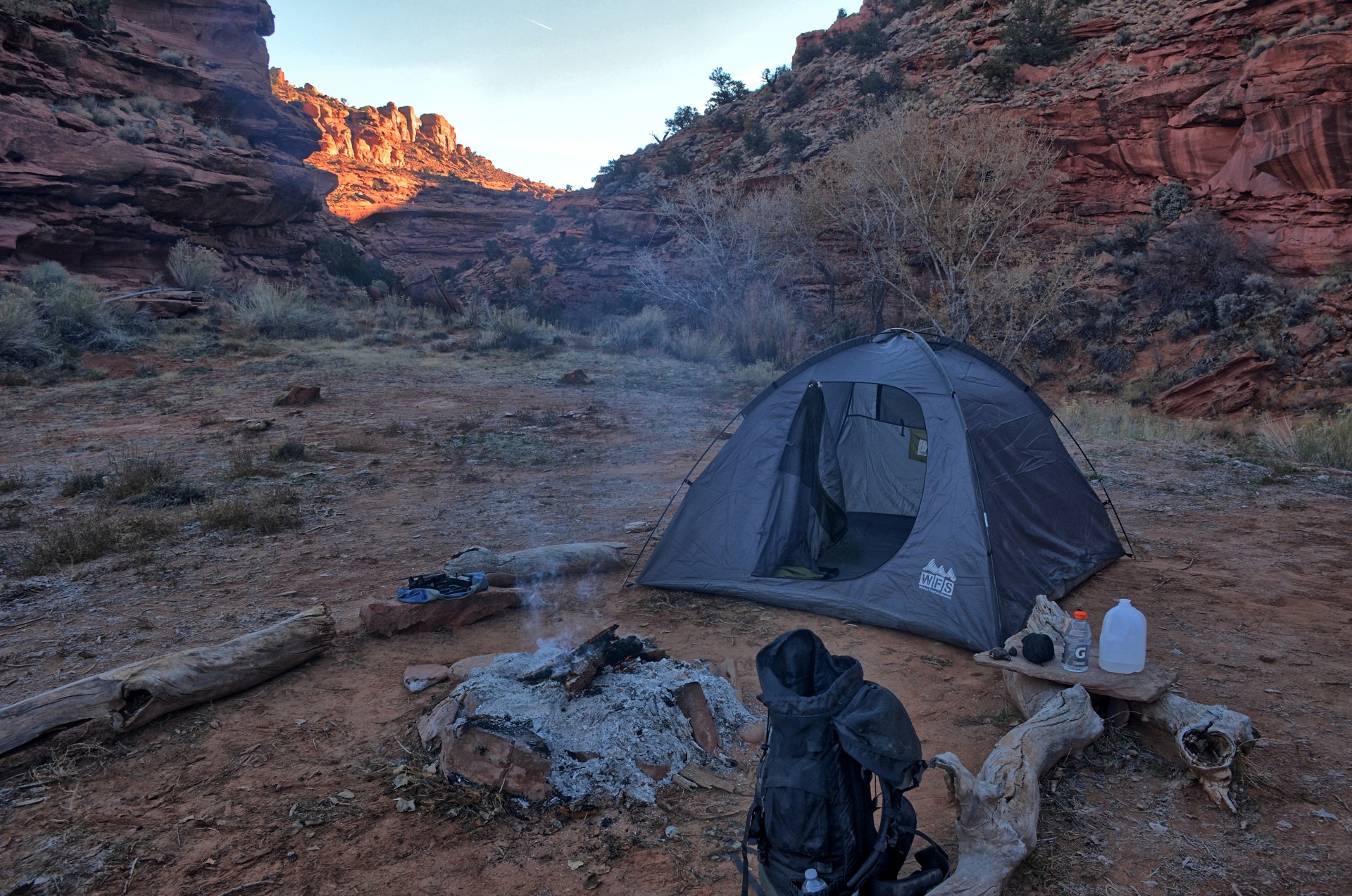
out of the water with no obstacles on Saturday. Chris camped at the
junction of Little Death Hollow and Horse Canyon on Friday night. It
got very cold, and Chris found that his sleeping bag did not support its claimed
low temperature rating of 20 deg F, so he started a campfire to keep warm.
Chris got up and cooked breakfast. As the water was warming
up, he flew his camera quadcopter at the campsite. The battery had been
cold-soaked all night long, so it gave out quickly and the flight did not last
very long. It was just long enough to get an aerial view of the camping area at
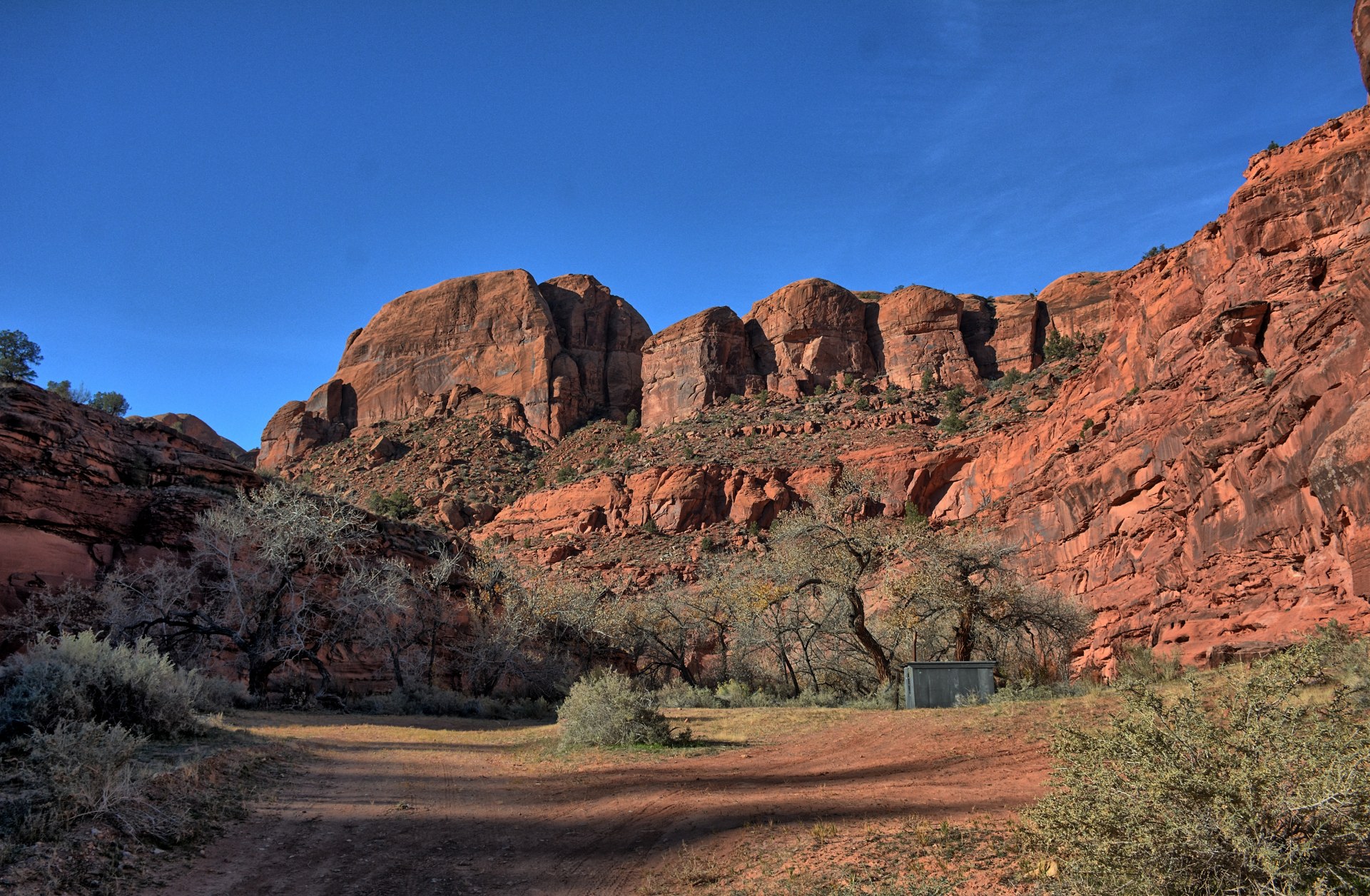
the confluence of Little Death Hollow and Horse Canyon. He packed up and
began the 10 mile hike back to his car through Horse Canyon and Wolverine Canyon. About 1/2 mile into the hike, he passed a small line cabin about
8 feet square. He looked inside to find a wood stove and cot. If he had
known that cabin was so close and had a stove, he would have hiked there the night before and
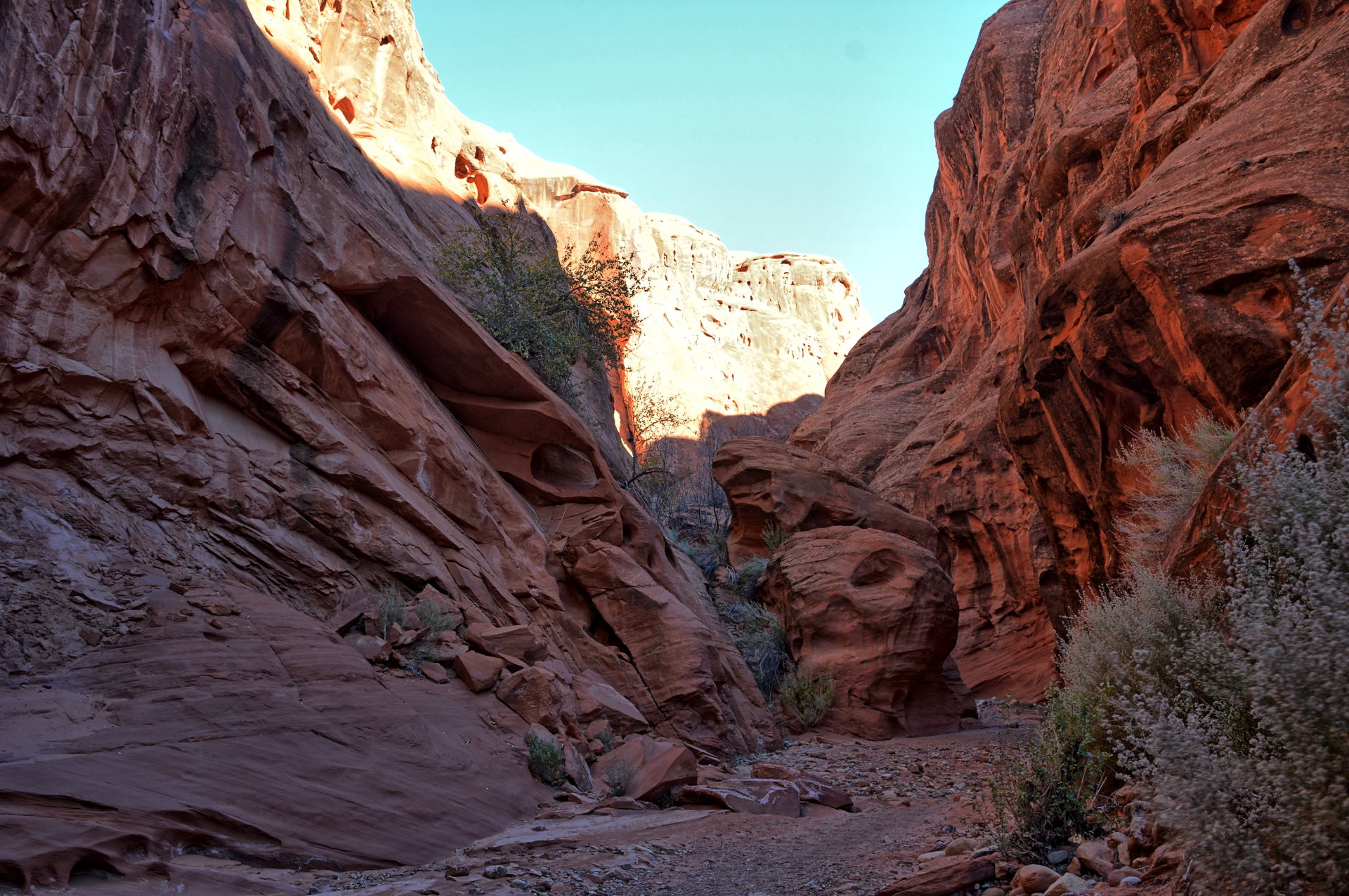
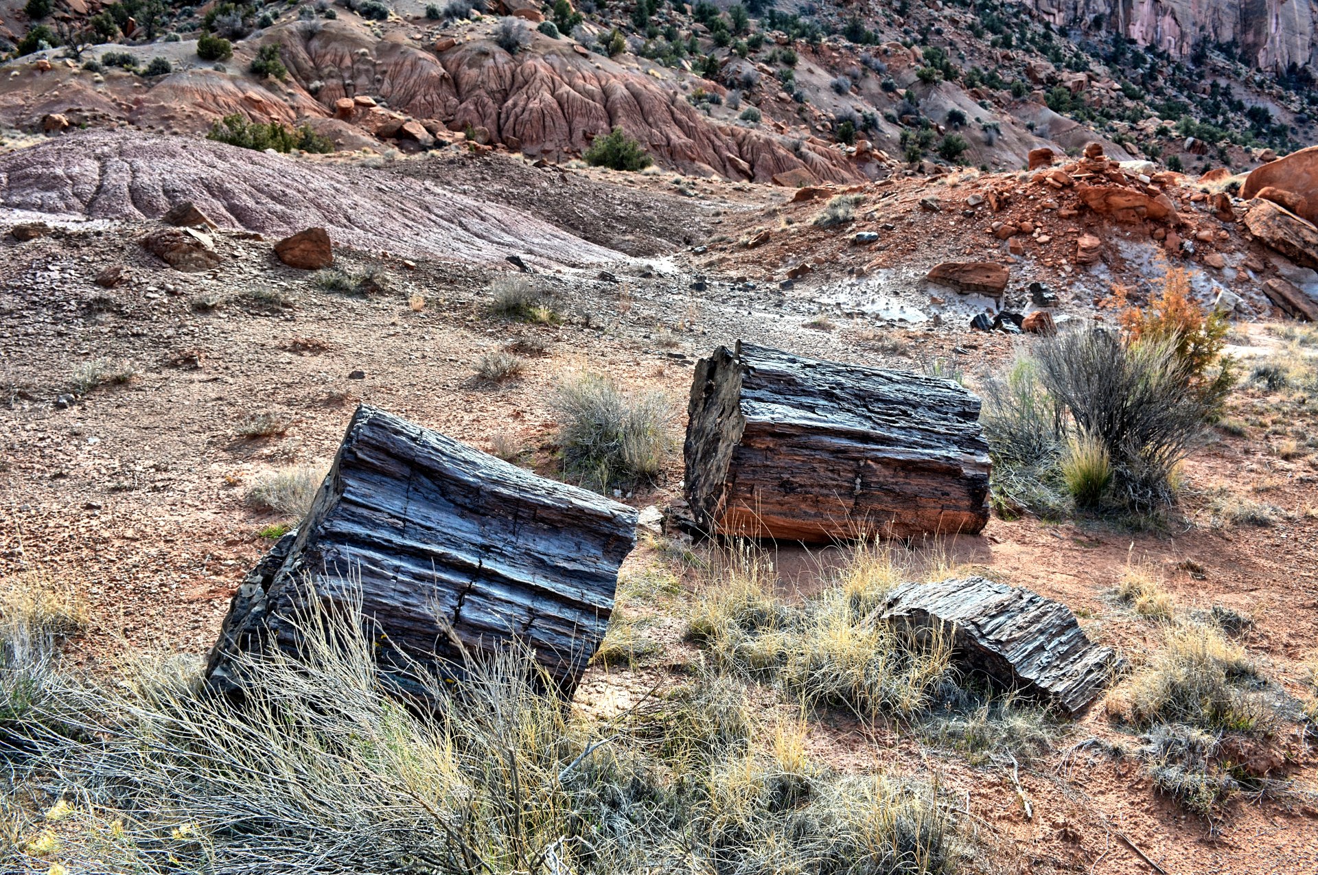
would have been much more comfortable. Wolverine Canyon ended up being
very pretty, better than he expected, so it was a nice hike on Saturday.
Wolverine Canyon is full of petrified wood; it is supposed to have the second
highest amount of petrified wood in the United States, second only to Petrified
Forest Nation Park in Arizona. Wolverine splits about half-way through, with the main canyon going north-east
and a side canyon going mostly east, followed the north side of Little Brown
Bench. This side canyon is a more direct route back to the Little Death Hollow
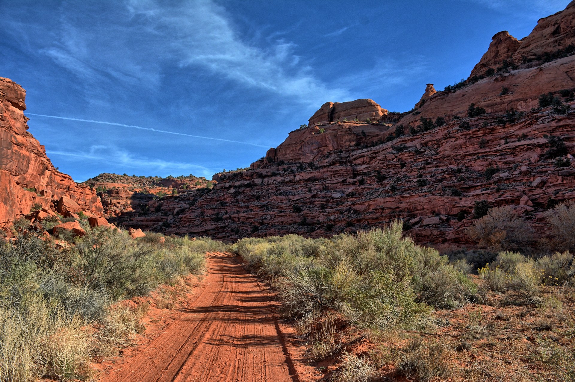
trailhead, and that is how Chris hiked back. After reaching his car, Chris
rested for a little bit then flew his flying wing at the trailhead. He
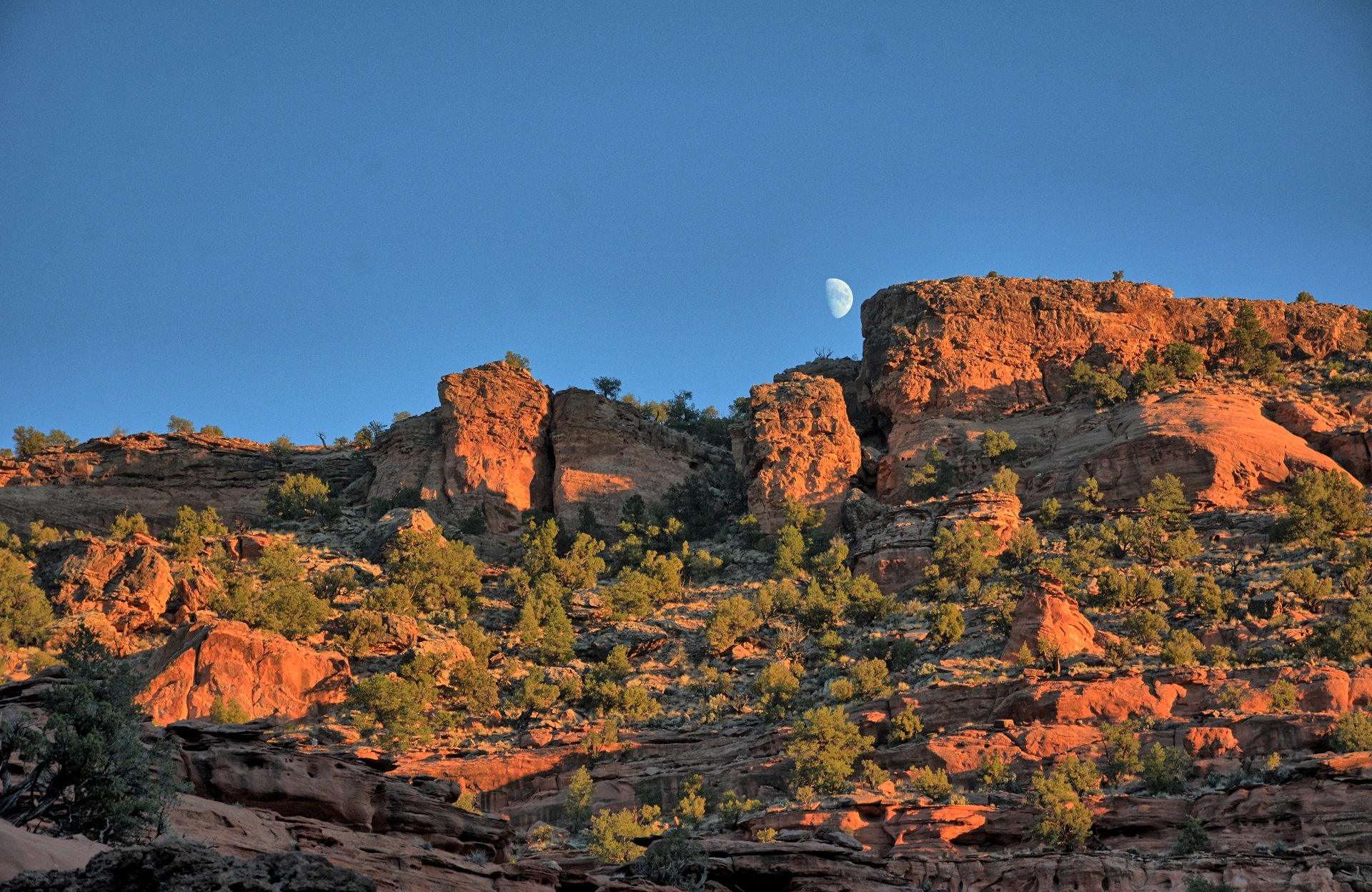
drove out on Wolverine Loop Road the way he had come in, rejoined the Burr
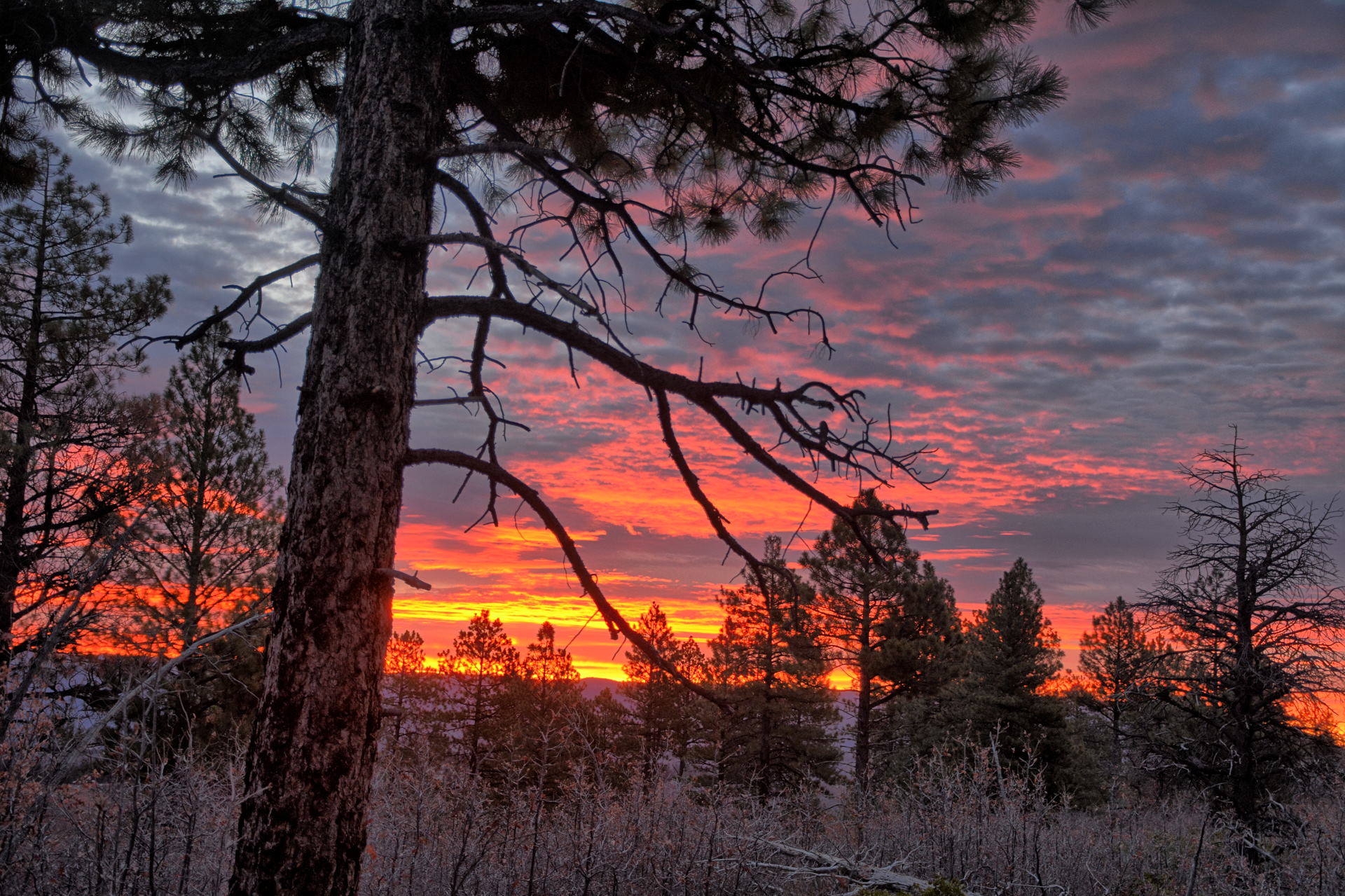
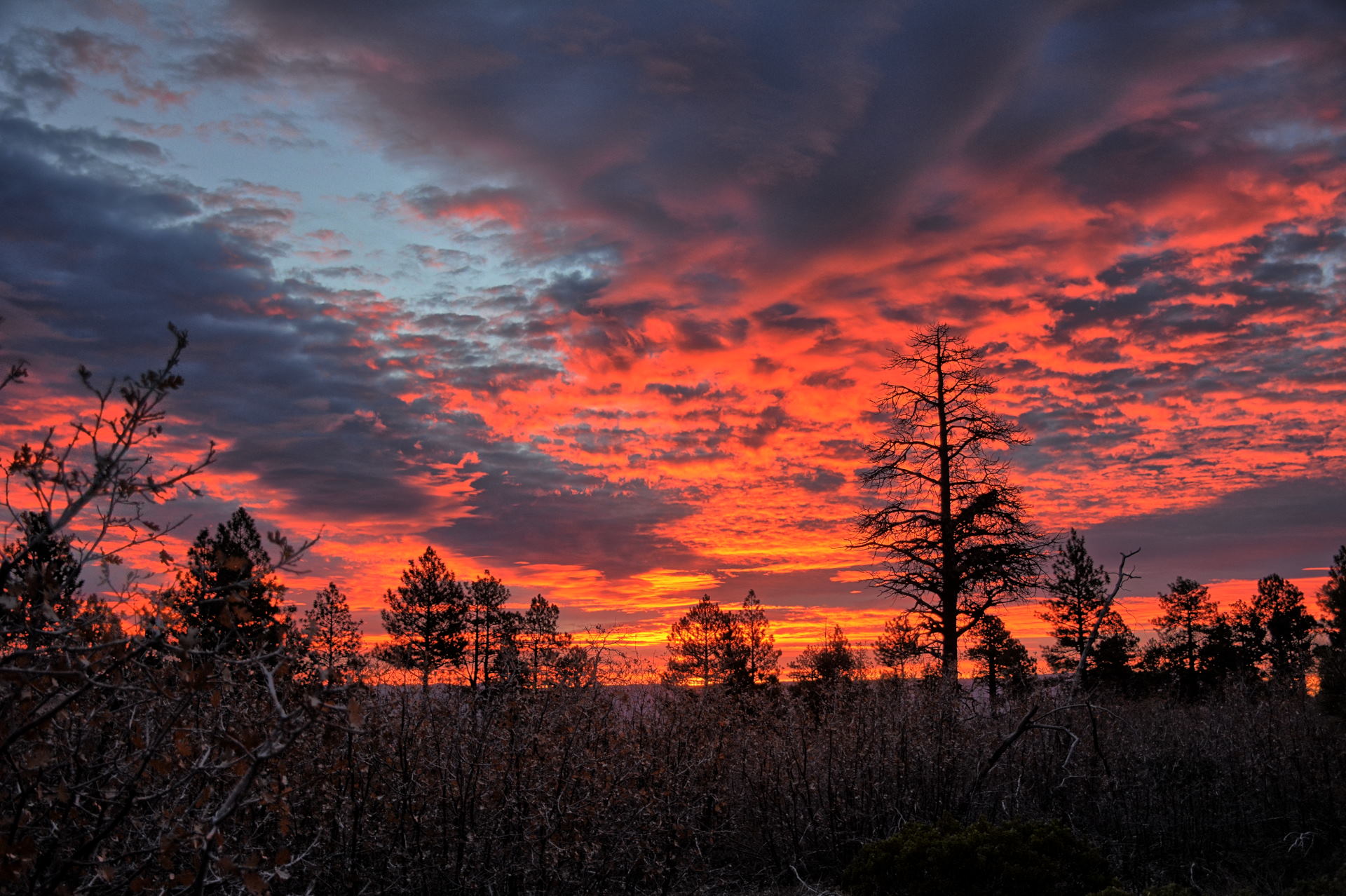
Trail Road, and eventually made it back to Boulder. He drove north over
Boulder Mountain, stopping to get sunset photos. He stayed at the same
hotel in Torrey where he had stayed at the beginning of this trip on 2 October.
He had a great burger in Torrey right next door to the hotel.
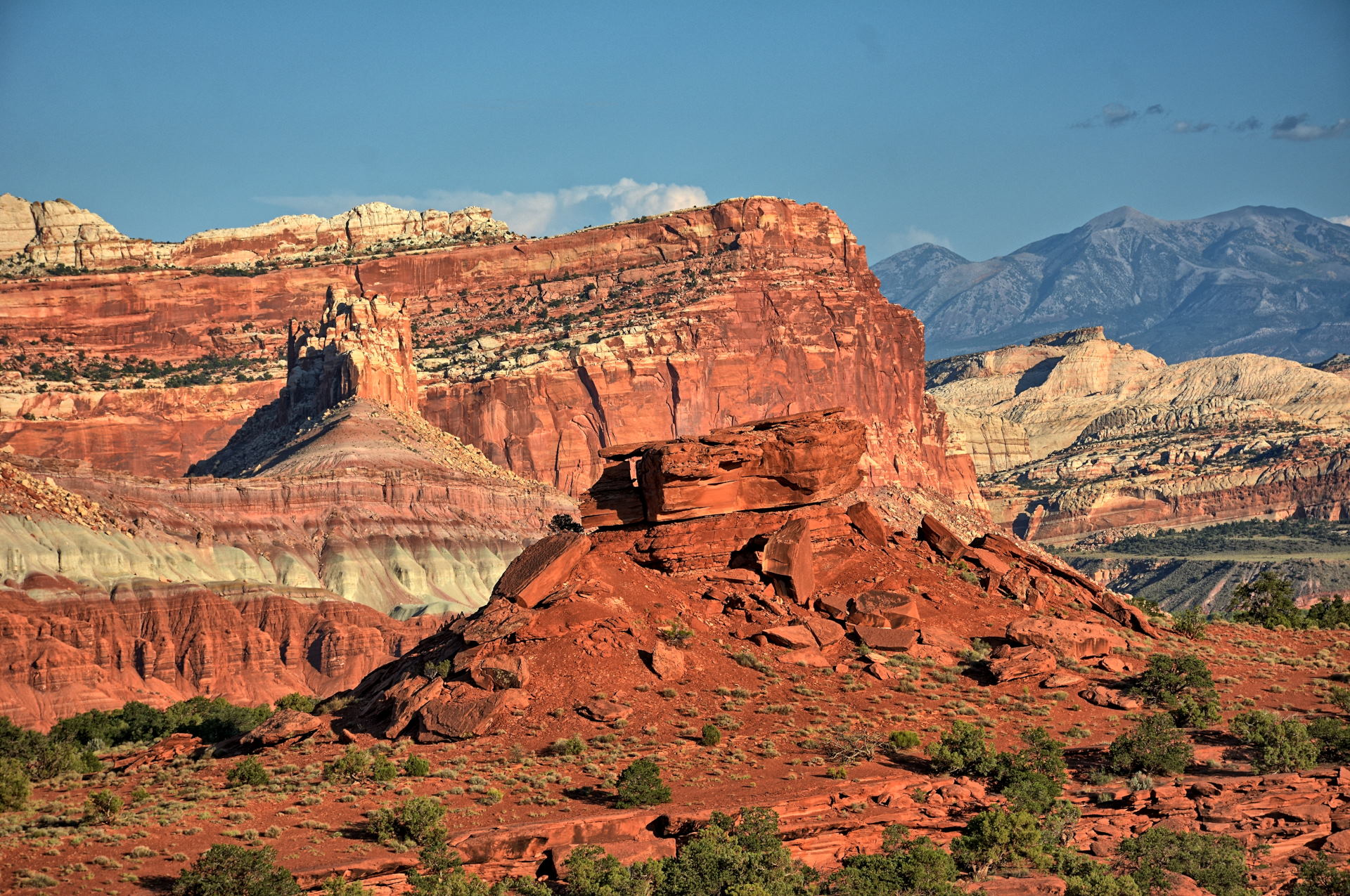
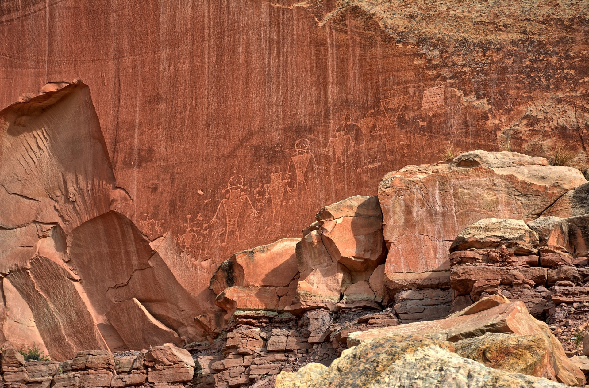
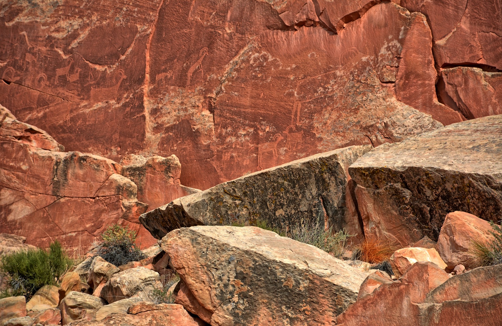
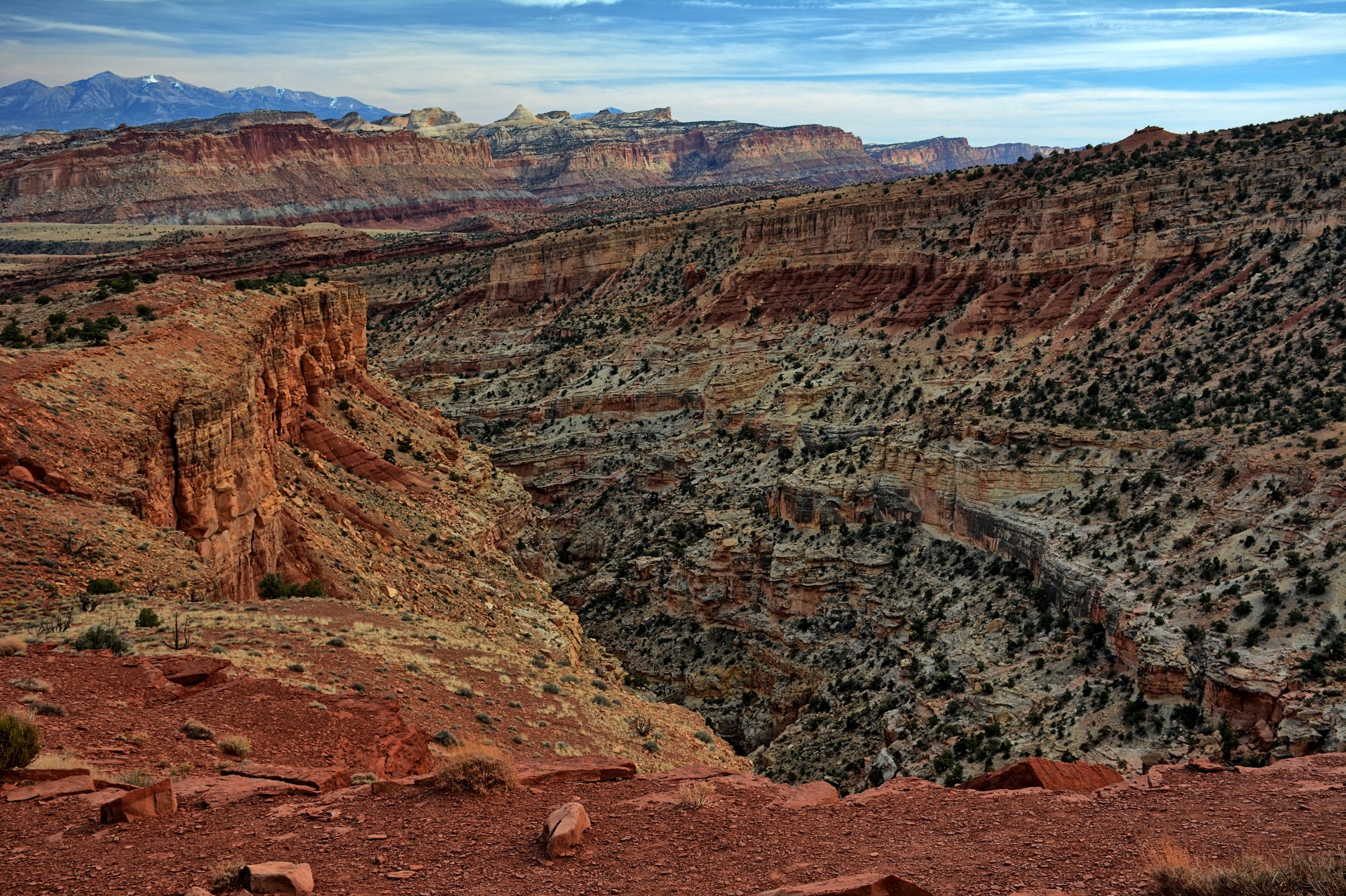
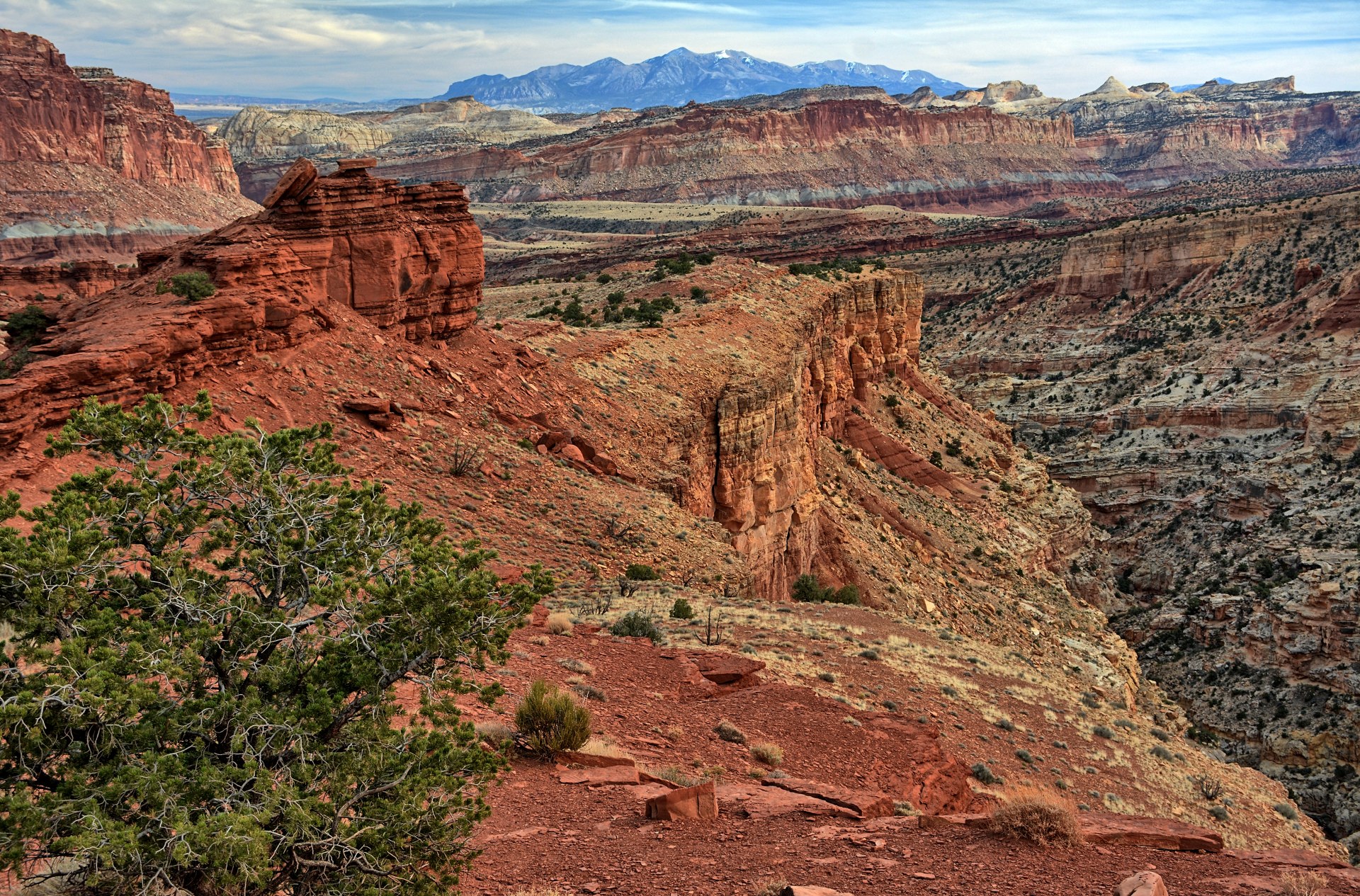
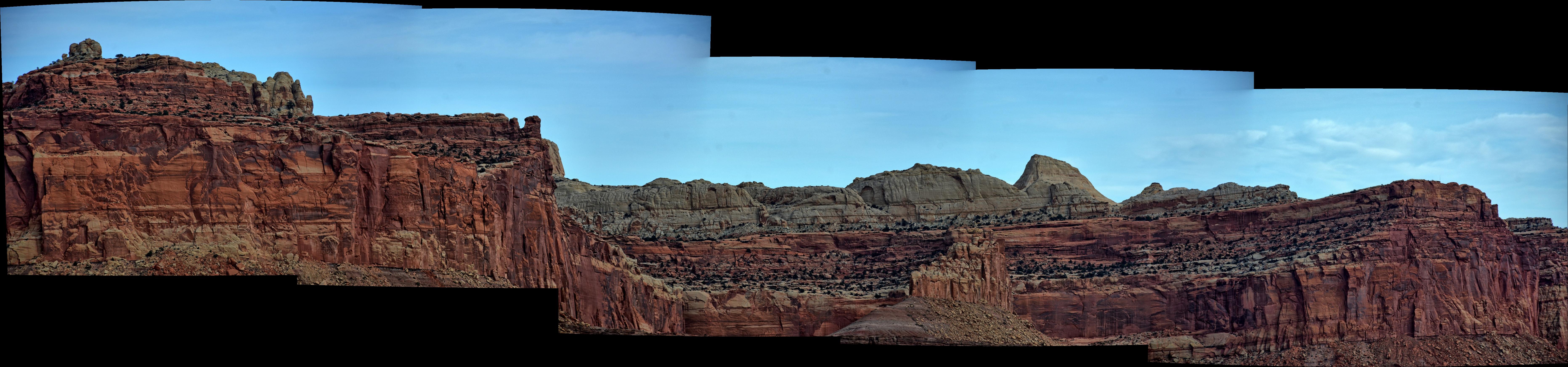
Chris relaxed on Sunday, visiting places at Capitol Reef
National Park he had been to in the past. He stopped at the pictographs panel in Fruita,
and then drove east to the Cathedral Valley Road, which starts outside the
national park border. He crossed the
ford of the Fremont River, and drove the first mile of the Cathedral Valley
Road to
reach a
small set of bentonite hills. He flew his Q180 quadcopter, flying
wing, and camera quadcopter at these hills, then returned back across the
Fremont River. He drove to the Notom-Bullfrog Road and went a few miles south to
an open area to fly his flying wing again. He went back west into the
park and stopped at Sunset Point and the Goosenecks Overlook of Sulphur Creek.
After leaving the park headed west,
he stopped again to fly his flying wing. He had a late lunch in Torrey and
returned to Dugway that evening.
Chris and the crew had
a great week of flying, accomplishing all their goals and some extras for this
week, finished the flight test series on Friday. They began to pack all the
equipment up to ship it back to Maryland after landing for the final time on
Friday afternoon.
Saturday -
Sunday, 20 -21 Nov
Chris checked out of
the Dugway hotel on Saturday morning, and he and the crew finished packing
on Saturday. Chris had a hotel reservation in Salt Lake City on Saturday
night, and a flight home early on Sunday morning. On the way back to Salt
Lake City on Saturday afternoon, Chris
flew his flying wing again in Skull Valley, and again in
Saltair on the edge of the Great Salt Lake. He and the remaining crew
had dinner at Red Iguana 2 on Saturday evening. Chris finished taking all
his RC equipment apart and packing for the trip home on Saturday evening. He flew home on Sunday, arriving back to BWI in the afternoon.