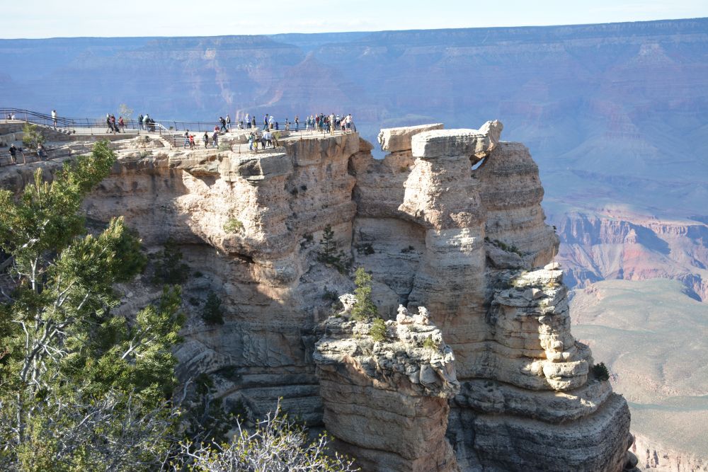
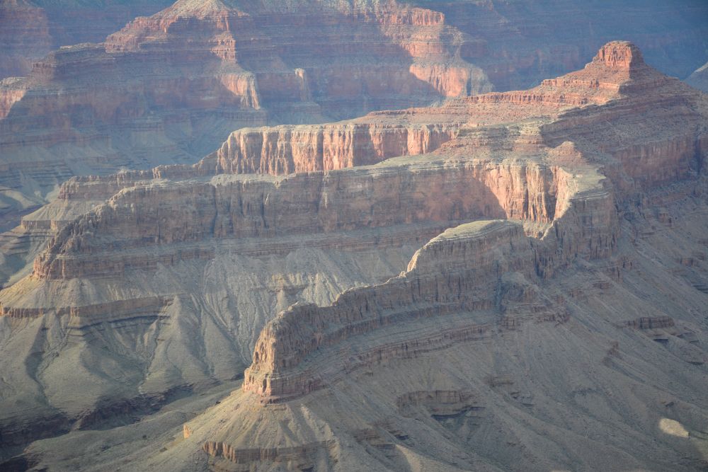
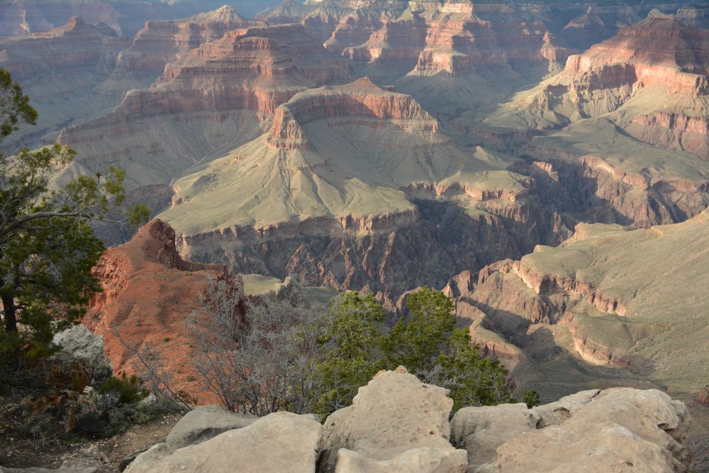
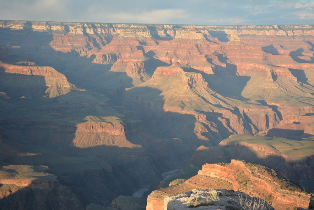
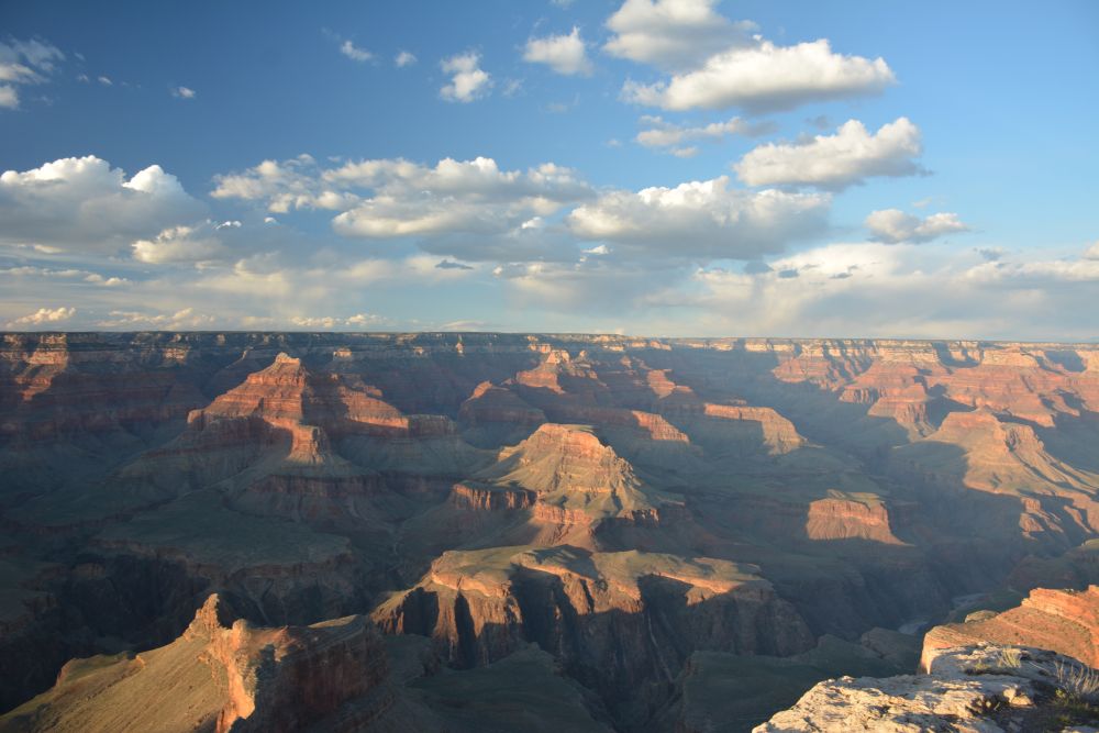
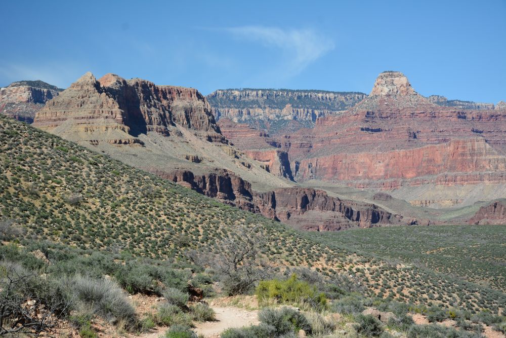
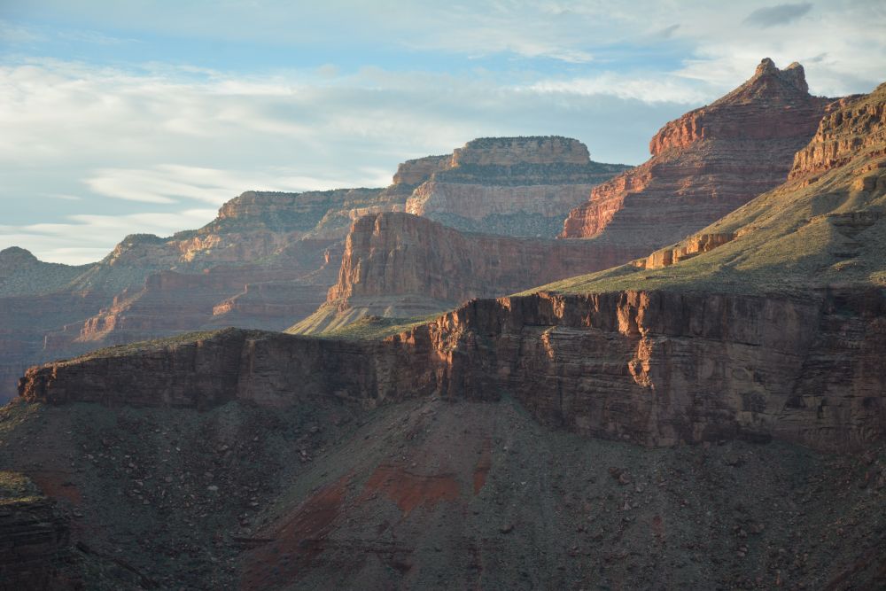
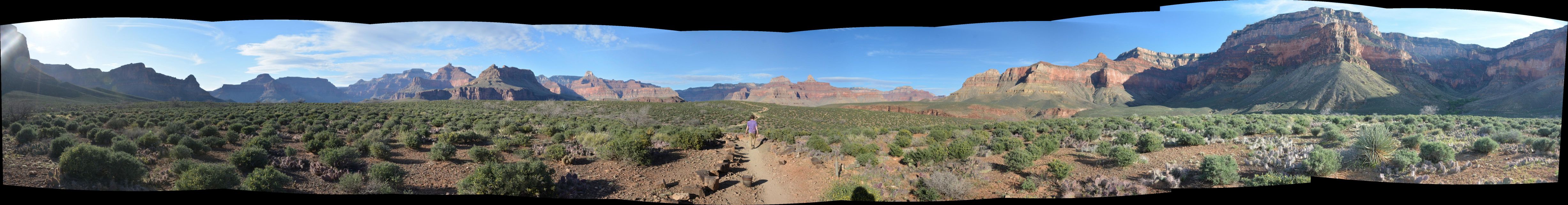
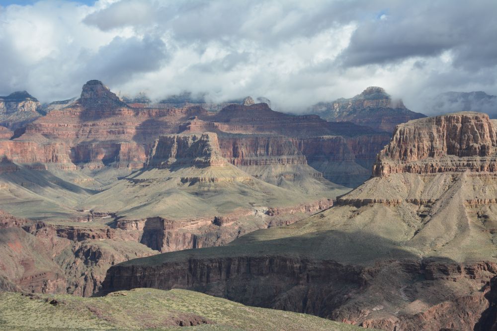
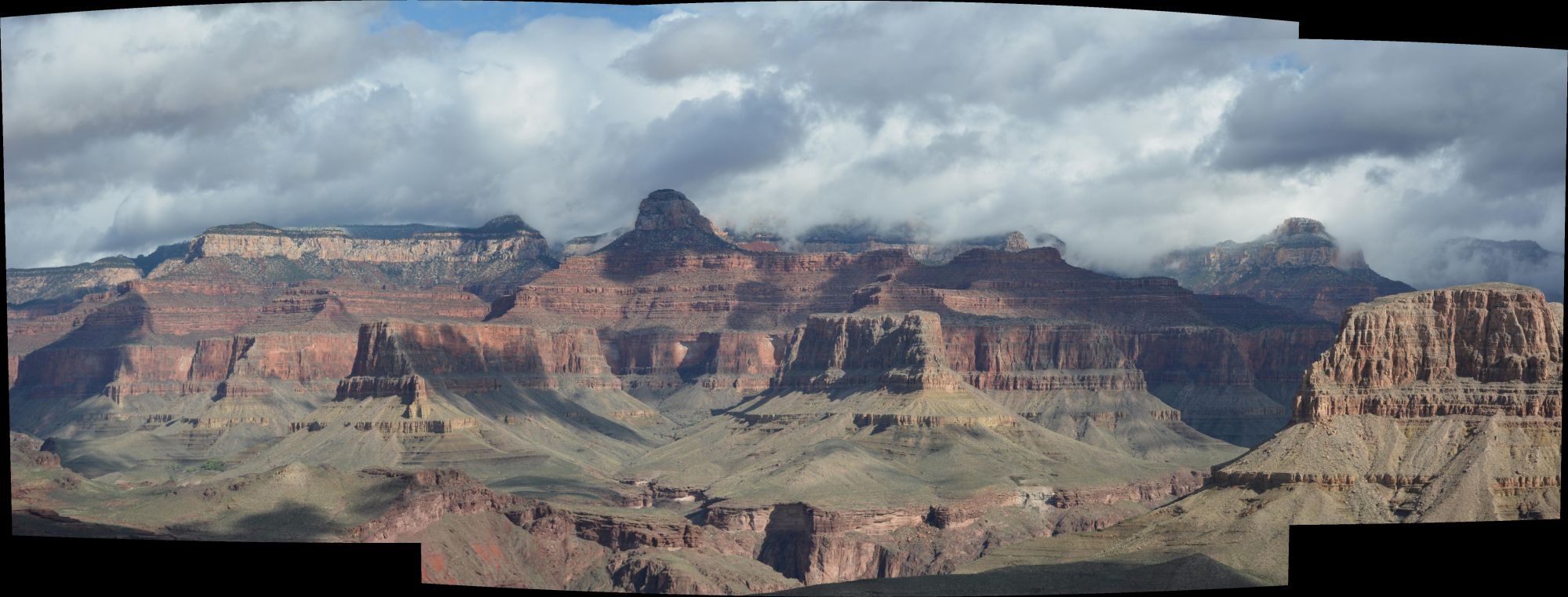
Mather Point
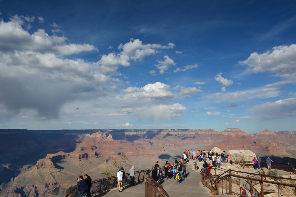
Mather Point
|
Mather Point |
Grand Canyon March 2017 |
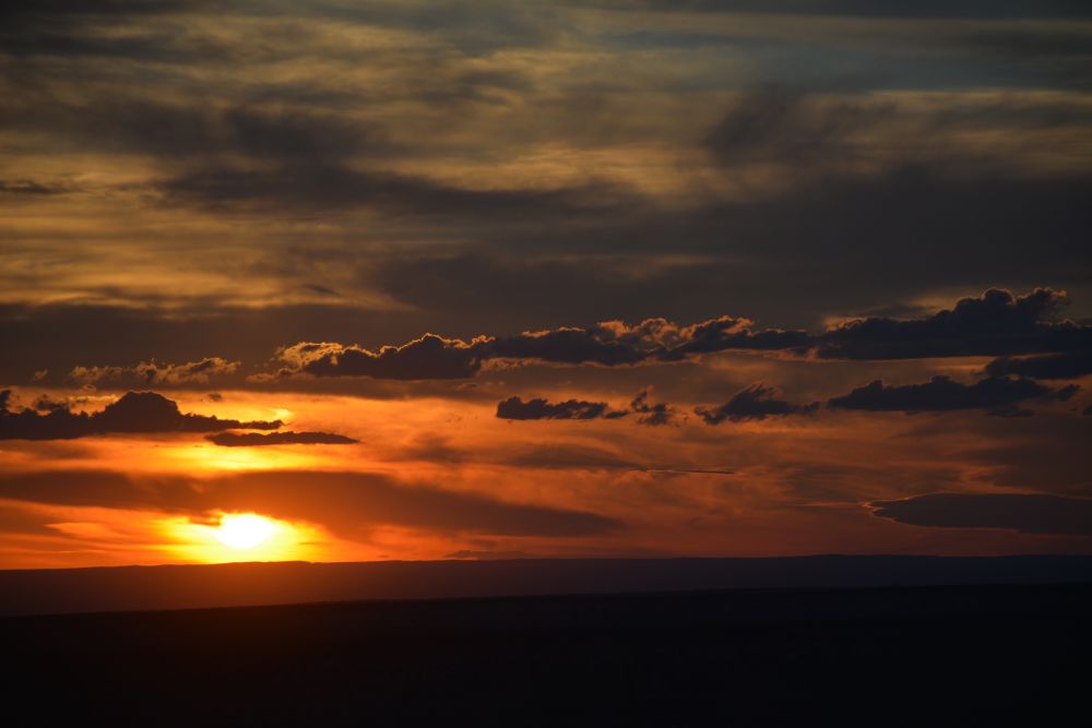
Mather Point |
I had spent three weeks in Yuma on a flight test program, starting at the end of February. When I finished up in Yuma, Eli flew out to Phoenix and I picked him up late on Saturday evening. We spent the night in north Phoenix and headed to the South Rim on Sunday. We arrived in the early afternoon, and I picked up our reservation number for the backcountry reservation give-away on Monday morning. I watched sunset from Mather Point, while Eli skate-boarded around Tusayan. We had a good dinner Sunday night at a steakhouse in Tusayan.
Monday, 20 March 2017: South Rim
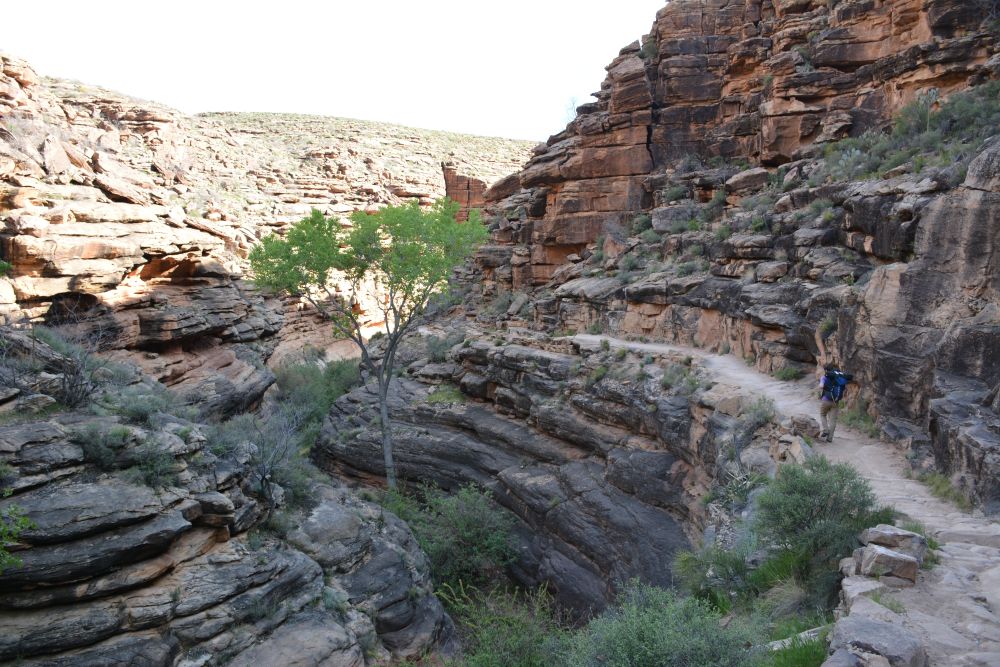
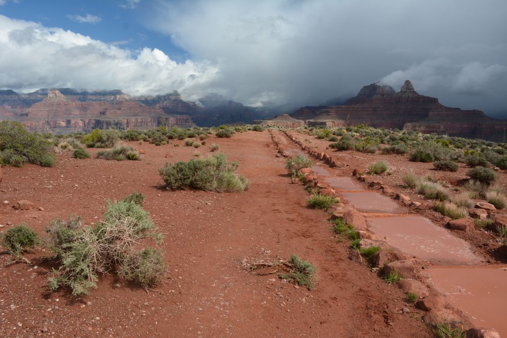
I got up early for sunrise at Yavapai Point on Monday, and then was waiting in line at 8 AM when the backcountry office opened. I usually hike in on the South Kaibab trail from Yaki Point to Phantom Ranch, spending the first night at Bright Angel Campground and then the next night at Indian Garden, but there were no available campsites in that order. Instead, I was able to get the first night at Indian Garden and the second night at Bright Angel Campground - Phantom Ranch. This gave us two choices for the full hike out from the river to the rim on Thursday: (1) hike back up the River Trail + Bright Angel Trail over 9+ miles and a 4460 ft elevation rise, or (2) hike up the South Kaibab Trail over 7+ miles and a 4860 ft elevation rise. The trailhead of the South Kaibab Trail is about 400 feet higher than the trailhead of the Bright Angel Trail, so that is why there is a height difference.
The Bright Angel Trail is the recommended path when hiking out of the Grand Canyon, and that is the way that I have always hiked out. However, the main reason this is the usual path is that there is shade along the Bright Angel Trail and water is normally available at Indian Garden, the 3 miles rest-house, and the 1.5 mile rest-house. Since it was still winter, the water at the rest-houses was turned off, so the Bright Angel Trail did not have this advantage over the South Kaibab Trail. Also, since it was still cool, we would be ok in the sun and would not need more water than we could carry, so we decided to hike out on the South Kaibab Trail. As it turned out, I finished the hike out with an extra 5 pints of water I did not drink, so this ended up not being a factor at all.
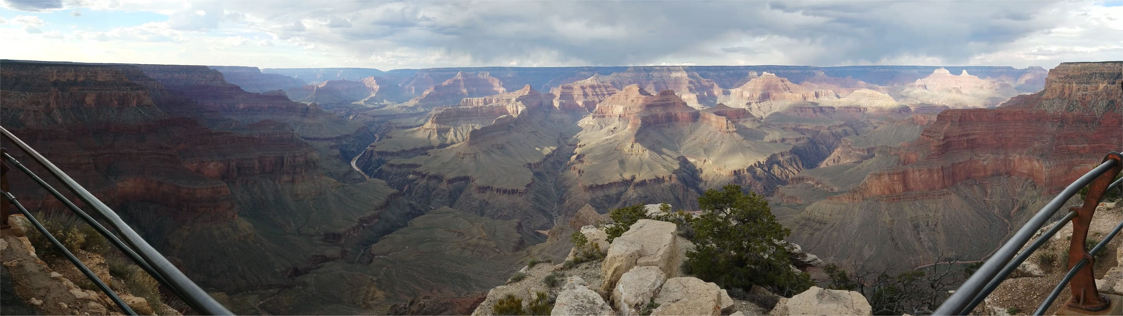
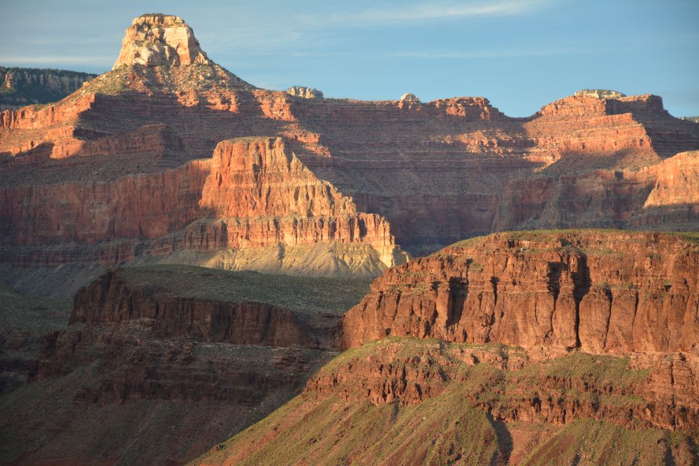
We both visited the South Rim Village Market, and bought the last few things we needed for the camping trip, including some dehydrated meals from Backpackers Pantry that were very good. We then went for a drive along the South Rim going east, making it to Grandview Point and a short visit there. I then took Eli back to our hotel in Tusayan, and I drove back to the South Rim Village. I took the shuttle bus out on West Rim Drive to Hermits Rest, and hiked down about 1/2 mile along Hermit Trail, descending a few hundred feet before returning to sit by the big fireplace at Hermit's Rest and reading a book about all the Harvey House buildings, many designed by Mary Jane Colter. Mary Jane Colter designed Hermit's Rest, El Tovar Hotel, Bright Angel Lodge, Lookout Studio, Hopi House, Desert View Watchtower, and the Phantom Ranch Canteen, along with many other buildings across the southwest while employed by the Fred Harvey Company from 1910 to 1948. Many of her buildings have been demolished over the years, but everything she designed is still up and in constant use at the Grand Canyon. After relaxing at Hermit's Rest for a while, I took the bus back along West Rim Drive, visiting several vistas, and eventually settled on Hopi Point for sunset. I then headed back to Tusayan. Eli and I walked down the street for dinner at an Italian restaurant in Tusayan. We loaded up on pasta for the hike starting the next morning, but it was really just an excuse to drink wine.
Hermit Trail
Hermit's Rest
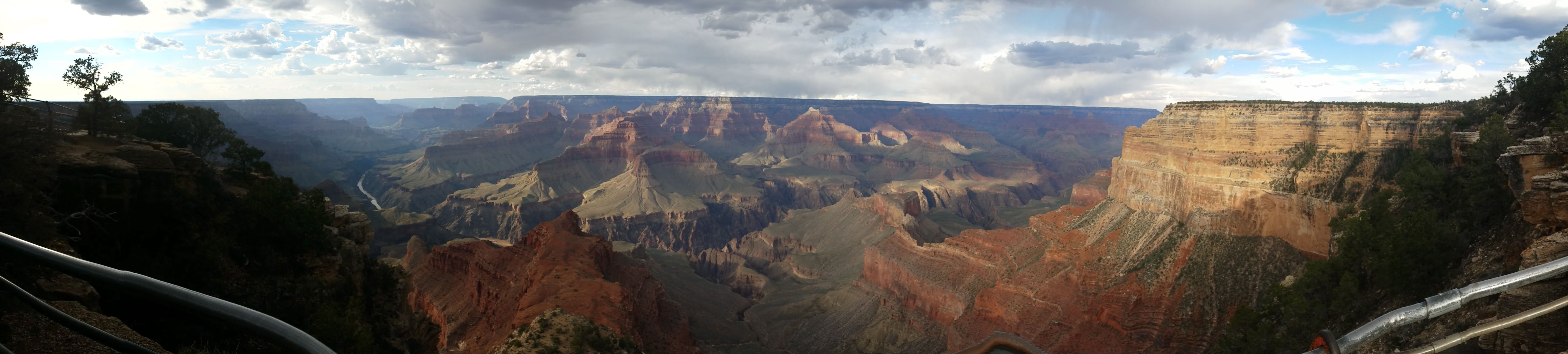
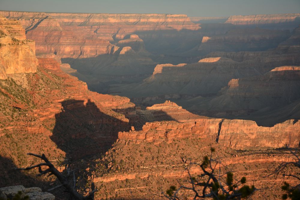
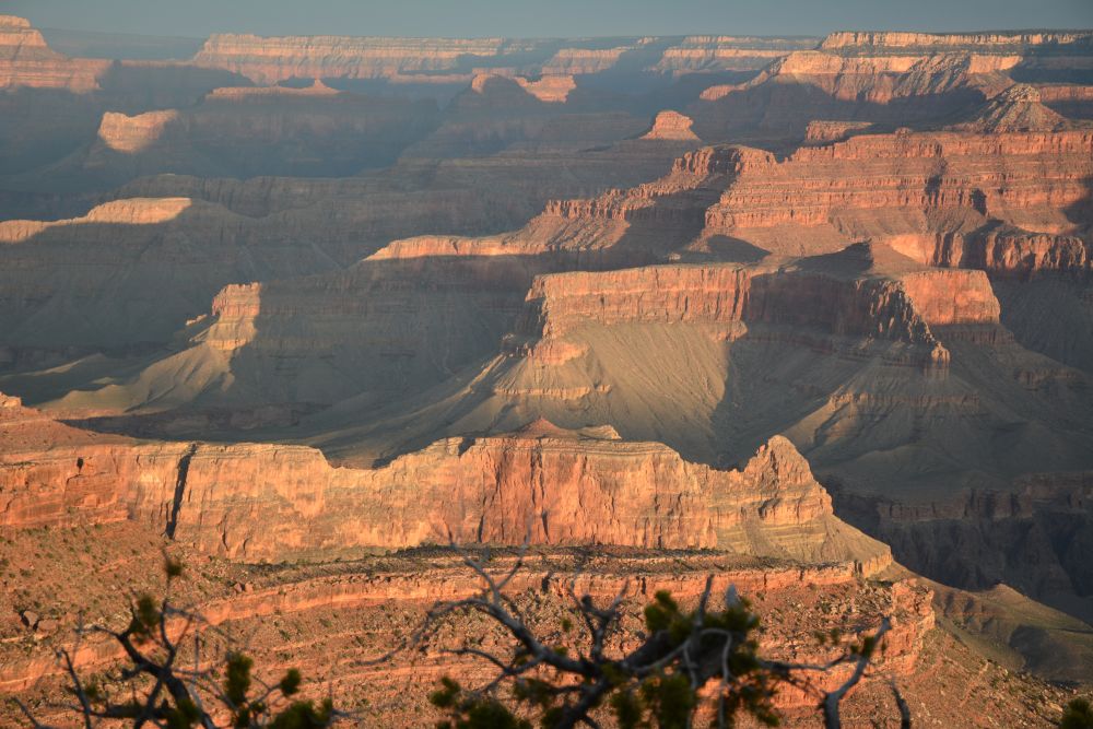
Hopi Point Sunset
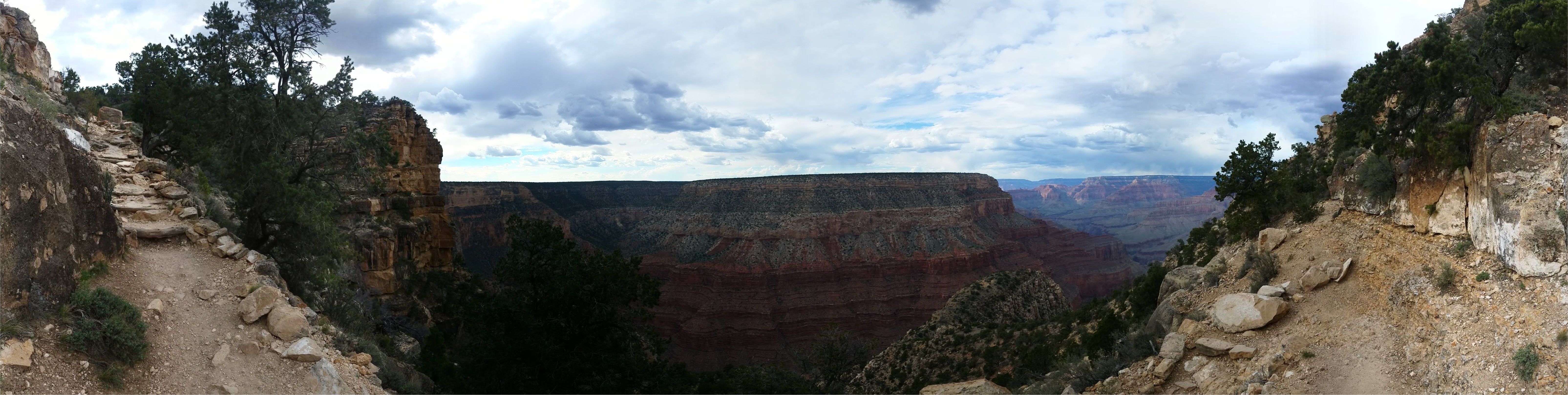
Tuesday, 21 March 2017: Bright Angel Trail: Bright Angel Trailhead at South Rim Village to Indian Garden & Plateau Point
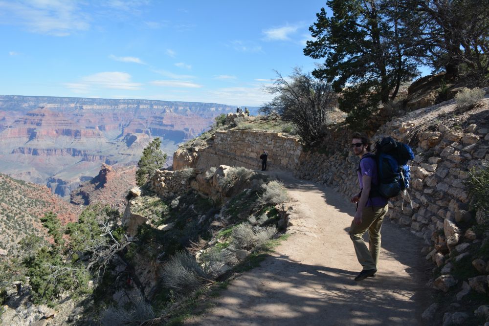
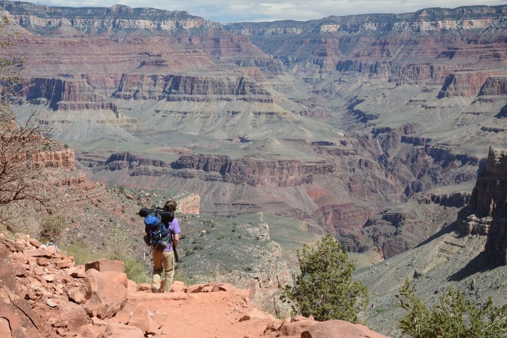
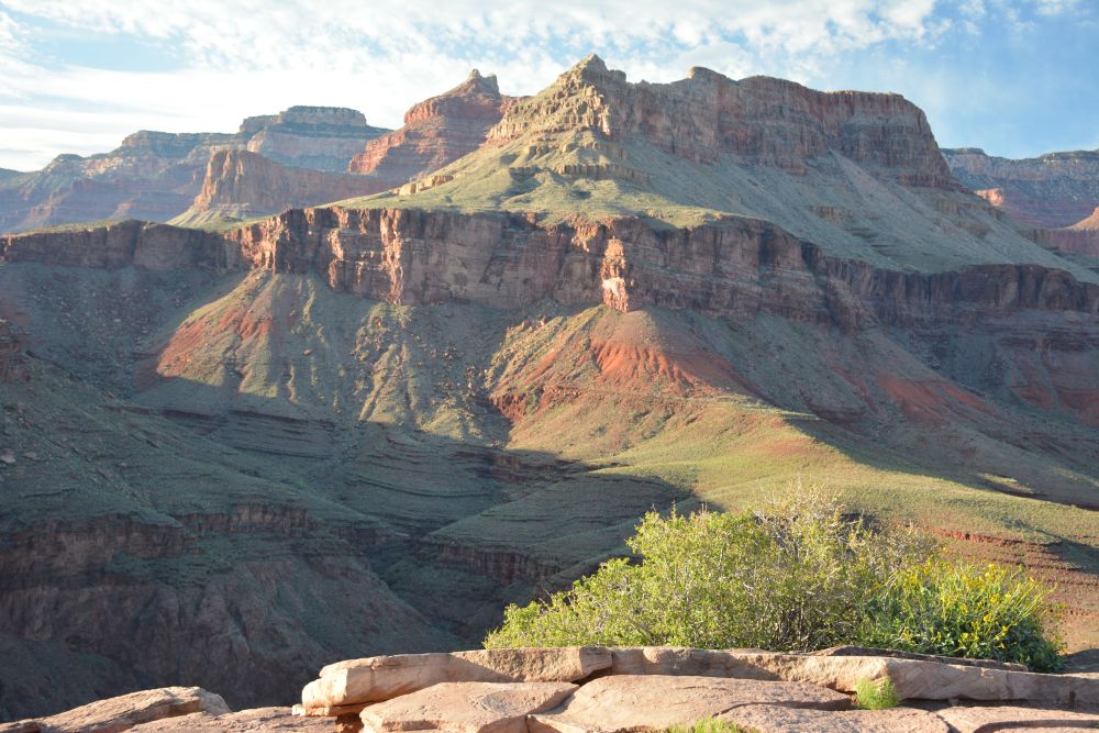
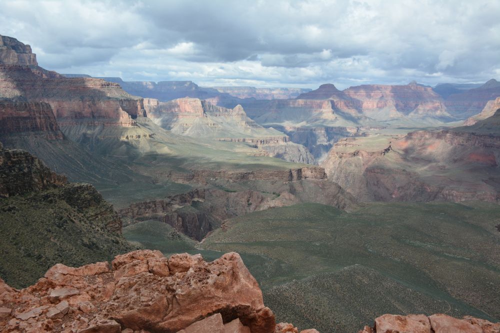
We drove to the Bright Angel Trailhead and parked our rental car in the parking lot behind the Bright Angel Lodge cabins. Many people ignore this parking lot, which is right on the rim of the Canyon. It is a great place to park and be near everything. We stretched, put on sunscreen, finished the last little bit of packing, and headed downhill on the 3000 ft drop over 4.5 miles to Indian Garden. We reached the campground in a few hours, then made lunch and rested for a while before taking a short walk around the immediate area. Later in the afternoon, we walked out to Plateau Point for sunset. This is an easy level hike that is 3 miles round-trip and gives the best sunset view anywhere in the Grand Canyon. After sunset, we walked back to camp, made dinner, and went to sleep.
Wednesday, 22 March 2017: Bright Angel Trail + River Trail: Indian Garden to Bright Angel Campground
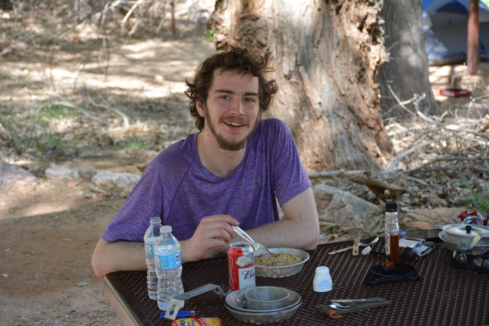
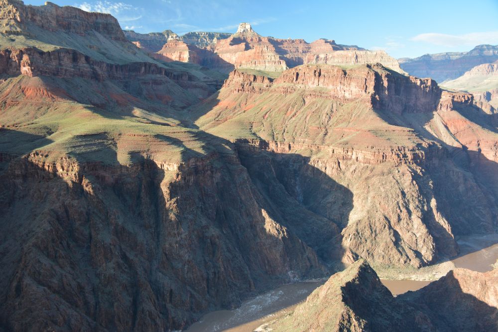
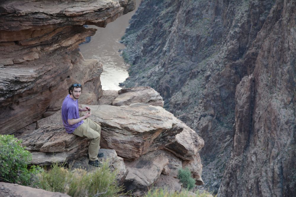
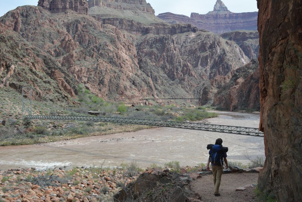
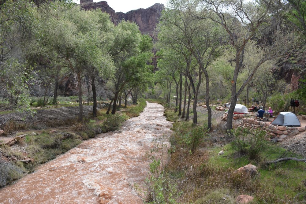
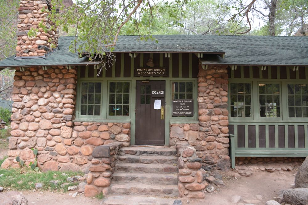
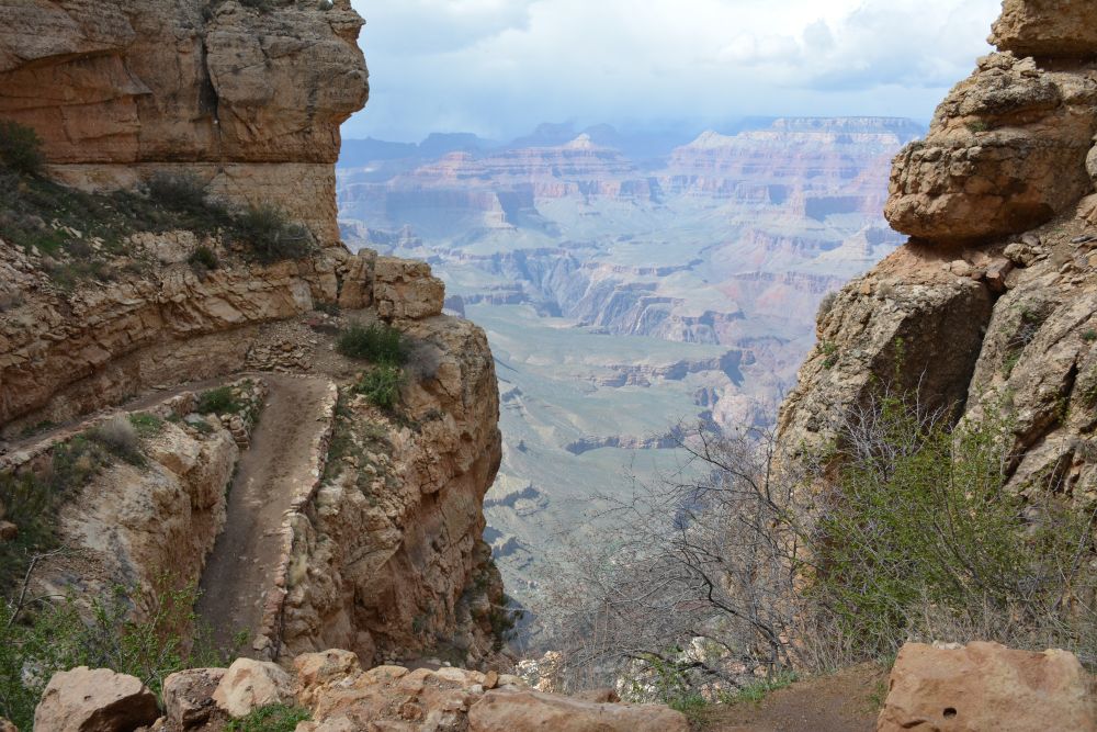
We slept in a bit, but were still up not too long after sunrise. After oatmeal for breakfast, we packed up camp and continued on down the Bright Angel Trail to the Colorado River. This was a 1450 ft drop over 3 miles. Then we continued on along the River Trail to Bright Angel Campground at Phantom Ranch, which was 2 more miles mostly level, crossing the Silver Bridge over the Colorado River. After setting up camp and making lunch, we walked up to the Phantom Ranch canteen for lemonade and beer. I walked back down along the river for a bit, taking photos at boat beach and where the Bright Angel Creek empties into the Colorado River. This an easy level walk of abut a mile. As I stood at Boat Beach, the mule train from the South Rim arrived with the overnight guests for Phantom Ranch. The first time I ever visited the Grand Canyon, in 1985, I rode a mule to Phantom Ranch and spent the night. It is a fun trip and was a great way to get introduced to the Grand Canyon. Eli and I rested into the afternoon, and made dinner as it started to rain that evening. From about 5:30 PM until past midnight, it rained, and rained, and rained... Everything was soaking wet. At 8 PM, we walked up to the Phantom Ranch canteen to get out of the rain and have some wine. It was dry and relaxing in the canteen while we read books. Eventually we had to head back to the tent, which by this time was more like a slip and slide. It was a rainy, wet evening. Sometime during the night, the rain did finally stop. Below is a video showing sunset from Plateau Point on 21 March, our hike across the Silver Bridge into Bright Angel Campground, and sunset from camp on 22 March.
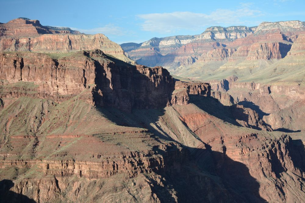
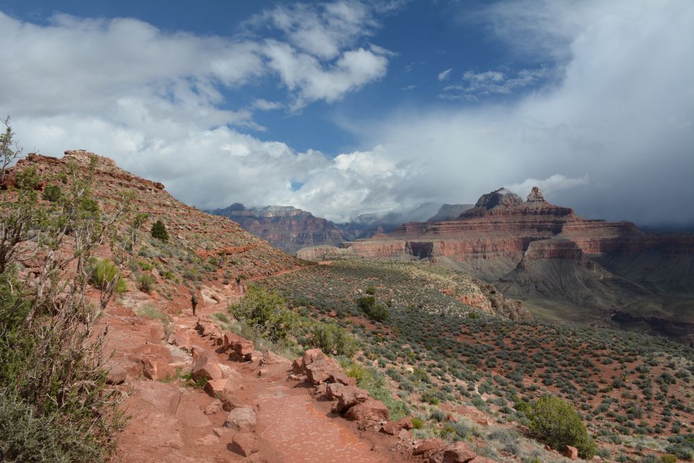
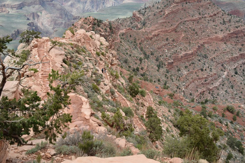
Thursday, 23 March 2017: South Kaibab Trail: Bright Angel Campground to South Rim at Yaki Point
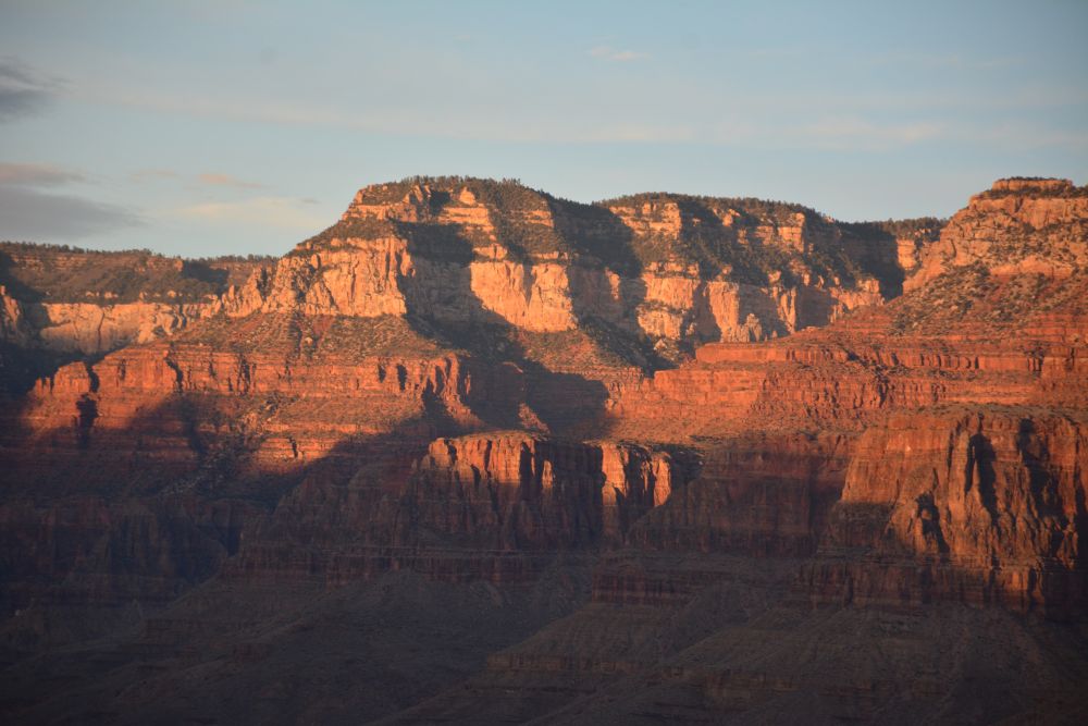
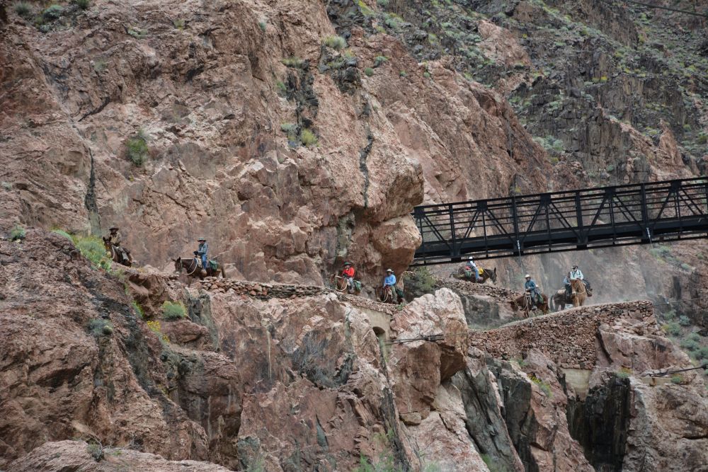
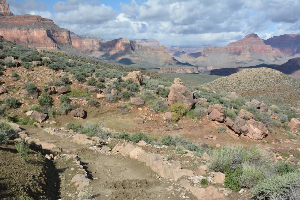
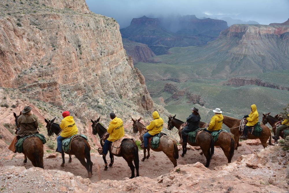
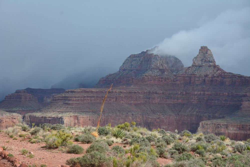
This was our final day in the Canyon, and we had a LONG climb ahead of us; it is a 4850 foot elevation rise over 7+ miles from the river to the South Rim at Yaki Point. We made breakfast, packed up all the wet gear, and began the climb out on the South Kaibab Trail. We left at about 7 AM. I stayed with Eli for a little bit of the climb out, but about half-way up the inner gorge to the Tip-Off, Eli left me behind and moved at his own hiking pace. The last time I saw him before Yaki Point was as he climbed past the Tip-Off above me, as I looked on from just above Panorama Point. I managed to make it out of the inner gorge and to the Tonto Trail junction by about 9:15. The temperatures were much cooler on this day, with the South Rim having lows in the 30's, with snow and hail falling at the rim and into the Canyon a bit. I slowly climbed up to Skeleton Point, just as the first of two short storms moved through. I managed to shelter in one of the small caves just below Skeleton Point as it rained. As I stood and watched everyone getting wet as they walked by, I relaxed and had a snack. The mule trip from Phantom Ranch passed going up as I rested, and I ended up getting some great photos looking out across the mule riders into the Canyon. I continued on across O'Neill Butte, enjoying the flat terrain for a little bit, before climbing up to Cedar Ridge. Just below Cedar Ridge, the second storm of the day hit, and this time it hailed. Again, I was able to get to some cover and waited the storm out under a large overhang just off the trail. I continued on, stopping briefly at Cedar Ridge, and then pushing on the last 1000 vertical feet to the South Rim at Yaki Point. I was moving very slowly by now, and the air was getting thinner. Eli had made it to the rim a long time before, and he watched me walk the trail under Yaki Point, approaching the last set of switchbacks at the trailhead. He said I seemed to walk 20 feet, stop, and then repeat. I finally made it out in 7 hours, and we shared a hug of celebration. Eli had been waiting at the rim for almost 2 hours. :-)
We took the shuttle to the visitor center, then transferred to the shuttle to the South Rim Village. We put our gear in the car, then had a late lunch at the Bright Angel Lodge; Eli had said the main thing keeping him going was the thought of a beer and hamburger waiting at the top, and the restaurant at the Bright Angel Lodge has always been my celebratory dining choice. We enjoyed the meal and headed for our hotel in Williams to rest the night. It had a Jacuzzi, where I relaxed while jets blasted my sore legs.
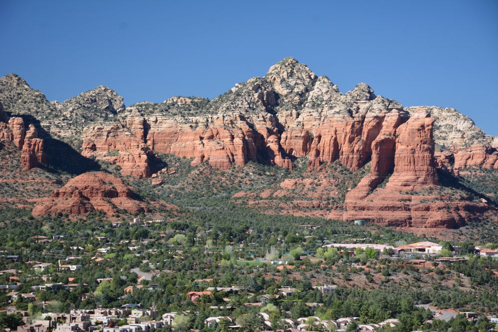
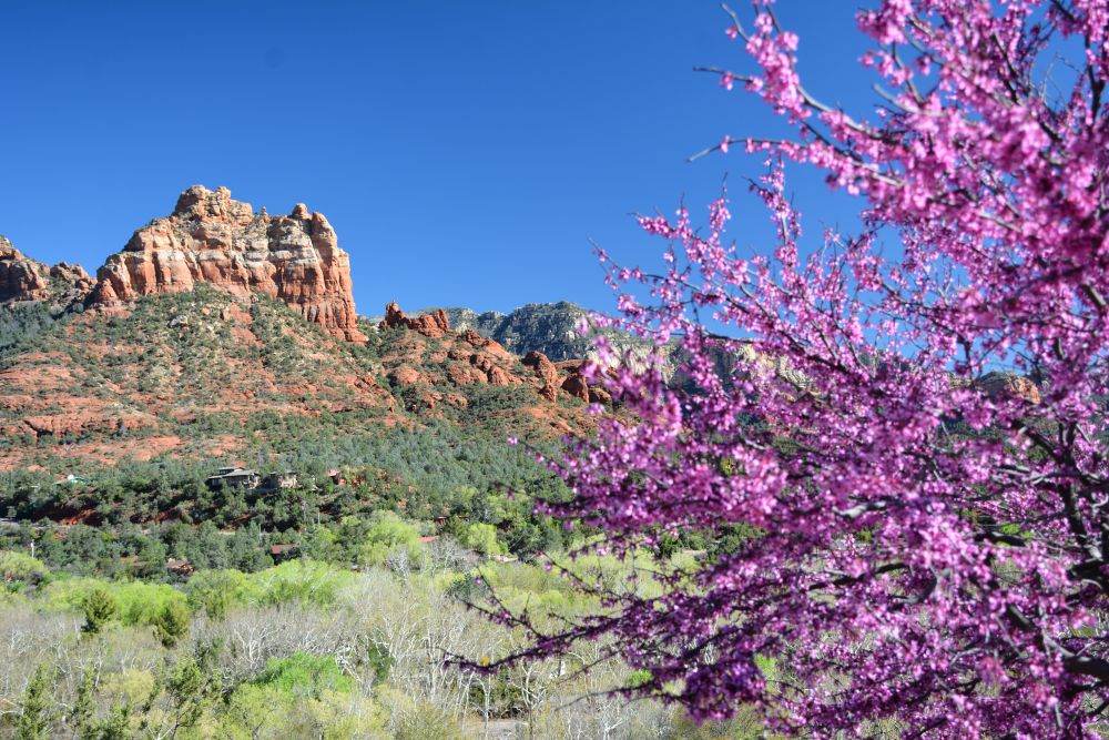
Friday 24 March 2017: Williams to Sedona, Arizona
We drove to Sedona and checked into our hotel in Oak Creek. Eli skate-boarded around Oak Creek while I drove and hiked around Sedona, including climbing up Bell Rock. As always for Sedona, we had dinner at Elote; nothing beats the food and drink at Elote.
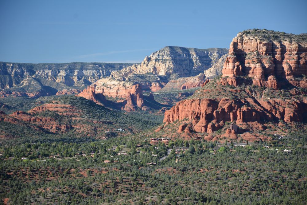
Bell Rock almost sunset
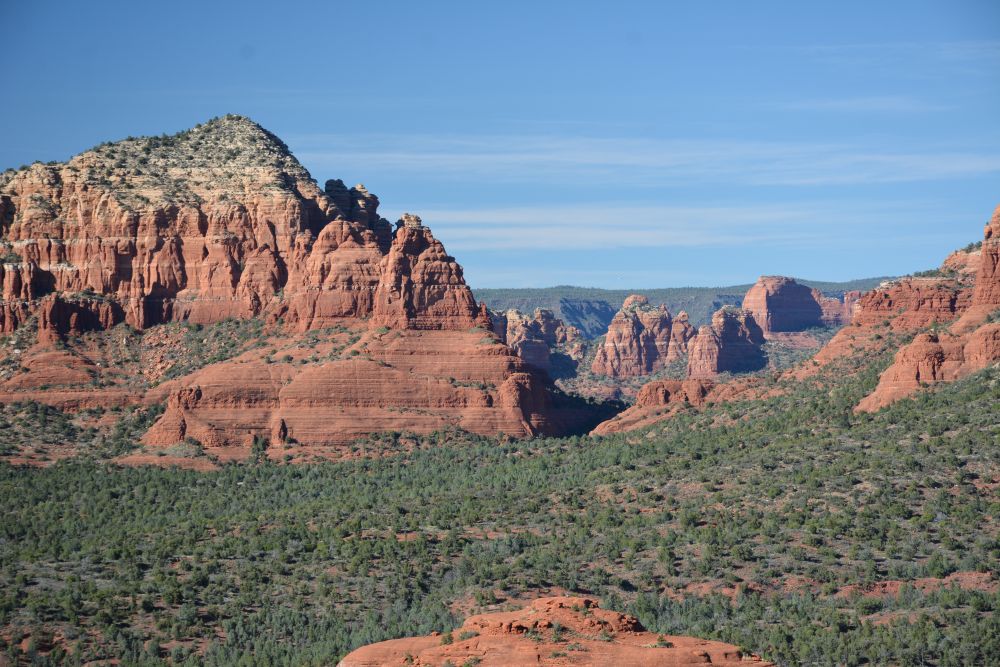
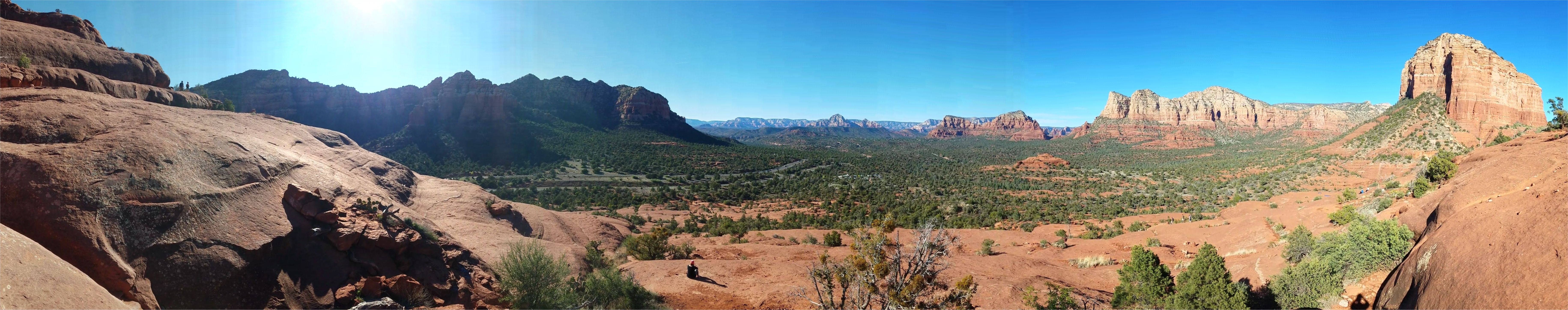
Saturday, 25 March 2017: Sedona to Phoenix, Arizona
We had reserved two quad-runner ATVs to rent for this morning, starting early. We spent four hours driving all over the west end of Sedona on trails. We had lunch in Sedona at an Italian restaurant, then drove to Phoenix that afternoon. We have a cousin who lives in Phoenix, so we met up with him and had dinner at a Mexican restaurant, before killing some time before our red-eye flight at midnight. We found a theater near the airport, and went to see a movie. Our red-eye flight left a bit after midnight, with one transfer in Minneapolis, before arriving in Baltimore at about noon on Sunday, 26 March.