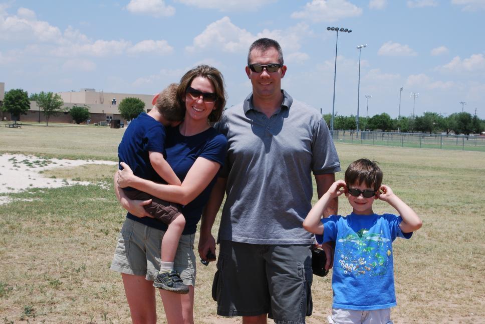
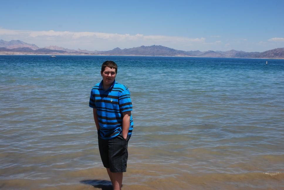
Summer 2009 Vacation Around America
Chris was going to be running flight testing for the Shadow 200 Unmanned Aerial Vehicle in Alabama and Arizona for June and July 2009, so we decided to coordinate a long-planned, but never taken, driving vacation with this flight testing. Chris drove from Maryland to Alabama, and then from Alabama to Arizona. After Chris completing work in Arizona, Tami and Nathan flew out to meet him and we started our vacation out west, with our own vehicle and its very comfortable ride and navigation system. We had plenty of room, and Chris left home with additional stuff to make the trip nice, without having to worry about carrying it on a plane. Chris took a few remote control planes along on the trip, including a plane equipped with a digital camera for aerial photos. The best aerial photos are in the Aerial Photography Forum at RC Groups. Chris took almost 14,000 pictures over the summer, and the best ones are below. All the photos below are thumbnails, so click on the image to see a larger version.
| Sunday | Monday | Tuesday | Wednesday | Thursday | Friday | Saturday |
| June - August (Redstone: 3 weeks, Ft Huachuca: 4 weeks, Vacation: 3 weeks) | ||||||
| 7 June | 8 Home --> Huntsville |
9 Huntsville |
10 Huntsville |
11 Huntsville |
12 Huntsville --> Soddy Daisy |
13 Soddy Daisy |
| 14 Soddy Daisy --> Huntsville |
15 Huntsville |
16 Huntsville |
17 Huntsville |
18 Huntsville |
19 Huntsville --> Soddy Daisy |
20 Soddy Daisy |
|
21 Soddy Daisy --> Huntsville |
22 Huntsville |
23 Huntsville |
24 Huntsville |
25 Huntsville --> Dallas |
26 Dallas --> Abilene --> Carlsbad |
27 Carlsbad --> Alamogordo |
| 28 Alamogordo --> White Sands --> Sierra Vista |
29 Sierra Vista |
30 Sierra Vista |
1 July Sierra Vista |
2 Sierra Vista |
3 Sierra Vista --> Chiricahua --> Sierra Vista |
4 Sierra Vista --> Tombstone --> Bisbee --> Coronado --> Sierra Vista |
| 5 Sierra Vista |
6 Sierra Vista |
7 Sierra Vista |
8 Sierra Vista |
9 Sierra Vista |
10 Sierra Vista --> Tucson --> Sierra Vista |
11 Sierra Vista --> Kitt Peak --> Tucson --> Sierra Vista |
| 12 Sierra Vista --> Tombstone --> Bisbee --> Coronado --> Sierra Vista |
13 Sierra Vista |
14 Sierra Vista |
15 Sierra Vista |
16 Sierra Vista |
17 Sierra Vista |
18 Sierra Vista --> Chiricahua |
| 19 Chiricahua --> Sierra Vista |
20 Sierra Vista |
21 Sierra Vista |
22 Sierra Vista |
23 Sierra Vista |
24 Sierra Vista --> Phoenix --> Sedona |
25 Sedona |
| 26 Sedona --> Grand Canyon --> Las Vegas |
27 Las Vegas |
28 Las Vegas |
29 Las Vegas --> Death Valley --> Mammoth Lakes |
30 Mammoth Lakes --> Yosemite |
31 Yosemite --> San Francisco |
1 August San Francisco |
| 2 San Francisco |
3 San Francisco --> Truckee |
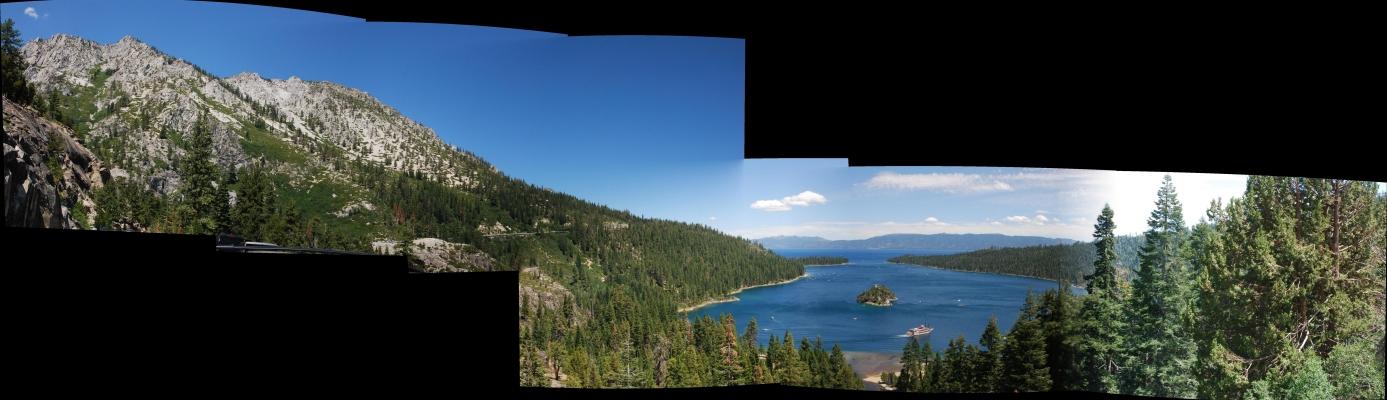
4 Truckee --> Lake Tahoe --> Salt Lake City |
5 Salt Lake City --> Jackson |
6 Jackson --> Old Faithful, Yellowstone |
7 Old Faithful --> Mammoth, Yellowstone |
8 Mammoth --> Cody --> Sheridan |
| 9 Sheridan --> Devils Tower --> Rapid City |
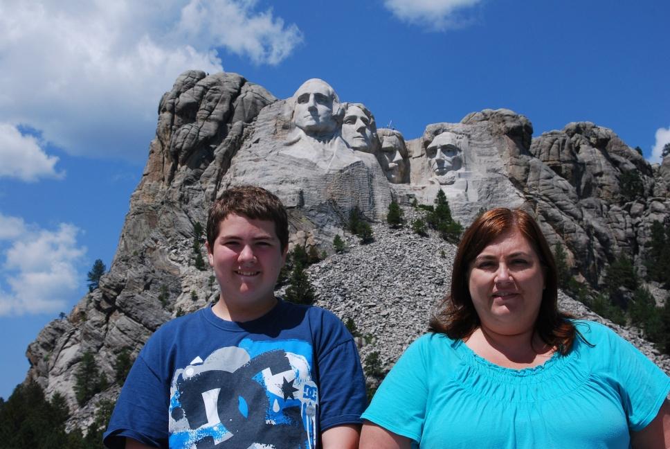
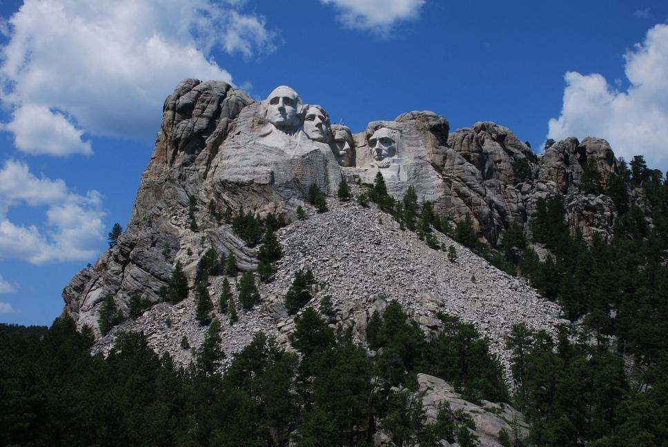
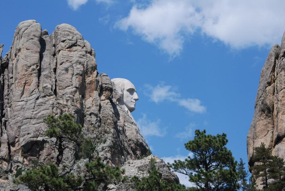
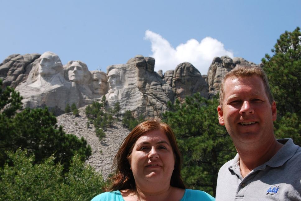
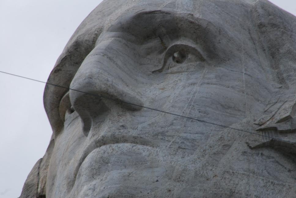
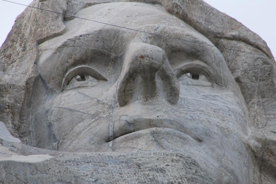
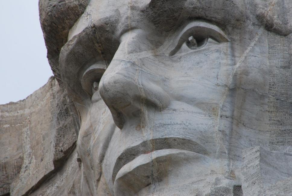
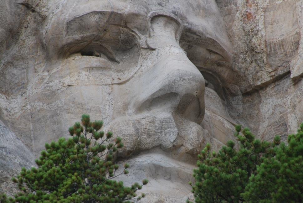
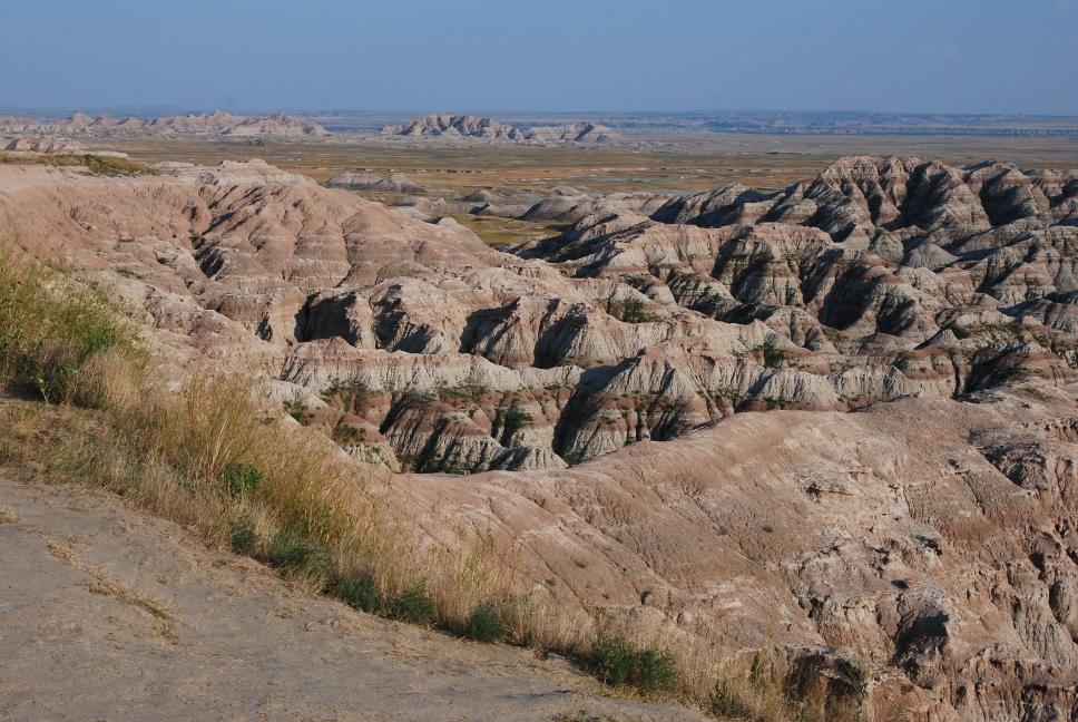
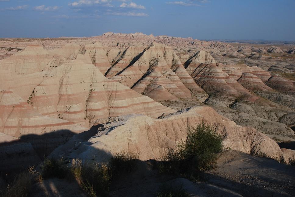
10 Rapid City --> Mt Rushmore --> Badlands --> Sioux Falls |
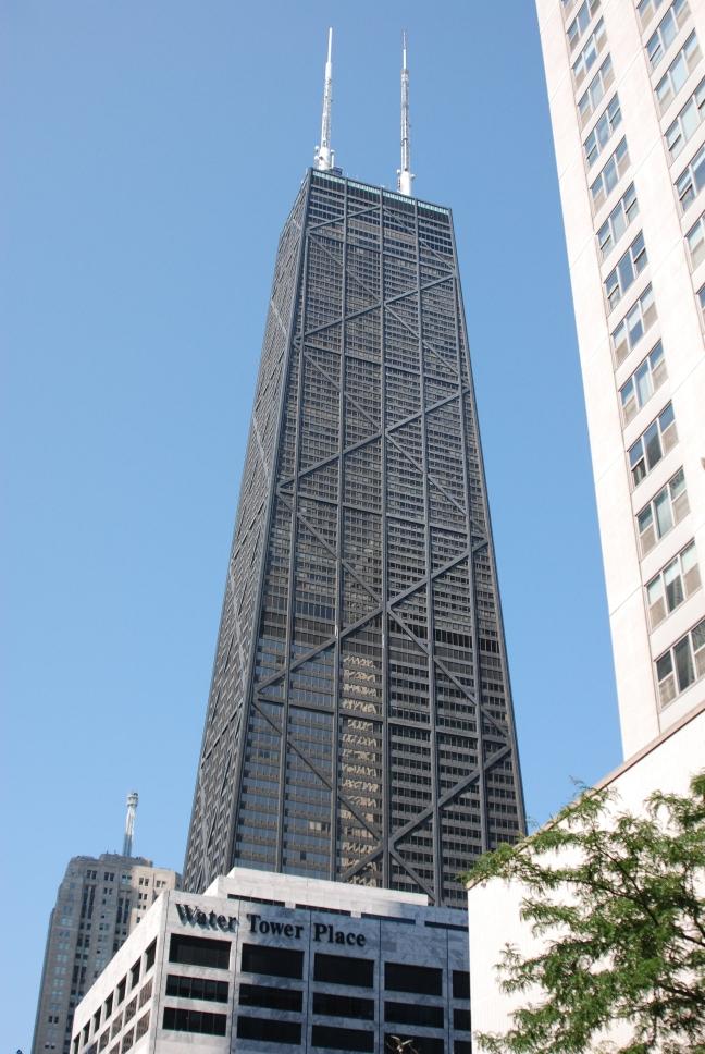
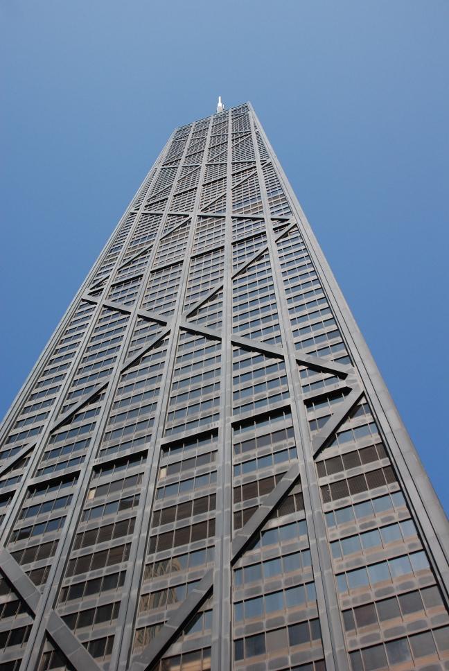
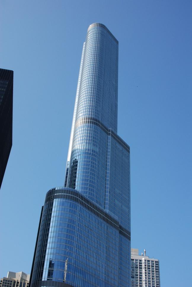
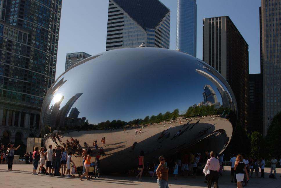
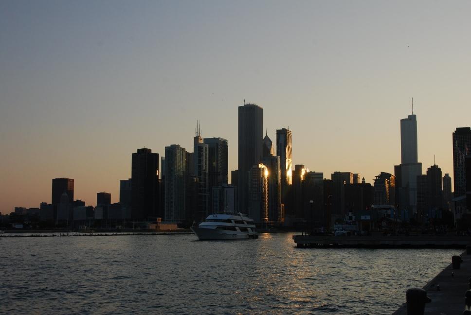
11 Sioux Falls --> Chicago |
12 Chicago |
13 Chicago |
14 Chicago --> Dayton --> Charleston |
15 Charleston |
| 16 Charleston --> Home |
17 |
18 |
19 |
20 |
21 |
22 |
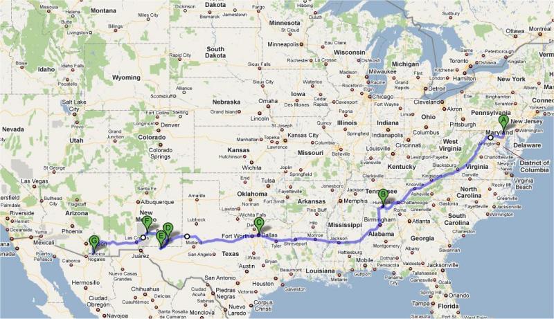 Hereford, MD to Sierra Vista, AZ 8 June 2009 - 24 July 2009 Hereford, MD Huntsville, AL Chattanooga, TN Ruby Falls, TN Abilene, TX Carlsbad Caverns National Park Guadalupe Mountains National Park White Sands National Monument Chiricahua National Monument Coronado National Memorial Kitt Peak National Observatory Saguaro National Park Sierra Vista, AZ |
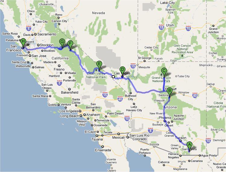 Sierra Vista, AZ to San Francisco, CA 24 July 2009 - 3 August 2009 Sierra Vista, AZ Phoenix, AZ Sedona, AZ Grand Canyon National Park Las Vegas, NV Red Rocks, Lake Meade, NV Hoover Dam, NV Death Valley National Park Mammoth Lakes, CA Yosemite National Park San Francisco, CA |
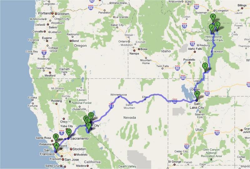 San Francisco, CA to Yellowstone, WY 3 August 2009 - 8 August 2009 San Francisco, CA Sonoma & Napa, CA Lake Tahoe, CA Salt Lake City, UT Bear Lake, UT / ID Jackson, WY Grand Tetons National Park Yellowstone National Park |
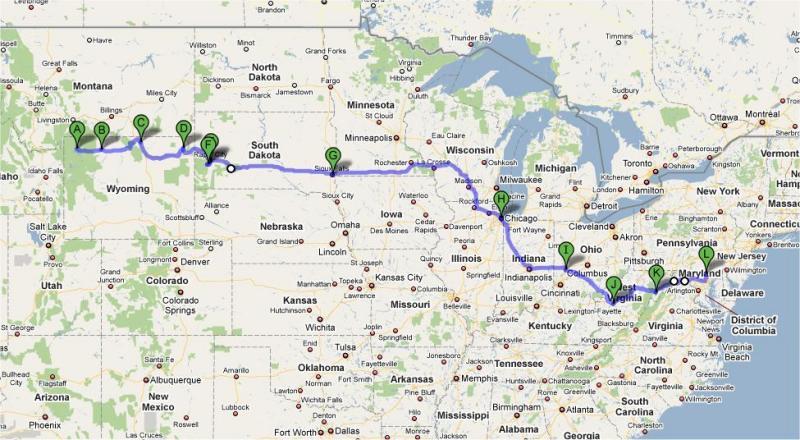 Yellowstone, WY to Hereford, MD 8 August 2009 - 16 August 2009 Yellowstone National Park Devils Tower National Monument Mt Rushmore National Memorial Badlands National Park Chicago, IL Dayton, OH Charleston, WV Seneca Rocks, WV Hereford, MD |
8 June 2009
Chris left for Huntsville, Alabama. Over the next three weeks, flight testing was run on the Shadow for its new software release at Redstone Arsenal. On the weekends, Chris was able to drive to Chattanooga, where his family lives. He visited with his mother in her nursing home, and his sister and her family, who live nearby.
13 June 2009
| Chris went hiking with his
sister on the Possum Creek section
of the Cumberland Trail in
eastern Tennessee, and took his mom for a drive on the Cumberland Plateau. |
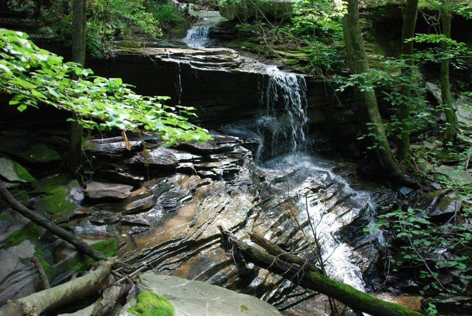 |
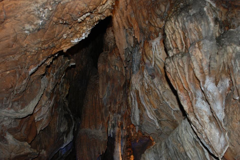
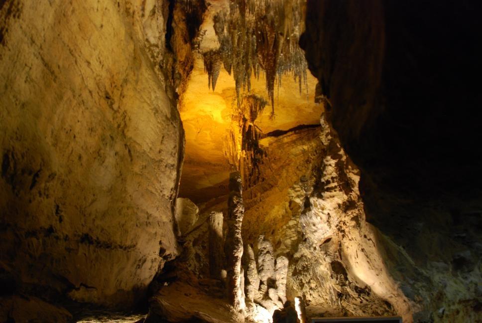
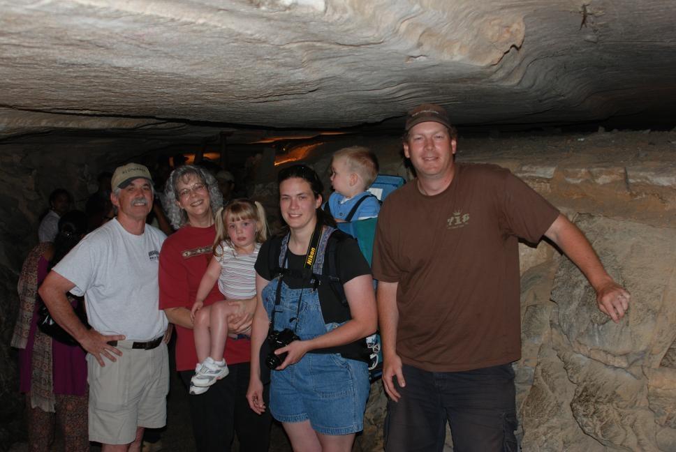
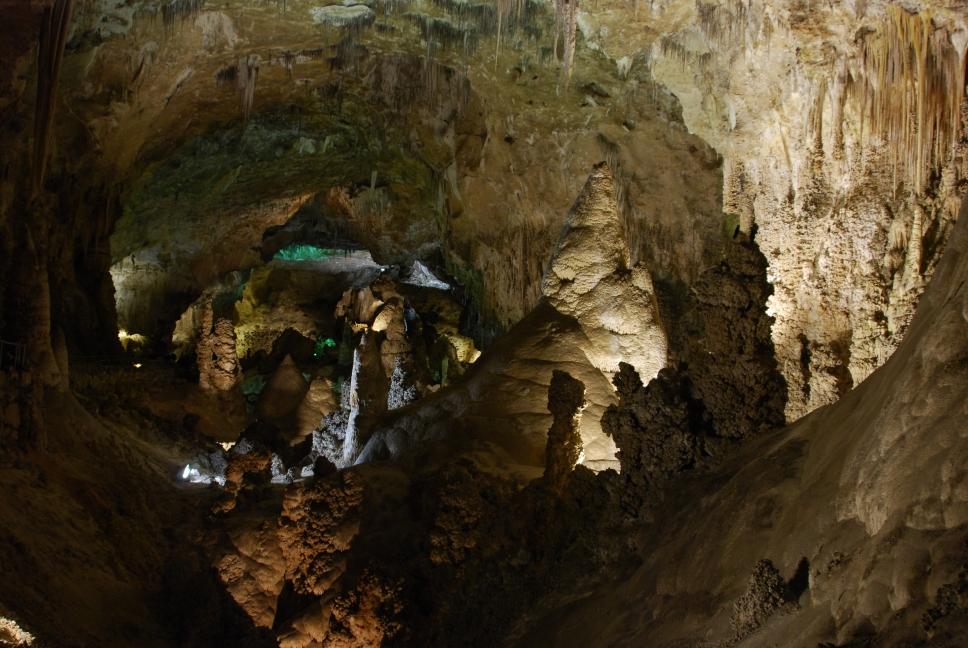
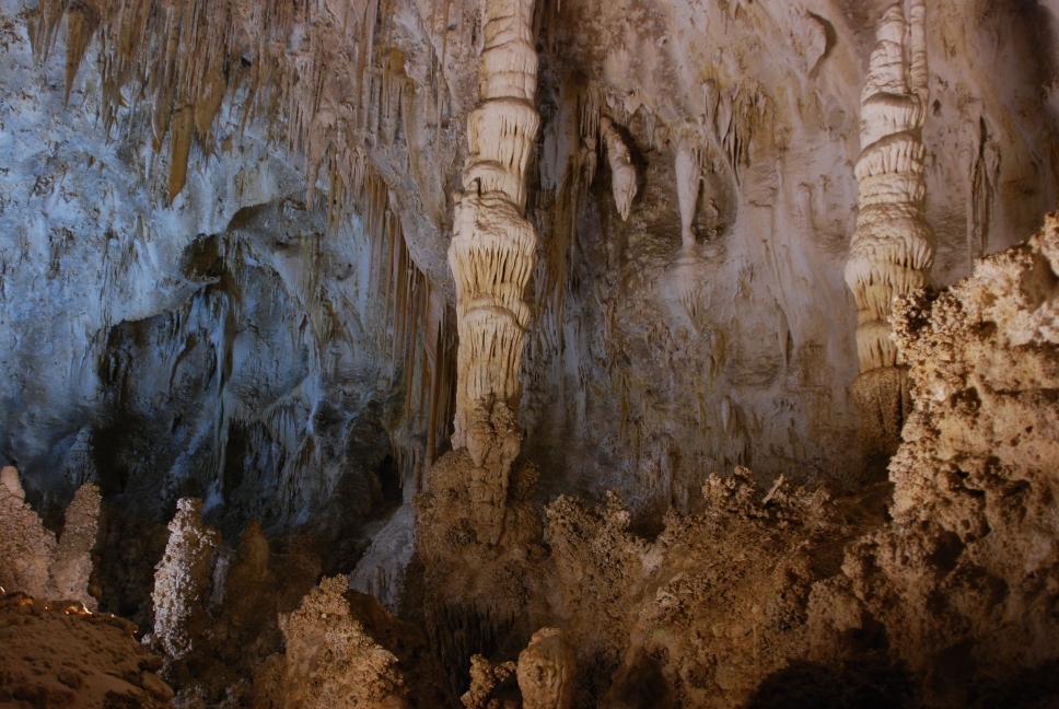
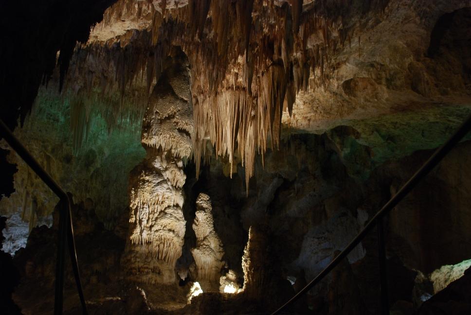
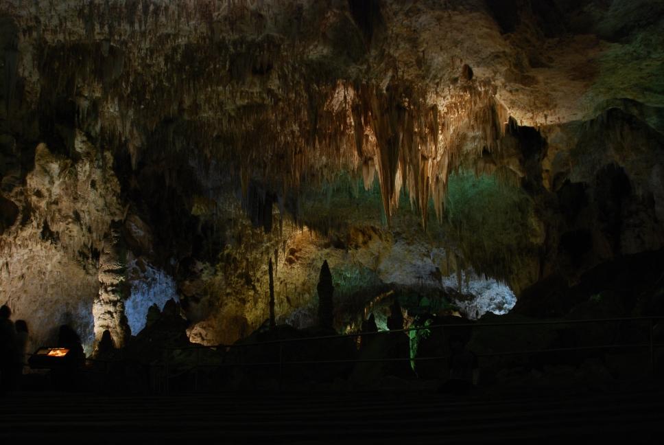
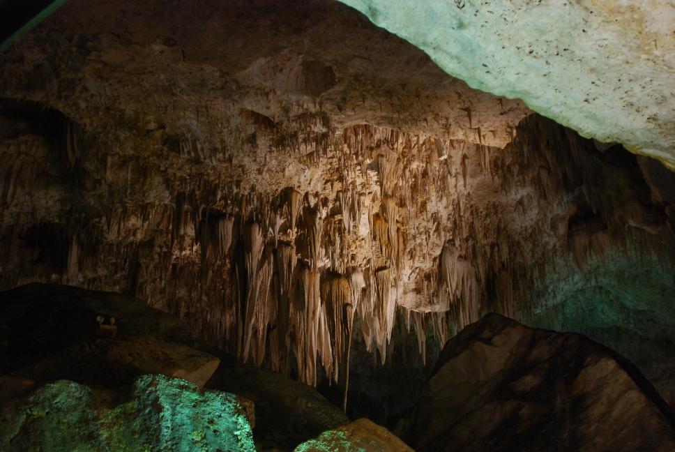
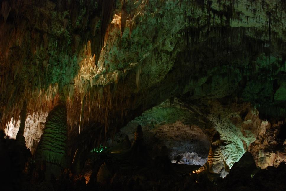
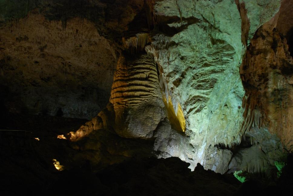
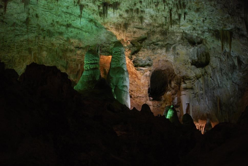
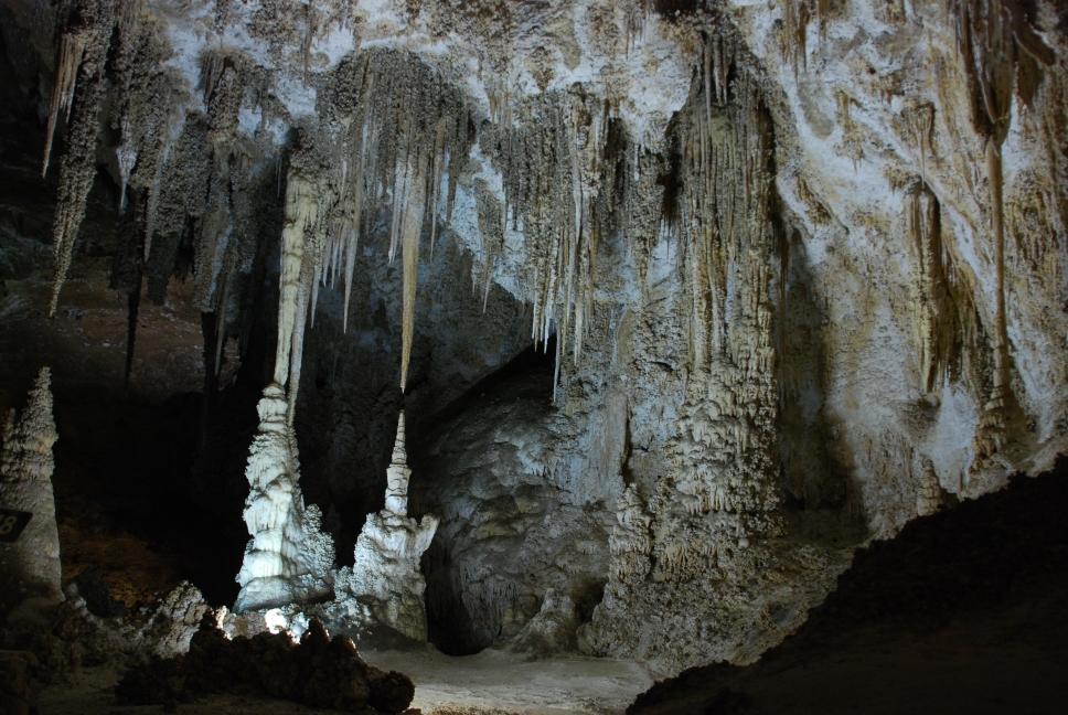
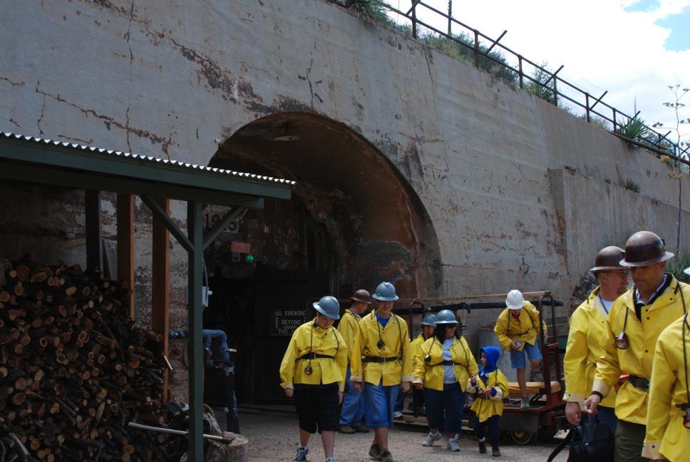
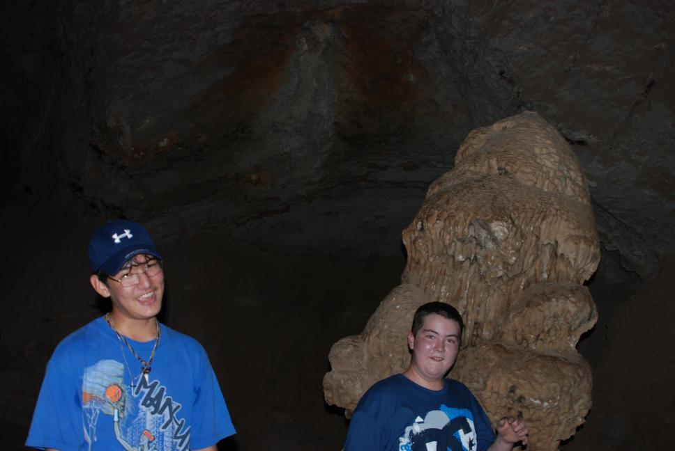
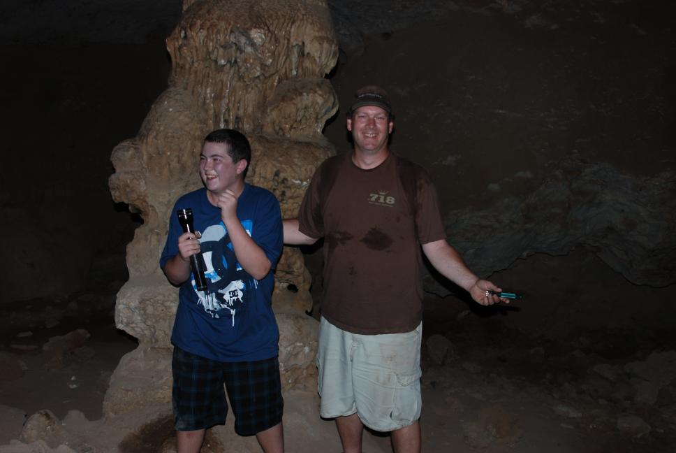
21 June 2009
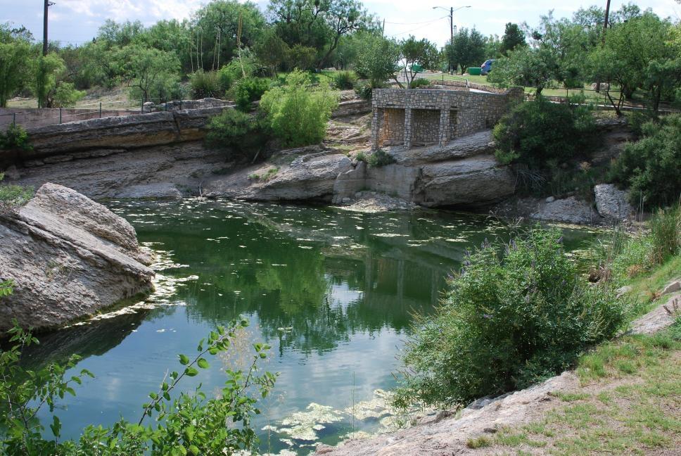
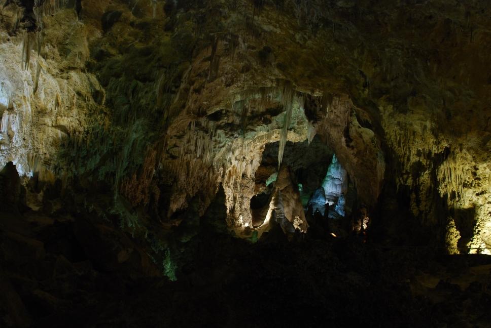
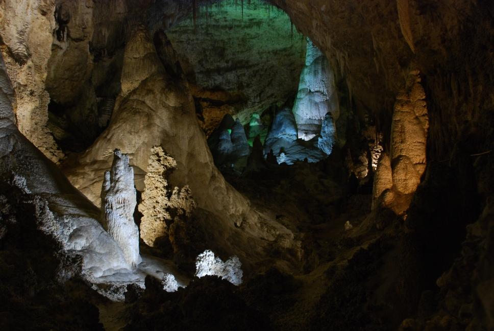
Chris, his sister, and her family visited Ruby Falls on Lookout Mountain in Chattanooga. Ruby Falls is about 150' high, and is reached by descending an elevator several hundred feet and then hiking back into the cave about 1/3 mile.
|
Chattanooga panorama |
Ruby Falls |
Cave formations |
Cave formations |
In the cave |
25 June 2009
Flight testing at Redstone Arsenal in Huntsville was completed, and Chris started his drive to Ft Huachuca, near Sierra Vista, Arizona. The remainder of the flight testing for this upgrade would be done at Ft Huachuca. On the first day of travel, Chris made it to Dallas, Texas.
26 June 2009
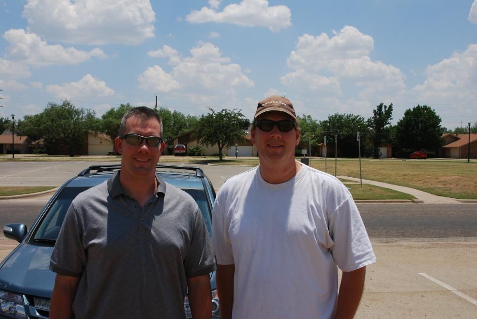
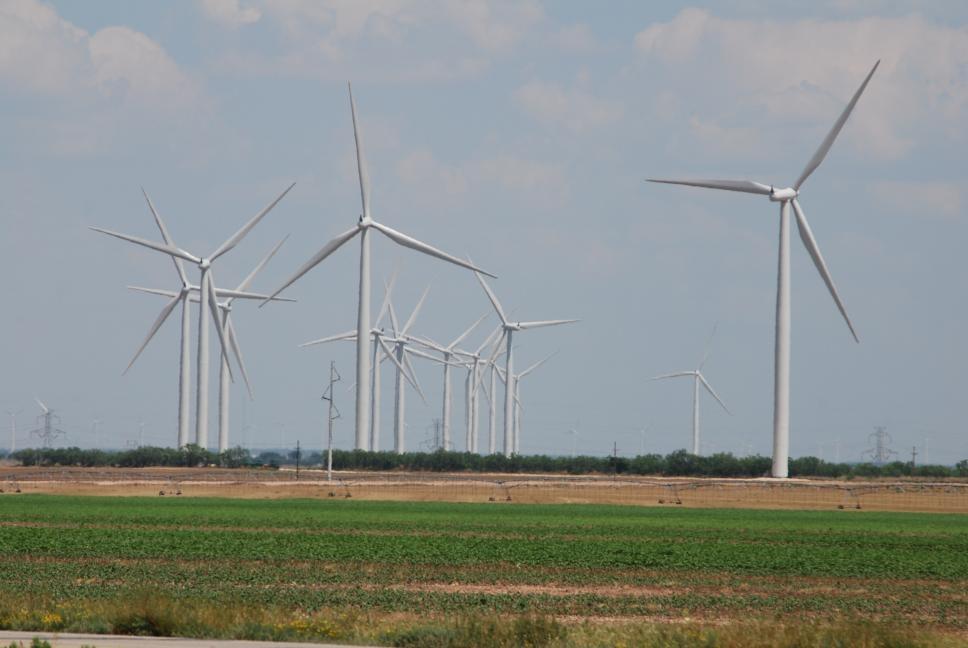
Chris continue the drive west. He stopped in Abilene, Texas to spend a few hours with his nephew Jason, and Jason's family. Jason is a major in the Air Force, and graduated from the US Air Force Academy (USAFA) in 1997, 8 years after Chris graduated from USAFA. Chris continued on west from Abilene. The western part of Texas is covered in thousands of windmills. He stopped in Big Spring, Texas, and visited the original spring where the city got its name, and then headed north and west, finally making it to Carlsbad, New Mexico, where he arrived in time to view the nightly bat departure at Carlsbad Caverns National Park.
|
Jason's family |
Jason & Chris |
Windmills in west Texas |
Big Spring, Texas |
27 June 2009
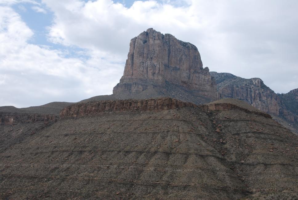
| Chris left the hotel the next morning and returned to Carlsbad Caverns, where he spent the morning hiking into the cave and then around the Big Room. After touring the cave, Chris drove 25 miles south, just over the border back into Texas, and visited Guadalupe Mountains National Park. He flew his aerial photo RC plane here and took some nice pictures of El Capitan, an early marker for settlers headed west. He then drove back north and further west into New Mexico, stopping for the night in Alamogordo |
. |
 |
 |
 |
 |
 |
 |
 |
 |
 |
 |
 |
 |
28 June 2009
| Chris drove south out of Alamogordo and visited White Sands National Monument, where he flew his photo plane again. There is not much to White Sands other than sand dunes, so the pictures aren't too exciting. He then continue his drive and reached Sierra Vista on the evening of Sunday, 28 June, where he flew his plane at the top of Carr Canyon Road in the Huachuca Mountains. | 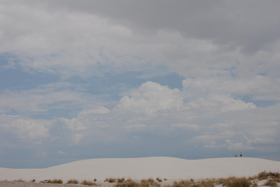 White Sands |
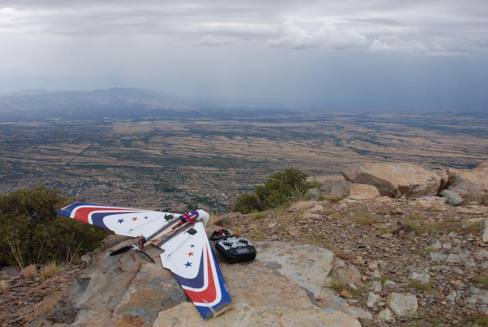 Carr Canyon overlook |
29 June 2009
| Flight testing at Ft Huachuca commenced on Monday, 29 June. On the weekends Chris was able to visit nearby national parks and forests, and local attractions. |
Carr Canyon overlook panorama |
3 July 2009
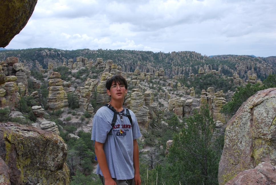
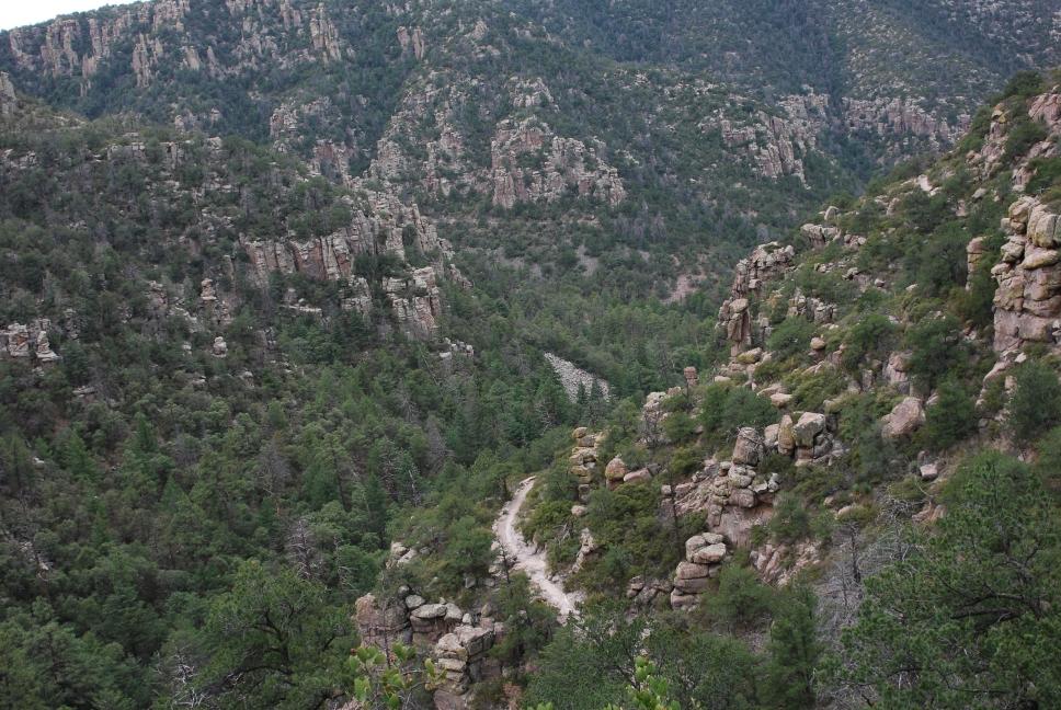
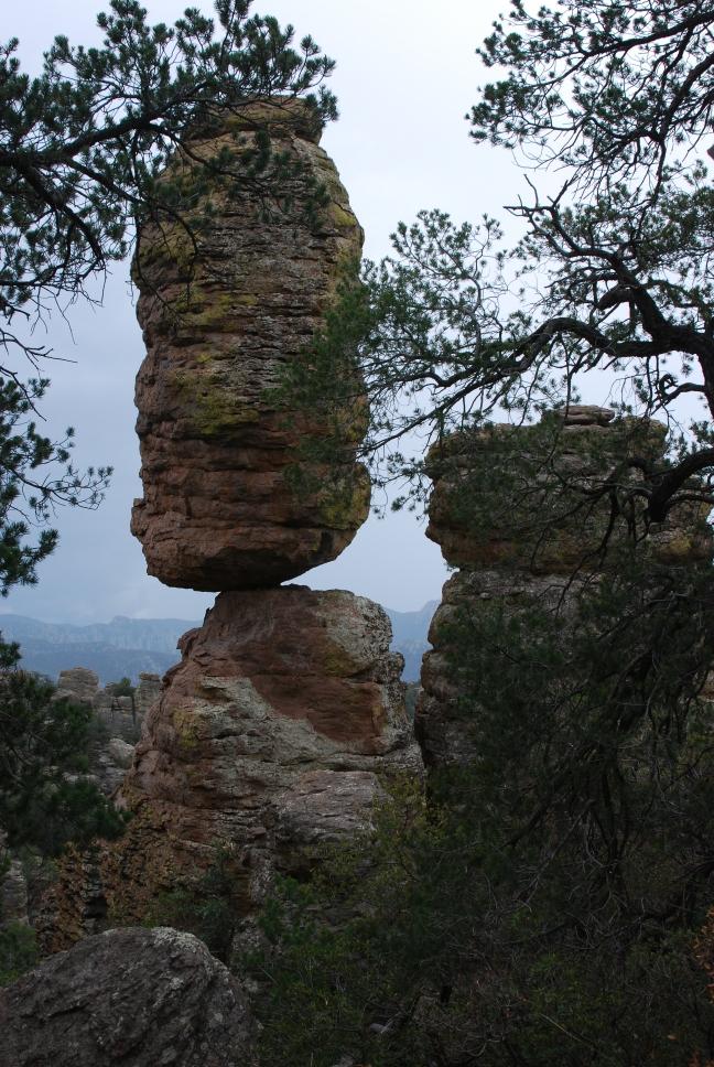
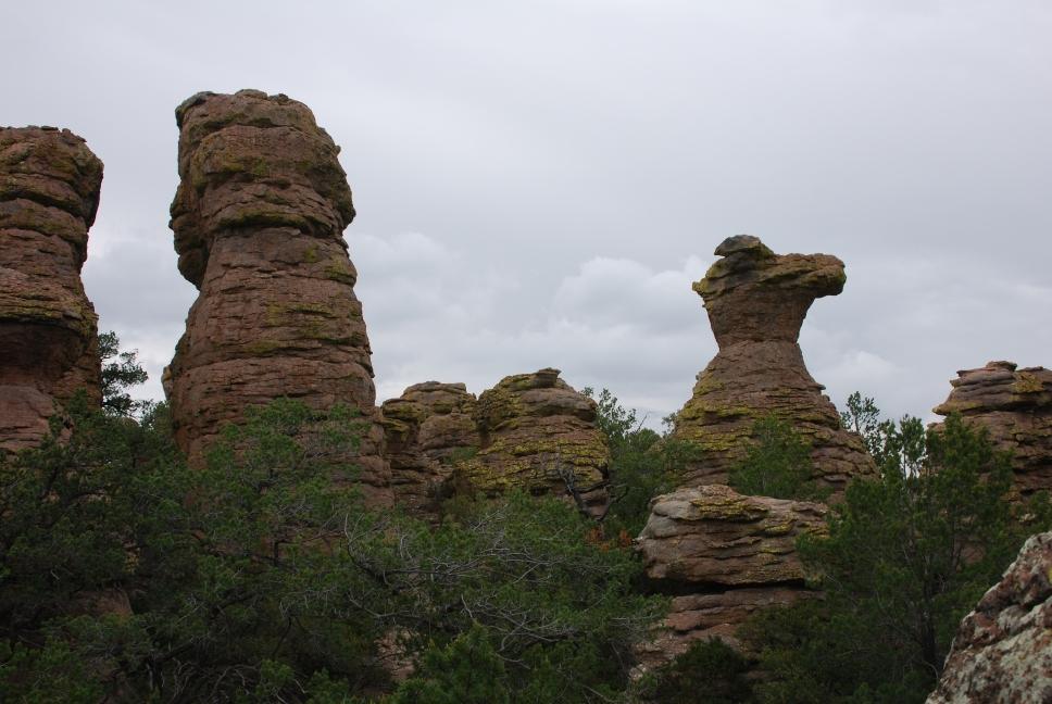
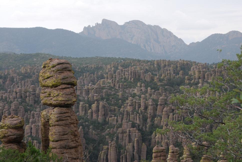
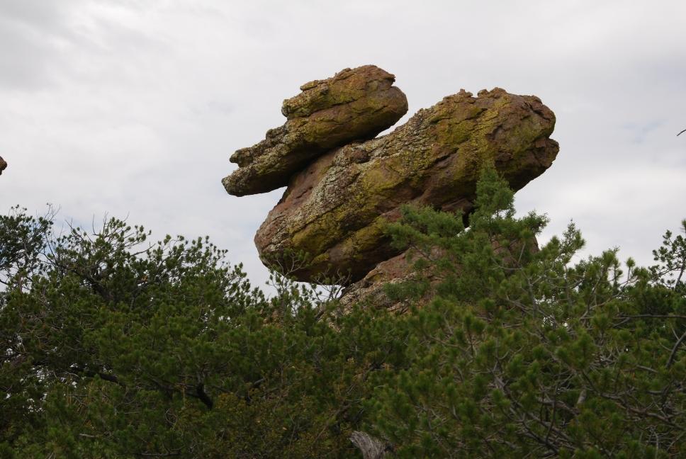
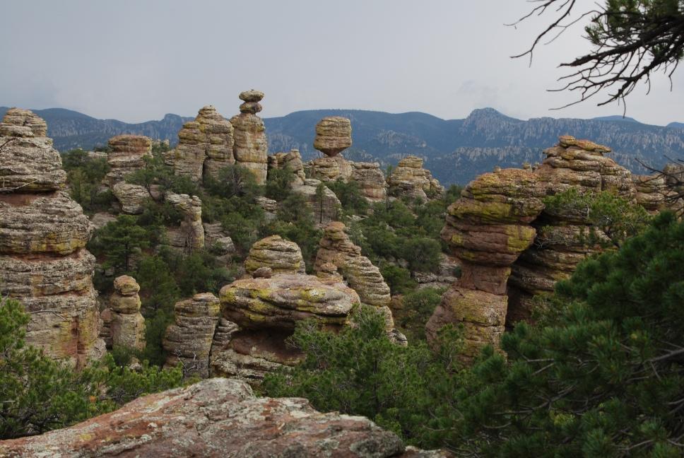
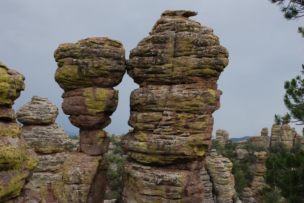
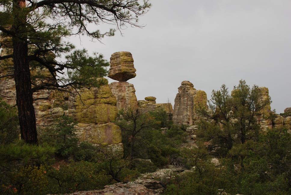
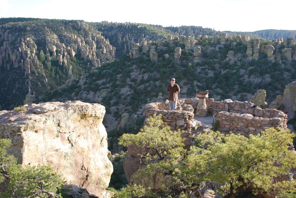
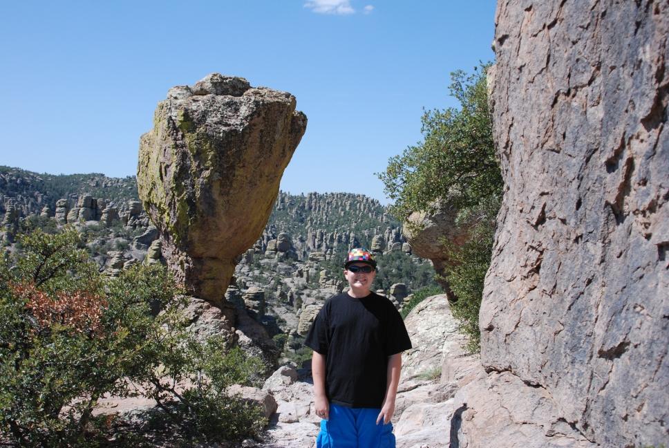
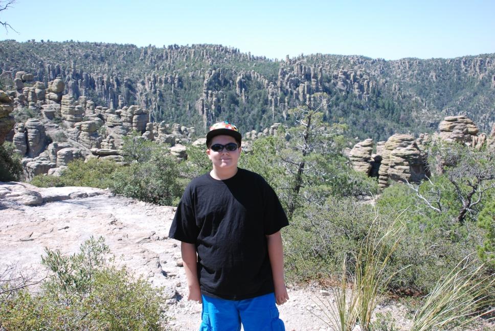
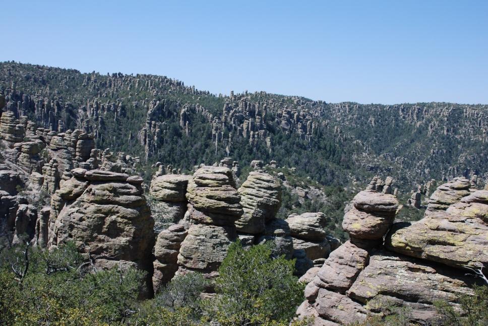
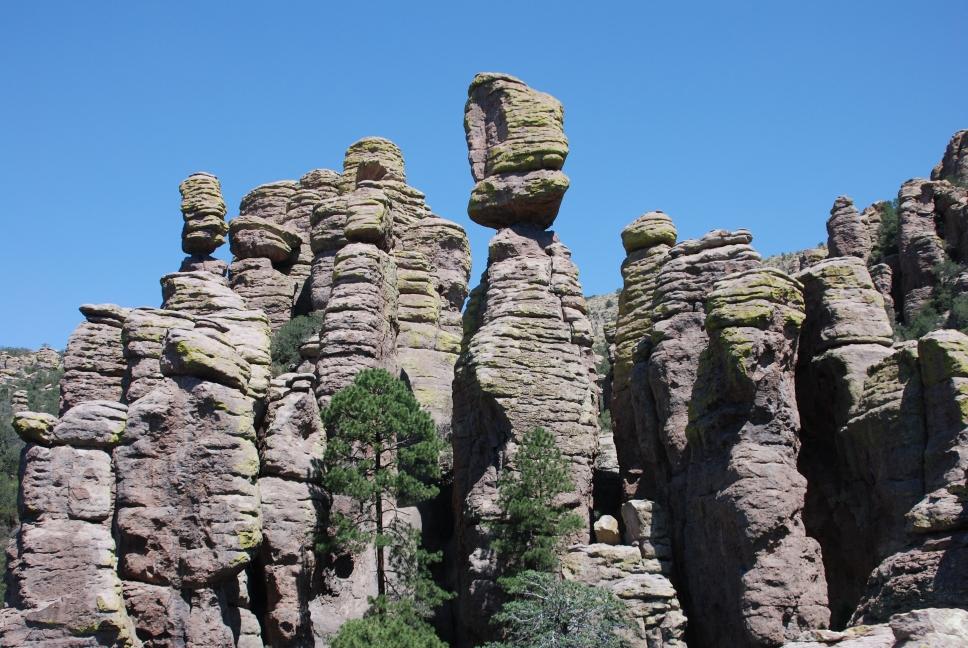
Tami has a cousin in the Army, and he was currently stationed at Ft Huachuca. He and Chris are friends, and had also been stationed together at Ft Meade in Maryland when Chris was in the Air Force. They had spent time hiking in the Huachuca Mountains in 2004 when he was temporarily assigned to Ft Huachuca and Chris was assisting with flight testing of the Shadow at that time. He was on an overseas temporary assignment, but his wife and son were still at Ft Huachuca, eagerly awaiting his return. Chris and his son Daniel went hiking at Chiricahua National Monument, a hike that Chris had done many times before. They hiked the Echo Canyon loop, and continued on to Heart of Rocks, the best section of the park to see rock formations.
 |
 |
 |
 |
 |
 |
 |
 |
 |
4 July 2009
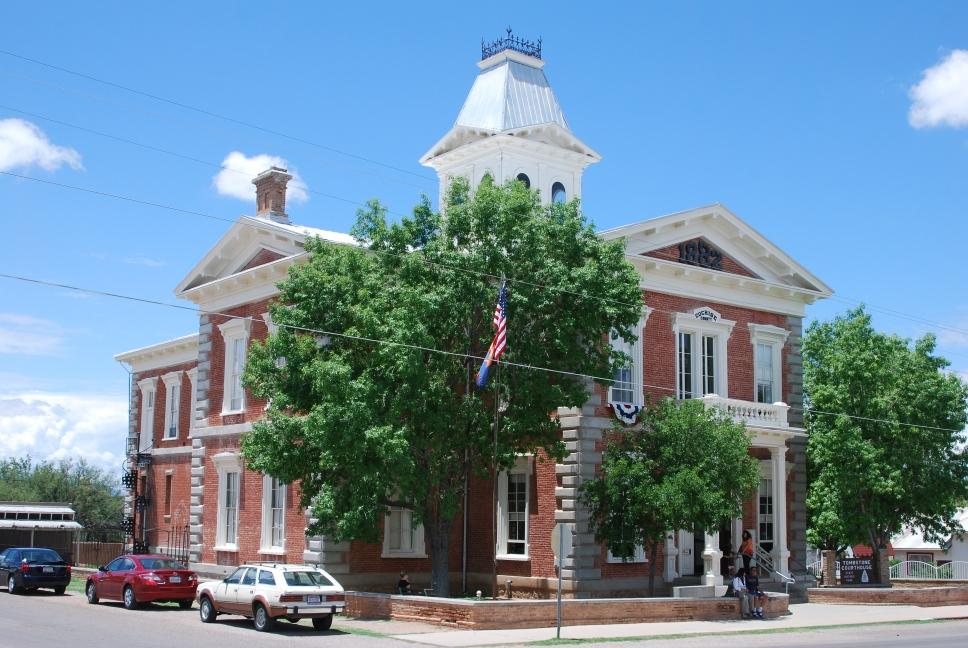
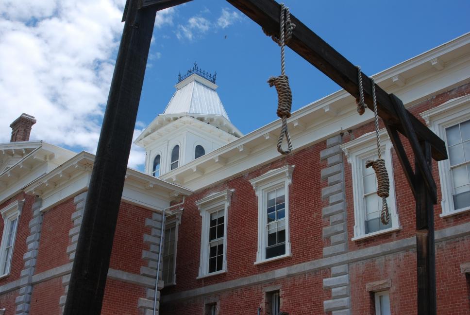
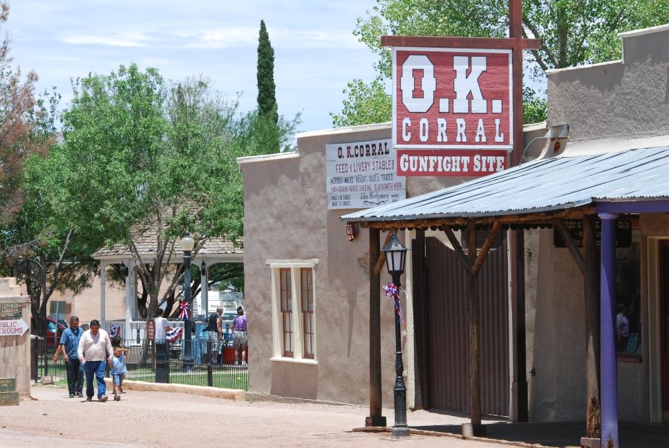
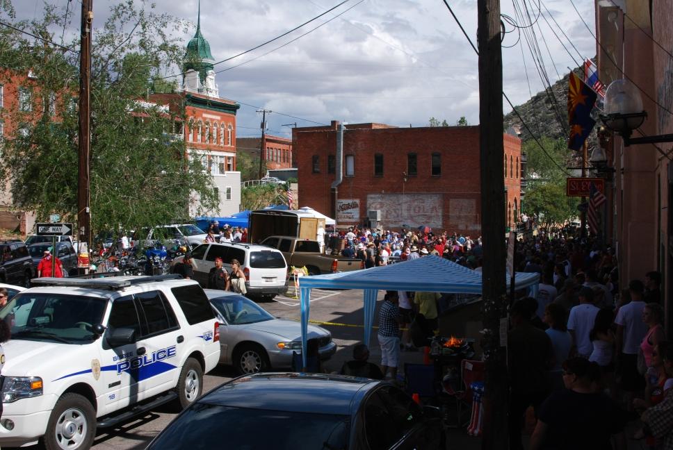
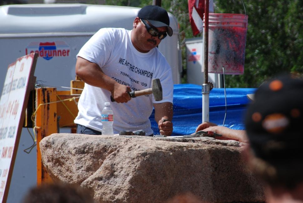
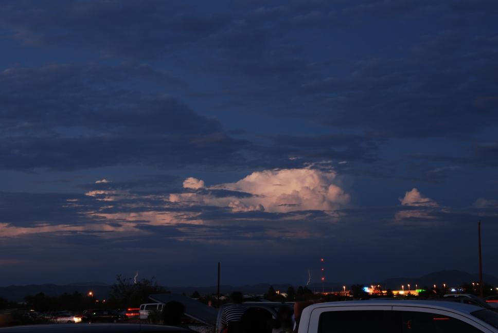
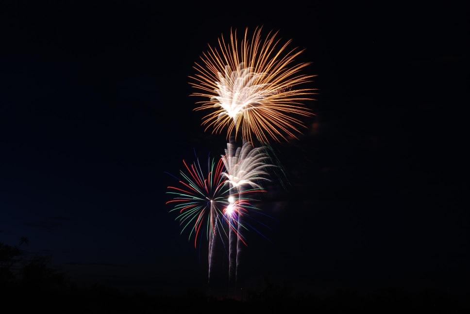
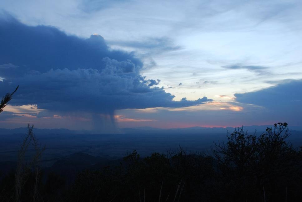
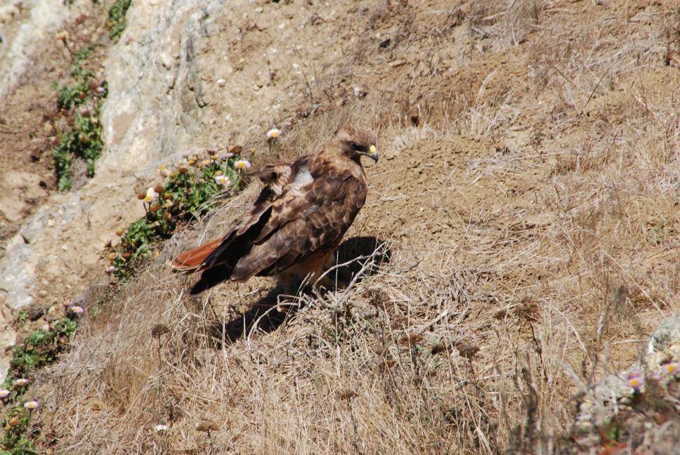
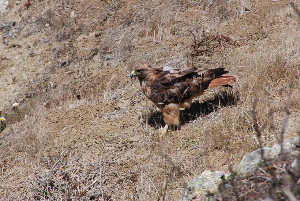
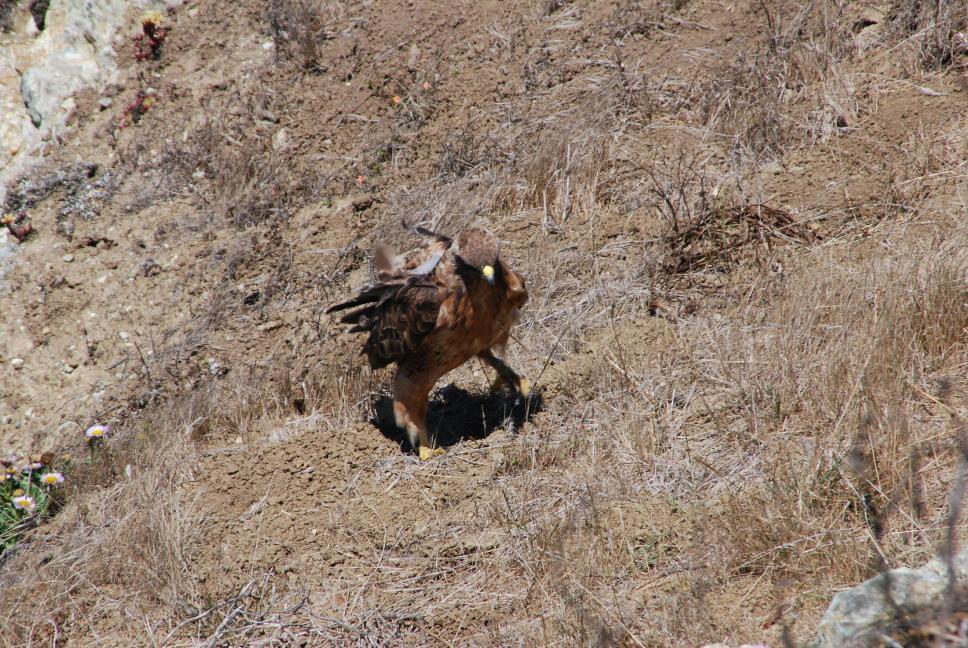
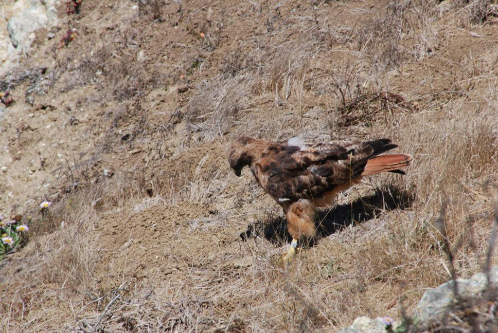
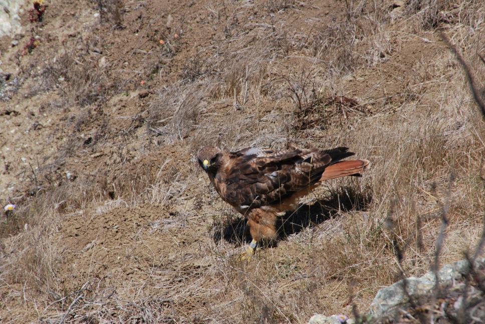
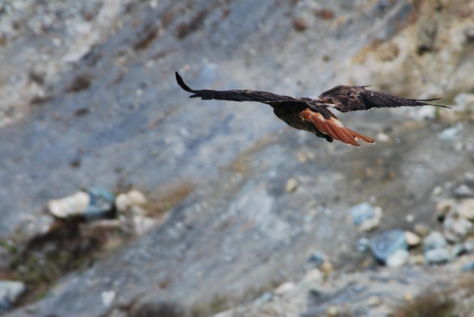
Chris decided to visit as much of Cochise County as possible on July 4th. He got up early and headed towards Tombstone, site of the famous "Gunfight at the OK Corral". On the way, he stopped at the San Pedro River and took some aerial photos. In Tombstone, Chris visited the old Tombstone Courthouse, an Arizona state park, and then took some aerial photos of the town. Chris then drove south to Bisbee, the county seat and once the largest city in the US between San Francisco and St Louis. It was an old mining town, but has been reborn in the last 15 years as artist town. Bisbee was having its 4th of July celebration going in full swing, including hand drilling contests, where contestants use hand drills and hammers to dig into granite. The town was packed and it was very entertaining. After spending a few hours walking around Bisbee, Chris drove west to Coronado National Memorial at the south end of the Huachuca Mountains. This national monument commemorates the path that Francisco Coronado took in 1540, when he journeyed from Mexico north, looking for Cibola, the 7 cities of gold. After flying his aerial photo plane again, he continued west to Parker Canyon Lake, a man-made reservoir on the west side of the Huachuca Mountains. He flew his plane again, and then finally headed north and east, back to Sierra Vista and that night's fireworks. It was monsoon season in Arizona, so there were natural fireworks also: thunderstorms.
 |
 |
 |
 |
 |
 |
 |
 |
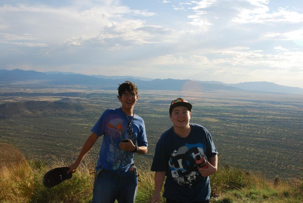
10 July 2009
Nathan flew into Tucson, and Chris picked him up. Nathan would spend the next two weeks with Chris and Tami's cousin's family.
11 July 2009
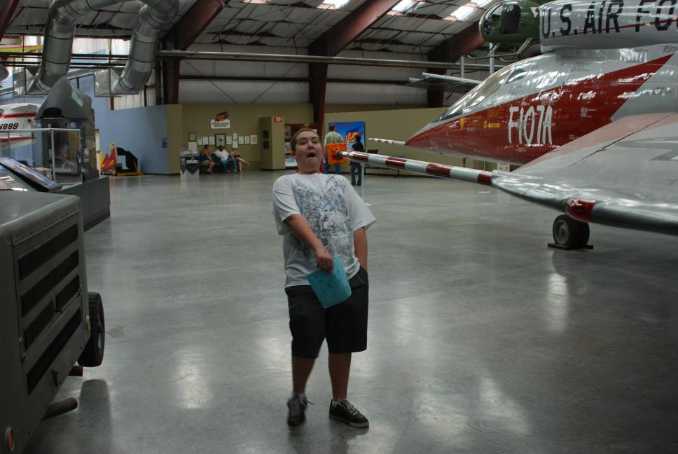
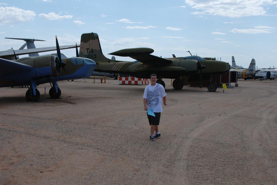
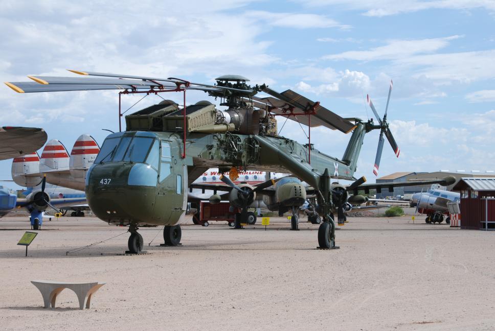
Chris and Nathan drove to Kitt Peak National Observatory, the largest gathering of telescopes in the world. It is about and hour and a half west of Tucson, two and half hours from Sierra Vista. They then drove to the Pima Air Museum in Tucson, adjacent to Davis Monthan Air Force Base, the "boneyard". This air museum houses one of the largest collections of aircraft in the world, the majority of them outside, protected by the dry desert air. After touring the museum, Chris and Nathan drove to the east section of Saguaro National Park, right outside the city of Tucson. They then drove north, up the Catalina Highway into the Catalina Mountains and watched sunset. Finally they headed back to Sierra Vista.
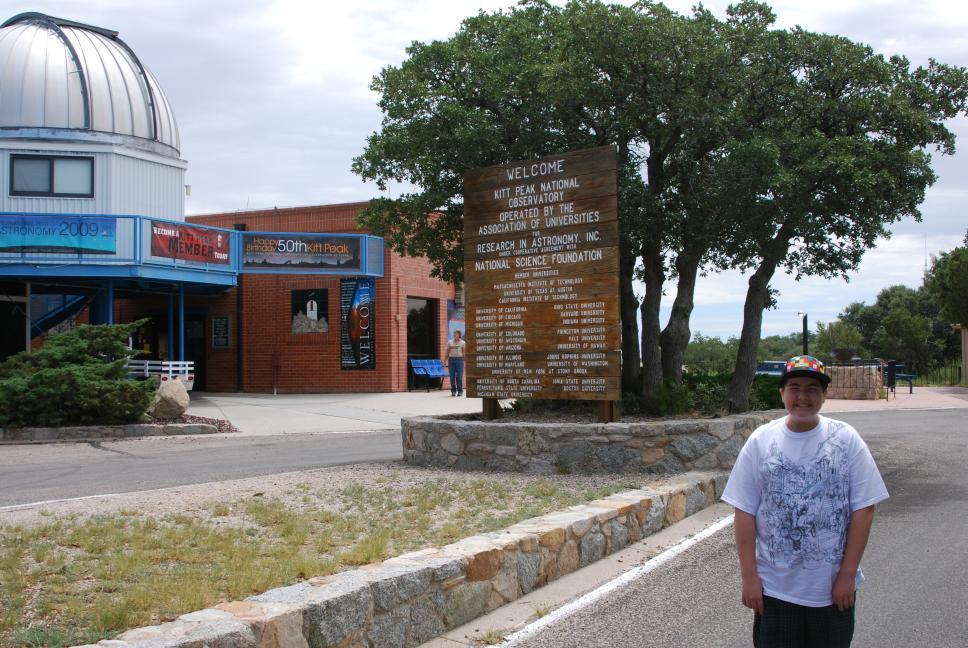 Kitt Peak |
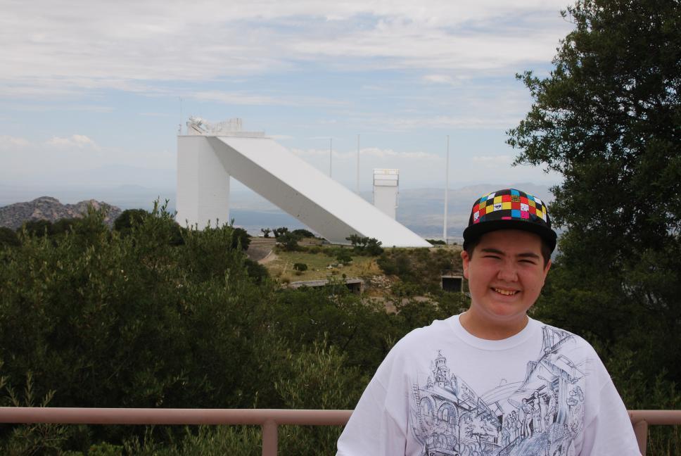 McMath-Pierce Solar Telescope |
Kitt Peak panorama from Mayall 4 meter telescope observation deck |
 |
 |
 |
 |
 |
|
Catalina Mountains panorama |
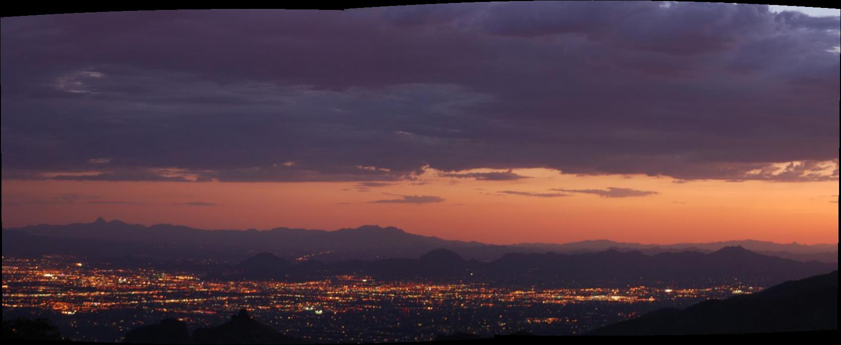 Sunset over Tucson from Catalina Highway |
12 July 2009
Chris, Nathan, and Tami's cousin Daniel drove most of the same route that Chris had done on the 4th of July. They visited Tombstone ("boring" - from the kids), and then went on the Queen Mine tour in Bisbee. You ride mine trains back into the mountain a few thousand feet and get off a couple times, touring hand and dynamite dug caverns and shafts. They then drove to Coronado National Memorial, and hiked up to Coronado Cave, which goes back about 600 feet into the mountain and has two very large rooms, with rock formations in the second room. After the hike, they drove up to and hiked out to Coronado Peak, which overlooks Mexico. Chris flew his aerial photo plane and took more photos from the peak.
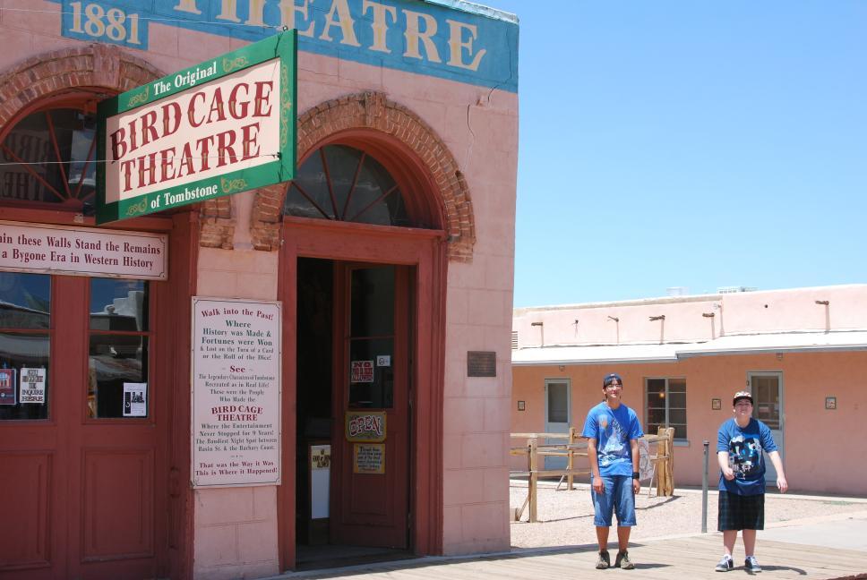 Bird Cage Theater, Tombstone |
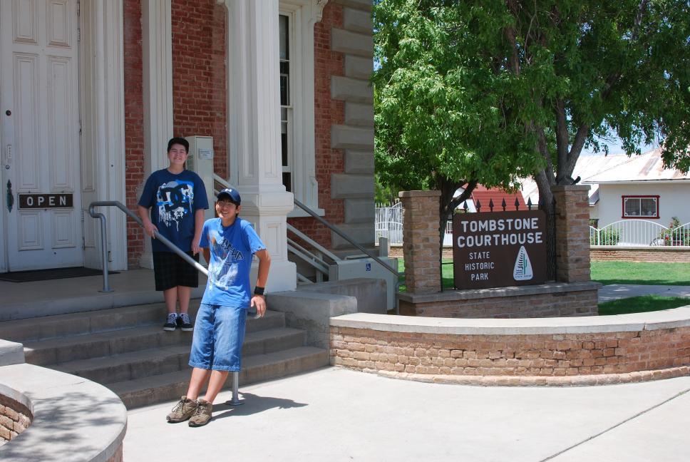 Tombstone Courthouse |
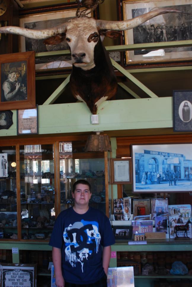 Inside the Bird Cage Theater |
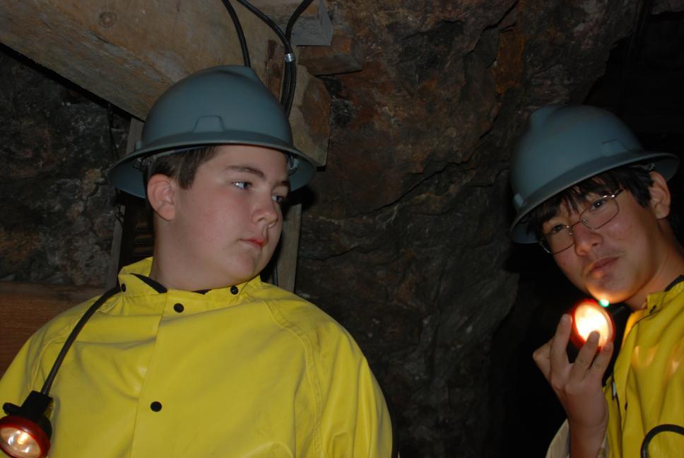 Queen Mine tour |
 Queen Mine tour |
 Coronado National Memorial visitor center |
 Coronado Cave |
 Coronado Cave |
 Coronado Peak Mexico in the background |
 Coronado Peak Mexico in the background |
 Hiking down from Coronado Peak |
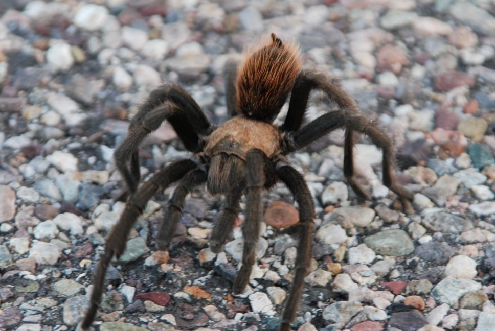 Tarantula at Coronado |
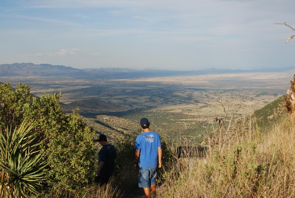
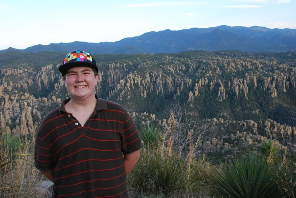
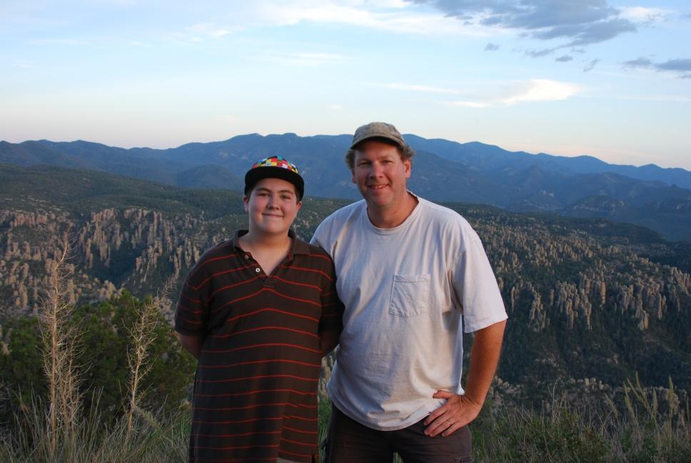
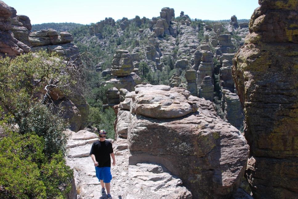
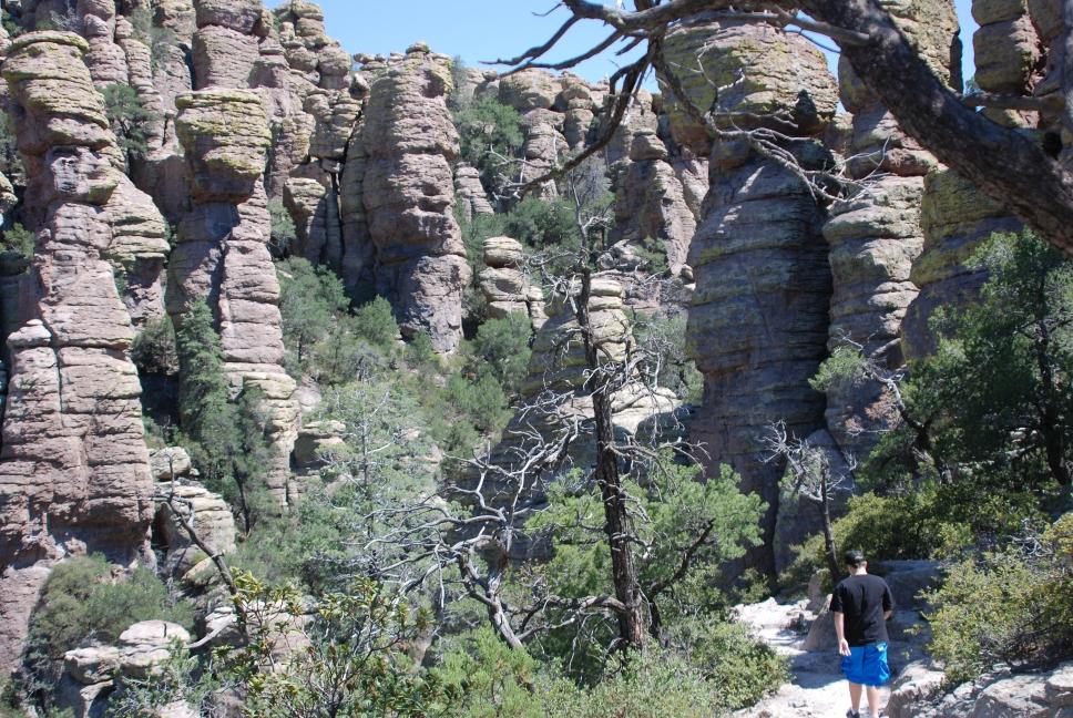
18 - 19 July 2009
| Chris and Nathan drove to Chiricahua National Monument and camped. They hiked up Sugarloaf Mountain Trail on Saturday afternoon, and did the Echo Canyon loop trail on Sunday. They also drove to Massai Point late on Saturday evening to look at the stars. There was no light pollution at all to spoil the view and they had the point to themselves. |
 |
 Massai Point |
 Sugarloaf Mountain |
 Sugarloaf Mountain |
 Sunset from Sugarloaf Mtn |
 Sunset from Sugarloaf Mtn |
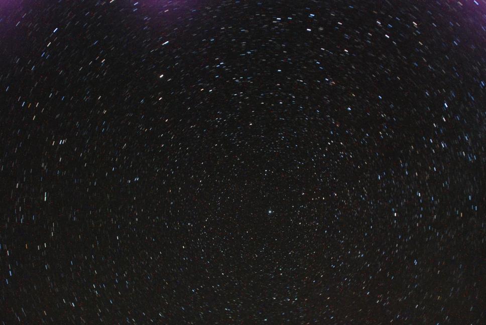 Stars from Massai Point |
 Echo Canyon Trail |
 Echo Canyon Trail |
 Echo Canyon Trail |
 Echo Canyon Trail |
 Echo Canyon Trail |
 Echo Canyon Trail |
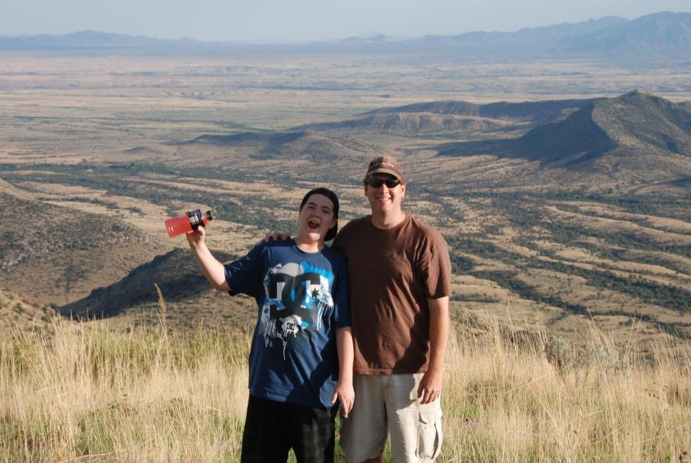
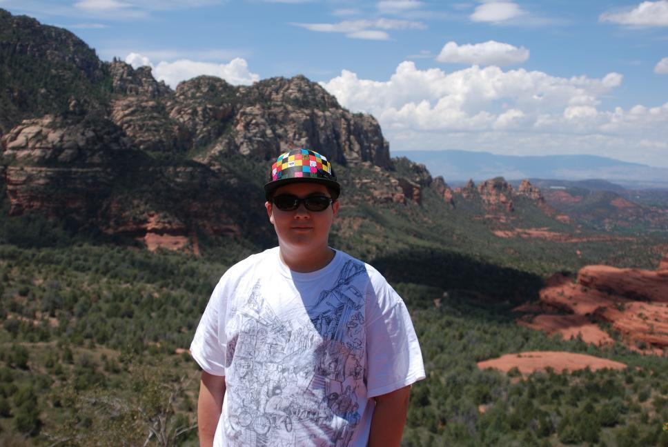
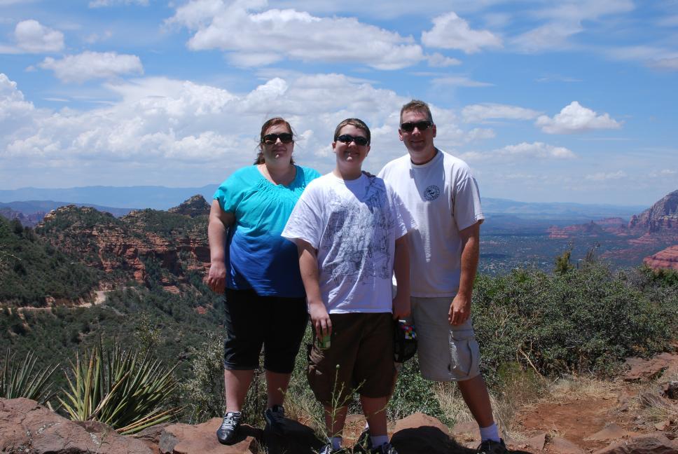
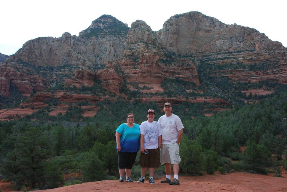
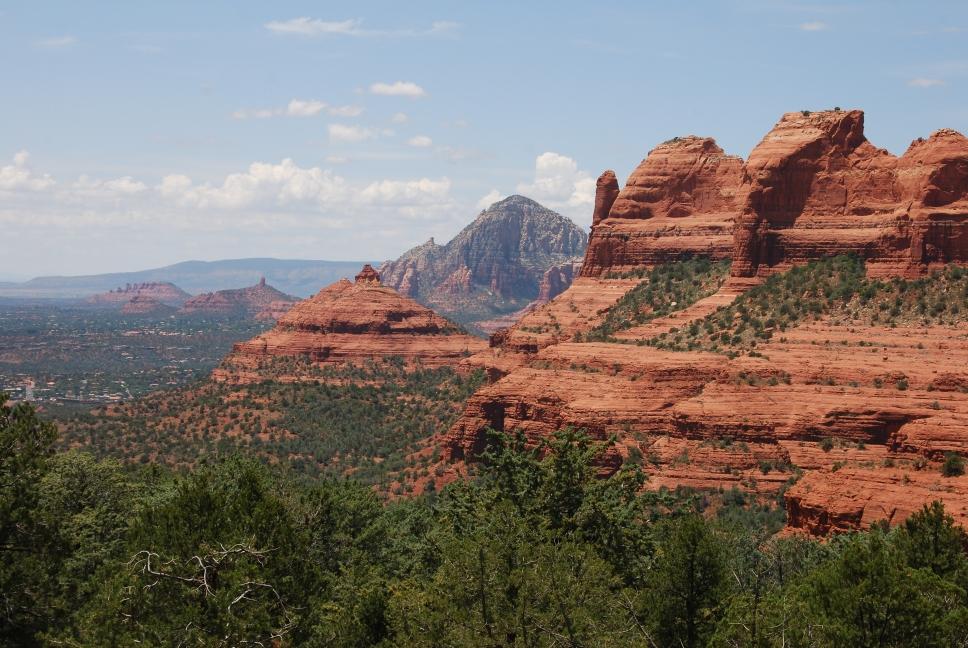
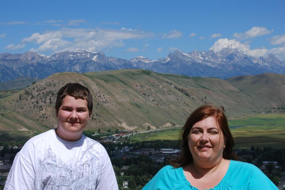
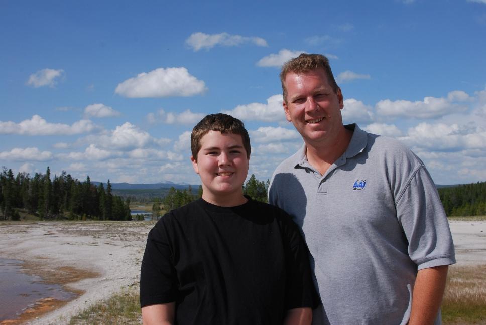
24 July 2009
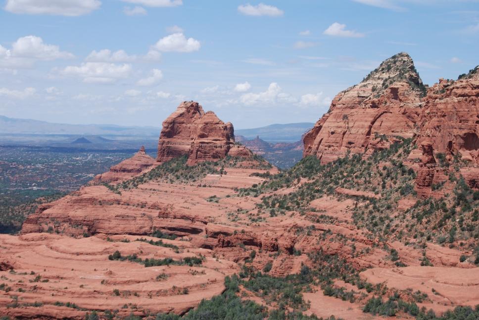
Flight testing was complete, so Chris and Nathan drove to Phoenix, where they picked up Tami, who had flown in from her parent's home in Charleston, WV. They all then drove north to Sedona, arriving in the dark. With all our travels, including living in Las Vegas, and Chris visiting and hiking the Grand Canyon many times, none of us had ever visited Sedona.
25 July 2009
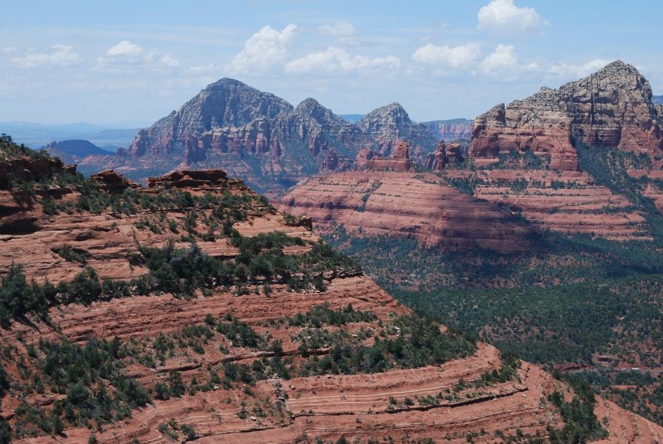
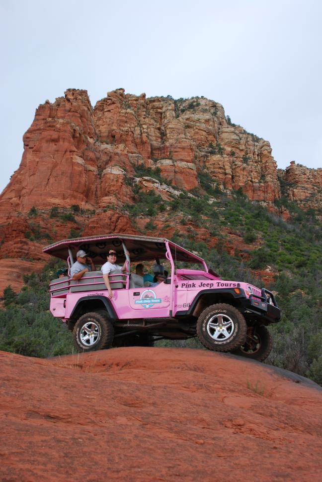
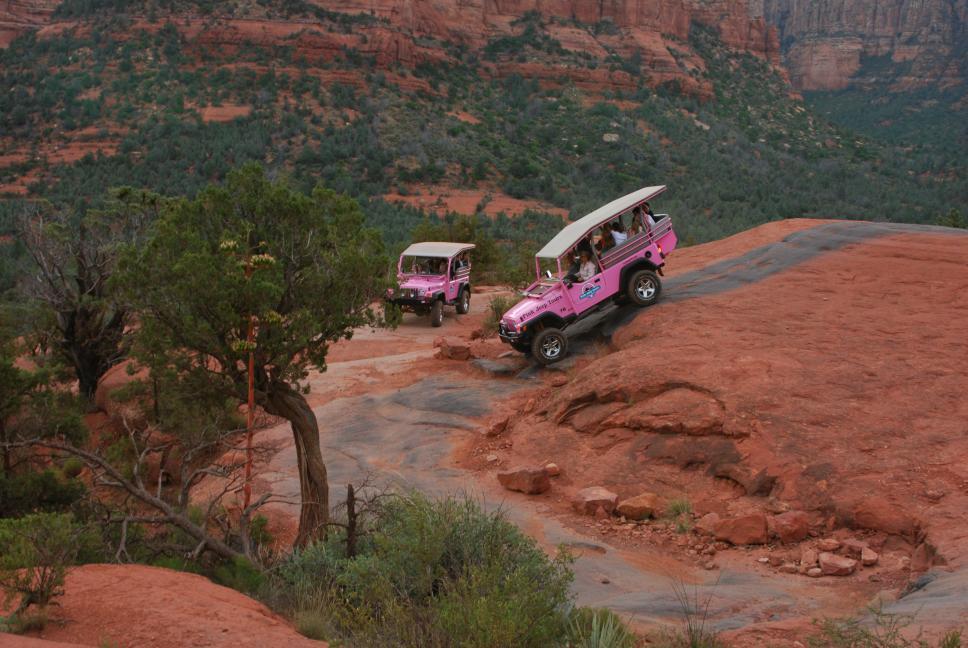
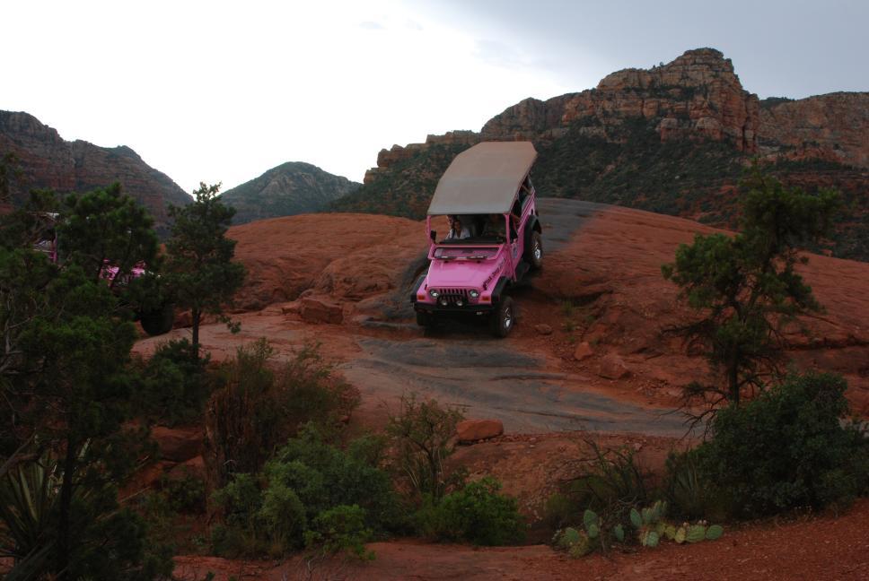
We drove to the top of Schnebly Hill Road, where Chris flew his plane and took some aerial photos of Sedona. We then took the Pink Jeep Broken Arrow Tour. The jeep tour is neat and the ride is incredible, with a couple of very steep hills, especially the "Road of No Return", which has 50 years of ruts carved out by the same tour over that time. It is pretty pricey, and Chris is still undecided if it is worth the cost. Nathan thinks it was the best thing we did on the whole trip. We visited the Elote Cafe for dinner; it has great food. The menu is small, but all three of us loved our food. If you order the "Elote" appetizer, the owner and chef brings it out to you himself; that was a surprise and was neat.
 |
 |
 |
 |
 |
 |
 |
 |
 |
26 July 2009
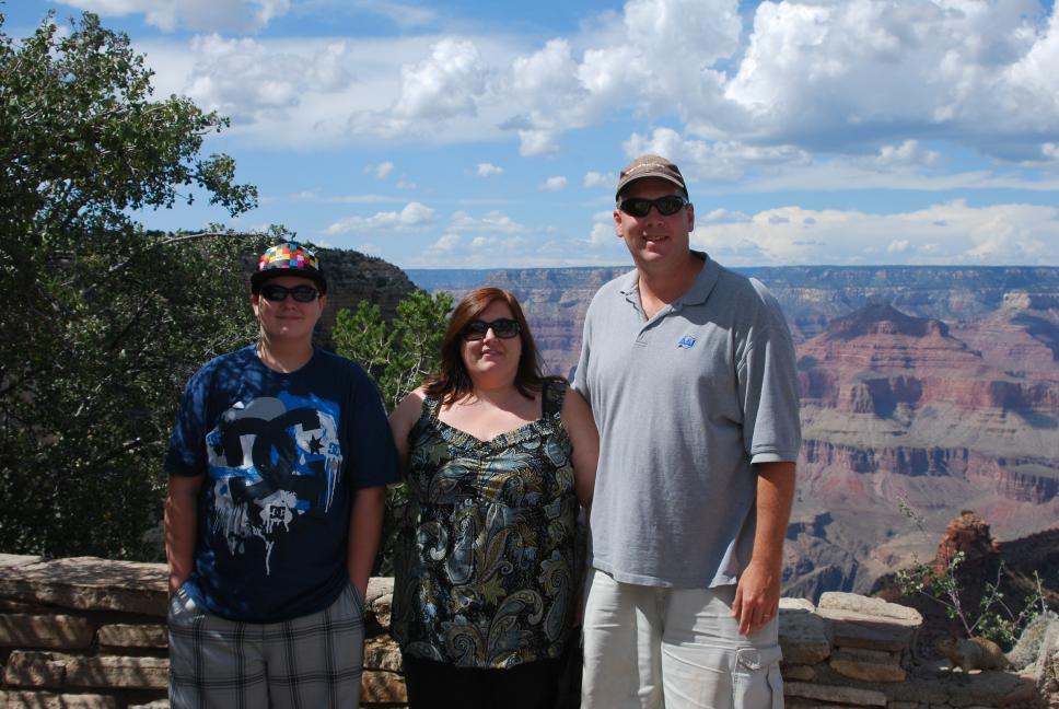
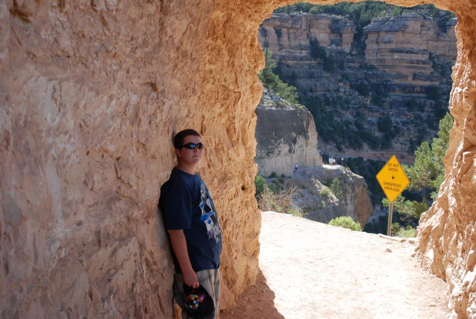
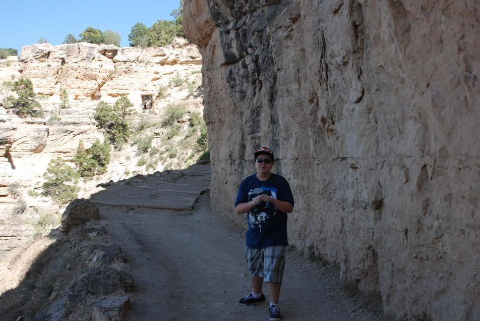
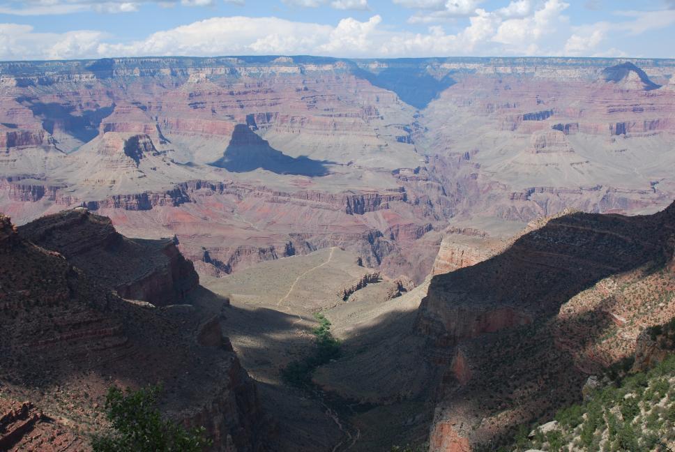
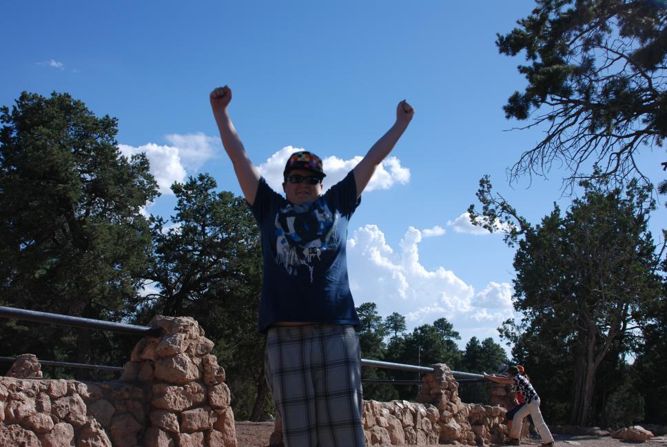
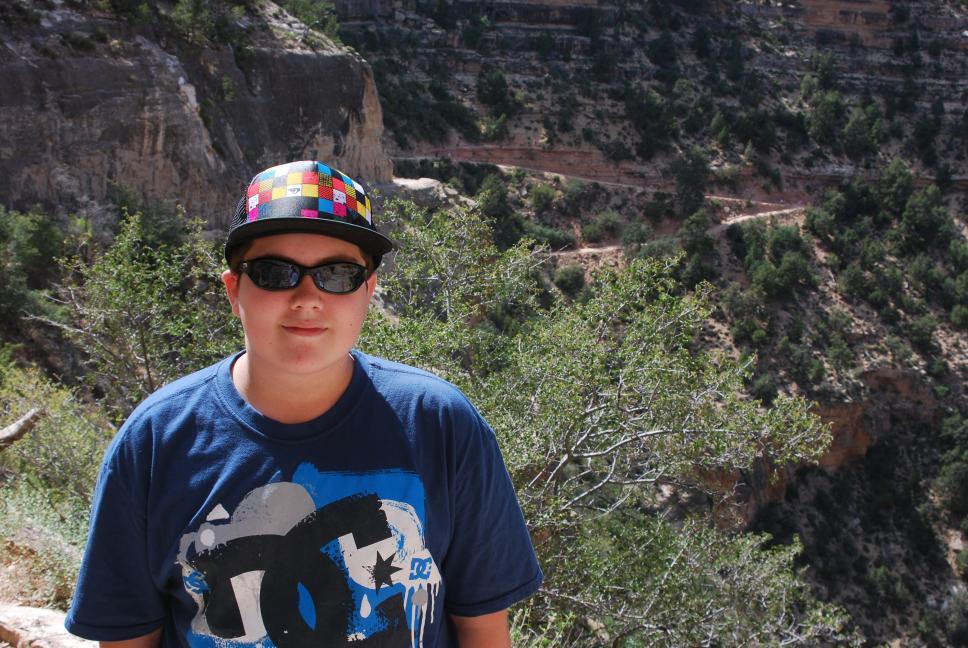
We drove north to Grand Canyon National Park. Normally Chris spends several days hiking the Grand Canyon whenever he visits, but that was not on the agenda this time, so we only spent about four hours on the South Rim, before heading to Las Vegas. We crossed the Hoover Dam at night, and arrived late into Las Vegas, where we stayed on the Strip.
 |
 |
 |
 |
 |
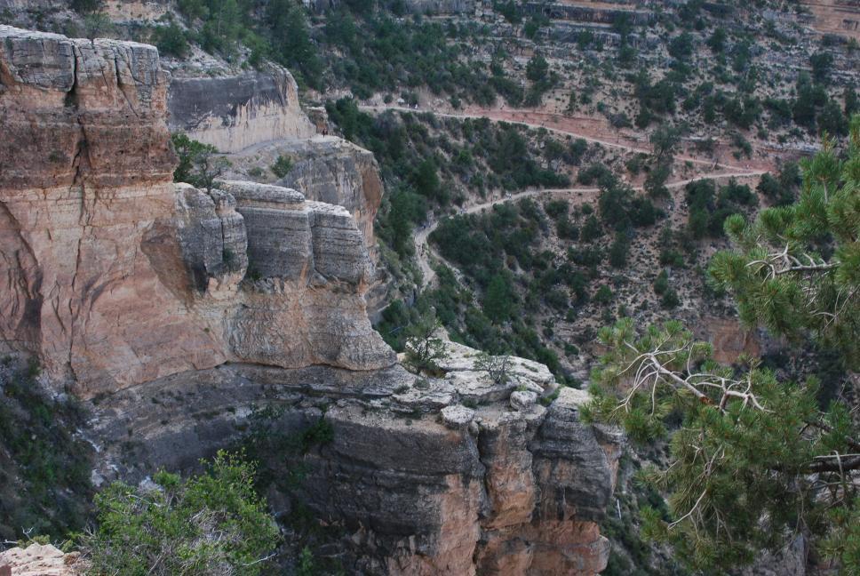 Bright Angel Trail |
 |
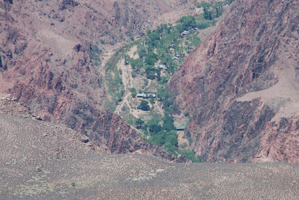 Phantom Ranch |
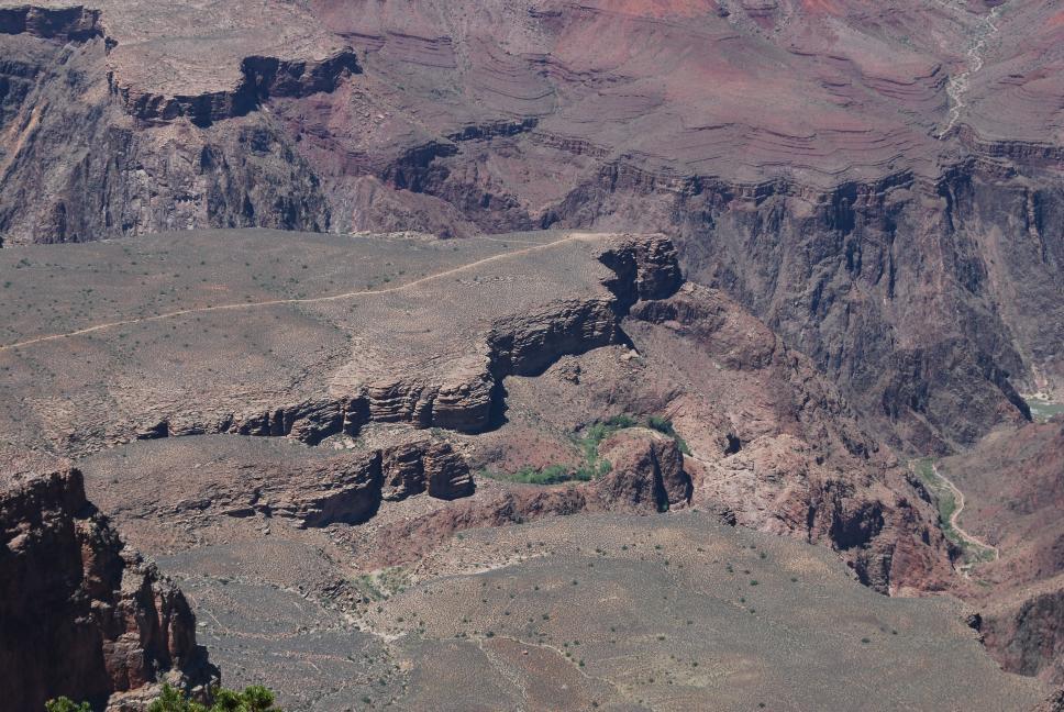 Plateau Point |
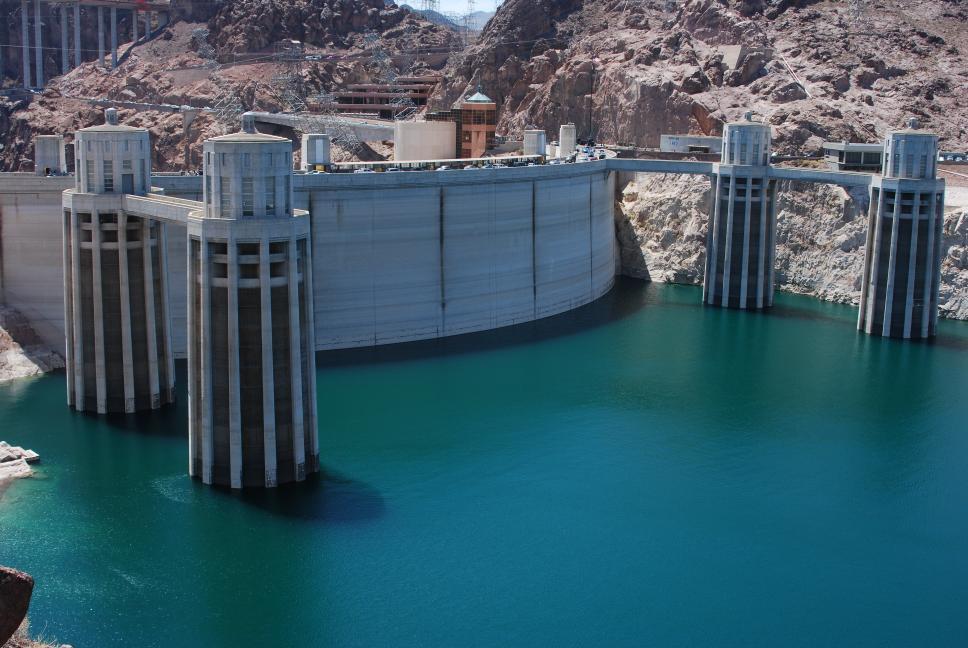
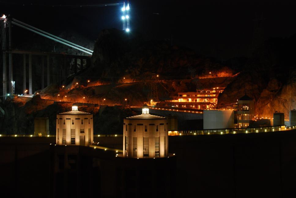 Hoover Dam |
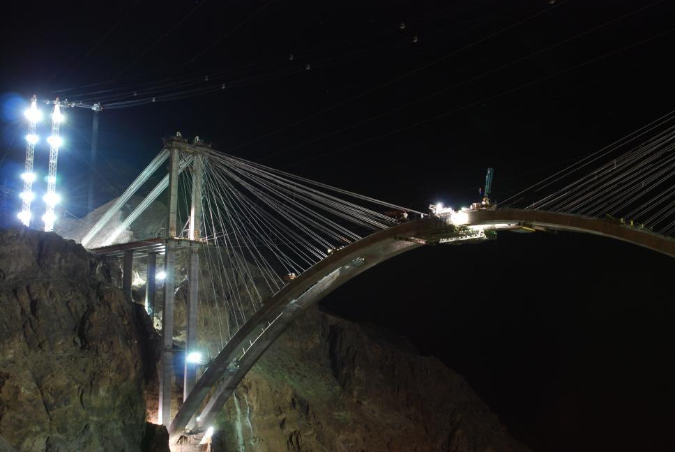 Hoover Dam Bridge |
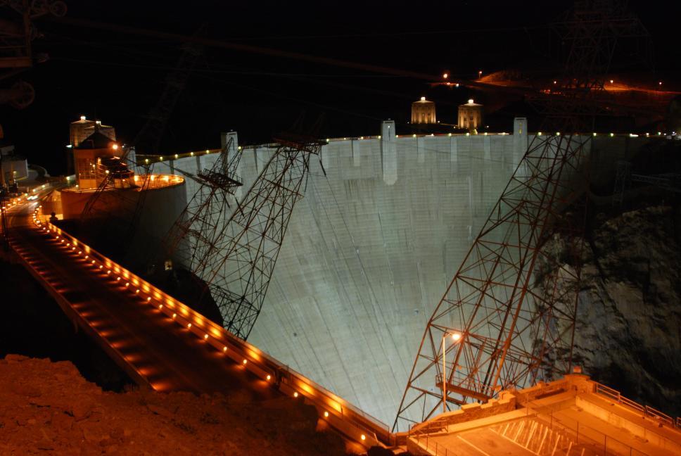 Hoover Dam |
27 July 2009
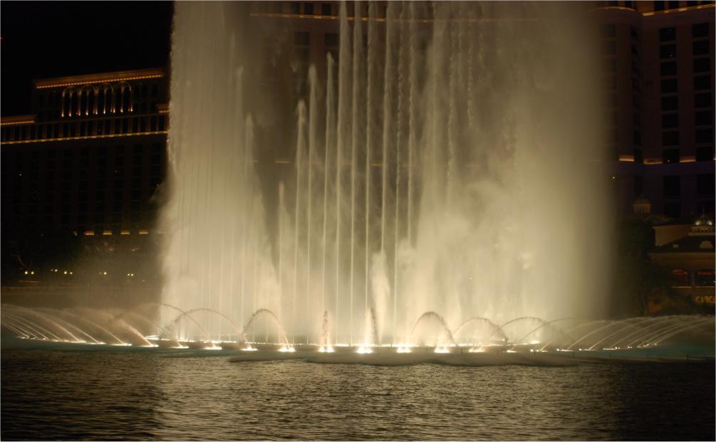
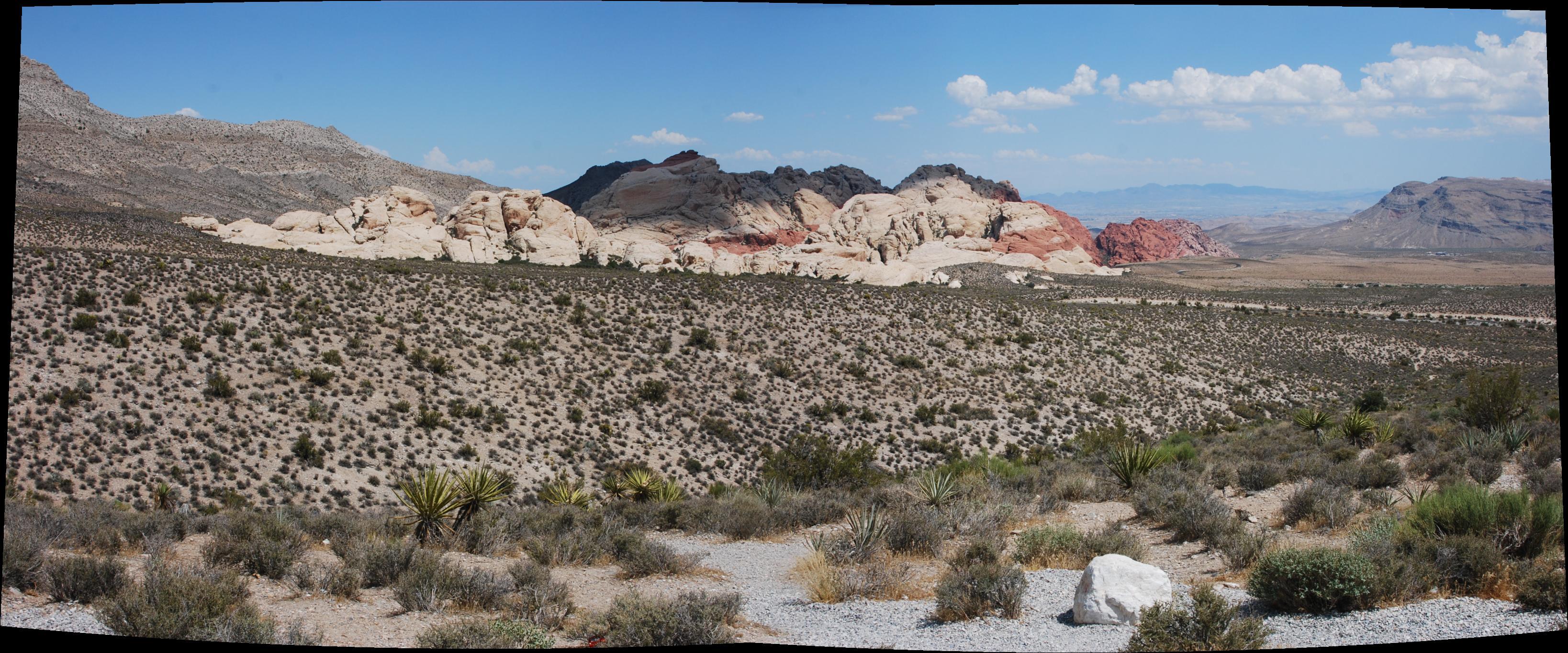
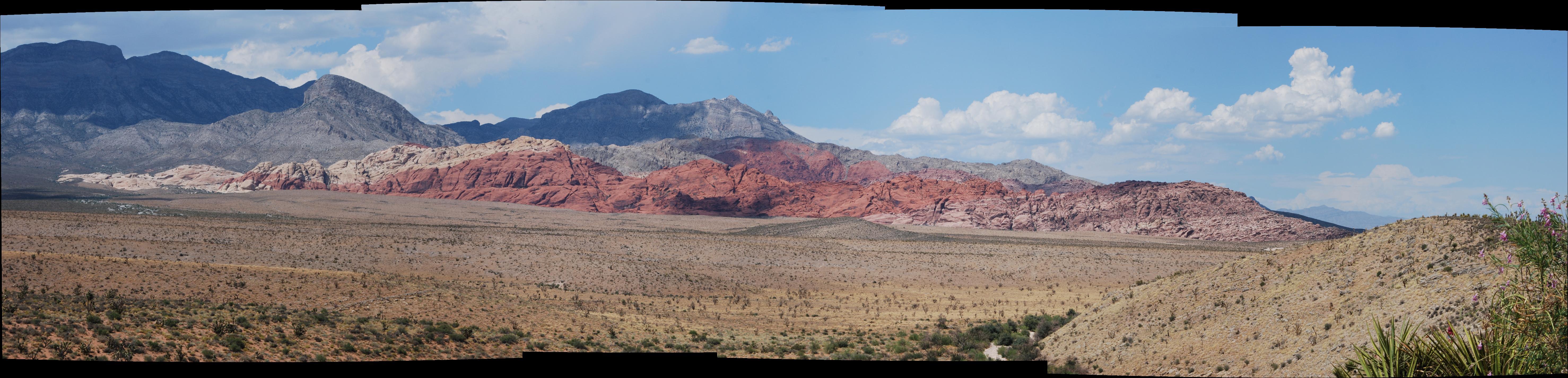
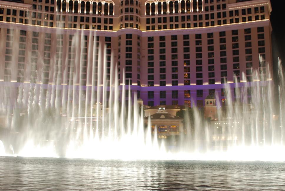
| We drove to the west side of town to visit where we had lived for four years, when Chris was stationed on the Nellis AFB range from 1993 to 1997, saying hi to some old neighbors. We then continued on to Red Rocks National Conservation Area, where Chris flew his plane again. We had dinner on the Strip at the Bellagio in Olives, and watched the Bellagio water show. |
Red Rocks |
 |
28 July 2009
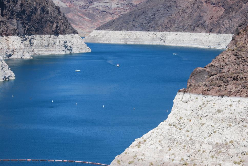
We drove east to Lake Meade National Recreation Area, where Chris flew his plane again, and then went to Hoover Dam so Nathan could see it in the daytime, and we could all see the new bridge under construction. The water level in Lake Meade is way down from what we are used to from living in Las Vegas from 1993 to 1997. The pictures below show the difference from just 2001, when the older panoramas were taken on Chris' last trip to Las Vegas.
We drove east to Lake Meade National Recreation Area, where Chris flew his plane again, and then went to Hoover Dam so Nathan could see it in the daytime, and we could all see the new bridge under construction. The water level in Lake Meade is way down from what we are used to from living in Las Vegas from 1993 to 1997. The pictures below show the difference from just 2001, when the older panoramas were taken on Chris' last trip to Las Vegas.
 |
 |
 |
|
|
2001 <-- Hoover Dam panoramas --> 2009 |
2001 <-- Lake Meade overlook panoramas --> 2009 |
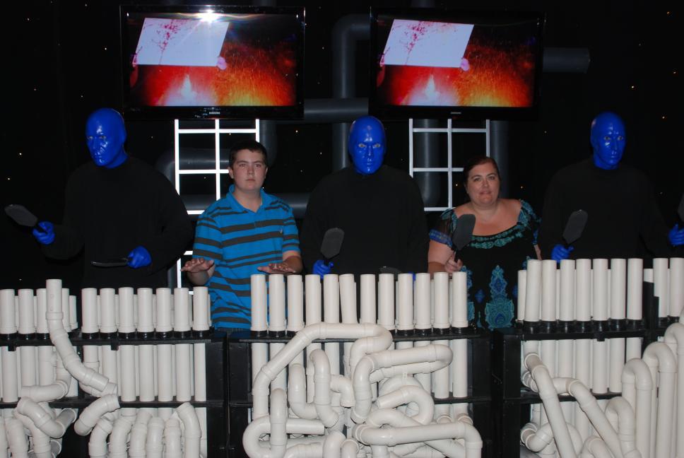
After returning to Las Vegas, we drove up to Fremont Street to watch the Fremont Street Experience, and then back to the Strip. We walked along the Strip and stopped to watch the pirate show at Treasure Island, which had always been entertaining when we lived in Las Vegas. We had been telling Nathan about the pirate show and were looking forward to it. We should have skipped it; its not fun anymore; it is some ridiculous show that the new owners, who took over from Steve Wynn, decided would make sense. They tried to take the original props and pirate ship theme and add scantily clad girls and have it all make sense. It doesn't make sense, and while Chris and Nathan will never complain about the scantily clad girls, it was still a big let-down. We walked down and watched a few presentations of the Bellagio water show; there are several and our favorite is the one that was featured at the end of the movie "Ocean's 11".
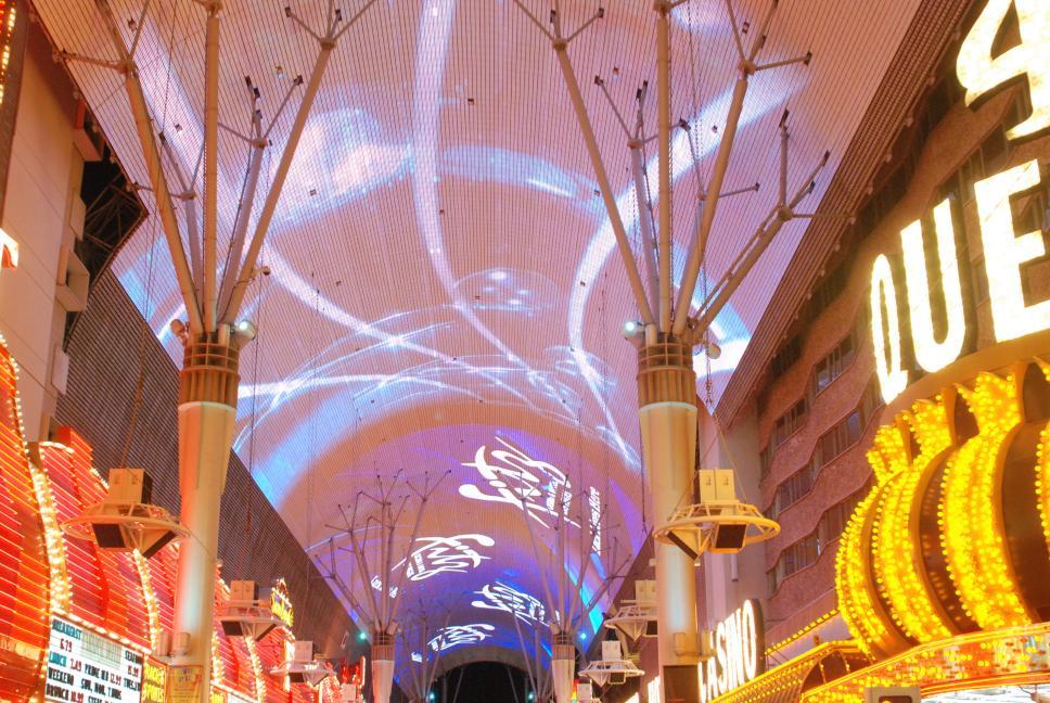 Fremont Street Experience |
 Bellagio |
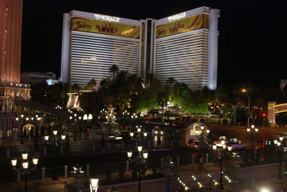 Mirage |
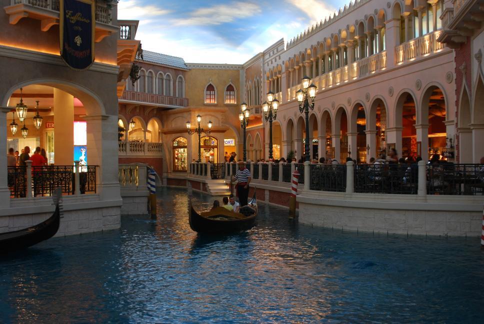 Venetian |
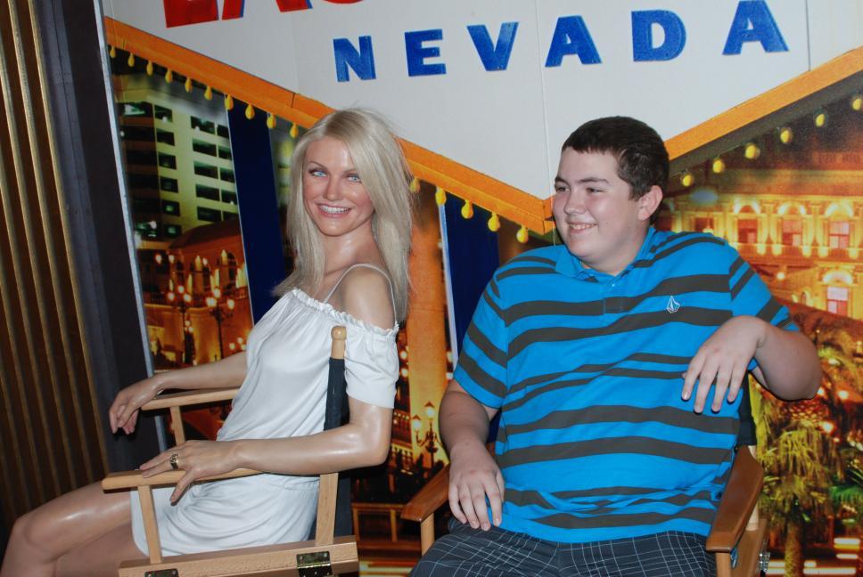
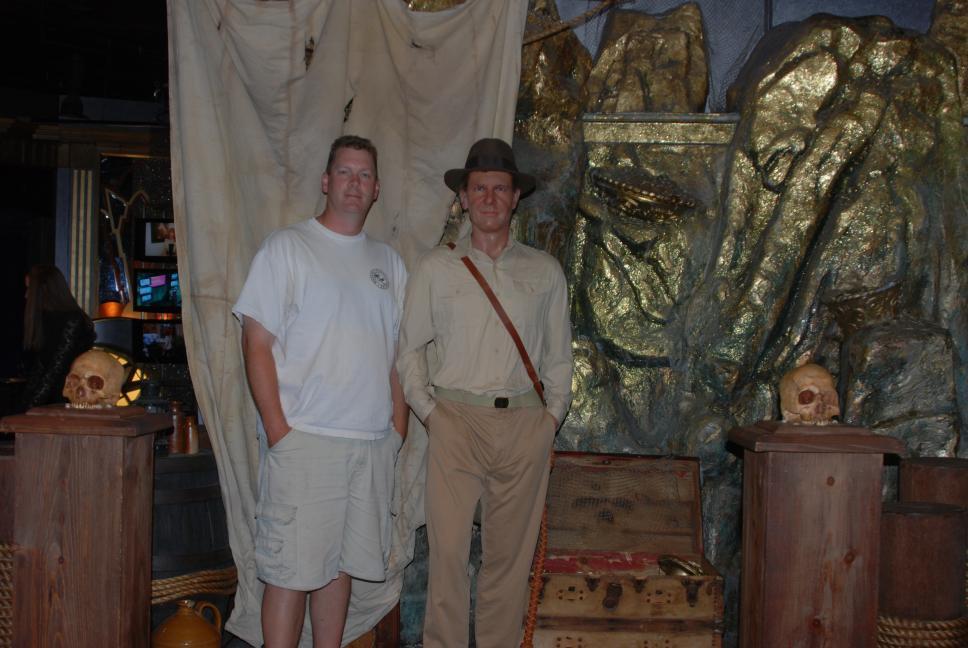
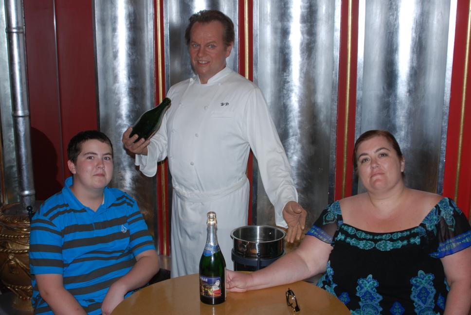
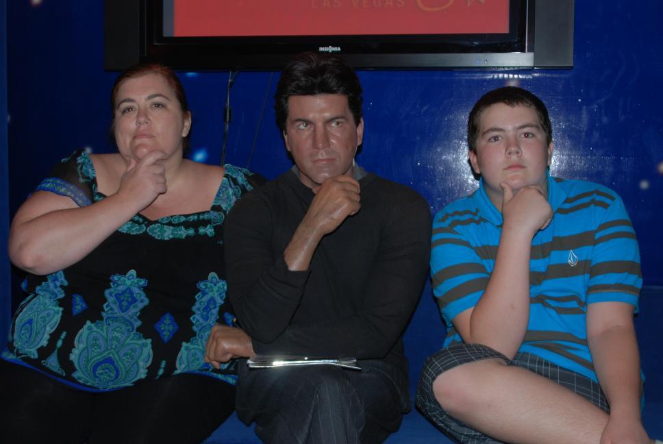
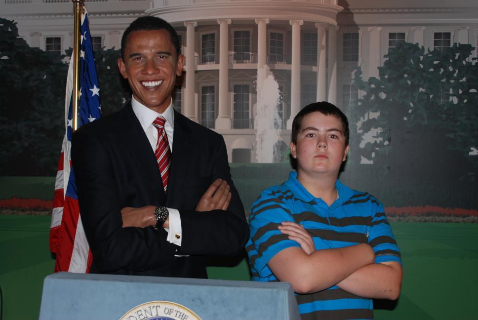
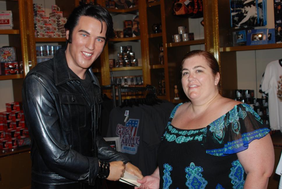
We returned to the Venetian, where we visited Madame Tussauds Wax Museum, and had a lot of fun taking pictures posing with the figures.
 |
 |
 |
 |
 |
 |
 |
 |
29 July 2009
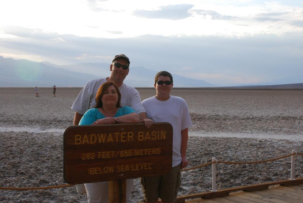
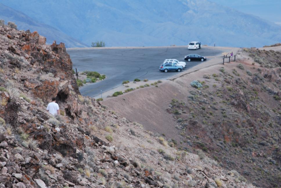
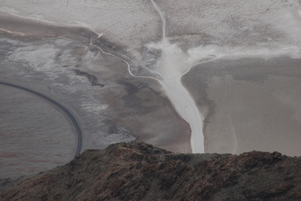
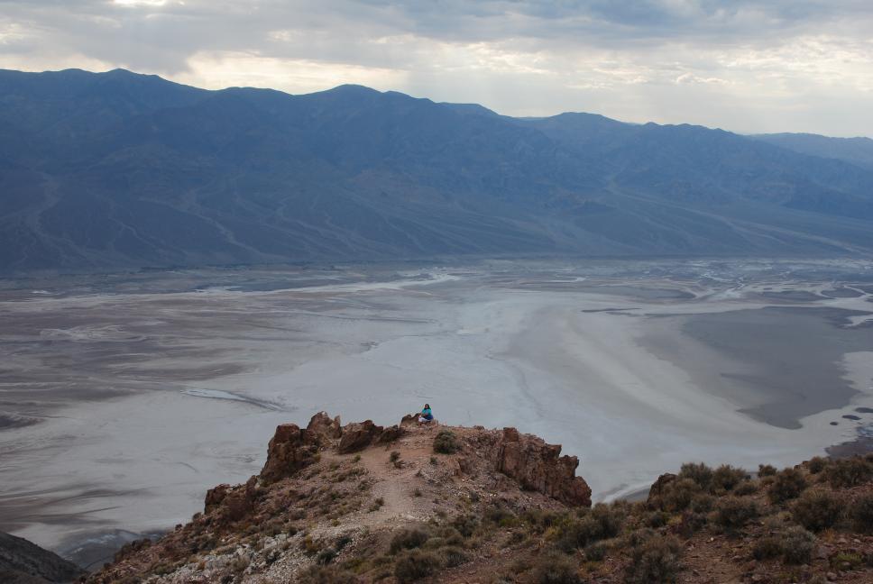
We drove west out of Las Vegas and headed for Death Valley National Park. Before leaving Las Vegas, we stopped at Capriotti's and bought some huge sub sandwiches that ended up feeding us for the next day and half. After visiting Dante's View on the east side of Death Valley, we continued into Death Valley itself and drove to Badwater, the lowest point in the western hemisphere, at 282 feet below sea level. We drove north through the valley, stopping at the Stovepipe Wells sand dunes, in the middle of sandstorm. We continued west out of the valley, and then north to Mammoth Lakes, CA.
 Badwater |
 Looking down at Dante's View |
 Badwater from Dante's View |
 Overlooking Death Valley |
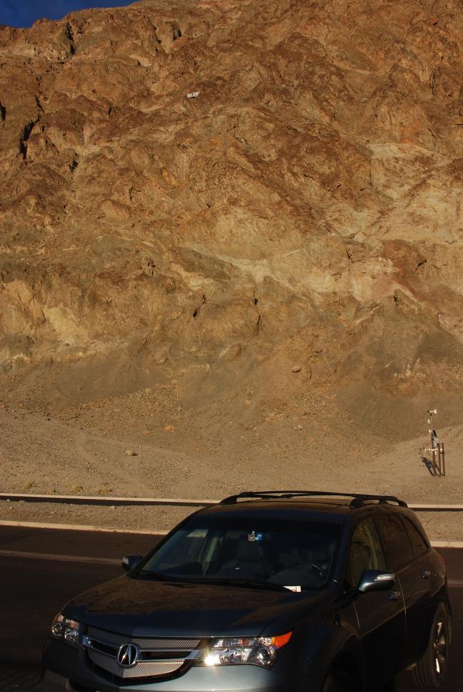 Looking up at sea level sign |
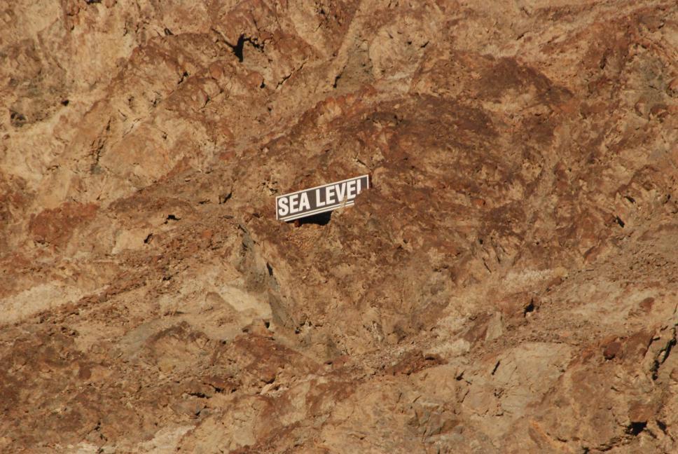 Sea level sign way up the rocks |
 Sunset at Stovepipe Wells |
 |
|
Death Valley from Dante's View |
Zabriskie Point |
30 July 2009
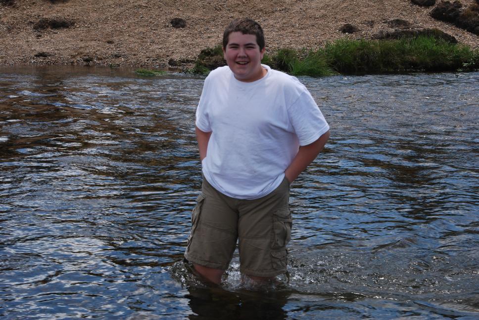
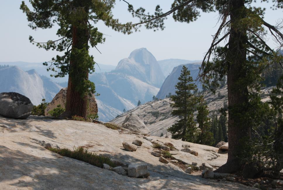
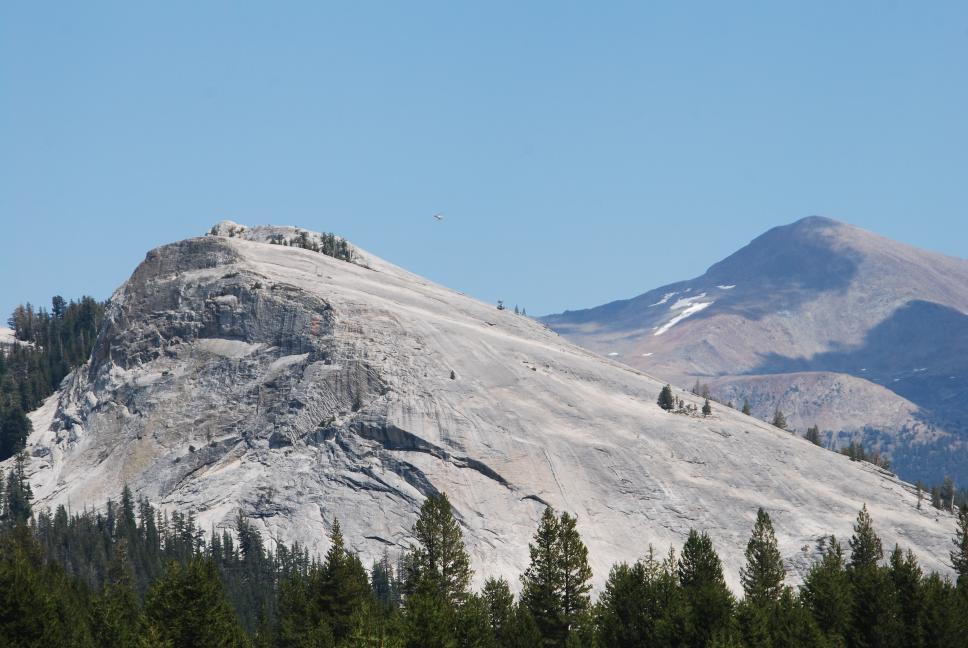
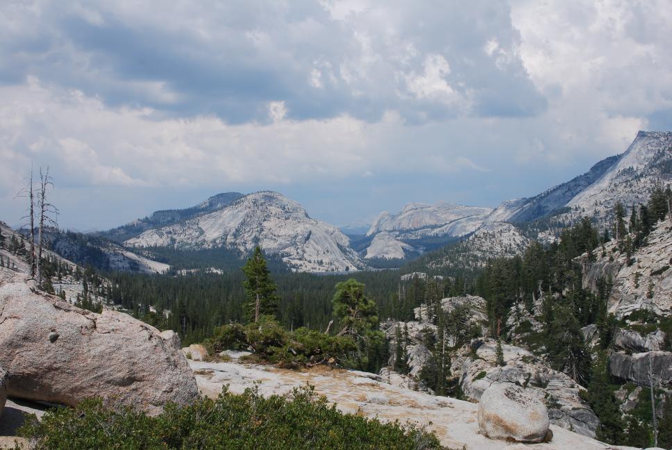
We drove the short distance from Mammoth Lakes to Mono Lake, and then entered Yosemite National Park from the east entrance at Tioga Pass. We stopped in Tuolumne Meadows, where Chris flew his plane again, and continued on to Tenaya Lake at 8150 feet. Chris and Nathan went swimming in the lake, which was cold but clear. A few miles further we stopped at Olmsted Point, before continuing to Yosemite Valley. We spent a short time in the valley before driving to Glacier Point for sunset. We spent the night at a hotel just south of the park in Portal.
 Wading the Tuolumne River |
 Half Dome from Olmsted Point |
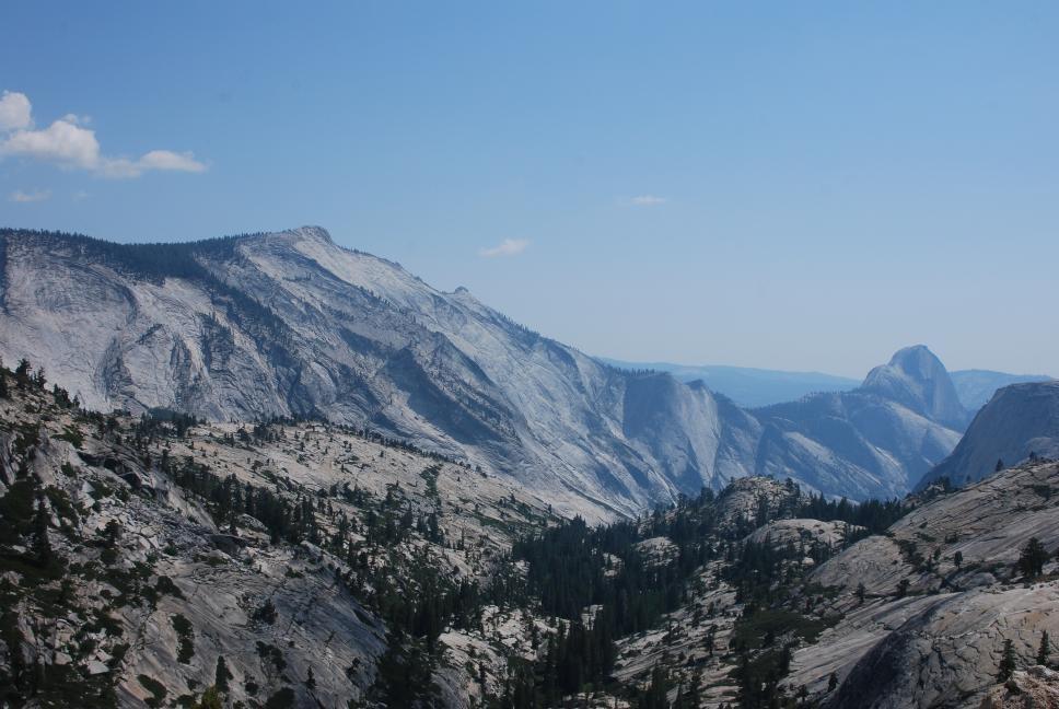 Half Dome from Olmsted Point |
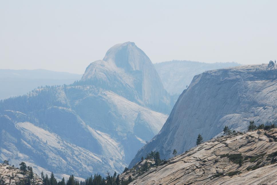 Half Dome from Olmsted Point |
 Lembert Dome |
 Tenaya Lake from Olmsted Point |
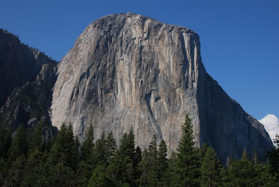 El Capitan |
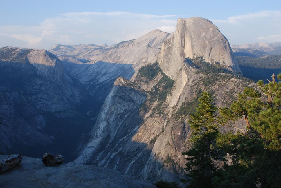 Half Dome from Glacier Point |
 Bridalveil Falls |
Glacier Point |
Tenaya Lake |
 Half Dome from Olmsted Point |
|
Olmsted Point panorama |
Mono Lake |
|
Glacier Point panorama |
Tenaya Lake |
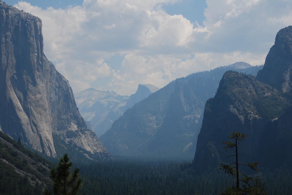
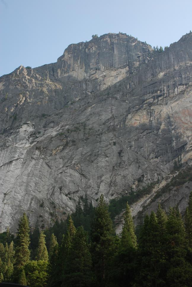
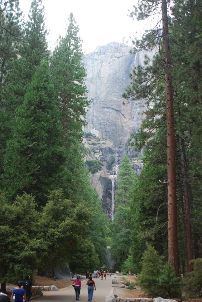
31 July 2009
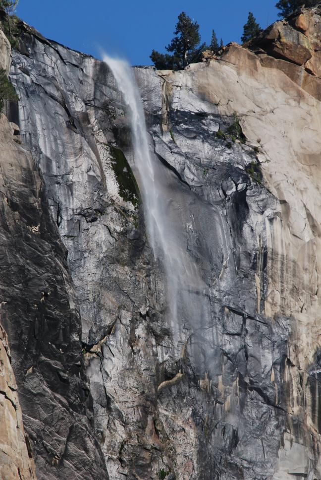
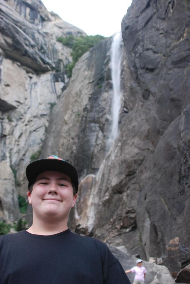
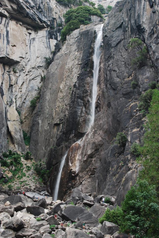
| We drove back into the park, and rented a raft for lazy river trip down the Merced River in Yosemite Valley. That was incredible; the 3000 foot cliffs on either side and the cool, clear waters of the Merced made the day seem to go on forever. After floating down the Merced for several hours, we walked out to Yosemite Falls. After walking to the base of the falls, we drove north-west out of the park and stopped for dinner at the Iron Door Saloon in Groveland, one of the old gateway cities to Yosemite. The food was great, and the bar and restaurant have a lot of history. We drove on, finally reaching our hotel outside San Francisco very late. |
 Tunnel View |
 Glacier Point from valley floor |
 Lower portion of Yosemite Falls |
 Lower portion of Yosemite Falls |
 Yosemite Falls |
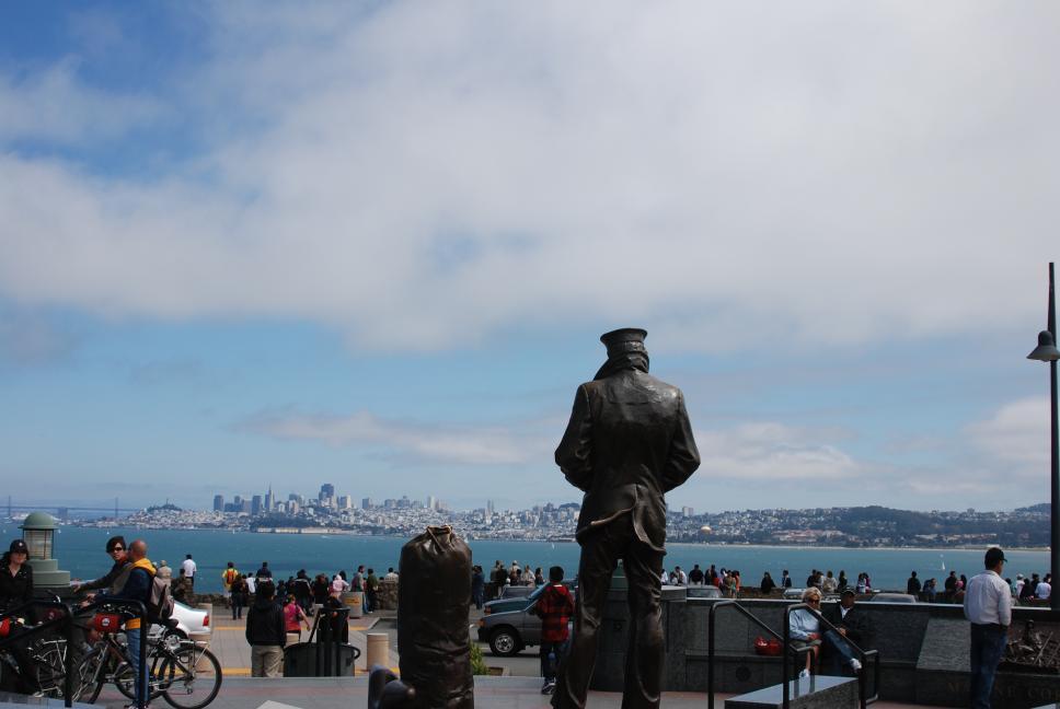
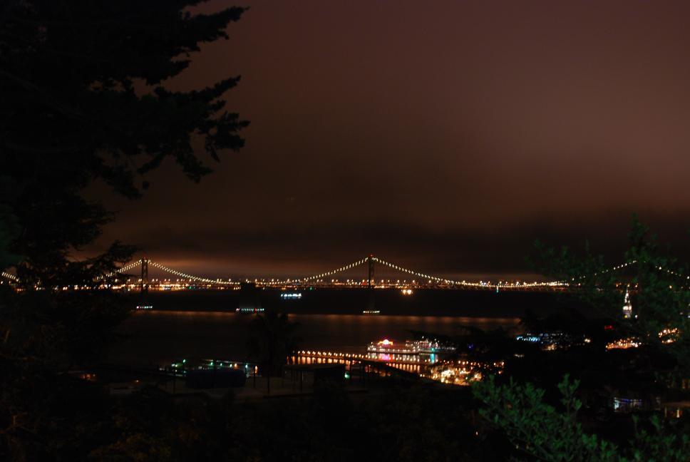
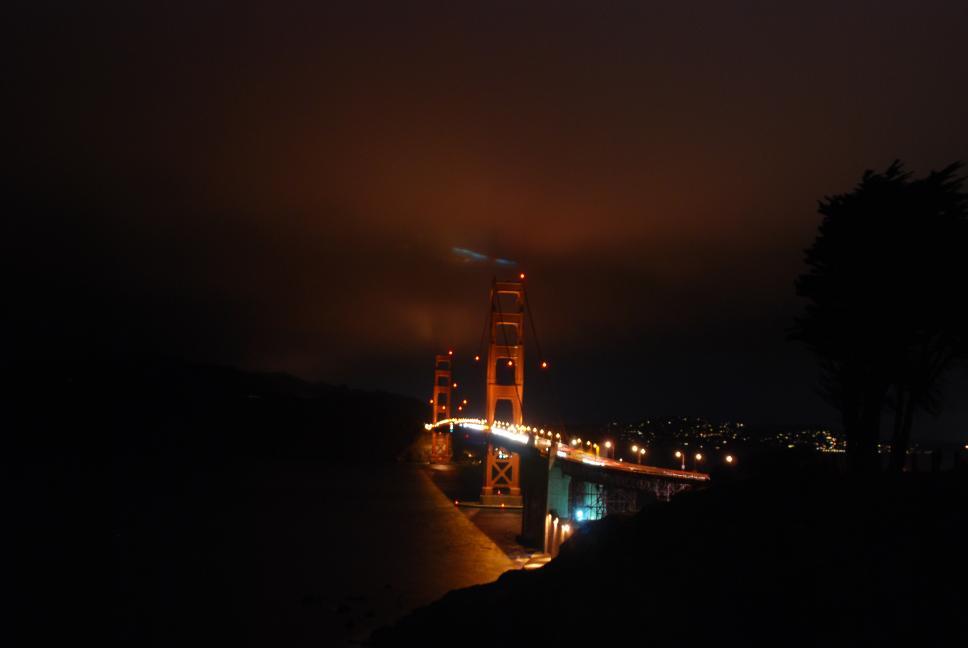
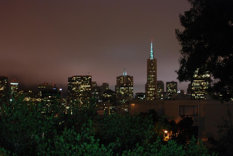
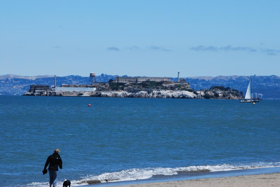
1 August 2009
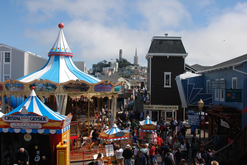
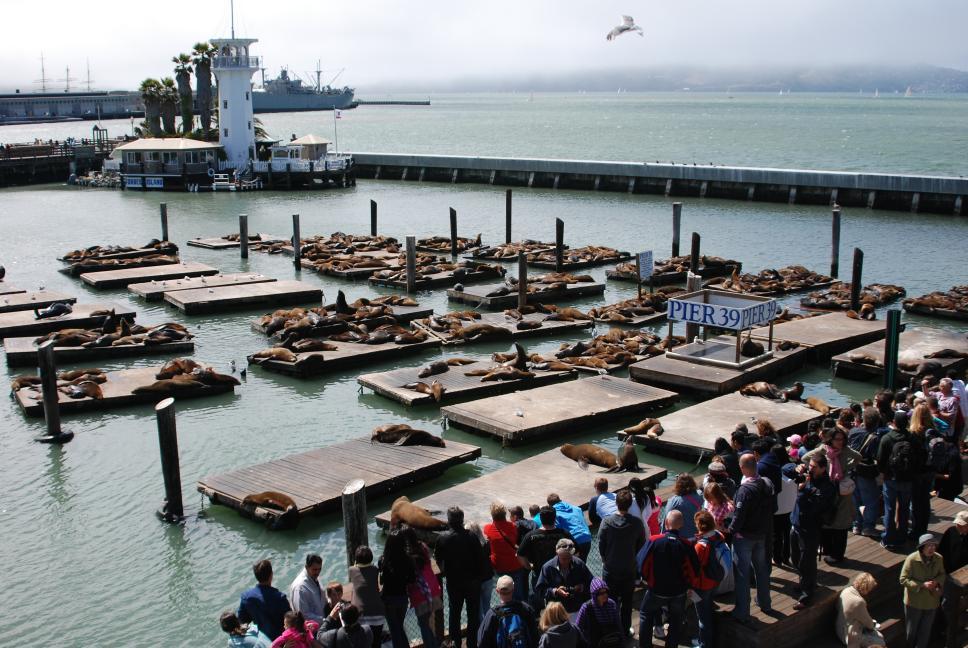
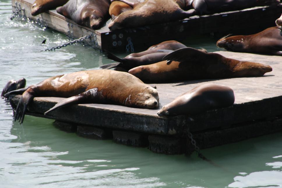
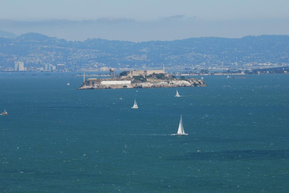
We had another hotel in Oakland for the next few days, right next to a BART (Bay Area Rapid Transit) station. We took the BART into the city and explored. The first day we walked up to Fisherman's Wharf and had dinner overlooking Alcatraz, before heading back to our hotel. We then got our car from parking, and drove across the Bay Bridge into San Francisco and explored.
 |
 |
 |
|
 |
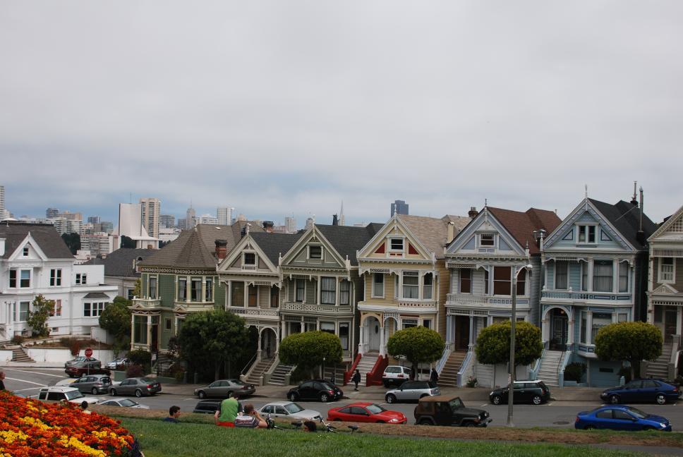
2 August 2009
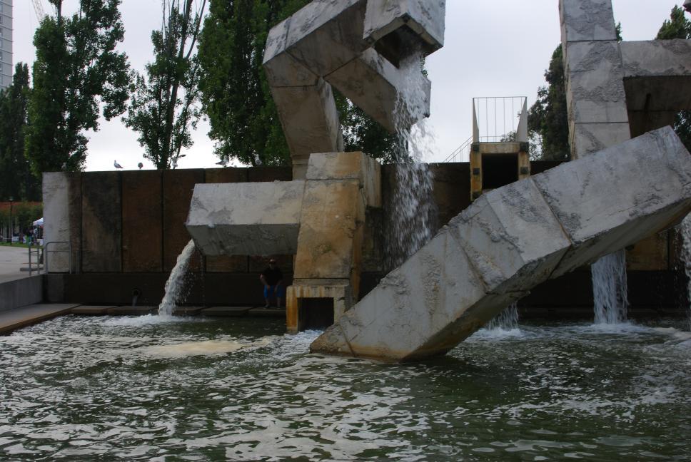
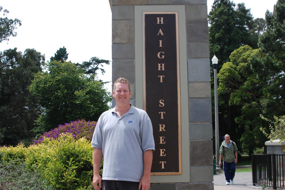
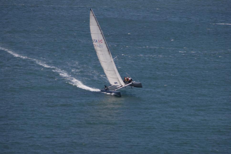
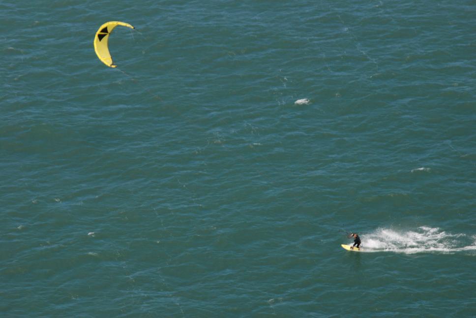
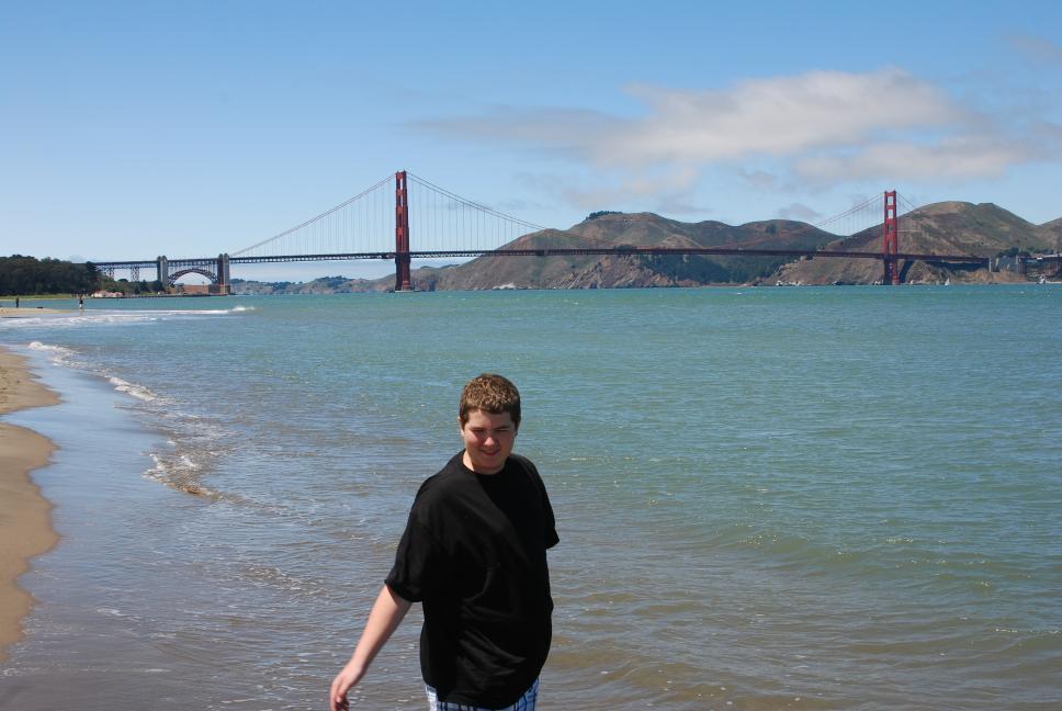
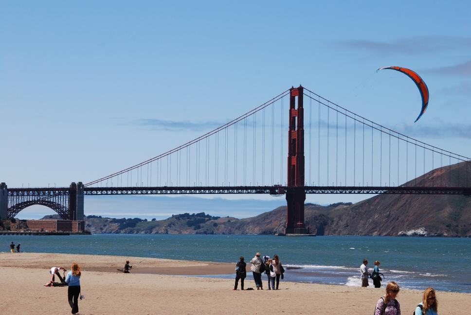
| We took the BART back into San Francisco, and bought tickets for a hop-on/hop-off bus tour. We visited a lot of city, having lunch at a Mexican restaurant in Haight-Ashbury, and walking across the Golden Gate Bridge. After returning to our hotel, we took our car into the city again, visiting some spots we had seen on the tour, and trying out Lombard Street and other steep hills in the city where the bus was not allowed. | 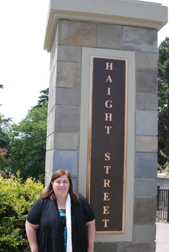 |
 |
 |
 |
 |
 |
 |
 |
 |
|
 |
 |
 |
 |
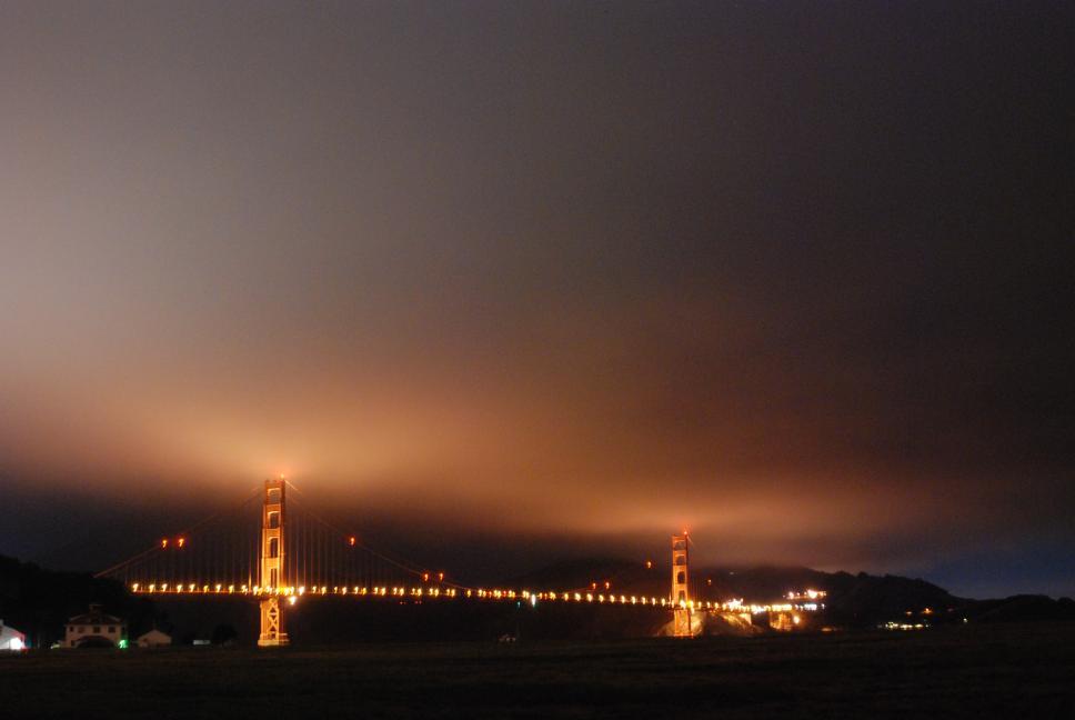
3 August 2009
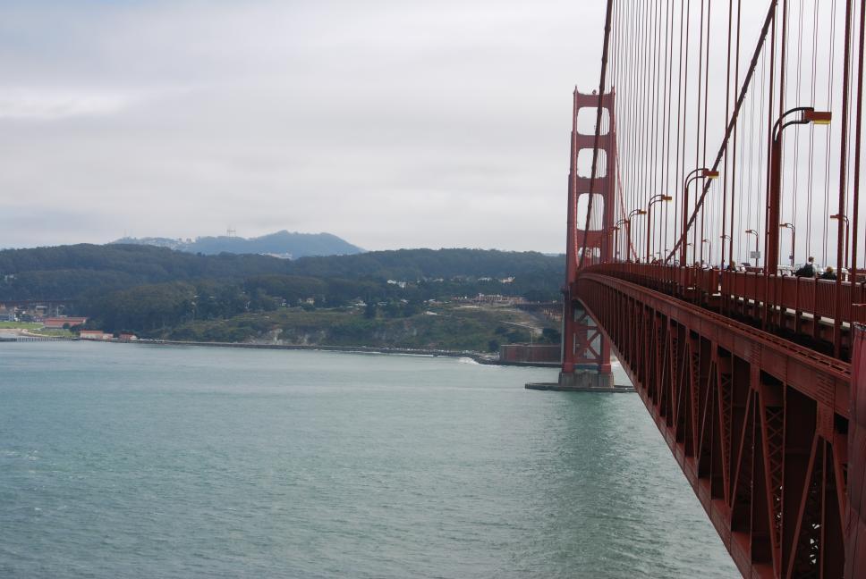
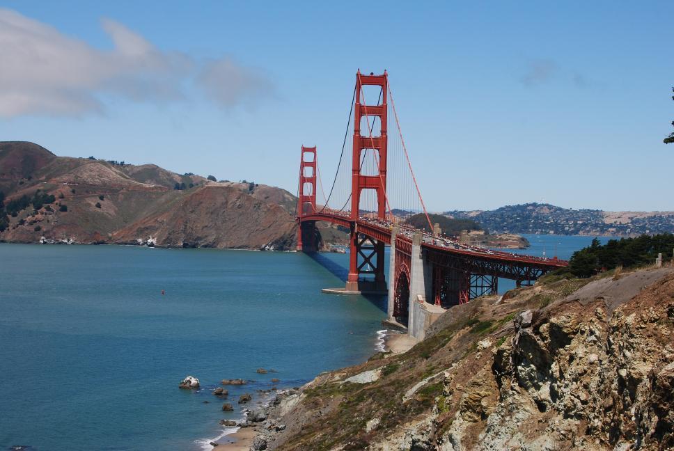
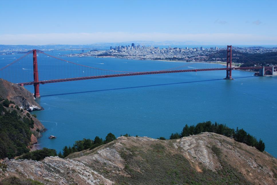
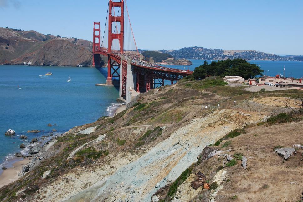
| We checked out of our hotel in Oakland, and drove through the city, across the Golden Gate Bridge, and west into the Marin Headlands, part of the Golden Gate National Recreation Area. We then drove north to Sonoma, where we bought some wine, cheese, and gourmet snacks at the Sonoma Cheese Factory. The cheese and snacks fed us lunch for the next several days. We continued on through Napa, and finally headed east to Truckee, just north of Lake Tahoe. |
Fine Arts Museum |
|
 |
 |
 |
 |
 |
 Hawk slope soaring at Golden Gate Bridge |
 |
 |
 |
 |
 |
 |
4 August 2009
| We drove south and around Lake Tahoe, counterclockwise, stopping at several beautiful overlooks, before heading north and west to Wendover, Utah and finally Salt Lake City. | 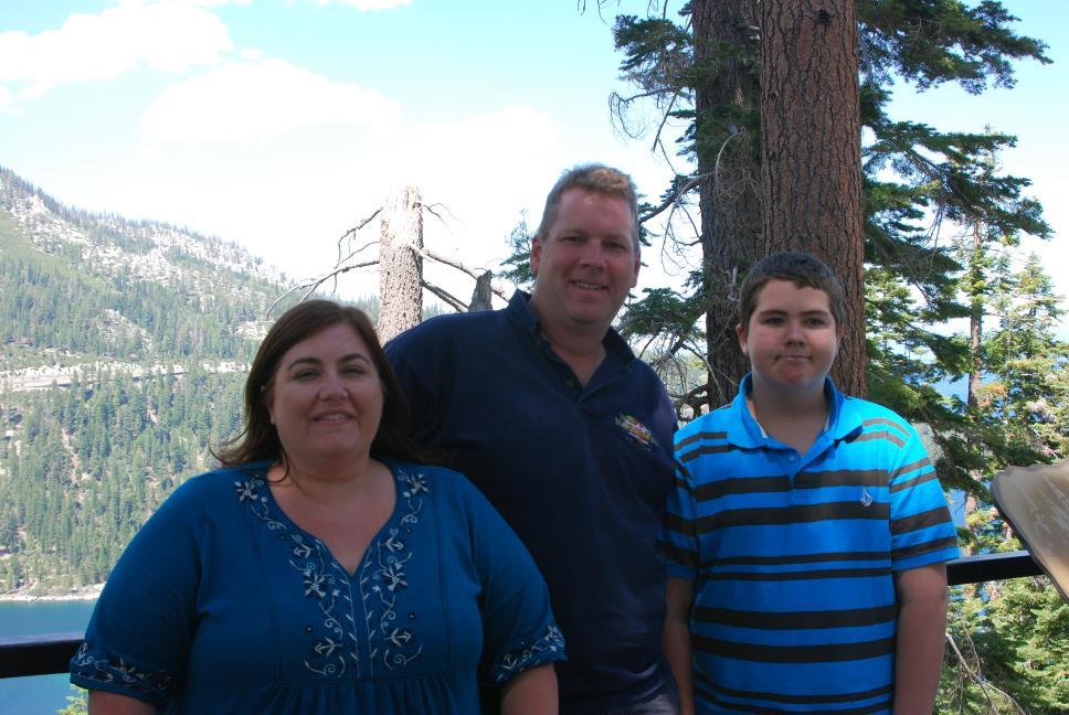 |
|
 |
5 August 2009
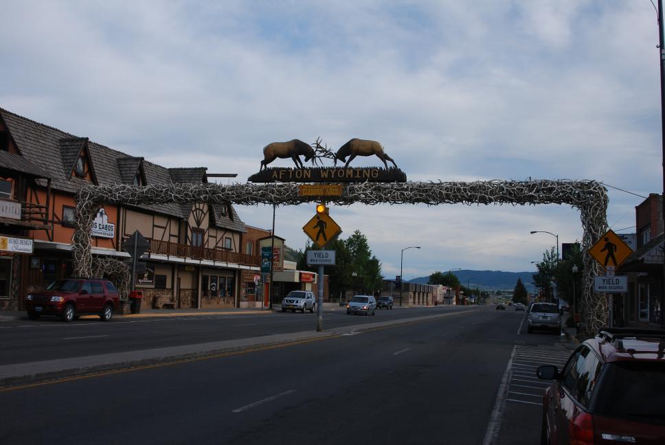
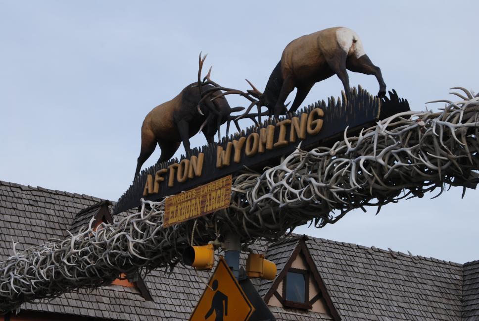
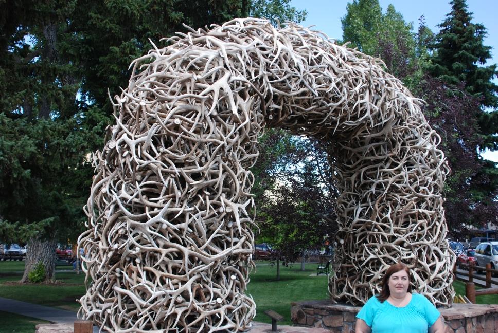
| We got up, drove around Temple Square, and had lunch at the Red Iguana, which has very good Mexican food. We then drove north and east out of the city, stopping at Bear Lake, where Chris flew his plane yet again. We then continued on to Jackson, Wyoming. On the way, we passed through Afton, Wyoming, which has the "World's Largest Elkhorn Arch". |
 |
 |
Bear Lake |
6 August 2009
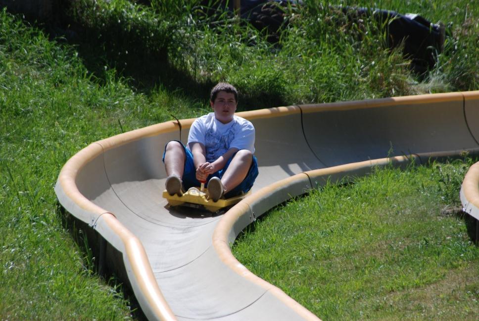
Jackson is known for its skiing, but those same slopes have summer uses too. We rode the alpine slide in Jackson and then went into Grand Teton National Park. We spent several hours visiting Jenny Lake, Jackson Lake, and Signal Mountain, before driving north to Yellowstone National Park.
 |
 Jackson Elkhorn Arch |
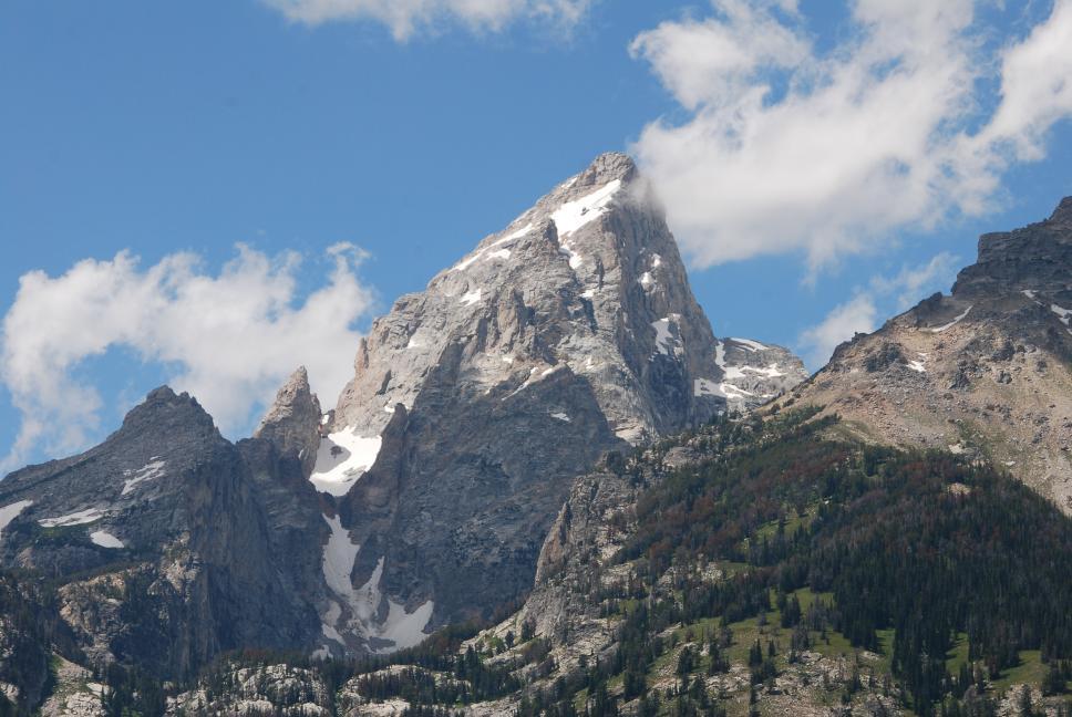 Grand Teton |
 |
 Jackson Hole valley |
Grand Tetons across Jackson Lake |
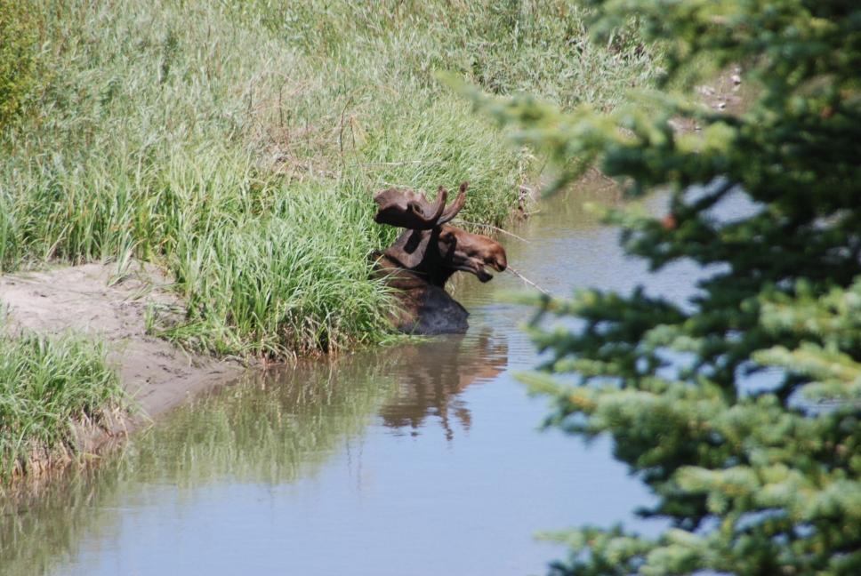 Moose (at Moose, Grand Tetons National Park) |
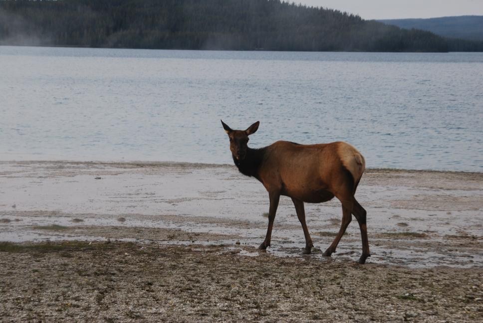
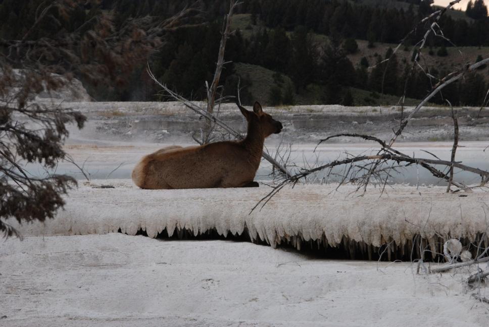
Look at the attached Yellowstone map to understand the park layout. There are two main loops; north and south. If you have time, do both; we spent two full days to do both loops, entering at the South Entrance and going clockwise around the two loops together. We stayed at Old Faithful - Snow Lodge the first night and Mammoth the second night. Old Faithful is crowded, Mammoth is quiet and relaxing. We say 3 bear, including one grizzly, and lots of bison, elk, foxes, deer, etc.
There are some things we had on our "had to see" list: Yellowstone Lake, Old Faithful, Upper Geyser Basin, Grand Canyon of the Yellowstone, and Hayden Valley.
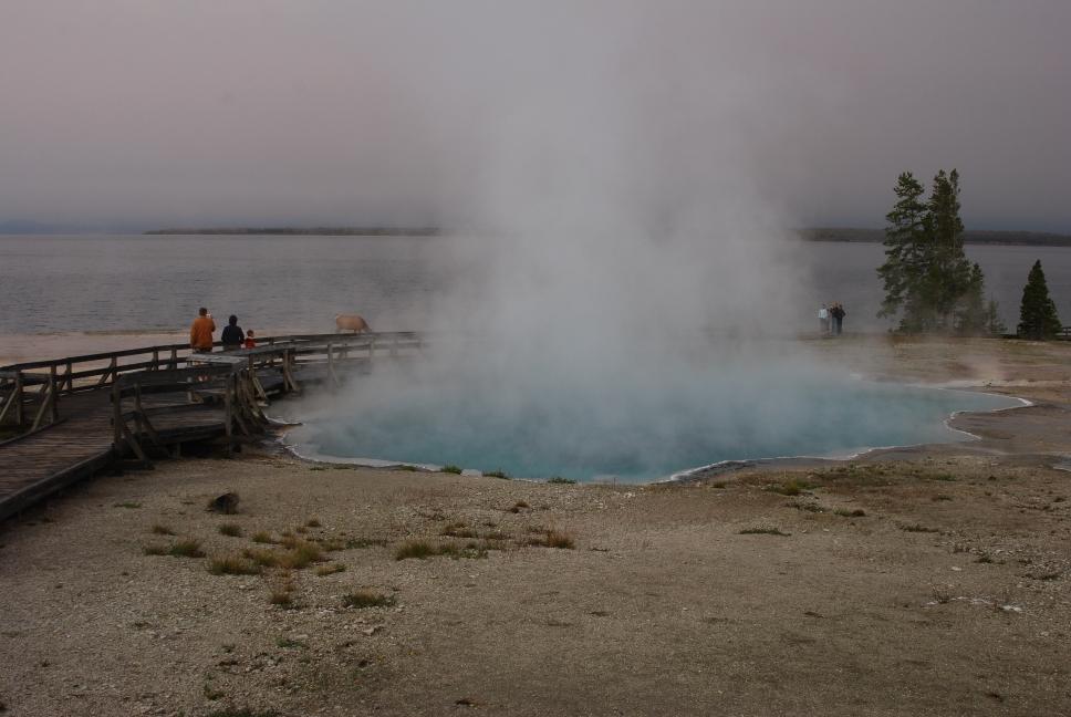
After entering via the South Entrance, we drove north and stopped at West Thumb Geyser Basin. It is neat, and not too crowded. It doesn't take too long, and it is on the shore of Lake Yellowstone. We then drove west on the lower loop and reached the Snow Lodge at Old Faithful in the dark, before having dinner at the lodge restaurant. Chris had stayed at Old Faithful Lodge on one of his trips with his parents when he was younger, and we stayed at the Snow Lodge; they are both very nice. The Old Faithful Inn is the oldest inn and has a huge beautiful lobby. Note: If you stay at the Snow Lodge, make sure not to get a room above the kitchen. During the day there is no problem, but when they run the dishwashers at night, the sound comes up through the heating system and you can't get to sleep.
 |
 |
West Thumb Geyser Basin |
 |
 |
7 August 2009
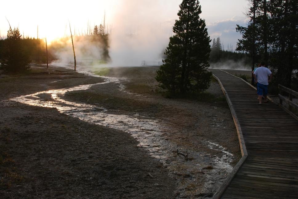
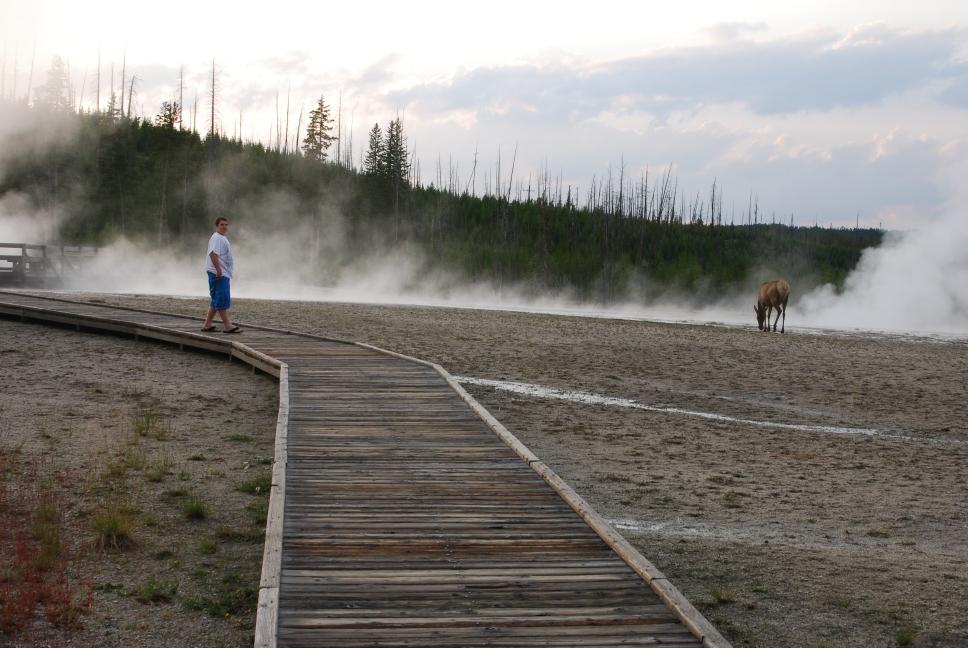
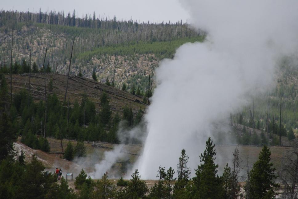
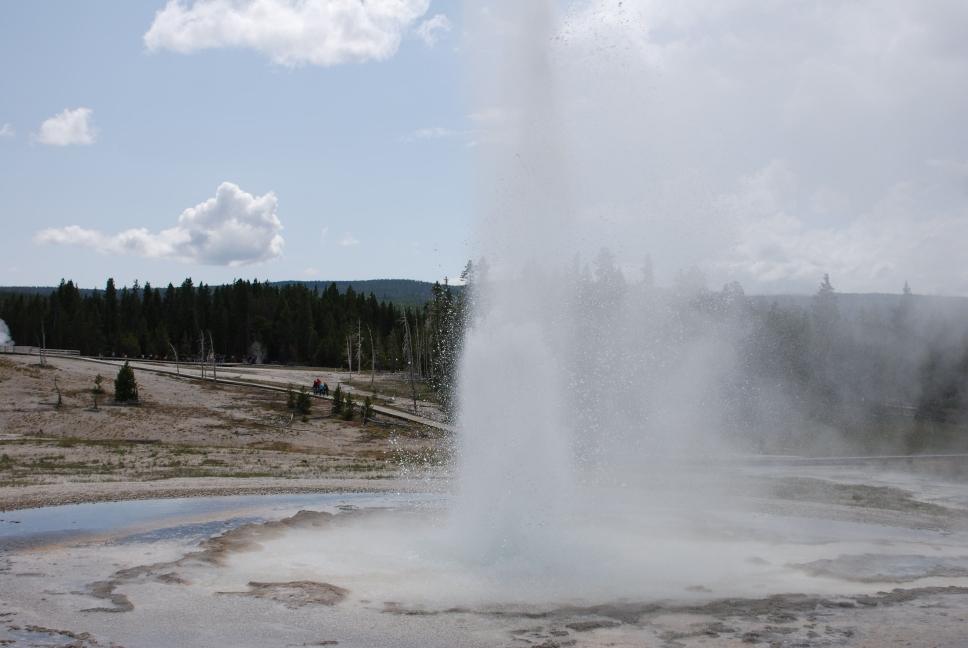
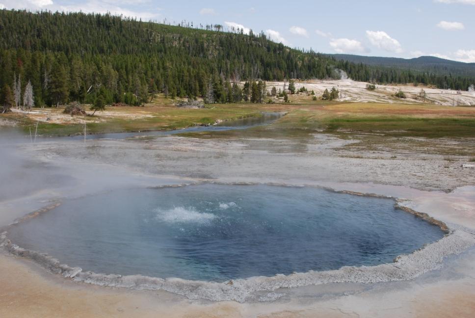
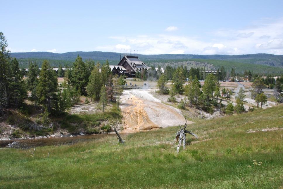
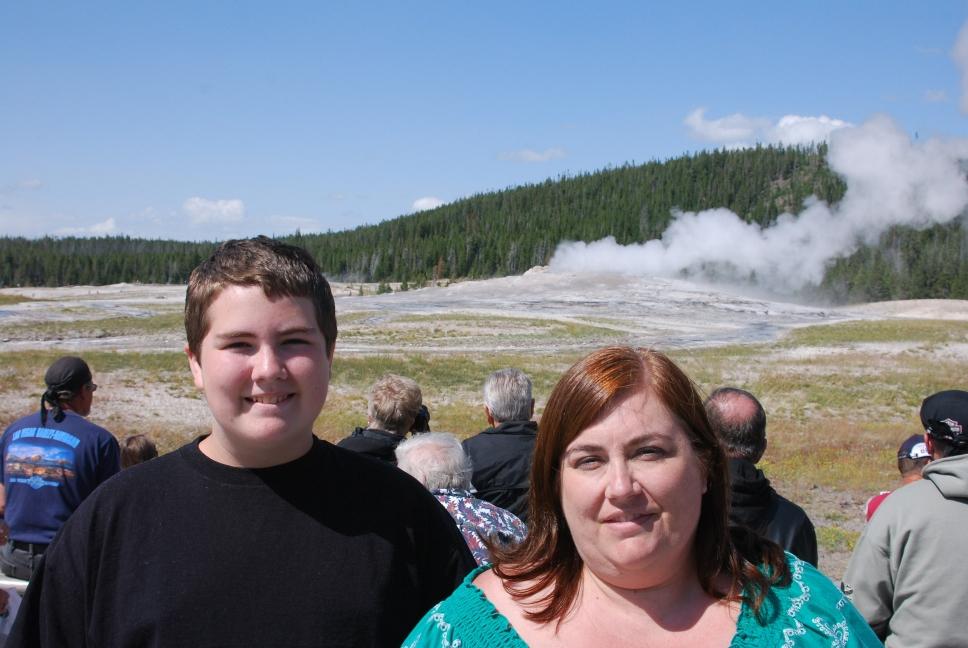
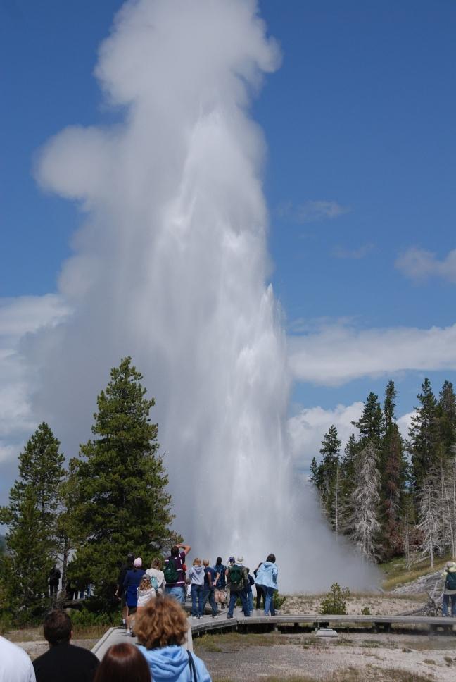
We hiked around the Upper Geyser Basin, which includes Old Faithful, and saw many geysers and hot springs. It is a couple mile walk round trip, but there are lots of geysers and hot springs. The expected eruption times for each geyser will be posted at the visitor center next to Old Faithful, and at the check-in desks at the 3 inns and lodges.
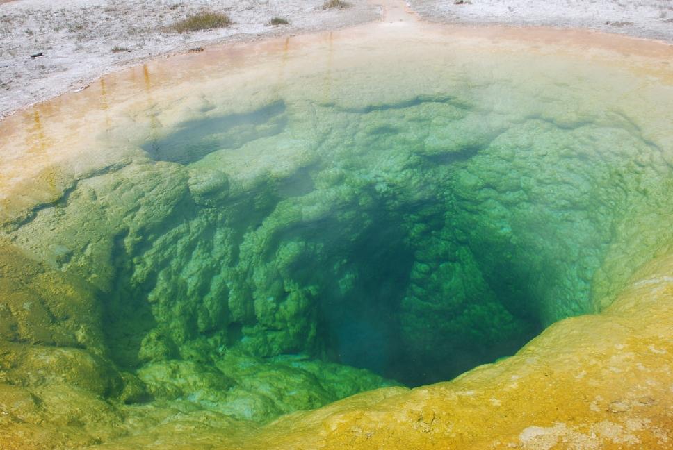
We drove west towards Madison, stopping at Midway Geyser Basin with giant Grand Prismatic Spring. From Madison, we headed towards Norris. There was construction between Madison and Norris, so it took a while to get through there. Norris Geyser Basin has lots of geysers and hot springs. Chris walked it on his last trip to Yellowstone in 1989, but we decided to skip it this trip. It is nice and not crowded, but we were running out of daylight and wanted to reach Mammoth before dark. We continued around the upper loop to Mammoth, and stayed at the Mammoth hotel in a single cabin. They are not too expensive and are private. We drove through Mammoth Hot Springs and walked out to the travertine terraces.
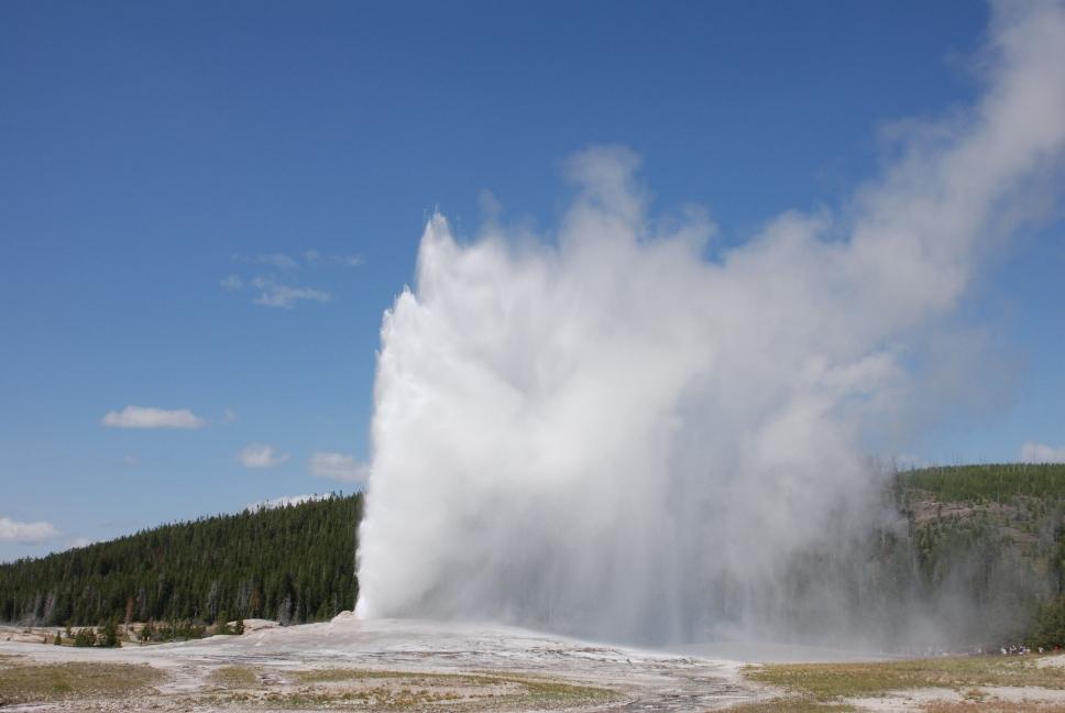 Old Faithful |
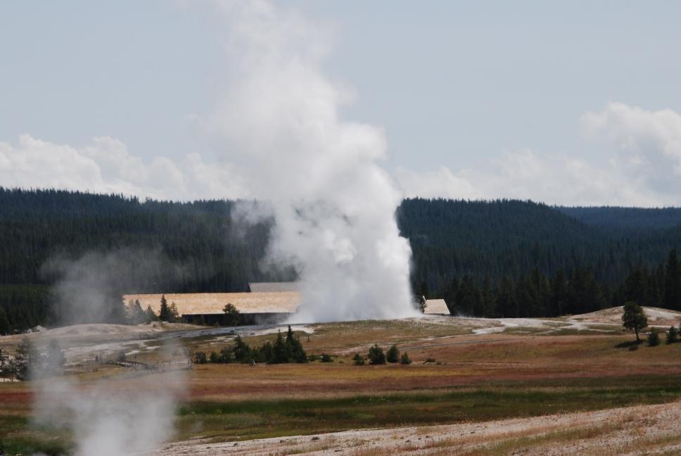 Old Faithful |
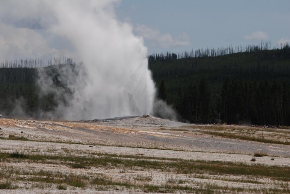 Old Faithful |
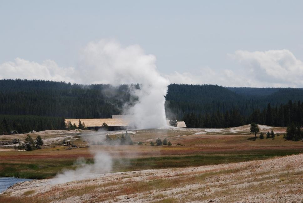 Old Faithful |
 Upper Geyser Basin |
 Upper Geyser Basin |
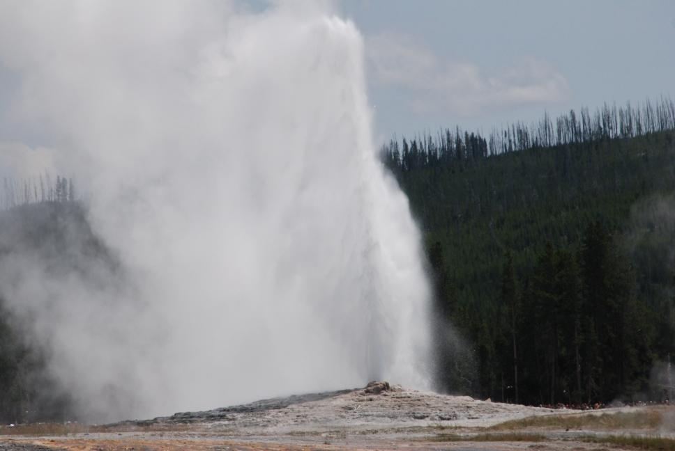 Old Faithful |
 Upper Geyser Basin |
 Morning Glory Pool |
 Old Faithful Inn |
 Old Faithful |
 Upper Geyser Basin |
 Midway Geyser Basin |
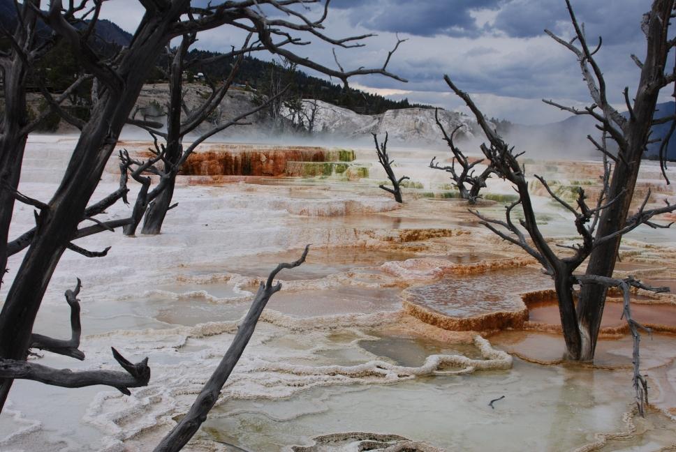 Mammoth Hot Springs |
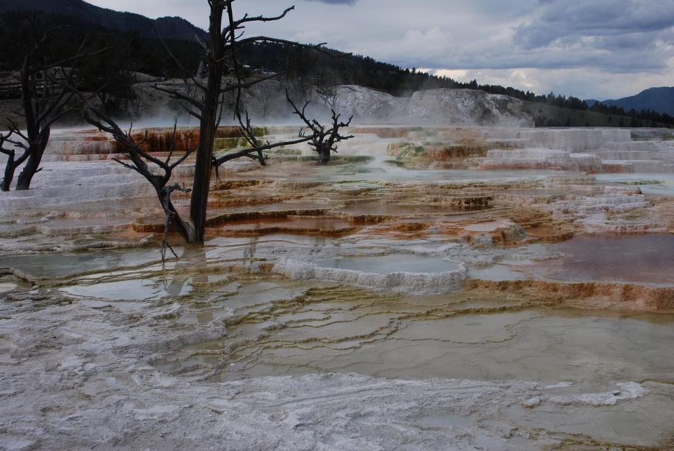 Mammoth Hot Springs |
 Mammoth Hot Springs |
 Bear between Old Faithful and Madison |
Grand Prismatic Springs Midway Geyser Basin |
8 August 2008
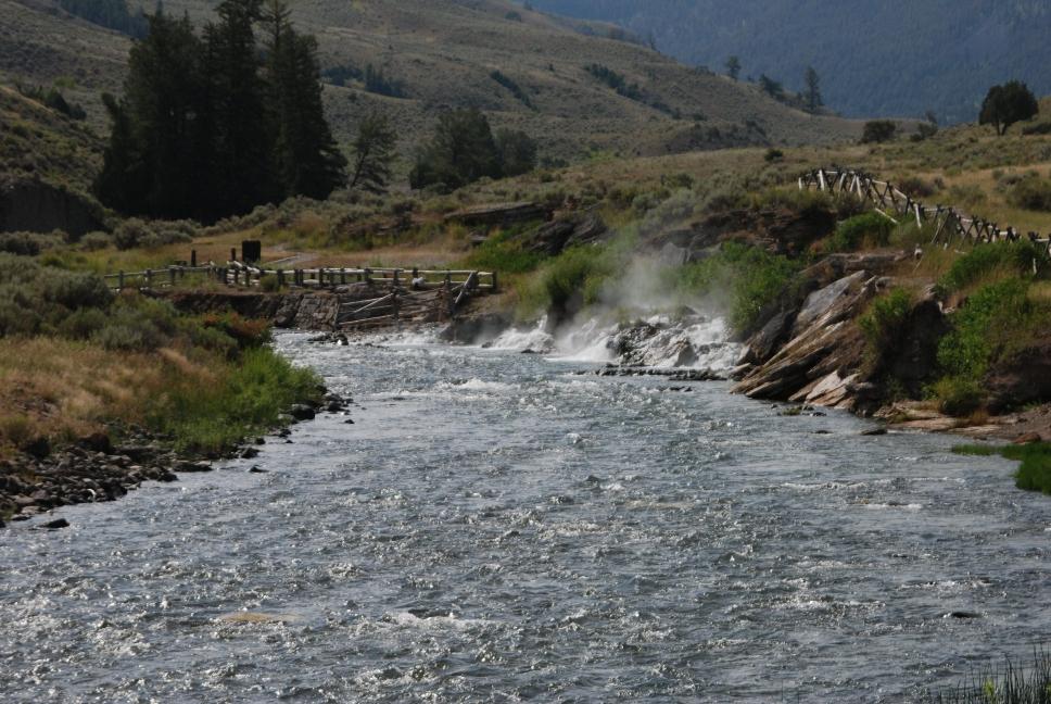
| We read there are only two places in the park where you can go into water with hot springs heating it, and we could only find one. On the road from Mammoth to Gardiner, about three miles north of Mammoth, you cross the border into Montana. Right at the border are parking lots of each side of the road. Park in the lot to the right of the road, and follow the trail along the river for about half a mile to the swimming area. The river is freezing, but hot springs run into the water and make a nice spot to sit and relax. There are signs in the parking lot saying where to go, but this is not advertised by the park service anywhere. | 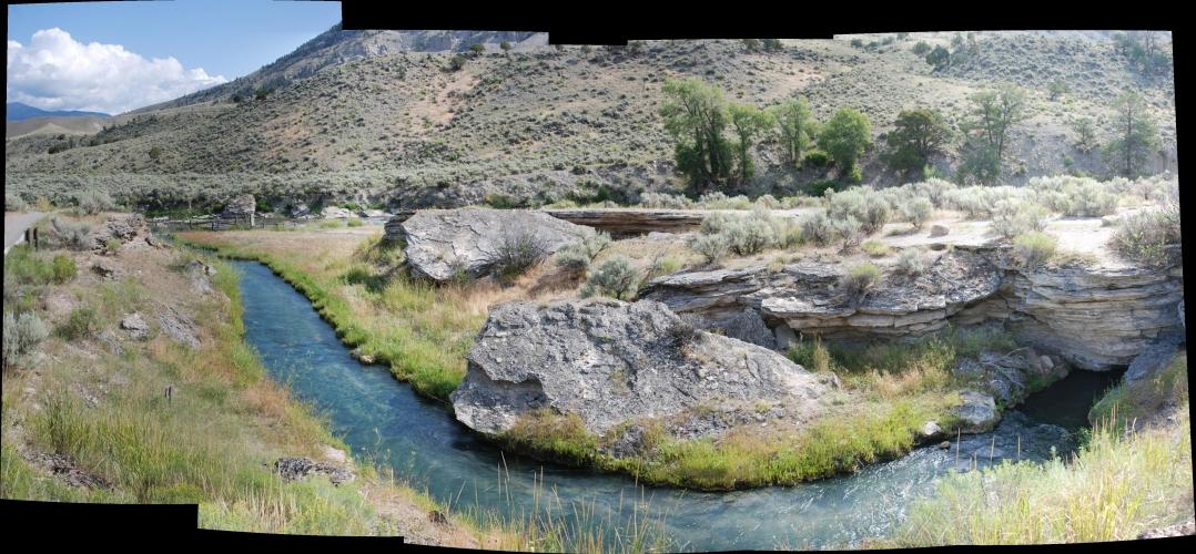 |
|
 |
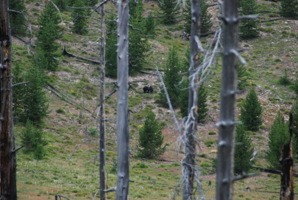
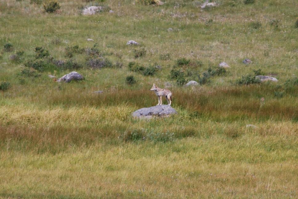
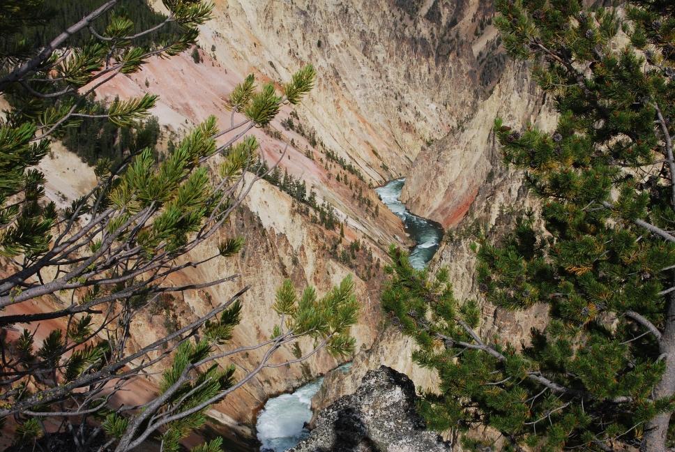
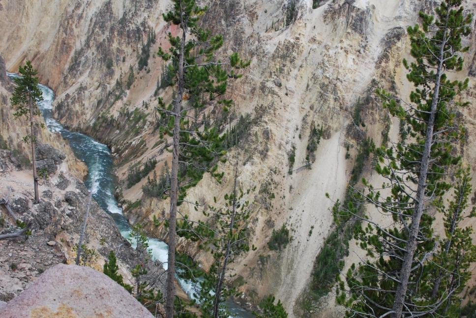
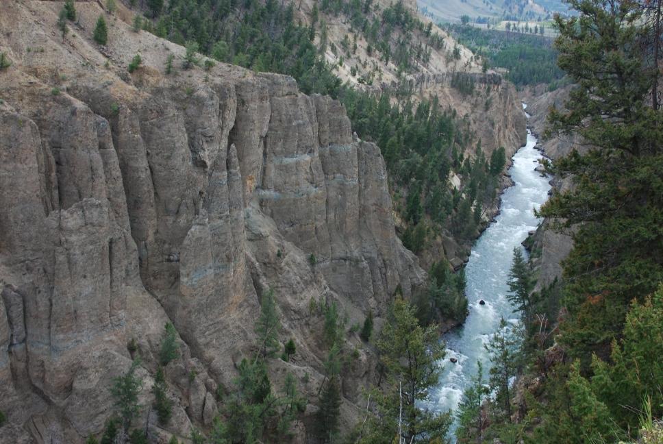
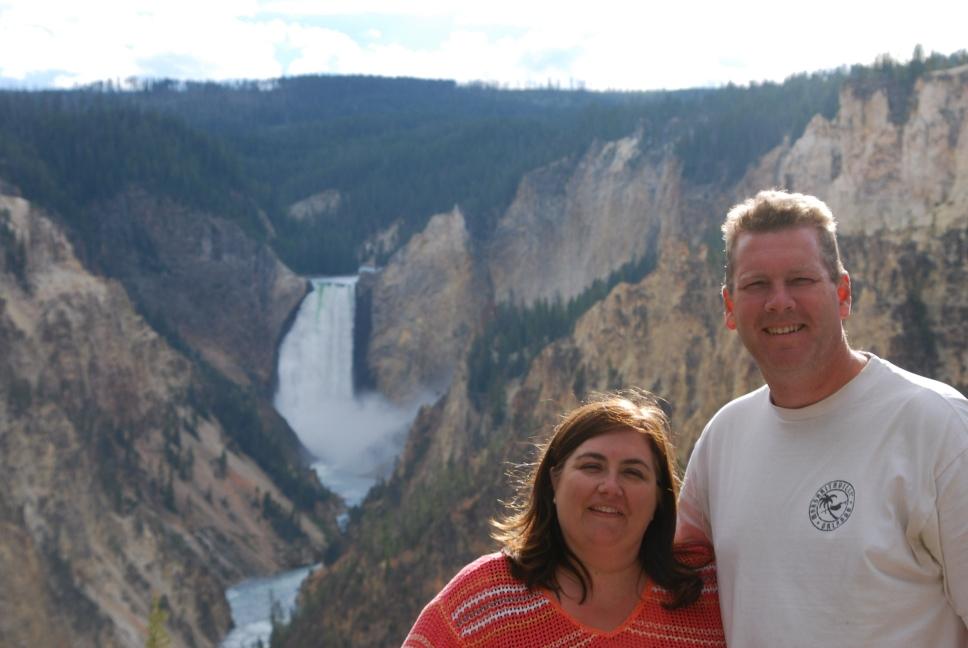
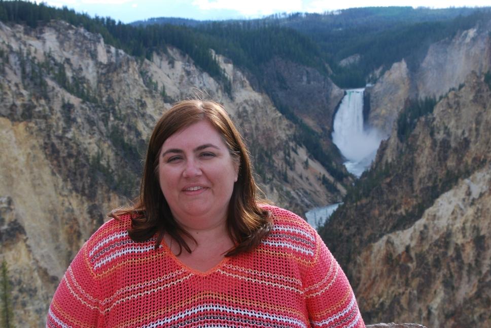
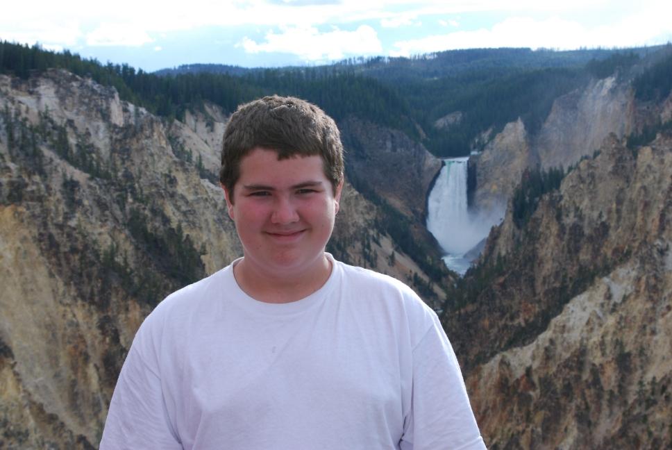
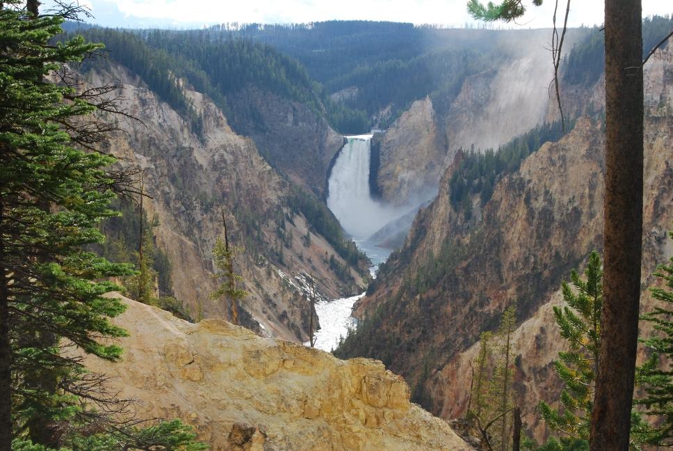
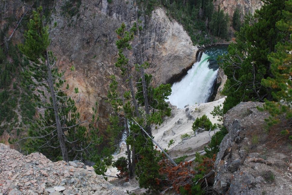
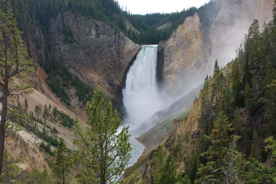
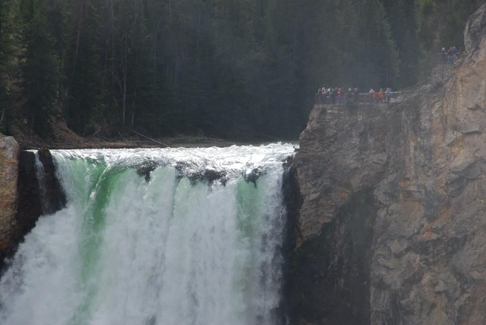
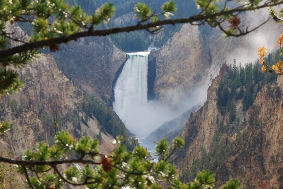
| We then continue around the upper loop clockwise. There are big open valleys between Mammoth and Roosevelt, so we looked for bear and elk, and did see a grizzly. Chris also flew his plane over one of these big open valleys and go some great aerial photos. Roosevelt has some cabins and a nice restaurant. A few miles past Roosevelt going south is Tower Falls; worth a look but much smaller than the main falls at Canyon Village. We kept going south to Canyon Village, and spent several hours to drive the east and west rim drives around Grand Canyon of the Yellowstone. The west rim drive has lots of good view points right from the parking lot, and we hiked down into the canyon at Red Rock Point. The trail descends 500 feet in 3/8 mile, and ends at a nice viewpoint. We then drove around to the east rim, and got out and walked the short distance from the parking lot to Artist Point on the east rim drive. That view is worth it. | 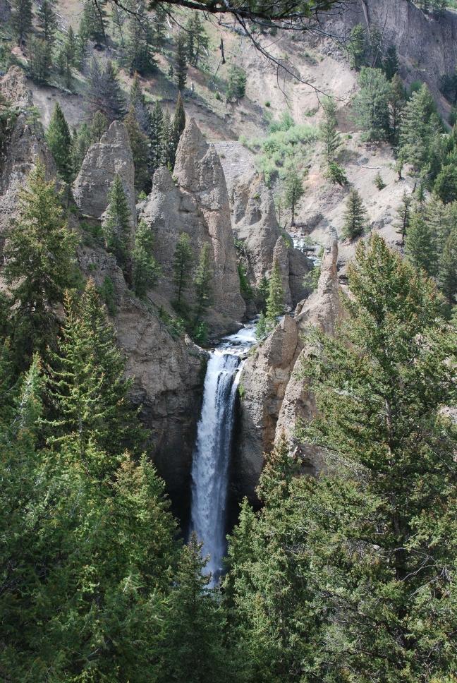 Tower Falls |
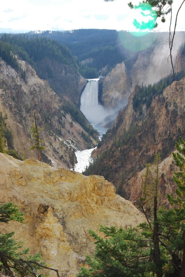 Yellowstone Falls |
 |
 |
 |
 |
 |
 |
 |
 |
 |
 |
 |
 |
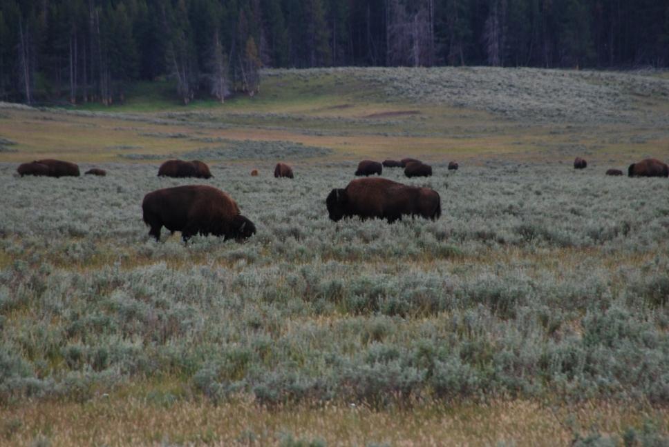
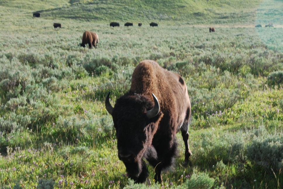
| We continued south through Hayden Valley, heading towards Fishing Bridge. Hayden Valley is full of bison; they are right on the road within a few feet of the car. From Fishing Bridge, we headed east and out the East Entrance. We stopped in Cody for dinner, and continued on to Sheridan, where we spent the night. |
 |
 |
9 August 2009
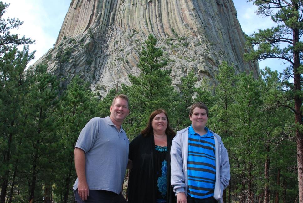
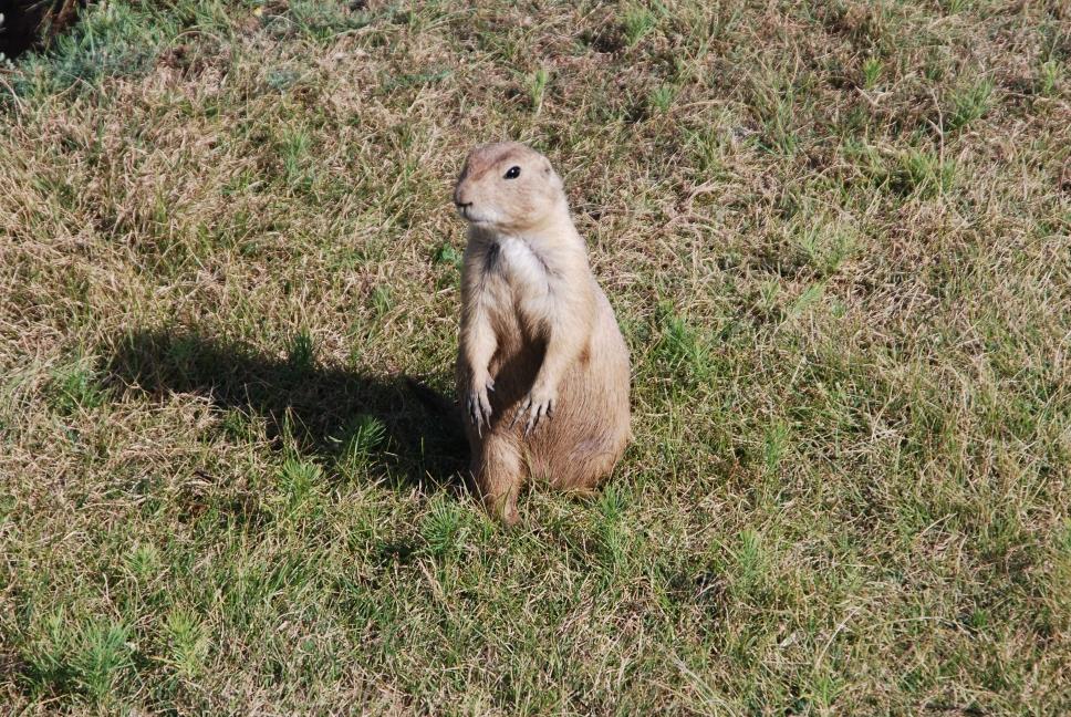
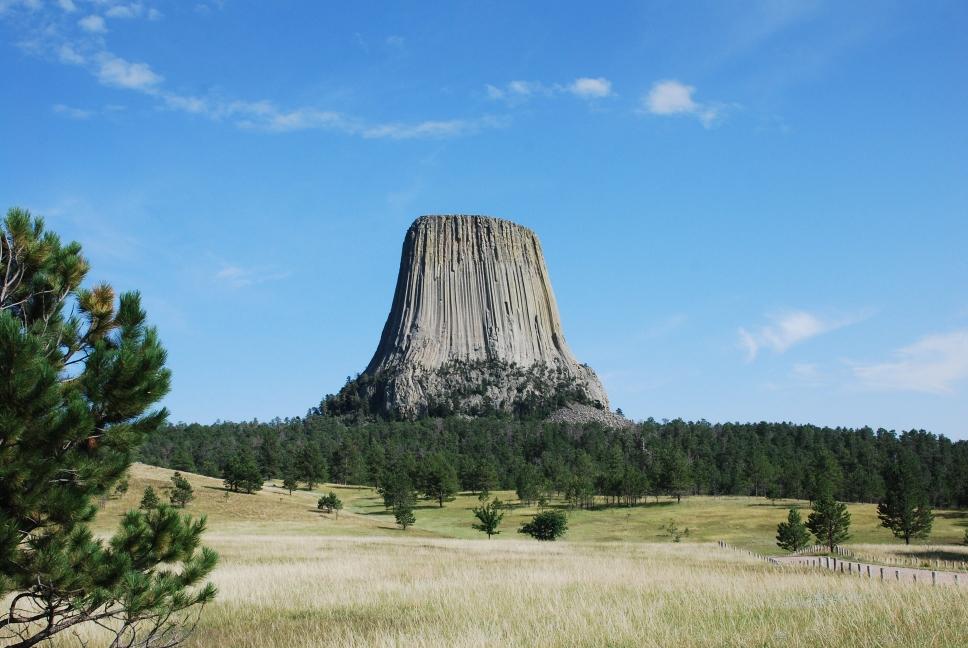
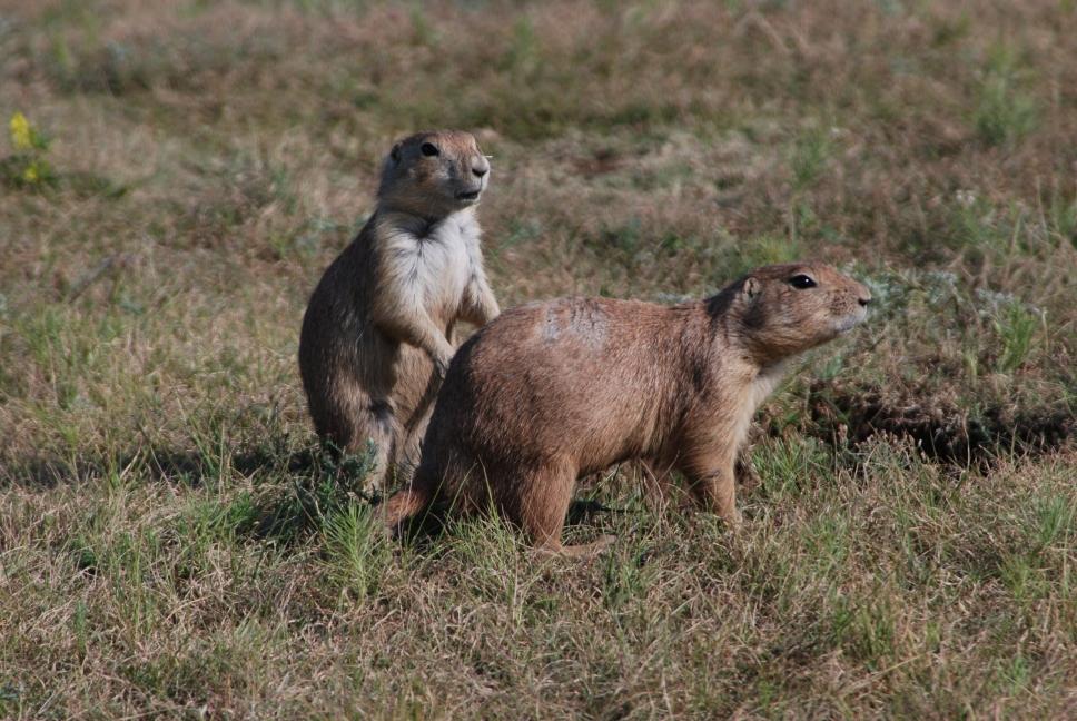
| We drove from Sheridan to Devil's Tower National Monument, where spent a few hours hiking around the rock formation, and Chris flew his plane again. The monument has a very large prairie dog town. We continued on to Rapid City, where we arrived early enough to enjoy the hotel's giant indoor water park. South Dakota seems to have lots of indoor water parks. |
 |
 |
 |
 |
 |
 |
10 August 2009
After spending more time at the water park in the morning, we drove to Mt Rushmore National Memorial, and then headed across South Dakota. We stopped for dinner at Wall Drug and drove through Badlands National Park, before stopping for the night in Sioux Falls.
 |
 |
 |
 |
 |
 |
 |
 |
 |
|
 |
11 August 2009
We drove from Sioux Falls to Chicago, and had a late dinner at the original Chicago-pizza restaurant, Lou Malnati's Pizzeria.
12 August 2009
We bought tickets for a bus hop on/hop off tour, and spent the day traveling around the city. We had dinner at the original Pizzeria Uno.
 |
 |
 |
 |
 |
 |
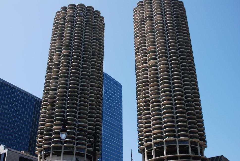 |
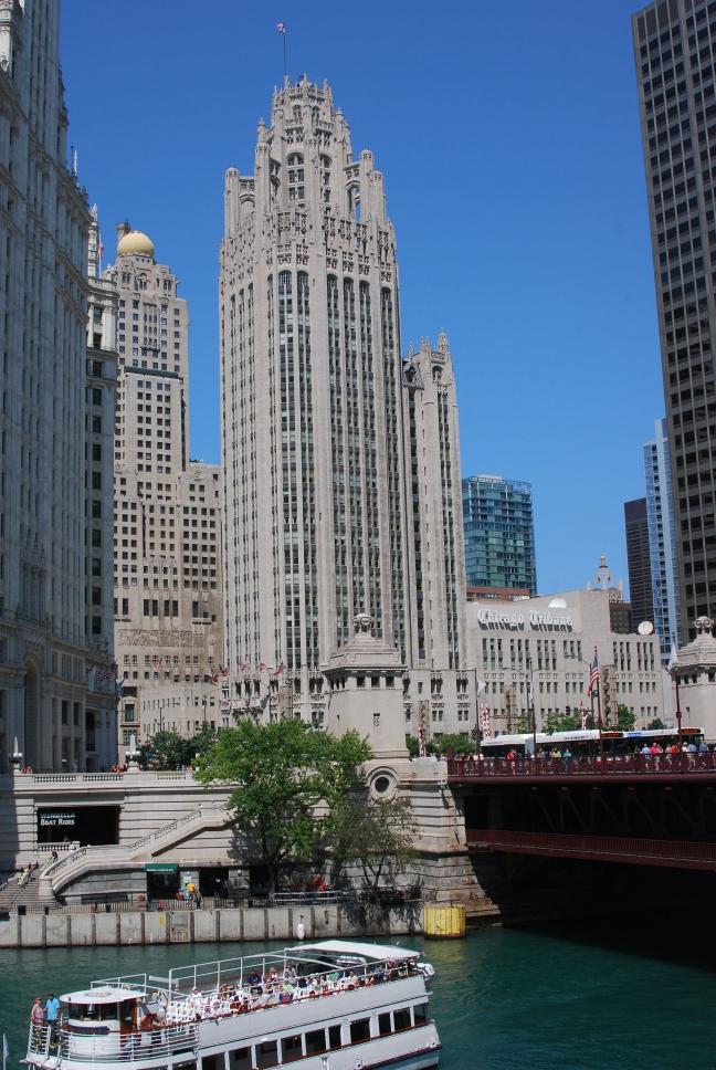
13 August 2009
| We drove over to the Field Museum and spent several hours. If you visit, check the prices for a family membership. It is good for a year, and they share membership with many museums around the country, so you can use the family membership in other places as well. There was special this day for only $90. Three individual tickets would have been more for a single day. We then returned to our hotel, before walking over to the Navy Pier and renting a quad bike to ride along the waterfront. Don't do that. They are not fun to pedal, and the waterfront is too crowded to make them easy to get around. We had dinner at the third well known Chicago-pizza place, Gino's East. We finished the night by going for a walk along the Chicago River at night. | 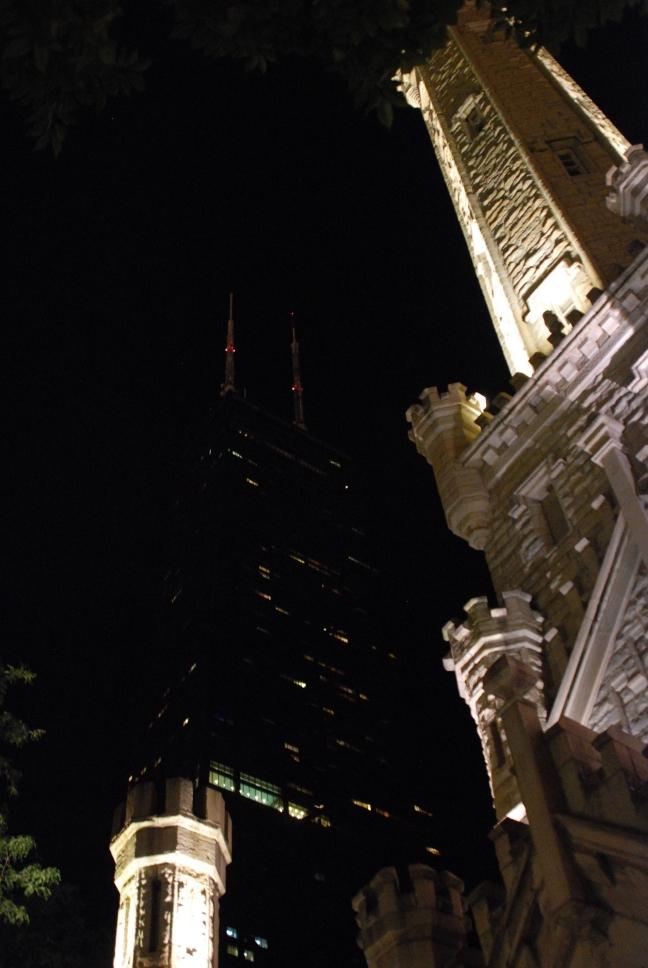 |
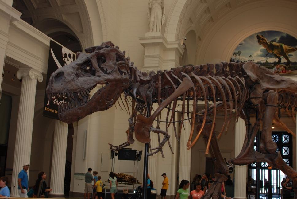 Sue the T-Rex |
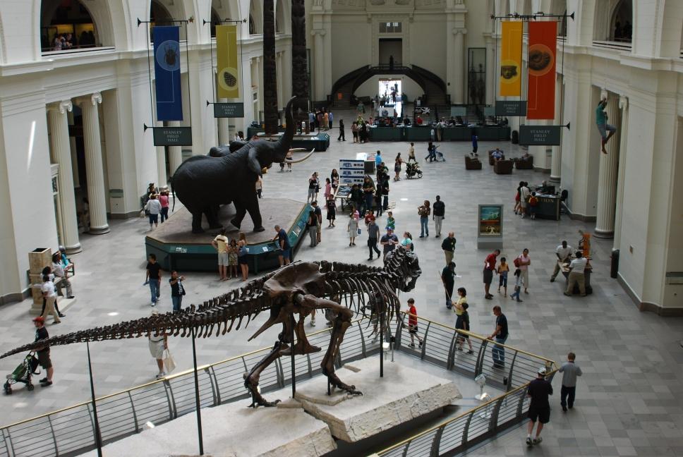 Field Museum |
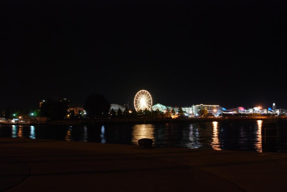 Navy Pier |
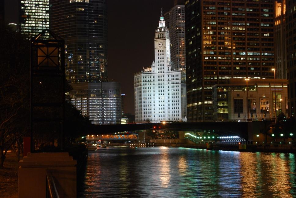 Chicago River |
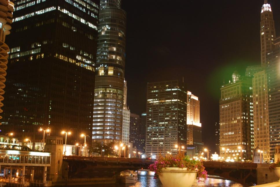 Chicago River |
Our final opinions on the three main Chicago-style pizza restaurants:
Pizza: #1: Lou Malnati's #2: Gino's #3: Pizzeria Uno
Hot Wings: #1: Pizzeria Uno - best wings we have ever had! #2: Gino's (we didn't try the wings at Lou Malnati's)
14 August 2009
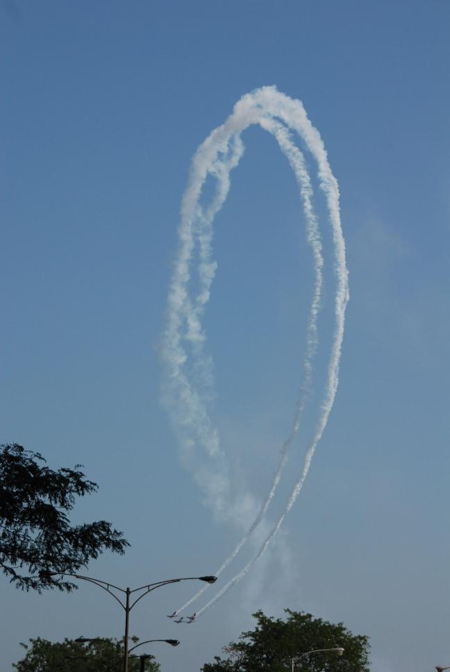
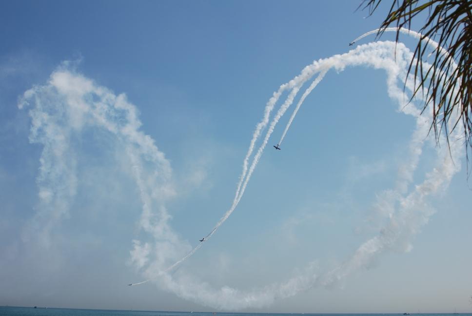
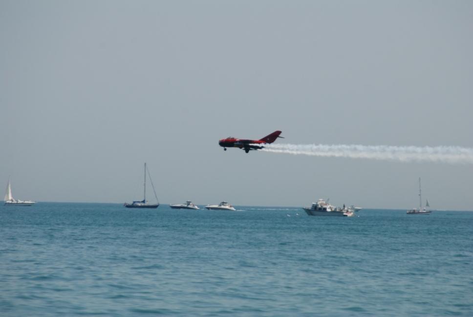
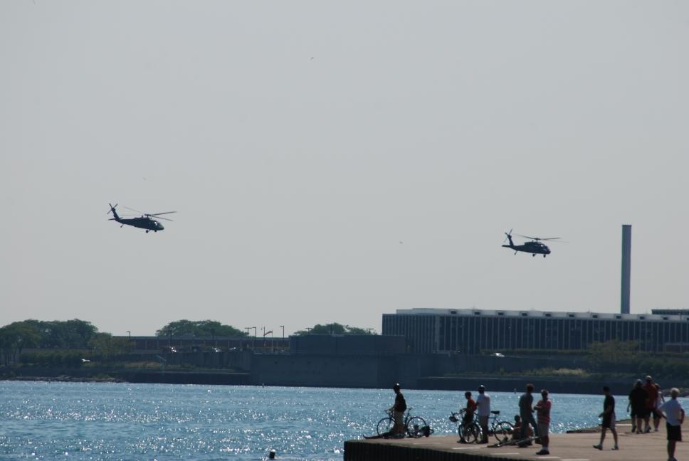
The annual Chicago Air and Water Show was scheduled for 15-16 August, and 14 August was the air show practice day. Chris got up early, quickly walked over to Oak Beach, and spent over an hour taking photos of the practicing airplanes, including the Thunderbirds. After he returned to the hotel, we checked out and headed towards Dayton, Ohio. Chris and Tami had met there when Chris was stationed at Wright-Patterson AFB and they lived there for 3 years. We had dinner at our favorite restaurant, Marion's Pizza, before continuing on to Tami's parents house in Charleston, West Virginia.
 |
 |
 |
 |
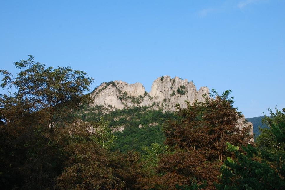
| Chris had to be back at work on Monday, 17 August, so he left Tami and Nathan in West Virginia and drove home by himself. He stopped on the way at Seneca Rocks near Beckley, and flew his aerial photo plane one last time on this trip before hiking to the top of the rocks. He arrived late at home in Monkton, racking up 12,140 miles on the car since he left on 8 June 2009. | 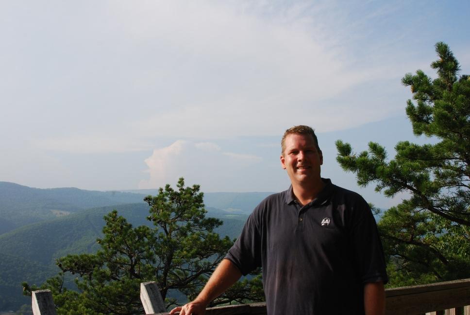 |
 |